I’ve decided to continue the tribute to Larry in both his words from the itineraries he provided pre-ride and my commentary when synapses are activated to recall my personal experience as the ride unfolded.
Tour de Ute 1997
The Burr Canyon
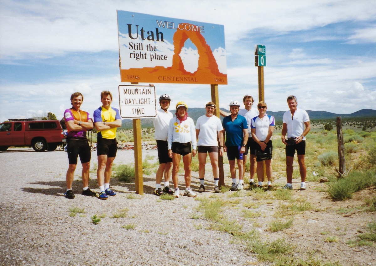
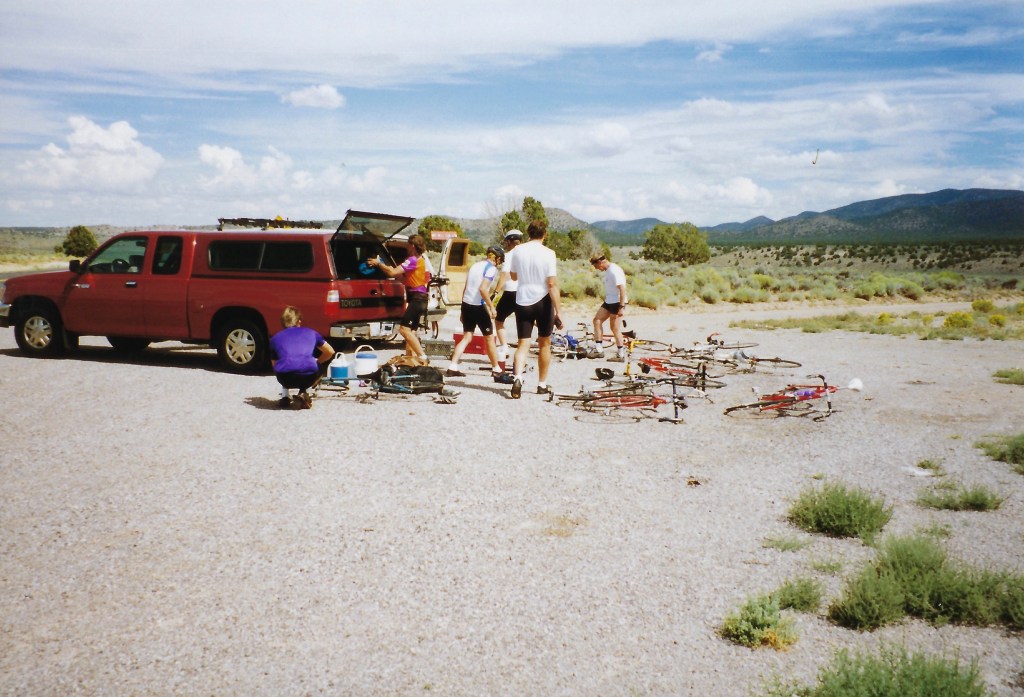
August 12 – 17 1997 4.5 days cycling L-R Larry Johnston, Lance Vaughn, Chuck Satterfield, Don Lundberg, Chuck Thuot, Richard Vaughn, Glen Rothell, John Holbeck, Coucou, c’est moi !, and Ron Burien (taking the photo)
In this first episode of Part 2, I’m going to use Larry’s detailed itinerary that follows and that we all received prior to the ride. I only hope the correspondence that Larry and I had prior and post ride are in some box in the garage that my wife insists that I toss. These notes are postmarked 25 Mar 1997, Mojave, CA.
Tour De Ute “Toor do ü-tay”
When: August 12-17 1997 (Tuesday, Wednesday, Thursday, Friday, Saturday, Sunday); 4.5 days cycling.
Where: Across Utah State beginning at Uvada (about 150 miles northeast of Las Vegas), ending at the Utah-Colorado border near Hovenweep National Monument. Best map: “Indian Country” by AAA. [ed. note: maps were those origami paper things that preceded GPS]
Sag Vehicles: Glen’s Suburban, John’s Tundra
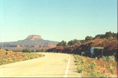
Day 1: Travel to Panaca, Nevada for 1:00pm rendezvous; proceed east in sags on Hwy 319 to NV-UT border at Uvada (el. 5,500’±) and ride via Hwy 56 to Cedar City (el. 5,600′). Stay that night at the Super 8 (#30± per person). Distance: 58 miles
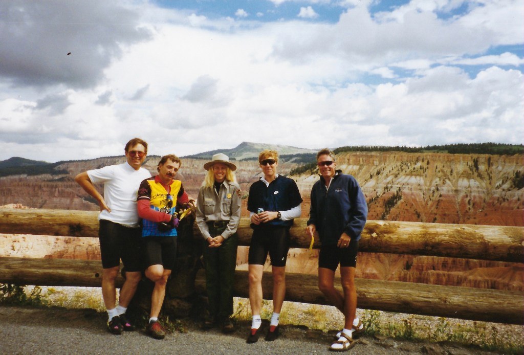
Larry engaging a Ranger. He had a penchant for natural history and blond rangers.
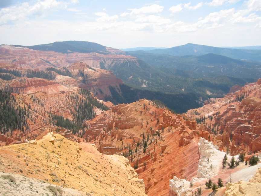
Day 2: Ride Hwy 14 east and up, up, up to Midway Summit (el.9,896′) – a definite “Vaug-han”. Check out nearby Cedar Breaks National Monument. Proceed down then up to Long Valley Junction (el. 7,900’±). Turn North on Hwy 89 to Hwy 12. Ride east on Hwy 12 through the tunnels, over the “summit” (el.7,619) to Bryce near Bryce Canyon National Park – stay that night at the $30±/person Fosters Motel (you know, Al Foster’s place). Distance: 70 miles (don’t you love it?). Terrain: Big climbs, big descents; watch out for tourists.
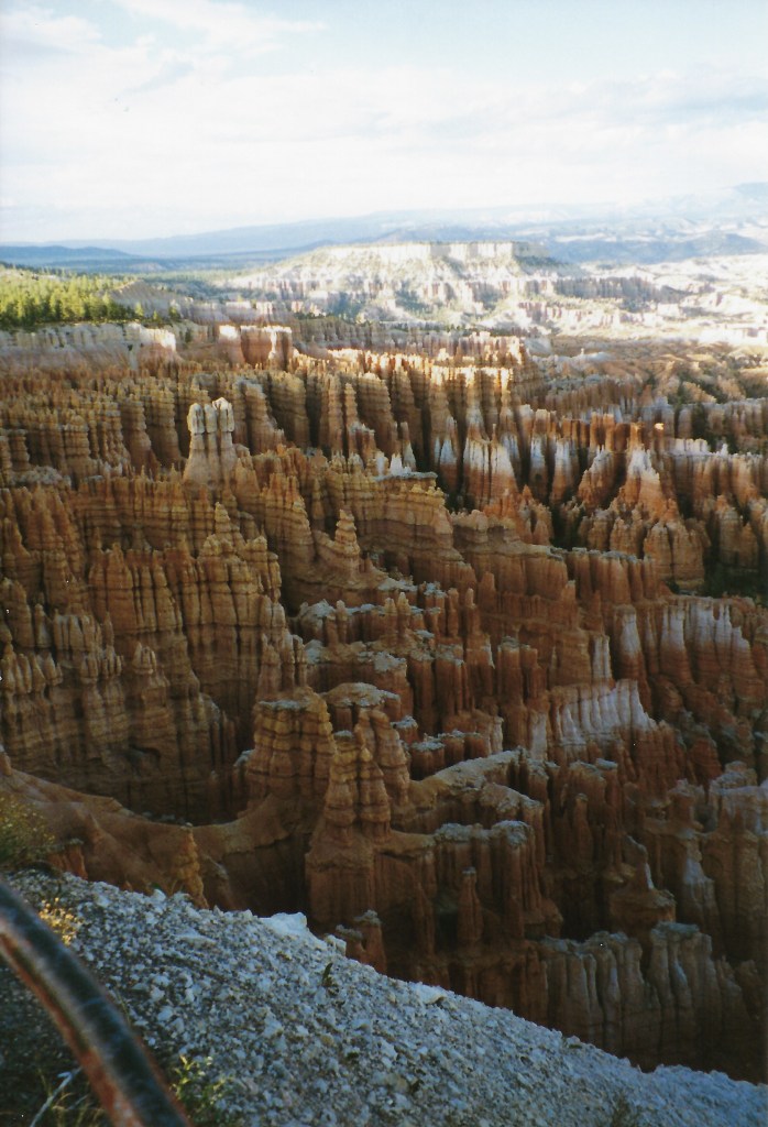
Bryce Canyon
Day 3: Follow Hwy 12 east and north through Escalante and the new national park to Boulder (el. 5,000′?). Stay at Pole’s Place$25±/person. Distance: 72 miles (don’t you love it even more?). Terrain: Up and down and all around; time to play…
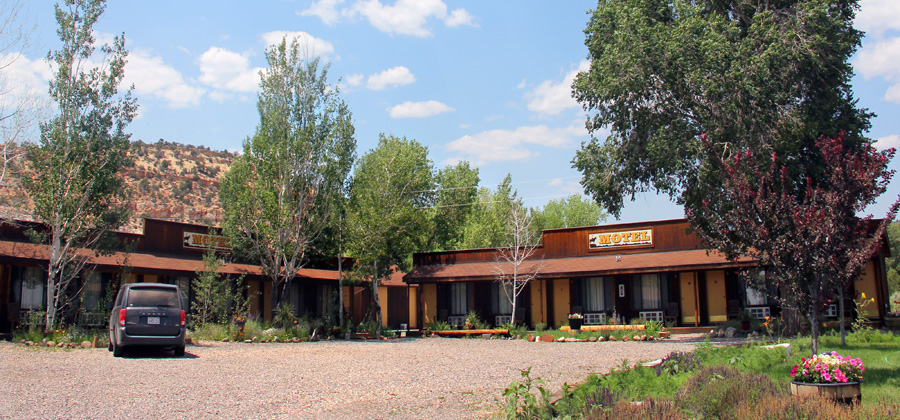
Boulder, UTPole’s Place
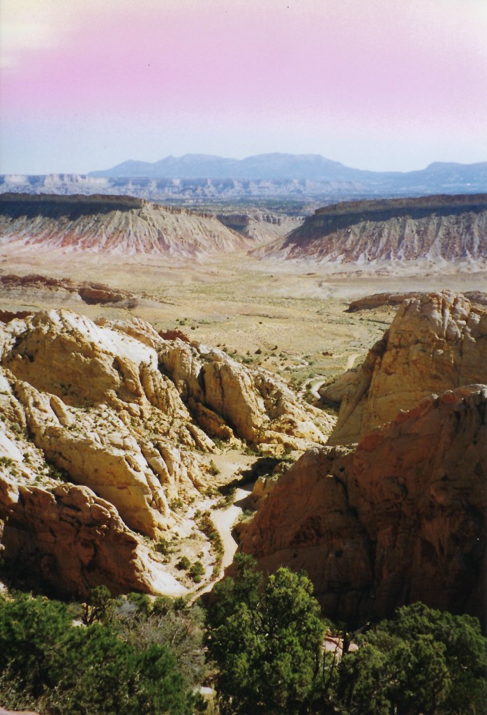
Day 4: A short cut’s in store, who could ask for more? Ride east from Boulder on the “Burr Trail” and shuttle the 20± miles through Capital Reef National Park. Ride south to the ferry at Bullfrog Basin; swim or take the ferry across Lake Powell ($9/car – free/swim) before heading east on Hwy 276 where the day’s adventure can end at Hwy 95. Shuttle northwest on Hwy 95 to the only place to stay for miles, the Fry Canyon Lodge (it’s near Natural Bridges Monument); maybe $40+ a piece… it ain’t cheap. Distance: 103 miles not counting the shuttles and ferry; bring paddles/swim suit. Terrain: the Lake Powell crossing will be flat.
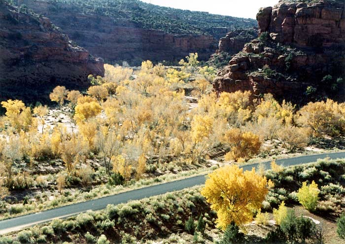
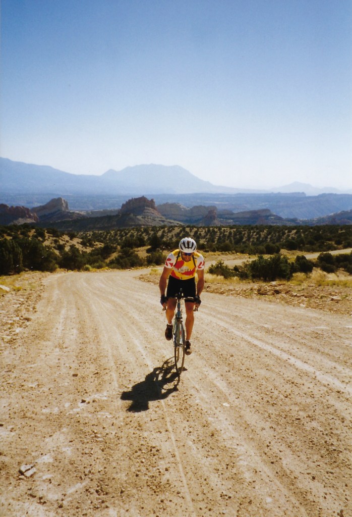
Grinding gravelThe Burr CanyonThe Burr Trail
“Some parts of ALL the rides leave edible memories, but that morning in Utah riding with you (…we were first out together) when we both dropped in to the entrance of that canyon on the Burr Trail was, for me anyway, perhaps the most ‘spiritual’ moment I’ve ever known in a wilderness setting (… and that’s after traveling on all 7 continents). At that moment I felt like I shouldn’t even speak so as to not desecrate experience. I remember us stopping and observing with profound awe at our stunning surroundings without a word be said between us…. thanks for being there !!” Chuck Thuot from a conversation prior to his passing…
Day 5: Spin 12 easy miles back to Hwy 276 and continue east on Hwy 95 past the Natural Bridges cutoff (Hwy 275), the Mule Canyon Ruins, the Arch Canyon Ruins, and the Butler Wash Ruins to Hwy 191 at Blue Mountain (el. 6000’± just south of Blanding. Take Hwy 191 south to White Mesa. Turn left (east) on Hwy 262 for a while (9± miles) then take the road that leads to Hovenweep National Monument (more ruins) on the UT – CO border. Pack ’em up and head south and west through Monument Valley, Page, and Zion National Park to St. George or thereabouts. Find a place to stay… Distance: 93 miles, it’s more or less 396 miles total. Terrain: It’s probably all paved… rock and roll, watch out for Navajos.
Day 6: Return to place of origin.
Communication was as important to Larry as the planning and logistics. What follows is an update received postmarked 05 August 1997 Mojave, CA:
All is in a go mode for les Tour! There are 11 participants. The sag vehicles will be provided by John Holbeck (south vehicle) and Glen Rothell (north vehicle). Sag drivers pay no gas.
Logisticas are looking like this:
On Monday the 11th, Lance vaughan will proceed to Waterford from the Bay Area with his bike, John Adam’s bike (John A. please coordinate with Lance on bike transport) and probably Chuck Thuot, but not his bike (Chuck T. may find his own way to Waterford; Chuck, please coordinate with Lance and Richard). They will rendezvous with Richard Vaughan (of “Vaug-han” fame) and Don Lundberg at Richard’s house in Waterford, hopefully around 4 pm.
Leaving Richard’s house at 4:30 pm, they will proceed (with 4 bikes and gear) to Crane Flat where they will meet Glen Rothell and Tom Jones at 6:30 pm. Tom Jones (from Merced) will have earlier joined with Glen Rothell in Mariposa and helped prepare Glen’s Suburban with racks for 8 bikes (Tom and Glen please coordinate departure from Mariposa to be at Crane Flat by 6:30 pm). Richard’s vehicle (or whoever’s) will be left at Crane Flat, all proceeding to Larry Johnston’s house in Mammoth Lakes, arriving around 8:30 pm; all will stay the night at Larry’s house (voulez-vous acouches avec moi?)
On Tuesday the 12th Chuck Satterfield (from Mammoth) will arrive at Larry’s at 5:30 am and join the rest of the north contingent in leaving Mammoth Lakes no later than 6am. Breakfast will be enroute, maybe in Tonopah. The north group will arrive around noon at Panaca, NV. There’s a small restaurant on the southeast corner of the intersection of Hwys 93 and 319. Lunch and rendezvous with the southern contingent will be there.
Meanwhile on Tuesday morning, John Holbeck and Ron Burien will leave (with 3 bikes; John H. will be be bringing a bike for Chuck T. along with extra bike shoes) from Calimesa in time to get to the Las Vegas airport by 9:25 am. This is the time John Adam’s plane arrives from the Bay Area. From Las Vegas, they will proceed to Panaca and meet the north contingent at the restaurant on the corner of Hwys 93 and 319. After lunch all will proceed to the UT border and bike to Cedar City as planned.
The Pine Tree Inn and Bakery, Panaca, NV
There are a couple of notes on the remainder of the trip:
First, the 2nd day’s route will be slightly different. Instead of continuing on Hwy 14 from Cedar City to Long Valley Junction, the route will turn north on Hwy 148 at Midway Summit through Cedar Breaks National Monument and then on Hwy 143 to Panguitch. From there, it will proceed south on Hwy 89 to Hwy 12, then to Bryce.
At Bullfrog Basin (at Lake Powell), the ferry supposedly leaves on the odd hour; 9, 112, 1, etc.
Lodging has been reserved on Saturday the 16th for 11 people at the Best Western Travel Inn in Saint George (Exit #8 from I-15). There will be 3 – 3 bed rooms and 1 – 2 bed room; around $30 per person.
The south and north vehicle people have each been asked to provide a large water container (5+ gallons), bike tools, two ice chests and a floor pump. The south vehicle has been asked to provide an extra set pf wjee;s (one front, one rear). A CB radio will be available for each vehicle at Panaca (via Larry).
For the north vehicle, baggage space will be at a premium; please go light.
Where Has Sisyphus Been? 2023 Late Spring Travels by Land, Sea, and Air the air, on the road, and in the sea…
Following our winter Desert Pilgrimage last reported in a series of posts beginning with https://sisyphusdw7.com/2023/03/01/2023-desert-pilgrimage-day-1-merced-to-three-rivers/, March found Sisyphus and Associates in Atlanta attending the wedding of our dear niece, Rachael. With the arrival of spring the city was enjoying most hospitable weather as blossoms and blooms were emerging and the forest canopies were leafing out.
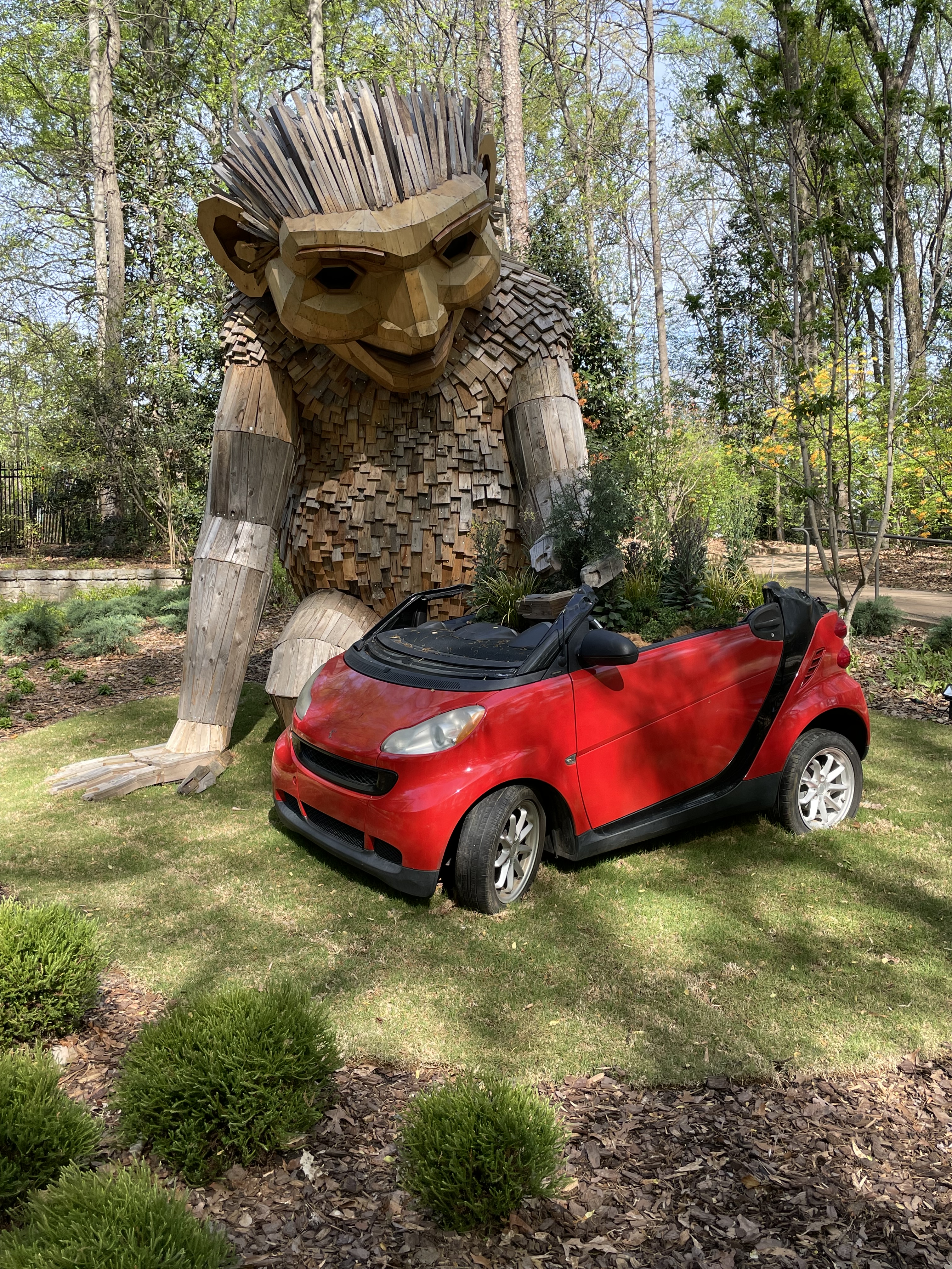
Mr. and Mrs. Sisyphus, my wife’s sister and her daughter Meg, another lovely niece, enjoyed witnessing the bond consecrated between two splendid young people at The Trolly Barn with an enchanting brick patio surrounded by lush gardens and graceful granite steps where vows were exchanged. The inside of The Trolley Barn with its 30 foot ceiling spanned by the original 1889 beams is where we delighted in meeting other family members and friends of the brides’ in celebration of their nuptial, dancing away the night on a mesquite wood floor at a raucous reception that followed. Raucous (rock-us) in the most courteous manner considering this was the South…
Following the wedding day, the Westies from California joined cousins Margaret Gale and Linda from Colorado, delighting in the hospitality of our hosts, the Floyds. Their beautiful Buckhead home was the scene of a series of late nights savoring family, those of the present and memories of those of the past, with an eye cast to a promising future.
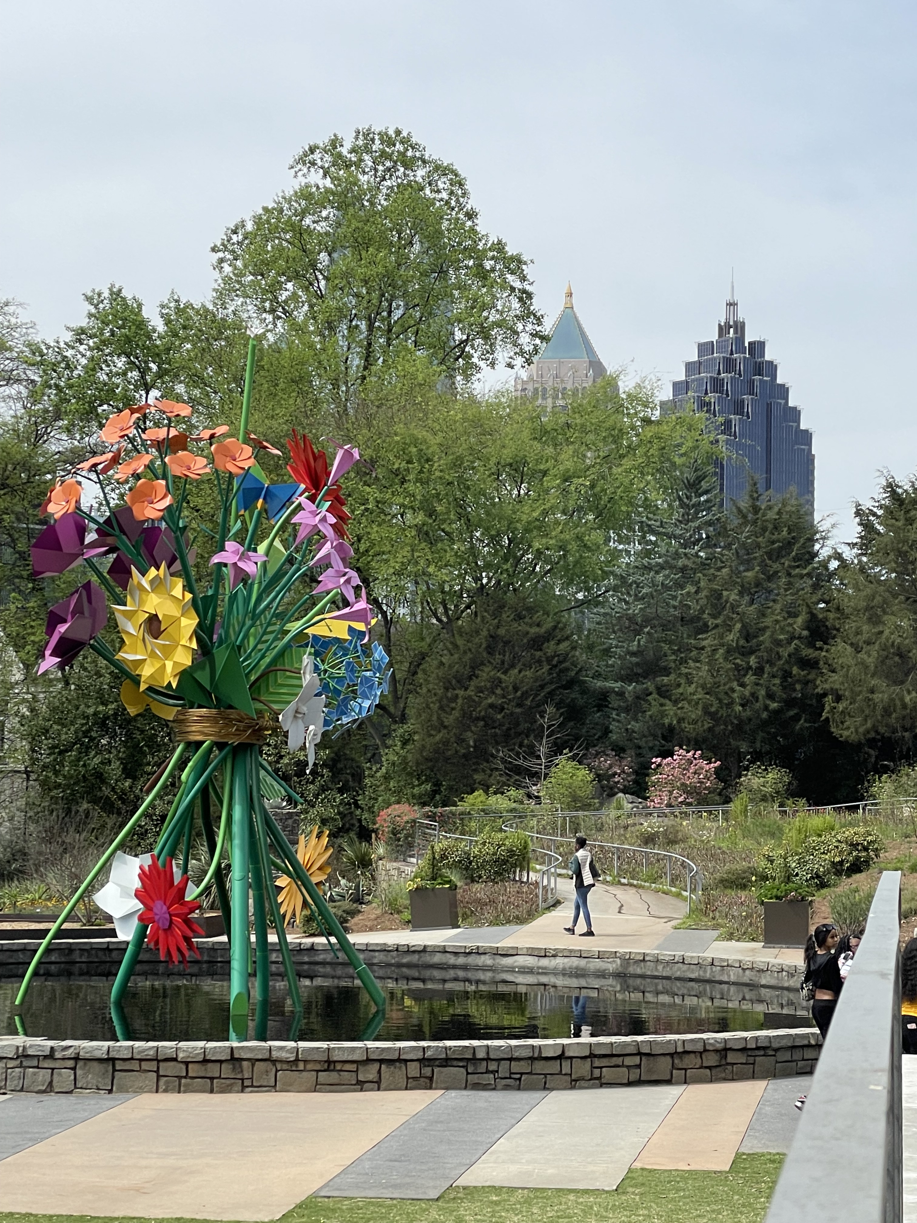
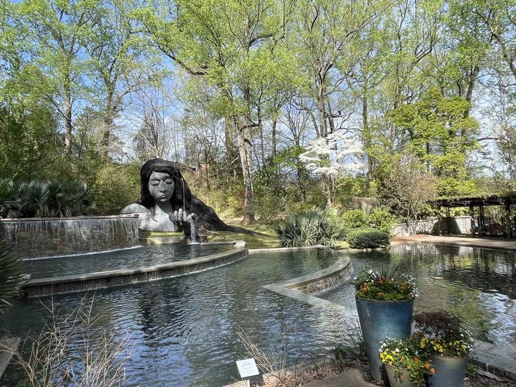
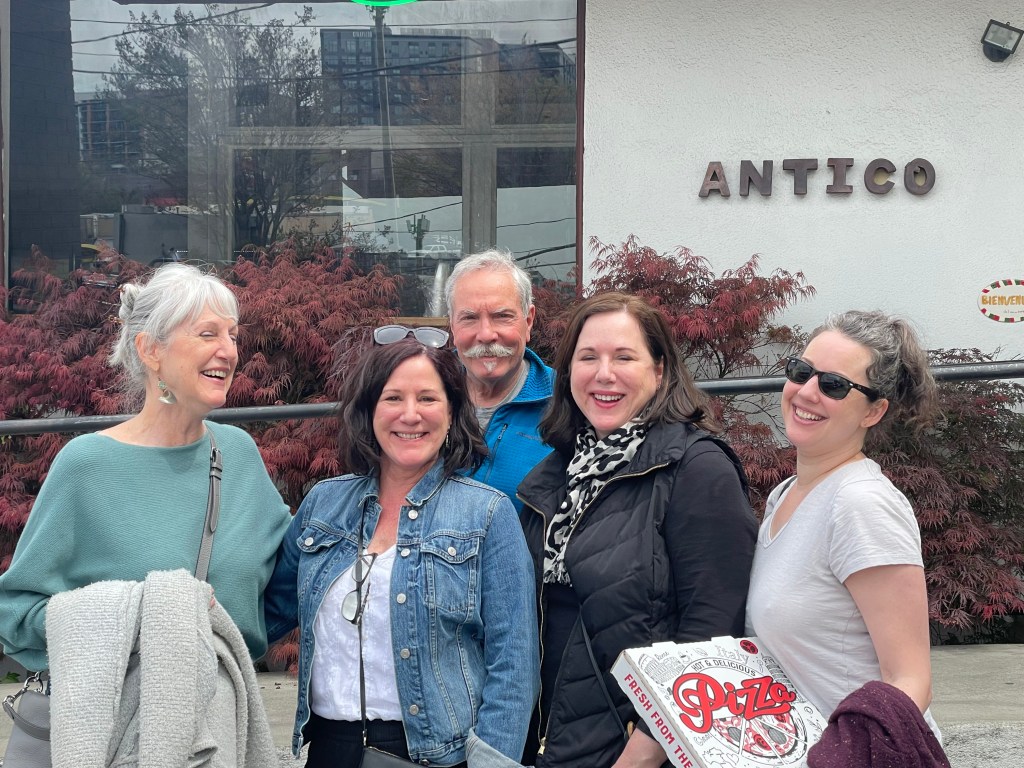
We were there for a week and managed to sample some of Atlanta’s great food and beverage scene at The Lantana Lounge in the Mid-Town Starling Hotel where we stayed the first two nights. The extended families dined at South City Kitchen for a pre-wedding dinner. Later lunches at Serena Pastifico, the Anis Cafe & Bistro, The Treehouse, pizza at Anticas, tacos at Tuza, and and dinner and drinks at Local3 were had in between exploring Buckhead and a stroll through the Atlanta Botanical Garden. And let me not forget to mention the notable meals prepared by my “Sister-Wife,” Lonna, Toni and Ginger’s youngest sister, that were exquisite as we dined in their charming home.
Left to right, Sisters G, T, (Sisyphus), L, and M, G’s daughter, our niece.
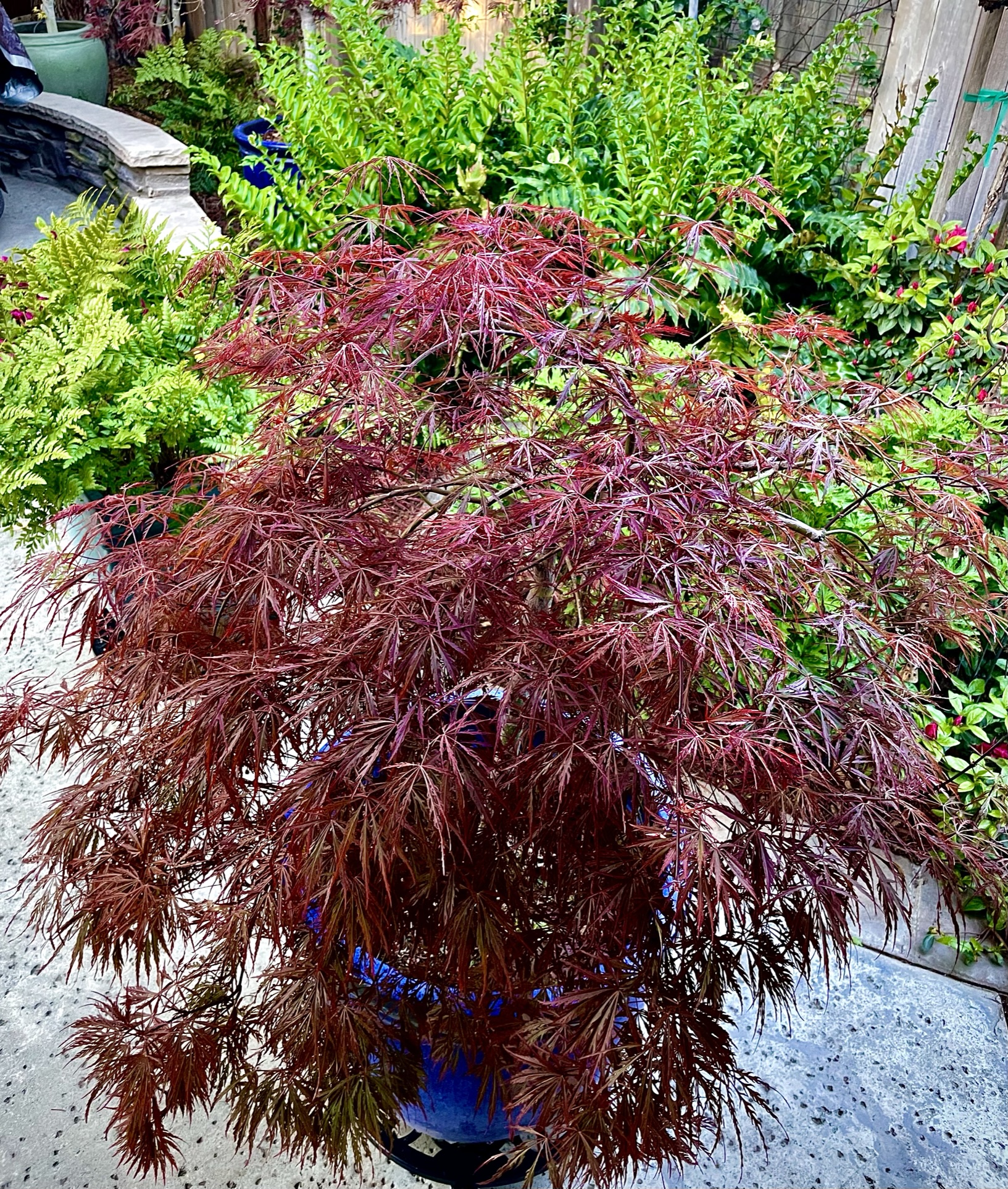
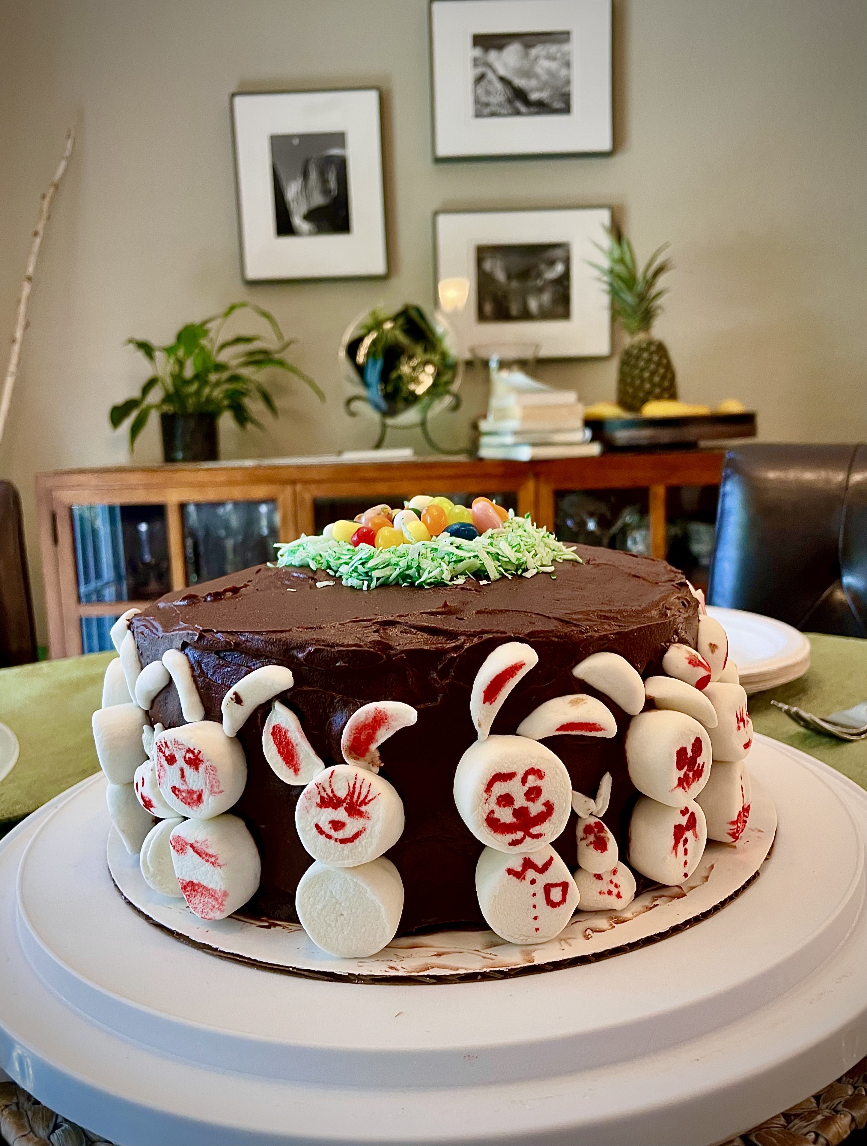
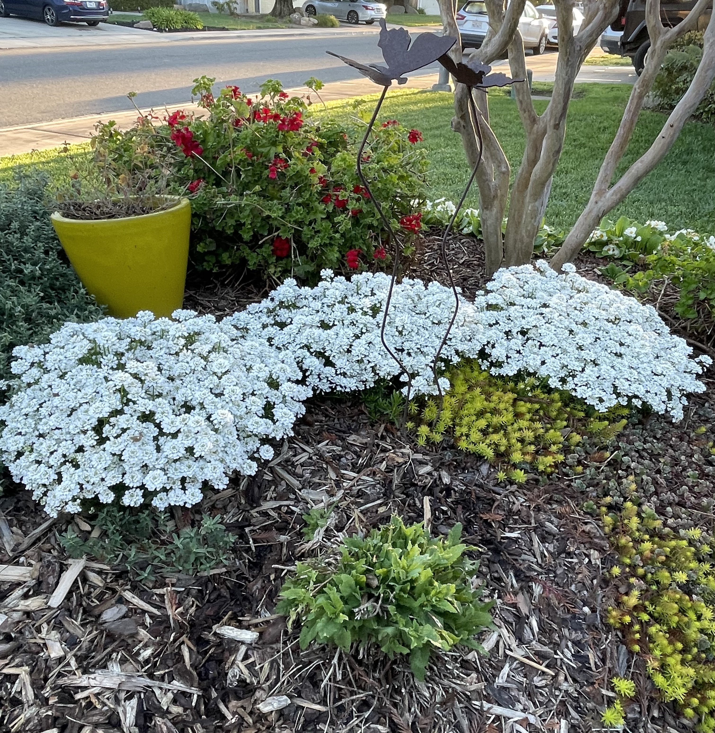
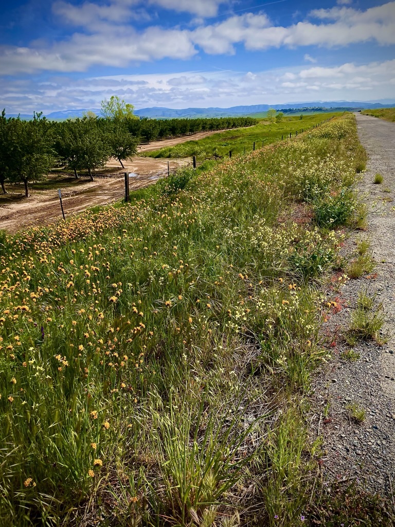
Upon returning to Merced from Atlanta signs of spring were bursting out everywhere. Vernal pools in the countryside, tulips, Japanese maples, and camellias in our yard, Mrs. Josephine Rabbit, Mr. Rabbit, The Bunny Cake in our home, and fiddlenecks along side of South Bear Creek Drive. All of the evidence was in. Our challenging winter was capitulating to a softer spring.
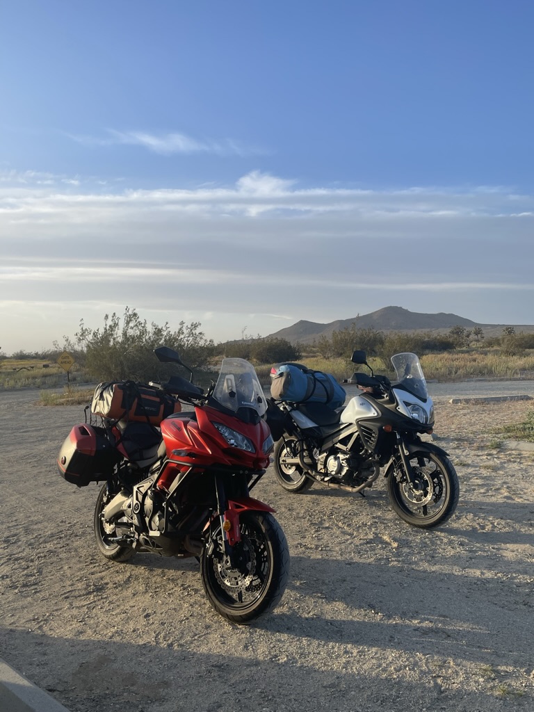
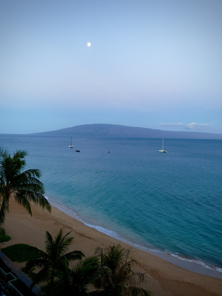
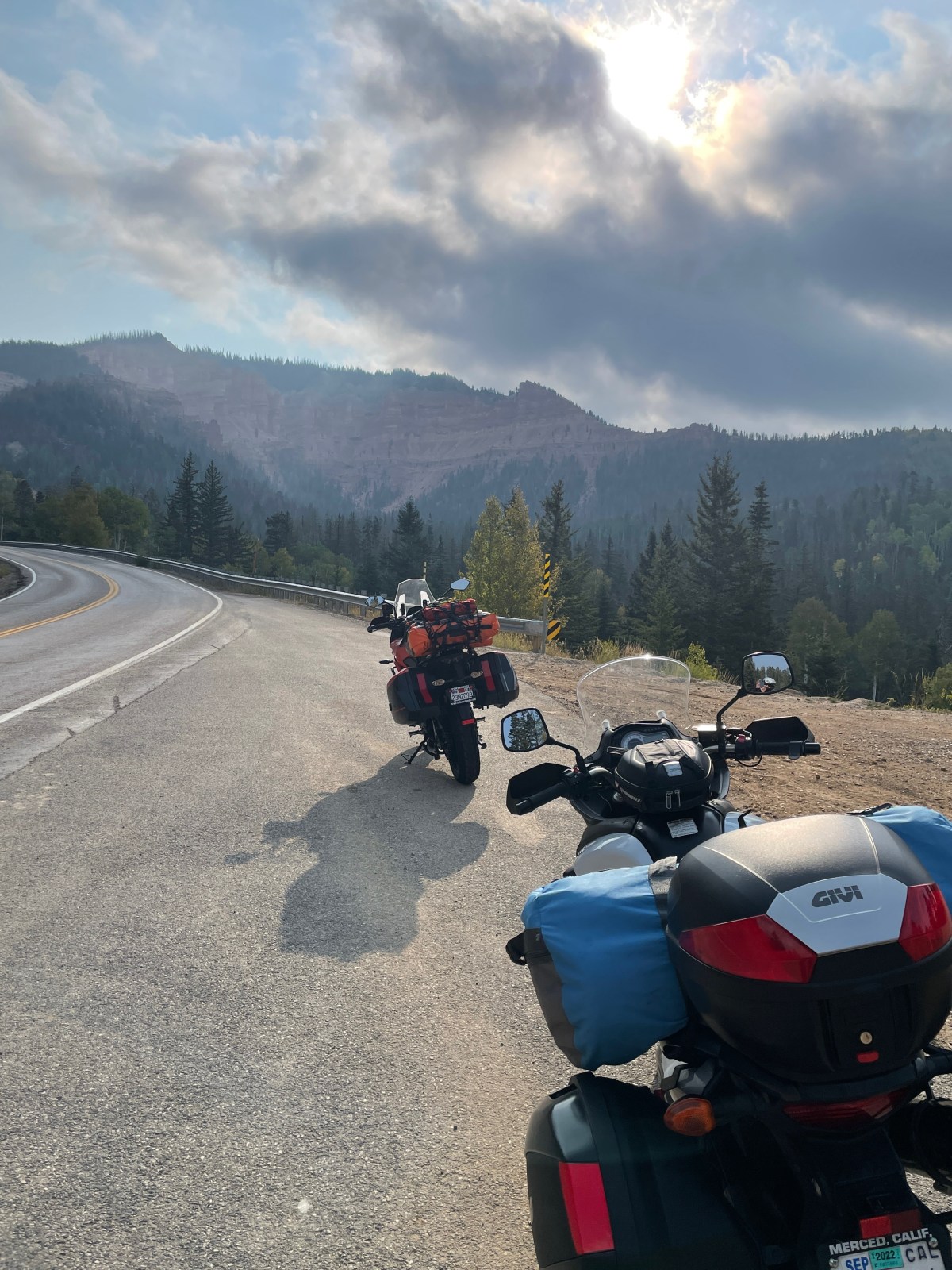
Since we were scheduled for Maui in May, that left April for Sisyphus to get on the moto, and with Pete, check out what was rumored to be a super-bloom throughout California and parts of the parched West. California had received bountiful precipitation over the winter into the spring causing hardships where flooding took place but nourishing the flora that had suffered consecutive years of drought.
Before and after
Almost to the day, four years ago Pete and I set off in search of the 2019 Super Bloom https://sisyphusdw7.com/2019/04/. Our plan now was to retrace part of that journey to witness the 2024 version of the bounty that water brings to the thirsty hills and dales of California’s central coast, the Mojave, and the Sierra.
Super Bloom 2023
Our son and granddaughter in Antelope Valley in April of 2023
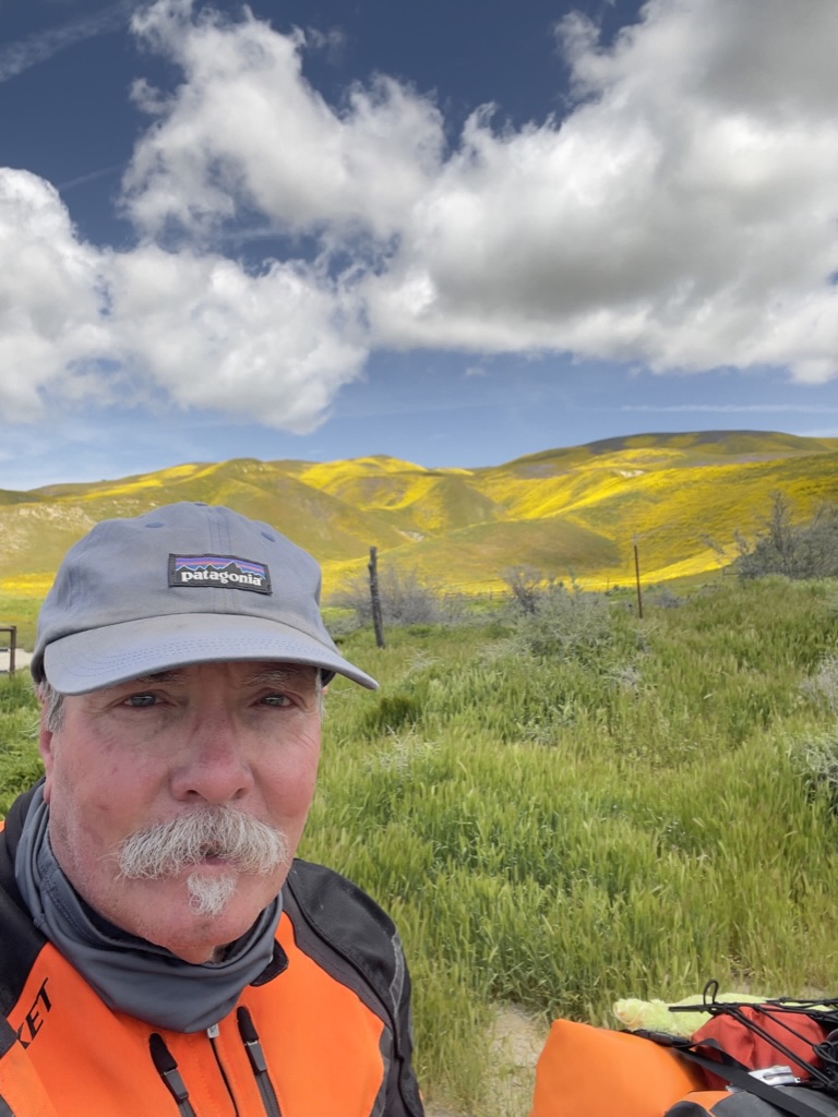
As Pete and I were preparing our route, my son and his family had made their way to see the splendor of the Antelope Valley Poppy Reserve. That was all I needed to set about planning for five days on the motos on the road.
This would be something of a reprisal of the 2019 Super Bloom Tour, following a familiar route that took us across the Central Coast Range over Panoche Rd, through the foothills of the Gabalan and Santa Lucia ranges to our first night near Cambria. From Cambria it was east bound up and over Mount Pinos in the the Los Padres National Forest and down to into Antelope Valley, Lancaster, to our second night at Saddleback Buttes State Park. Then it was across the Mojave to for our third campout in Shoshone. From Shoshone it was westward back to the Sierra Foothills through Death Valley to our camp in Kernville before returning home along the familiar roads of Kern, Tulare, Fresno, Madera, Mariposa, and Merced Counties: https://go.rever.co/sS8ZMN3OMyb. The route I linked was amended as an exploration here, or a left or right turn there, got us to each night’s planned camp.
Day 1 Cambria
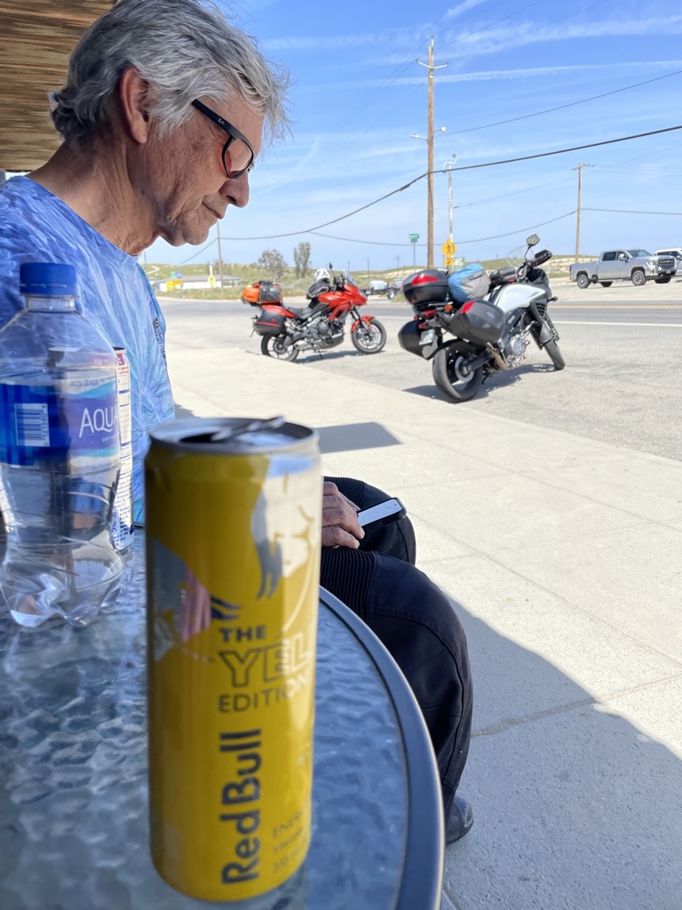
A reunion of sorts took place in Paicines as we made our way through some fog over Panoche Summit. We landed in Cambria where we made our way to The West End Bar and Grill followed by our first night at the Hearst-San Simeon State Park Washburn campground, making new friends along the way.
Our customary route to the coast combines several back roads through the San Joaquin Valley and across the Coast Ranges that I’ve documented many times on previous trips. For this journey we serendipitously encountered three gents on motos, two of whom we met in the spring of 2021 on our trip to Joshua Tree (https://sisyphusdw7.com/2021/04/) at the same little Paicines Store. They were out for a Sunday ride and were debating continuing because it was a tad foggy and they were chilled.
We bid our adieus and continued south on CA-25 riding out of the fog just a few miles down the road near the Pinnacles. Still cool, the warming sun took the frigid sting out of what couldn’t be warmed by the heated grips. The ride into Cambria had us passing through Paso Robles where my wife an I enjoyed some grape and hops tasting last fall. Winter storm damage closed our Santa Rosa Creek back road entry into Cambria, a delightfully narrow two lane road that winds itself through vineyards and oak woodlands that feature valley oaks, blue oaks, coastal live oaks and many more, all interspersed are laurels, madrones, and chaparral including chamise, manzanita, and ceanothus. Grasses are abundant and given the climate, fire is an ever present danger even in a wet year as the long hot summer beckons.
We are apparently creatures of habit as our favorite dining spot in Cambria is the West End Bar and Grill where we re-introduced ourselves to the owner who greeted us on the Moment’s Inattention post from last spring , under considerably less favorable conditions. (https://sisyphusdw7.com/2022/05) Gary, the proprietor, is quite the jovial fellow as one must be as a pub owner.
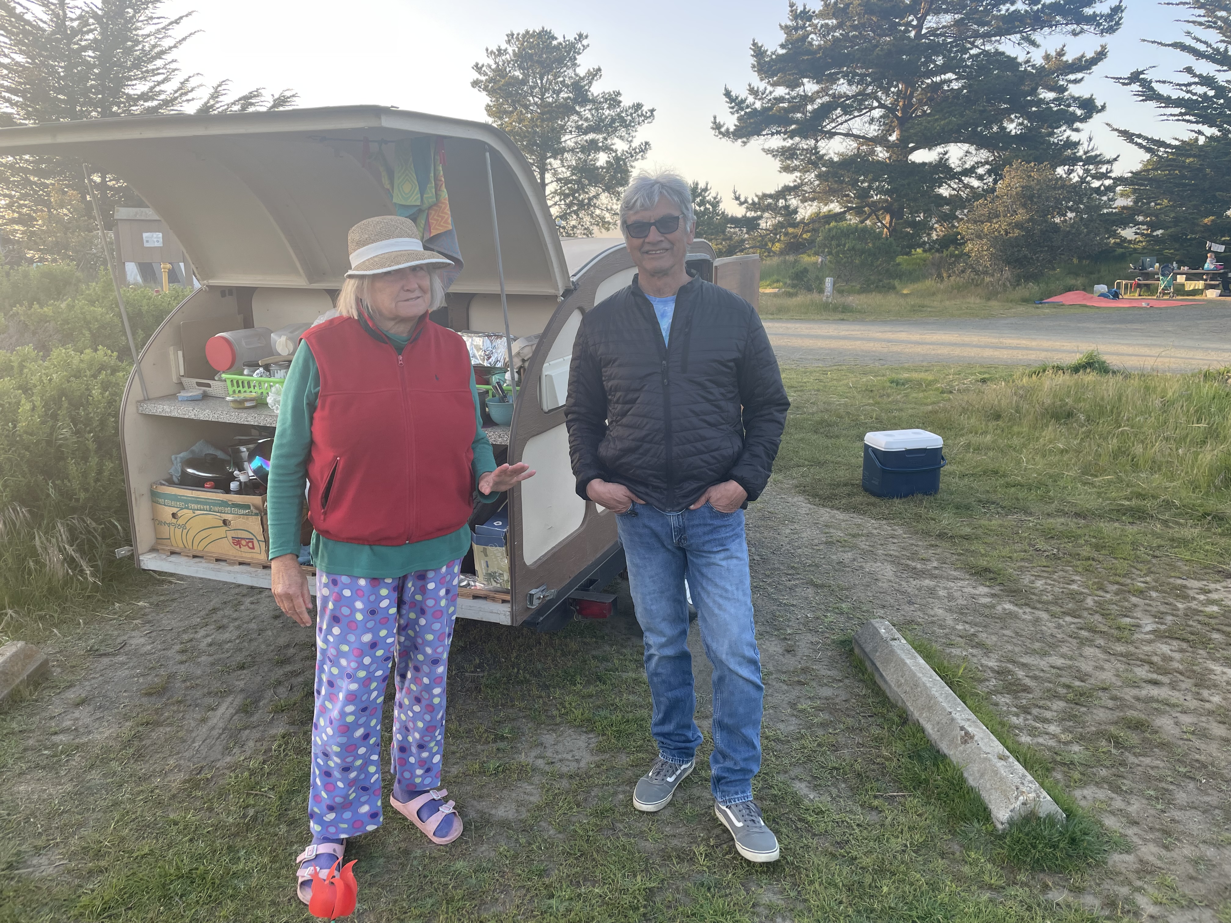
As a feature of the Three R’s of Moto Touring: Rehydration, Reflexion, and Relaxation, we found ourselves taking our customary evening stroll through the campground since riding a motorcycle all day requires at least some movement. We came across an interesting character who had to share her story of wanderlust. A bit eccentric and perhaps a bit lonely, she regaled us with the tale of her teardrop towed behind a Camry, both completely filled with what must be her worldly possessions. She was from Seattle and had been on the road for some time traveling from National Parks in the southwest in search of, well, we weren’t sure. As far as that goes, upon reflection, we weren’t sure of what we were in search of. Maybe that was because of the rehydration that had taken place…
Day 2 Saddleback State Park
Early the next morning as we prepared our eastward departure, we discovered that a critter, likely a racoon, had invited itself to the remaining chips from last evening’s snacks. I believe that smudge on my nose is sunscreen and not ranch dip.
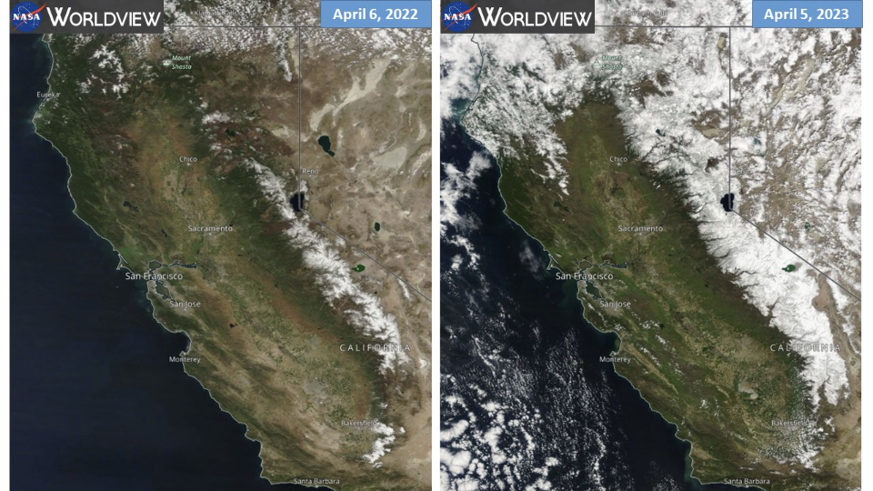
Departing via CA-1 south to Morro Bay, we headed east on CA-41, A.K.A. the Atascadero-Morro Road, then south on US-101 to CA-58 east. While the verdant spring had been expressing itself upon entering the Coast Ranges, we hadn’t yet seen the evidence of a Super Bloom but more or less a typical spring bloom in fields of meadowfoam, fiddlenecks, and lupine.
Lots of green, not many wildflowers.
For some botanists, “super bloom’ is a vexing term. There is no scientific definition, only the eye test–you know it when you see it. There was no short supply of media trumpeting the one sublime aspect of a burdensome winter, a super bloom, however, we just weren’t seeing it. We were still a few degrees of latitude north for the Super Bloom variables to manifest themselves at this time, this year. What we did see was lots of evidence of damage to road infrastructure, much in repair. We must have encountered a dozen, “Prepare to Stop”, “Road Work Ahead” signs on this trip.
Blossoms and fruit destined to become guacamole
As we were entering Santa Margarita we noticed orchards that appeared to be blooming with an interesting blossom, but also heavy with fruit. Signage along the roadside at the entrance to one such orchard solved the mystery: avocados!
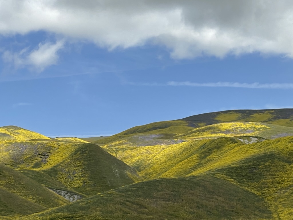
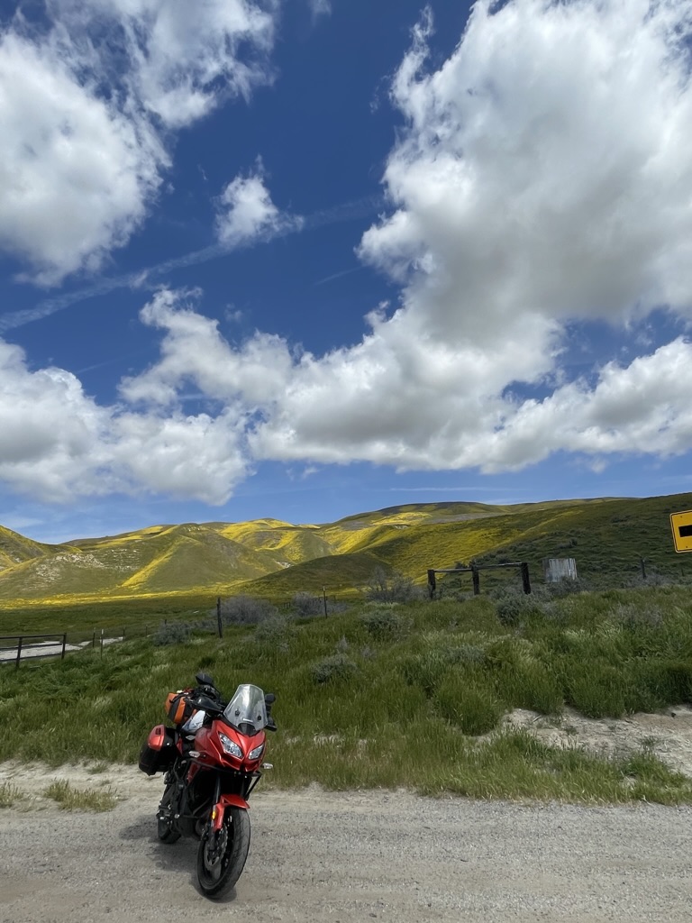
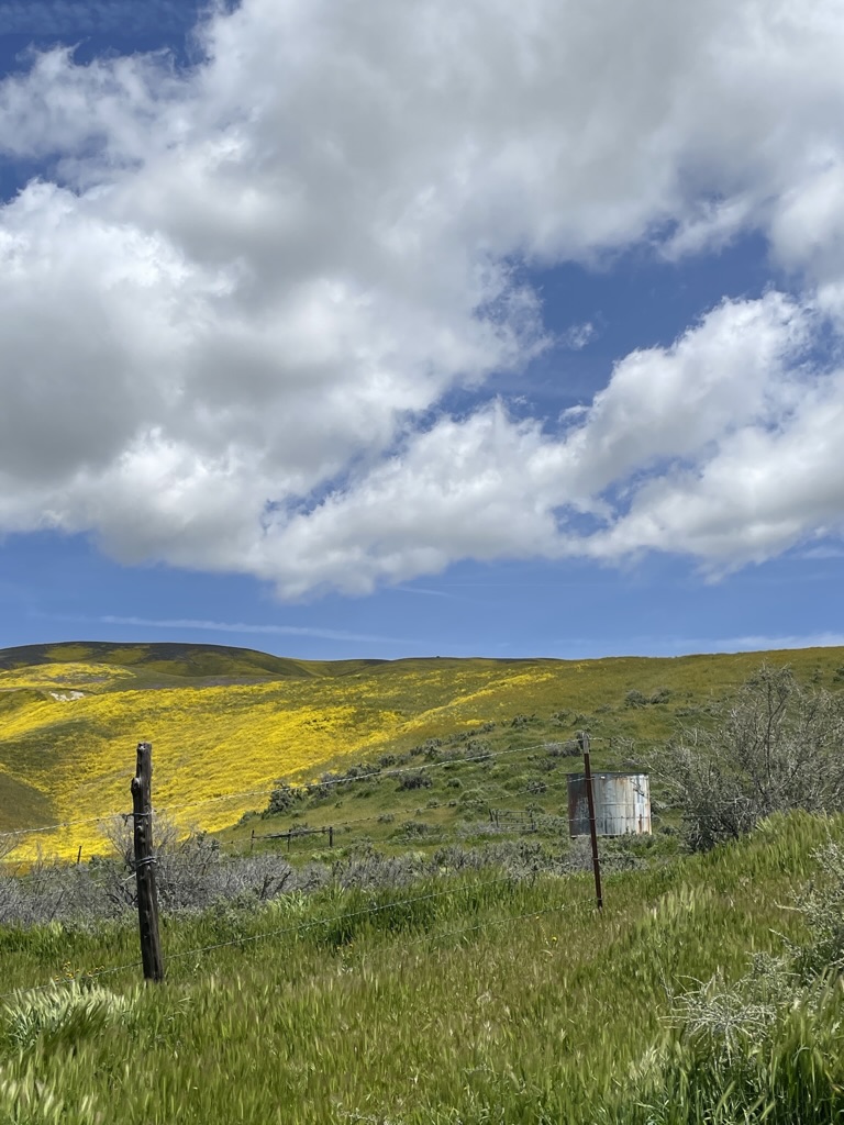
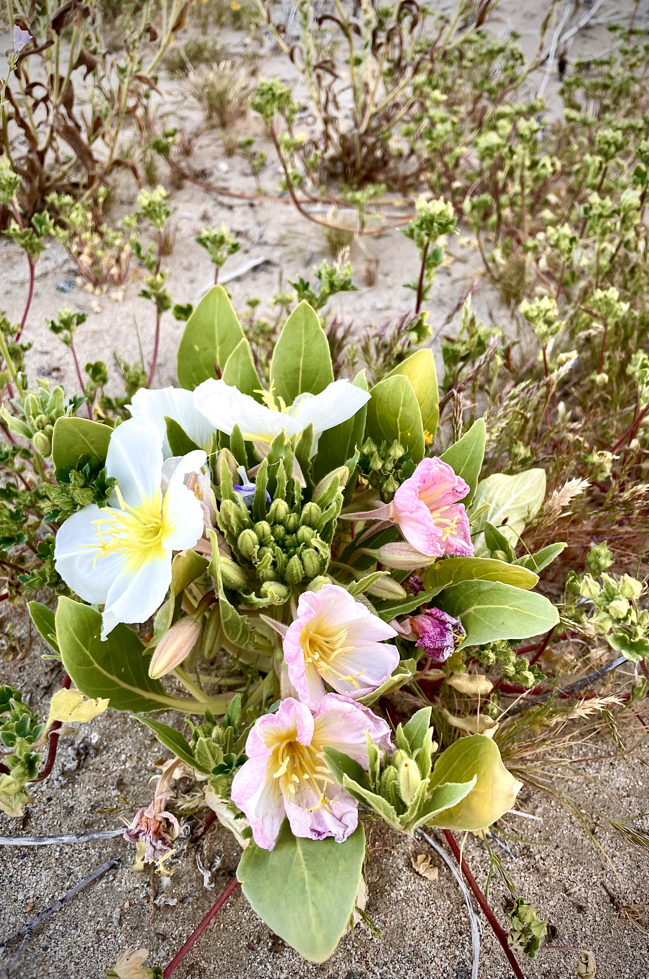
Highway 58 took us just north of the Carrizo Plain where blooms from space could be seen. The hills just north of the monument’s dusty topography had erupted in Super Bloom color: yellow from the hillside daisies, goldfields, and tidy tips, whose ends are frosted white; purple from the phacelia and wild hyacinth; azure splashes from the lupine and baby blue eyes and orange fiddlenecks and poppies. Ah yes, we were in the midst of the 2023 Super Bloom!
I had intended to chronicle all of this remarkable color from a GoPro mounted on my handlebars. Technical difficulties and user error, however, botched the video and I wasn’t able to get the most dramatic of the bloom as we crossed the Temblor Range into McKittrick, the vast orange sea of the Antelope Valley Poppy Reserve, or the dramatic CA-58 canyon along the raging Kern River. I guess there will be yet another spring trip to film when I figure out the camera… I humbly offer the following:
The beginning features some of the bloom near the Carrizo Plain
McKittrick and checking the investments
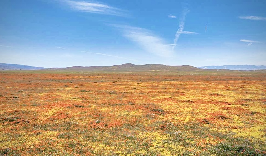
I didn’t know at the time, but as we were traveling through the Antelope Valley Poppy Reserve along with thousands of other bloom seekers, I thought the GoPro was capturing what the Spanish sailors in the 18th century first had laid eyes on along the California coast, declaring it la tierra del fuego, the land of fire. They had arrived as a giant super bloom of flaming orange poppies, which would later be named the state flower, glowed from the hillsides.
La tierra del fuego
By the 1870’s the poppies were so threatened that the state government and a group of concerned citizens, led by the Great Poppy Lady, Jane Pinheiro, were working to establish a preserve to ensure the blooms would live on. That effort became the Antelope Valley California Poppy Reserve, an island of native flowers among encroaching development and creeping invasive species. Even after the 1,800-acre park was founded, the pace of growth persisted, bringing cookie cutter suburbs, vast solar farms, and nonnative plants that crowded out other species.
Oh, and then there’s Adelanto, a desert city in California’s Mojave as it tried to transform itself from a bedroom community of affordable housing in eastern Los Angeles county and a city of prisons to a metropolis of pot… Check out the Crooked Media Podcast,Dreamtown: The Story of Adelanto where ever you get your podcasts: https://crooked.com/podcast-series/dreamtown-the-story-of-adelanto/
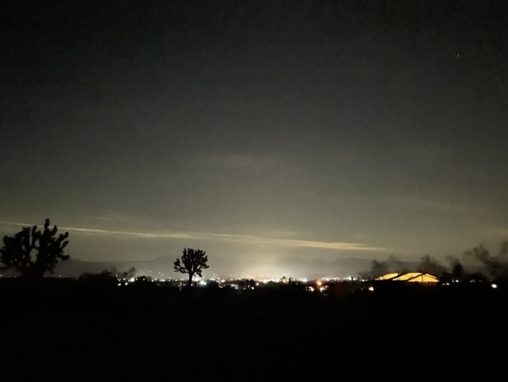
Saddleback Butte State Park includes over 2,955 acres (4.617 sq mi) of land, and was created in 1960 to protect the area’s Joshua Tree (Yucca brevifolia) desert habitat. It’s the OG Joshua Tree Park, formerly a monument. The lights in the distance are from Lake Los Angeles. But Lake Los Angeles has no lake. Instead, the now-nonexistent lake is a remnant of the town’s manipulative speculative real estate history. It seems the desert fancies drifters and grifters trying to convince folks of putting down roots. Roots that die of thirst and dreams that evaporate.
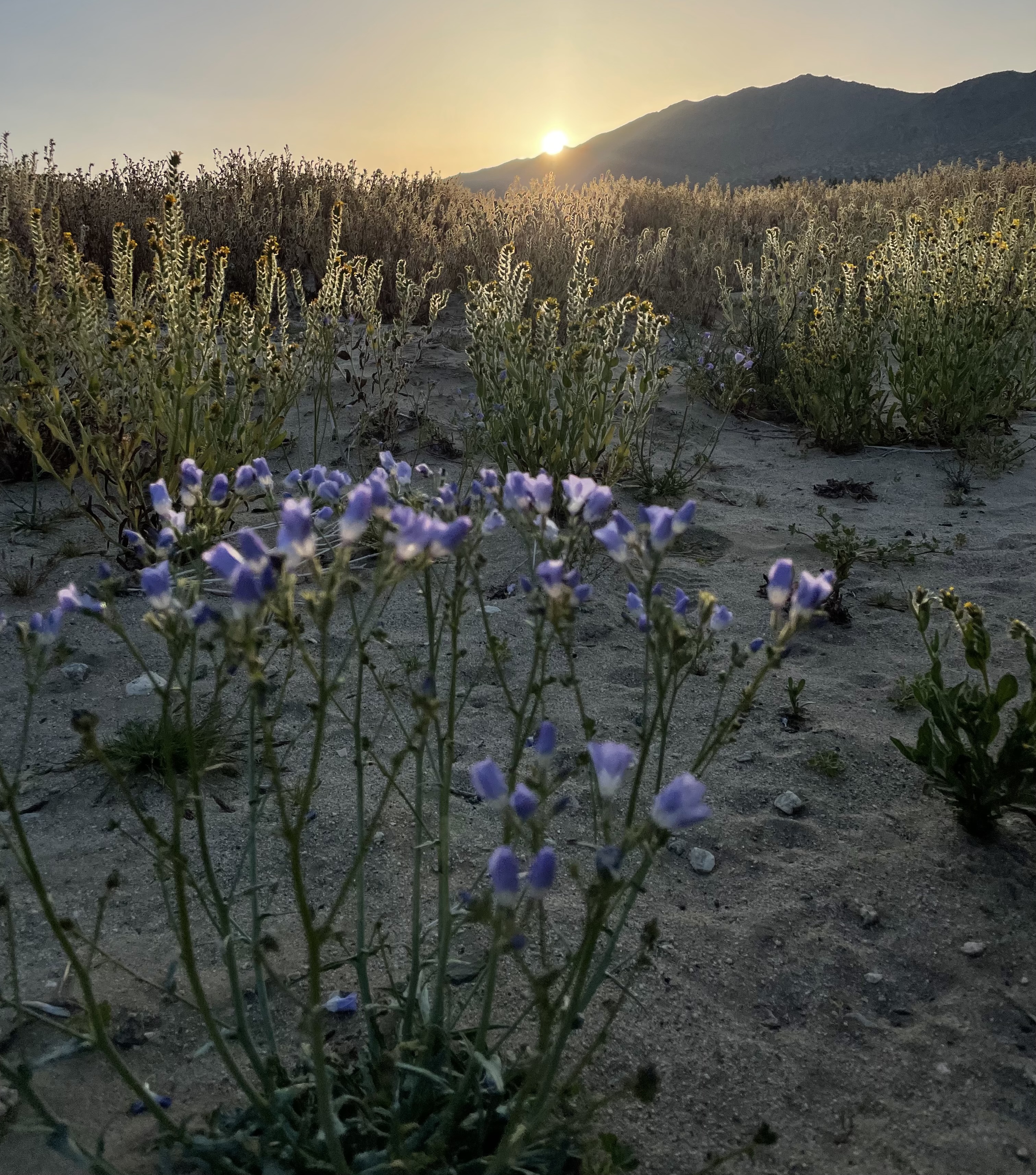
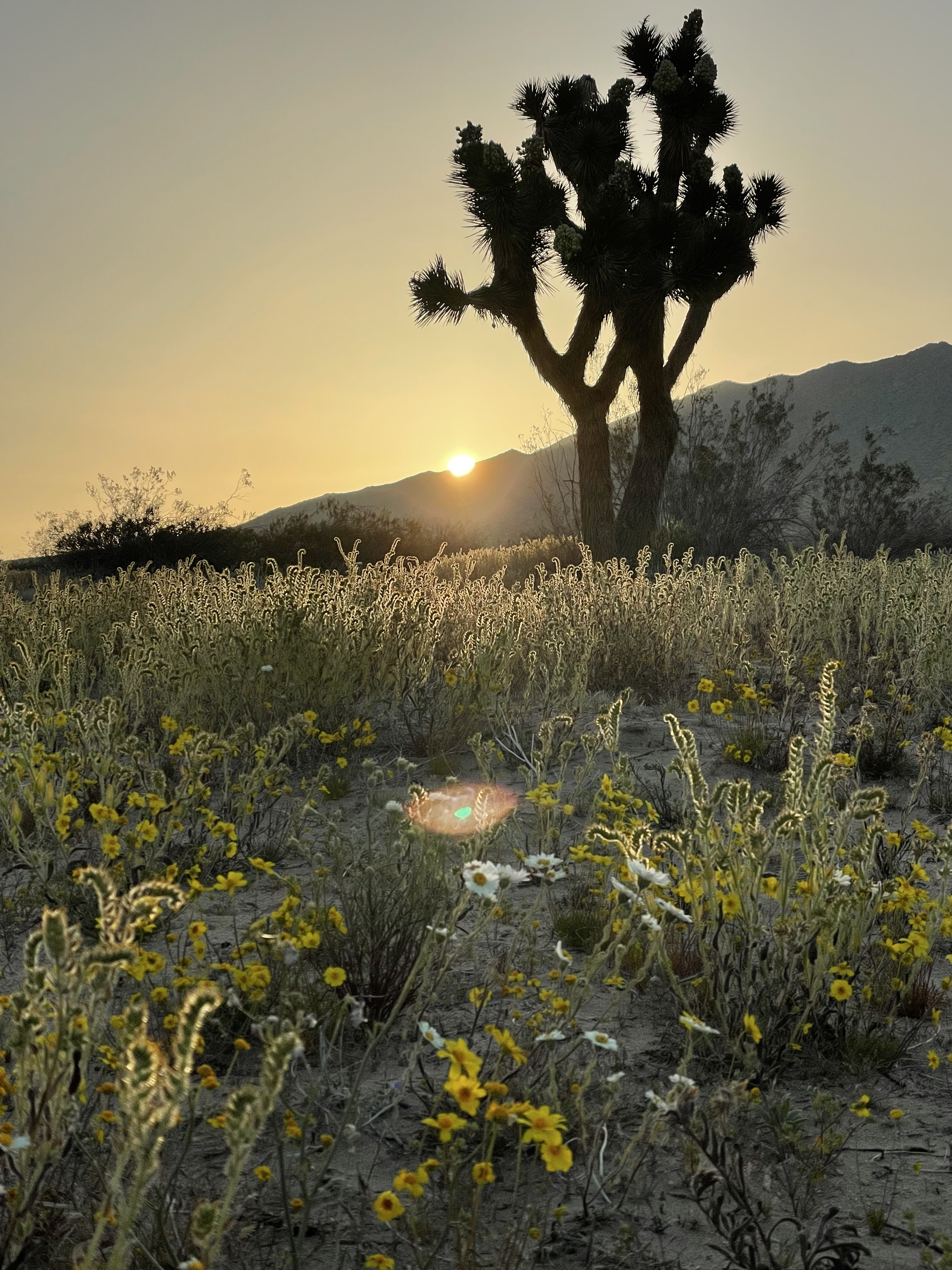
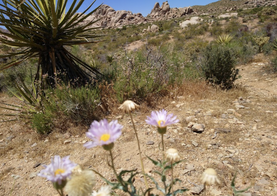
I arose the next morning to catch the first rays of the sunrise and noted the desert flora showing off.
A Butte and a Joshua Tree
We only come to the desert as visitors who appreciate the complexity of an environment. While hostile to hominids, the Mojave has an incredibly robust ecology should you take the time to look and listen and learn. Perhaps eco-tourism will at least compel people to consider there’s more there than meets the eyes, eyes focused on exploitation of a fragile landscape.
Day 3 Shoshone
As we planned the day’s ride, rather than retrace a previous route the trusty Butler Map indicated a more direct route to US-395 by heading east on Avenue J. We were still in Los Angeles County when we set off and after 8 miles we encountered the San Bernardino County line where the pavement ended despite our Butler Map guidance for the most direct route. It would be 15 miles on dirt to US-395 and another 9 miles, on dirt, to Helendale where we hoped to join the Mother Road,Route 66 rather than the longer route through Mirage, Adelanto, and Victorville, another desert prison town. Hence, the less direct paved route would have to do.
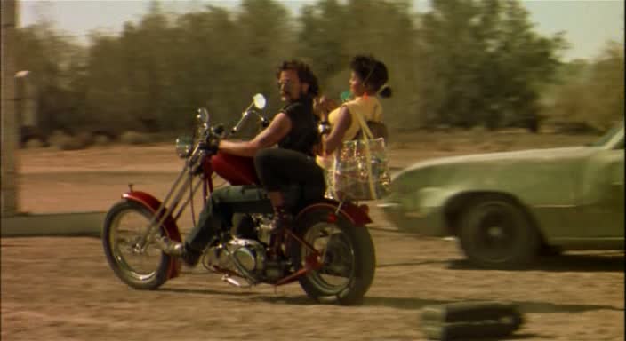
After getting gas at a sketchy Arco station adjacent to I-15 in Victorville we hopped on the interstate for 10 miles to Daggett where we picked up the National Trails Hwy, Route 66 east. A lunch stop in Newberry Springs where the wind was gusting at 25+mph and I found myself eavesdropping on the conversation of two local residents. I asked if the “desert road from vegas to nowhere, Some place better than where you’ve been, A coffee machine that needs some fixing, In a little café just around the bend”… was open just down the road. One of the lady’s eyes lit up as she shared that she and her husband were extras in the movie, her husband on a HD chopper with Brenda’s carefree daughter, Phyllis, below…
When I first saw the movie, I loved the eccentricity of the characters and wagish storyline. Even more appealing was the haunting Bob Telson composition, Calling You, https://youtu.be/IZ0e5AHdDXw . Jevetta Steele recorded the soundtrack for the film. Here’s an update with a beat that features Ms. Steele, however some of the melancholy of Telson’s original, IMHO, has been lost, https://youtu.be/e7dZq8NYZwg.
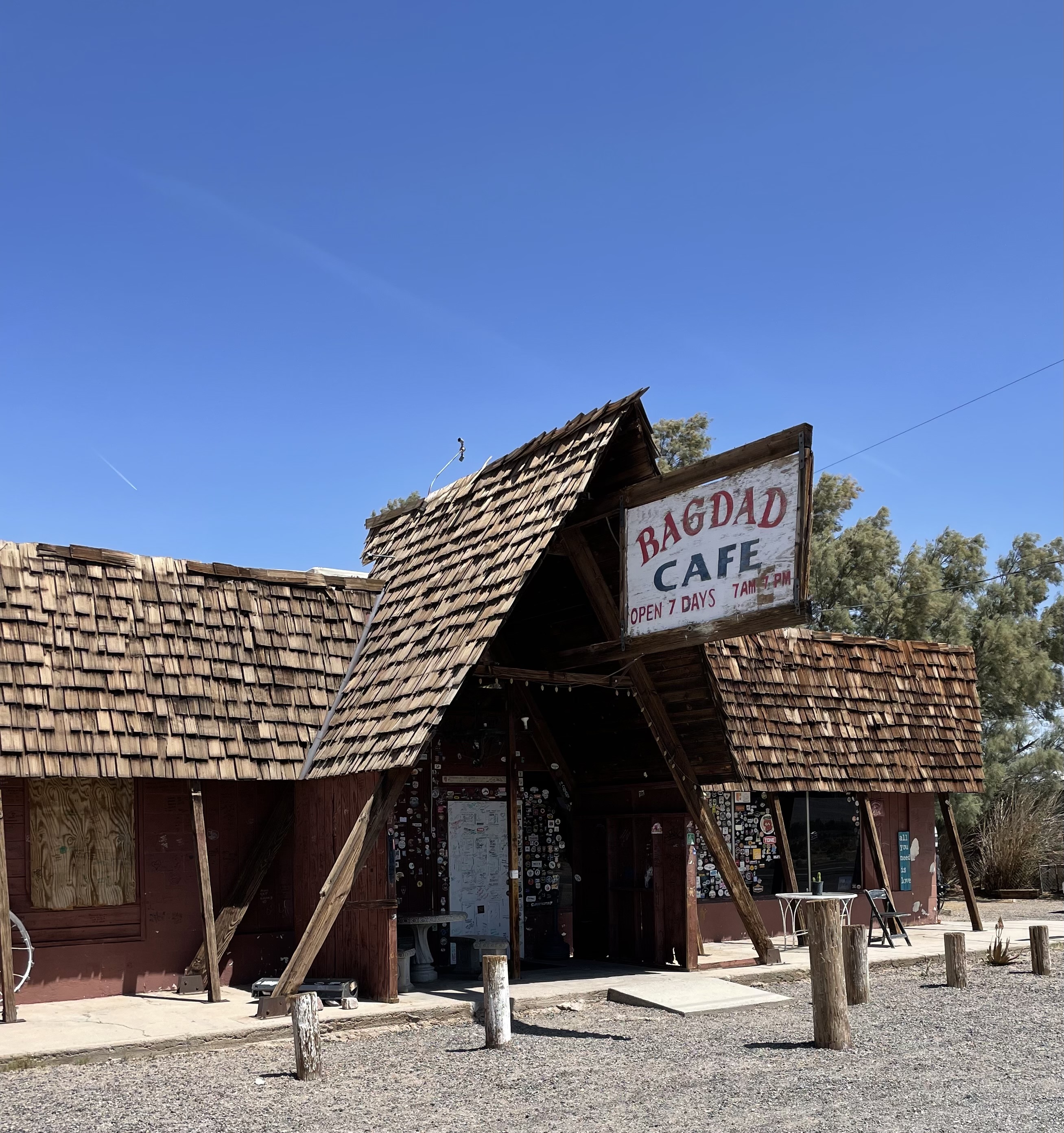
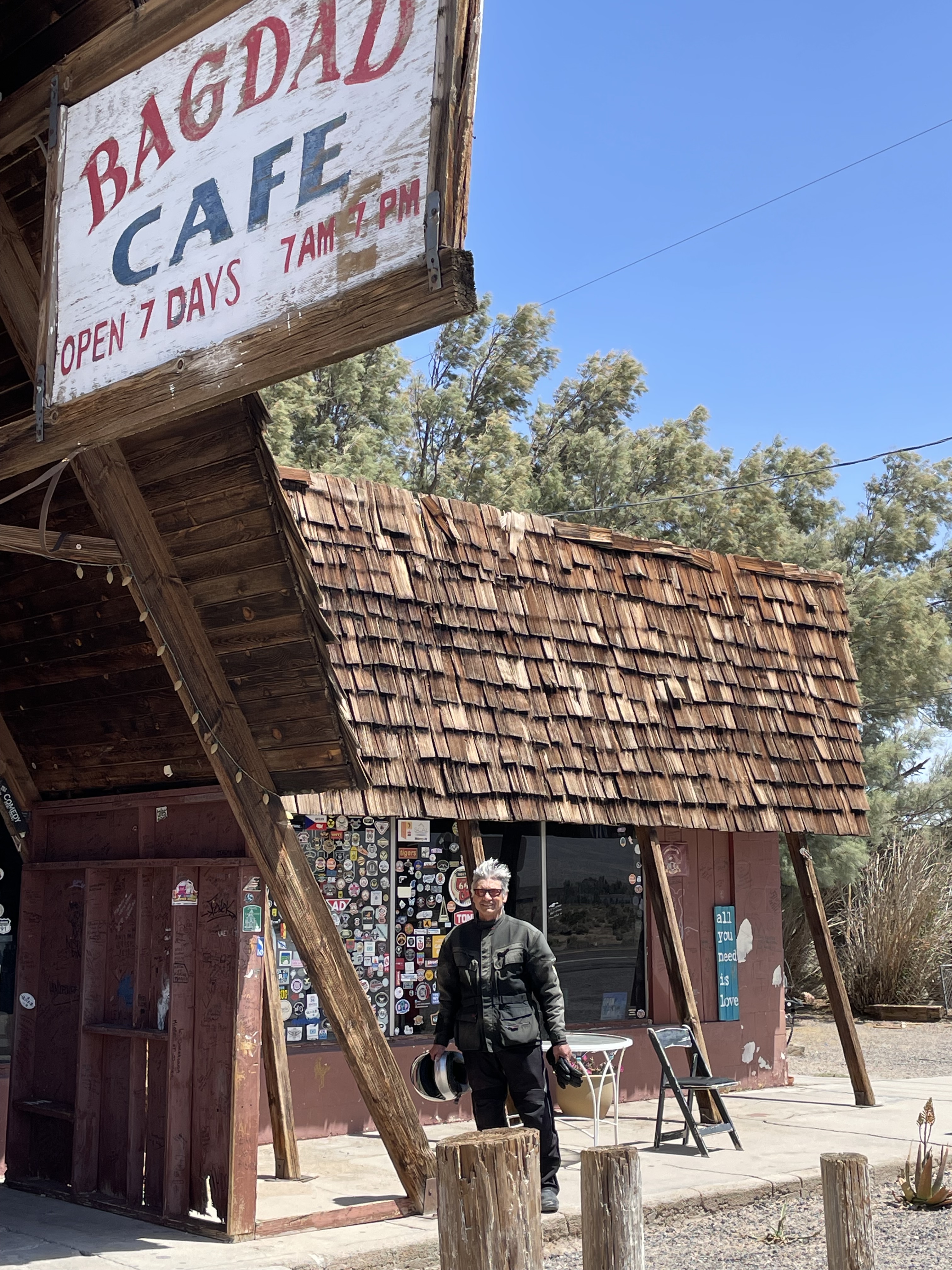
Today , the Bagdad Cafe is a tired, melancholy roadside attraction.
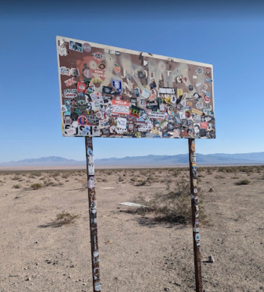
Having decided that the memories of a whimsical movie about a little cafe just around the bend, are better than the actual cafe of the present, we set off for Amboy and the Kelbaker Rd intersection. You can’t miss it as the Joshua Tree Sticker sign notes the turnoff…
Looks like a lift tower on Chair 7…
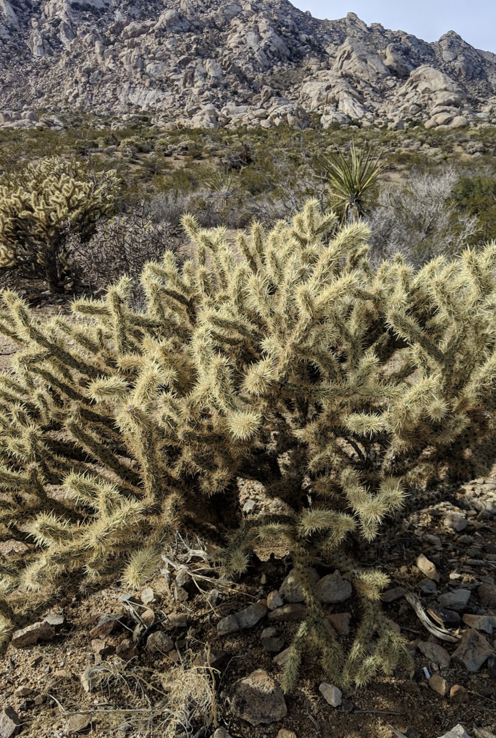
From the sign we had another 125 of our 280± mile day’s ride to our destination in Shoshone before us. Kelbaker Road features some interesting desert flora and the granite outcrop in the Boulder’s Viewpoint area is worth a stop.
A controversial mega-solar energy project that would extract massive amounts of groundwater from the area around the Soda Mountains in the vicinity of Baker would also impact the dwindling bighorn sheep population that once flourished in the area. I-15 and I-40 has already interrupted ancient migration trails. Desert bighorns once thrived in the serrated mountain ranges across the Mojave Desert, where they formed a “metapopulation” of groups connected by these ancient trails. Today, their survival is threatened by disease, drought, interstate highways and now, renewable energy.
Flying through Kelso and Baker we made our way through the Mojave National Reserve, arriving in what is our favorite little town of Shoshone, just outside of Death Valley NP.
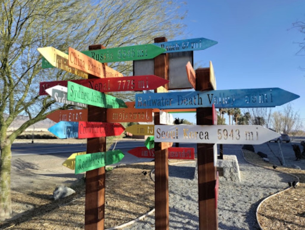
It’s impossible to get lost in Shoshone
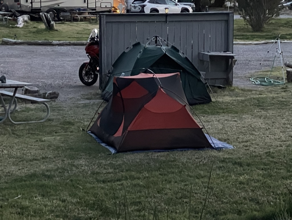
After setting up camp and checking directions, we strolled down Old State Highway 127 which runs parallel to the new state highway past the school and ‘Sorrells House’. I’ve noted in previous posts that the house was designed by Richard Neutra and is now occupied by the surviving daughter of the family whose great-grandfather founded the town and whose family has owned the town, lock, stock, and other revenue generating venues, now with a nod to ecotourism rather than strip mining, solar farms, malls, and subdivisions. That, and there’s a natural hot springs that keeps the community pool at a comfortable 89 degrees year round!
A raucous Tuesday night crowd had gathered at the Famous Crowbar Cafe and Saloon where we enjoyed dinner and a whistle wetter or two. Our server who was working solo serving a capacity crowd at the bar and tables managed to restore our whistles while awaiting victuals from the solo line cook in the kitchen. Somehow the wait didn’t matter. More impressive is that she didn’t write anything down.
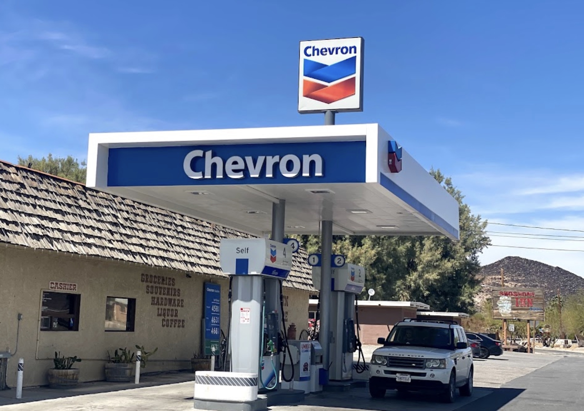
Following a delicious grilled Ortega chicken sammie and salad, we checked out the antique Chevron gas pump in the museum area adjacent to the cafe, a relic of a distant past that displayed a three digit price display as in: “_._ _”. We then strolled across the new State Highway 127 to the Chas Brown Market for procuring the first “R” of the hour of rehydration, relaxation, and reflection that beckoned. Pete made a new friend in the market while discovering that beer, by volume, costs more than gasoline. The new Chevron pumps in front of the market, that had sold a $1.9 million dollar Mega Millions lottery ticket in 2020, sported considerably higher prices with updated displays to several digits. You might just be able to fill your Range Rover’s tank with those winnings.
From its headwaters north of Beatty, NV, the Amargosa River flows underground in a southerly direction. Near the Dumont Dunes south of Shoshone and Tecopa, it makes a big u-turn and heads north into Death Valley National Park, finally terminating in Badwater Basin, the lowest point in the United States. The very same water that fills the campground pool and rises to the surface in the wetlands restoration areas, mostly flows beneath the desert surface and is warmed by subterranean thermal activity.
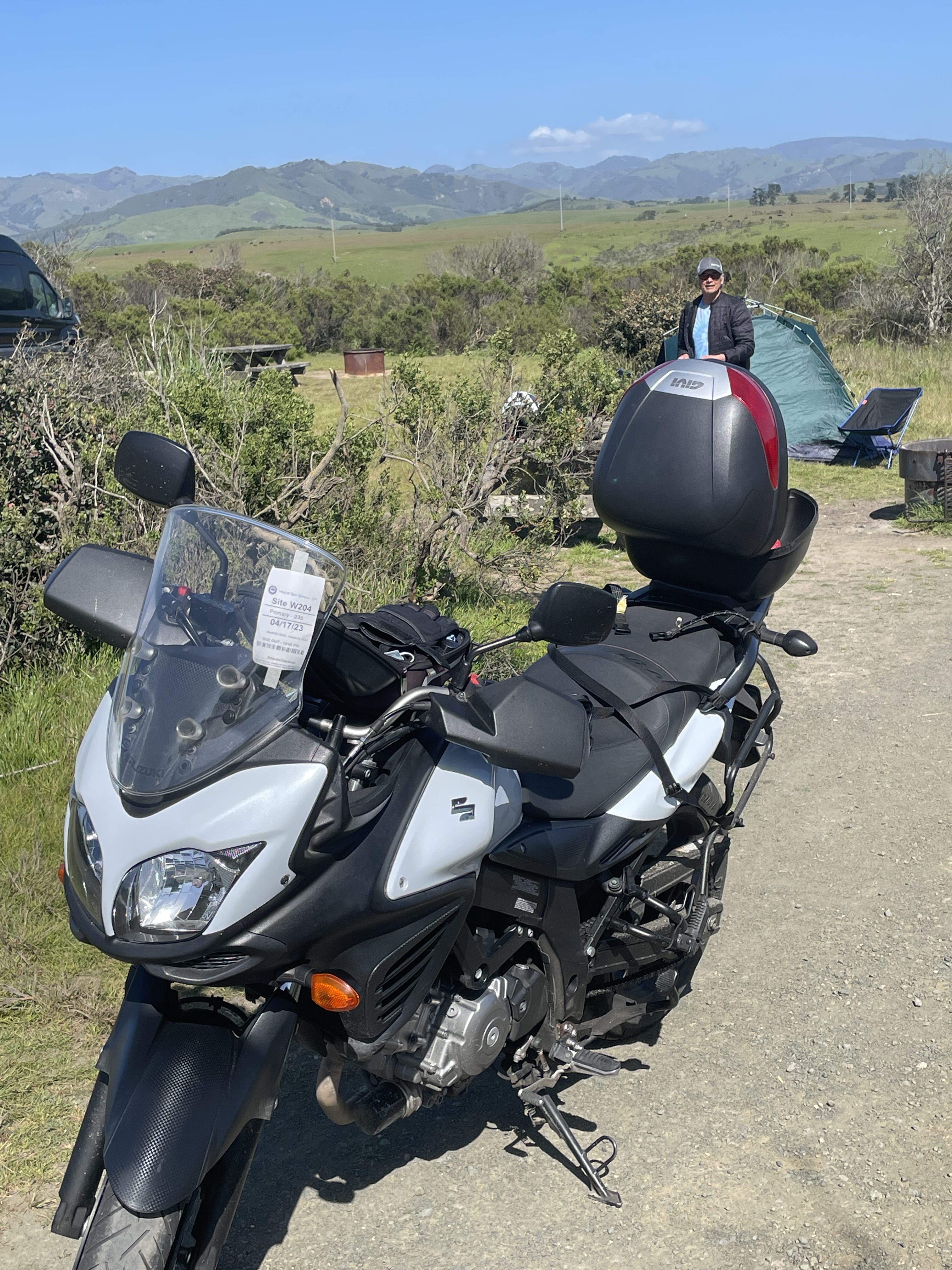
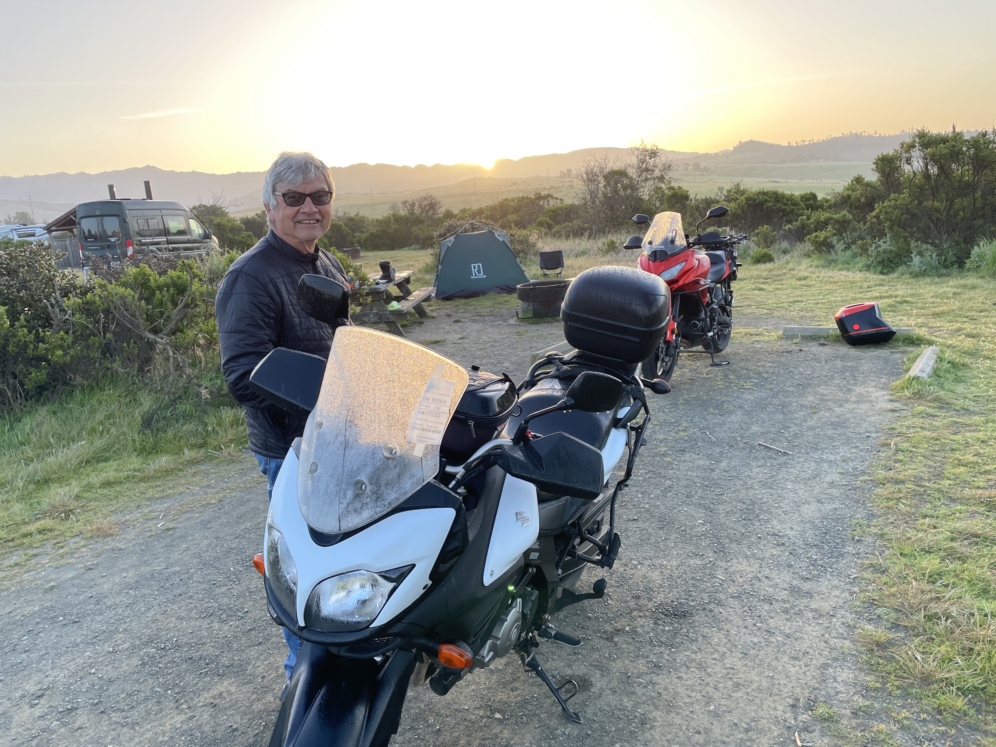
Day 4 Kernville
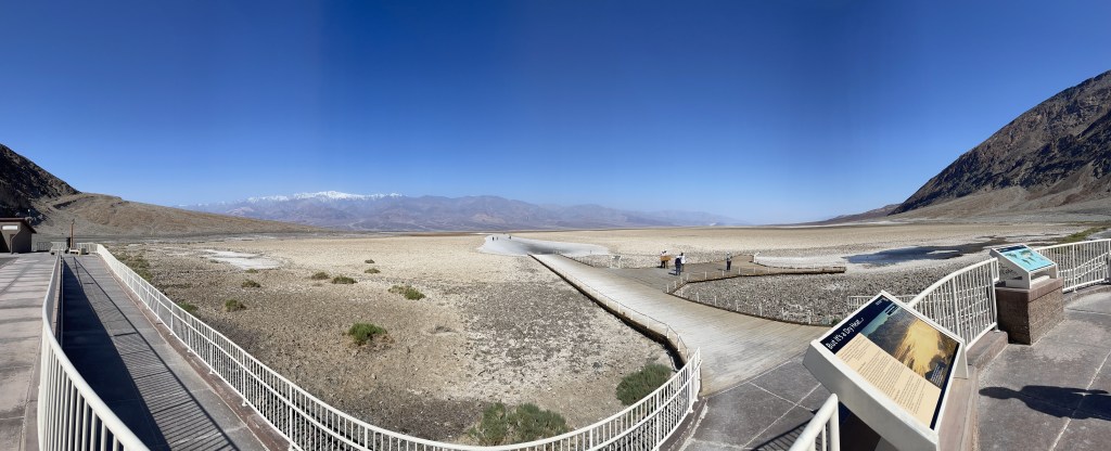
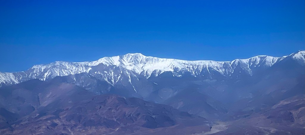
We decided to take CA-178 into Death Valley. The last time we rode this route was at night and is featured in the Riding Under a Fool Moon post from 2019 https://sisyphusdw7.com/2019/11/ . The route took us through BadwaterBasin, the lowest elevation below sea level in the US. The snow capped mountain is Telescope Peak in the Panamint Range and summits at 11,043 feet above sea level. The photo at the bottom shows the sign from the basin viewing area to sea level, some 282 feet above the road.
We decided to forgo the hustle and bustle of Furnace Creek to stop at Stovepipe Wells for a mid morning snack before heading to another of our favorite spots in the desert, the Panamint Springs Resort. We stayed there earlier in March on The Desert Pilgrimage Tour, https://sisyphusdw7.com/2023/03/. This day it was just for lunch before heading up and out of the lowlands on CA-190 to the high desert, US-395 and CA-58 over Walker Pass to our destination for the night in Kernville.
At the Father Crowley Overlook we stopped to view the colorfully striped canyon created by ancient volcanic activity. In Panamint, the market cashier said that Tom Cruise had a few weeks earlier, flown into Panamint Springs to check out Rainbow Canyon that was a location for filming the first, pre-CGI Top Gun. The canyon was nicknamed “Star Wars Canyon” by visitors who came to observe and photograph the military test flights which occured in the vicinity. Star Wars Canyon is part of the R-2508 Complex, which has been used by the military since the 1930s. Unfortunately a jet crash in the canyon in 2019 resulting in the death of the pilot and injury to several visitors in the area, put an end to training flights through the canyon. We did meet two delightful couples, one from Britain and the other from New York by way of France who were curiously hoping for an F-16 to rip through the canyon. We had an enlightening exchange of cultural perspectives of our respective travels.
As Rick Steve’s says about travel: Globetrotting destroys ethnocentricity. It helps you understand and appreciate different cultures. Travel changes people. It broadens perspectives and teaches new ways to measure quality of life. Many travelers toss aside their hometown blinders. Their prized souvenirs are the strands of different cultures they decide to knit into their own character. The world is a cultural yarn shop. Back Door Travelers are weaving the ultimate tapestry.
Ian and Melissa at the Father Crowley Overlook
“Rainbow Canyon” isn’t quite as colorful in the midday light. It was however green from spring rains.
We continued up past the turnoff to Darwin and over the Inyo Range to Olancha. The Owens Lake was beginning to show signs of life as water from the winter storms and the beginning spring runoff was making its way downslope.
Before crossing over Walker Pass on CA-58, Pete and I pulled over to stretch following a fuel stop in Ridgecrest at the intersection of CA-58 and CA14 where we were warned by a passing motorist that there was an unsafe driver ahead. This after a brief conversation with another solo motorist in an “all earthly possessions on board” van who was headed west, back to civilization after an extended desert stay. I guess unsafe drivers are a feature of civilization.
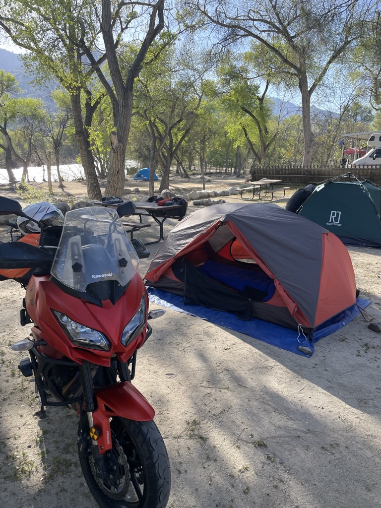
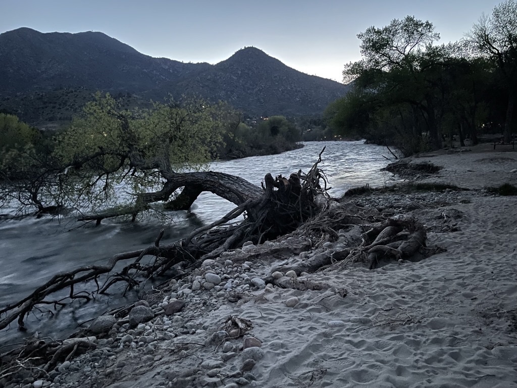
We made our way the Rivernook Campground in Kernville passing by the recently upgraded Isabella Dam. You might find this video recently posted by the Kern County Fire Department interesting as the project overview is examined in the context of this year’s river flows https://youtu.be/cDwY4sWs9MU .
After a fine meal at Kern River Brewing we were pleased to have a bit mellower experience than when we were in Kernville last February during the community’s Whiskey Flat Days celebration (below) where winding our way through the SRO crowd to get to the gas station was the most daunting aspect of that 5 day ride.
Try riding a motorcycle through that crowd
I had a brief clip of the Kern River as it raged near our campsite, but once again, my technical expertise (and budget) doesn’t permit purchasing format conversion to make IPhone video in HDR into a YouTube friendly format. Not sure who the villain is in this, WordPress, Apple or YouTube. I know who the victim is… You, my audience, who can only appreciate the still photo above https://youtu.be/LukyMYp2noo .
Day 5 Homeward Bound
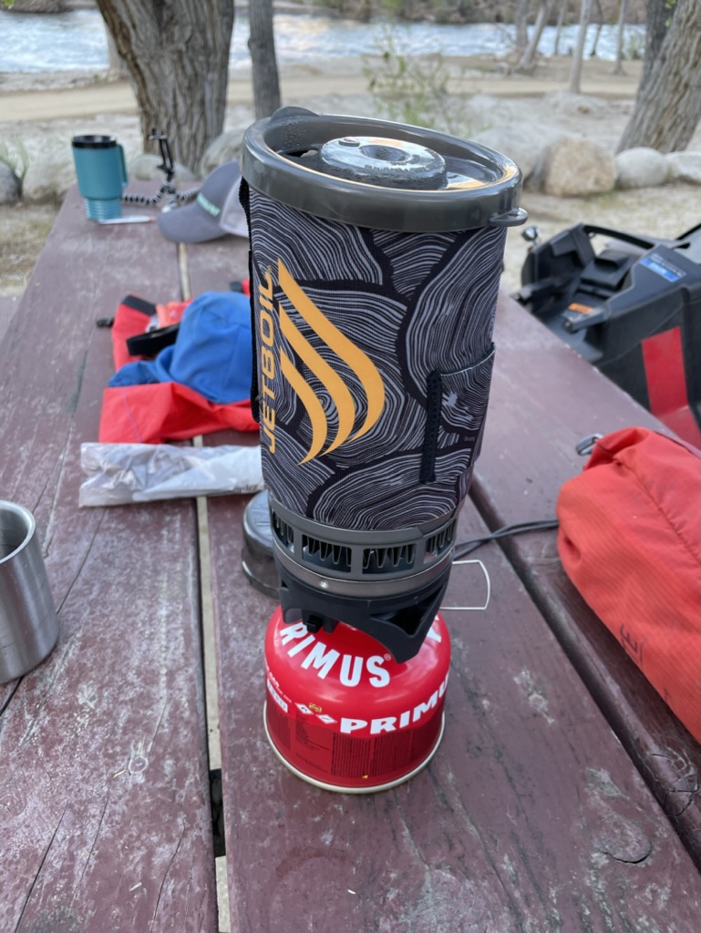
Good Morning Mr. Jetboil
One of the subtle calibrations one makes when “roughing it” is how to maintain the adventurous aspects of unpacking and setting up camp, not showering for consecutive days, making a fire to keep warm while enjoying the Three R’s after riding a motorcycle for 300 miles, sleeping on the ground, awakening to a frosted campsite, only to break down and pack up camp again. How to ameliorate those “hardships” without seeming to be too much of a wuss? A warm cup of coffee, mixed with some chocolate is the solution to the fine recalibration from discomfort to comfort. In fact, it seems like beverages, both associated with the Three R’s and morning reverie, more than compensate for any of the major and minor nuisances of motorcycle touring.
Our route home found us rolling over some new roads through Bakersfield to Oildale because of the closure of foothill roads east of Bakersfield due to winter storm damage. After riding through Kern River County Park into Oil City then out, the contrast of the two could not be greater.
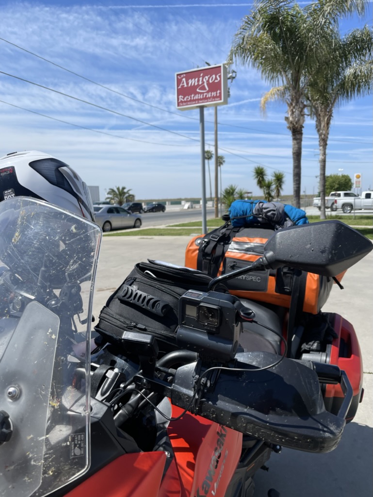
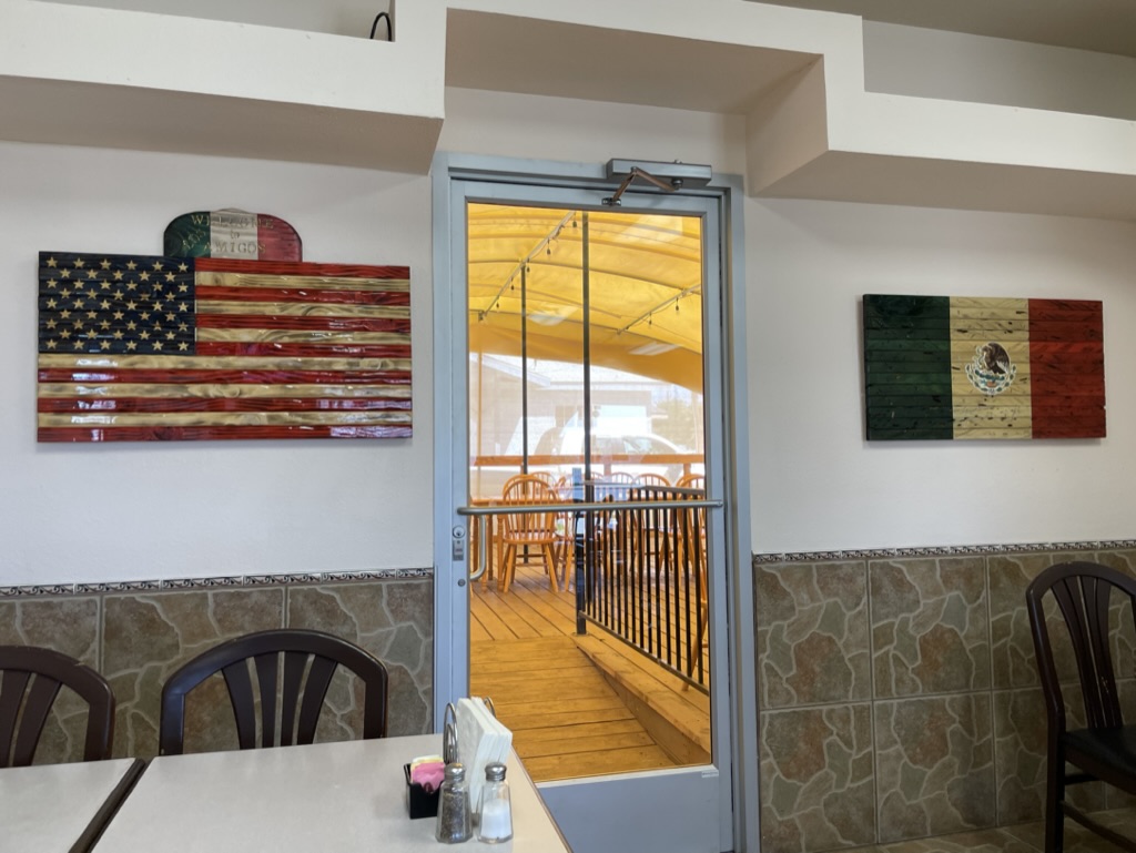
Once through the sucker rod pumps of Oildale we headed north on CA-65 stopping in Terra Bella for one of the best Mexican breakfasts we’ve ever had. The tortillas, flour and corn, were handmade and the huevos rancheros with chorizo were incomparable. The Amigos Restaurant reflects the very best of determined sisters to operate a treasured eatery in the rural Southern San Joaquin Valley.
In Porterville, where once again foothill road closures kept us rolling through the citrus groves Strathmore, Lindsay, Cutler, Orosi, and Orange Cove we made it to CA-168, Tollhouse Road by way of N. Academy Avenue in Fresno County. Our intent was to make our way to Friant and then drop down into Raymond and home. Now, I’m not the greatest navigator once we’re on the road as my issues with Butler Maps, Google Maps, Apple Maps, and Rever have all been documented in previous posts. So, I decided to turn over the last leg of the trip to Pete, acknowledging his ancestral Basque heritage in proximity to Portugal, a nation that once ruled the seas. You had to know a thing or two about navigating to rule the seas.
Our left turn onto CA-168 wound up taking us into the heart of of the 5:00 Fresno slab commute as we merged onto CA-180 followed by CA-41 merge. It was white knuckle, bumper to bumper traffic at 80+ miles per hour until we exited onto CA-145 and Rd-406 that took us on winding foothill roads devoid of crazed cagers at the foot of Hensley Lake and eventually to Raymond on Rd-600. From there it was Raymond Rd to Ben Hur Rd to Buckeye and Yaqui Gulch roads to CA-140 and home. I highly recommend a Sunday afternoon drive on any of the aforementioned foothill roads. Try to avoid becoming a crazed cager, or at least avoid crazed cagers anytime you can.
Epilogue
Extroverts have more fun. If your trip is low on magic moments, kick yourself and make things happen. If you don’t enjoy a place, maybe you don’t know enough about it. Seek the truth. Recognize tourist traps. Give a culture the benefit of your open mind. See things as different but not better or worse. Any culture has much to share. Rick Steves
What creature appears to be washing ashore? Could it be a descendant of Wilson?
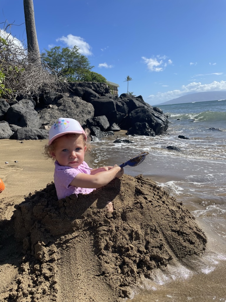
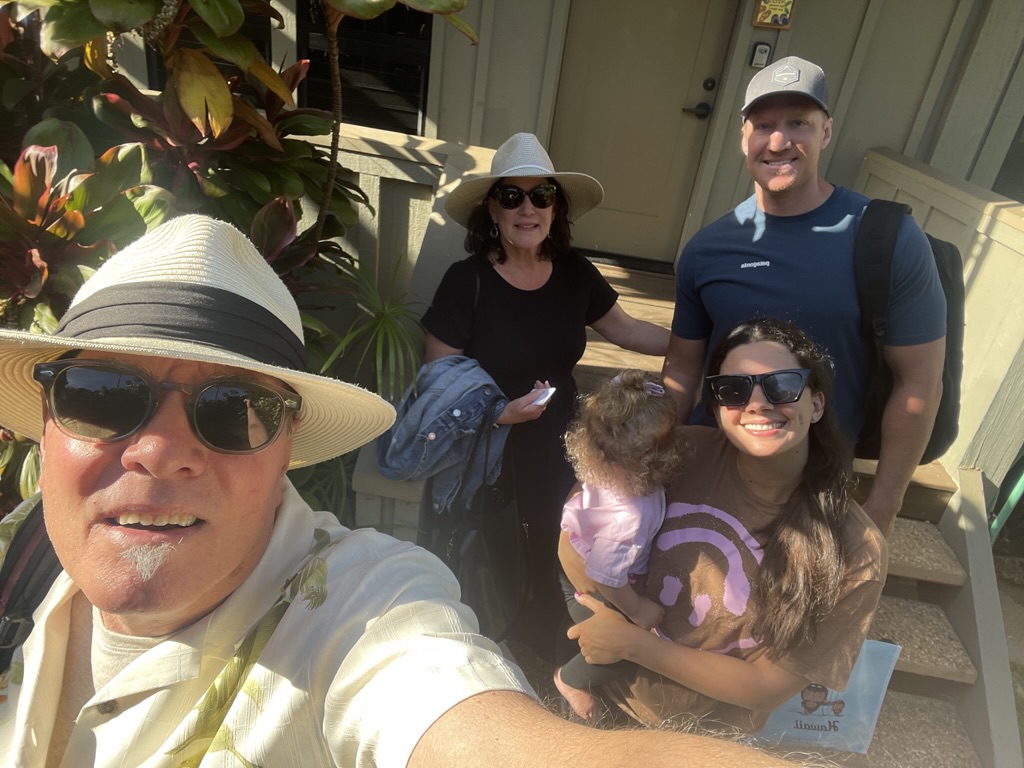
Just prior to a delightful week spent in the company of my wife, our son, his wife and their beautiful little daughter in Maui, a new member of Sisyphus’s family arrived…
Two beautiful Italians and a hillbilly
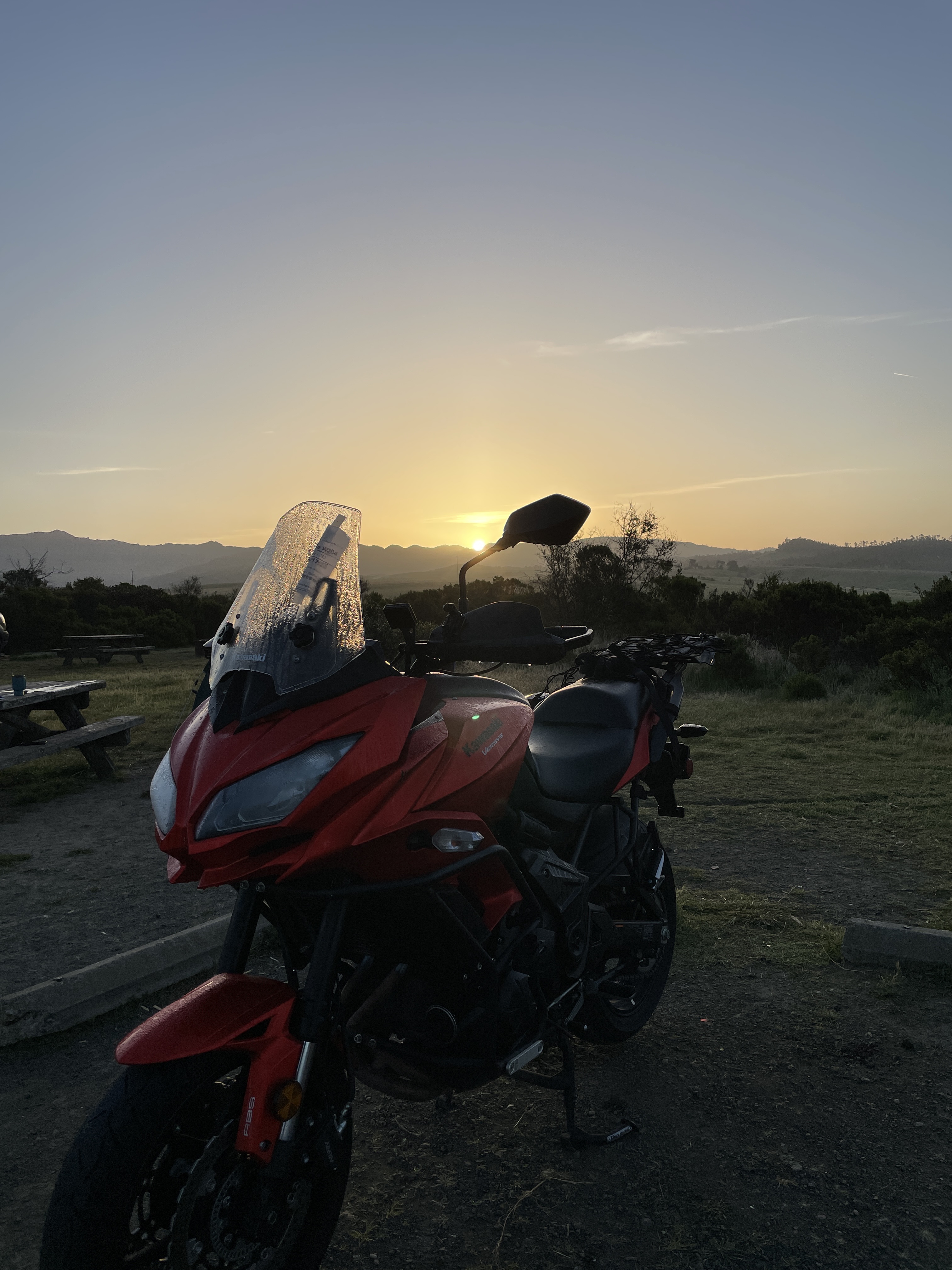
So, if you are interested, or know someone who may be interested, in purchasing the 2016 Kawasexy Versys 650 LT loaded with several touring-friendly features and lovingly maintained with a mere 28,440 miles, message me. Both Italians insist on moto-monogamy!
“Not if you have the right attitude. It’s having the right attitude that’s hard.”
“I argued that physical discomfort is important only when the mood is wrong. Then you fasten on to whatever thing is uncomfortable and call that the cause. But if the mood is right, then physical discomfort doesn’t mean much.”– Robert Pirsig, Zen and the Art of Motorcycle Maintenance
Feb 7, 2023
Well, wouldn’tcha know, it’s that time again. Time to mount the Kawasexy and roll south and east to the Mojave. Since I’m in a line to access ChatGPT, I went to resource 1.2, Wiki, to make sure my understanding of “a pilgrimage” was at least in the ballpark, or desert, as it happens. From Wiki:
A pilgrimage is a journey, often into an unknown or foreign place, where a person goes in search of new or expanded meaning about one’s self, others, nature, or a higher good through the experience. It can lead to a personal transformation, after which the pilgrim returns to their daily life.
That sounds pretty high minded. Not like mindedness after edibles, but mindedness beyond the capacity of my mind, high or otherwise. Since I’ll be in the company of my motley band of brothers, the Silverback Dirtbags, I can’t vouch for their mindedness except to say Pete is all in and Andy is somewhat equivocal. It’s not that Andy has anything against expanded meaning or higher good. In colloquial Dirtbag, Andy, like a Rorschach, is as clear as dishwater in his intent. I suspect if we asked him for a mandala to clarify, he would produce something along the lines of a compass rose, leading us to no clear intent. It may be, if I take him at his word, that his decision to join us depends on a diagnosis and favorable prognosis with regards to an orthopedic issue.
Speaking of orthopedic issues, my guy, Dr. Beauchman has cleared me for any and all activities that will fuel my desire to keep on keeping on in search of self, others, nature and/or higher good. All with the caveat that I will use my good judgment to, Don’t let the sound of your own wheels drive you crazy, Lighten up while you still can, Don’t even try to understand, Just find a place to make your stand and take it easy.
As is my indefatigable desire to plan, our journey will twist and turn us on backroads, some familiar, others foreign in keeping with the pilgrimage theme, through the Sierra foothills to Three Rivers. From Three Rivers we’ll make our way over Alta Sierra, past Lake Isabella, over Walker Pass to Ridgecrest.
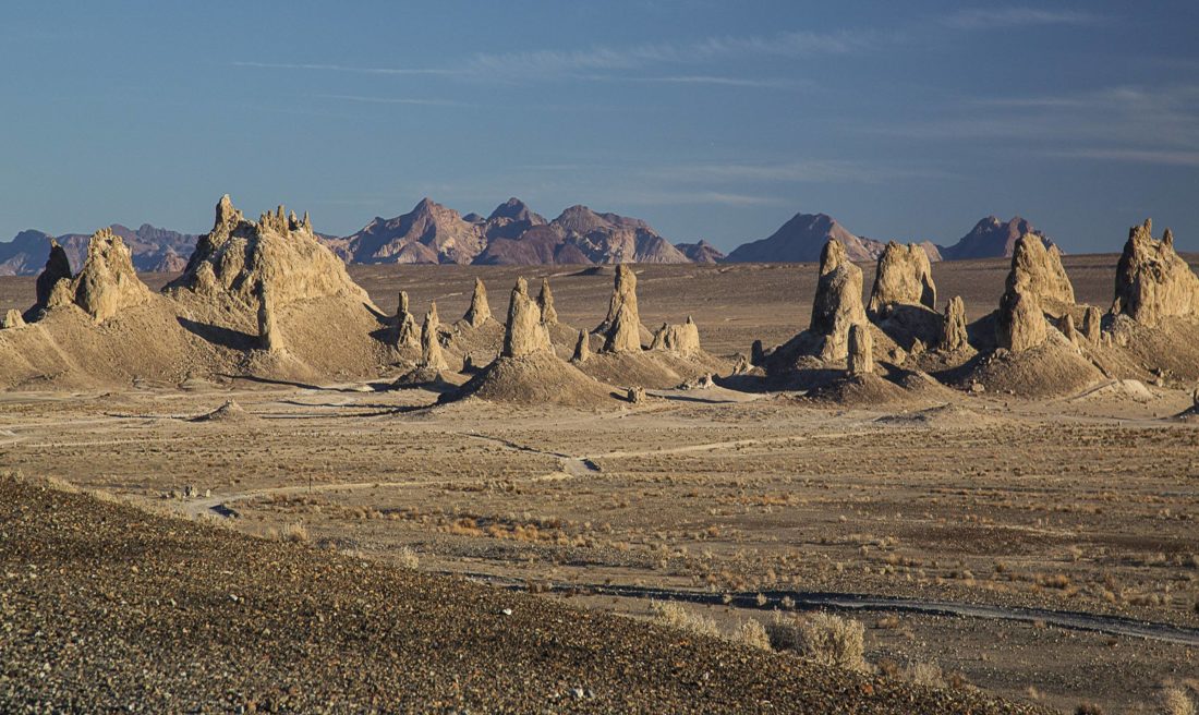
From there it’s to Trona, the garden spot of the Owens Valley, (left, the bustling Searles Valley Minerals plant where Na2CO3•2NaHCO3•3H2O is processed and right, the Trona Pinnacles, tufa,or calcium carbonate spires). Then it’s on to the Panamint Springs Resort. It’s as much a resort as Trona is a garden spot. But it is the desert and we are there not because the “resort” is unknown, moreover, that it is a reminder of “daily life” in the middle of the Panamint Valley where we can enjoy victuals, beverages, and fuel our steeds. Two nights.
The next day we will venture forth to unknown or foreign places to expand our understanding of ourselves, others, nature, and a higher good through the experience of Rhyolite, NV. Okay, it’s not entirely foreign, though it is in Nevada, or for that matter unknown as 40ish years ago I explored Rhyolite in another life. I expect the venture to be rewarding nonetheless. After Rhyolite it’s back to Panamint Springs for the night. Not foreign but there will likely be foreigners there.
Day four of our journey will find us back in Three Rivers for the night in a foreign campground, not our favorite and familiar first night destination at the Three Rivers Hideaway, but now opting for the Sequoia Campground and Lodge for the night.
Day five will be the return route to our daily lives where our no doubt expanded consciousness of self, others, nature, and higher meaning, along with dirty laundry awaits. Stay tuned for the post ride update on sisyphusdw7.com. Cheers!
The road beckons, as usual, Sisyphus and Associates are willin’ to scratch the “Quest into the Unknown” itch on this proposed journey that will reprise a scene or two from where we’ve been before (check out the links). This is to satisfy our incurable quest into the unknown, including some new territory close to Tucson and Tucumcari. Tehachapi, meh.
As the seasons begin to change, we hope the weather cooperates and foregoes any extreme behavior. Well, we’ll just have to wait and see. Our first two days are familiar as they include previous stops in Tonopah and Cedar City with drive throughs in Torrey, Caineville, Hanksville, and Green River. Our ultimate destination and turnabout will be Santa Fe in the Land of Enchantment. I’m curious how the state motto, “Crescit Eundo,” translated from Latin, means “It grows as it goes.” I’ll have to ask Bob and Suzanne our enchanting hosts about the allusion to dynamic progress…
Sisyphus is an insufferable map geek. The roads over which our route will take us fall into the Butler designated “road qualities” of Lost Highways, G1, G2, and G3 segments. Check out Mojave Moto Spring 2021 for Sisyphus’s expansion of the Butler “road qualities” descriptions at https://sisyphusdw7.com/2021/04/29/mojave-moto-spring-2021/. There will be deserts and high forested mountains, river valleys, and arroyos to cross through small towns on backroads that are our preferred intermediate waypoints. What did folks do before Google Maps and Earth? Okay, our quest will sort of be into the unknown. Sorry Mr. Natural.
You may think this trip isn’t so much a quest into the unknown what with having covered ground on previous rides and extensive use of mapping. And you’d be correct. The quest into the unknown isn’t so much about the terrain. We know we’ll be awed by the varied landscapes we’ll ride through. The quest is more about the journey following some of Edward Abbey’s travels and the romance of the road that seems to permeate the long-haul trucker’s, poet’s, and map-loving motorcyclist’s zeitgeist. So, why not let’s call it, There and Back Looking for the Other Abbey’s Road (Trip2021).
Sisyphus humbly offers a scroll-worthy (at least click on the blue map links) proposal for this twelve-day moto adventure, broken into Part 1, Eastward We Go, and Part 2 Westward Down and Bound. Bring your imagination along and join us if you’re willin’ as a brief narrative of the route with some images captured previously in-person and from the interwebs detail our intended waypoints and consider the ese on Guest-friendship that follows.
There’s nothing creepier than a cemetery next to a Clown Motel
The Sierra poses the first “obstacle” to overcome. We’ll take CA-120 by way of J-59, CA 132 to Smith Station Rd. (281 miles) with the Tioga Pass Option, or the CA-108 over Sonora Pass Option (~309 miles) to Bridgeport then Lee Vining on US-395. It just depends on which route is on fire…
From Lee Vining, it’s US-395 to the junction w/ CA-120 to Benton (Hot Springs). From there we make our way on US-6 to Tonopah, across range and basin country, where Sisyphus and his Associate Pete stayed in the fall of 2020. You can read about that trip and the next two legs we are reprising from the Burr Trail Here We Come blog post. sisyphusdw7.com, Burr Trail Here We Come
From Tonopah, we ride on US-6/NV-95 through Warm Springs and catch the road to Rachel on NV-375. We hope to avoid being abducted by aliens who are allegedly held captive at Area 51. That doesn’t preclude stopping for a souvenir T-Shirt at the Alien Research Center at Crystal Springs should we escape. T-Shirt safely stowed, we proceed on US-93 through Caliente, perhaps for a delightful lunch, infusing cash into the local economies, to the junction w/ NV-319 in Panaca.
Sisyphus’s Associate, Pete at the Alien Research Center in 2020
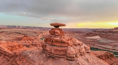
From Panaca it’s NV-319 to the Nevada/Utah border where the road becomes UT-56 to Modena. Modena, just an R away from mRNA vaccine name recognition fame… I wonder if there’s a Pfize Utah?
From there we will climb to Cedar City on UT-56.
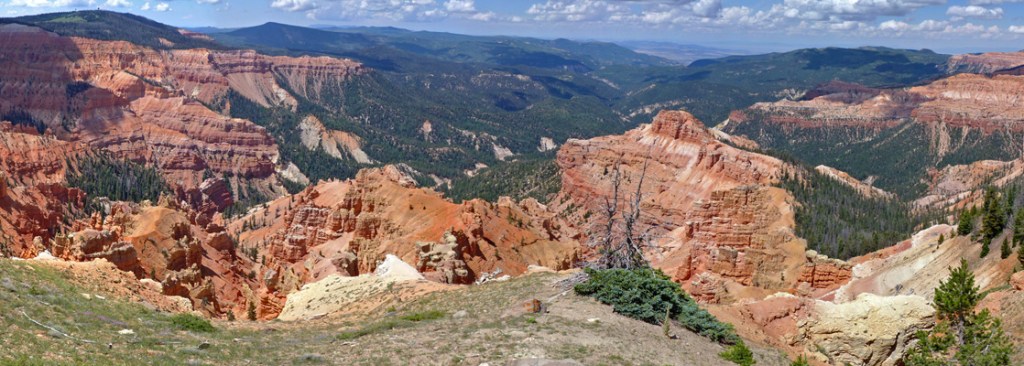
East of Cedar City, Cedar Breaks from the Chessman Ridge Overlook
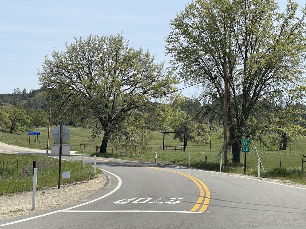
Following breakfast, an early departure takes us on UT-14 to Tod’s Junction meeting UT-14 and US-89 through Hatch to the junction w/ UT-12 through Tropic, Cannonville, Henrieville, Escalante, and Boulder where we will tip our helmets to the Burr Trail, then roll into Torrey to the junction w/ UT-24.
State Route 12, Utah
From Torrey, it’s UT-24 along the Fremont River, past Capitol Reef, through Fruita, Caineville to Hanksville. Staying on UT-24 we make our way through Green River via a brief spin on I-70 to US-191 to Moab, Arches, and red rock country.
The irony of technology vs the written word was not lost on Edward Abbey
Via Moab US 191 through the La Sals and into the Rockies to Monticello and the junction w/ US-491 we make our way through Lewis and UT-184, to Mancos and UT-3 and US-160 to Pagosa Springs. Here we take US-84 through Chomo, cross the Colorado/New Mexico border to the junction of US-84 and US-64. The last leg on US-64 is to the junction w/ UT-17 into Chama.
Via US-64 from Chama, we pass through Brazos, staying on US-64 at Tres Piedras, we cross the Rio Grande on the Rio Grande Gorge Bridge on our way to Taos. It’s fun to walk to the middle of the span and jump up and down. More fun if an 80,000-pound rig passes by.
From Taos, it’s UT-68 to Pilar, where we roll alongside the Rio Grande to Espanola and Pojoaque, then take US-285/US-84 into Santa Fe.
The Rio Grande near Taos
= OR =
Abbey’s Road Trip 2021 V1.1, a.k.a. The Aspen Anna Option (with a nod to Taos)(?)
This route option skips the Moab to Chama, Chama to Santa Fe Days 4 & 5 legs of The Other Abbey’s Road Trip V1.0.
With this option, the riding distance for days 4 and 5 increases by 140 miles so that we might visit Aspen. One of the other Associates, Andy, who you will recall from the Riding Under a Fool Moon post, has daughter who resides there. And Anna happens to be a former student of Sisyphus. Who knows, maybe we’ll see Lance Armstrong and George Hincapie riding their bikes, neither of whom is a former student, but Aspen is a small town. The bonus of crossing the Continental Divide resplendent in fall color looms as we make our way through the Rockies.
Briefly, south out of Moab on US-191 to the junction w/ UT-128 to junction w/ UT-46 in La Sal. A short distance to the Utah/Colorado border where UT-46 becomes CO-90 we roll to Naturita where we don a few extra layers and take CO-141 up and up to the junction w/ US-50 just south of Grand Junction to Delta. Junction US-50 w/ CO-92 to Hotchkiss and junction w/ CO-133 to Carbondale and the junction w/ Rds. 101, 100 to CO-82 on to Aspen. Lots of twisties in the mountains.
Out of Aspen, likely wearing every stitch of clothing we’ve packed, it’s CO-82 over Independence Pass. Unless closed whether the weather! Then on to the junction w/ US-24. US-24 due south to the junction w/ US-285 near Johnson Village. US-285 to junction w/ CO-17 to Alamosa where we pick up US-285 crossing the Colorado/New Mexico border to Tres Piedras and US-64 to Taos. From Taos it’s UT-68 to Pilar where we roll alongside the Rio Grande to Espanola, and Pojoaque and take US-285/US-84 into Santa Fe.
Should the decision be made to skip Taos, remain on Hwy-285 to Santa Fe (Aspen to Santa Fe) ~303 miles. If my vote counts, I say Taos it is.
Meanwhile, on to Santa Fe…
Day 6 – Santa Fe Layover*
Mask man to the rescue!
Without imposing too much, while in Santa Fe we anticipate that the Bob and Suzanne Delaware, our resident hosts, will consent to allow Bob to summon his considerable skills as a platinum tour guide to provide Sisyphus and his Associates with a condensed tour of Santa Fe. This skill set has been honed over a number of years shepherding student travelers to the nation’s Capitol and the Big Apple, as well as his personal European and stateside rambles.
Land of the Enchanting Delawares
Hopefully we’ll not have to deal with any plague spreading oppressors! Besides, Bob’s tour will get us out of Suzanne’s lovely red hair…
From Santa Fe, we head north on US-84 to Pojoaque and cross the Rio Grande on US-285 to Espanola. Remain on US-285 to La Quachia (US-84) along the Rio Chama to Abiquiu, with Georgia on our minds, or choose the option to head west and visit Los Alamos via NM-502, -501, -4, and check out what’s shakin’ at ground zero for mutually assured destruction. In either case, then proceed to NM-126 through the mountains to the junction w/ NM-96 and US-550 near La Jara. From the US-550 Interchange, we roll through Counselor, Nageezi to US-64.
On to Farmington along the San Juan River to Shiprock where US-64 will take us across the New Mexico/Arizona border to Teec Nos Pos and the junction with US-160 and the Four Corners Monument north on US-160, a six-mile (x2) round-side trip.
Back on US-160 near Red Mesa, we cross the San Juan River just west of Bluff to the junction w/US-163 to Mexican Hat.
Es un hermoso sombrero
Day 8 – Mexican Hat to North Rim Campground ~265 miles
Okay boys keep the bikes in the middle of the lane
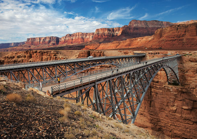
From Mexican Hat on US-163, in the midst of the Navajo Nation, to Kayenta and the junction w/ US-160 and AZ-98, up to Page and the Glen Canyon Dam and Lake Powell where we’ll spend a moment considering the abject reality of climate change, then head to the junction w/ US-89 across Antelope Pass to Bitter Springs and US-89A crossing the not so mighty Colorado River on the Navajo Bridge across Marble Canyon to Jacob Lake (from Mexican hat it’s ~220 miles to Jacob Lake Campground) where Hwy-67, which takes us to the North Rim of the Grand Canyon, lies some 45 miles south from Jacob Lake.
Backtracking, as the North Rim is an out-and-back, we take US-89A back to Bitter Springs, then US-89 south to Cameron, where we roll to the South Rim of the Grand Canyon on AZ-64.
Leaving the South Rim, we motor on AZ-64 to Williams before getting on the Historic Rte-66 the following morning. Maybe we can find a corner to stand on with fine sights to see, not Dallas Alice, but the takin’ it easy girl…
Williams Arizona, lost in time
Take’ It Easy You may recognize JB. How ’bout the fiddle player? Hint: DL
Getting our kicks on Historic US Rte-66 while takin’ it easy, we roll through Ash Fork, Seligman, Yampai, Peach Springs, Truxton, Cozier, Valentine, Hackberry, Antares, Hualapai, Berry, Getz, to Kingman perhaps to mistakenly stand on a corner scanning to see a flatbed Ford. Road-weary, a kind passerby reminds Sisyphus that the corner about which Jackson is singing is in Winslow, not Williams, or Kingman for that matter, though either city’s name satisfies the meter of the song… There’s probably a corner in Seligman we can stand on too, though there is one too many syllables.
In Kingman we take US-93 to the junction with AZ-68 to the Arizona/Nevada Border.
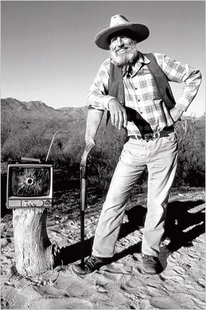
Entering the great Mojave at the interchange of AZ-68 and NV-163 and crossing the Colorado River again, what’s left of it downriver from the Davis Dam, this time in Laughlin, we head to Palm Gardens on NV-163. From the junction w/ US-95 in Palm Gardens, we roll to Searchlight and the Nevada/California border as NV-164 becomes Nipton Road to the I-15 (Barstow Fwy). From there we “slab” over Mountain Pass past the historic but abandoned and vandalized Hi-Lo Restaurant, to Baker and the world’s tallest thermometer where the Mad Greek Restaurant and Alien Fresh Jerky all await a similar fate.
From there we cruise through the remaining Mojave National Reserve to Shoshone on CA-127, the Death Valley Rd. We will heed the Desert Oracle’s advice and Desertoracle.com, Episode 127, Try Not to Die
Somewhere in the distance is the Amargosa River that “flows” through Shoshone
Our early departure from Shoshone takes us past Death Valley Junction and the Amargosa Opera House on CA-127 or we detour through Death Valley CA-190 ~164 miles to Lone Pine*
CA-127 becomes NV-373 at NV border where we continue to the Interchange of NV-373 and US-95 to Beatty, maybe catching Rhyolite on a short side trip on NV 374 (six miles, twelve round trip) that we missed on the Riding Under a Fool Moon, Death Valley by Moonlight ride (because of Sisyphus’s navigation error) for a picture or two. Then it’s back on US 95 to Goldfield (to check out the Santa Fe Motel and Saloon). Parenthetically speaking.
*Death Valley, Furnace Creek and Stovepipe Wells, through Panamint Springs on CA-190 to Lone Pine: DV to Panamint to Lone Pine
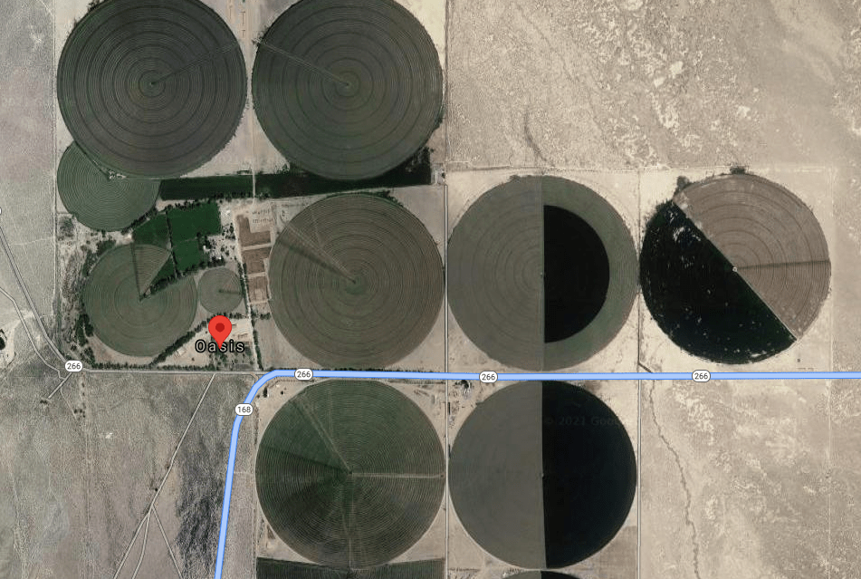
From Goldfield we take US-95 south, backtracking as it were, to the junction w/ the Lida NV-266 junction crossing the Nevada/California border to the junction w/ CA-168 at Oasis where circular irrigated alfalfa fields thrive. This was the scene of an alien abduction during our Riding Under a Fool Moon, Death Valley by Moonlight moto adventure linked above. This was a pre-pandemic ride in the fall of 2019 with the Associates Pete and Andy, one of whom mysteriously disappeared. Fortunately, for Anna’s sake, he was released by his captors and we were reunited in Big Pine.
Alien guidance systems posing as circular irrigated fields
Over Gilbert Pass, past Deep Springs College, where Sisyphus regrets not having the wherewithal to have attended, and over Westgard Pass to Big Pine Hwy on CA-168 where we take US-395 to Lee Vining and CA-120 over Tioga Pass and CA 140 to la douceur du foyer where there are numerous corners to stand on, but not many flatbed Fords. Thus ending the story of our route with a hard-to-read text, according to my editor…
Deep Springs College features fewer distractions than Chico State, Sisyphus’s alma mater
But wait, there’s more…
Abbey’s Road Trip 2021 Layover Days: Lessons From the Past Regarding Guest-friendship, An Ese…
Where Sisyphus considers a dialog with an Homeric epic. The italics indicate Sisyphus’s considerations…
While ours is scarcely an epic journey, Sisyphus will reflect on how the classics deal with road trips and apply their wisdom to our contemporary adventure. Sisyphus has considerable regard for how the past informs the present and future.
According to J. B. Hainsworth, in the course of the Homeric epic Odysseus encounters several examples of xenia, “guest-friendship” providing models of how hosts should and should not act. The Phaeacians demonstrate exemplary guest-friendship by feeding Odysseus, giving him a place to sleep, and granting him many gifts and a safe voyage home, which are all things a good host should do.
The Delawares have Phaeacian DNA.
Polyphemus demonstrates poor guest-friendship. His only “gift” to Odysseus is that he will eat him last. Calypso also exemplifies poor guest-friendship because she does not allow Odysseus to leave her island.
Polyphemus and Calypso offer classic “six of one, half dozen of another” poor guest-friendship outcomes. I’ve always known the Delawares to offer the finest beverage upon their guests’ arrival and to offer exceptional repast and delightful conversation before bidding adieu. Neither Bob nor Suzanne have ever once hinted at cannibalism. Their abiding hospitably permit their guests who’ve either satisfied or have exhausted their memorable visit to exit with good cheer. The Delawares conduct all guest-friendship with exceptional grace and decorum unlike Polyphemus or Calypso.
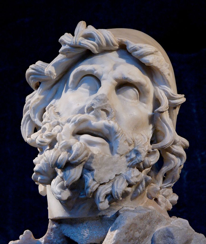
Odysseus
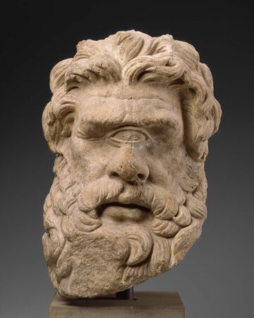
Polyphemus
Antinous
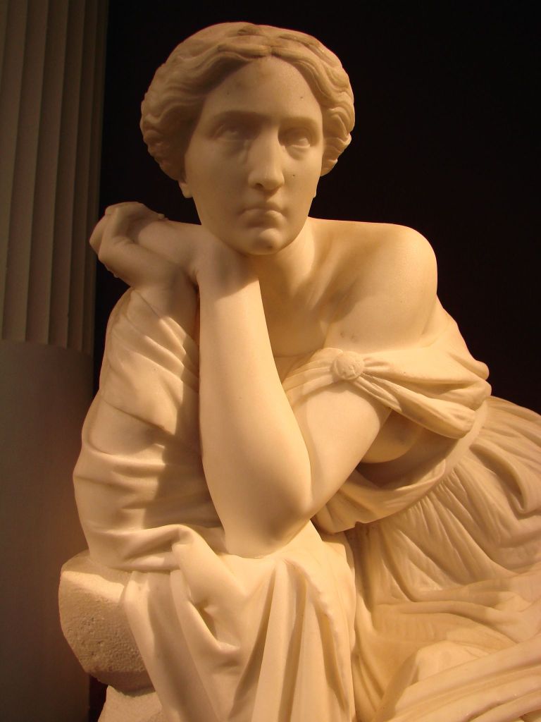
Calypso
Another important factor to guest-friendship is that kingship implies generosity. It is assumed that a king has the means to be a generous host and is more generous with his own property. This is best seen when Odysseus, disguised as a beggar, begs Antinous for food and Antinous denies his request. Odysseus essentially says that while Antinous may look like a king, he is far from a king since he is not generous.
I promise to not relegate Pete or Andy as beggars to test Bob’s hospitality, as Odysseus did to Antinous since I know Bob, unlike Antinous, is kingly in his every manor and exhortation. If at all flawed in his sincere humility, Bob is indeed kingly in his generosity. I am reminded of his wise counsel: It never happened.
Guest-friendship follows a very specific pattern:
The arrival and the reception of the guest.
Arrival will be on September 30, 2021, mid afternoon, baring the incalculable unforeseen delays of any quest into the unknown.
Bathing or providing fresh clothes to the guest.
A garden hose or perhaps a refreshing Santa Fe thundershower will do. We may need to do laundry. Perhaps we can obtain a wash tub and scrub board from one of the vendors on the Plaza.
Providing food and drink to the guest.
We will sustain the first three rounds of any beverage occasion. Beyond that, neither Santa Fe nor the Delawares bear any responsibility for poor choices. The Delawares may still be on the hook to shuffle us off to the nearest pub or contact our loved ones for bail.
Questions may be asked of the guest and entertainment should be provided by the host.
Good cheer and maybe a beverage or two are the only requirements for entertainment since exposure to centuries of Santa Fe culture and history requires more time to absorb and greater tolerance than the Delawares can muster for weary moto riding dirtbags despite my earlier comments about Bob’s superb skills as a guide.
The guest should be given a place to sleep, and both the guest and host retire for the night.
A curb for our mounts, a yard for a tent, perhaps a couch or a chaise lounge will do. Should the Delawares elect to get a room for the night elsewhere, I think we can support their choice, as we pledge to limit damage to their domicile. We can’t guarantee that no harm will come to Bob’s tomatoes, however.
The guest and host exchange gifts, the guest is granted a safe journey home, and the guest departs.
Our gift will be our departure. As for the safe journey home, guaranteed. We will leave more or less on time.
Another important factor of guest-friendship is not keeping the guest longer than they wish and also promising their safety while they are a guest within the host’s home.
Departure will be on the morning of October 2, having stayed with our gracious hosts Bob and Suzanne for two nights max. It likely takes longer than that for the Santa Fe authorities to evict us. Regardless, the Delawares know Sisyphus’s attention span is limited.
Sisyphus will guarantee the safety of our hosts, only insofar as the pharmaceuticals and preventives guarantee our safety. We will respectfully do our best to erase any plague spores the heretofore mentioned oppressors have spread…
Thanks to Wiki for informing Sisyphus of the specifics of the Homeric epic.
The actual post trip narrative will arrive sometime in October, Sisyphus is already feeling it…