SoBe, The Blue Heeler

The Origin Story

December 4, 2018

Out of the Mystic

December 4, 2018… A cold, nearly winter, overcast Tuesday morning.  Bicycle rides on Tuesdays are routinely on roads less traveled east of my home in Merced.  On this day, there were three of us, Pete, Tom, and yours truly, on the saddles.  It’s apparently different from when on horseback you’re in the saddle that’s on the horse’s back.  

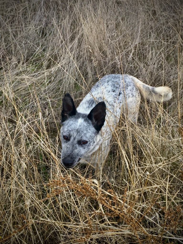
We were just making our way past the last of the pistachio orchards approaching the rangeland of the Sierra foothills when a little blue heeler spotted us, popped out of the rows of trees, and ran up to greet us.  

There’s no other way to explain my reaction other than it was love at first lick.  My second thought was I’m taking this dog home.  I’ve always had the notion of adding to the long list of Labrador Retrievers canine family members we’ve kept over the past 32 years, either a Standard Poodle or an ACD, Australian Cattle Dog.  

The Dilemma

Why a Standard Poodle?  That’s easy, because of Charley, John Steinbeck’s Standard Poodle there for companionship and comic relief, was along for his journey in Travels with Charley.  

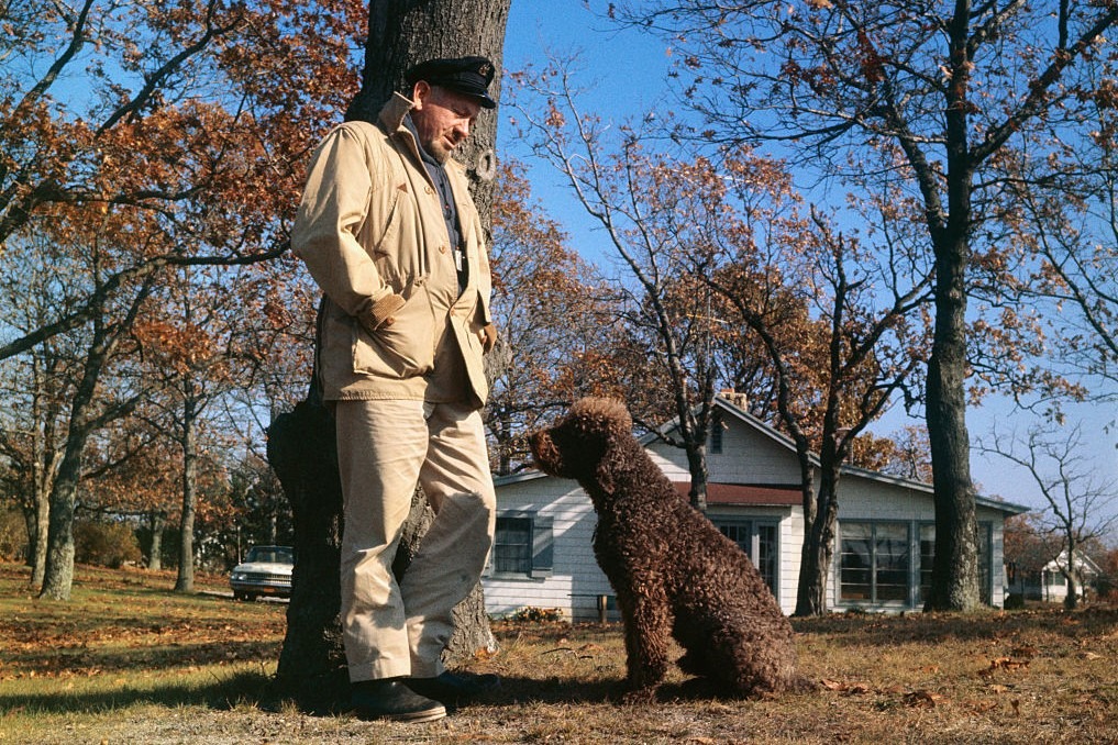
Though I was only six when Travels was published—I read it later in college—the book touches on themes of nostalgia, identity, and the complexities of post WWII America.  I vividly remember how Charley was more than a pet along for the ride. He was an essential character in Steinbeck’s assessment of the rapid change he witnessed taking place in post war America.  

Homeward Bound

Why an ACD? Because Bluey, who lived to 29, holds the Guinness World Record as the “Oldest (verified) Dog to have Ever Lived”. Since longevity is a characteristic of ACD’s, and Skidboot’s intelligence declared him the “World’s Smartest Dog,” Heelers are the very embodiments of hearty stock with brains. Labs are friendly and playful, Poodles smart and sophisticated, but they live on average for 12 years. Note: neither ever earned titles of longevity and intelligence.

Skidboot (top) and Bluey

Of course, I would end up doing due diligence, stopping by the few residences along South Bear Creek and asking if they knew to whom this little blue heeler, perhaps less than a year old, belonged. I would then place ads in the local newspaper and list her on social media as lost. And I would contact the local county animal shelter and SPCA about her status and advice on the statute of limitations for claiming a “found” lost dog.

But honestly, the little blue heeler wasn’t lost. She found me and I was prepared to suffer the two weeks that is required before you can claim “ownership” of an abandoned animal. I can’t explain the anxiety I experienced in those two weeks… It bordered on heartbreak akin to that I felt longingly for Molly and Godiva, our yellow and chocolate Labs lost to old age and knowing that dogs only occupy the physical world for a short time but live on in our hearts and memories. The longer they live, the greater the memories.

On the ride home with SoBe, reluctantly tethered to my side by a leash fashioned from roadside rope, she must have been wondering, “what’s with this thing around my neck?” She couldn’t imagine how her life was about to change. I don’t know what perils she faced before I found her so it wasn’t hard to accept her pulling against the rope while I struggled to stay upright. I knew it was this little ACD’s fate to securely join Luna and Dakota, another pure bred English yellow and black Lab rescue respectively, that would erase any of her anxiety and add to the joy of yet another member of our pack. We own a Subaru. We’re dog people.

At the corner of Plainsburg Rd and E. South Bear Creek, as I looked at the signpost marking the intersection, a perfect name appeared to me.  SoBe, from South Bear Creek.  No, I did not name my dog for an iced-tea beverage from South Beach.  I decided to call my wife to ensure safely bringing SoBe home as the traffic increases from this point to home.

The phone call went something like this:

“Hey sweetie, you’ll never know what I encountered on this morning’s bike ride,” “A damsel in distress…” I intoned.

“Oh, and so what is it that you needed to call me about your encounter?” my skeptical wife replied.

Thinking fast, I thought, “Well, I’m smitten with finding this pup’s home and since I’m getting closer to traffic, I thought you might be able to come fetch us in the Outback, you know, the dog friendly Subaru.” 

I was amazed and somewhat shocked when my wife, after sighing, agreed to leave her work to meet us at SoBe’s namesake intersection.  I knew she would resist my intent to keep SoBe.  She’s skeptical of my “great ideas” about 85% of the time.  So, I assured her that something this beautiful and sweet had to belong to someone. Only later I lamented the fact that SoBe was deliberately abandoned and she deserved so much more in life.  I leveraged keeping her on that basis.  My wife eventually relented.  SoBe reigned in that 15% of good ideas!

Welcome to your forever home Now, just make it through the next two weeks…

The Interloper

“Who is this?  She looks innocent enough?”  

While sitting out the two week statute of limitations, we had SoBe vaccinated and spayed.  With no response to two weeks of searching for her “owner” due diligence, we formally adopted SoBe, registering her with the county, getting vaccination tags and a name tag with our address and phone number.  

As spirited and fearless as a heeler can by way of breeding be, SoBe quickly adapted to adoption and membership in our pack.  Luna was the senior member but not the alpha. She was a goofy love bug.   Dakota was a few years younger, arriving at our home a few years after Luna.  She was a tad less jovial, nevertheless asserting herself alpha-like.  This perhaps because as a rescued mix of German Shepherd and Labrador Retriever she may have been a little less “refined,” more given to instinct.  

Boney, bone time

SoBe, bred to nip at the heels of animals a thousand times her mass, had chosen to be an unofficial “alpha,” age and/or instinct be damned, much to Dakota’s chagrin.  There was always tension simmering between the two of them that might erupt as play would escalate to combat, not unlike that of the sibling rivalry between our two boys.  Luna simply dismissed all of the dramatic posturing, finding Swiss-like neutrality leaving any quarreling to the late-comers.  

A Dog Is (for) Life

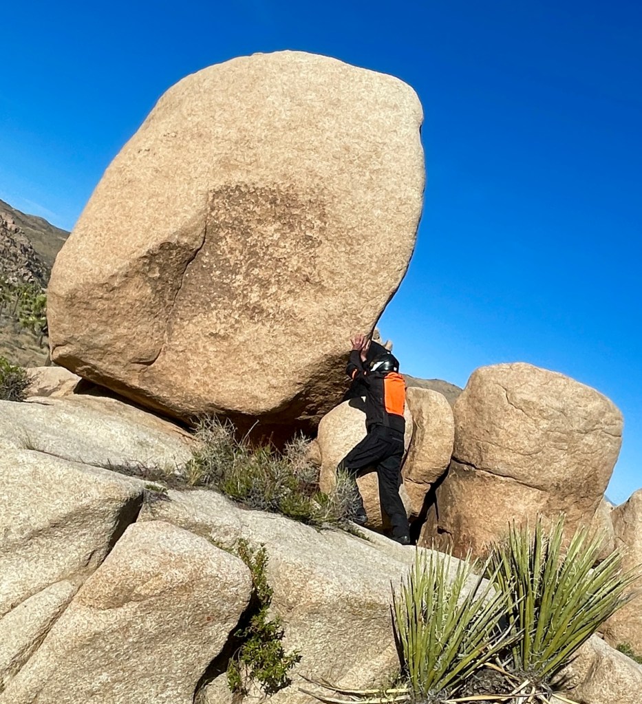
It is as though I find myself in the same circumstance as Steinbeck in my own  Sisyphus and Associates musings and screeds navigating encounters and insights, nostalgia and identity in contemporary America on my two-wheeled travels.  Having SoBe long for me as I long for her when we are apart, has given me a portal to gratitude that the evening news, now 24-7, robs from me. I have found out there, on the road, traveling through the West such generosity, encouragement, and genuine curiosity.  I have a sense that the America in the news or online, isn’t necessarily the America most of us know.  I just know that trust is earned when it comes to people.  When it comes to dogs, it’s just a lot easier to build.  Now, how to acquire a side car to bring SoBe along for the ride…

Time Flies Like an Arrow

Since those early days introducing SoBe to our pack, we’ve lost Luna and Dakota.  Well, sort of.  Their ashes, along with Godiva’s are in our closet awaiting a fitting internment.  Molly’s ashes are entombed in a boulder at the top of Chair 3 at Dodge Ridge where she spent her best years.  

My intent is to continue sharing SoBe stories.  SoBe is still with me, which means there’s more road to travel.  This isn’t just about finding SoBe; it’s about what she replaced, what she has filled, what she represents in the ongoing cycle of love and loss that comes with keeping dogs.  With all due respect to all of my family and friends, SoBe is my best friend.

12/8/25 Sisyphusdw7.com

In memory of Buddy, Bill and Ginger’s baby…

Of This Specific Emptiness

No Italics Necessary

Almost… On Cunningham Rd.

It’s been two weeks of fog and I don’t know what to write about. The holiday season is pressing in with its expectations. The motorcycle has been quiet and to ride the bicycle is a challenge in enduring the cold. The blog is waiting. All of it creates this particular kind of hollow that needs filling.  As I gaze out the window I see a redbud that has retreated into dormancy, stripped of its life affirming leaves.  An acer holds fast to its red-orange leaves drained of chlorophyll.  The redwood towers over all of this drabness, ironically, taking succor from the moisture that flattens the light.

The last of the citrus, Persian limes and Meyer lemons, have been harvested.  The annuals and perennials that provided exuberant blush to the landscape just a few weeks ago have collapsed into a damp, dreary withering beneath leaves shed by the crepe myrtle, now barren.  The last gasp white flowering begonias and lantana with enduring lavender or orange, yellow, and red sepals and leaves of deep green await a chilling frost to join its flowerbed mates. The azalea, ferns, and hearty primroses whose blossoms are only now awakening, give some relief to an otherwise fading landscape. 

Living in an area surrounded by almonds, pistachios, walnuts, and other assorted deciduous fruit bearing orchards, dormancy is overwhelmingly apparent. Ornamental trees both native and cultivated non-natives, are taking on their winter semblance, stripped of energy producing leaves as well. Only the conifers that we barely keep alive during the brutally hot summers by inundating with the remnants of the previous winter’s snowfall that comes from their native Sierra Nevada appear to thrive.

Gardners revving leaf blowers and leaf collection machinery dispatched by the city to harvest their efforts break the muted neighborhood sounds.  Dog walkers are shuttered in their warm homes, rather than brace the cold dampness.  Even the playful cries of children at recess attending neighborhood elementary schools is vague, only occasionally do the high pitched squeals of little girls, likely chased by little boys, break through. 

Crows squawk on their morning journey northeast and again on their return flight southwest before sunset.  Flickers peck for insects on the dead birch branches.  Sparrow hawks dispatch cedar waxwings down from the mountains – the waxwings drunk on fermented pyracantha berries, excreting everywhere.  Squirrels from Rascal Creek scamper about storing the last of wild pecans in flowerbeds that become deeply rooted nuisances as they forget their larder and I try to extract them come spring. 

Birds getting drunk, squirrels being squirrels, nature carrying on messily despite everything. Yet for all this dormancy and dampness, something else is happening.  Even in the gray stillness, there’s an impulse to create light and warmth and community when nature withdraws. It shows up at Christmas, and exists across cultures. It’s what humans do when it’s dark and cold. It punctures the fog.  People have been doing this for thousands of years. When it’s cold and dark, we light fires, we gather, we feast, we make noise and music. Decorating, celebrating, gathering is a kind of gentle rebellion against the dreariness. We refuse to just hunker down like dormant trees and wait it out.

Familiar carols and seasonal music create a soundtrack that the fog can’t quite muffle.  Christmas has absorbed and carries forward these older winter traditions of light-making and gathering.  Squawking crows, orchards of naked trees, bone chilling cold that penetrates, and those forgetful squirrels cannot stifle a spirit that the Christmas season evokes. I may find myself toasting the cedar waxwings, acknowledging that my spirit can be warmed by a yule log from without and a cup of eggnog from within. 

Cheers and season’s greetings!

Sisyphus 12/5/2025


Fog

No Italics Necessary

Fog

The gray mask of the fog, the pale plate of the sun,
The dark nudeness of the stripped trees
And no motion, no wave of the branch:
The sun stuck in the thick of the sky and no wind to move it
The sagged fence and the field
Do not remember the lark or her mate or the black lift of the rising crows,
The eye sees and absorbs; the mind sees and absorbs;
The heart does not see and knows no quickening.
There has been frog for a month and nothing has moved;
The eyes and the brain drink it, but nothing has moved for a number of days;
And the heart will not quicken.

William Everson

The tule fog arrives like a whispered incantation, stealing across California’s Central Valley on phantom feet. It is no ordinary mist—this is fog with weight and presence, a living shroud that swallows orchards whole and erases the horizon line between earth and emptiness. The fog denies fellowship with lunar transit; phases of the moon marking the progress of the month. Denied also is communing with emerging winter constellations scoring the progress of the seasons.


Born from the marriage of high atmospheric pressure, cold winter air and moisture rising from irrigated fields, it pools in the valley’s basin like spilled cream, thick enough to taste. Tule fog doesn’t drift like the summer coastal fog, so much as settle, heavy and deliberate, transforming familiar landscapes into liminal spaces where distance loses all meaning. A grove of almond trees becomes a procession of gray ghosts. Highway signs emerge from the white only to vanish again, oracles speaking their warnings to no one. Even Christmas lights appear diffused, in soft focus, haloed as if the fog absorbs their illumination.


There’s something primordial about tule fog, something that predates the geometric precision of modern agriculture. It takes its name from the tule reeds that once dominated the valley’s marshlands—those ancient wetlands now mostly drained and paved, yet the fog remembers. Each winter it returns like a revenant, reclaiming the valley floor, asserting the old wilderness beneath the cultivated rows.


In the half-light of winter dawn, the fog transforms the mundane into the mythic. Travelers become pilgrims crawling through an achromatic dream. Sound behaves strangely here—absorbed, muffled, made intimate. The world contracts to whatever small circle of pavement your headlights can carve from the white.


And then, just as mysteriously as it descended, the fog lifts, burned away by afternoon sun or banished by wind, leaving only damp memory on fence posts and a peculiar clarity to the air, as if the valley has exhaled.

No Italics Necessary: Adventures in “Kosgrowvic” Surgery

Join Sisyphus in his adventure in youthful indiscretion.

A Public Service Message (Warning: Graphic photos follow)

I greeted the good doctor early on a recent November morning, “You know Dr. Mehrany I have a low incentive threshold,” 

“How’s that Mr. Jones?” he asked.

“Well, all it takes is a maple bar in your waiting room, and I’m willing to have you take a knife to my face.”

“I guess it beats cancer, eh?” he replied.

“But what about donut-induced heart disease or diabetes?” I beseeched.

“Everything gives you cancer, there’s no cure, there’s no answer except that Mohs surgeries are 98-99% successful, the most  efficacious treatment for any cancer,” retorted the doctor, “You take your chances with cholesterol and blood glucose.”

Drop the mic!

My apologies to Dr. Mehrany whose response I doctored and Joe Jackson’s line about cancer from Everything Gives You Cancer.

What are the Odds?

And so began my most recent appointment with Kosgrow Mark Mehrany, MD, a skin cancer specialist whose practice is divided between San Jose and Modesto, near my home in the Central Valley. This would be my fourth basal cell carcinoma removal by way of a procedure known as a Mohs surgery. 

Skin cancer is the most common type of cancer in the United States, with about 1 in 5 people developing it at some point in their lives. Each year, more than 3.5 million cases are diagnosed, making it a significant health concern.  As one of the 3.5 million—it’s not a league in which I am proudly enrolled.

It Pays to Have Good Doctors

My now deceased family doctor, Christian Gallery, began detecting suspicious growths he diagnosed as a type of pre-cancer called actinic keratoses a decade ago.  He was comfortable removing most of these scaly patches on my back and chest by freezing or a simple surgical removal, the standard treatments.  When he suspected there may be a more serious basal cell carcinoma on my face he recommended I see a specialist. 

That was my first encounter with Dr. Mehrany in his office in Modesto, CA in the spring of 2019.  Dr. Mehrany confirmed Dr. Gallery’s diagnosis by biopsying a spot on my cheek.  The resulting confirmation was that of a basal cell carcinoma he proposed to remove, using what is known as a Mohs micrographic surgery.  

Mohs surgery is a procedure performed by a specially trained surgeon. Dr. Mehrany’s six page curriculum vitae* is impressive, but the fact that in his career he has performed over 20,000 Mohs surgeries is even more reassuring. 

His manner is straightforward yet he has an amicable sense of humor.  At least he feigns to laugh at my jokes. And once he’s executing the procedure his focus and attention is razor-sharp.  Ugh.   His staff are all equally genial and give you the sense that even though the office waiting room is full, each patient is accorded sincere regard and every effort is made to erase apprehension.  Perhaps that’s the purpose of the donuts and coffee…  

What Is Dr. Mehrany Screening For?  

Skin cancer comes in a variety of forms, and some kinds are more frequent or dangerous than others. More than 98% of skin cancers are either basal cell and squamous cell carcinomas. Melanoma is another, less common type of skin cancer. Melanoma can be deadly unless it’s detected and treated early. Getting your skin checked regularly by a skin cancer specialist, like Dr. Mehrany, helps to protect you by catching skin cancer early when it’s easiest to cure.

Given that my youth into adulthood was spent when skin cancer detection wasn’t as refined as it is today, all of the summers spent in swimming pools, backpacking in the Sierra, riding bicycles, running, sailing, golf, and skiing meant I had a healthy year-round exposure to UV wavelengths of natural sunlight. Skin cancer develops when skin cells grow uncontrollably, in my case due to damage from ultraviolet (UV) rays from the sun, or tanning beds for those whose desire for sun-kissed aesthetics don’t have the time or hobbies to bronze in hours of exposure outdoors. And for those whose labor exposes them to harmful solar radiation, my sincere empathy.

This damage can lead to changes in the DNA of skin cells, resulting in abnormal growths that can become cancerous.  Though I became aware of damage that repeated long exposure to sunlight was a form of Russian roulette that only emerged later in life, my haphazard mitigation with protective clothing and topical sun screens was preempted by naiveté.  In the hypocrisy of pretending that tanning beds were for the vain, I was convinced that celebrating life in the great outdoors could achieve the same aesthetic that was beyond consequence.  Vanity, it appears, is in the skin of the beholder.

Warning, the photos below are quite graphic. You can thank my wife who enjoyed the surgeries from the peanut gallery.

April 2019-The First Round:  Mapping the sutures

Cheek surgery site with stitches and the surgical wound dressing you flaunt leaving his office

January 2021-Round Two: Can’t You Hear Me Noggin

Start to finish, about three weeks. “Covid doesn’t stop for cancer…” declared Dr. Mehrany (I neglected to “flip” the selfies)

February 2022-Round Three: Another Cheek Crater

in the middle photo is the pressure dressing, awaiting results of the first scraping. We were still masking.

November 2025-Round Four:  Too Close to the Eye for Comfort

Oddly, all four carcinomas have clustered on the right side of my face. (The flipped selfie makes the appearance of the scar on the left side. I assure you, it’s on the right side.)

How Mohs Surgery Actually Works

Armed with a pocket full of syringes, donning appropriate PPE and surgical loupes, with a surgical blade called a curette, and a cauterizing pen at hand, Dr. Mehrany removes a layer of cells.  Although the official name for the procedure is Mohs micrographic surgery, the shortened version of Mohs Surgery is common.

The surgery is performed as follows: the skin suspicious for cancer is treated with a local anesthetic, so there is no feeling of pain in the area.  In fact, the most painful part of the procedure is the “poke and burn” of the injection.  To remove most of the visible skin cancer, the tumor is scraped using a sharp instrument called a curette. A thin piece of tissue is then removed surgically around the scraped skin and carefully divided into pieces that will fit on a microscope slide; the edges are marked with colored dyes; a diagram of the tissue removed is made; and the tissue is frozen by Dr. Mehrany’s technician, Manny. Thin slices can then be made from the frozen tissue and examined by the doctor under the microscope.  

I asked Dr. Mehrany if there’s any way to know when the damage actually happens. Turns out it’s impossible to pinpoint. The two biggest variables are how aggressive the mutation is and how well your immune system fights back. The damage could have occurred decades ago, but when it decides to show up as cancer? That’s anyone’s guess. 

Of course minimizing exposure is the gold standard for preventing skin cancers, however  a history of sunburns along with genetic factors of having lighter skin and a family history of skin cancer are the most common causes. Other factors include having many moles or atypical moles and certain skin conditions.  When the damage occurs and how long it takes for the cells to mutate is widely variable. Thus any pale skin entitlements are moot when it comes to skin cancer.

It Doesn’t Smell Like Bacon Frying in the Kitchen

Most bleeding during the procedure is controlled using light cautery, although occasionally, a small blood vessel is encountered, which must be tied off with suture. A pressure dressing is then applied, and you’re asked to wait while the slides are being processed. Dr. Mehrany will then examine the slides under the microscope to determine if any cancer is still present and subsequently annotate his map of the cancer location accordingly.

If cancer cells remain, they can then be located at the surgical site on the patient by referring to the map. Another layer of tissue is then removed, and the procedure is repeated until Dr. Mehrany is satisfied that the entire base and sides of the wound have no cancer cells remaining. As well as ensuring total removal of cancer, this process preserves as much normal, healthy surrounding skin as possible.

More Donuts Await

The removal and processing of each layer of tissue take approximately 1-3 hours. Only 20 to 30 minutes of that is spent in the actual surgical procedure. The remaining time is required for slide preparation and interpretation. It usually takes the removal of two or three layers of tissue (also called stages) to complete the surgery. Fortunately for me, the most recent surgery took only the removal of a single layer of tissue.  Even the more severe first case only took two tissue layers. I figure that’s about a donut per stage

Therefore, by beginning early in the morning, Mohs surgery is typically finished in one day.  I was in at 7:30 am and out by noon.  At the end of Mohs surgery, you will be left with a surgical wound free of tumor which is then reconstructed that same day. Several options for reconstruction may be discussed with you in order to weigh your preference of what will provide the best possible cosmetic outcome versus what will provide the easiest and simplest recovery.  

Time to Lace Up the Pigskin

Suturing the wound was interesting from my perspective. The site was completely numb, so I did not feel pain. However, the snugging of the suture was a little unnerving. For this surgery, there were some 25 stitches. Times four surgeries—those are the battle scars of freedom. Or inattention. Dr. Mehrany’s skill at reconstructing the surgical wound is truly his genius.

There was modest discomfort following the wearing off of the anesthetic. Not unlike what you might feel after a dental procedure like a filling or crown, and the slight pain was softened by a couple of extra strength Tylenols.  Sorry RFK, I’ll risk autism for relief from surgery whether I plan to get pregnant or not.  

Moving Forward

These days wide full brimmed hats have replaced ball caps.  UV protective arms and legs are a part of my cycling kit.  SPF 70 is used on the other exposed parts, namely my face and neck.  Prevention.  It’s never too late, I suppose.  It beats the consequences of my youthful naiveté masked as virility.  In January of next year, I have my six month follow-up exam.  I’m hopeful that I will get the all clear, until the following exam in July. 

Despite displaying the battle scars of freedom, I’m not ready to look like the patchwork of grandma’s quilt, but it beats an early departure for the dirt farm to join her…

My advice? If you’ve spent anytime in the sun be aware of the consequences! Also, you’re likely to gain more weight from the donuts than lose weight from the removal of the cancer…

*Dr. Mehrany’s Information

No Italics Necessary: Maps As Catalysts for Exploration

Maps:  They’re Really Invitations…

…each one offering new knowledge.  Or a route to conquer new lands.  Maps get at the fundamental question of “where is this place in relation to everything else I know?”  Or answering the question ‘what do I want?’ in the case of kings (actual and would be, wink, wink, nod, nod) and conquistadors seeking new lands to conquer.

My earliest encounter, as I remember, was with the colorful US state map puzzles in elementary school.  In figuring out the spatial relations of states borders with their identities, geography was revealed. Classroom globes and Nystrom pull-down maps gave me a sense of the scale of place.  It was also around that time when a subscription to the National Geographic magazine introduced maps with their rich colors and cultural details.  I also learned that Greenland is not larger than the African Continent once the Mercator Projection illusion was explained. 

Then came California State Automobile Association maps that guided my fledgling journeys from the nest as a newly licensed driver.  

Around that time, topographic maps of the Sierra became the next oracle at whose feet I spent hours in the off-season exploring potential backpacking adventures for the summer.  From learning how to use a compass for navigating crosscountry routes, and as I developed a love of sailing, marine charts taught me to read water the way the backpacker reads terrain and how a compass heading would get me safely from point A to B on land as well as water.  A collateral effect to marine maps was to avoid submerged hazards or wayward currents in the Central Coastal waterways of California, since boats with holes in the hull don’t float very well.  

There was a time that whenever traveling I went out of my way to find sources of maps whether at gas stations, visitor centers, bookstores, marinas, or any other map wielding enterprises I might encounter, anticipating yet another magically satisfying guide to my curiosity about the world.  

My favorite daydreaming map from ravenmaps.com

60/40 the “Golden Ratio”

Whenever I read about an unfamiliar place or see such a place in a YouTube video, or on television, or come up in conversation, I always seem to open Google Maps to see that place in the context of geography and topography.  It’s generally the story in the piece about the place that leads me to look up that particular spot.  As I’ve come to expect rapid change in the evolution of technology, Google Earth and Maps, presented a whole new way to satisfy my curiosity of a place.  I go to Google first to get the big picture.  I’m really trying to read a place, not just locate it.  I sort of see a 60/40 split between the context of a place and its location on a map.

Each view in the Google cartography catalog is like a different chapter about a place in context.  Satellite view gives us the ground truth—the actual colors and textures, the patterns of development or wilderness, how light or dark it is, whether it’s green or brown or white. We can see things like agricultural patterns, the density of settlement, the relationship between built and natural environments. Terrain view tells us the story that gravity tells—where water flows, what’s difficult to cross, why settlements are where they are, what views people might have. It’s the view that the backpacker and sailor in me probably gravitates toward instinctively, because I’ve learned to read consequences in contour lines.  And the Standard view gives us the human overlay—the names, the roads, the political boundaries, the infrastructure. It’s the interpreted landscape, the one that shows us how people have organized and named and connected things that makes up the context.

Using all three together, I’m essentially triangulating—getting a more complete picture than any single view could give me. I’m catching things like: “Oh, this town that sounded random is actually at a mountain pass” or “This coastal city has a natural harbor that explains everything about its history” or “These two places that seem close are actually separated by serious terrain.”  It’s almost a form of due diligence before my imagination fully commits to a place.  It’s like I need to see it from multiple angles before I really know it.  Thanks also to Wikipedia et. al. for providing further context.

Cartographic Curiosity

That reflex to open Google Maps when I encounter a new place name—I think that’s the same cartographic curiosity in my past experiences with maps, just a bit more evolved. I’m not just passively receiving information about a place; I’m actively situating it, understanding its neighbors, seeing how it fits into the larger puzzle, but not as confusing as the four corner states in that elementary puzzle. It’s a form of engagement, really. Different map types have probably shaped different aspects of my curiosity. The topo maps from backpacking taught me to read landscape in three dimensions on a two dimensional plane, to anticipate what’s around the bend. Marine charts taught me about hidden geography—the shapes beneath the surface that matter just as much as what’s visible. Each type of map is almost like learning a different language for understanding a place.

For bicycling and motorcycle adventures, Plotaroute and Rever deliver both planning and real time features of tracking terrain.  Interestingly, Butler Motorcycle maps are a throwback to the AAA roadmaps of yesteryear (although AAA roadmaps are still available and updated from their predecessors).  Butler maps differentiate between different types of road criteria (road undulation/twisties, elevation change, scenery and peril) in the traditional folding paper maps, albeit in waterproof and tear resistant forms.  From the Rever (in collaboration with Butler Maps) website: The recommendations are illustrated on the map by color-coded overlays indicating the quality and/or type of road. Those are illustrated as follows:

As you can see, the Butler/Rever collaboration offers the benefits of using an app in real time on the moto rather than stopping to drag out and unfold a paper map, which in the wind presents challenges of a different sort.  

The Butler Paradox

I use Butler Motorcycle maps in planning my “moto-adventures” along with digital and other resources.  I’ve written about them in my blog, sisyphusdw7.com  using the maps in the context of their rating system of roads as G1, G2, and G3 and my parodying them by rating some blasé road out of Huron, California on which a blind intersection or straight away sight lines obscured by rolling hills and impatient cagers, speed-drunk, make for peril that Butler chooses to define a little differently.  From my blog, 2021 Spring Mojave Moto: To See a National Park Devoted to a Tree…:

Pouring over Google satellite views of our intended route was subordinate to the Butler Motorcycle Maps criteria of Lost Highways and PMT’s (Paved Mountain Trails) and G1-3 routes. These byways are also a throwback to the roads I’ve pedalled over in another time and place and that I’m trying to reprise on the moto before riding off into the sunset.

“A Butler Lost Highway [is one] of faded center lines, crumbling shoulders, and long lonely miles putting these roads in a category of their own. These are the roads that seem lost in time. It is what these roads lack that make them worth the journey.”

“A Butler PMT sweeps through the remote forests and mountain ranges of California that are paths of pavement that leave even the most seasoned riders searching for ways to describe their riding experience. These roads are exceptionally tight and twisty and other unique opportunities to explore the less traveled corners of California.”

Those descriptions are from the editors of Butler maps. I’ll add the first of a few more categories of my own, the Jones PARoC‘s (Paved Ag Roads of California), or, “Two lane roads astoundingly arrow straight with right angled intersections bordered by crop obscuring sight lines and stop signs, double yellow line disregarding, pucker inducing, impatient cagers of questionable sobriety trying to pass anything with ≥ 2 or ≤ 18 wheels.”

My parody ratings, PARoC’s (Paved Ag Roads of California) highlight what Butler Maps don’t show—the agricultural hazards, the blind intersections hidden by orchards, the deceptive rolling hills where you can’t see what’s coming over the crest.  A perfectly straight farm road could be a G3 in the Butler system but a terror rating in the Sisyphus system if it’s got dust-covered blind corners and ag equipment pulling out unpredictably, which in the agricultural heartland of California, is a year round hazard, as are speed-drunk cagers.  These PAROC’s are theG-ratings for anxiety rather than joy.  A perfectly straight farm road could be a G3 in the Butler system but a terror rating in the Sisyphus system if it’s got dust-covered blind corners and ag equipment pulling out unpredictably or oncoming cars passing slow moving trucks.

The Paradox Explained

On a recent episode of The Lowdown hosted by Neil Graham The Best Motorcycle Ride in America, Scott Calhoun, a co-founder of Butler Maps, told the origin story of this tool I, like thousands of other riders  rely on. I better understand how they decided what made a road a G1 versus a G3, what criteria mattered, how they balanced twistiness with scenery with pavement quality with traffic.  Butler Maps are really selling a curated experience, aren’t they? They’re not just showing you how to get somewhere; they’re saying “these are the roads worth riding for their own sake.”  The map becomes aspirational—a collection of possible adventures rather than just routes.  

While my blog may be a shameless imitation, my integration strategy is straightforward—using Butler roads as the backbone or highlight reels of longer journeys, the sections I’m actually looking forward to rather than just enduring to get somewhere.  A G3 road isn’t necessarily “better” than a G1—it’s just different. A newer rider, someone on a heavy touring bike, or someone who just wants a scenic cruise without technical demands might specifically seek out G3s. Meanwhile, the experienced rider on a nimble bike looking for that flow state of linked corners gravitates toward G1s.  And G2s are that sweet spot—interesting enough to be engaging, but not demanding your full concentration on every curve.  Aristotle would recognize it: the mean between extremes, neither a boring slog nor a white-knuckle terror.

The fact that I’ve chronicled a couple dozen of these multi-day, multi-state rides on my blog suggests I’ve become something of a cartographer myself—documenting not just the routes but the experience of riding them, occasionally noting when Butler’s assessment matched mine, when conditions had changed, and what I discovered that the map couldn’t show.

Into the Unknown

There’s also the aspect of using a map as a security blanket in planning any outing, whether on foot, a bicycle, motorcycle, (BTW, I’ve catalogued dozens of rides on Plotaroute, Rever, and Google Maps with links on my moto blogs), or a sailboat on the bay, basically, any adventure into the unknown.  It’s nice to have a preview of what awaits and some degree of preparedness for the inevitable, unknowns. Maps don’t eliminate the unknown, there will always be unknowns, but they shrink them to a manageable size. You can see the big climb coming, know where the water crossings are, anticipate when you’ll be exposed or sheltered. It’s not about controlling everything; it’s about not being blindsided

A dramatic coastline or mountain range can grab you on its own merits.  That’s the 40% of a map’s utility I noted earlier.  The geography itself poses questions about how it formed, what it’s like to be there, how people navigate it. But that 60% of a map’s utility, context, means the stories attached to places are what really animate them for me. A town becomes more interesting when you know it was the setting of some historical event, or that someone you’re reading about lived there, or that it’s mentioned in a documentary about a particular way of life.

Shrunken to a manageable size

Those two elements probably feed each other, don’t they? The context makes me look at the map, and then the geography adds new dimensions to the story. You hear about a remote town in Nevada, say Jarbidge, and look it up—and suddenly you’re understanding why it’s remote, what kind of journey it would take to get there, and what the surrounding terrain tells you about how people live. The map fills in what the story left out, or sometimes contradicts what you imagined.  Just in case you’re curious:  Jarbidge, Nevada 

By cataloguing many of my rides on my blog, in Plotaroute, Rever, or Google Maps—I’m essentially building my own atlas of personal experience. Each mapped route is a record of a negotiation between what I hoped to find and what I actually encountered. I sometimes look back at those routes and remember specific moments: where we stopped, where it was harder than expected, where we found something surprising. 

The “preview” aspect is interesting too. I’m essentially doing reconnaissance from my desk or phone—checking grades, finding bailout points, seeing whether that road actually goes through or dead-ends. The multi-state rides require a different kind of planning too. I’m not just stringing together good roads; I’m thinking about daily mileage, where to stay, weather patterns across regions, the rhythm of challenging sections versus easier cruising. The Butler roads become ingredients in a larger recipe I’m composing.  For motorcycle rides especially, knowing what kind of curves are coming, whether the pavement is likely to be good, if there are services along the way—that’s not just convenience, it’s safety.  

OMD, (Obsessive Map Disorder)

That’s Larry on the right and me on the left on the Chief Joseph Trail, WY-296, at Dead Indian Pass in Wyoming in July, 2002

I cannot complete this “Confession of OMD” without noting the Western States bicycle rides with various groups of knuckleheads that were planned by our dear departed friend, Larry Johnston.  It has contributed to the scope of my relationship with maps and trip planning—from those National Geographic maps of childhood to literally crossing entire states under our own power, relying on Larry Johnston’s meticulous planning. Bicycle touring in July—when most people avoid being outside—speaks to a particular kind of commitment. And doing it state by state through the West, we experienced the geography in the most intimate way possible: at bicycle speed, feeling every grade, every wind pattern, every temperature shift. That’s reading the map with your legs and lungs. The planning for those trips was critical—water sources, daily mileage limits, places to resupply, lodging, bailout options if someone struggled.  In my tribute to Larry, the friend who did that cartographic labor of love for the group, I hoped to honor the often-invisible work of the planner. Someone has to be thinking three days ahead while everyone else is just focused on the day’s ride.

I hope that my current motorcycle and bicycle itineraries with distances and profiles on Google Map and Plotaroute links embedded on sisyphusdw7.com are carrying forward that same ethic. I’m not just documenting my trips. I’m creating usable maps for others, the way Larry did for us.  Each route I share is another invitation, the kind I first accepted when I put together those state puzzles so long ago…

10.31.2025