


“A plan once made and visualized becomes a reality along with other realities- never to be destroyed but easily to be attacked. Thus Kino’s future was real, but having set it up, other forces were set up to destroy it, and this he knew, so that he had to prepare to meet the attack. And this Kino knew also- that the gods do not love men’s plans, and the gods do not love success unless it comes by accident.”
― John Steinbeck, The Pearl
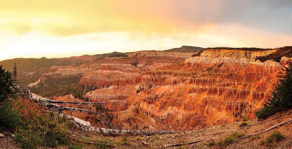
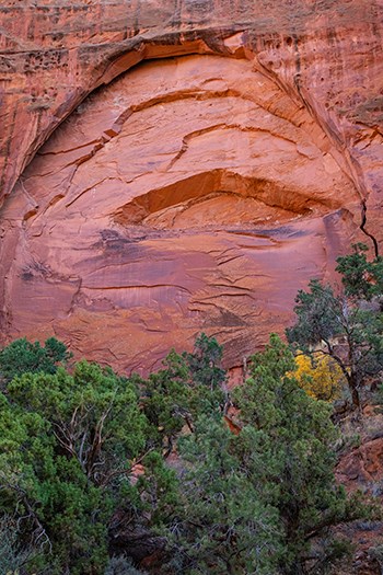
Photo Credit : Credit: NPS-Brent and Dawn Davis
And so ours was not, like Kino’s, an epic struggle to survive, but an attempt to dupe the gods who curbed several of our plans by visiting a plague, oppressive heat, and fire upon us. We prepared to meet the attack. Our plan was simple. Visit the Burr Trail in Utah and in the process escape the viral vector and acrid air of climate change induced fires by seeking the most favorable atmospheric conditions and terrain. Our success was not an accident. Average a couple three hundred miles a day on mostly lonely back roads seeking obscure destinations equipped with masks and hand sanitizers. It was two blokes on bikes–no closer than six feet–and six days to get from here to there. Sorry to disappoint you gods, we had a blast and it wasn’t by accident.
Merced to Tonopah

https://goo.gl/maps/MSXAswqQ8eu8EoJ2A
We left Merced at 8:00 am. We took our normal route over Sonora Pass to cross the Sierra because I wasn’t able to secure two reservations to go over Tioga Pass. Since this Sierra crossing is a leg of the trip we’ve done so many times before, I’ll get on with the novel parts of of this particular journey over the next six days on the road while citing some satisfying memories of former past adventures.
My mate Pete and I have traveled US-6, US-95, NV-375 (The Extraterrestrial Hwy), US-93, and US-50 (The Lincoln Hwy) by way of Sonora Pass (CA-108), US-395, and CA-120 several times. I rode across Nevada on a bicycle with a group of knuckleheads in 1993 from the California/Nevada border all the way to the Utah border in four days. Three years later we rode our bikes across Utah taking six days. In fact we rode bicycles across all of the Western United States over the course of twenty-six years. What have I learned? It’s easier on a motorcycle. And so that’s my plan. Re-ride those bicycle adventures as moto adventures. That’s not to say the bicycle rides weren’t as fun, even though privacy was scat, uh, pardon me, scant, but we were younger then and suffering didn’t matter… as much.

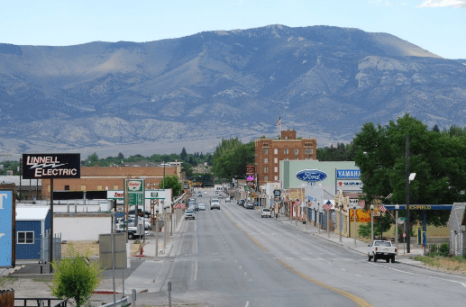
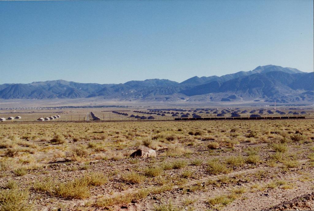
Tonopah, our first day’s destination, lies at the base of a range above a basin that has a remarkable resemblance to every other basin and range in Nevada. I guess that’s why this area is known as the Basin and Range province of the Great Basin. I used to think it was nothing but miles and miles of miles and miles. Riding a bicycle across those miles and miles will do that to you.
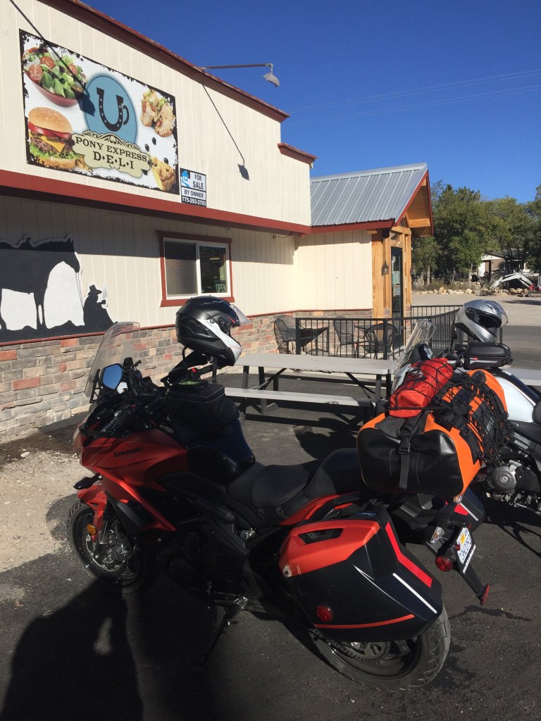
After “riding hard” from Merced, stopping for fuel and grabbing a bite in Lee Vining, we stopped 13 miles west of Tonopah at the Miller’s Rest Stop well into the afternoon. We were closing in on mile 296 for the day and though just a few miles from our destination a stretch and nalgas break was taken. Any moto adventure always involves the road, terrain, weather, and landscapes. There’s another dimension too. You meet people, many of whom are on adventures of their own. For instance, meet Tim from Sacramento.
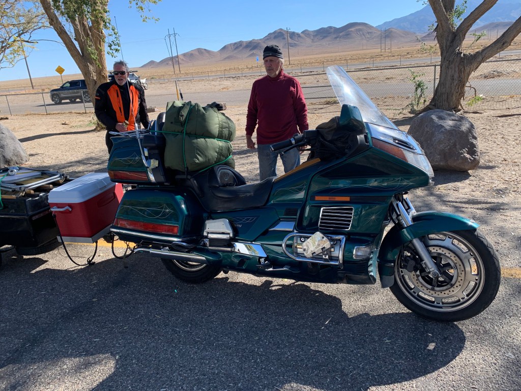
Pete and I pulled in and we soon spotted Tim on this beautiful 1995 GoldWing. As you can see, he had it outfitted with a trailer, complete with a pad for his cooler. He was just finishing up preparing an egg salad sandwich when he walked over to offer us a sandwich and a beverage. We declined the sandwich, but after considering it was only 13 miles to Tonopah, we humbly accepted the beverage with much appreciation.
Like us, Tim was traveling with a few buddies heading to Alamo, NV for the night some 174 miles down the road, considerably greater than our remaining miles. I guess that’s the difference between riding a GoldWing for hours and miles as opposed miles and hours on our Versys and V-Strom. After sharing stories of our respective trips and exchanging other motorcycle pleasantries, we bid adieu thinking that since Tim was heading southeast to Prescot, AZ (his ultimate destination) as we were heading east to Escalante (our ultimate destination) our chance encounter and receipt of gracious hospitality was a bonus feature on the day.
Tonopah, nestled near the base of the San Antonio Mountains and known as the “Queen of the Silver Camps,” like Her Majesty the Queen, is a bit long in tooth. I suspect that the unincorporated town primarily exists today because it is located at the junction of U.S. Routes 6 and 95, approximately midway between Las Vegas and Reno. Oh, and there’s the Clown Motel. I guess that’s as good a raison d’être as is the gas, “food”, and lodging in a mining town that’s seen better days.
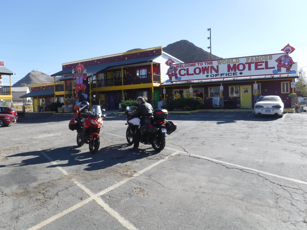

Tonopah is not exactly a city on the rise, as our Mayor declares Merced to be, unless after dark the denizens of this neighborhood choose to step up and out of the ground… Wait, what’s that shadowy figure in foreground? Could it be an alien presence?
Tonopah to Cedar City

https://goo.gl/maps/qYgTrHf3C7mFPu7WA
Typical of contemporary rural Nevada, its recent history tells a story of abandoned dreams.

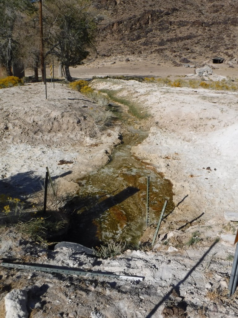

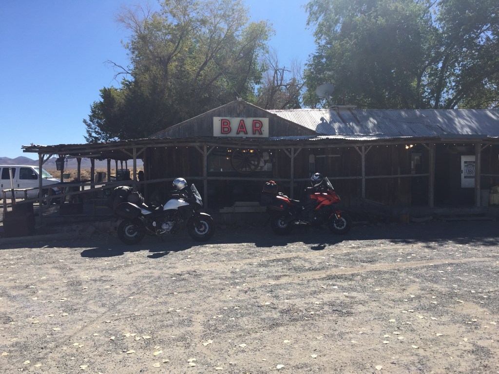
These photos were taken at the intersection of US-6 and NV-375. Speed and fuel efficiency apparently replaced the need for stopping at Warm Springs for fuel and sustenance. Pausing for a stretch and nalgas break, a pleasant necessity, apparently isn’t sufficient for restoring the Warm Springs Bar and Cafe to its heyday.
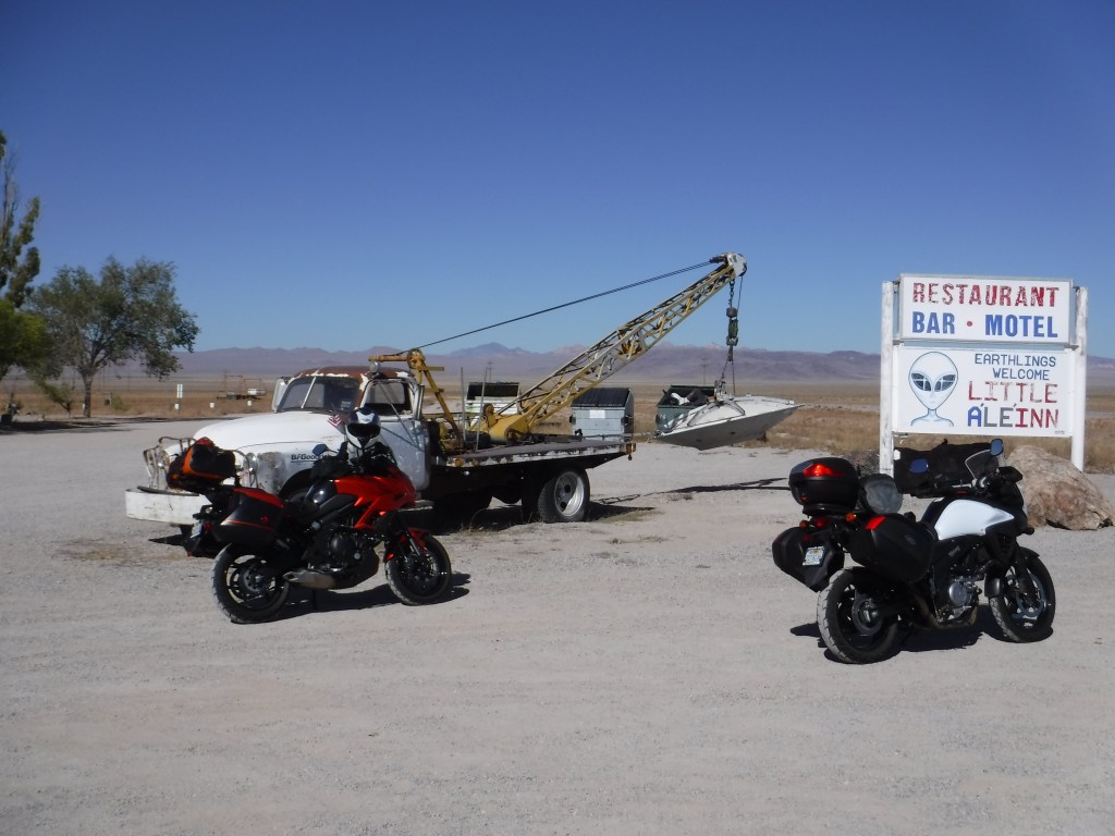
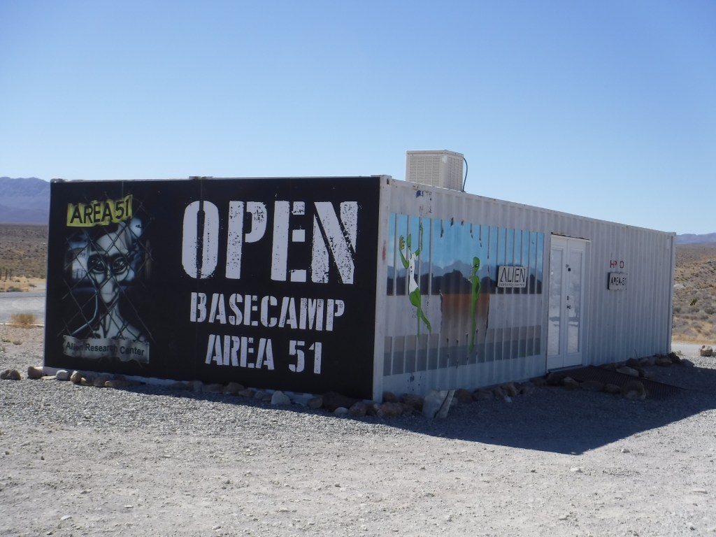
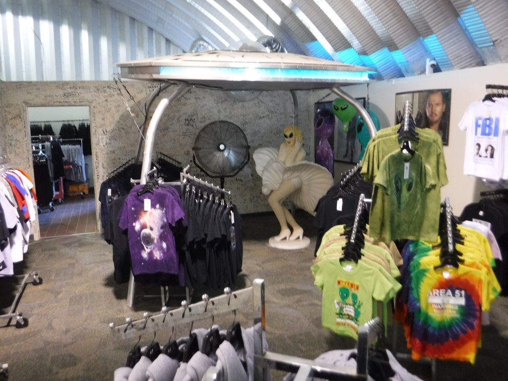
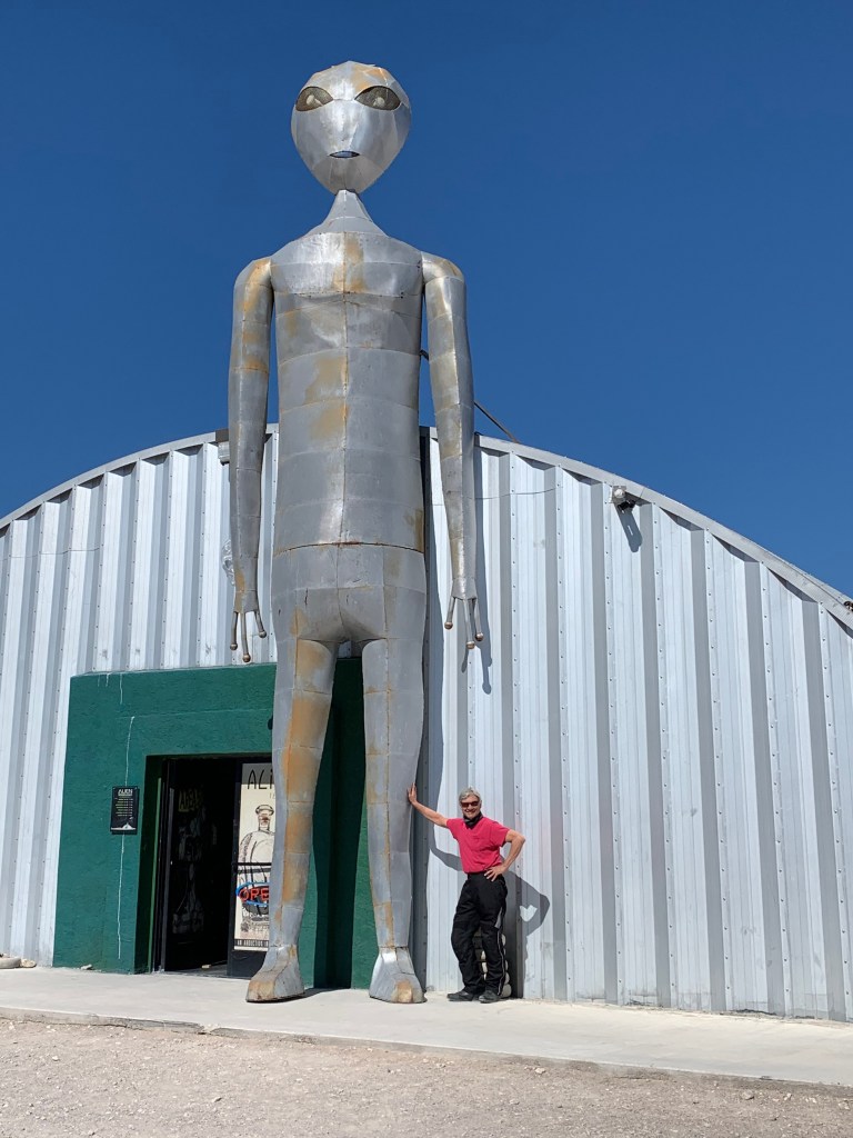
Bound for Cedar City, UT by way of Rachel and Hiko, NV on NV-375 we took a few moments to consider Area 51. And using our best Desert Oracle suspension of reason to contemplate the wonders of obscure yet sustaining alien induced capitalism enroute to Caliente for lunch. What little imagination Warm Springs lacked, the Little A’Le’Inn and the Alien Research Center has in spades.


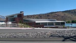
I don’t wish to make the impression that we found Nevada to be in anyway lacking sophistication or refinement. Unlike the alien gimmick, the town of Caliente trades on its historic Union Pacific Railroad and depot.

We also found something that was missing back when I rode a bicycle across rural Nevada. Feast your eyes on our lunches…

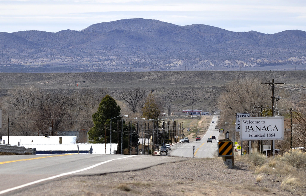
Our last touch with civilization in Nevada was Panaca where we left US-93 for NV-319. Panaca from our perspective was typical of a quiet, not much happening sort of remote Nevada town where cows considerably outnumbered people.
https://www.seattletimes.com/nation-world/man-stunned-at-being-target-in-nevada-bombing/
To know Nevada is to not be deceived by bright lights, sleepy towns, or barren landscapes…
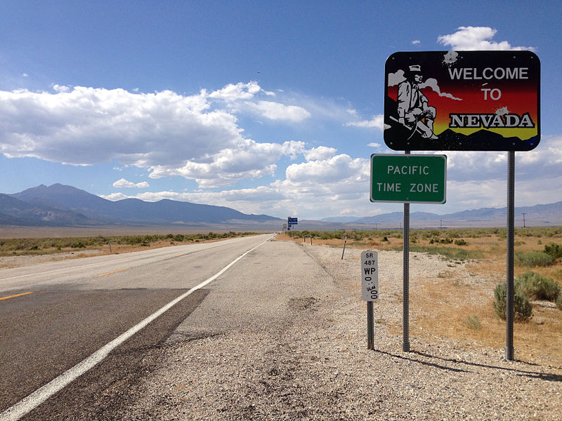
With 300-plus ranges separating as many basins in Nevada, from Montgomery Pass (7,419′) just east of the CA/NV border we crossed the last range over Panaca Summit, (6,719′). It was downhill into Modena, UT where NV-319 became UT-56 at the border.

And Now for Some Science:
Temperate deserts of continental regions have low rainfall and strong temperature contrasts between summer and winter. In the intermountain region of the Western United States between the Pacific coast and Rocky Mountains, the temperate desert has characteristics of a sagebrush (Artemisia) semidesert, with a very pronounced drought season and a short humid season. Most precipitation falls in winter, despite a peak in May. Aridity increases markedly in the rain shadow of the Pacific mountain ranges. Even at intermediate elevations, winters are long and cold, with temperatures falling below 32F (0C).
These deserts differ from those at lower latitudes chiefly in their far greater annual temperature range and much lower winter temperatures. Unlike the dry climates of the tropics, dry climates in the middle latitudes receive part of their precipitation as snow.
Temperate desert climates support the sparse xerophytic shrub vegetation typical of semidesert. One example is the sagebrush vegetation of the Great Basin and northern Colorado Plateau. Recently, semidesert shrub vegetation seems to have invaded wide areas of the Western United States that were formerly steppe grasslands, due to overgrazing and trampling by livestock. Soils of the temperate desert are Aridisols low in humus and high in calcium carbonate. Poorly drained areas develop saline soils, and dry lake beds are covered with salt deposits.
https://www.fs.fed.us/land/ecosysmgmt/colorimagemap/ecoreg1_divisions.html
From the xerophytic shrub vegetation of the semidesert through Beryl Junction and Newcastle, we arrived in Cedar City, Utah entering the Colorado Plateau ending the second day of our tour just a few days before the Cedar City Livestock & Heritage Festival…


https://www.cedarlivestockfest.com
Cedar City to the Burr Trail and Torrey
https://goo.gl/maps/w9e9hJjwN3eSs7P59
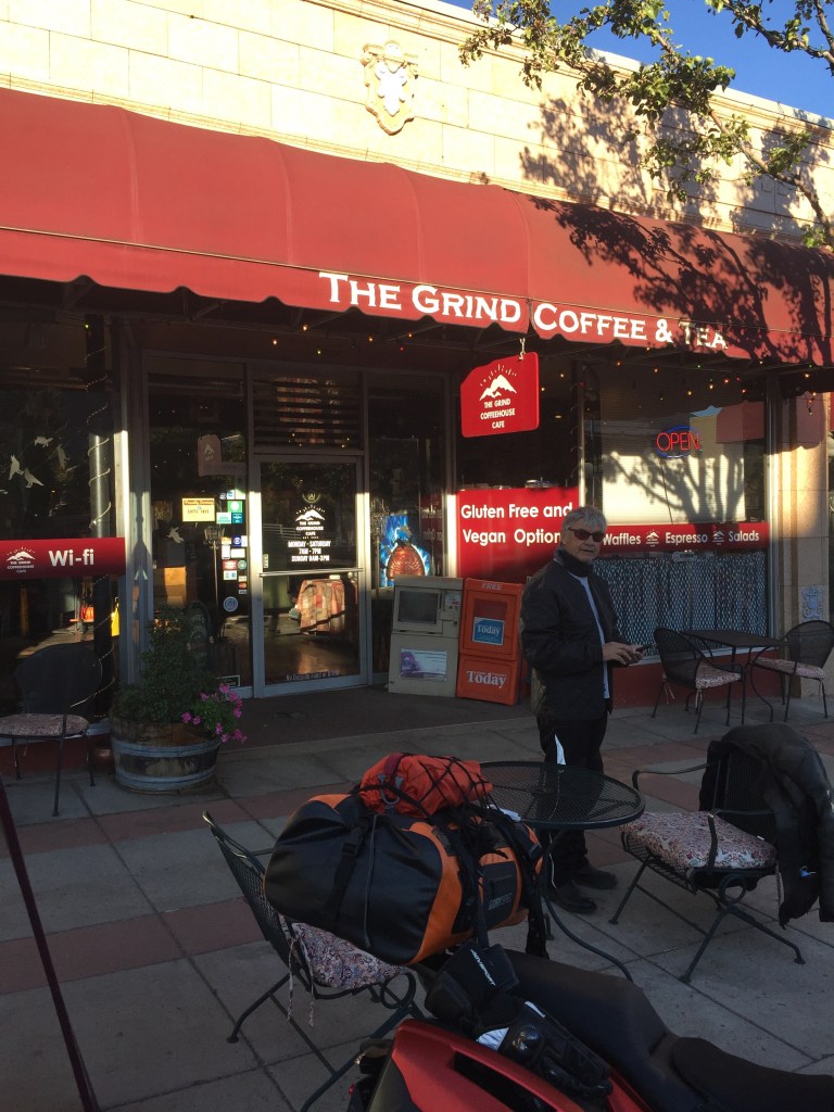
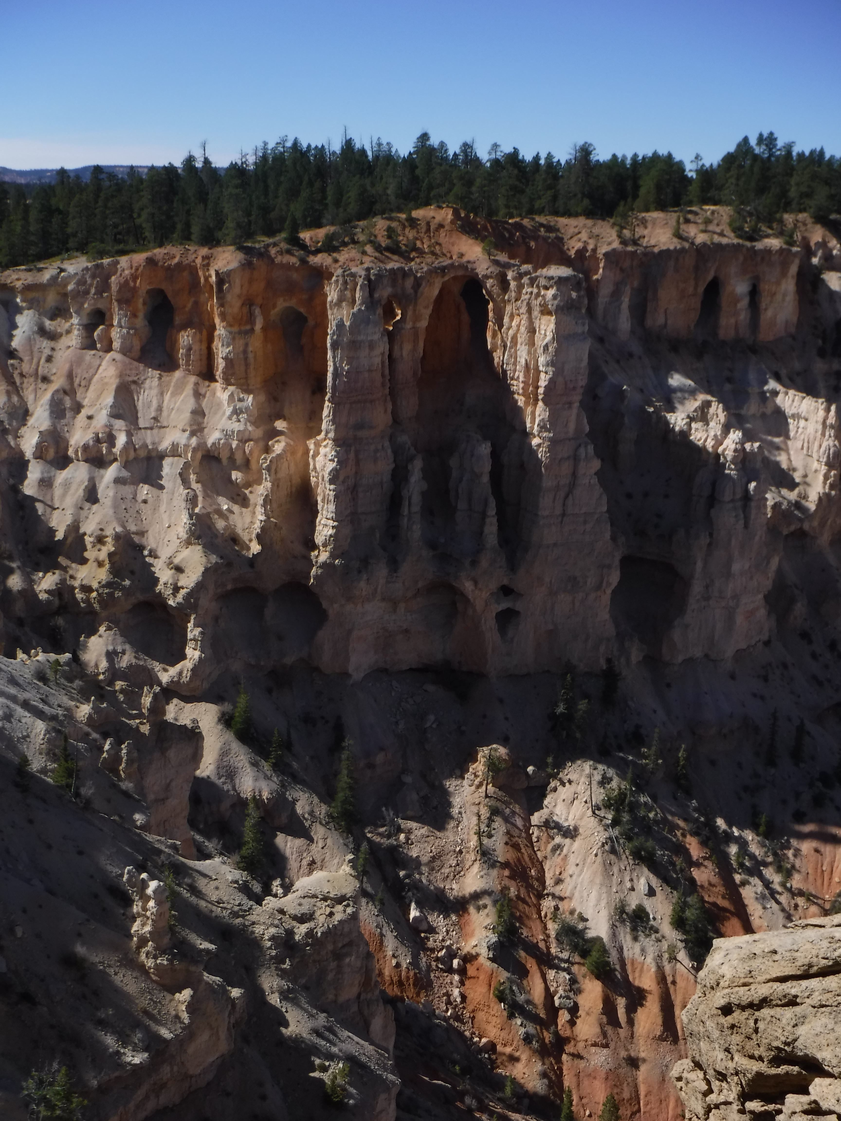
Leaving Cedar City after a fine breakfast at The Grind Coffee and Tea we wound our way to the hoodoos of Cedar Breaks. We were there in the morning so the angle of the sun’s illumination wasn’t as impressive.
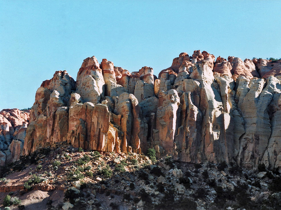
Hidden in the forested Ashdown Gorge lie the oldest rocks in the monument, relics from a time when Cedar Breaks would have been beach front property! In the late-Cretaceous period (~90 million years ago), southwestern Utah was a shoreline. It’s ironic that the ability of geologists to accurately date these geologic formations lies in conflict with the timeline most Utahans subscribe to. I guess they don’t have any conflict with the tourist dollars these remarkable formations lure.

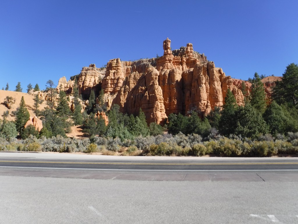
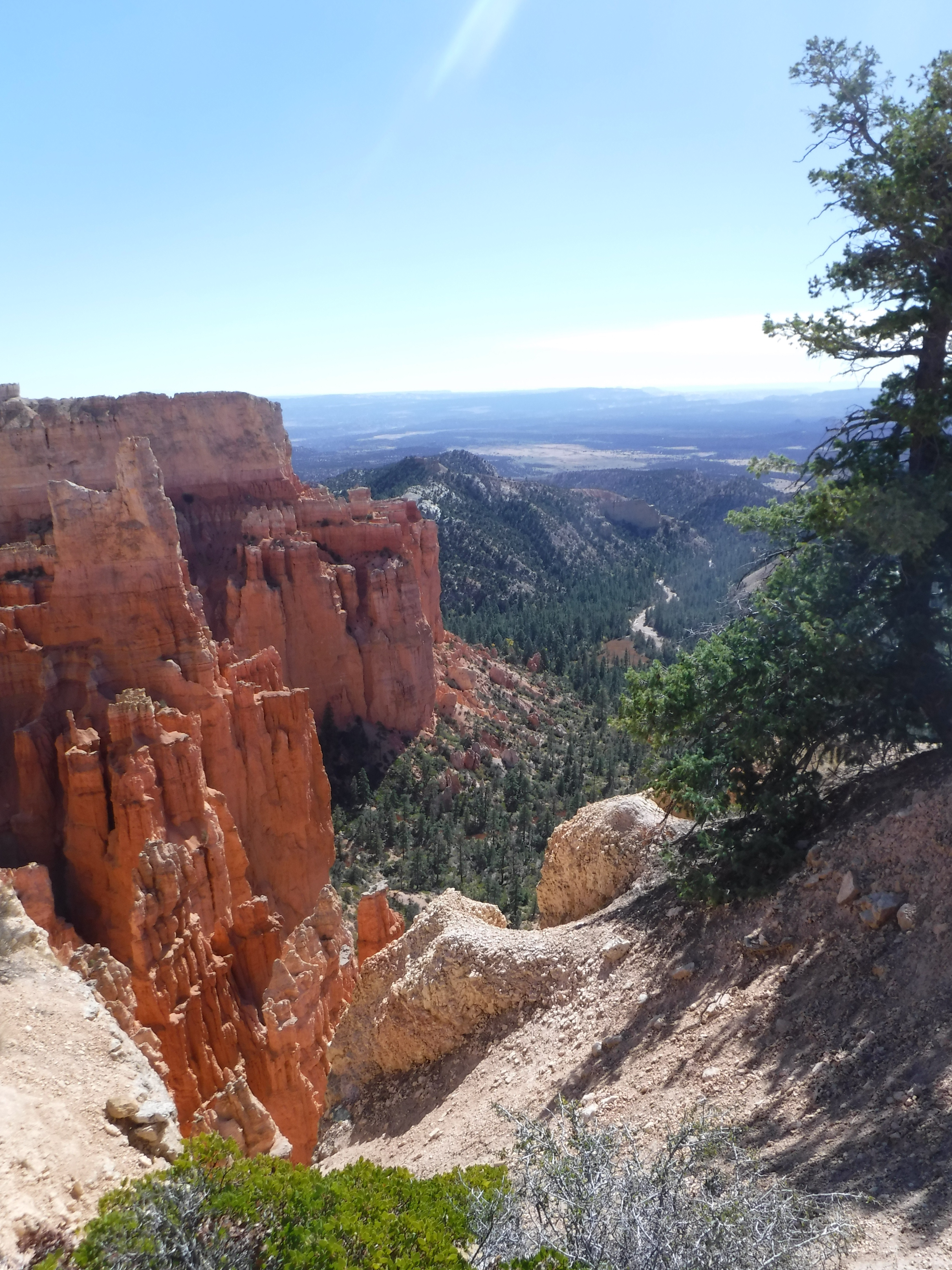
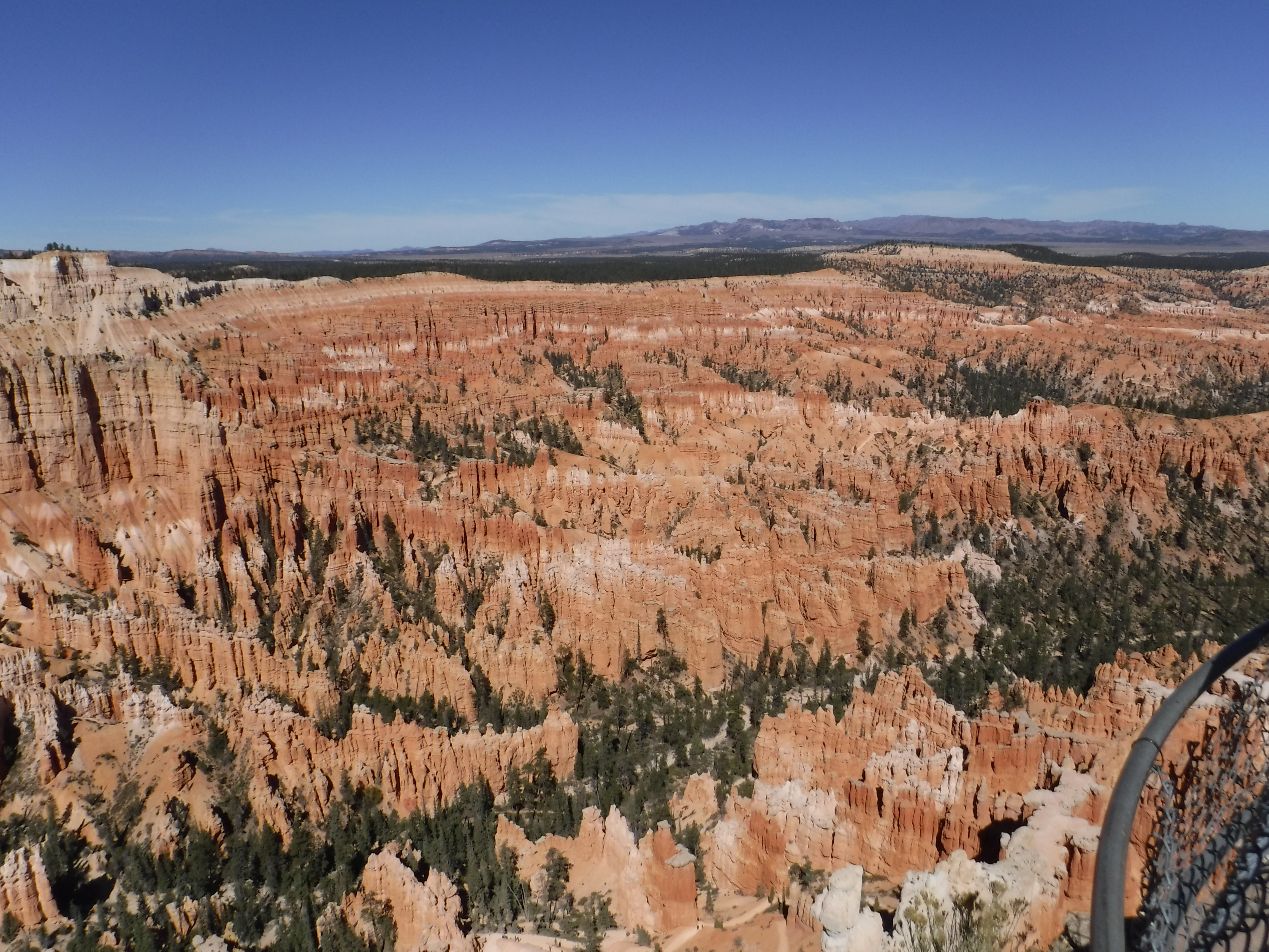
From Cedar Breaks it was a quick run through Panguitch on UT-93 and “Highway 12 — A Journey Through Time Scenic Byway” to Bryce Canyon. The geology and topography was outstanding. Speaking of tourist dollars, the crowds, rivaling anything we might see in Yosemite mid-tourist season, were surprising. A beleaguered attendant supervising traffic in a parking lot overlooking Bryce Point told us that the number of visitors to the park had exploded in the last several years peaking last year. Though crowded this day, he reckoned that the coronavirus would see smaller numbers of visitors this year. A quick search of Wiki confirms his story:
With 2,679,478 recreational visits in 2018, Bryce Canyon National Park has seen another record year for annual visitation. Recreational visits in 2018 were up by 107,794 visits from last year, and up over 1.6 million visits from 2010. The park has remained above 2 million annual recreational visits since 2016. (NPS)


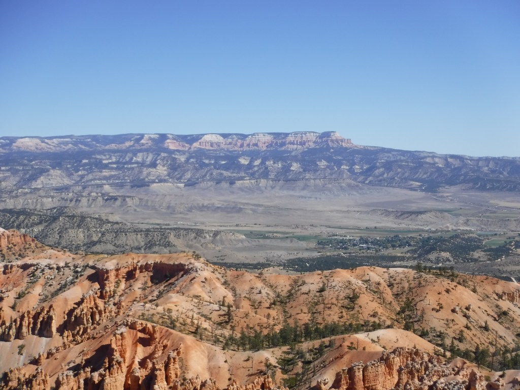
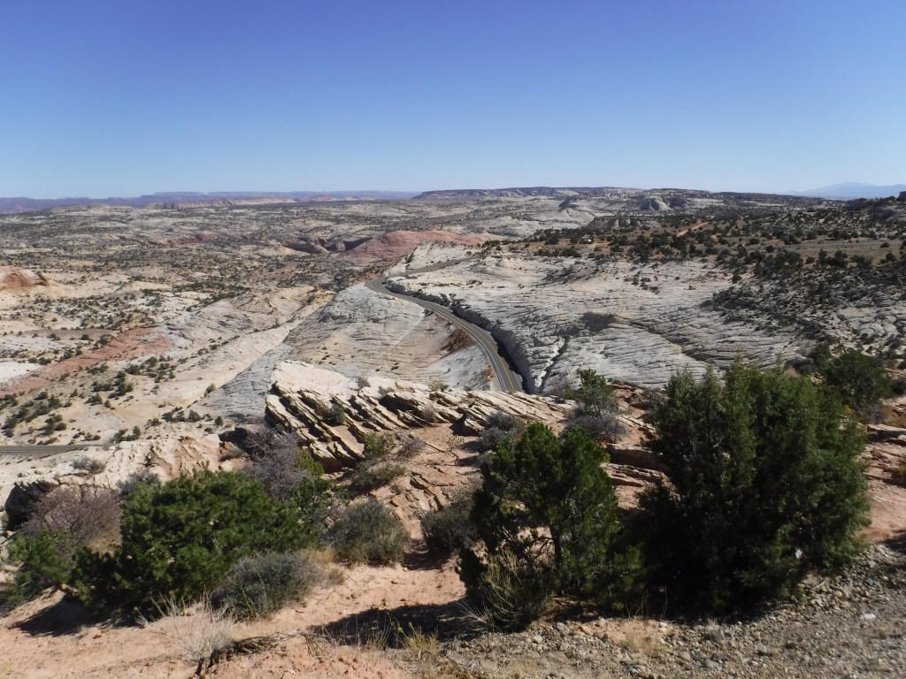
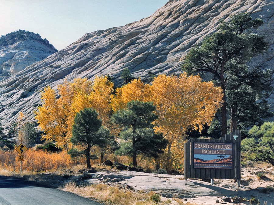
From Bryce Canyon our route took us through Tropic and Escalante to Boulder. Scenic Byway 12 (SR-12)n is a 122.863-mile-long (197.729 km) state highway designated an All-American Road. SR-12 crosses various parts of Grand Staircase-Escalante National Monument, and continues northeast through Escalante and over the Escalante River, then over the Hogback, a narrow ridge with no guardrails or shoulders and steep drop-offs on each side. I recall riding my bicycle across the Hogback in 1997 in a thunderstorm. The air smelled of ozone and the hair on my arms stood erect. I was terrified then. My memory now is that I was heroic!
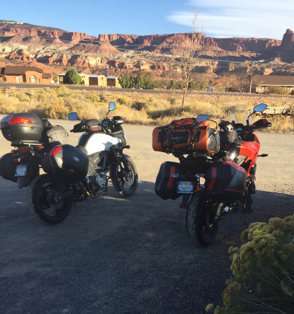
UT-12 proceeds north through more of the Aquarius Plateau, through Boulder and Grover, ending in Torrey at an intersection with SR-24, five miles west of Capitol Reef National Park where we would spend the night.


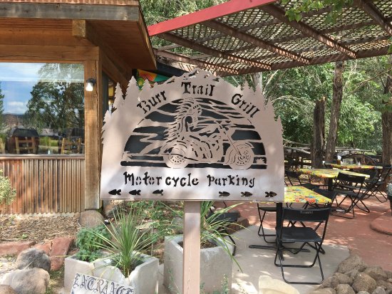
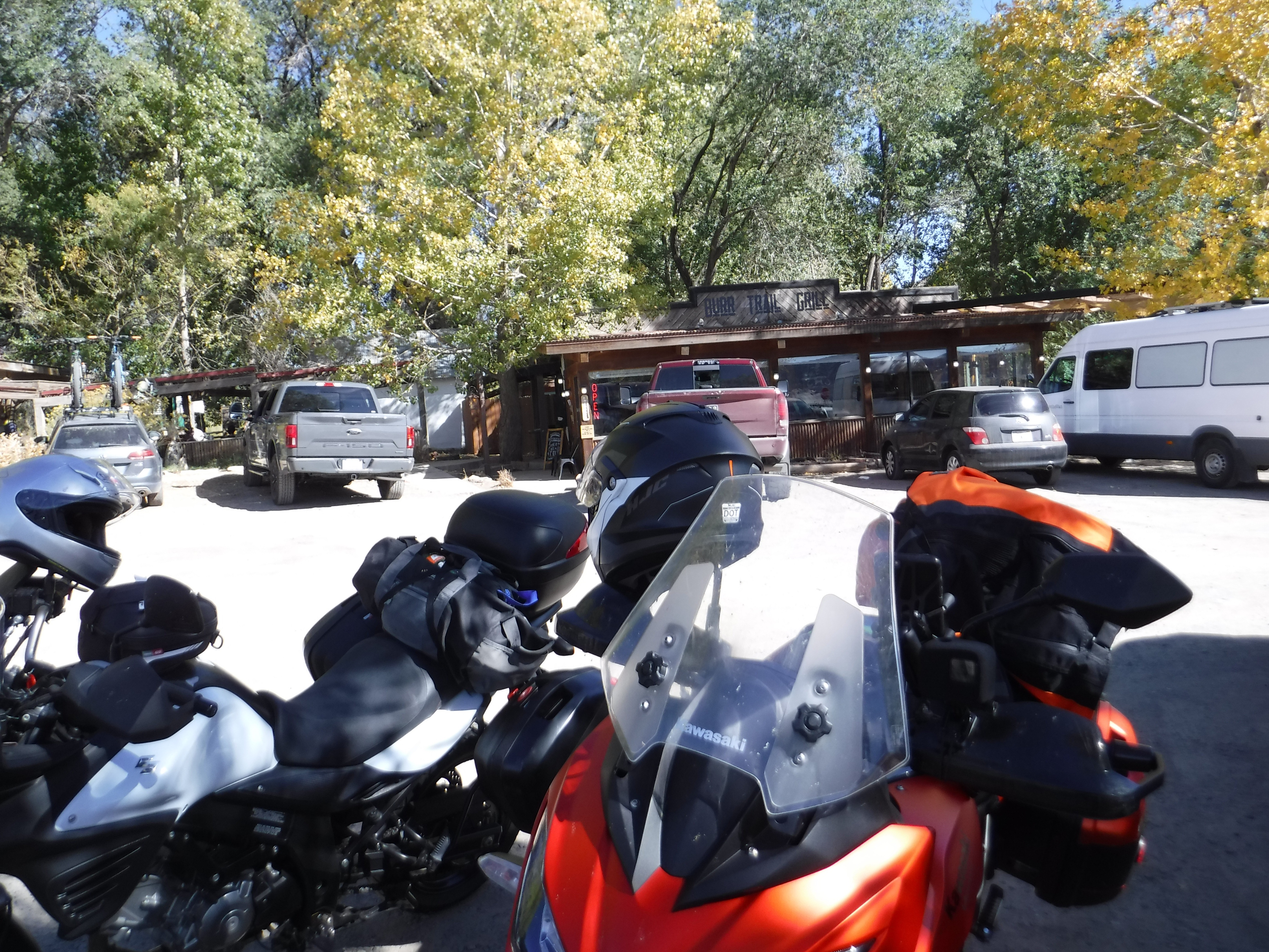
After a delicious lamb burger with coleslaw for lunch at the Burr Trail Grill we made our way down the Burr Trail. While ordering, we saw Tim from Sacramento ride by with his crew. We were just a tad puzzled as we were under the impression he was not headed in our direction. Daylight was burning and so it was time to tackle the Burr Trail.

In 1997 our dearly departed bicycling buddy Larry led us on a ride across Utah. I was retracing parts of that tour and our Nevada (1994) tour on this moto trip some twenty-three years later with the goal of taking the Burr Trail once more. In 1996 the Clinton administration designated the Grand Staircase–Escalante a National Monument and it didn’t take long for the 34 mile leg from Boulder to be paved. Me thinks Edward Abbey understood the weltanschauung of the Utah DOT and Visitors Bureau. Progress, I reckon.
And Now for Some History…
John Atlantic Burr was born in 1846, during his family’s journey from New York to San Francisco on the SS Brooklyn while sailing across the Atlantic Ocean. Once they arrived, Charles and Sarah Burr then set out to Salt Lake City with their new baby. As part of the early pioneers from the Church of Jesus Christ of Latter-Day Saints, the Burr family eventually moved south in 1876 and founded the town of Burrville, Utah.
John Burr grew up to be a cattle rancher in the rugged backcountry of Utah. Living in such a desolate area, he needed to develop a route to move his cattle between winter and summer ranges, as well as to market. This cattle trail through the rough, nearly impassible country around the Waterpocket Fold, Burr Canyon, and Muley Twist Canyon came to be known as the Burr Trail.
The westernmost section of the trail down, some thirty-four miles to the border of Capitol Reef, was paved in 1996. The following summer a group of eleven lads pedalled across Utah, their intrepid leader, Larry Johnston, having planned the route to include this portion of the Burr Trail on what was then, fresh pavement, still warm from being laid. Well, maybe not that fresh, but it was new and little used. From the Day 4, August 15, 1997 itinerary entry Larry prepared:
Day 4, A short cut’s in store, who could ask for more? Ride east from Boulder on the “Burr Trail” and shuttle the 20± mile dirt section through Capitol Reef National Park. Ride south to the ferry at Bullfrog Basin, swim or take the ferry across Lake Powell ($9/car – free/swim) before heading east on Hwy 276 where the day’s adventure can end at Hwy 95. Shuttle northwest on Hwy 95 to the only place to stay for miles, the Fry Canyon Lodge (it’s near Natural Bridges National Monument) maybe $40+ a piece… it ain’t cheap. Distance: 103 miles not counting the shuttles and ferry. Bring paddles/swim suits.
Larry’s posaic description of the Burr Canyon Trail conned us into believing it was nothing compared to what we traversed to get there. The excitement of a short cut would soon be erased to be replaced by our reaction to riding through this spectacular canyon in the morning chilled air with a monumental sense of the sublime. It was at once breathtaking and exhilarating. That was characteristic Larry’s sense of humor, ever the coyote.


In Torrey we managed to again cross paths with Tim from Sacramento. He actually noticed us passing by as he and his comrades were in search of accommodations for the night and rode to catch us. When I asked, “I thought you were headed to Prescot via Las Vegas?” Tim replied, “We decided to take the scenic route.” I would like to think the enthusiasm Pete and I had conveyed had inspired him back at our chance meeting at Miller’s Rest Stop.
Note: I made GoPro video of the canyon ride, however, my free WordPress account doesn’t permit uploading video. I’ve posted it on YouTube and have linked it to Sisyphus and Associates, my Facebook alter ego.
Torrey to Ely
https://goo.gl/maps/y555pSnkw7VBR3at9
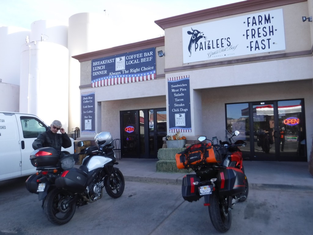
Starting the day with a fine breakfast burrito at Paizlee’s in Torrey we hit the road bound for Ely, Nevada, our trip now at its mid-point.
And Now It’s Time for an Observation…
We would head northwest on UT-24 to Sigurd, missing the UT-119 cut-off to Richfield. Retreating on UT-118 south we merged onto I-70 to Beaver. This might be a good time to review the various highways, byways, and two-laners we encountered on the trip. Nevada’s and Utah’s roads were superior compared to most of the roads we’re familiar with in California. Aside from being well engineered with consistently maintained and even surfaces, virtually free of potholes, the roads were also free of the trash we commonly find in California, despite all of the “Adopt a Highway” volunteers.
Of course our population of nearly 40 million is considerably greater than the combined 6.28 million populations of Nevada and Utah. I imagine wear and tear and a cavalier attitude about litter (despite postings of fines) given so many people on the road–just over 15 million registered automobiles rolling over 163,696 mi² of California as compared to just over 2 million autos in Nevada and Utah rolling over 195,456 mi²–beats up the pavement in ways Nevada and Utah are spared, despite the ratio of cars to area.
Taking the UT-21 exit at Beaver, Ut, we traveled through Milford, Frisco, and Garrison, all ranch country sporting circular irrigated fields of alfalfa dotting the otherwise parched xerophytic shrub vegetation of the semidesert terrain to the Nevada/Utah border.
From the border, it’s about 6 miles to Baker, NV where UT-21 becomes NV-487. Baker sits at the entrance to the Great Basin National Park. Pete discovered Baker a few years ago when returning home from a Colorado moto. His stories regaled the festive atmosphere of this artistic gateway to a National Park found in this very small town. When I learned that Kerouac’s Restaurant was going to be closed for the season as we were rolling through, I decided to press on to Ely for our fourth night to cut down our Day 5 mileage.

Just north we merged onto US-6/50. The route was constructed over a historic corridor, initially used by the Pony Express and Central Overland Route and later for the Lincoln Highway. The Nevada portion crosses the center of the state and was named The Loneliest Road in America by Life magazine in July 1986. The name was intended as a pejorative, but Nevada officials seized it as a marketing slogan (the Utah DOT and Visitors Bureau have nothing on Nevada). The name originates from large desolate areas traversed by the route, with few or no signs of civilization. The highway crosses several large desert valleys separated by numerous mountain ranges towering over the valley floors, in what I’ve noted as the Basin and Range province of the Great Basin.


And Now Some More History…
Ely is the largest city and county seat of White Pine County, Nevada. Ely was founded as a stagecoach station along the Pony Express and Central Overland Route. In 1906 copper was discovered. Ely’s mining boom came later than the other towns along US 50. The railroads connecting the transcontinental railroad to the mines in Austin, Nevada and Eureka, Nevada have long been removed, but the railroad to Ely is preserved as a heritage railway by the Nevada Northern Railway and known as the Ghost Train of Old Ely. (Wiki)

By the time we set up for the night in Ely, we were pretty exhausted from pounding out the miles from Torrey. Pete refers to this as, “riding hard”.
Ely to Markleeville
https://goo.gl/maps/ZDXPrurbGMoAVRTE6
Another long day of riding hard lay ahead. We were headed back to California from Ely some 78 miles to Eureka, 69 miles to Austin, and 64 miles to Middlegate on the Loneliest Highway. From there, it would be another 168 miles to Markleeville. We decided to get on with the hard riding by departing a frosty Ely (36 degrees) hoping it would warm up down the road. By the time we reached Eureka, my fingers were popsicles. Time to stop and warm up from the inside out.
for breakfast!
And Now for Some Avocational Sociology…
It was an interesting cafe. No tourists, just locals except for us. There were a couple of what looked to be freshmen in high school aged girls having breakfast with one of their mothers. I thought about how difficult it must be to be so isolated, from what I learned in 26 years of teaching middle-school aged kids and raising a high school aged granddaughter, about the desire the age group has for their peers and for connecting with a world outside of a small town. Not so much a surprise, I Googled Eureka schools to learn that Eureka High School is the home of the Vandals (Vandals: A people of northern Europe, known for their cruelty and destructiveness, who invaded the Roman Empire and plundered Rome itself in the fifth century.) I guess that’s not much different than Viking or Raider mascots…
To my absolute surprise, I was pleased to see how for the 2020-21 school year there are 3 public schools in the Eureka County School District serving 291 students. Eureka County School District has one of the highest concentrations of top ranked public schools in Nevada. This district’s average testing ranking is in the 10/10, top 10% of public schools in Nevada with a student:teacher ratio of 10:1 which is less than the Nevada public school average of 20:1.


Whoa, there’s one book whose cover shouldn’t be judged.

After another sixty some miles of not using any cornering body position, we encountered a 30 minute delay due to repaving of US-50 through the town of Austin. Austin, a well preserved mining town, is known as a “Living Ghost Town”.


Stokes Castle, a strange three-story stone tower, is located just outside town. It was built in 1897 by Anson Phelps Stokes, a wealthy eastern capitalist who had a financial interest in several of the local mines. It was occupied only for a month. Vacant and abandoned, it fell into disrepair. After fueling up, we continued westward.


A quick Coke and cup of coffee and from Middlegate we leave US-50 for NV-361 to Gabbs and Lunning. It seems that Happy Hour begins pretty early in the day at the Middlegate Bar…
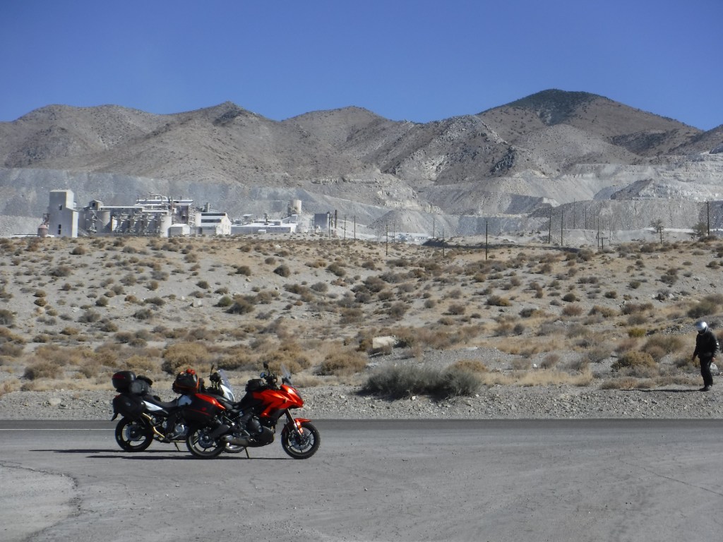
We passed through Gabbs where the only domestically-mined source of magnesia ore in the United States can be found. You know, magnesia it goes into lots of stuff.
Time for More Science…
Magnesia is considered a “universal neutralizer”, which makes it ideal for applications where pH control is essential for safety and treatment, such as:
Water Treatment
Animal Feed
Spill Response
Industrial Manufacturing
Oil & Gas
Construction
Power Plants
Environmental Waste Treatment
Food & Beverage
Pulp & Paper
Marine Scrubbing /Desulfurization and Epson salts (premiermagnesia.com)
See, Epson salts doesn’t just come from the pharmacy.

The intersection of NV-361 and US-95 was just west of Luning which is the only thing I remember about Luning. Next town was Hawthorn, home of the worlds largest ammunition depot. I found an article entitled, “Hawthorne Army Depot: Providing Lethality That Wins,” on the interwebs.
https://www.army.mil/article/223519/hawthorne_army_depot_providing_lethality_that_wins
Interesting. Fortunately the Army stores munitions much more safely than the Lebanese store ammonium nitrate. Nevertheless, we quickly rode through Hawthorn and skirting the western shore of Walker Lake we made our way to Yerington.
Yerington, on approach, appeared to be a small community of large alfalfa growing ranches. It is also home to the Anaconda Copper Mine, an open pit copper mine that closed in 1978. It is located just west of the town. A company town, Weed Heights, was built to support the mining operation which ran from 1952 until 1978. In Yerington we headed south on N-339 skirting the pit.

Like Hawthorne, we didn’t hesitate to make our way through Yerington, though there are many fine people on both sides of the pit, I’m sure…
From Yerington we continued south on NV-339 to Smith Valley. Nevada State Route 339 merges with NV-28 through the valley, leading west 15 miles to US-395 north of Topaz Lake. Skirting past the lake, the California border was in sight.

Now heading west on CA-89 we made our way over Monitor Pass to Markleeville for the night and a very nice meal at the Cutthroat Brewing Company.

Homeward Bound

https://goo.gl/maps/m1DdXRhnvgbx5DY77
Our final morning, at a frosty 36 degrees, found up suiting up with our warmest layers. We had Ebbetts Pass and the Pacific Grade Summit on CA-4 to make that morning. Approaching the pass are a series of gnarly switchbacks that require quick reflexive shifting and appropriate body position to navigate the grade and curves.

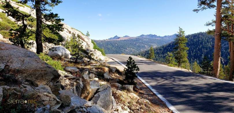
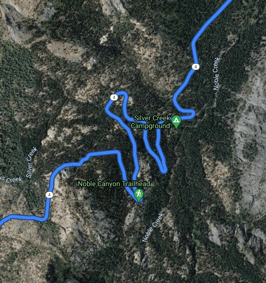
The curve just to the right of the middle CA-4 label on the map is a compound curve. According to Wiki, in the jargon of road engineers, a compound curve has two or more simple curves with different radii that bend the same way and are on the same side of a common tangent.
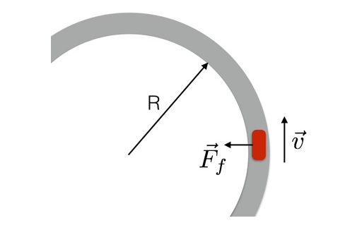
Given the curve is also on an upward sloping grade of ±24%. You don’t want to be downshifting into first gear to slow on approach then roll onto the throttle at the apex of the turn to increase friction (traction) but suddenly, and accidentally, shift into neutral! The whole physics thing about momentum and friction is, well, actually pretty complicated to explain. But it’s not that difficult execute on a motorcycle.
My failure to execute the acceleration component (by shifting into neutral) neutralized the increase of friction component sending me into a wobble then exiting the turn across the middle of the lane into oncoming traffic. Fortunately, no cars were coming as that could have turned out much worse than it did. Strangely, I didn’t panic and was able to bring the Versys to a stop, upright, shift into first and find the correct line for the next curve making sure of my shift.
Fortunately the remainder of the ride was uneventful. I’ve already written about those remaining roads to get us back to Merced so I’ll conclude by supplying another quote from Steinbeck…
“Once a journey is designed, equipped, and put in process, a new factor enters and takes over. A trip, a safari, an exploration, is an entity, different from all other journeys. It has personality, temperament, individuality, uniqueness. A journey is a person in itself; no two are alike. And all plans, safeguards, policing, and coercion are fruitless. We find after years of struggle that we do not take a trip; a trip takes us. Tour masters, schedules, reservations, brass-bound and inevitable, dash themselves to wreckage on the personality of the trip. Only when this is recognized can the blown-in-the glass bum relax and go along with it. Only then do the frustrations fall away. In this a journey is like marriage. The certain way to be wrong is to think you control it.”
― John Steinbeck, Travels with Charley: In Search of America
Notes and Disclaimers
Unless credited, all photos were taken by either Pete or me.

3 thoughts on “2020 Fall Moto: Burr Trail Here We Come…”