

It began as it had for the previous four weeks with a text to Pete on Tuesday April 28, 2020, “So, up for a ride? Tomorrow? Thursday?”
Pete’s terse response, “Thursday”.
It’s kind of like fishing. I toss a small bit of bait out by way of text and wait for a nibble. I reply to Pete, “Okie Dokie… Thinking about heading up into the higher elevations.”
We’ve been getting out, beyond the confines of our homes and dog walks about our respective neighborhoods, in a series of semi-spontaneous “neighborhood” moto tours in this new age of sheltering, social distancing, mask wearing, and sanitizing, all in an effort to avoid the Coronavirus plague while maintaining our sanity and only slightly and with no malice or virus, veering just a bit from the California Coronavirus (COVID-19) Response webpage regarding recreation: “You can walk, run, hike and bike in your local neighborhoods as long as they continue to practice social distancing of 6 feet. This means avoiding crowded trails & parking lots. Californians should not travel significant distances and should stay close to home.”
With no disrespect for those whose suffering is real, accustomed to unfettered retirement freedom, these restrictions on exercise and travel have been a challenge for my gaggle of sorta-fit retired adventure seeking pals. Especially since the moto “gang” (see my post Riding Under a Fool Moon) had to cancel our five-day spring trip scheduled to depart on April 8, 2020 to the Mojave when state parks and businesses were suddenly shuttered as we awoke to the reality of the plague.

So we have interpreted staying close to home to mean one day rides with no stopping for commerce (except to purchase fuel), practicing hyper-social distancing, though there are only two of us, and using sanitizers as necessary. A motorcycle helmet paired with a kerchief is perhaps equally protective from receiving or transmitting a virus. At the conclusion of the ride, all gear is treated and my bike has never looked as clean.
Wednesday rolls around with no reaction from Pete. I text out a bit more bait, “Que hora manana?” and Pete replies with another terse response, “8:00 Chevron”.
My thumbs up emoji in response gets one right back from Pete. Two thumbs up and the ride is on, sort of an homage to “two hits and the joint turned brown,” perhaps how we may have dealt with these challenges of existential threat in our youth… These days we hoist a Corona, in lieu of bleach, to toast the defeat of the virus!
On Thursday morning at 8:00 a.m. we met at the Chevron on Yosemite and “G” with no particular plan as thus far our Covid-19 Tours have been meticulously planned because I suffer from OMD, obsessive map disorder. I said they were semi-spontaneous, right? Planned insofar as I’ve been sheltering at home and with hours to while away and what better enterprise than to meticuolously plan motorcycle escapes. This would be our fourth “local” ride since Governor Newsom imposed the statewide “lockdown” or “stay at home” orders in California.
And with that preview, the following are brief descriptions of the trips with maps and directions, and a few visuals for your enjoyment. You’re welcome. The first three were put together prior to riding and the last ride I pieced together after the fact. Note: Every ride I take I think about how I need to photograph more of the ride, namely the bikes and scenery, the visuals part. Afterall, who wants to look at a couple of squinting geezers out playing like a couple of kids…
Covid-19 Moto Tour #I to West Point, CA ±226 miles
Our first trip on April 2nd was a backroads trip over familiar roads with a couple of new avenues to San Andreas and West Point, returning through Copperopolis to our home in Merced. Since the five day trip to the Mojave was cancelled, we figured (okay maybe we rationalized) a day trip through sparsely populated rural areas with stops only for fuel and to stretch, as we brought along snacks and water to enjoy while social distancing and of course hand-sanitizing, what could be the harm?
A note about Google Maps… It seems that the fine folks who code for Google Maps have decided that when you plot a route, save the URL to embed to give others access to your route, and link the route, as you designed it for use in a blog intending to share the exact route, the map randomly reverts back to what some algorithm directs is a more time saving route over busy roads that are uninteresting to this motoist author, <IMHO>.
The first leg of our route took us over rolling hill county roads we often ride bicycles on through orchards, vineyards, rangeland, and a dairy or two along Keys, Olsen, and Los Cerritos Roads while crossing the Merced and Tuolumne Rivers.

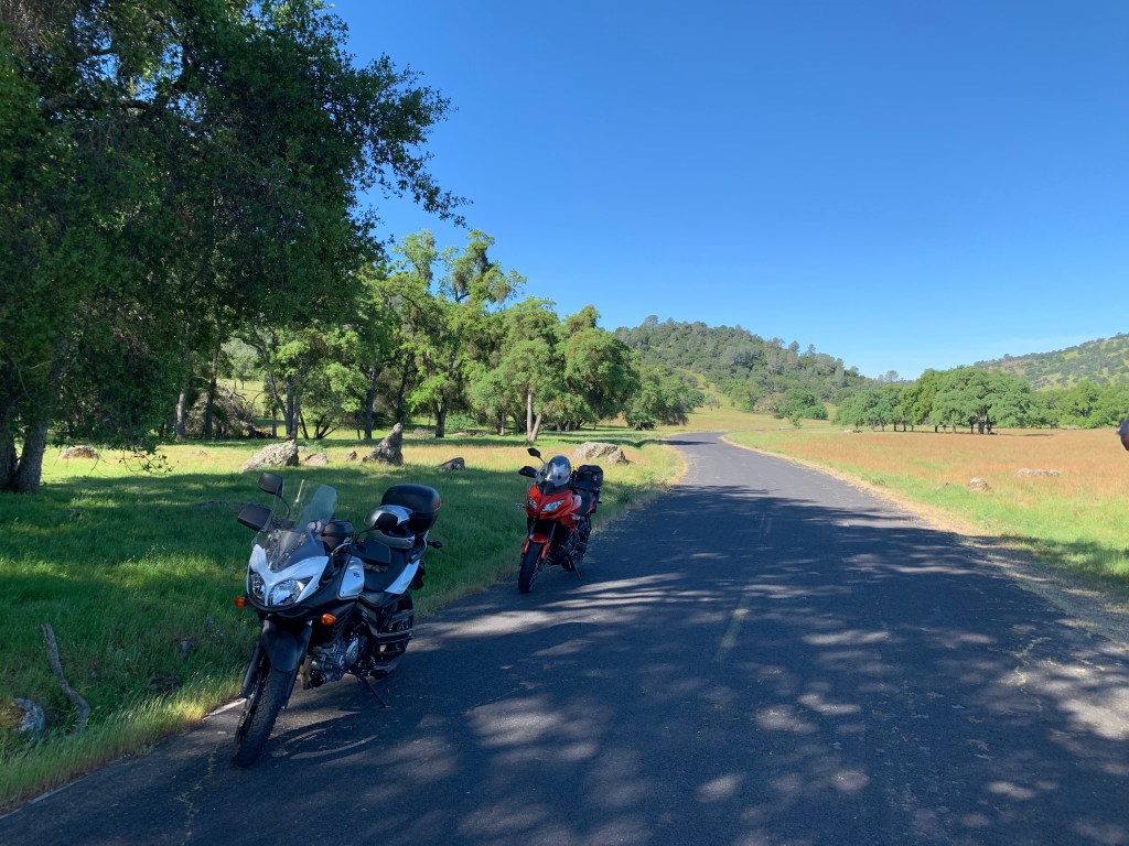
That’s Dry Creek from just off Keyes Rd above. As you might infer, it might just as well be called Wet Creek this time of year. Okay, so photographic failure #1: squinting geezer with moto in background instead of foreground (top), and photo-fail #2, moto should be in the foreground of the scenery. I did, however, avoid the squinting geezer.

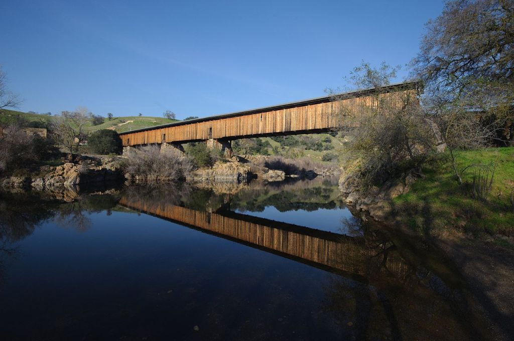
We crossed the Tuolumne on the Robert’s Ferry Covered Bridge where you can stop, though the new Roberts Ferry Bridge isn’t historical, it replaced the original bridge built in 1916 but it still commemorates the regional history. A short historical walk down each side of the bridge features a series of interpretive markers, each telling the region’s story. The whole tale is there, from the Native Americans who first called the land home, to Robert’s heyday, to the fertile farmlands of Stanislaus County today.
Continuing on Crabtree Rd to Williams Rd you arrive in Knight’s Ferry. We took Sonora Rd north, spanning the Stanislaus River but just a short distance upriver from the modern Sonora Road bridge you come across the Knight’s Ferry Covered Bridge. This is an historical bridge. It is almost 379 feet (116 m) long, with a total of four spans set on stone abutments and piers. In addition to spanning the river, the bridge crosses a historic millrace north of the river. The bridge sections consist of Howe trusses formed out of wooden planks bolted together, with wrought iron tension rods, all joined by wrought iron bearing blocks. The exterior of the bridge is finished in vertical board siding, with a metal roof. So, make the turn north on Shuper Rd, just before the Sonora Rd turn and you will find the Knight’s Ferry Bridge. (Wiki)
An interesting part of that ride aside from the terrain and landscape was how effectively the stay-at-home orders reduced traffic on the lowland county roads as they were largely deserted save the usual ranch/farm traffic. E Sonora Rd and Milton Rd to Jenny Lind were a bit more active. But stay-at-home didn’t seem to affect traffic as much on Hwy 26 to Valley Springs and Hwy 12 to San Andreas. Rejoining the busy Hwy 49 in Mokelumne Hill, traffic seemed normal for a weekday. Traffic tapered again on Hwy 26 up to West Point. The one/two-lainers, Railroad Flat Rd and Mountain Ranch Rd, back to San Andreas were pretty vacant.
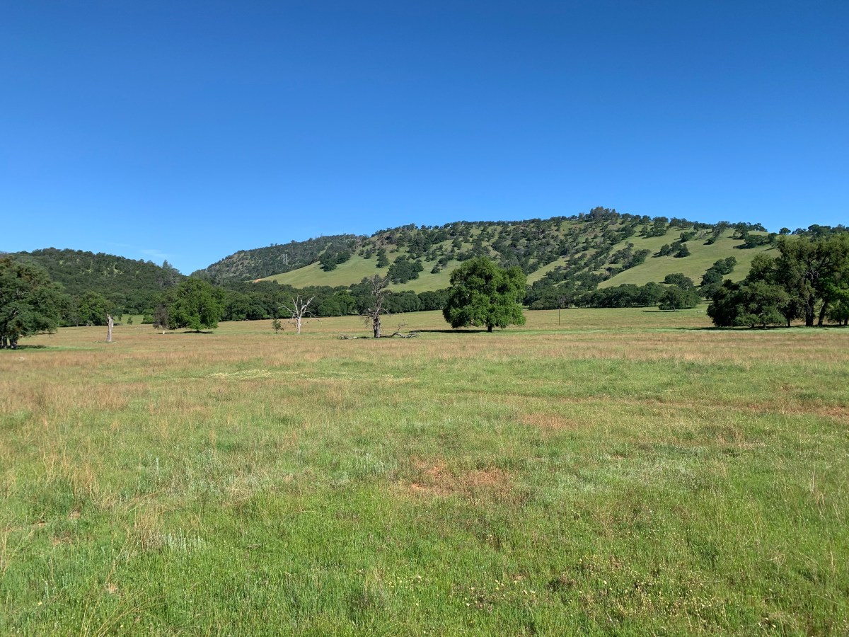
The verdant spring grasses and wildflowers were a visual feast. We took Pool Station Rd back to Hwy 4 and Copperopolis where the traffic was equal to that on Hwy 49. O’Byrnes Ferry Rd skirted Lake Tulloch to Hwy 120. Hwy 120 to J-59, La Grange, Snelling, and home.
Hill folk live in the hills for many reasons and I suspect chief among them is to live free of the hustle and bustle of towns and cities.
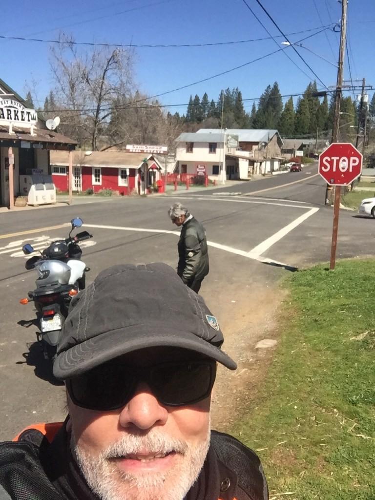
Since most of the roads we take, regardless of a pandemic, are rural, through sparsely populated areas, unless you consider the population of cows, there was still little activity at the street level at most of our stops in the little towns we rolled through. At times, we almost felt as though we were trespassing. Riding without distractions of country road traffic and yet always aware of various other road hazards like potholes and guinea and pea fowl, kept us on the bikes with little urge to stop and take photos having traversed these quaint gold country roads for so many years. I’ve listed the roads and you have a map so if you like, you can take the tour and your very own photos. Just don’t linger around too much. You never know when you may be ask to show your badge…
Disclaimer: The clip from Treasure of the Sierra Madre isn’t intended to disparage people of Hispanic descent or hill people. It’s a joke, based on a classic Humphrey Bogart film directed by John Huston, illustrating the lengths to which the characters in the 1948 film wished to distance themselves from one another the result of another pan-demic, gold fever! Having taken the edge off of my attempt at Covid humor, I’m not going to explain the pun.
Covid-19 Moto Tour #II to Coalinga, CA ±275 miles

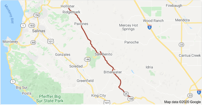
The next trip on April 16 took us again over familiar and novel roads* to Coalinga via Panoche Rd to Paicines, Hwy 25 to Coalinga Rd, then Hwy 33 back home.

Sadly, our traditional burrito breakfast at the Paicines Store was foregone in observance of the plague. This was just a “stretch” stop after the 18 miles of twists and turns of Old Panoche Rd. We have in the past had to head north a few miles to Tres Pinos for fuel when heading down Hwy 25 on previous trips when Pete was traveling on his volume challenged Bonneville T-120 gas tank. Confident that our 5.5 gallon tanks on the Kawasaki Versys 650 and Suzuki V-Strom 650 could get us all the way to Coalinga from Merced, we headed south on Hwy 25, aka the Airline Highway, via the Coalinga Rd to where else ? All the while, *novel virus free.
I have often wondered why the stretch of Hwy 25 is also known as the “Airline Highway”
Now we will all know: “The Airline Highway Association was organized in 1933-34 and was composed of representatives of Alameda, Santa Clara, San Benito, Kern and Kings Counties. Its purpose was to establish this “Airline Highway”.
In the Oakland Tribune article, (Tues. June 19, 1934 page 5. “NEW AIRLINE, HIGHWAY TO L.A. PLANNED”) it states “the highway would follow the air line between the northern and southern part of the state as closely as possible”. The use of the word Airline is confusing as we associate it with modern-day transportation. In this sense it is defined as an Americanism dating back to 1805 meaning “traveling a direct route”. (Wiki)
I’ve been experimenting with a GoPro 7 trying to figure out the best way to mount the camera and capture interesting video. Well, maybe not as interesting as Jamie Robinson’s MotoGeo videos on YouTube or any of the other thousands of talented and dedicated moto-vlogers, but illustrative of the essence of why I love to ride a motorcycle. At least Jamie and I have that in common.
Besides filming. editing video is something of a challenge for this old dog, but I’m slowly learning new tricks. I whittled two hours of video into the following 30 minute unnarrated clip featuring Panoche Roads (New and Old) and Coalinga Rd. To the uninitiated, it might appear monotonous. To the smitten, eat your heart out…
Sparing your having to read a list of roads, you can just sit back and enjoy the ride. Hint, these back roads took us to our destination and fuel with only slight pucker fatigue as empty fuel warning lights began blinking at least 30 miles from Coalinga. The flashing light does a good job of keeping your thoughts trending on how to deal with running out of fuel with no signs of civilization on a road much less traveled by plague reduced traffic. I have determined that when the Kawasaki’s fuel warning light comes on and the fuel range indicator showing 30 miles til empty disappears, I have roughly 1 gallon of gas remaining. If the average miles/per/gallon indicator is accurate, I have at least 58 miles, okay, maybe 50, remaining before empty. Therefore when the fuel light comes on I have at least 80 miles of fuel. There was no measure of conciliation in the number of oil rigs that began showing up sporadically in the last 15 miles into Coalinga.

We arrived in Coalinga and our first stop was a Chevron station on Hwy 33. Topping off our nearly empty tanks, we reflected and gave our thanks for the dinosaures whose sacrifices made our combustion engines possible. Speaking of dinosaurs (ouch!), we serendipitously met a friendly group on a variety of HD baggers and a Spyder who were affiliated with the ROMPs group from home. Like us, they were out for the day, perhaps attracted to Coalinga by the aroma of tri-tip grilling. A friendly group who seemed to be practicing social distancing… Or maybe they just though us to be peculiar on our modest touring Japanese motos.

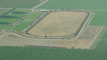
The ramble home was uneventful. Mostly “airline” roads, Hwy 33 through Westside farming communities of Three Rocks, Mendota, and Firebaugh. We passed by Harris Farms Horse Division on the Coalinga-Mendota/South Derrick Ave frontage to the Westside Freeway/Hwy-33/I-5. It appears that naming roads in the region is ripe with redundancy. This ranch is where the Harris Farms training track, an immaculately groomed 7/8-mile facility, is located along with the breeding shed that is the home of “world class stallions and Grade I sires claiming an annual conception rate hovering above 90%”. Hmmm, I wonder what the attempts at bat number might be… And you thought the only Harris Farms interprise was the resturant and stinky feed lot along I-5.

I remember being introduced to the sport of thoroughbred racing at the training track by a gentleman with whom I worked a couple of summers in the early 80’s as a field rep during the tomato harvest for Tri-Valley Growers Cooperative as a summer job supplementing my elementary teaching gig. Jim, who worked as a dispatcher for one of the trucking firms hauling tomatoes, was a connoisseur of tracks, county fairs, and racing forms. He attempted to explain to this greenhorn the nuances and subtleties of how to evaluate a horse and the art of wagering respectively. Of course this was all wasted on me. I was trying to deal with wazillionaire westside growers who were never satisfied with the news I delivered about how at the peak of the harvest our canneries couldn’t take their excess production from the more lucrative spot market buyers who were refusing them. You can’t squeeze another tomato into a cannery that’s at capacity I tried to reason. It’s a little unnerving to have a pistol wielding ranch supervisor threaten one about “sending” a message to my supervisor. Especially since I was on summer vacation from my fourth-graders. Needless to say, I never developed a passion for horse racing nor am I a big fan of industrial grade agriculture. This despite the gift of an apologetic Harris Farms sweatshirt and fifth of bourbon following the incident. That’s why we buy most of our fresh seasonal produce from Yang’s, a local Hmong farm/stand. I since went on to teach middle school kids. I could probably have handled the posturing of that incensed supervisor if I knew then what I now know these days…
The rest of the ride home on Hwys 33, 152, and 59 was it’s usual windscreen-bug-splatter-art producing commute, however, with a little less traffic.
Covid-19 Moto Tour III to Bass Lake, CA ±169 miles
A week later on Friday, April 24th, we rolled to Bass Lake over many familiar roads but with a rearrangement of segments and directions making it a semi-new ride. That’s the beauty of two wheels. You face forward peering into the future, a future that may hold any number of road conditions, migrating animals, unfocused motorists, or errors in judgement distracted by splendid scenery, any one of which just might end an otherwise beautiful day’s ride permanently. The pitch of the landscape changes on the return trip creating a new future only slightly associated with rolling over the very same of the recent past. Curves with mountain sides to the right and precipices on the left are now curves with precipices on right and a mountain sides on the left. Eyes remain keenly focused for any sign of the aforementioned hazards or distractions as well, even though it’s an out and back only traversed minutes before. If it’s a loop ride then only the future lies ahead.
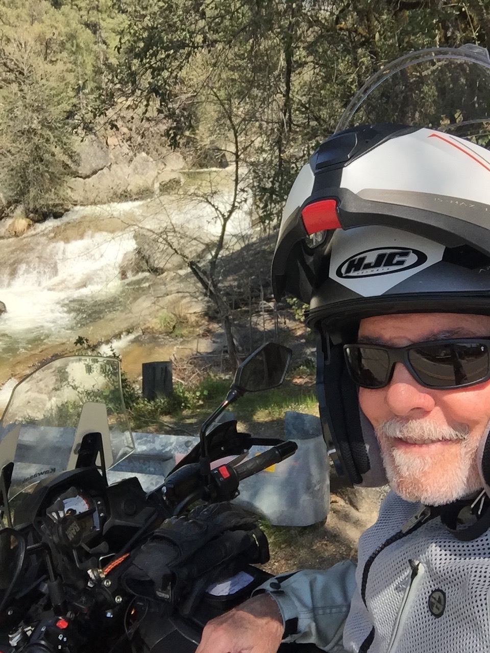
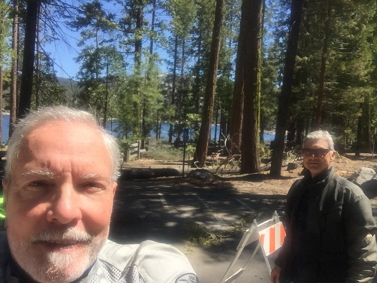
Sadly, as you can see, this photo features yet another photo-fail. The scenery and moto are secondary, overwhelmed by the grizzled photo bombing geezer. At least you can’t see the squinting eyes masked by the glasses. Willow Creek that empties into Bass Lake in the background was the star of the photo. More of the motorcycle in the foreground with more of the starring background scenery (and none of the geezer) would have garnered the supporting actor honors for the bike.
I don’t know what possesses me to take a selfie when I know that in viewing the photos later I’m profoundly disappointed. Especially when that selfie is the only photo either you or your partner Pete took to commemorate the ride… Did I mention I’m no Jamie Robinson?
On this ride our route took us from Merced East on Hwy 140 to Agua Fria with a right turn onto Yaqui Gulch Rd to Buckeye and Ben Hur Rds to Mormon Bar where we jumped on Hwy 49 through Bootjack, Nipinnawasee, Ahwahnee to Oakhurst. Road construction and bumper to bumper traffic on the very busy Hwy 41 that bisects Oakhurst found us taking Crane Valley Rd to The Forks on Bass Lake. We whipped around the lake on Rd 222 to North Shore Road to check on Pete’s partner Cheryl’s recently sold cabin and returned by way of Rd 222 and 221 to North Fork Rd, Finegold and O’Neals. Bombing down Hwy 41 we turned west on Hwy 145 to Rd 400 taking us along the southern shore of Hensley Lake that looked pretty empty for this time of year. Road 603 through Daulton, Rd 29 and Ave 26 back to Santa Fe Ave got us to Le Grand where our bicycle zig zag on E Savana, S Burchell Ave past Jay’s to Childs Ave, Planada, then Plainsburg Road to South Bear Creek drive (not far from where SoBe found me) took us home.

Covid-19 Moto Tour IV to Pinecrest Lake, the Clavey and Tuolumne Rivers ±248 Miles
That brings us to where this installment all began back on Thursday, April 30. On the spot, after fueling up at the Chevron, getting a shocked expression from Pete that I had formulated no explicit plan with step-by-step Google directions, I suggested we go up to the Donnell Lake Vista or Dardanelle on Hwy 108 near where Hwy 108 over Sonora Pass is closed for the winter. Mind you I was in my mesh gear because we were experiencing something of a heat wave (temps in the 90’s) in the Valley and I only had a t-shirt as my base layer and shorts under the armored mesh pants.
Pete’s wheels began turning as we tossed about a route to take since his catalogue of the local “backroads” has been honed over some 50 or so years riding motorcycles. We agreed on a route that would avoid most of the highways even though, because of stay-at-home orders, traffic was considerably reduced. We simply prefer back road touring. There’s a purity or authenticity to the experience when you can ramble through an area or region away from the monotony of the slab and cookie-cutter boulavards lined not by repetitively interchangeable chain stores and eateries, but interesting “natural” landscapes. Not much is natural about rows of almond trees or cows on pasture but it has an aesthetic value superior to strip malls <IMHO>. That is not to say I don’t enjoy the convenience of shopping centers or an occasional burger at In and Out, or tacos from Ramon’s or M&D, it’s just that battling traffic doesn’t enhance the motorcycle experience, <again, IMHO>.
The trip took us through the foothills into the Sierra above Sonora on back roads including Algerine-Wards Ferry Rd to Tuolumne Rd past Black Oak Casino, closed due to the Covid-19 pandemic. I guess even casinos aren’t willing to gamble by permitting their Social Security slot playing patrons to mingle in the confines of the 50,000 square-foot gaming floor with 11,000 square-feet, smoke free. I wonder what the odds are on dying from smoking related diseases compared to death from Covid-19. I suspect the timeline is a factor and that the casinos have calculated there to be limited liability…


I know. The May rides will be better. More moto and scenery, less squint and repetitive video. Left to right, Marsh’s Flat (again), dual selfies at Marsh’s Flat and Pinecrest Lake.
We took the Kelley Grade portion of Marshes Flat down to Moccasin and west on Hwy 49 to Jacksonville Rd where we headed north to Stent Cut-Off Rd (wait, doesn’t a stent increase flow?) to a lovely wooded country Algerine Rd that became Algerine/Wards Ferry Rd popular with the bicycling crowd. More twists and turns on Wards Ferry Rd north to Tuolumne past the aforementioned Black Oak Casino to Hwy 108 and Pinecrest Lake which was “closed” except we were able to ride up to the lake as roads through the community of cabins allowed us to access Pinecrest Lake road. A stretch, walk down to the lake, and some snacks from our top boxes allowed my fingers, numb from the cold, to restore feeling.

The turnoff to Pinecrest Lake also includes Dodge Ridge Rd where the ski resort, our family’s favorite, is buttoned up for the summer.

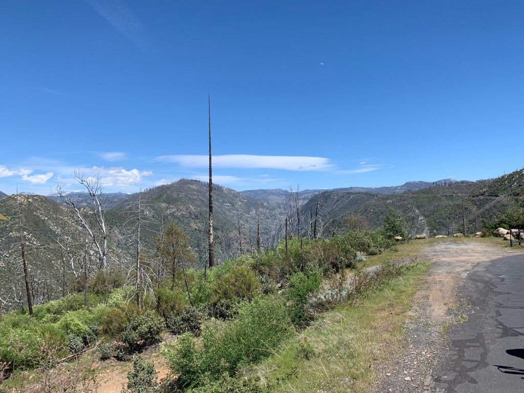
We decided to forego gaining more elevation as the temperatures were dropping pretty quickly from Cold Springs so we reversed our course and headed back down Hwy 108 for the town of Tuolumne where we then headed east in the direction of Cherry Lake by way of Buchanan Rd/Forest Route 1N01. The road is well paved and is filled with superb twists and turns down to the grand Clavey and Tuolumne Rivers in fine spring runoff form.


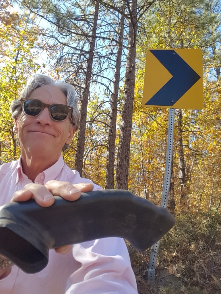
Pete is preparing to take a photo of the Clavey River so since it’s a picture taken of him, and so it isn’t a selfie and there is a moto in the foreground. The photo on the right is self-captioned. In chalk.

The photo above is a view of the Rim Fire burn scar taken from Cherry Lake Rd above the Tuolumne River Canyon. The fire started on August 17, 2013, during the 2013 California wildfire season and grew to be (at the time) the third-largest wildfire in California’s history having burned 257,314 acres.
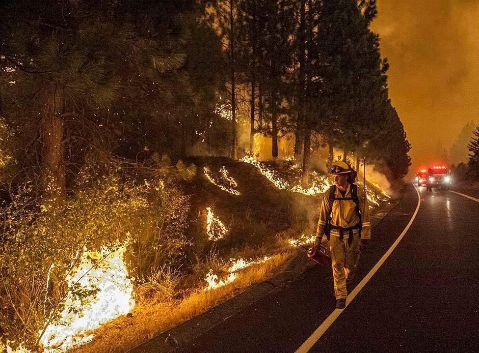
The inferno was caused by a hunter’s illegal fire that got out of control and it was named for its proximity to the Rim of the World vista point, a scenic overlook on Highway 120 leading up to Yosemite.

Chamise (Adenostoma fasciculatum) was in abundance along with a number of other native wildflowers (excluding the invasive Scotch broom front left) covering the burned hillsides of the Tuolumne River canyon and the fragrance that afternoon was intoxicating. Unfortunately chamise is oily and highly flammable as the season wears on and conditions dry. On the other hand, it is an excellent plant to stabilize the fire ravaged hill sides. It’s just like nature to giveth and taketh away…
Speaking about “taketh-ing” away, back on Hwy 120 from Cherry Lake Rd to our turnoff, the return ride made its way past the Dead Toenail curve near the intersections of Smith Station and Greeley Hill Roads about 8 miles north of Coulterville without incident. It seems we have exorcised the bad juju from that curve that was earlier referred to (never again to be mentioned) in my Riding Under A Fool Moon post. Did I mention that earlier?


Pete’s expression pretty much summarizes what he’s anticipating I will eventually write about the ride. After a brief stop in Coulterville, again practicing social distancing, we avoided stopping at the Coulterville Cafe and General Store for our usual ice cream bar and stimulating coffee beverage. After a brief stretch, we made our way home on the usual roads reinvigorated having gotten out of the house for a couple of hours doing what we love.
Stay tuned for May’s rides as loosening restrictions may make for an overnighter. Until then, stay safe all!
