

Death Valley by Moonlight

It all began as an invitation from Andy Neufeld to ride the moto, with whom in countless chance meetings at the supermarket or hardware store our conversation always ended with, “Let’s get together and ride some time…” The body of the emailed invitation follows:
“Please get your bike (and your core) in shape and join me for an October ride. I propose that we leave Merced on the morning of Saturday, October 12 and cross over Yosemite National Park via Tioga Pass Road.”
“I propose that we then continue south from Lee Vining and stay the first night either near June Lake or near Mammoth Lakes. Mammoth is the more populated and busy of the two areas and it’s a little further along the route but in my opinion, June Lake is more desirable.”
“From the Lakes area I propose to travel to Panamint Springs and rest there through the middle of the day. Panamint Springs is a bit on the rough side as tourist destinations go. There are, however, hot springs and resort environments. There may be beer available for purchase. “
“When the sun goes down in Panamint Springs I propose to travel across Death Valley by the light of October 13th’s full moon, arriving late at our next destination, which will be Beatty, Nevada.”
“After a night in Beatty, we will travel north through Nevada and turn west toward Lee Vining, where we third and final night. The next morning, it’s back home through Yosemite.”
“I am inviting 4 people for this ride. If you can come, you are welcome to invite others. Please let me know if you are able to come, and how many you will be, and I will get to work finding us places to stay!”
I always get excited when invited on a ride. Especially one that comes with an itinerary and disclaimers and endnotes:
- Weather can ruin everything. It can certainly change plans without notice. We’ll have to deal with it.
- In my imagination of this trip, the riding will be the roughest part. No sleeping on the ground or eating out of cans.
- There should be no expectation of any standard of any sort for gear or machines.
- There are lots of individual decisions to be made and people might join late, leave early, or generally go off on their own paths at any time.
- Sound like fun? Then let’s go!
Little did I know what was meant by disclaimer (or note) iv, “There are lots of individual decisions to be made and people might join late, leave early, or generally go off on their own paths at any time.” Especially the “go off on their own paths” part…
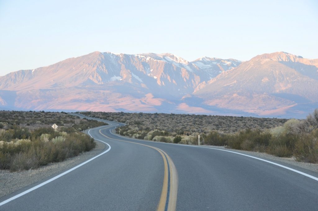
Day 1, Up and Over Tioga Pass


A disclaimer of my own:
Sadly, WordPress won’t allow directly embedding any of the video I took from the moto. I would first have to publish it on YouTube and link the content. I’m new at the whole GoPro thing, but there were several spectacular clips riding over Tioga Pass that would have added to the beauty and feel of the ride. The old dog needs to learn some new tricks… That’s why there are no photos of our crossing.

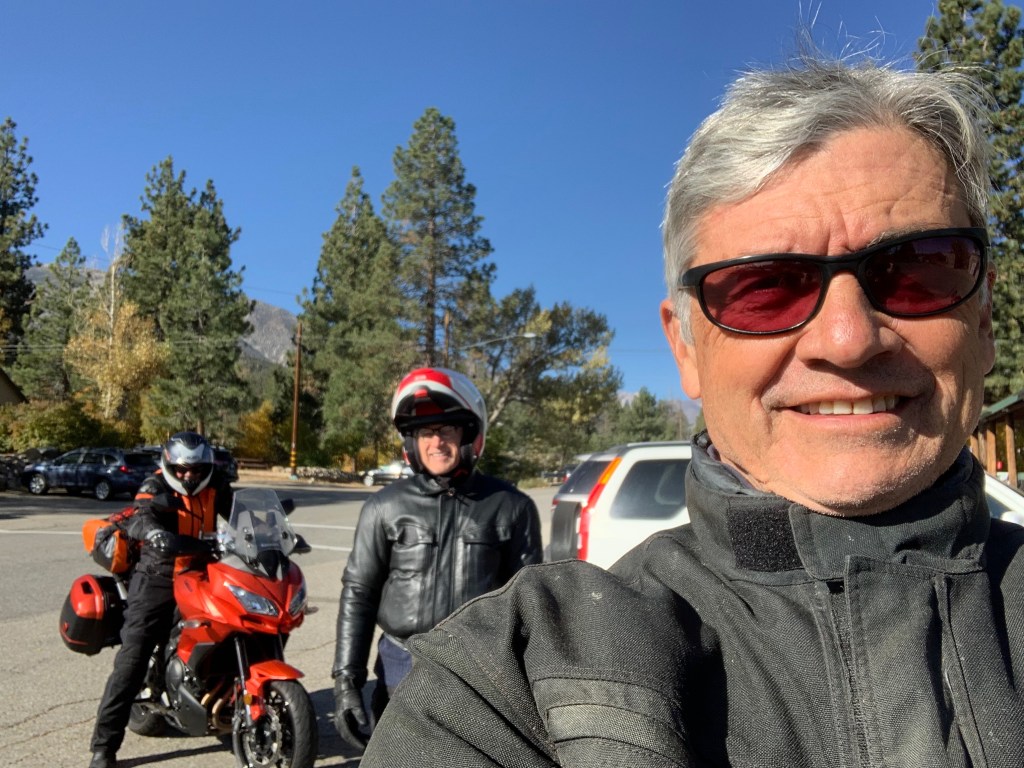
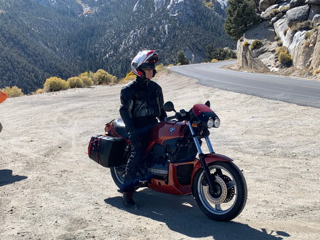
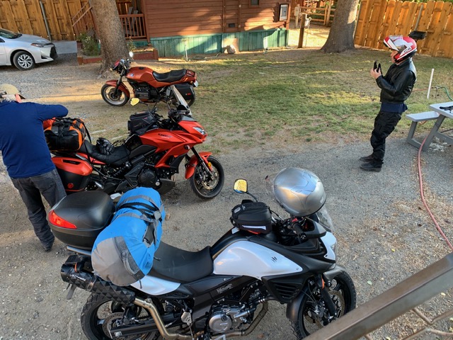
Another friend, fulfilled Andy’s generous offer to invite others and ignoring his second end note or disclaimer (ii), Pete Etchegaray, who you might have noticed has appeared in several of my previous moto adventures. Pete and I planned to camp. We drew the line at eating out of cans however.
Stoked to travel over Tioga Pass in the fall to enjoy the splendor of an East Side autumn was a deliciously seductive reason to ride in October. Sunny days and chilly nights were perfect, especially since we’d come off of a debilitatingly hot summer and that we’d only be riding through the night on the Death Valley leg of the journey. Perfect!


Seems to me Coulterville could use a visit from Kevin Bacon…
We began the ride by making our way to Hwy 120 via Hwy 59 north through Snelling, Merced Falls Rd. and Hwy 132 to Coulterville, Greeley Hill Rd. to Smith Station Rd. and the northern route through Yosemite. With the exception of a brief delay on the Greeley Hill Rd. leg to look for, but sadly not find, an air duct that fell off of Andy’s “Flying Brick”, we arrived in Lee Vining at the Whoa Nellie Deli for a snack around noon.


We arrived in Mammoth intending to meet with a veteran bicycle riding comrade, Karl Teller to exchange mockery, insults, and other juvenile impudence. However, as once before on an earlier Autumn East Side Moto, Karl and his son Johnny were off bow hunting elk. I guess next time I come to visit I’ll check the California Fish and Wildlife Big Game Hunting Digest to see what’s in season and when…
After a fine dinner at Roberto’s in Mammoth watching the sun set over the Sierra, the night chill began to weigh on our decision to ignore that second endnote as we motored back to the Sierra Nevada Lodge. We decided to disavow the notion of camping choosing instead to awaken in a warm motel room rather than a frosty campsite.
Data driven 
Danny driven
Day 2, Elevation Extremes
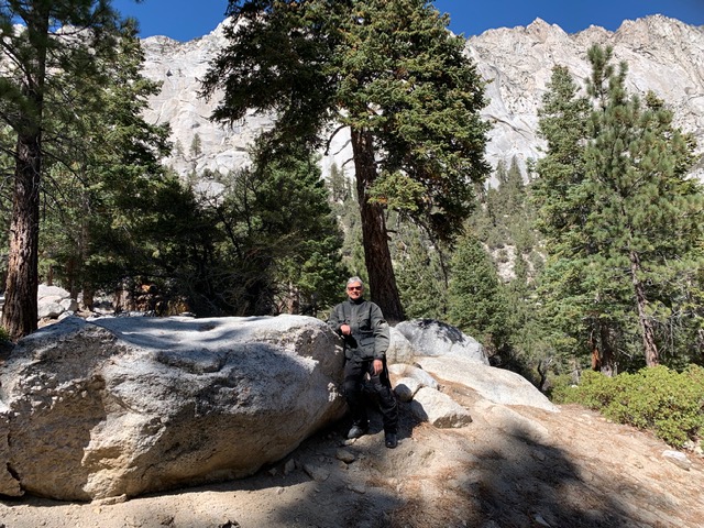
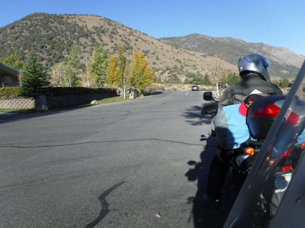
Awakening to another clear sunny day, though chilly to be sure, we set off for breakfast at the Tom’s Place Resort, Cabins, Lodge, General Store, Cafe & Bar near Crowley Lake down Hwy 395 from Mammoth.

Manzanar Camp
Having time but little distance to make our afternoon destination in anticipation of the full moon rise, we took a side trip up to Whitney Portal along the way stopping at the Manzanar Camp, a U.S. National Park Service Historic Site just north of Lone Pine. A little history thanks to the NPS:


I highly recommend touring the Manzanar Camp. I recall my first visit some 40+ years ago when the visitor center facility that is now a remarkable interpretive, interactive, historical museum of Smithsonian caliber was then a road maintenance facility for Inyo County. If timed right, you could jump the fence, trespassing, and examine the camp’s ruins back then. Today the Park Service has reconstructed many of the features of the camp with the compelling story of the hardships imposed on the interned, but resourceful and dignified Japanese American citizens during WWII.

Upon arriving at Lone Pine for fuel and a mid-day snack, we were diverted from Hwy 395 to B Street so that a parade could commence commemorating the Lone Pine Film Festival. It seems that movies had been screened for three days, all day long and the event was wrapping up with a parade and later a campfire.
In 1920, Lone Pine was changed forever when a silent movie, The Roundup, was filmed in the Alabama Hills. Since then, over 400 movies, 100 TV episodes, and countless commercials have been shot in location in the area, immortalizing the striking rock formations and taking advantage of the picture-perfect weather.
https://lonepinechamber.org/history/the-film-industry-in-the-lone-pine-area/
If you are curious: https://en.wikipedia.org/wiki/List_of_films_shot_in_Lone_Pine
I’ve always enjoyed spotting Mt. Whitney in as a backdrop to many of the western films I’ve seen over the years. Indeed the mountain is the star!
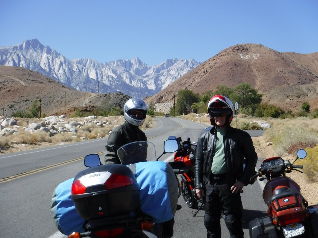
Whitney Portal
The East Side of the Sierra Nevada Range or what Mary Austin called “The Other Side of California” is captured in John Muir’s concise description, “In general views no mark of man is visible on it, nor anything to suggest the richness of the life it cherishes, or the depth and grandeur of its sculpture.”
The road to the road’s end at the portal is filled with stunning views of the peaks above and the valley below, each stretch of pavement revealing the majestic geology characteristic of this extraordinary western landscape. You have to overlook the road, movie crews, and other folks bagging the YOLO hike up to Whitney summit to appreciate Muir’s description, however, there is this…
Top pic below: Pete, Andy, and Mt. Whitney with a guest appearance by the official LP ‘Bama Hill; Next pict, Tj and Mt. Whitney; 3rd pic, Andy as Motaur; Last pic in the series, the Owens Valley, Alabama Hills, the southern terminus of the White Mountains, and what’s left of Owens Lake…


Pete on the rocks followed by a sweeper, neat, back…

Onward to Panamint Springs
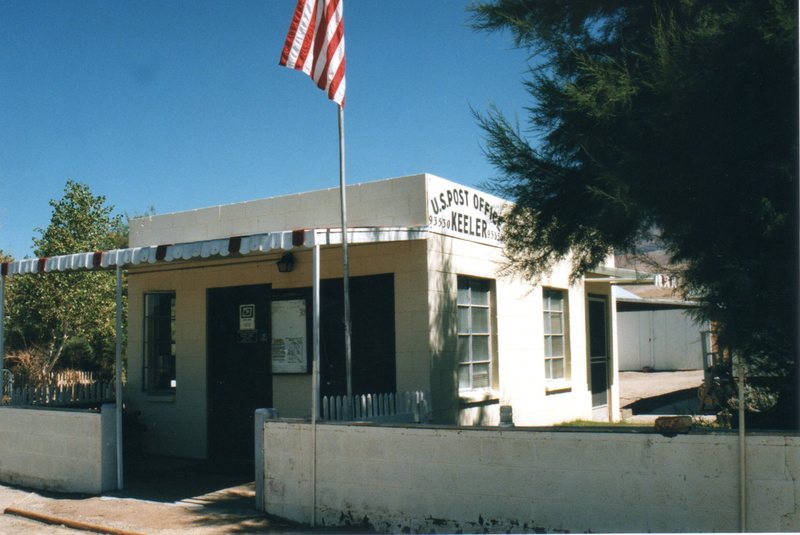
No trip to Death Valley would be complete without entering the park from the north out of Lone Pine. After a brief reach on Hwy 395 south from Lone Pine to the intersection with Hwy 136 we headed in south-easterly direction through the settlements of Dolomite, Swansea, Keeler, all having seen more prosperous days when silver ingots were hauled by steamship across Owens Lake and then by rail to Los Angeles from ore mined at Cerro Gordo in the 1870’s. Had Andy and I been on more adventure worthy bikes like Pete’s V-Strom, we would have taken the 4×4 road up to the ghost town. Cerro Gordo will have to wait for the next bike upgrade.


https://www.cnbc.com/2018/07/19/photos-california-ghost-town-cerro-gordo-sells-for-1point4-million.html
History lesson: The 1872 Owens Valley Earthquake interrupted mining briefly rendering a pier in Swansea inoperable so enter Julius M. Keeler whose steamship “Bessie Brady” brought ore from Keeler across the lake to the town of Cartago. 1882 the Bessie Brady was destroyed by fire. There was a 300-foot wharf at Keeler, and the steamship route cut days off the time a freight wagon would have taken to circle the lake. She carried 700 ingots at a time in a three-hour crossing. Silver prices in the late 1800’s plummeted so the next boom of zinc, rallied the town along with small surges in the mining of silver, lead, and limestone. However, by the 1950s all mining had ceased. Train service was stopped in 1960.
A few reminders of those better days remain as does a small population of residents in Keeler.


A Catholic Priest and a Jedi Knight
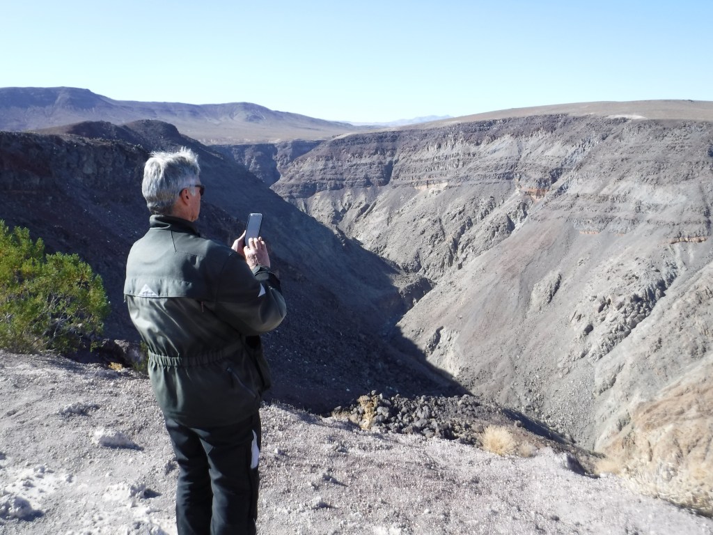
Continuing east on Hwy 190 we rolled up and down, but more down than up considering we were heading towards Death Valley into Panamint Springs. The highway takes you through Rainbow Canyon (nicknamed Star Wars Canyon and Jedi Transition) just inside Death Valley National Park in Inyo County on the park’s western border. It is commonly used by the United States Air Force and Navy for fighter jet training and is frequented by photographers who, from the canyon rim at the Father Crowley Overlook, are able to photograph jets flying beneath them.
No jets today Pete, who is neither a priest nor Jedi Knight, as far as I know…

History lesson cont.: Father Crowley, for whom Crowley Overlook is named, is also the namesake for Lake Crowley, just north of Tom’s Place. Upon the completion of the Los Angeles Aqueduct in 1913, the diversion of the Owens River by the Los Angeles Department of Water and Power took the water from the the “Land of Little Rain” along 223 miles to Los Angeles, resulting in that city’s phenomenal growth. No mystery in the corresponding decline of the Owens Valley farms as the once verdant and productive agricultural economy collapsed. Before long, the verdant valley was returned to desert conditions where the vegetation consisted largely of greasewood and sagebrush. It was in this harsh environment that Fr. Crowley would live during his years of service to the area. With the demise of agriculture as an economic base, Fr. Crowley turned to tourism as a potential means of helping the valley residents survive. Learn more at: https://www.catholic.org/featured/headline.php?ID=1576
Tourism, that’s what gets a lake and and overlook named in your honor on The Other Side of California.
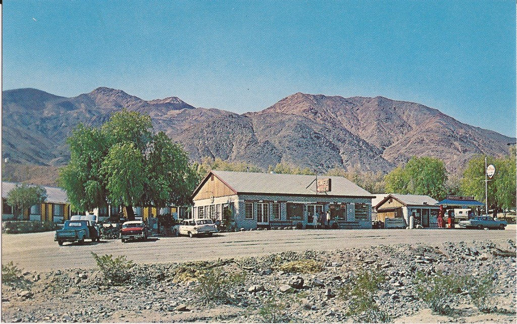
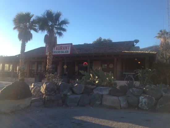
The Panamint Springs Resort in the 1950’s (top) and today…
Slipping into Darkness
After a fabulous burger and a thirst quenching draft we retreated to our respective corners. Andy found a lovely ironwood tree to nap beneath at the Panamint Springs Resort. Pete and I schemed to get a tent campsite and lodging for Andy so that we could enjoy the serene beauty of a night in the Panamint Valley as we had in the prior spring. Since riding across Death Valley under the cover of darkness illuminated by a full moon was the raison d’être, we thought we could use the resort as our base camp and tool around Death Valley and return to the camp that evening. After awakening Andy, since it was his inspiration to ride under the full moon to Beatty, we folded. After fueling up, we set off for Furnace Creek.
Since we were only 140 miles into our 290 mile day we topped off our tanks with some expensive petrol and as the sun was disappearing quickly, we bypassed the road to Zabriskie Point for the sunset. Besides, it was closed for repair, thus beginning our trek across Death Valley (278.5 feet below sea level at Badwater) in the fading light of the day. Seeing a young coyote alongside the road in the fading twilight–the soft, diffused light from the sky when the sun is below the horizon, either from daybreak to sunrise or, more commonly, from sunset to nightfall, or, a state of uncertainty, vagueness, or gloom–? You decide as I began to wonder about other potentially somewhat immovable obstacles that might wander onto the road. You know, like a freed descendant from the 20-Mule Team or Death Valley Scotty’s great, great, grand burro enjoying a saunter in the full moonlight. But the air, much cooler than the temperate mid-eighties of the afternoon and the low angle of the setting sun made for a dreamlike landscape and collision concerns briefly faded. Blissful optics only lasting for a few miles so we hunkered down keeping eyes peeled for any critters or road conditions that might detract from the otherwise surreal ride.
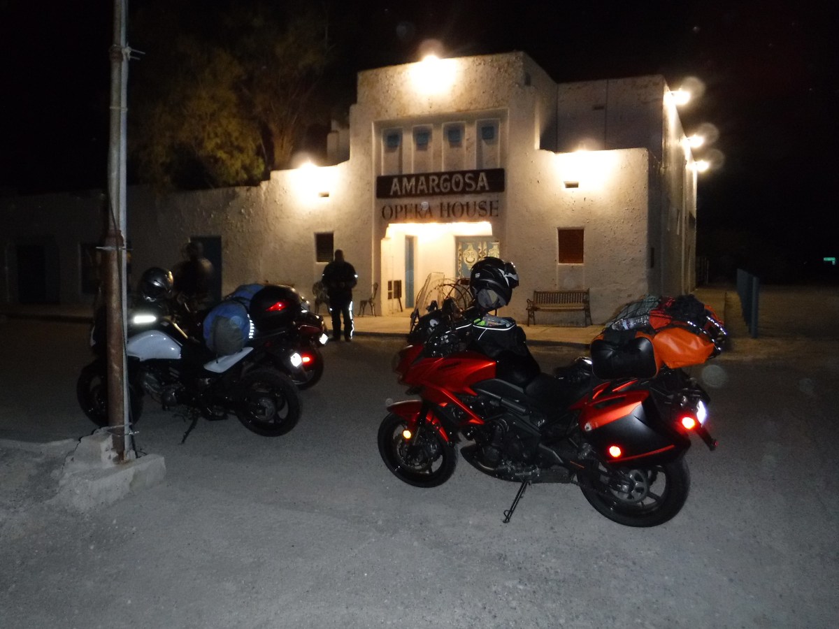
Fooled by the Full Moon
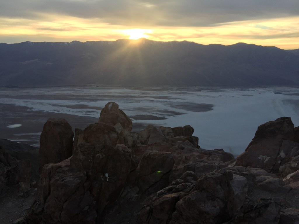
We didn’t really see the moon or enjoy it’s illumination until we had pretty much climbed out of Death Valley and began heading east on Hwy 190 crossing the Funeral Mountains. Finally, upon seeing the moon rise over the Funeral Mountain Wilderness Area, we pulled over. It wasn’t disappointing, it was just sort of not as we had imagined. Bundled up in ATG and concentrating on the road, the whole full moon affect was not so much noticeable. At least not like cross country skiing across a frozen Ostrander Lake, hiking above the treeline on the Sierra over Muir Pass, or sailing on the San Francisco Bay under a full moon. Besides now it was getting cold as we climbed up Hwy 190 out of Death Valley and we had variously been on and off the bikes for 12 hours. Fortunately the glow on the horizon of Amargosa Springs gave us inspiration to keep going so that stopping and adding a layer of insulation would make the final 70 mile leg possible, if not a little more bearable, in wind chilled to the single digits according to Pete’s V-Strom ambient temperature gauge.
Andy as the OH (original hipster) in minimalist leather and jeans…


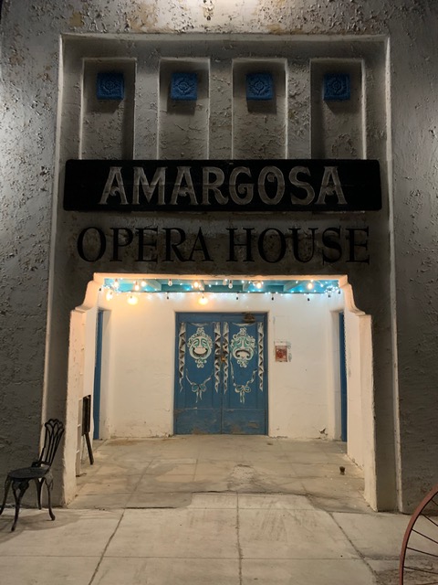
From Wiki: Amargosa Opera House and Hotel is a historic building and cultural center located in Death Valley Junction, in eastern Inyo County, California near Death Valley National Park. Resident artist Marta Becket staged dance and mime shows there from the late 1960s until her final show in February 2012. The Death Valley Junction Historic District is on the National Register of Historic Places and is owned by the nonprofit established by Becket for the preservation of the property. http://www.amargosaoperahouse.org/
Next trip along Hwy 127 the Amargosa Hotel is a must stop to stay the night…


The theater was part of a company town designed by architect Alexander Hamilton McCulloch and constructed in 1923–25 by the Pacific Coast Borax Company. The U-shaped complex of Spanish Colonial Revival architecture style adobe buildings included company offices, employees’ headquarters, a dormitory and a 23-room hotel with a dining room, lobby and store. At the northeast end of the complex was a recreation hall used as a community center for dances, church services, movies, funerals and town meetings.
Had we only known that the now hipsterish AH&C served, “Delicious entrees and nourishing choices with ingredients sourced from a surprising abundance of local artisanal growers. No visit to the Death Valley region is complete without the discovery of how well you can eat in the desert!” (from the Amargosa Hotel and Cafe website), we could have gotten rooms enjoyed artisanal abundance and ridden those 70 miles the next day in the warmth of daylight.
Spacing Out in Beatty

Rebel 74 convenience store
Riding Hwy 127 across the Nevada border then on Hwy 95 to Beatty was to say the least, a bit of a let down. The first hour of the night ride from Stovepipe Wells was sublime. The second hour of the night ride to Amargosa Springs was “interesting”. The third hour of the night ride to Beatty was agony. Cold, hungry, and in the dark on a motorcycle riding up a lineal two lane undivided highway heavy with triple tractor trailer rigs isn’t my idea of a great time. Given my latent masochistic nature though, I kind of enjoyed the suffering. I think we all did and if by our subdued manner upon reaching the hotel was any indication, the distress was nary mentioned.
I did express early in the planning stages that when we arrived in Beatty, if too beaten up to pitch a tent in the cold at 10:00 pm in the dark, maybe staying at the Atomic Inn would be just the thing… to do… in Beatty Nevada. From their website: “The Atomic Inn is a retro themed classic style Death Valley lodge located in the Eastern Mojave Desert in the Wild West pioneering town of Beatty, Nevada. We are the gateway to Death Valley National Park, located just 6 miles from the Hell’s Gate Entrance! Established in 1979, The Atomic Inn has been under new management since 2012. We have completely remodeled the rooms in our boutique, themed hotel to offer the finest Death Valley accommodations in the area. However, we do remain the most affordable of Beatty Hotels.”
Pause to think what “boutique” and “most affordable” in separate sentences means. Yep. You can tell you’re in quality affordable boutique lodging by noting the preserved 70’s era wall panelling and luxurious see through bath towels that also work as dermabrasion devices. Notice the classic Nevada landscaped theme in the bedding…
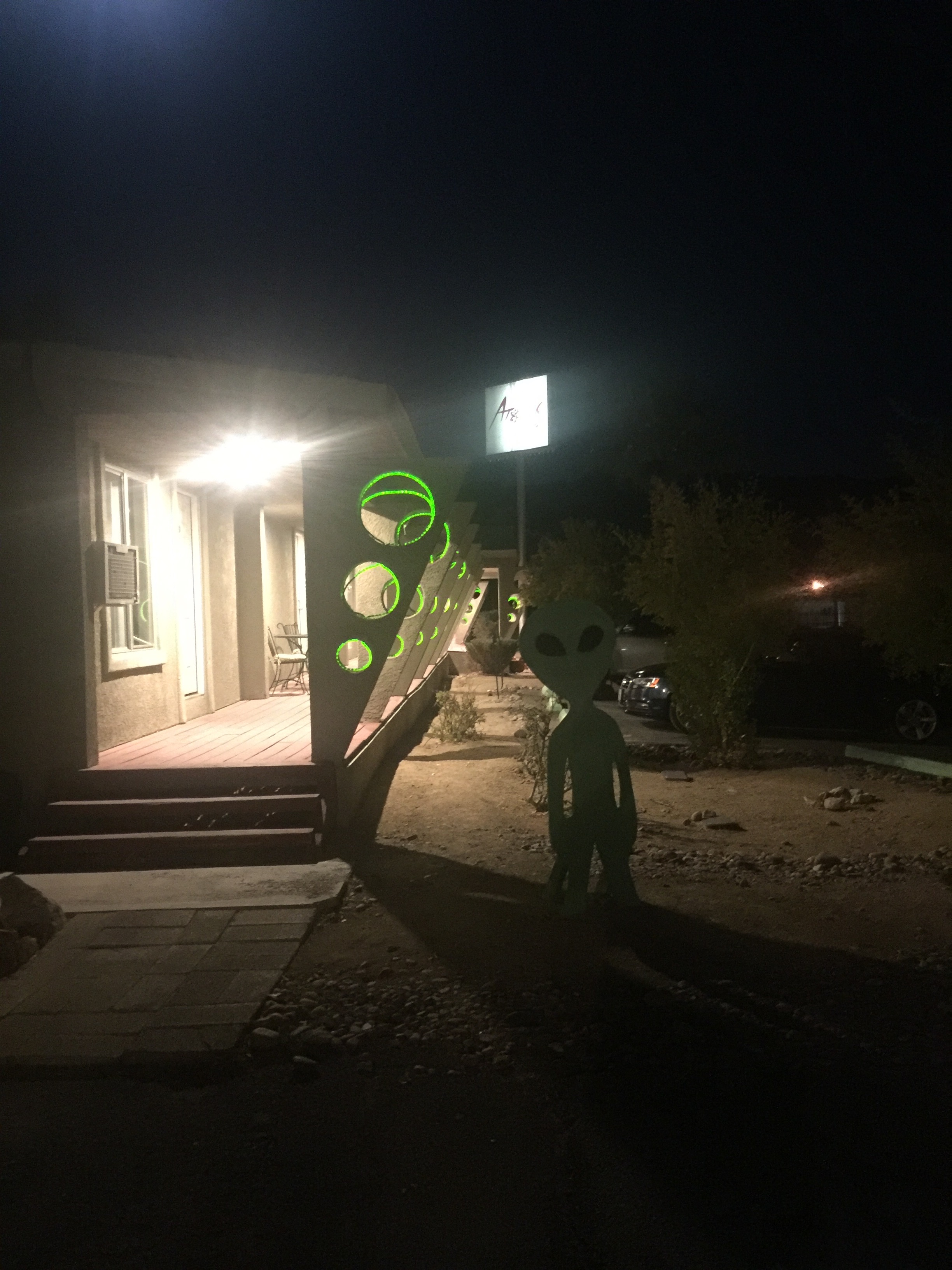
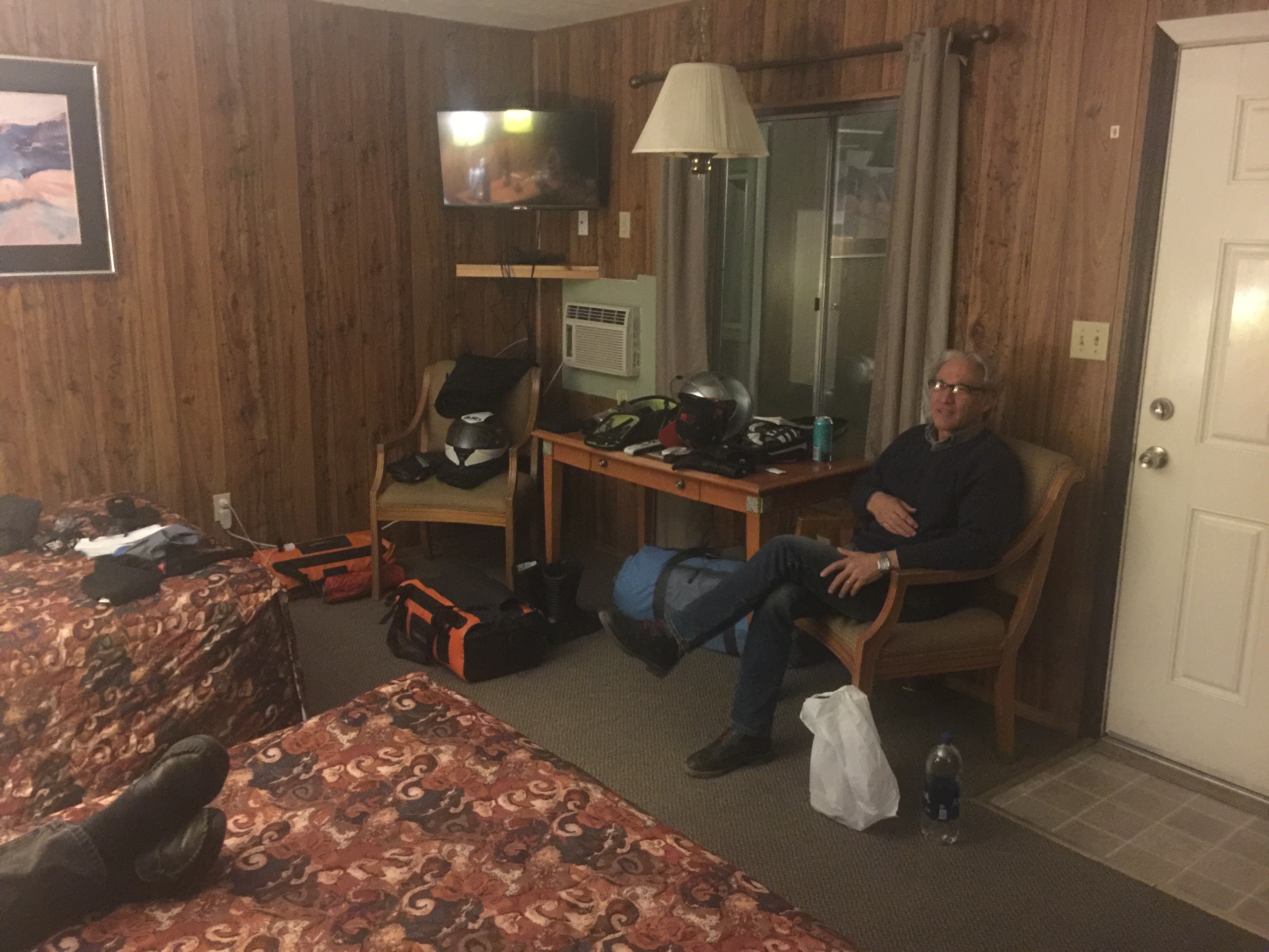


It was late so in lieu of a hot dog from Rebel 74 gas station (note Andy grasping his stomach having eaten one…) Pete and I opted for a tasty boutique microbrewed beverage. 40 years ago such a thing didn’t exist in Nevada. 40 years ago the Atomic Inn wasn’t a boutique inn either.
Day 3, Columbus or Indigenous I’m Not


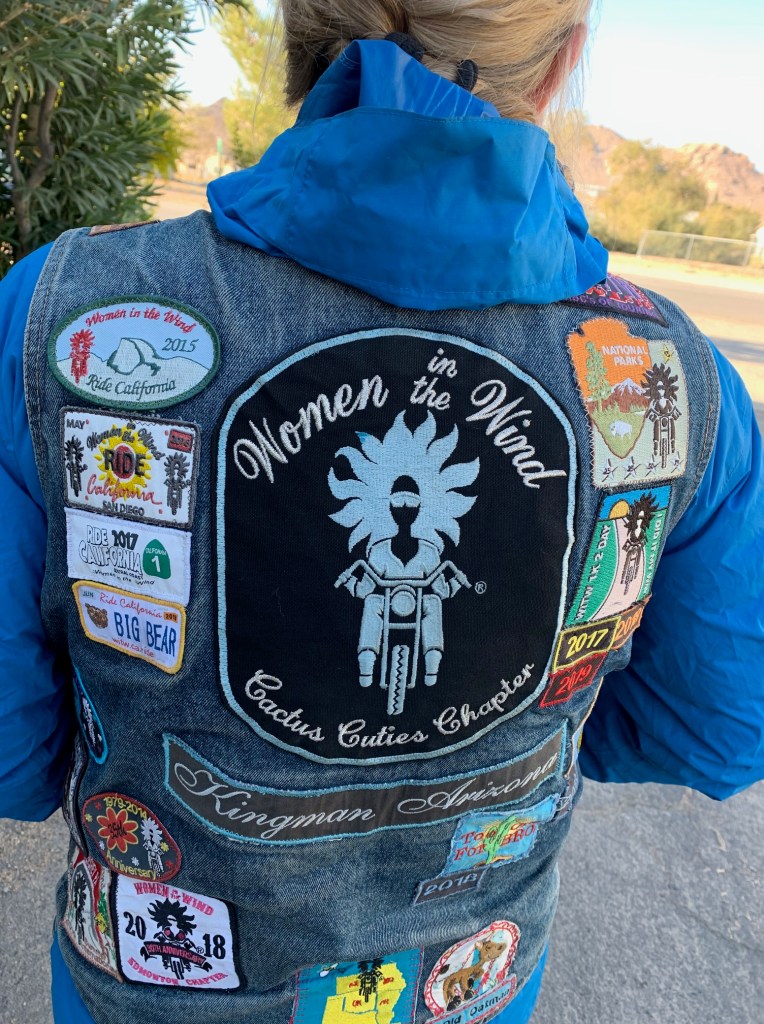
The following Columbus/Indigenous Peoples’ Day morning awash with sun shine was much warmer than just a few hours earlier. Packing before breakfast, Pete a conspicuously minimalist rider and aspiring hipster, finished first while I was wrestling with my strap dense DrySpec bags as an aspiring geezer. Andy was enjoying a few extra minutes of snooze as a seasoned OH would. Pete happened to meet fellow motorcyclist who had also spent the night at the Atomic Inn and who is a member of the Women In The Wind motorcycle club. She had been on the road for a few days hailing from Kingman Arizona and was enroute to a club gathering on the coast of California, at Morro Bay or Monterey if memory serves, or somewhere in between. It seems the Atomic Inn appeals to we wind therapy seeking types notwithstanding gender or club affiliation. It’s also testimony of Pete’s uncanny ability to meet and collect the stories of fellow motorcyclists.
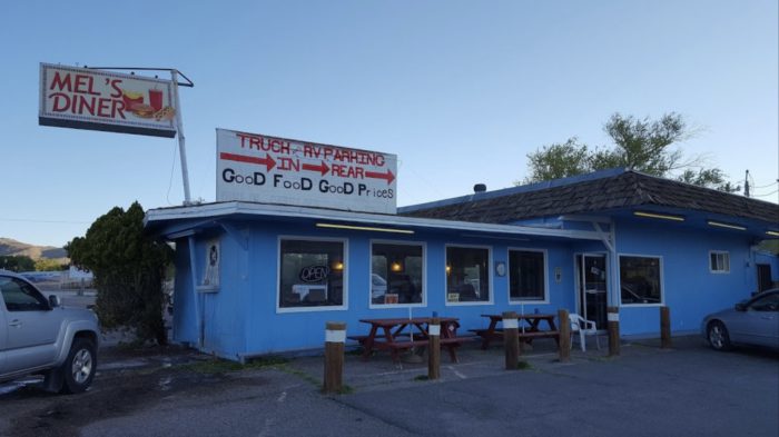
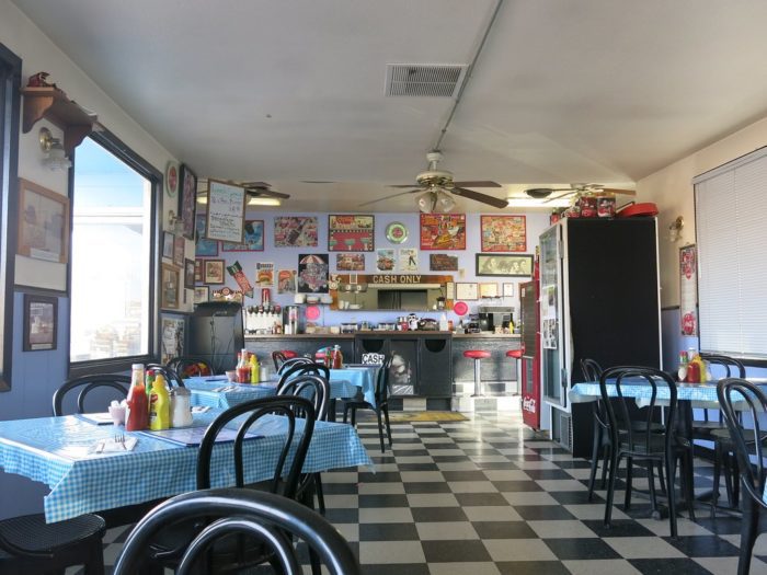
After a nice breakfast of corned beef hash, eggs, and hashbrowns at Mel’s we were caloried-up for the ride ahead to Lee Vining for the night. The service was a bit slow because the place was packed. We were only one of two tables where English was spoken. There were families and couples of French, Dutch, Asian and Spanish speakers, all of whom apparently have a knack for finding places like Mel’s. It may have some renown in the Yelps or TripAdvisors of the interwebs and therefore attracts unwitting foreign tourists. I’m sure the tired kitsched-out Happy Days theme is uncommon in Flanders or Paris. There was one hitch in an otherwise fine, yet ordinary breakfast experience. A churlishly rude and ill tempered waitress, far more so than the fabled surley servers at McSorley’s Ale House in NYC, seemed indignant to have to take orders or deliver plates. She had the customer service skills of Social Security aged Bevis and Butthead. Fortunately, we had a much nicer, younger, and far more affable waitress. Maybe if you live in Beatty long enough it changes you…
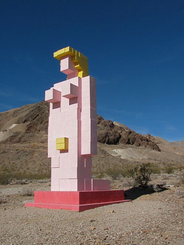
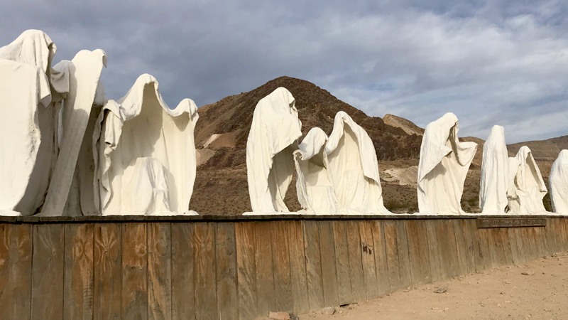
After a slight navigation error (uh, my bad) our attempt to visit Rhyolite and the Goldwell Open Air Museum installations fell flat as temperatures were rising and miles and miles of nothing but miles and miles lay ahead. https://en.wikipedia.org/wiki/Goldwell_Open_Air_Museum

Passing through Beatty once more, having traveled some twenty miles in the wrong direction, we righted our course and lo and behold we encountered our first true sign that we were definitely in Nevada.

Oops, I (He) Did It Again

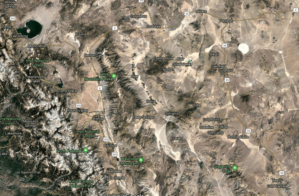
Our day included the option to head north on Hwy 95 to Lida Junction (home of the boarded up Cottontail Ranch Brothel) (Like Amazon, has the interwebs delivered the demise of the local Brothel?) then west on Hwy 266 to the Oasis junction then on to Hwy 168 over the twisties up and over Gilbert Pass to Big Pine. Another option was to travel further north to Tonapah then head west on Hwy 6 to Benton Springs. None of the three of us view love as a game nor do we have any affection for Tonopah. I don’t think Britney Spears, whose lead single from the album by the same name, Oops I Did It Again (not Tonopah), had geography on her mind when belting out the song on MTV in March of 2000 following the Y2K scare. Nor do I think she ever performed in Tonopah. Nor did Andy, who at mid-day, suddenly disappeared for the second time on the ride. (We are sworn to never speak of the first time he went MIA.)
I had taken the lead with Pete and Andy behind. The roads were true and in good condition so the throttle hand was itching to eat up some miles. When I arrived at the Y in the road where Hwy 266 splits from Hwy 168 I had by then lost sight of my two companions.
Like the closing stanza in Robert Frost’s, The Road Less Traveled;
I shall be telling this with a sigh
Somewhere ages and ages hence:
Two roads diverged in a wood, and I—
I took the one less traveled by,
And that has made all the difference.
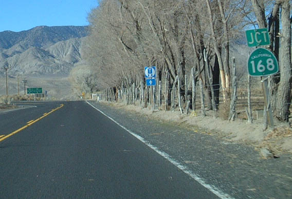
Not ages hence, as I write this in November following our October adventure, and not in the woods but along a tree sided road, I sighed and thought that we had clearly discussed this junction, at and earlier junction to Goldfield on 266, when we contemplated how lost we were. You see, this part of the ride was untraversed by any of us in the past as had much of the prior route. I pitched the leg earlier because it passed by Deep Springs College once over Gilbert Pass on Hwy 168 to Big Pine.
From Wiki: Deep Springs College is a small, private liberal arts junior college in Deep Springs, California. With fewer than 30 students at any given time, the college is one of the smallest institutions of higher education in the United States. https://youtu.be/utziPMKcK3U
Deep Springs is founded on three principles, commonly called the “three pillars”: academics, labor, and self-governance. In addition to studies, students work a minimum of 20 hours a week either on the ranch and farm attached to the college or in positions related to the college and community. Position titles have historically included cook, irrigator, butcher, groundskeeper, cowboy, “office cowboy”, dairy, and feedman. Deep Springs maintains a cattle herd and an alfalfa hay farming operation.
Why I chose Chico State over Deep Springs is a something of a regret I have. What I didn’t have is the IQ to get into the place… https://www.deepsprings.edu/
When I arrived at the summit of Gilbert Pass weaving in and out of scores of perfectly banked curves I decided to rest, collect myself for the downhill, and await my pals. After a few minutes with no sign of the lads, Pete arrived and asked if I had seen Andy. Uh, I thought he was behind you… After waiting for 20 or so minutes, we decided to turn back and find out what was up insofar as we were concerned given an earlier episode (which we are sworn never to mention).
Arriving back at the Oasis junction, no Andy was in sight. We puzzled over whether he had taken the wrong road, one diverging in an alfalfa field, one less traveled by, wondering what difference it would make. After inquiring at what appeared to be a ranch where the residents were apparently checking the back 40 and not around, I stopped a car asking the two young Parisians if they had seen a fellow on an orange moto heading east in the opposite direction from them on Hwy 266, the road less traveled. They smiled and said they had not. I asked them if they needed directions. Smiling again, they did not. I thought about how my dear and departed friend Larry would have handled that encounter. I am not worthy…
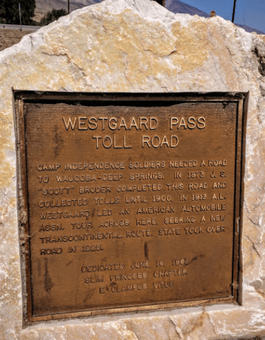
Pete and I decided to ride up and over Gilbert Pass, past Deep Springs, and high-tail it to Big Pine over Westgard Pass where we knew cell service was available to give Andy a head’s-up. Getting to ride the twisties back up Gilbert Pass again distracted me temporarily about wondering where Andy was and appeased my disappointment for not stopping and checking out Deep Springs College, maybe buying a tee shirt or mug. On my first trip up and back down the road, I passed by a pick-up and camper rig that was on the side of the road with a family having lunch. There was a table and chairs and food so I didn’t bother stopping and asking if they needed assistance. On the second trip up with Pete we noticed another vehicle stopped and so we decided to inquire. Neither vehicle’s occupants spoke English. Dutch and French again. Imagine that. Assuring us they were okay and awaiting a tow truck, we departed.

Following Gilbert Pass we enjoyed Westgard Pass, one of the best ways to pass time on a moto.

We rolled into the Mobile station in Big Pine. I called Andy leaving a voicemail and text and retreated into mini-mart seeking a High Brew “for those who do” and some sunflower seeds. As I was walking out of the store, checking my phone to see any response from Andy, I look up and what do I see? Andy walking up! I was relieved to find out that he wasn’t abducted by aliens that are rumored to visit the area in a cosmic rapture but that he consciously decided to take the road to Dyer, a 30 mile detour form Oasis, to get fuel as the “Flying Brick” didn’t have the gas mileage or capacity of the Kawasexy or Wee Strom. Feeling relieved we soon hit the pavement heading to our Lee Vining destination for the night (refraining from mentioning the earlier episode about which we’ve sworn to never speak).
Benton Breakaway
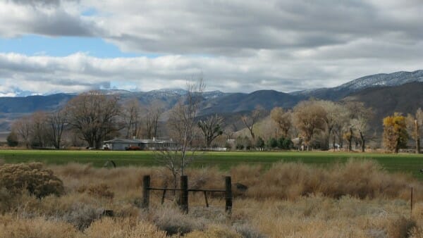
A quick 15 miles on Hwy 385 we continued north from Bishop taking Hwy 6 to Benton Station and the intersection with Hwy 120 to Lee Vining. Benton Hot Springs, a few miles west of Benton Station, is a funky relic of a time when miners and original Cowboys enjoyed the mineral waters heated from the depths below the thermally active Long Valley Caldera. https://volcanoes.usgs.gov/volcanoes/long_valley/
From the Historic Benton Hot Springs website:
The west was wild along the California and Nevada border in the late 1880s and Benton Hot Springs was no different. Horsemen came in from around the range on payday and enjoyed a good meal, a stiff drink and anything else they could find. The town was populated by fairly peaceful folks, but there was a sturdy jailhouse for those stepping over the line.

Benton was once a small mining town with up to 5,000 inhabitants. Many of the original buildings still remain, but the town has never completely died. In fact it is still rich in ranching and farming and features the Old House and Inn, a popular vacation destination.

In 1883, a railroad line was completed to Benton Station and soon train service was initiated to Laws Station, located several miles east of Bishop Creek. Benton Hot Springs got its start around 1863 with the discovery of silver in the nearby Blind Springs Hills and along the White Mountains. One of the oldest surviving towns in Mono County, Benton was once thriving, with up to 5,000 inhabitants.
It’s always interesting to contemplate how in such a short period of time, maybe twenty years, the enterprise that would support several thriving East Side communities where mining, agriculture, and commerce could ramp up to build such impressive infrastructure that would sustain a significant population for another 50 years, but is today, scarcely evident.


46 Miles of Sweepers, Rollers and Long Straightaways…

46 miles to Hwy 395 with another 13 miles of slab to Lee Vining lay ahead. Now, late afternoon with shadows lengthening, there was an “urgency” to make our way to Lee Vining for what would likely be a competition for the last room at the inn, or Lake View Lodge, where Andy had earlier made reservations. By this time our camping gear was an accessory to make our bikes look like we were hearty adventure travelers.


It was on this stretch of highway I temporarily suspended my otherwise conservative approach to riding a motorcycle by opening up the throttle to see what the venerable Kawasexy could do. Throwing caution to the wind, I experienced the landscape passing by so rapidly it was a blur concentrating intently on the road as speed clearly exceeded the distance needed to stop should a wayward elk or pika run across the road before me. Only two vehicles passed in the other direction on the entire 46 miles between Benton Springs and Mono Lake. Knowing Pete’s predilection for speed, I was surprised not to see him in my mirror.

Venerable Institutions Galore
I arrived at the Lake View Lodge and in a few minutes was joined by Pete. It seems we had the same idea about the road. Andy, maybe ten minutes behind, savored the experience, sipping the landscape as Pete and I quaffed it.
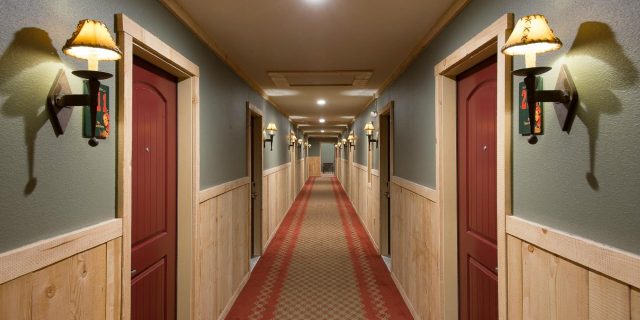
As I had considered, the Lodge was full up for accommodating two more weary travelers on this late Monday evening. However, Andy asked if it would be possible to upgrade his reservation for one of the larger “cabins” that when presented to Pete and me exceeded our budgets for hostel. The Lake View Lodge is family owned and operated since 1932 and is a mash-up of a motel, a variety of small cabins, and larger modular homes. We were given the 4 Queen Cabin that could accommodate eight guests. The math worked out getting a deal since it was unlikely to be occupied that evening so we signed the register and made plans for dinner.
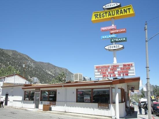
After a fine dinner at Nicely’s, a venerable Lee Vining institution with a menu that probably precedes my first visit 47 years ago, we procured some après dinner beverages at the Mono Market (ditto a venerable institution) to enjoy while gathered around the smelter-caliber gas fireplace in the Queen to watch the Lions lose to the Packers on Monday Night Football. Much reflective conversation about the ride took place as we were warmed from the outside by fireplace and on the inside by a fine bourbon. The ride was on the whole quite satisfying. Covering over 800 miles by then, experiencing the changing season over a range of topography, can not be under appreciated.
Tomorrow the homeward leg over Tioga Pass…
Day 4, Adieu… As for 1/3 of the Crew, the Grind Beckons

Time keeps on slippin’, slippin’, slippin’
Into the future
I want to fly like an eagle
To the sea
Fly like an eagle
Let my spirit carry me
I want to fly like an eagle
Till I’m free
The clock was ticking and Andy, anxious to get back for the obligation of work, was pressing for an early start. Since we couldn’t fly like an eagle over Tioga Pass on our return route we rolled up to gas up at the Whoa Nellie Deli Mobile at the intersection of Hwys 395 and 120.
The ride back over the pass was absent of any warmth whatsoever as evidenced by Pete’s ambient temperature gauge reading below the scale of single digits. Wearing virtually every stitch of clothing I brought, including layering up the gloves, I resembled Ralphie’s brother Randy, from a Christmas Story.


Nature is not a place to visit, it is home
Poet Gary Snyder’s words expressing the relationship between nature and home is just the sort of Zen I was feeling as the ride concluded. We arrived home in Merced sound of body, mostly, and with rejuvenated minds. Rides such as this with friends elevates the experience especially when taken across the interestingly elevated topography* from the Sierra Crest to the depths of Death Valley and across the Great Basin of Nevada and the high desert of Eastern California. Certainly a motorcycle ride is the cure for most any ailment induced by inactivity or isolation. We all agreed that another ride would surely emerge to enjoy another season over new terrain in the fine company of one another.
Epilogue

*Topography defined as the relief features or surface configuration of an area or schema of a structural entity, as of the mind, a field of study, or society, reflecting a division into distinct areas having a specific relation or a specific position relative to one another.


4 thoughts on “2019 Fall Moto: Riding Under A Fool Moon”