A Ramble to the Salton Sea, Anza-Borrego, and Death Valley
Welcome back to my legion of followers. I just looked up “legion” and it is defined as “a division of the Roman army, usually comprising 3000 to 6000 soldiers.” That I have a legion of followers may be a slight confabulation. However, If you’re new or have forgotten (having somehow stumbled on Sisyuphusdw7.com), here’s a little about what’s in store for you.

Summer, Fall, Winter, and Spring along local roads
Planning a Ramble
All of Sisyphus’motorcycle rambles are conceived, considered, and calendared on bicycle rambles. Two wheels are conducive to getting excited about the coming and going of the seasons (see above). Ideas are pitched and affirmed by the calendar subject to family considerations and geezer appointments. And then there’s the fickleness of weather as the West contends with climate change. In spite of all of that, a planned route takes shape, and like a clay sculpture, is worked until it resembles something doable by a couple of geezers intent on remaining vertical, defying the dirt farm hopefully to return to the warm embrace of our families.
This winter after the December deluge, unrelenting fog returned to the Central Valley floor. This was unanticipated because of scant early winter rains of the past few years. Not much fun to ride a bicycle in the fog, even less so on a motorcycle.


On one such ride the subject of a late winter throttle-twisting ramble came up. Tired of the rain and fog interrupted two-wheeled pedal adventures, the desert beckoned. That’s where my love of maps, interest in weather, and curiosity about new places to explore got me into the SPM, Sisyphusian Planning Mode…
Pete (Sisyphus’s moto-associate, henceforth labeled as SMAP) and I enjoy the routine experiences like Mexican food and campgrounds on a ramble and the unique experiences like Box Canyon in 35 mph winds or meeting a fellow Guzzi rider (I’ve only met two since 2023 when I acquired IlBellaosa). Assured of the usual Mexican restaurants along the way, it is California afterall, where had we never been before and will there be another Guzzi out there, somewhere?
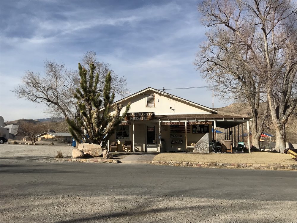
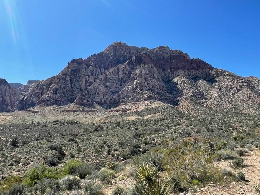
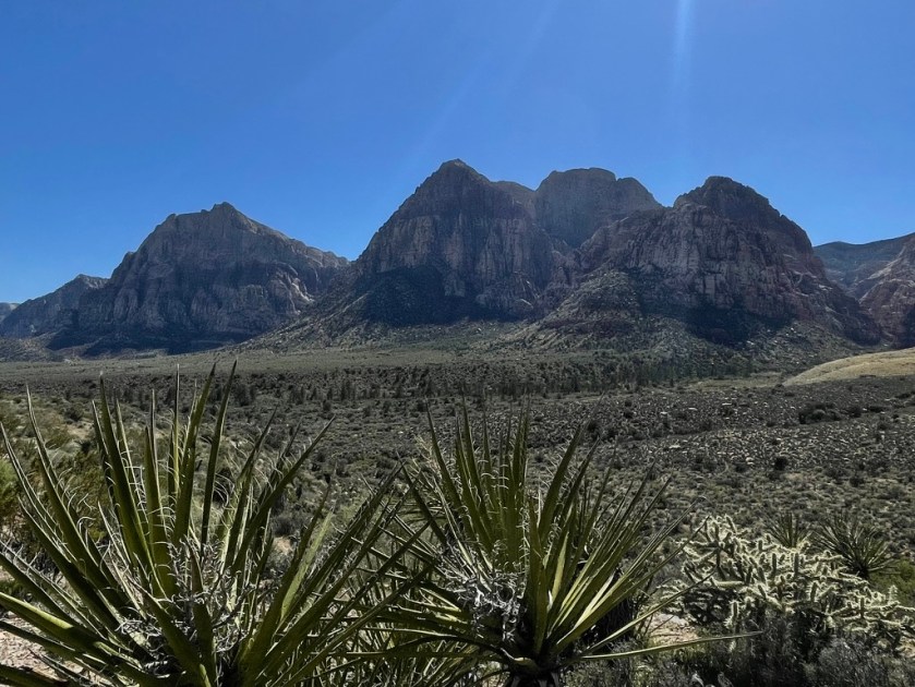
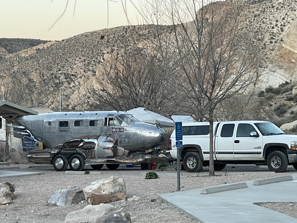
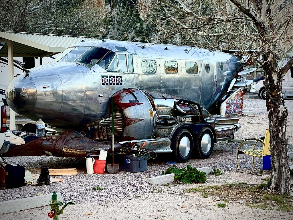
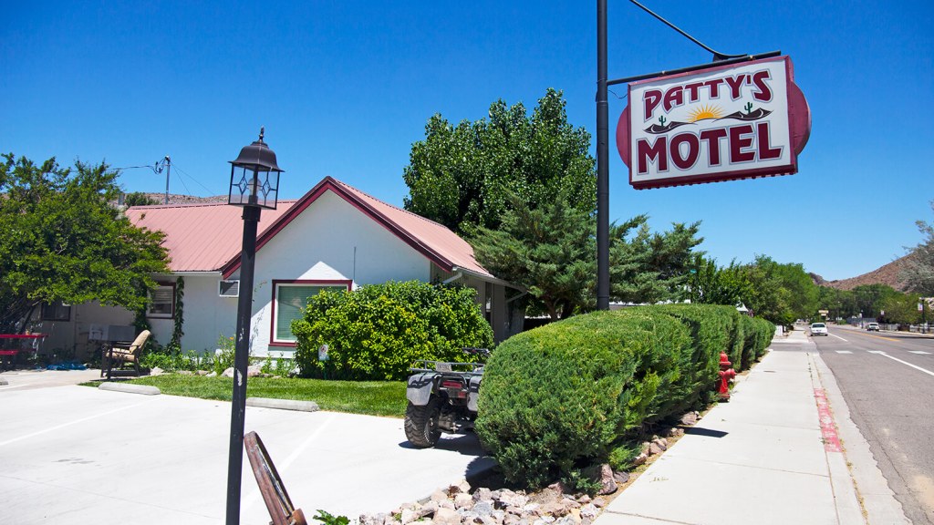
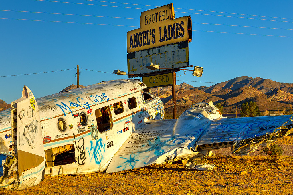
Mecca Box Canyon

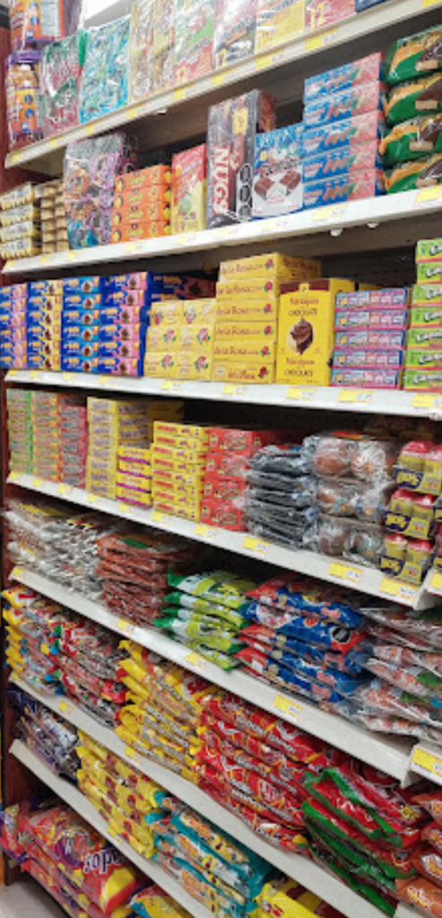
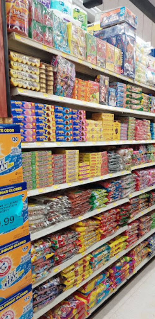
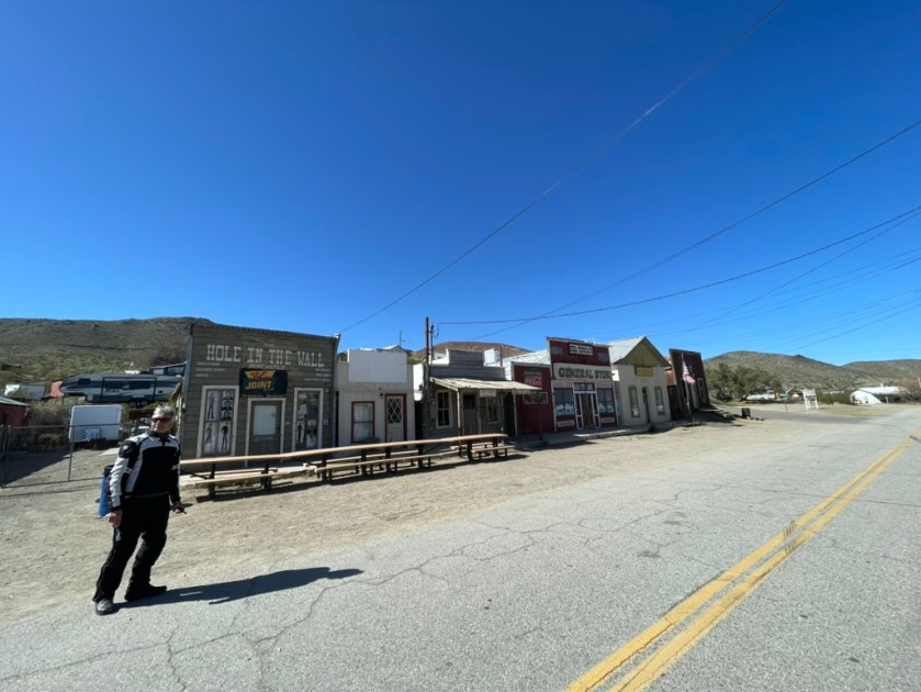
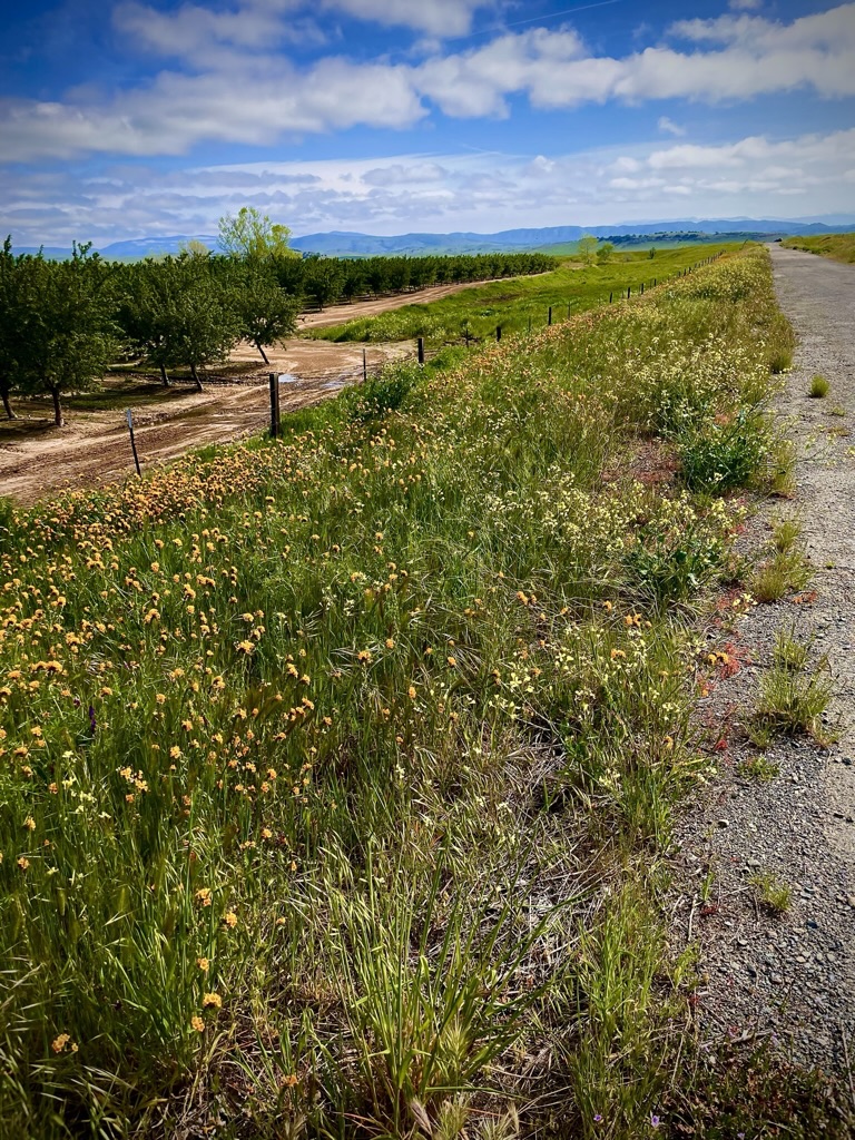
Worth a return visit in Terra Bella.
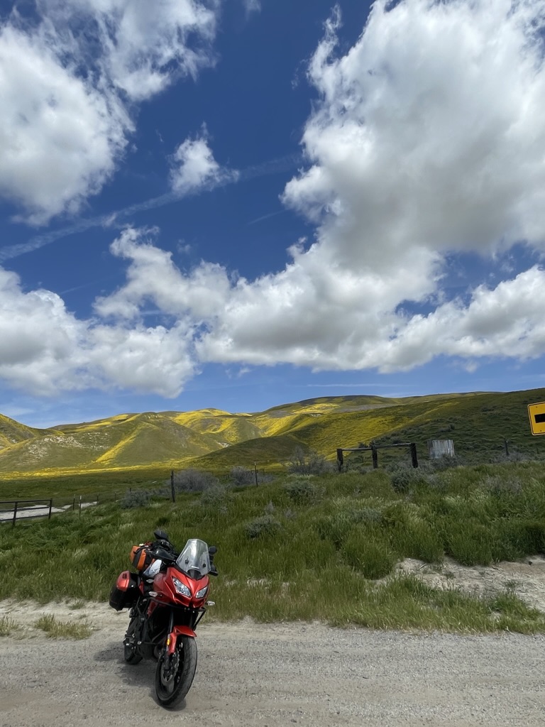
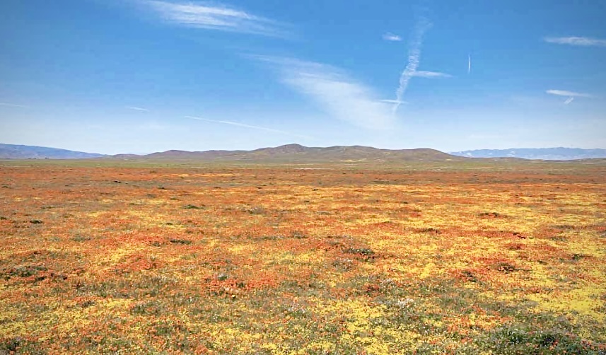
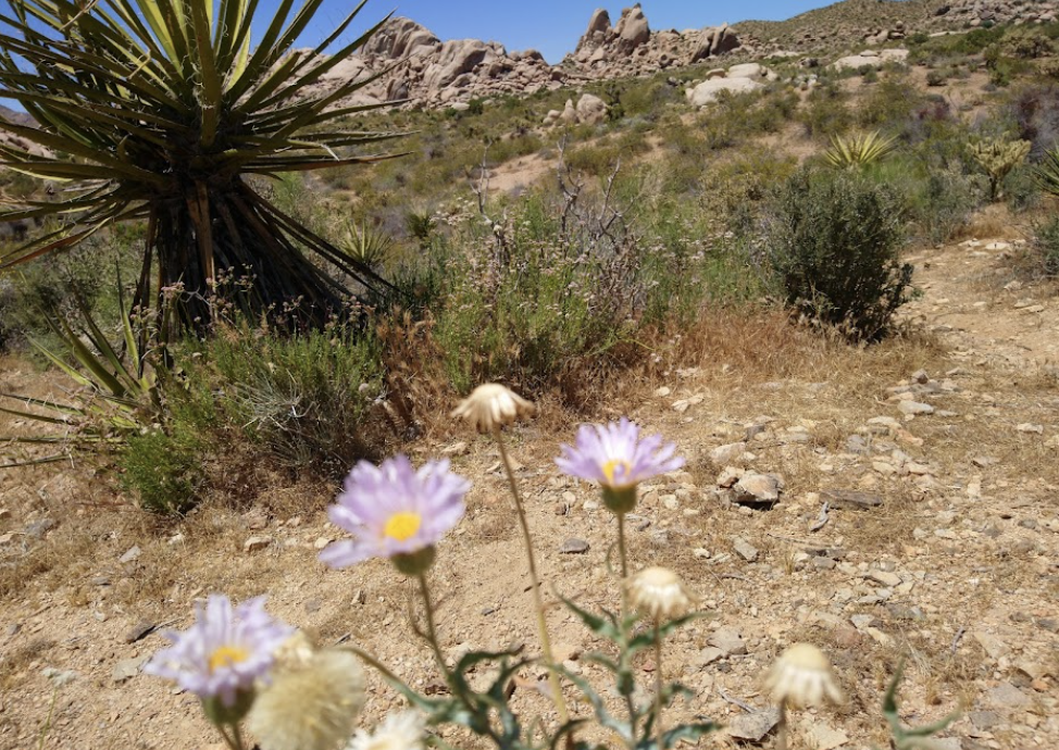
That’s when the prospect of another ‘super bloom’ began to suggest a destination. Previously Sisyphus and Associates have attended nature’s splendor on the 2016 Sand to Snow Super Bloom Tour in the TRD, or the 2019 Super Bloom on Two Wheels. Word was getting out that while this season’s bloom might not quite be up to the 2016 version, it would likely rival the 2019 bloom. Ah yes, a super bloom.
You might just be wondering what constitutes a super bloom? There is no official definition (or spelling) of a ‘superbloom,’ the term is usually used when entire hillsides are covered with blooms dense enough to give them a swath of color, exciting Instagram influencers to trample them while frolicing among the delicate blossoms. At least that’s what I learned in my first retirement coursework as a certified California Naturalist.
Now let’s go find one as later-day influencers…
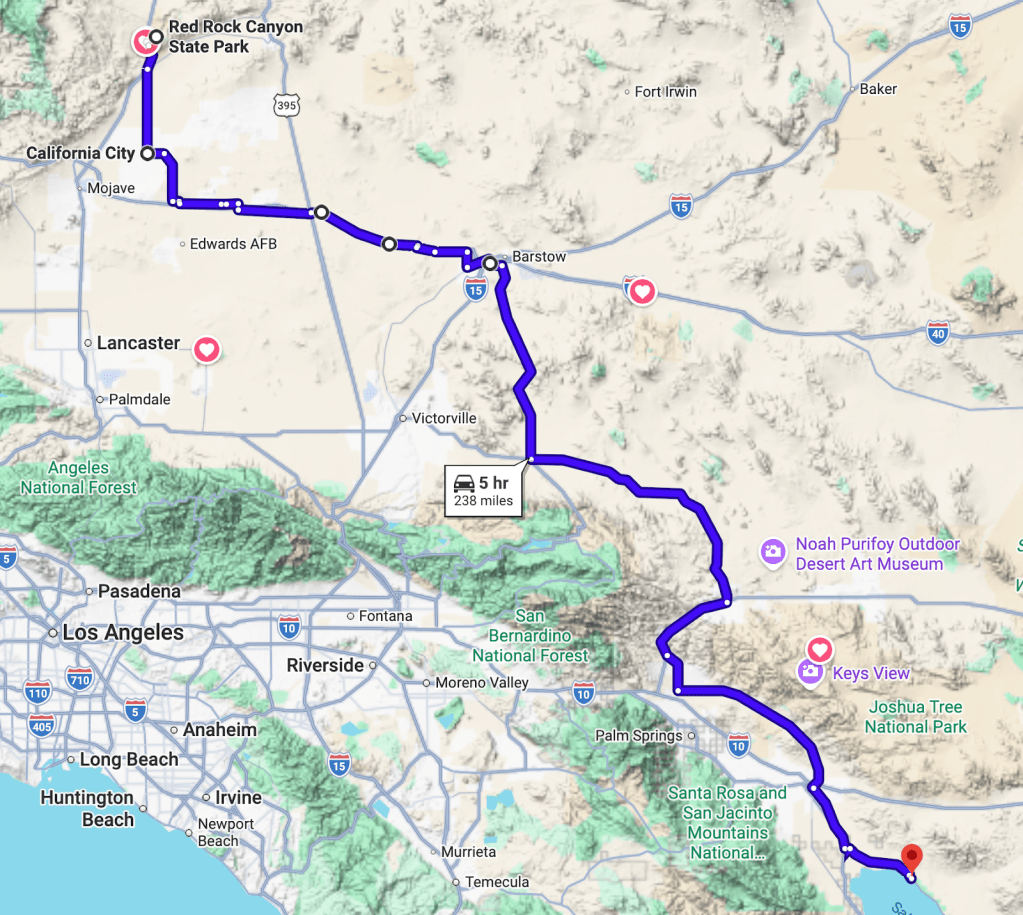
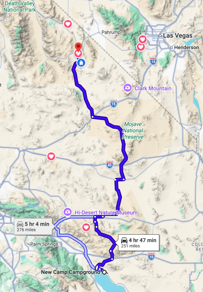
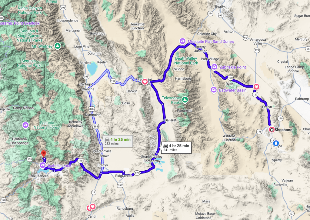
Day 1 – Merced to Red Rock Canyon State Park Itinerary
Merced to Red Rock Canyon State Park, Ricardo, CA: 296 miles (332 miles if Ridgecrest stop for supplies is included)
Via CA-33 to CA-46 to CA-65 to CA-178 to CA-14 and RedRock Canyon: 296 miles
Tehachapi via Wasco Alternative: 297 miles
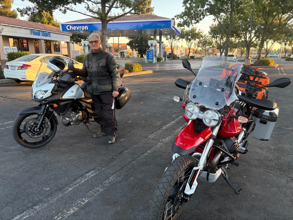
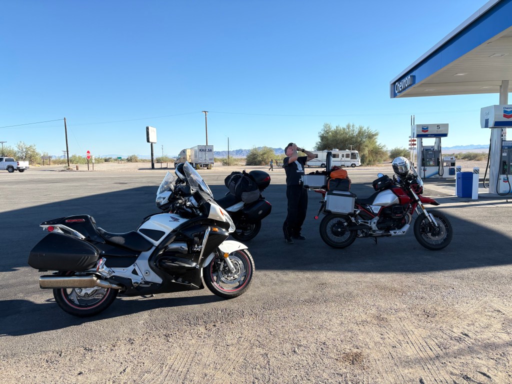
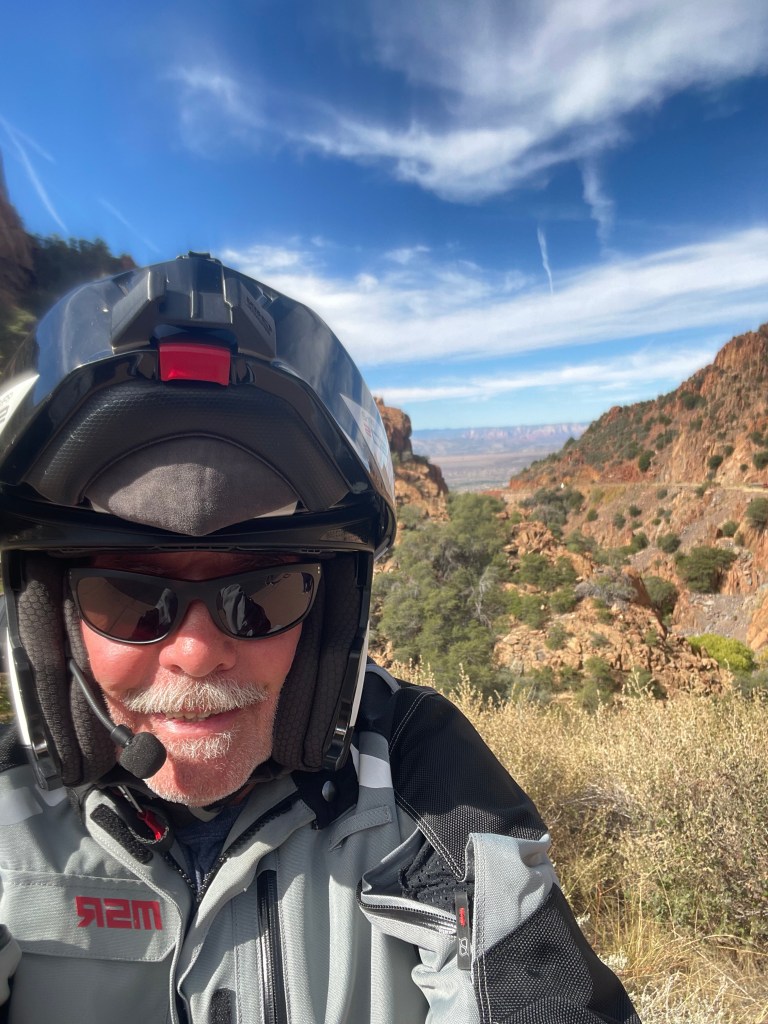
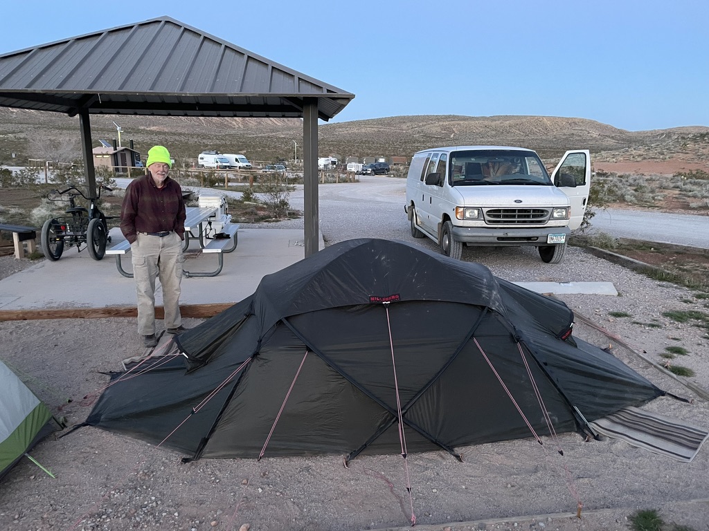
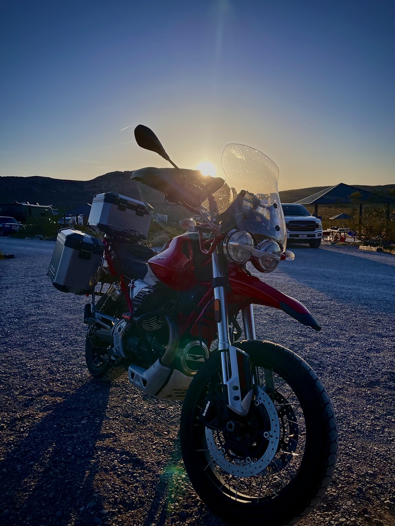
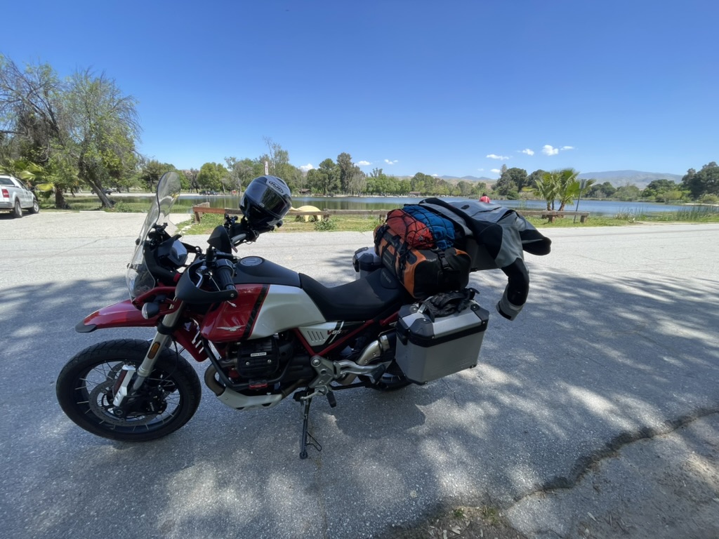
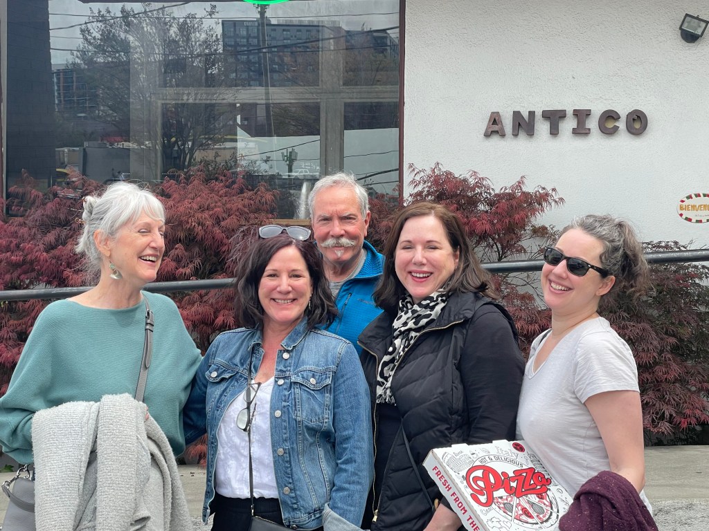
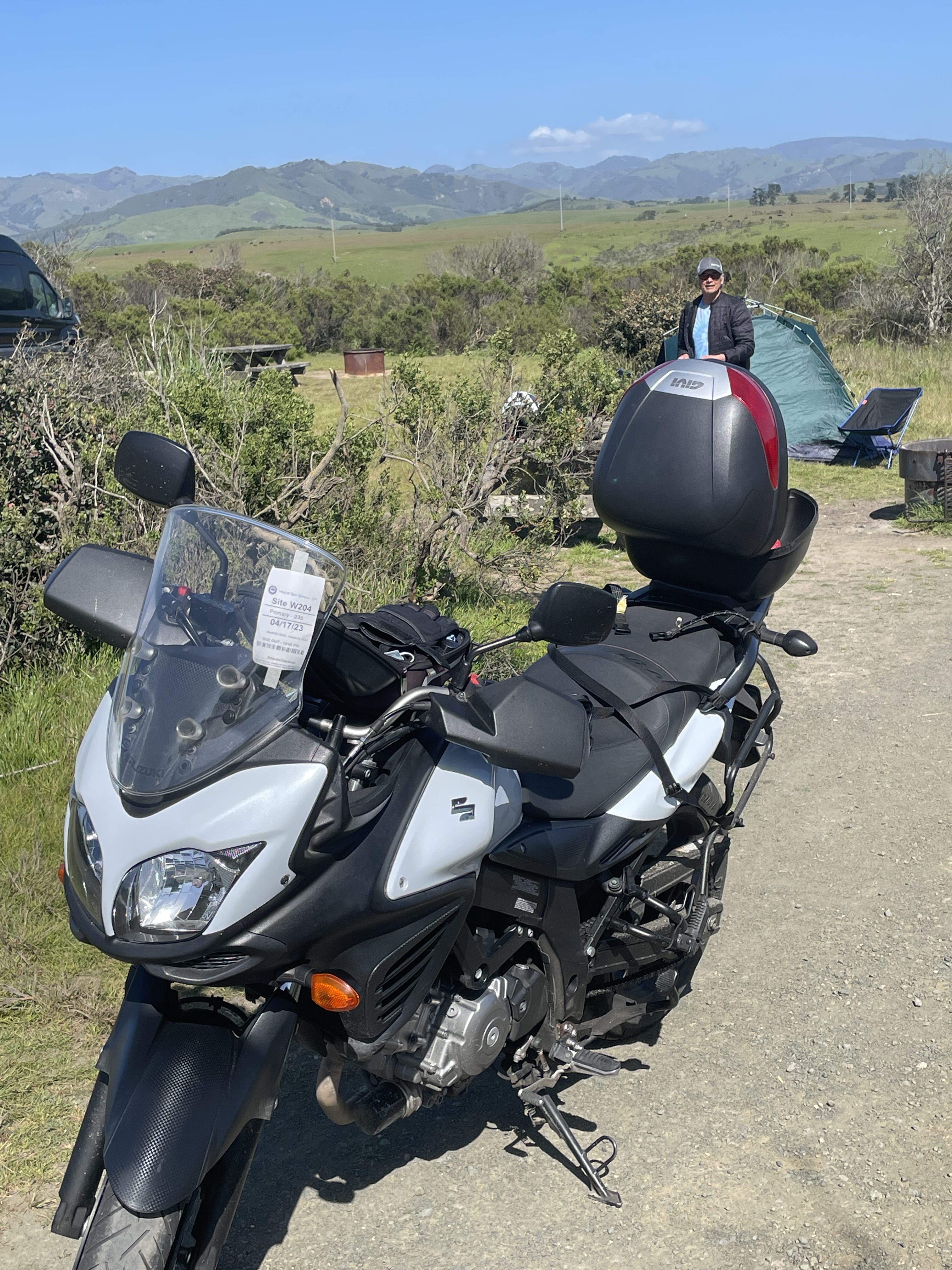
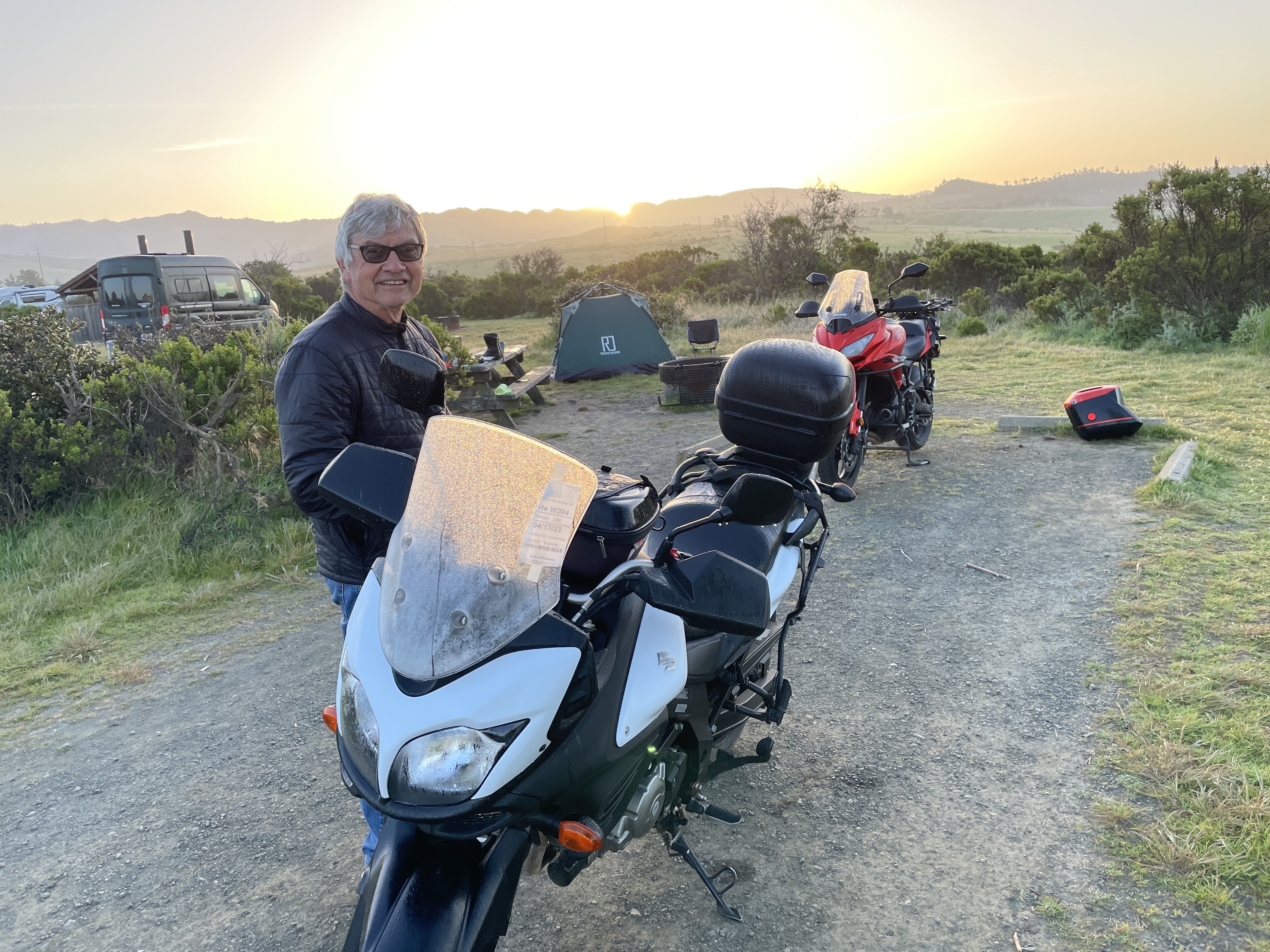
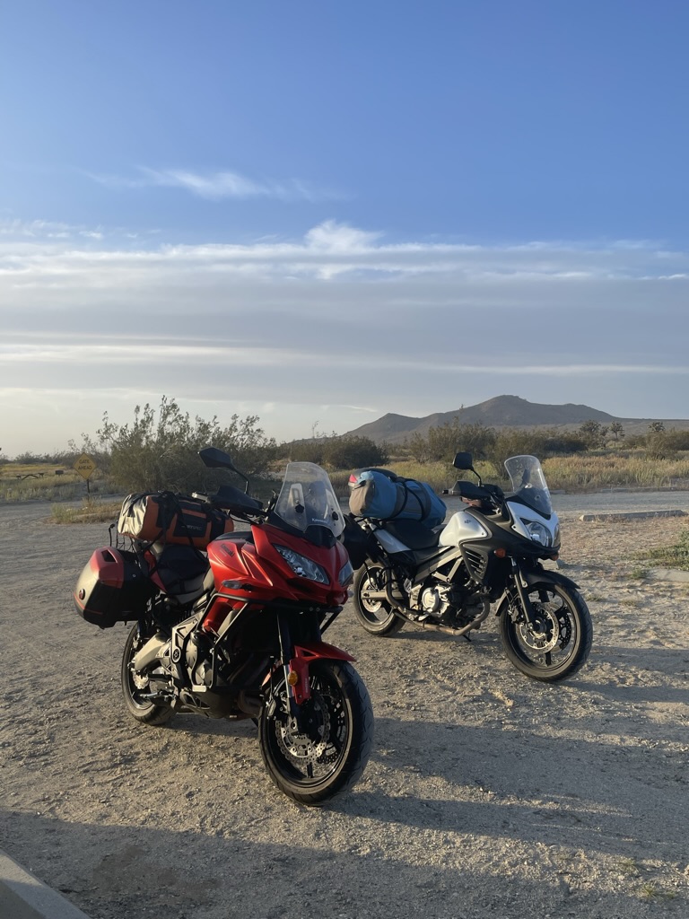
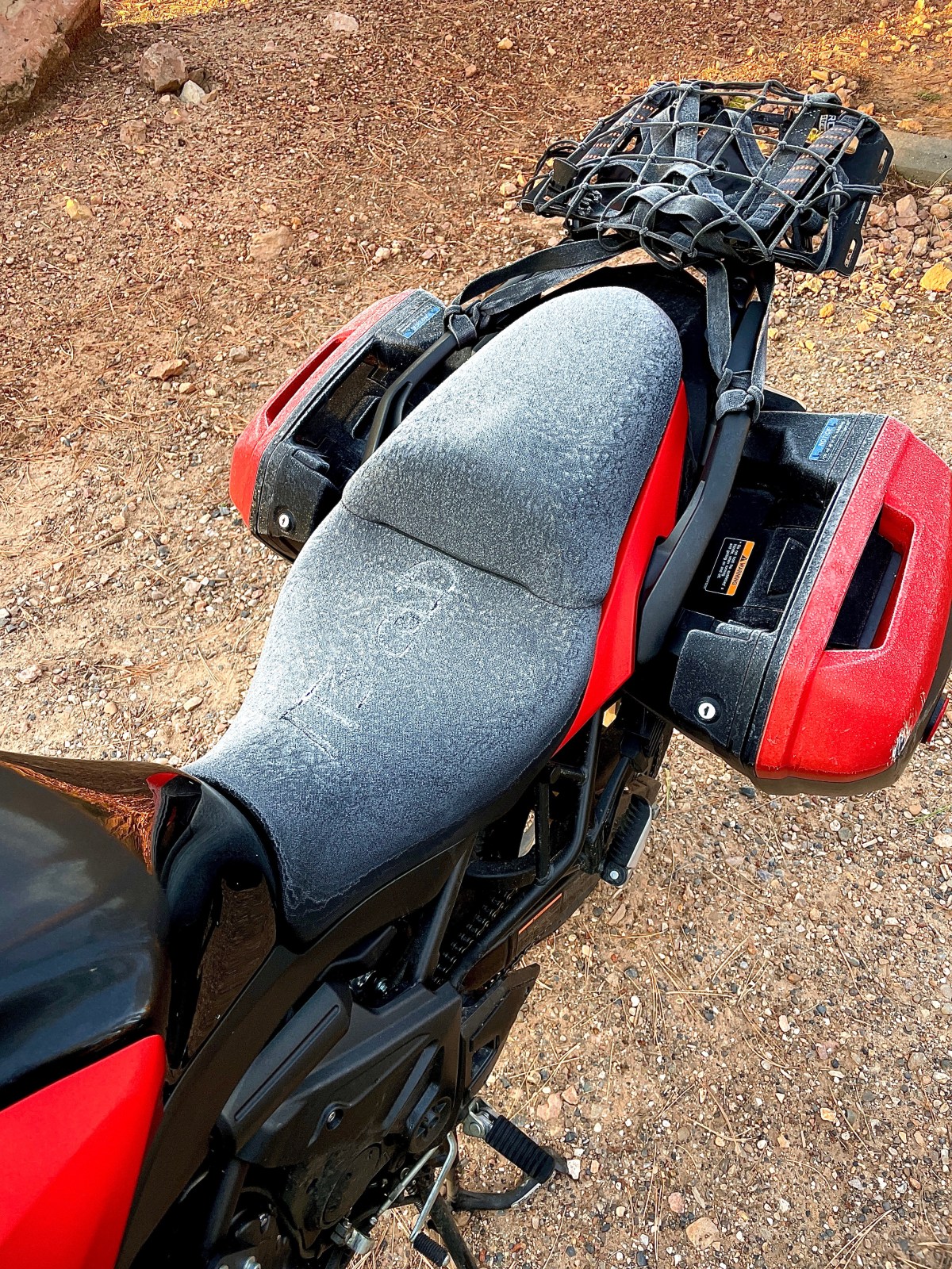
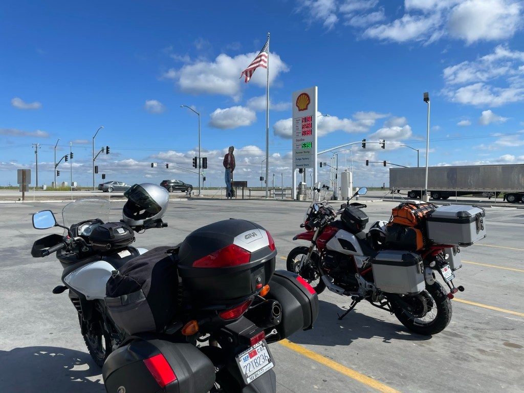
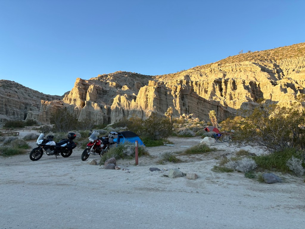
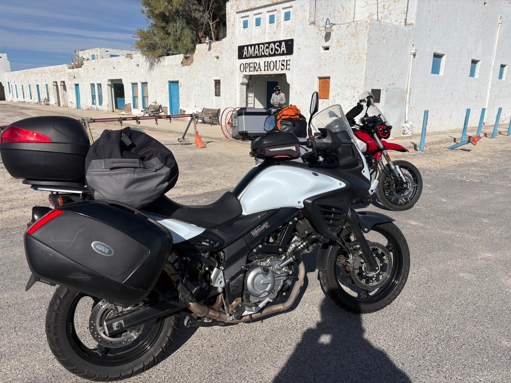
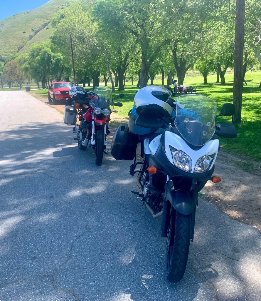
Bright and early on March 2nd we convened at our usual ramble departure venue, the Chevron Station at Yosemite Ave and G St. I was on IlBellaRosa, my 2022 Moto Guzzi V85TT and SMAP was on his unnamed 2014 Suzuki V-Strom. That’s a clear insight into our personalities. Sisyphus is self-consciously flashy, giving his moto an Italian sobriquet, and SMAP is decidedly not on his anonymous Japanese whip.
Flashy or decidedly not
For those not in the know, a Moto Guzzi is an oddball’s choice. First of all, it’s European. Guzzi’s fall somewhere between sexier Italian motorcycles like the glitterati Ducati’s or Aprilia’s and the beau monde BMW’s. It’s kind of a well read, blue-collar moto for those of us who have an affinity for modestly priced pinot noirs (flashy?). SMAP’s more of a bangers and mash fellow (actually carne asada and frijolles), decidedly not flashy.
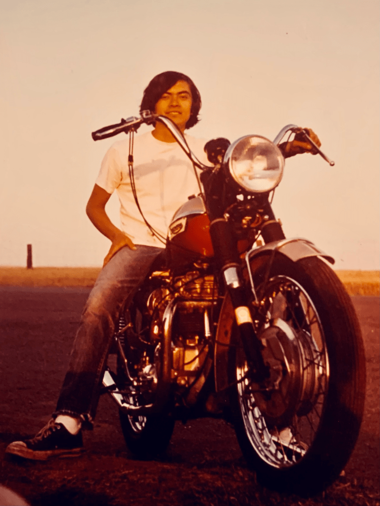
My moto is red and white, both of his are black and white. His stable includes a 2019 Triumph T120 alongside the VStrom and a 1975 Kawasaki Z900 variously in parts in his garage, a commemoratory from his youth, all motorcycles for Modelo (and Guiness) drinkers. Note, there is no comparing any of them to a Harley. None. Full stop.

In Search of the Super Bloom
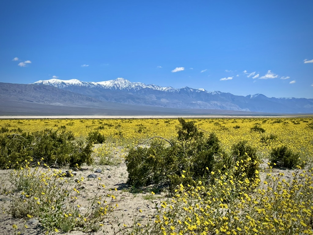
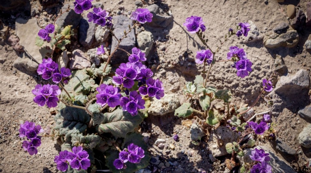
As the title implies, part of our quest was to see this alleged, ‘super bloom’ that was shaping up across California. Having made our way to the Carrizo Plain and Antelope Valley, two of California’s most prolific wildflower shows on past rambles, it was time to explore the Anza-Borrego desert bloom while tacking on a loop through Death Valley to witness the alluvial fans around Furnace Creek covered by the ephemeral burst of Desert Gold (yellow blooms) and Phacelia (purple blooms). I had to hit up my 2016 post, fresh out of the Naturalist training, to remember the names of flowers by which the San Francisco Chronicle was seducing its readers in publishing photos of the current super bloom…
And so an itinerary began to take shape.
Which Pass?
Crossing the mountains to get to the Mojave leaves us with but two options in the winter: Walker Pass on CA-178 or Tehachapi Pass on CA-58. Walker Pass above Lake Isabella is our go-to winter/spring southern Sierra crossing, and a third, little-known Sherman Pass, is only available in the summer. Tehachapi tends to be crowded with 18-wheeled commerce that makes for more of a “slab” ride than the “scenic route” experience of Walker or Sherman Passes .
Since our first night’s destination was Red Rocks Canyon State Park, pretty much 25 miles (~50 round trip from the campground) from any Mexican restaurants or fuel, this after nearly 300 miles to get there in the first place, I selected the following route: Tehachapi via Wasco Alternative: 297 miles
Thus avoiding I-5 or CA-99, the idea was to minimize the CA-58 slab while making our way through Mojave where we could procure supplies for the night at the isolated campsite after a long day’s ride rather than detouring to California City or Ridgecrest for essential 3-R’s (Relax, Rehydrate, and Reflect) beverages and victuals.
And so, on a sunny crisp Monday morning, we made it to Blackwell’s Corner by way of CA-59 and 33 through thousands of acres of alfalfa, pistachios and almonds all supported by the artery known as the California Aqueduct and a diminishing aquifer. That is where the metaphorical sculpture (mentioned earlier) assumed a slightly different form.
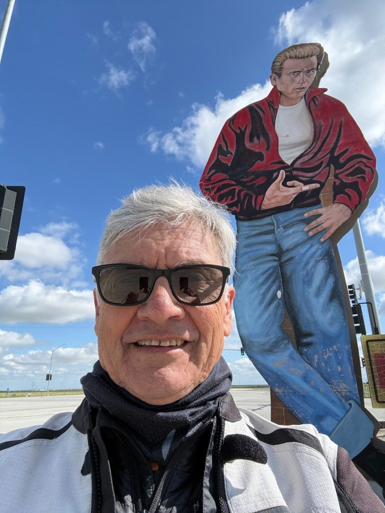
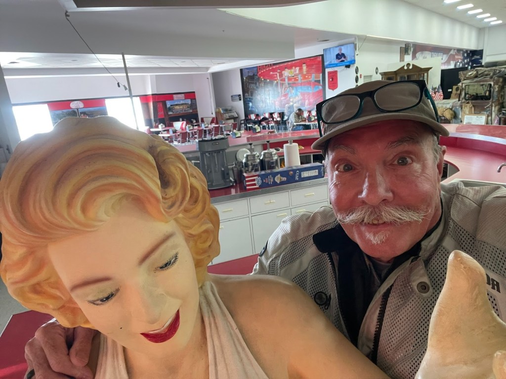
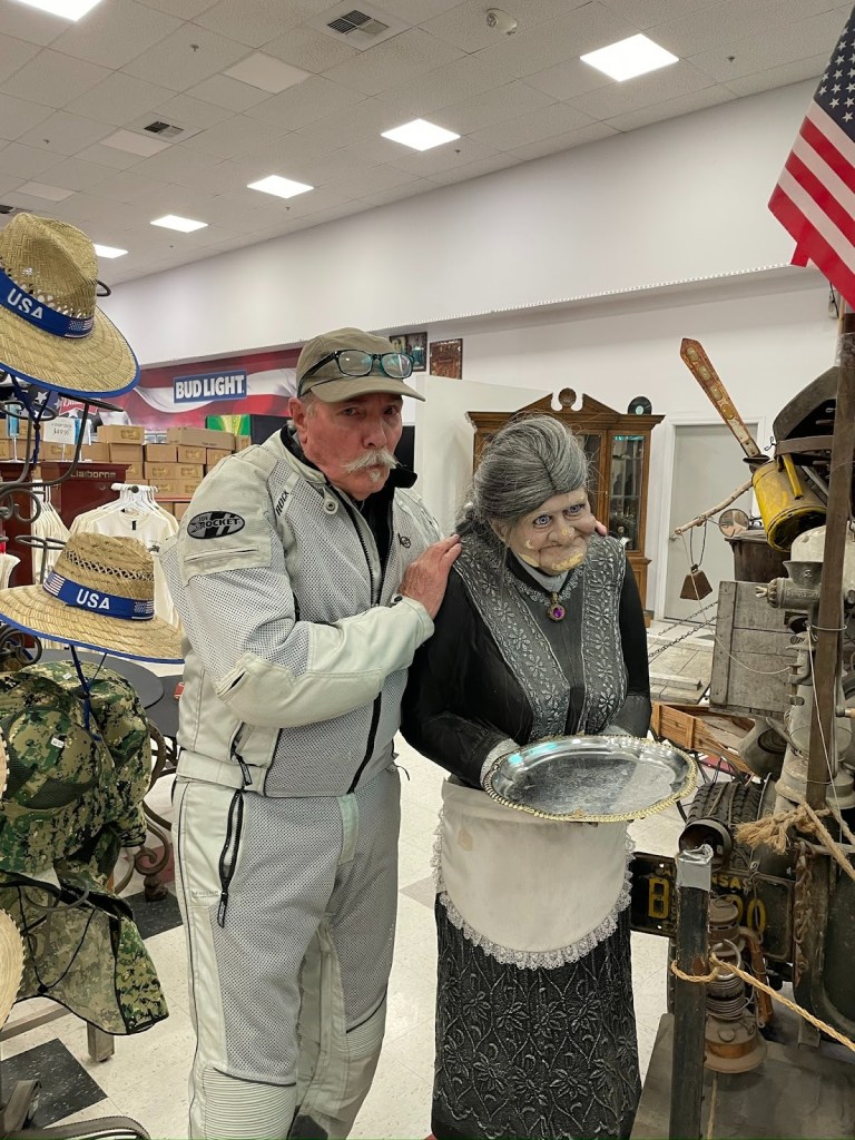
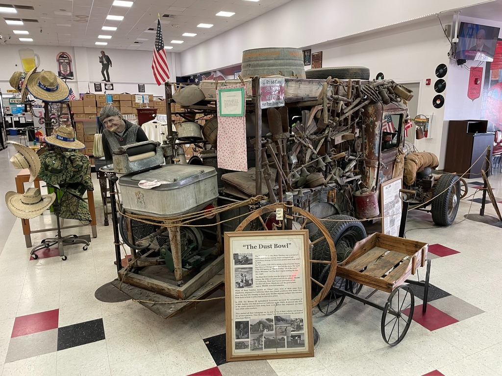
Nalgas relief and some James Dean, Marylin, and a tribute, of sorts, to the Dust Bowl at a gas stop in the Lost Hills. I’m not sure why Marylin is featured except it goes with the whole 50’s vibe of the Dean reference. No shame.
A little bit about Blackwells Corner and my family
Besides being the only fuel for 50ish miles, Blackwells Corner is at the intersection of CA-46 and CA-33 and was the last place James Dean was seen alive prior to his death in a car wreck. Hence the 16 ft likeness next to the Shell sign.
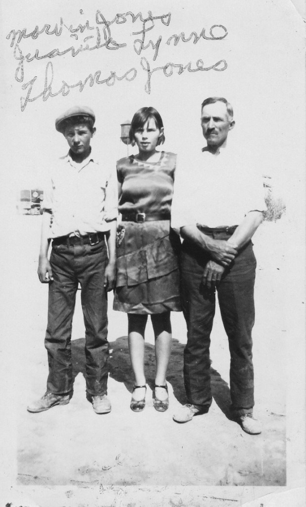
Marketing knows no shame. It was also where many displaced Americans, my grandfather father, his sister, and uncle among them, ended their migration west, the result of the Great Depression and disastrous agricultural practices in the south and southwest.
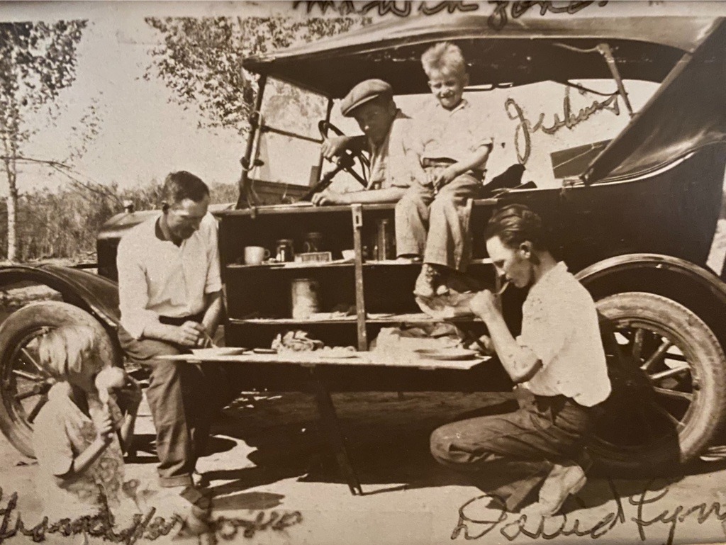
and Uncle Dave squatting on the Right.
So much for “meticulous planning’
From there, it was CA-43 to Wasco… We rerouted from the “meticulously planned” route. Navigation is always subject to change as Google does its best to alter a saved route in favor of a real-time faster route. Faster routes usually involve the dreaded slab in the map App’s “Drive” mode despite setting the “Avoid highways” feature.
Instead we headed east through Famoso, home of the March Meet that was taking place at the famous, Famoso Raceway. Past the dragstrip we joined CA-65 south to Oildale. The hillsides were in lush spring green. Seeing the pump jacks of the Kern River Oilfield was only modestly incongruous to the otherwise verdant rolling hills. Besides, we were a little tired of the pistachio and almond scenery. We get enough of the orchard scene on our local bicycle rides.
Zagging and zigging through Oildale we joined CA-58, yes, the slab, abandoning the “meticulously planned” route south of Bakersfield by weaving in and out and around CA-58 on frontages crossing Tehachapi Pass thus missing the Tehachapi Rail Loop vista and several small hill communities dotting those frontages! Likey places my family members would have stopped humping the Model T over the pass. Oh well, by this time the nalgas were crying for relief, the belly a bit peckish, and a more direct route made for an easy compromise.
A bite to eat at the local Mojave Korean fast food establishment, no sideboards on a motorcycle…
… and a quick stop at the market for 3-R beverages and ‘dinner’ snacks for our campsite, likely unavailable in 1930.
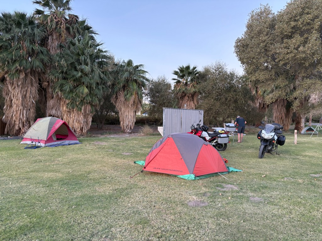
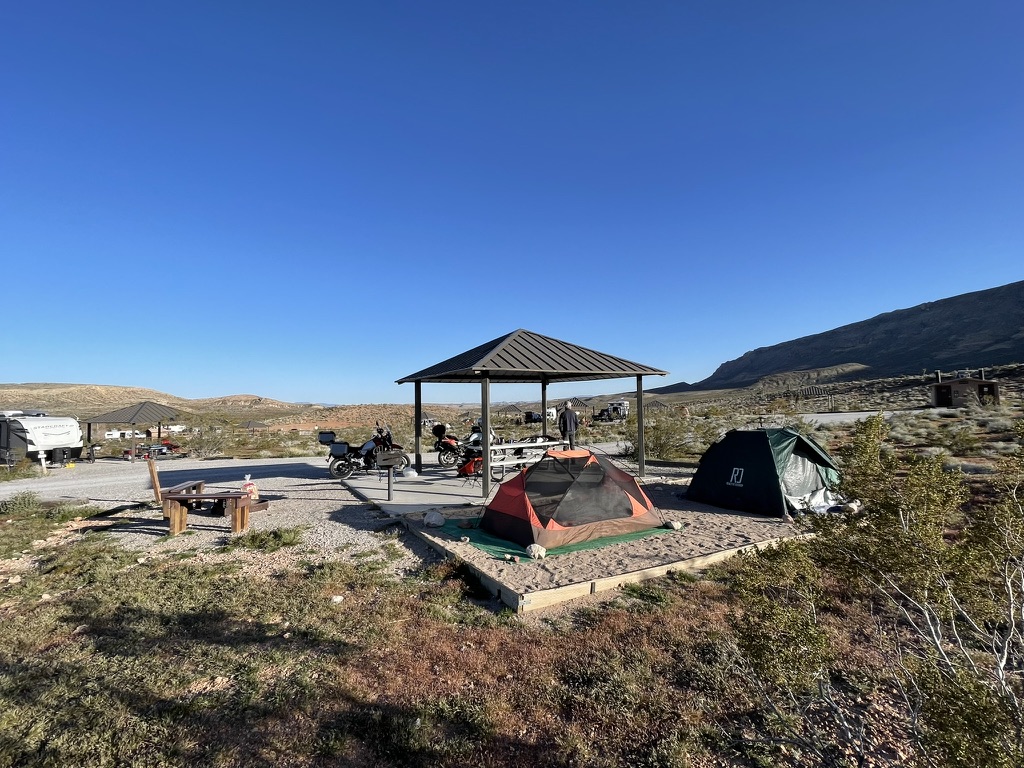
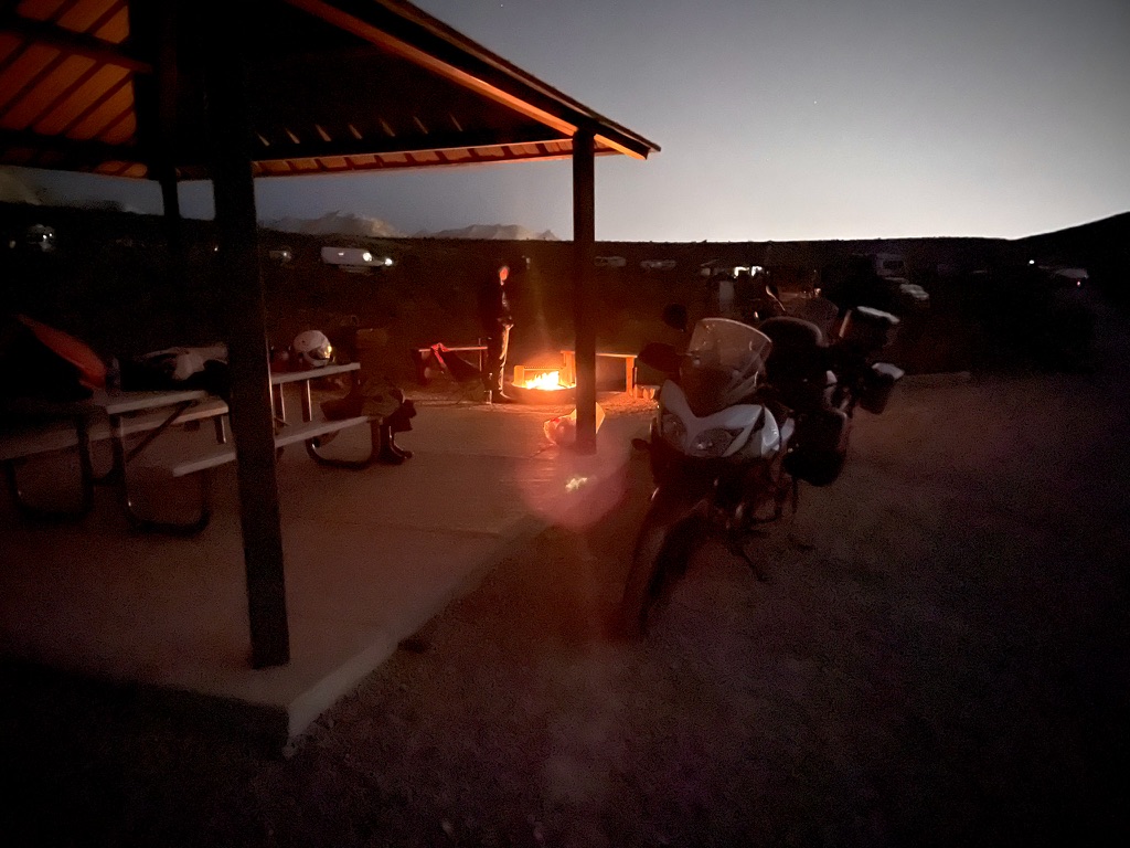
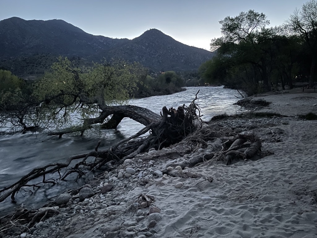
Ricardo Campground
We then hopped on to a windy CA-14 to our home-home-on-the-road in Ricardo at the Red Rocks Canyon State Park Campground. Red Rock Canyon State Park with Huell Howser explains the Ricardo reference on the map.
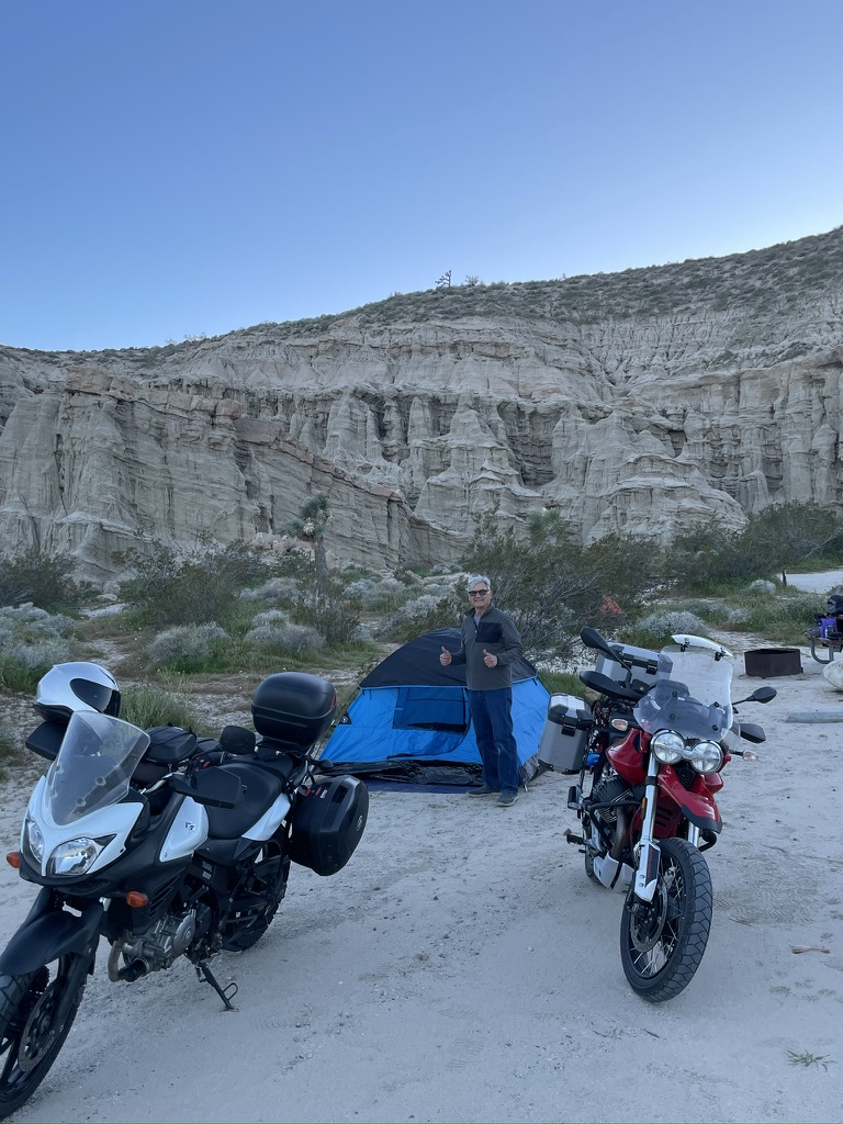
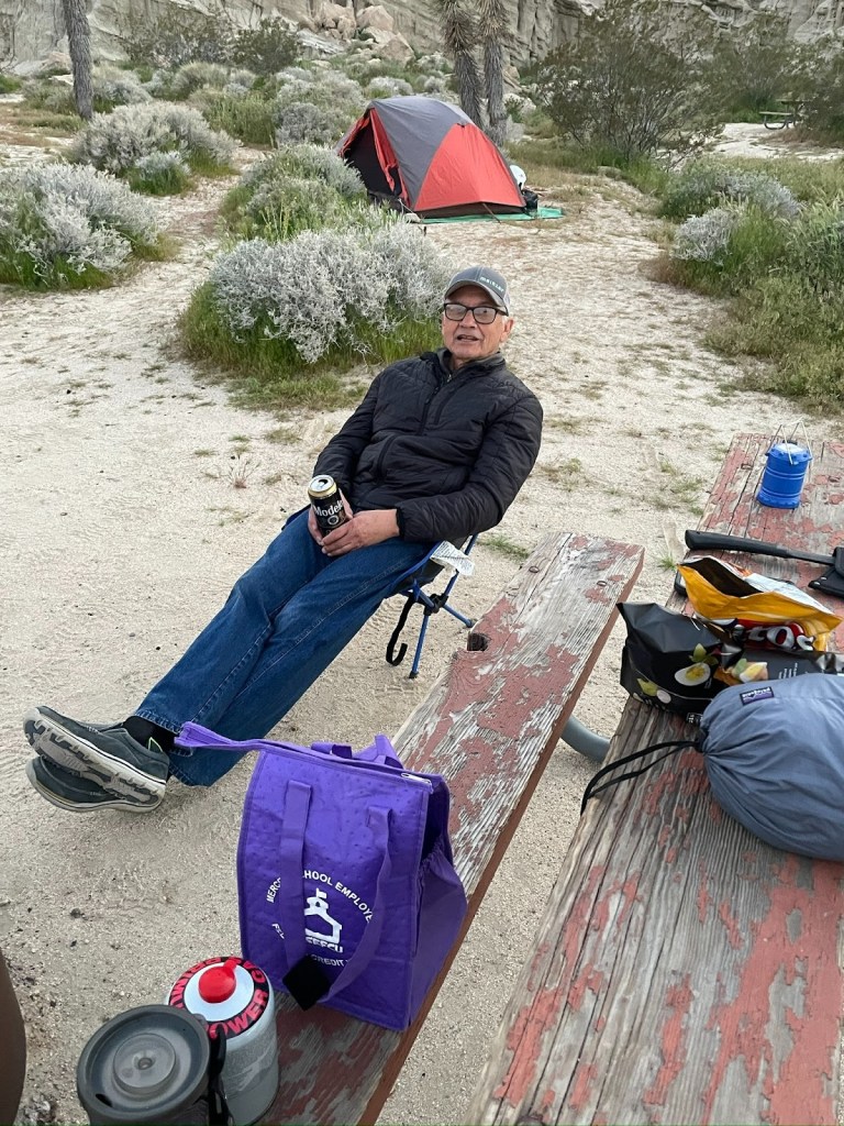
Better than caviar and champagne as we commence with the 3R’s
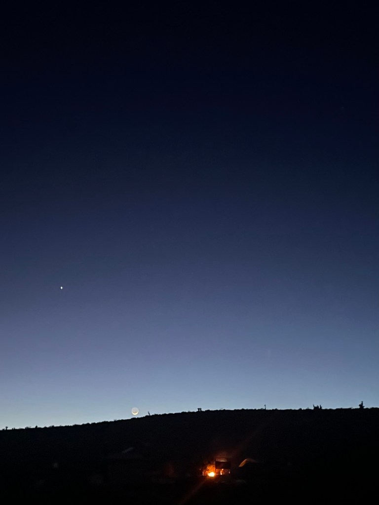
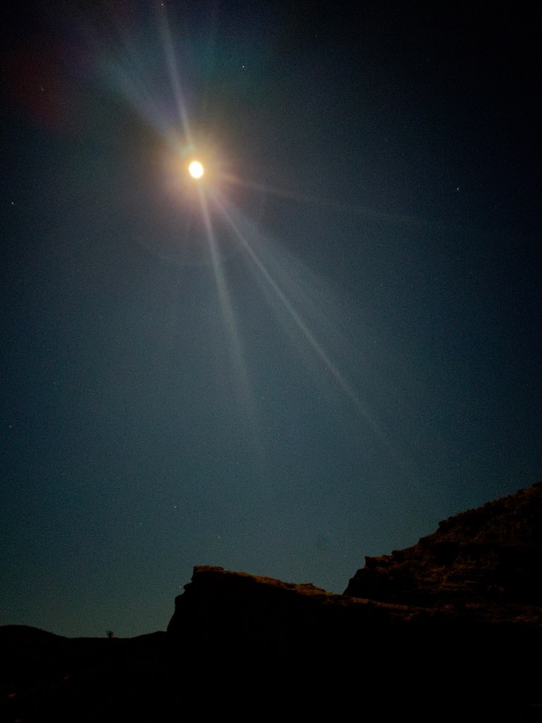
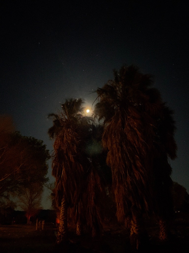
March Blood Moon
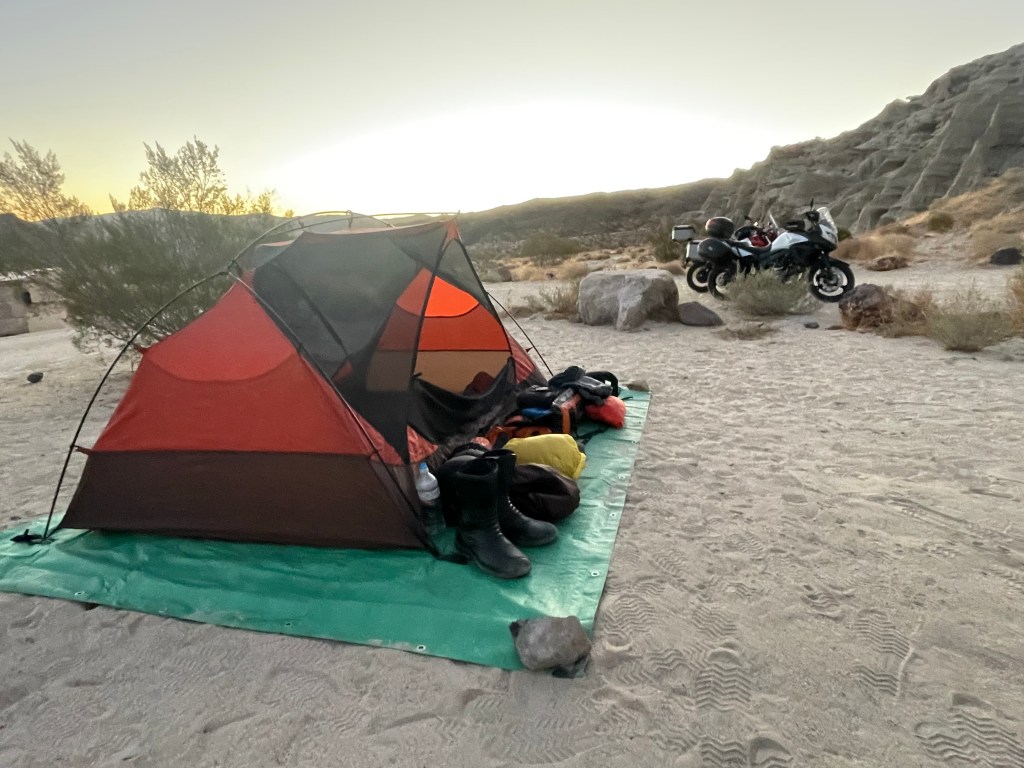
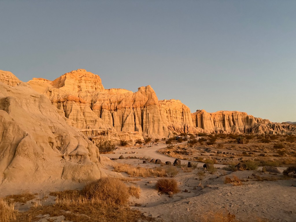
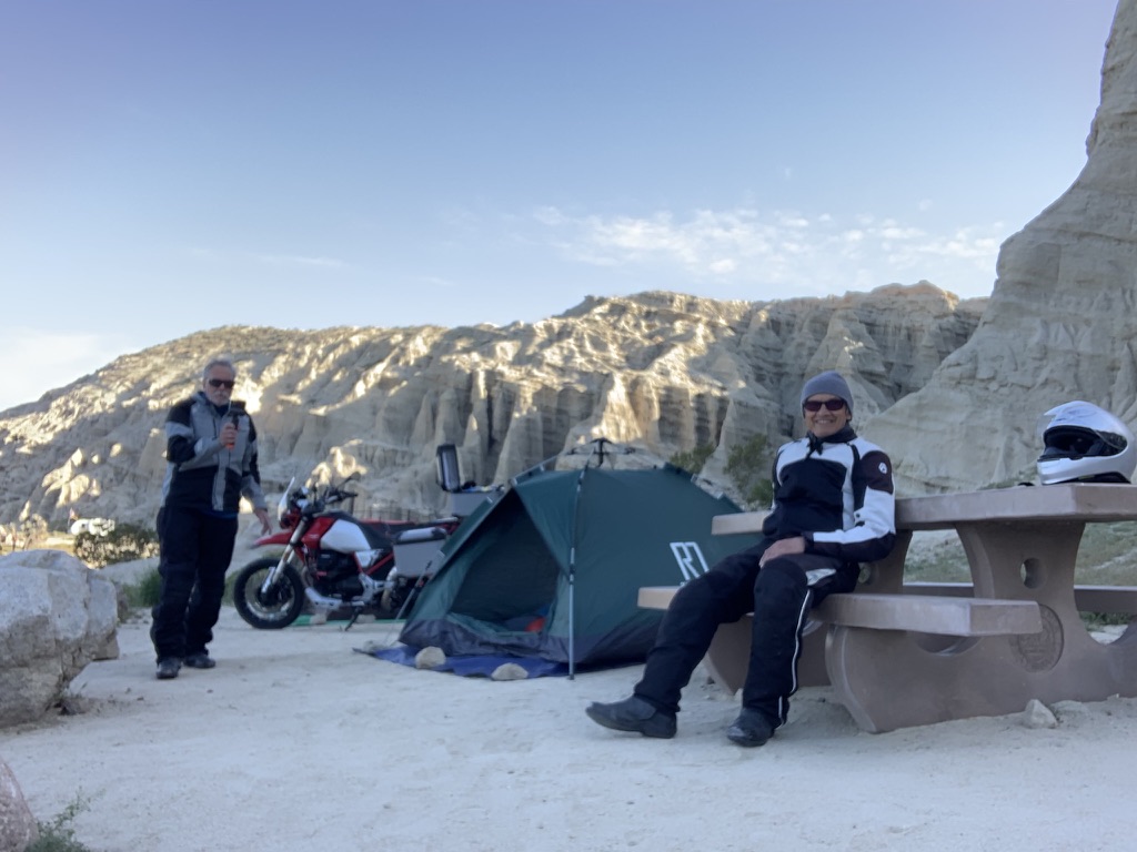
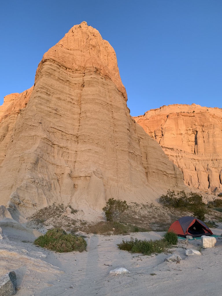
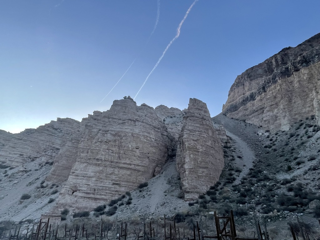
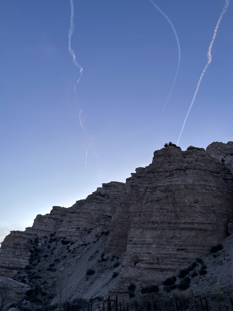
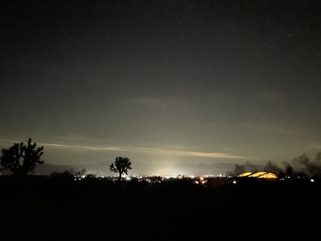
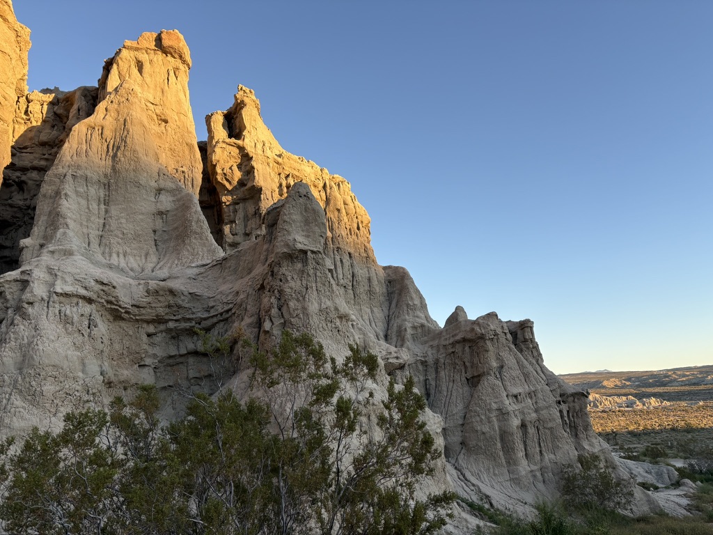
We were fortunate to have a full moon that would eclipse, making for a blood moon later in the night. After relaxing and rehydrating, we reflected on a fellow camper’s hike to a surrounding hilltop vantage earlier. We hiked up above our campsite where cell reception and quick check-in with the home fires was complemented by stunning views south to California city and the campground below, all illuminated by moonglow!
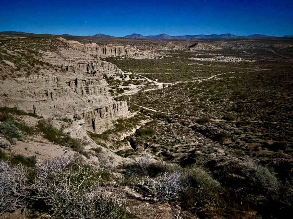

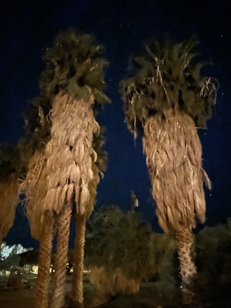
The full moon, view from atop the ridge, hoodoos, creosote, and my tent.
I usually make an effort to capture astronomical events on a ramble. We have pursued meteor showers, chronicled constellations, watched satellite launchings and tracked the International Space Station arcing in the night sky. We hope someday to see UAP’s (formerly known as UFOs), all the rage these days in the dark state conspiracy cadres.
We’ve tracked the Wolf and Snow Moons of winter, the Worm and Pink Moons of spring, the Buck and Sturgeon Moons of summer, and the Hunter’s and Beaver Moons of fall. Normally I need to climb out of the tent to see a man about a mule in the middle of the night when and where my eyes open unto the inspirational heavens (as that other thing happens). Not so this night. I slept through the night and had to accept the ole muleskinner SMAP’s, “Ya shoulda seen the blood moon!”
With the blood moon a bust, I was left holding out for a super bloom.

when the man and mule finally summoned me just before sunrise
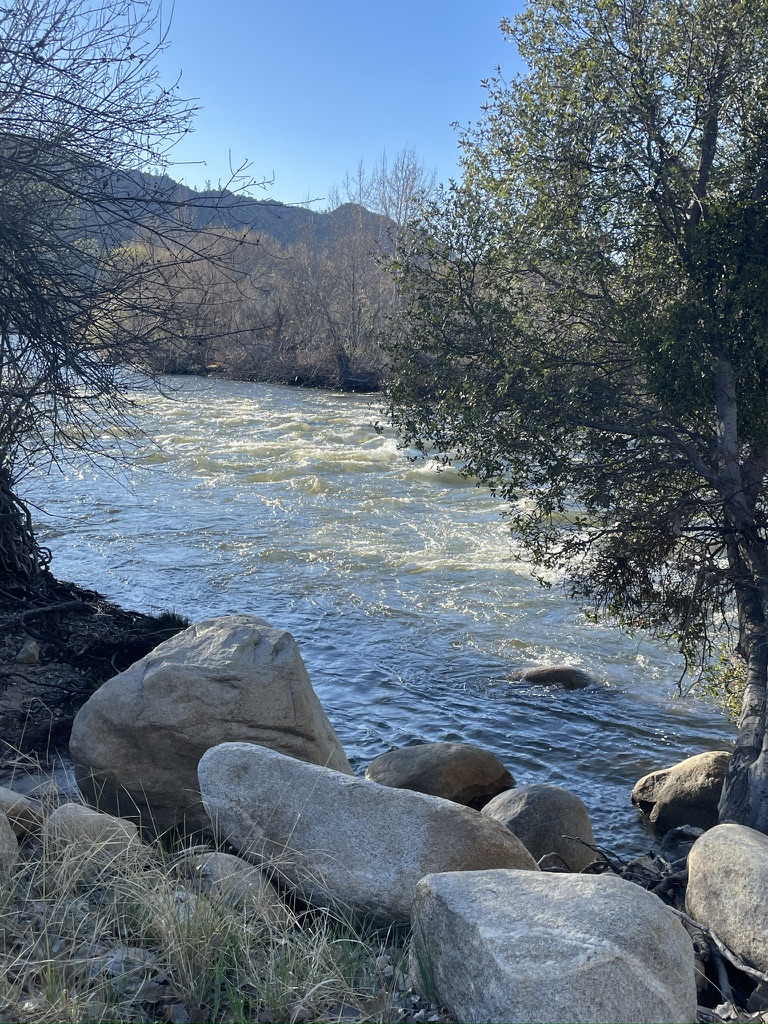
Day 2 – Red Rock Canyon State Park to Salton Sea State Recreation Area (Anza-Borrego)
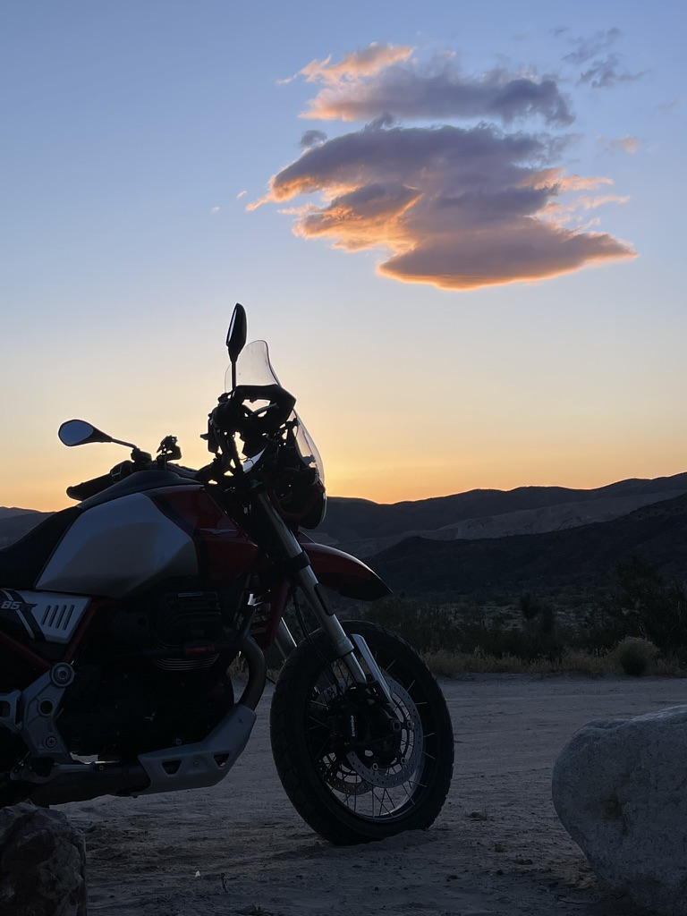
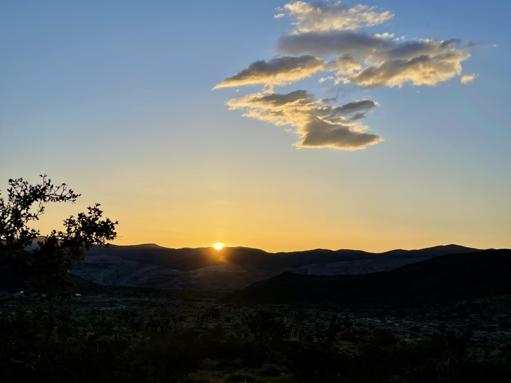
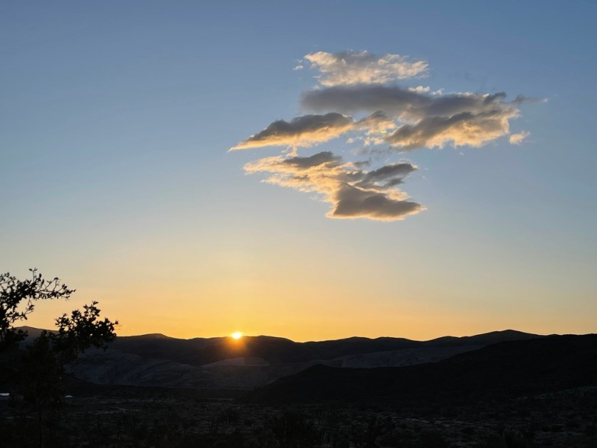
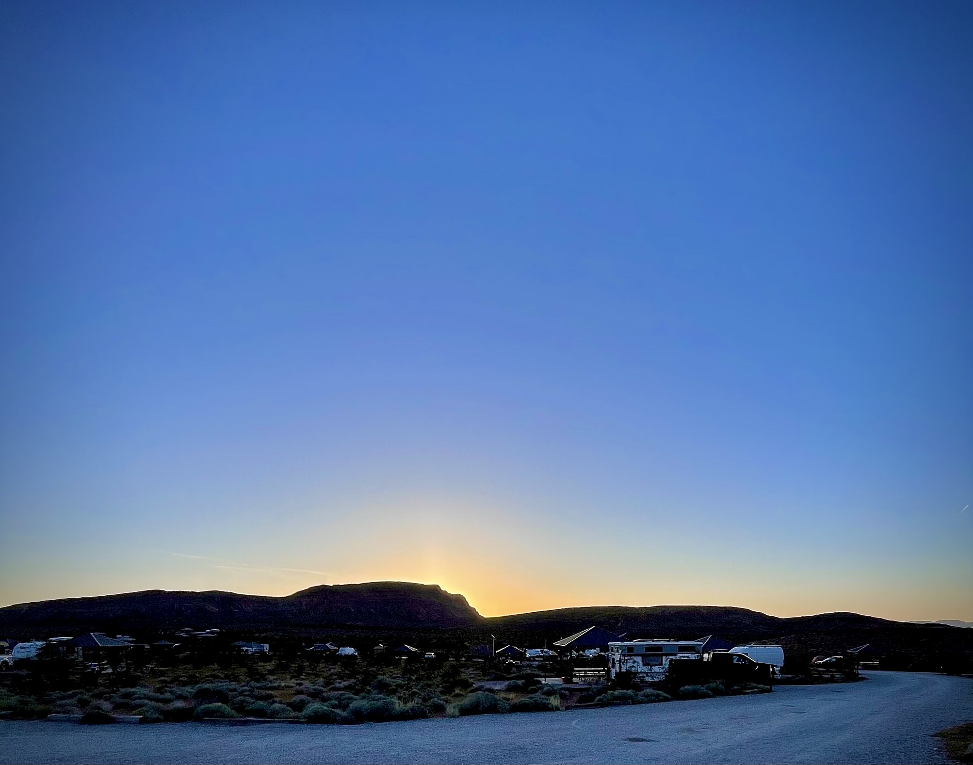
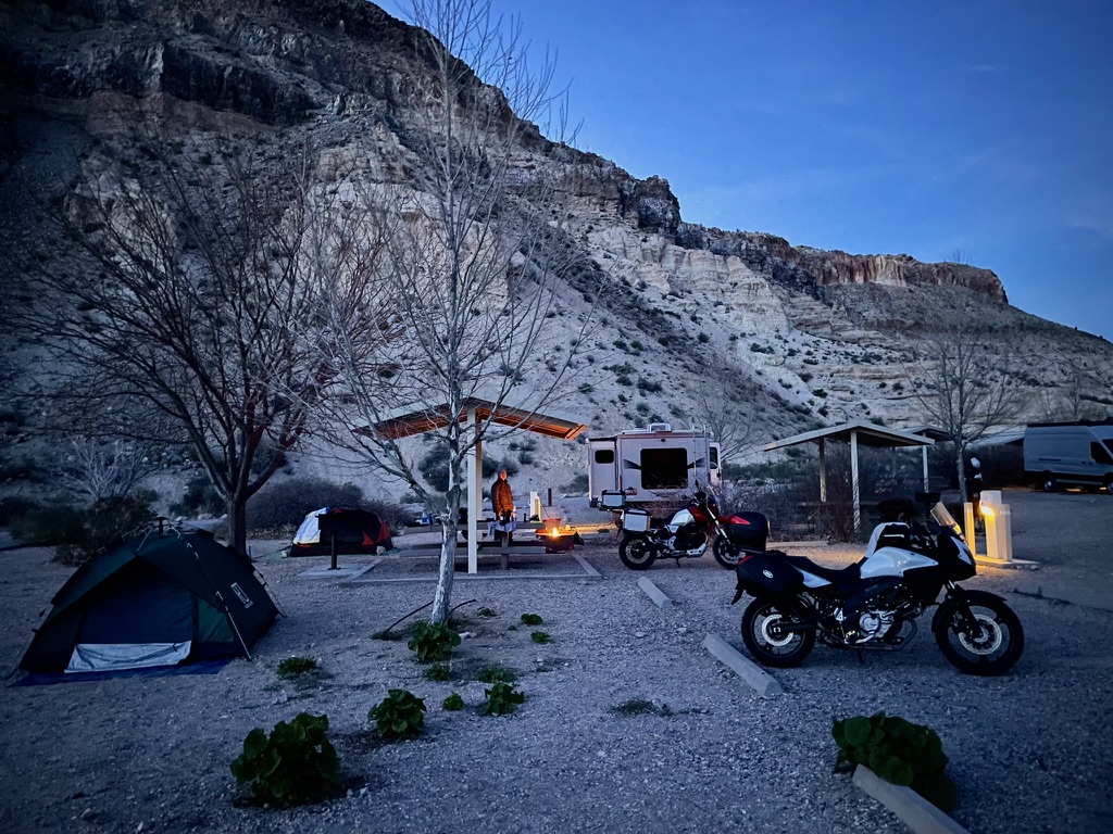
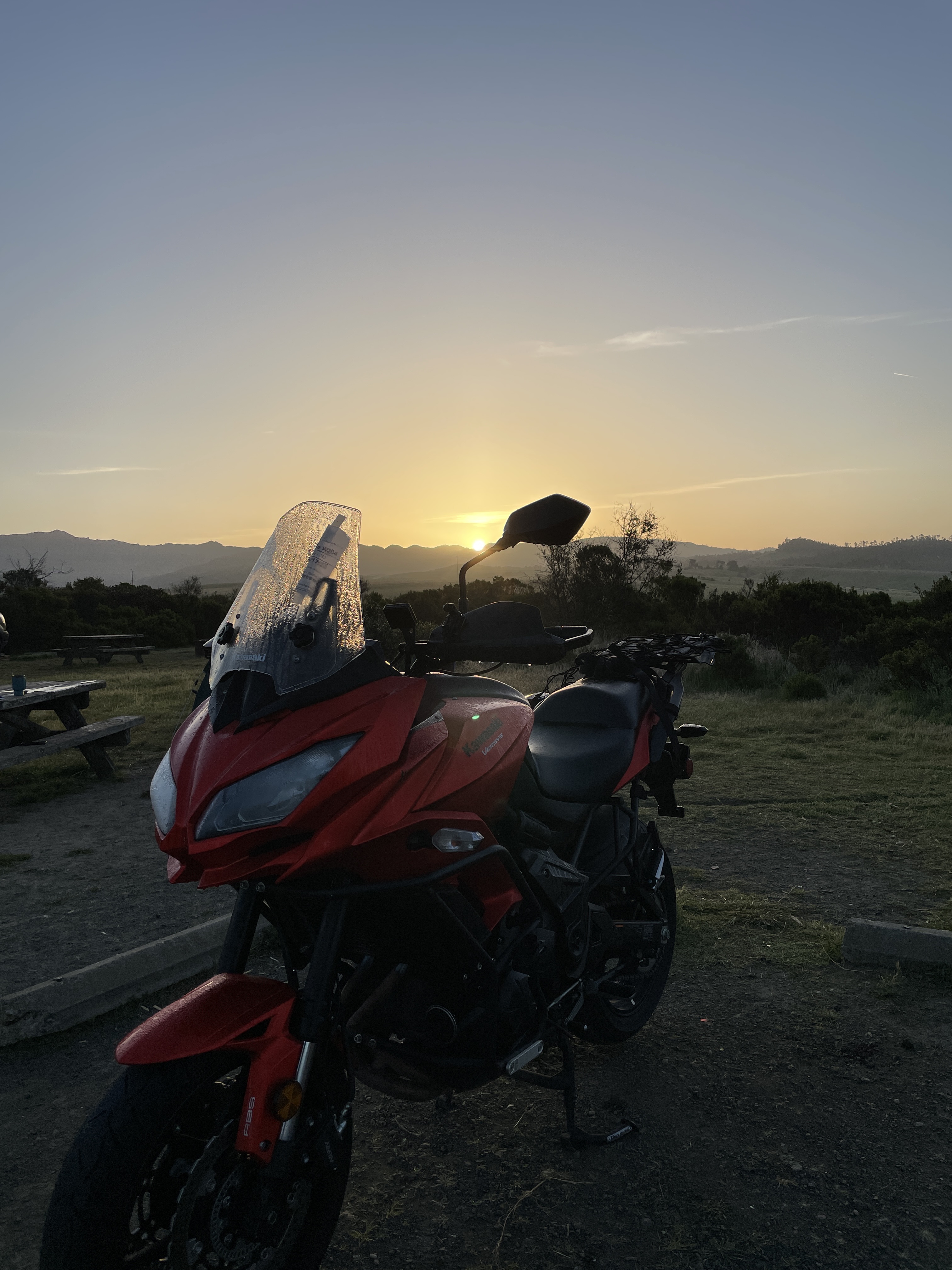
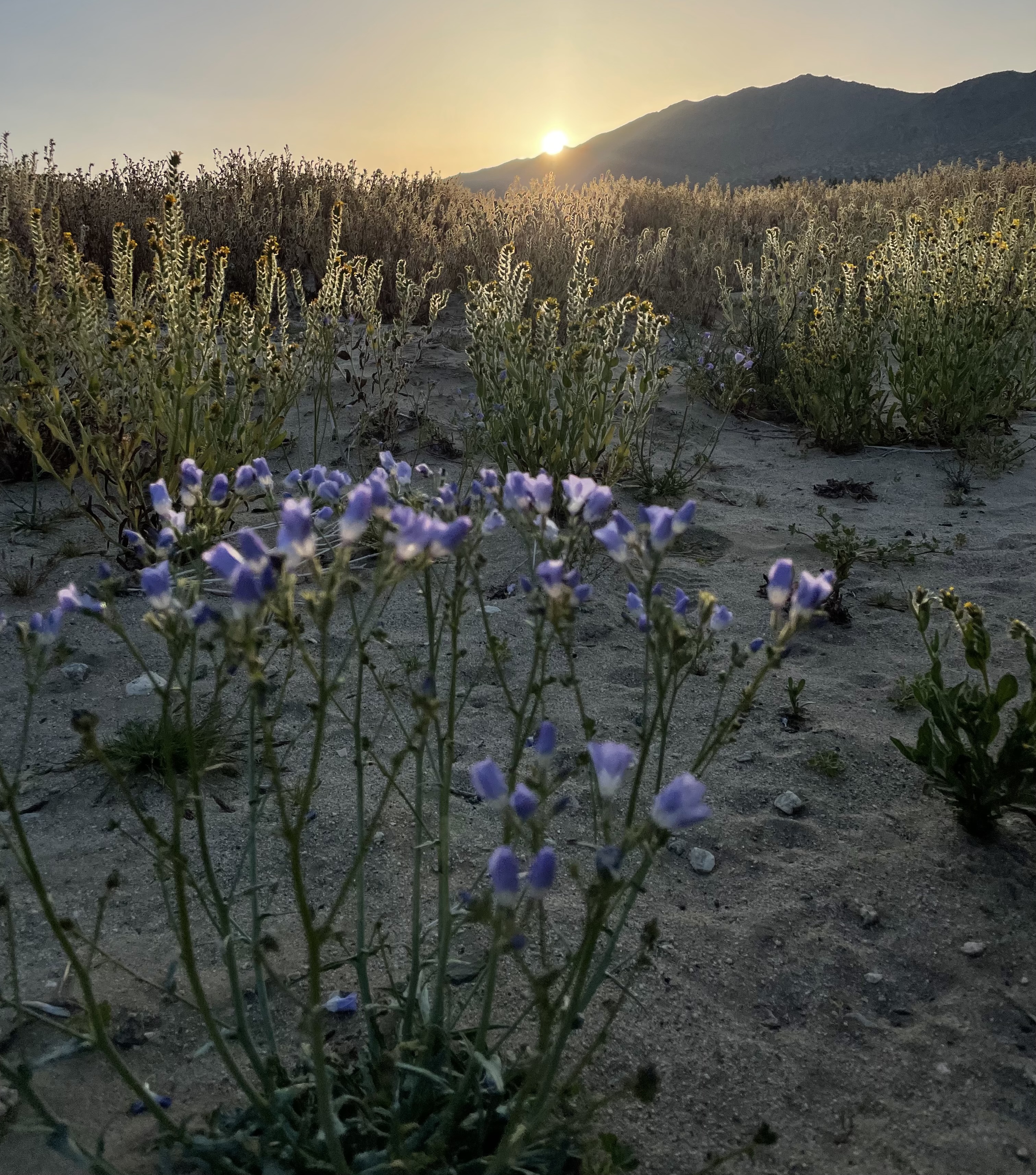
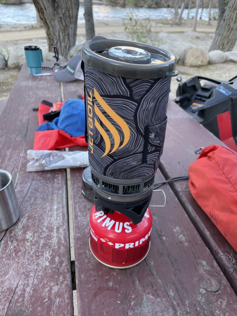
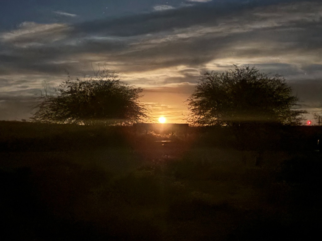
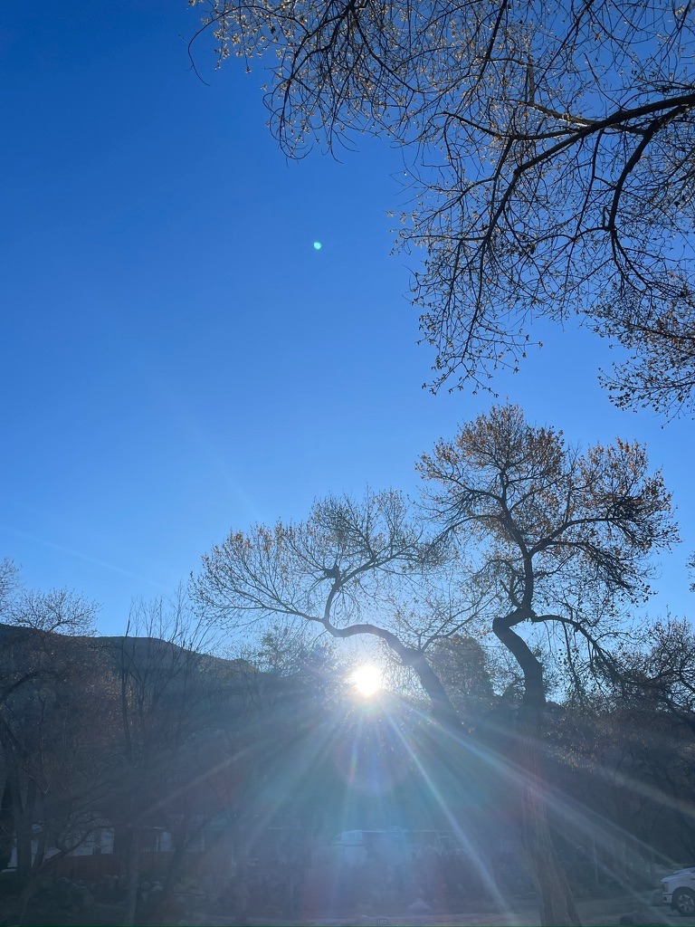
The next morning was no less visually satisfying. Anticipating rambling to virgin territory for both Sisyphus and SMAP, we packed up early to hit the road, but not without appreciating the first light, sunrise, and our JetBoil foglifter mochas.
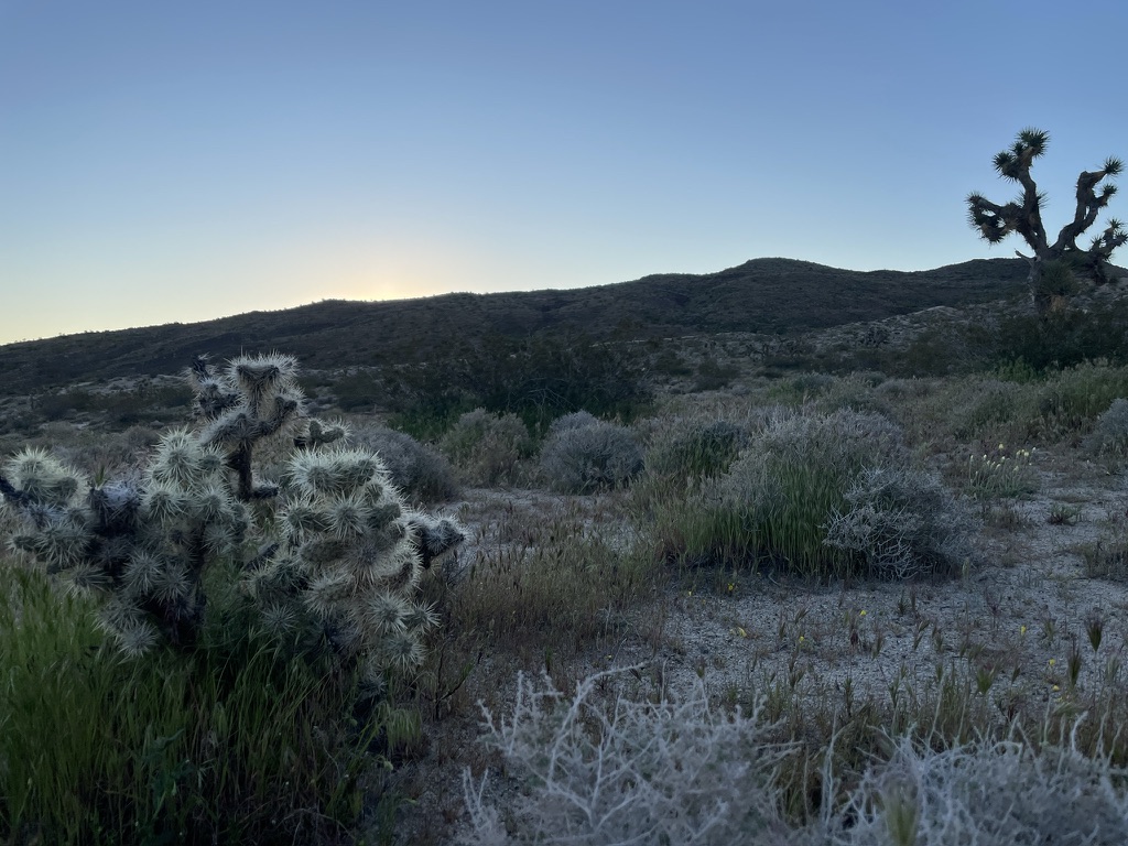
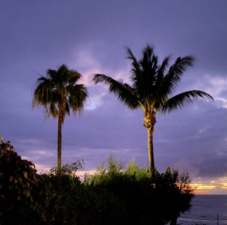
Sunrise service in the hoodoo cathedral…


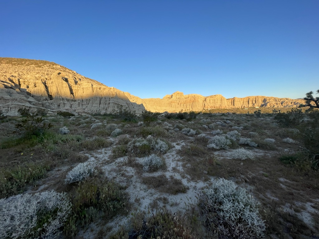
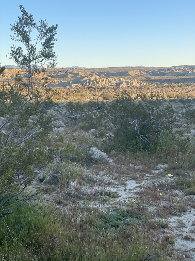
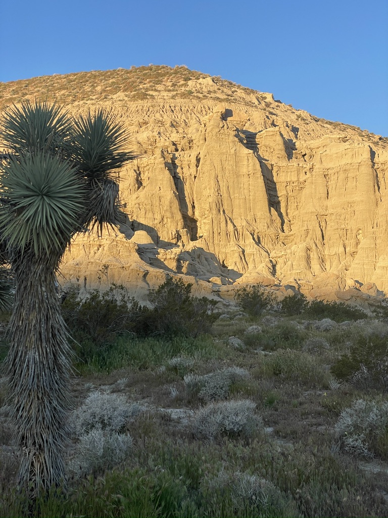
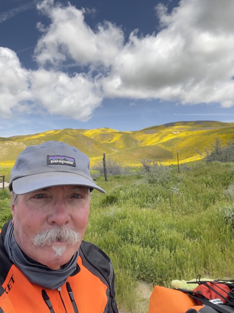
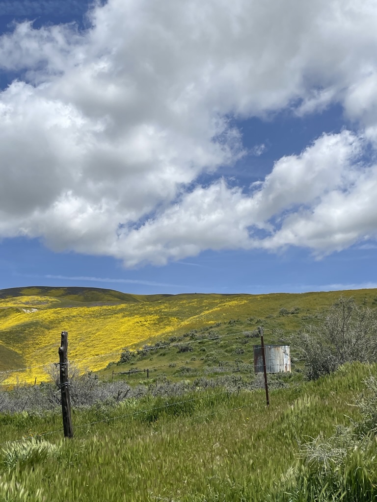
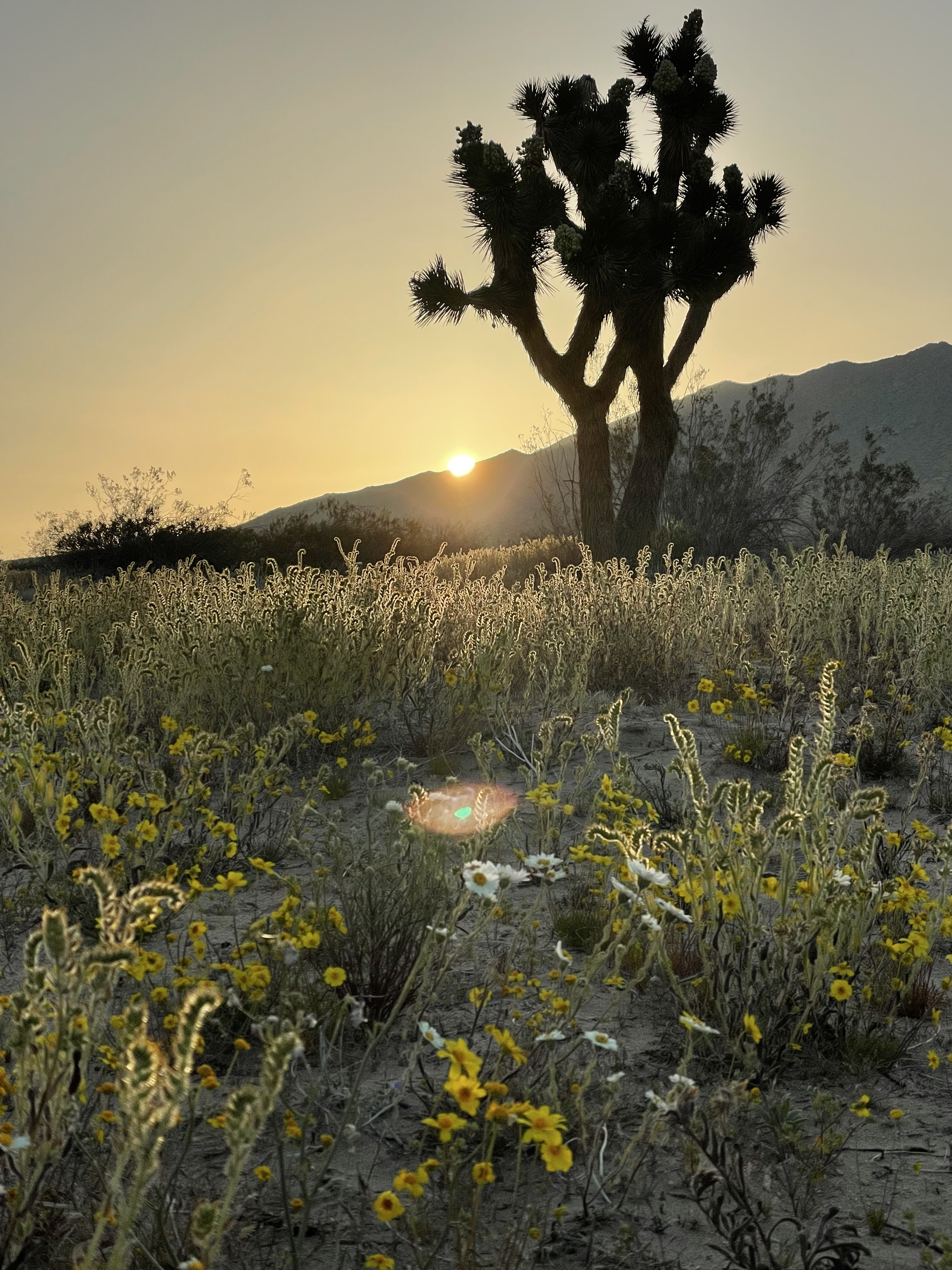
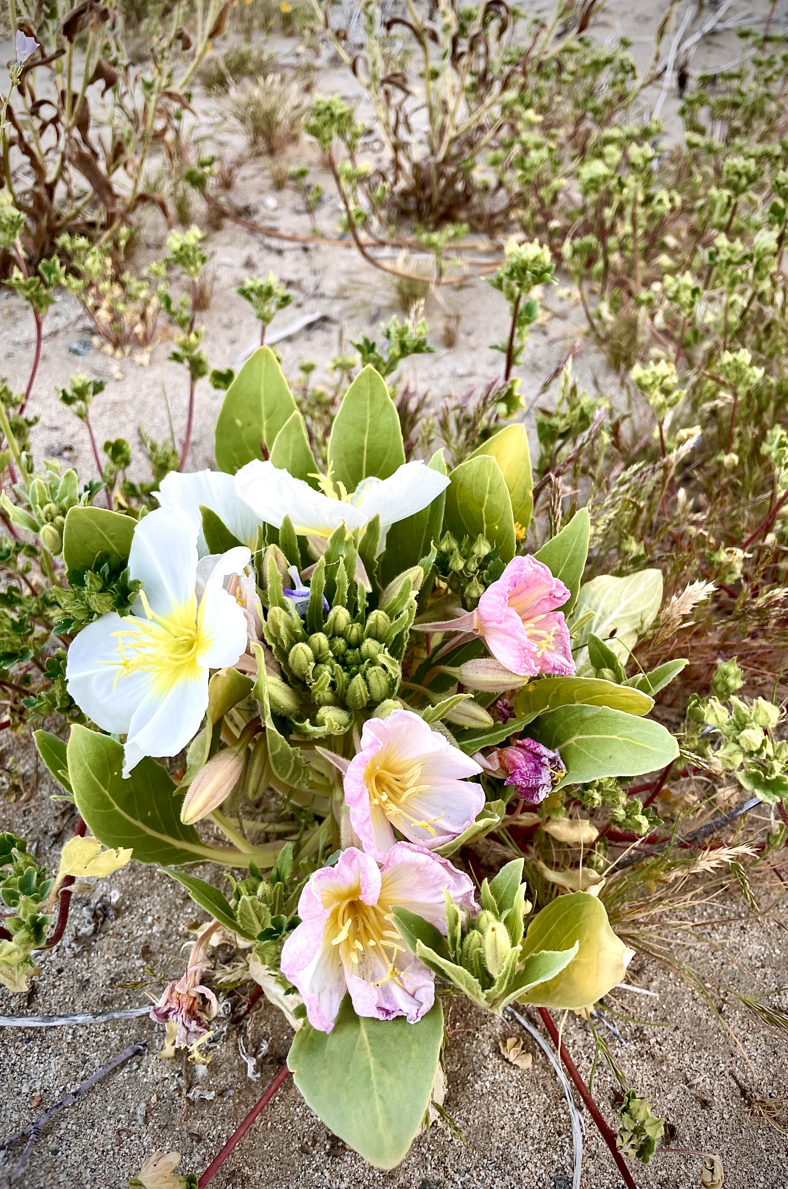
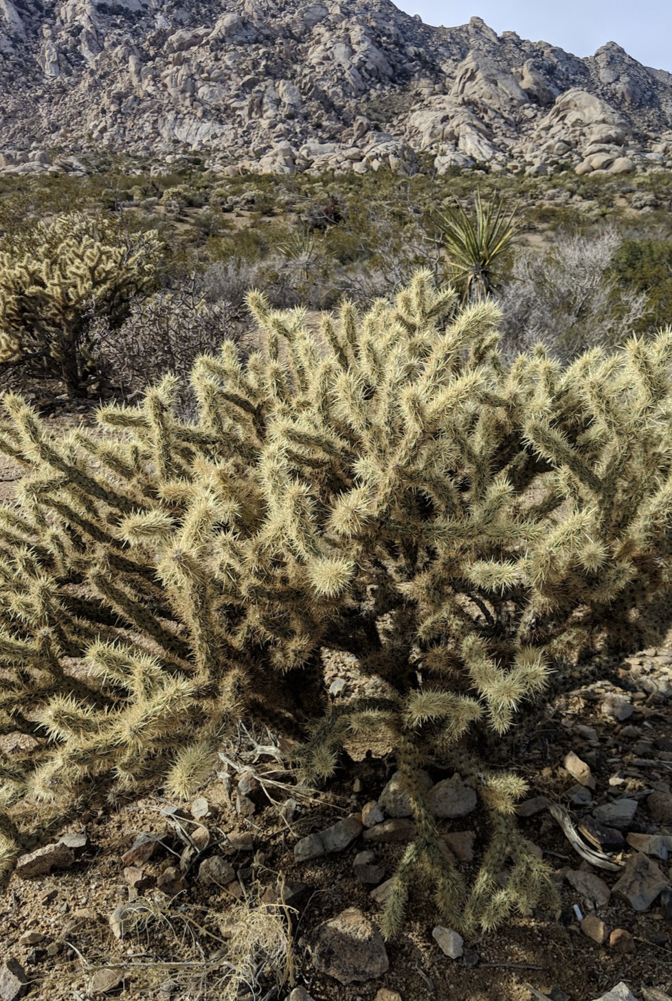
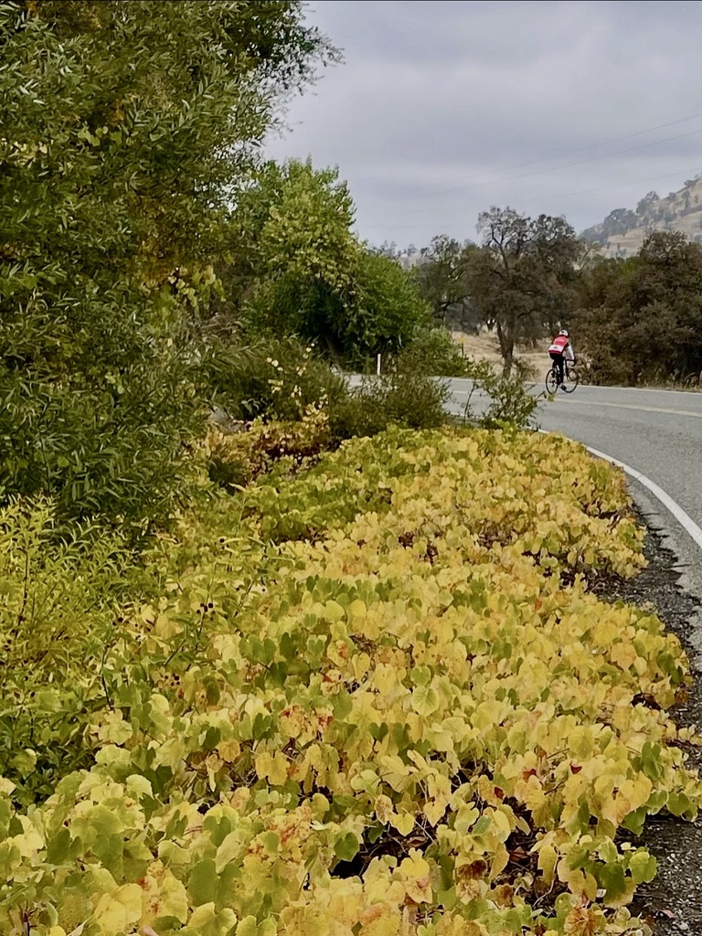
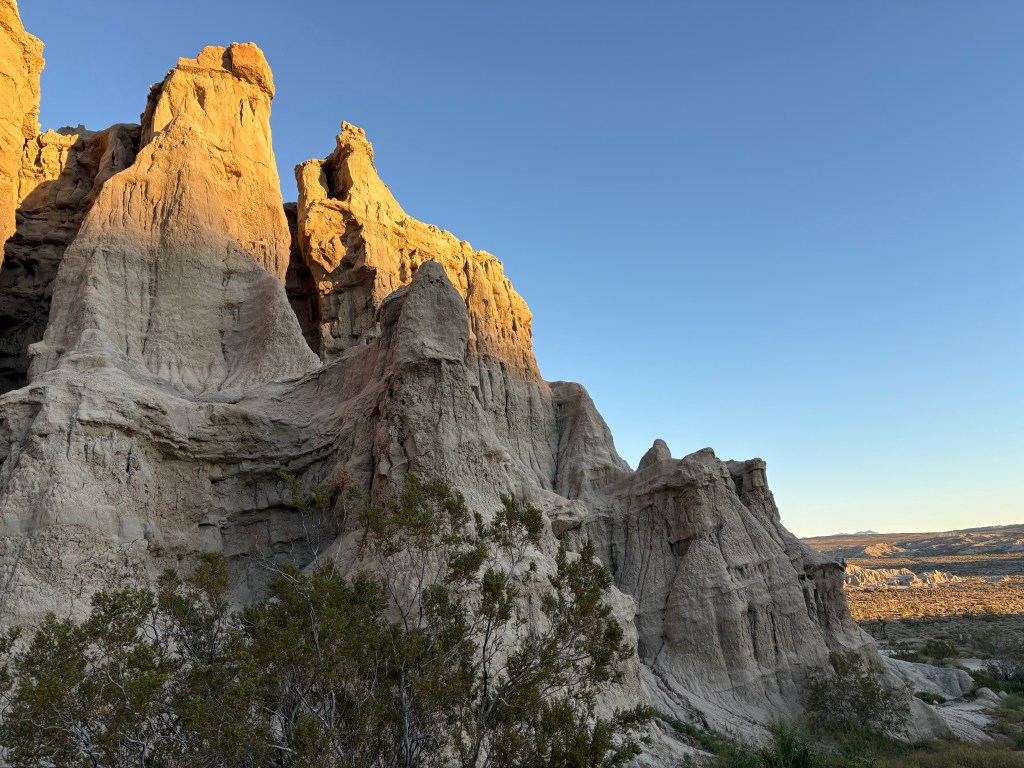
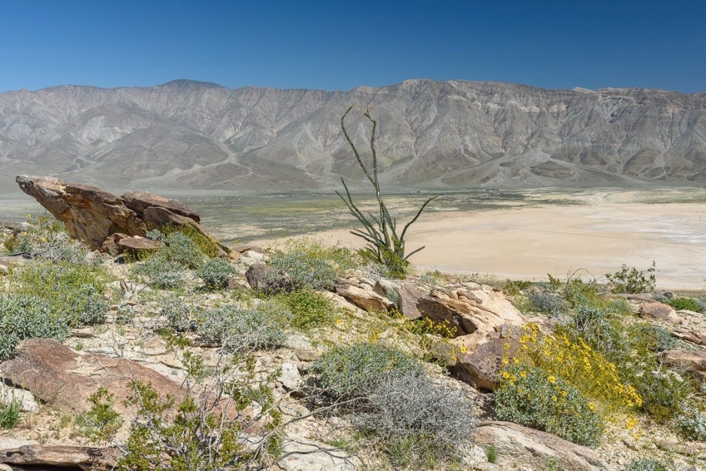
Not exactly a ‘super bloom’, but resplendent nonetheless.
‘Decidedly not’ and ‘flash’, senior Instagram posers…
Days 2 & 3: Red Rock Canyon to the Salton Sea State Recreation Area & Anza-Borrego Desert State Park Itinerary
Red Rock CG to New Camp CG (Salton Sea State Recreation Area): 261 miles
Our objective for day 2 was to sculpt our way around the big interstates and urban routes through the Coachella Valley opting for long lonesome desert byways.
From the Red Rock Canyon State Park, we rode south to California City and continued east through North Edwards and Boron on frontages to CA-58 to Kramer Junction where we ran out of frontages. Hopping on CA-58, the slab, we continued east to Wagner Rd where we found a frontage just south of Hinkley to Linwood and Barstow.
The antique 20 Mule Team Borate (borax) tribute can be found in Death Valley
Photo “courtesy “of the US Borax Visitor’s Center website
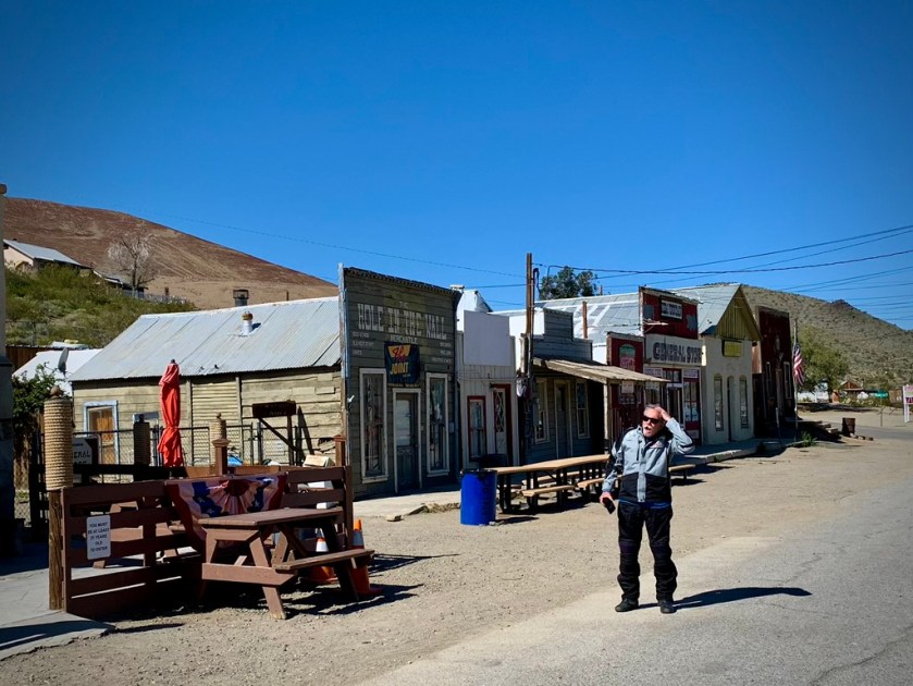
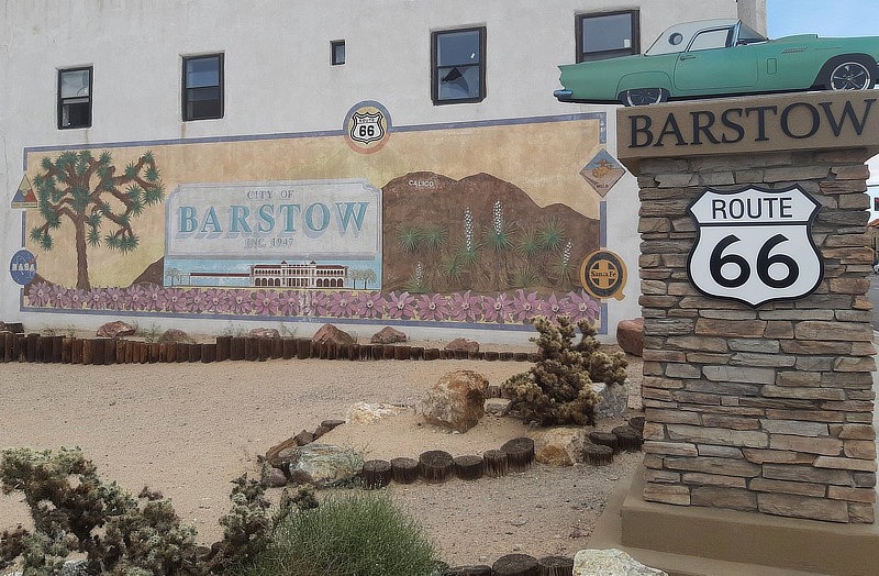
Barstow
We decided we needed something to eat since we got on the bikes and began the ride breakfast free. After not being able to find the famous Los Domingo’s Restaurant billboard and off-ramp, we took the Main St, Route 66 National Trails Hwy exit figuring we’d find a decent Route 66 themed diner, or, because we are in Southern California, a decent Mexican restaurant.
We rode past what seemed like every other business either a tire repair, break shop, or liquor store. I bet planning commission meetings in Barstow for Historic Route 66 zoning codes are a hoot. I thought modern vehicles weren’t as susceptible to breakdowns as those of Route 66’s heyday. The Barstow Planning commissioners must know something I don’t…
We bypassed Robertireo’s, a small outdoor counter service Mexican restaurant, because the name implied it was a combo taco shop and llantera. SMAP also thought it looked “sketchy”.
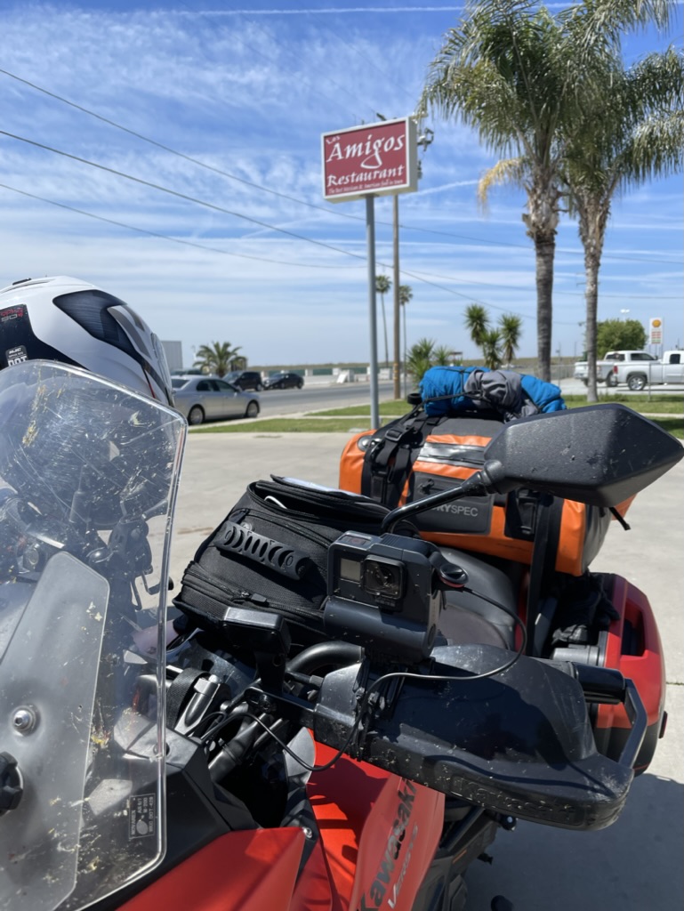
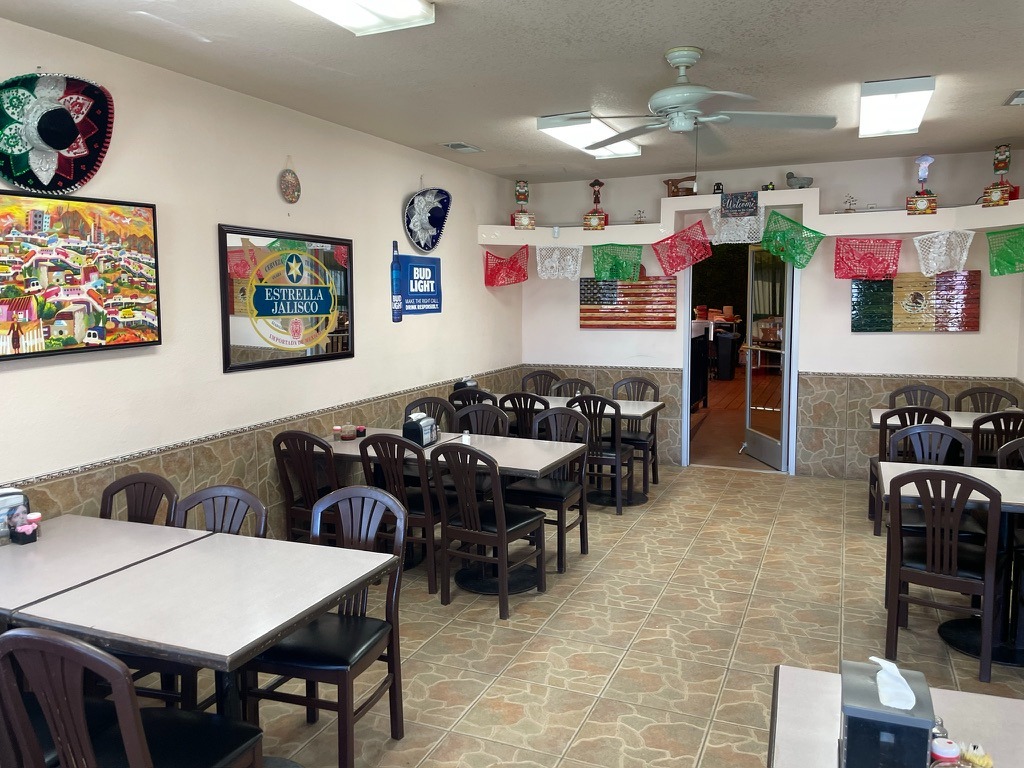
Past a Dollar General, a couple of motels that didn’t appear to have captured the alluring Route 66 vibe, more liquor stores and more tire and brake shops, we located what appeared to be a Mexican restaurant with indoor seating. Amigo’s Restaurant was sandwiched amidst a Midas Auto Repair, a Route 66 Vape and Smoke Shop, and an Enterprise Rent-a-Car. Interesting layout by planning commissioners.
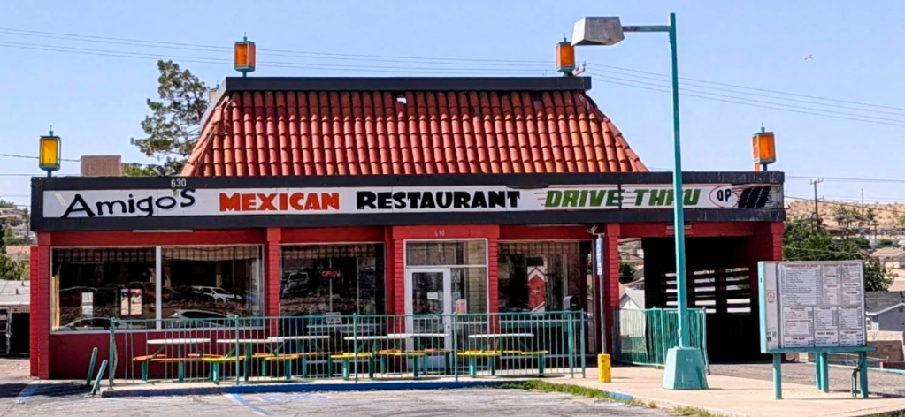
We parked the bikes taking anything that was susceptible to being stolen into the restaurant having spied a couple of Vape Shop customers hanging out next to the restaurant, who, being only modestly judgemental, appeared in SMAP’s estimation to be, “sketchy”.
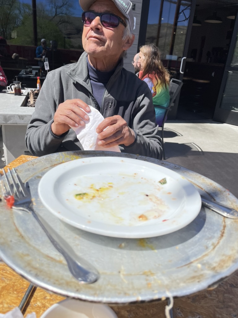
The food was okay, not great, but not bad. This was the second of what would be 4 meals at Mexican restaurants on the ramble and on the Sisyphusian Mexican Restaurant Ranking Index (SMRRI), it was a solid 4th place finisher on this trip. The proprietor was friendly. It didn’t seem to be too busy for a Tuesday lunch hour. There were a couple service truck drivers who came in to order take-out. The fish taco I had was made with fish sticks, Barstow style. Defiantly not a podium finisher.
Gathering up helmets, gloves, tank bag, phones, key, glasses, and jackets, we exited. As we were assembling our gear for departure, one hoodied fellow on a BMX bike, a lass who appeared to be familiar with all of the downsides of meth, and a third hoodied fellow on foot had all assembled near the entrance to the restaurant. They didn’t enter, they just stood by the door and appeared to be conspiring.
As the hooded cyclist disappeared to an alley behind the Amigo’s, the third fellow approached us ostensibly to make some sort of sketchy request. It must be the Moto Guzzi that makes us appear to be uptown. Flashy doesn’t always pay off. Little did he appreciate that the Guzzi is an everyman’s bike. With earplugs in, SMAP later told me his registering a firm “NO!” was in reply to hooded sketchy fellow #3 asking if we’d be interested in purchasing ‘anything’.
Coded language in Barstow isn’t challenging to interpret. I couldn’t understand a word that was said between the two because of the hearing protection, but my assumptions were spot on. Although he was, in a way, exhibiting an entrepreneurial spirit Barstow Route 66 style. We exited without incident.
SR 247 to Joshua Tree and an oddity or two, or three
I hear the burgers are pretty good
With a long lonesome stretch ahead, it’s nice to be able to communicate with SMAP without having to stop. Our Cardo Freedom 4X bluetooth comm devices allow us to do just that. However, they are a bit finicky to get comm-ing. We find ourselves having to exhaust the start protocols several times a day to initiate communication, and then, without any warning, rhyme, or reason, the devices stop working. I was able to listen to iTunes and maintain communication with SMAP intermittently. It’s nice being able to have Pat Methenny or Robert Glasper serenade you as you ramble over long lonesome byways. It beats listening to SMAP clearing his throat.
Old Woman Springs Rd
From Amigo’s, it was a zig and a zag through Barstow then south on the legendary Old Woman Springs Rd, CA-247, also known as the Barstow Rd, past the St. Joseph’s Monastery in Lucerne Valley to Cafe 247 to stop for a map check, yet another comms reset, and nalgas relief. Since we had just eaten, it was too soon to try out the cafe’s fare.
To understand the legend of this thrice named route, check out the Desert Oracle’s Episode #248: Mapping The Mojave With Col. Henry Washington.

Out here in the Great Mojave Wilderness, we’re always talking about Section 6 or Section 33 or Section whatever it is, but how did we get that system, that public-lands overlay? Who did the work? Tonight we tell you about . . . well, not the father of our country, but his nephew. The nephew of our country. Col. Henry Washington, the man who surveyed and plotted the baseline and the meridian back in the 1850s, the defining lines by which all other property in Southern California is measured. He named a lot of desert landmarks, too. Like “Old Woman Springs,” that’s one of his many desert place-names still on the maps and on our minds, nearly two centuries later. (Ken Layne, from Episode #248 Mapping the Mojave with Col. Henry Washington)
East on Old Woman Springs Rd we plowed through Johnson Valley, past the Giant Rock and Integratron in Landers. I hope you’ll excuse the departure from the travelogue for a brief explanation of these desert oddities and a Ricky Ricardo “esplanation” about why Huell and Ken are so inspiring.
The Giant Rock
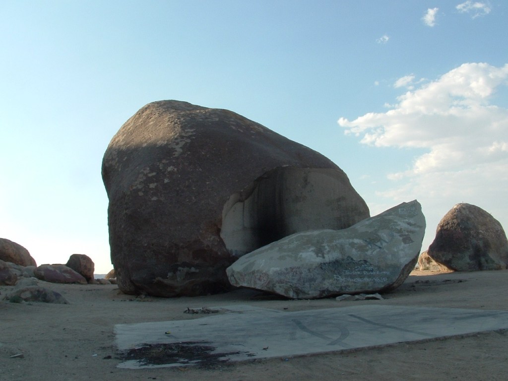
The Giant Rock is the largest freestanding boulder in North America and is purported to be the largest free standing boulder in the world. Now, that’s amazing! as Huell Howser would likely exclaim. Beside being a big Howser California’s Gold fan, I’m an equally big fan of Ken Layne’s Desert Oracle radio show/podcast.
Huell touched on unique features of California culture geography in his decades of exploring the five corners of California. Ken Layne explores more of the extraordinary, strange, uncommon, and peculiar features of Southern California, especially the Mojave.
You can listen to Desert Oracle podcast episodes anytime, and if you’re down in the Mojave, listen to The Voice of the Desert on the radio Fridays at 10 p.m. on Z107.7 FM in Joshua Tree/Yucca Valley/29 Palms/Pioneertown/Wonder Valley… ‘from Amboy to Zzyzx! ‘
Layne, the Desert Oracle, is kind of a modern day Art Bell, but a bit more “intellectual” and way funnier and much less homespun than Huell. I’ve taken to playing his episodes for SMAP while camping in the desert. It gives us the mindset to see UAP’s, formerly known as UFO’s. You might say, Huell and Ken inspire my curiosity for exploring on the moto. Kind of flashy, eh?
You can find the podcast at Desert Oracle Radio.
I first learned the story of the Giant Rock and Integratron on the California’s Gold with Huell Howser: Giant Rock episode originally aired in 2001. More recently both have been featured on Ken Layne’s Desert Oracle Radio Podcast and in his pocketbook publications.
The Integratron
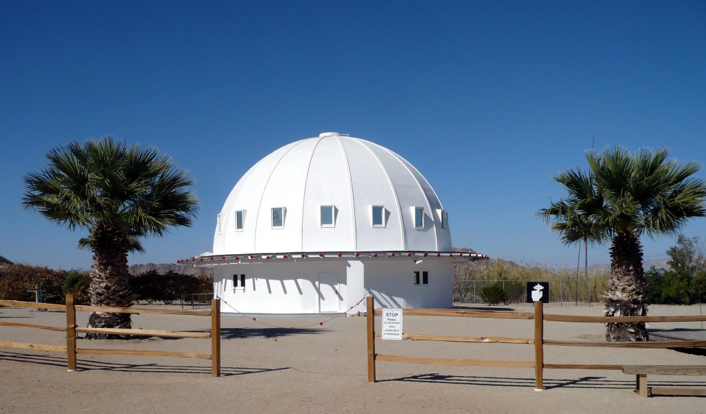
From Wiki: Van Tassel died, there was a proposal to turn the Integratron into a disco, but that plan was never realized. The Integratron’s new owners operate it as a tourist attraction and offer “sound baths” where groups of people are “exposed to harmonic sound frequencies” produced by quartz bowls, claimed to have a deep calming effect. According to one of the structure’s docents, the Integratron is an “acoustically perfect sound chamber”.
From a desert disco to a sound bath? While that’s not something you see every day, we bypassed a side pilgrimage to get to our destination near Mecca in the adjacent Colorado Desert. Rolling through the southern vestiges of the Mojave, Homestead Valley and Yucca Valley, we hopped on to CA-62 through the Morongo Valley exiting onto N Indian Canyon drive to N Palm Springs. You can get a taste of Ken Layne’s enchanting version of this part of our ramble at The Desert Oracle: Highway 247 Revisited.
South on Dillon Rd we bypassed Palm Springs and Desert Palms winding up in Indio where CA-86 becomes CA-111 and our route to Mecca. Indio, kind of a Mecca in it’s own way is home to Cycle Garden , “where vintage Moto Guzzi’s are brought to receive a full restoration”.
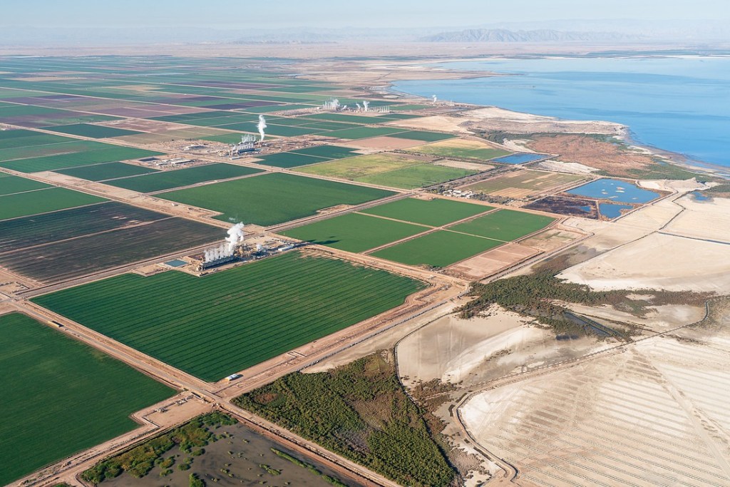
Fit’s with the whole “restoration” vibe of Palm Springs, I guess. Mecca is more agriculture than the sprawling up-scale desert communities we rambled through to get to Mecca. Our humble apologies to the citizens of Mecca, the town sits on the down-scale side of the Coachella region.
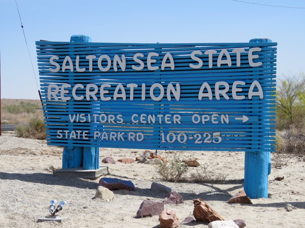
After a fuel and provisions stop at the Mecca Arco Travel Center, we made our way to the Salton Sea State Recreational Area Campground passing California date palm orchards. Quite a departure from the orchards in our neck of the valley. I was surprised that we didn’t see a single Instagram influencer on our route into the Salton Sea.
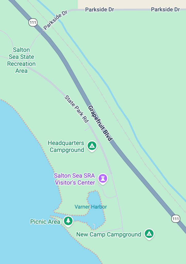
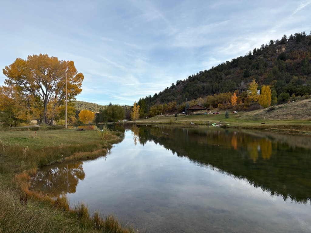
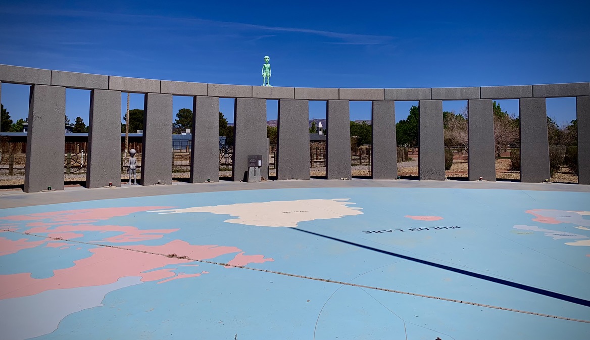
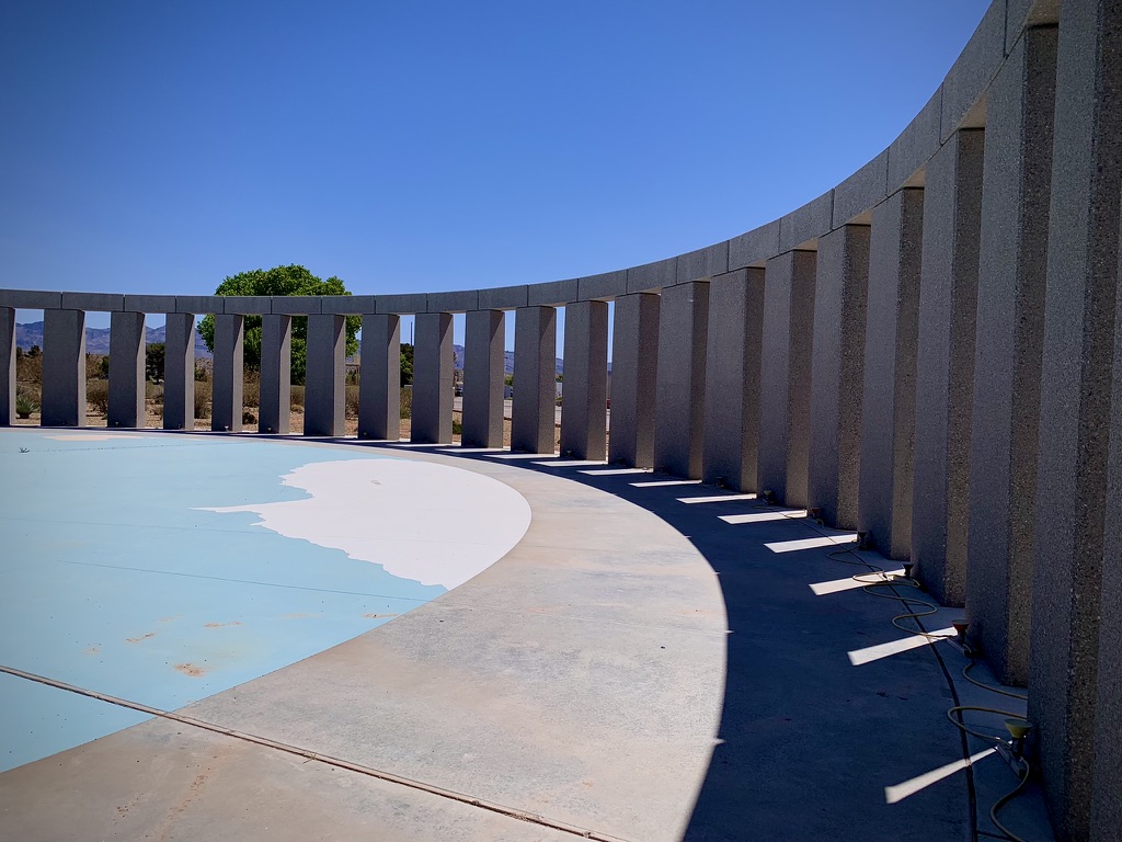
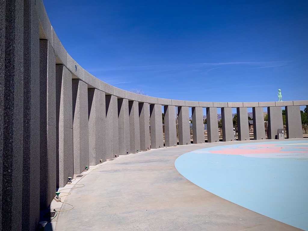
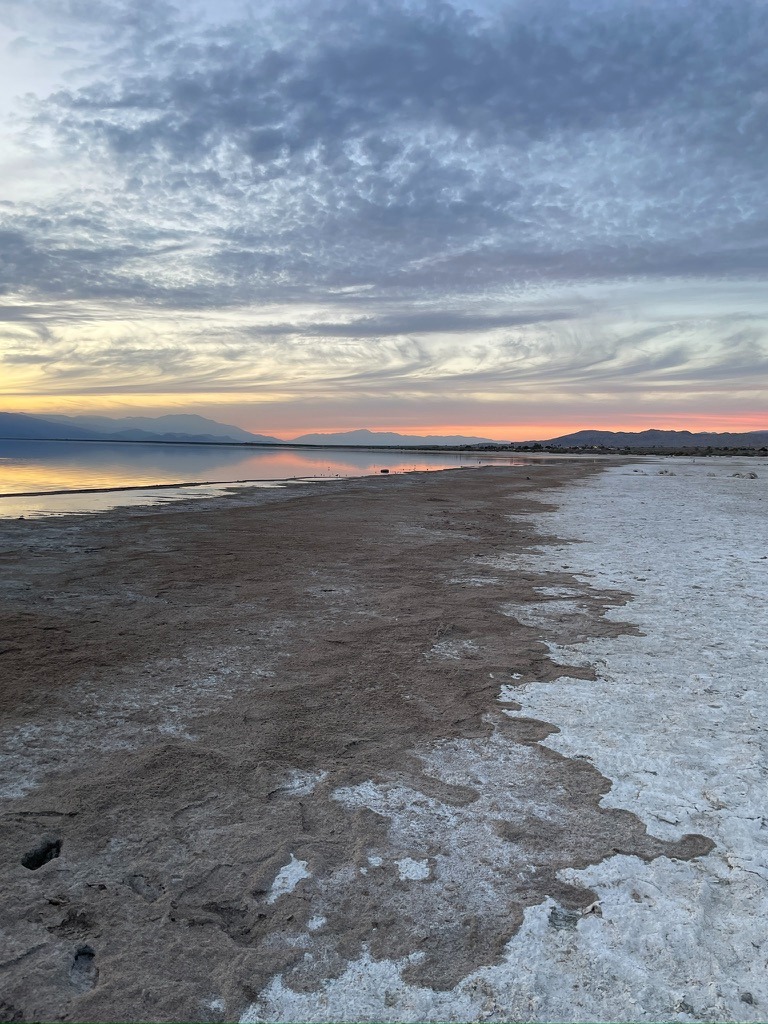
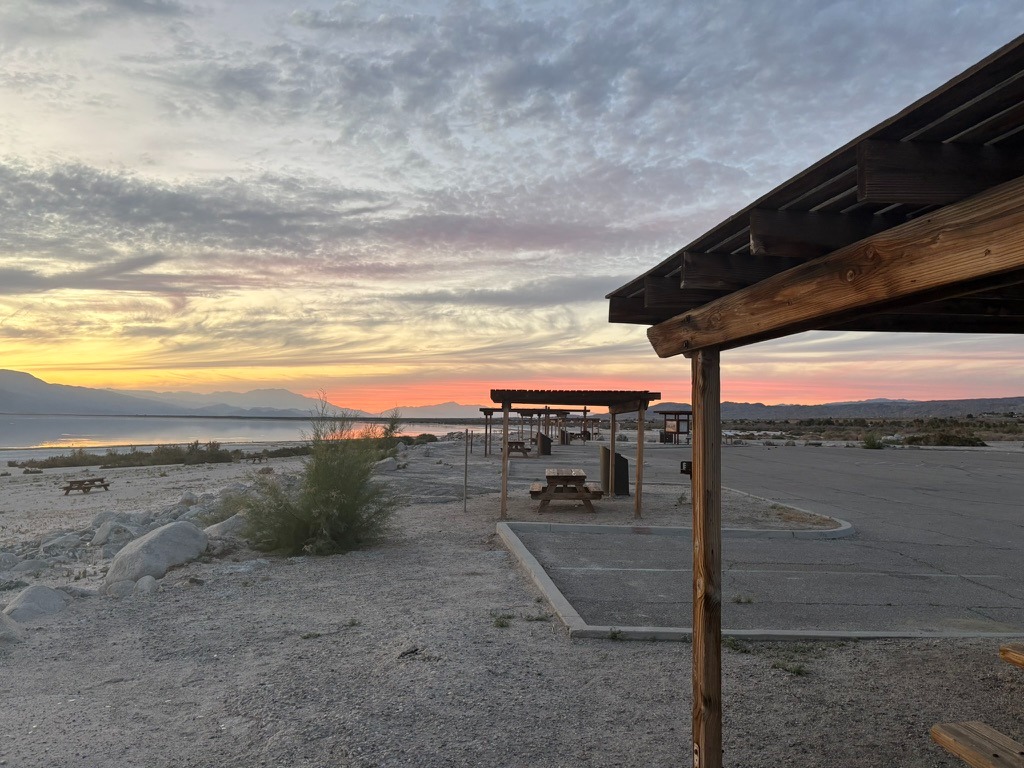
The Salton Sea State Recreation Area, New Campground
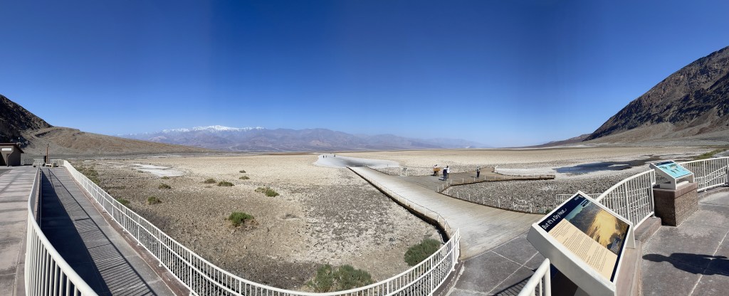
Timeline of Salton Sea History
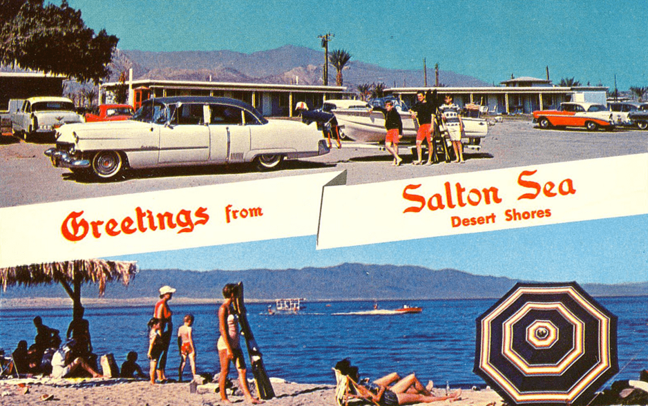
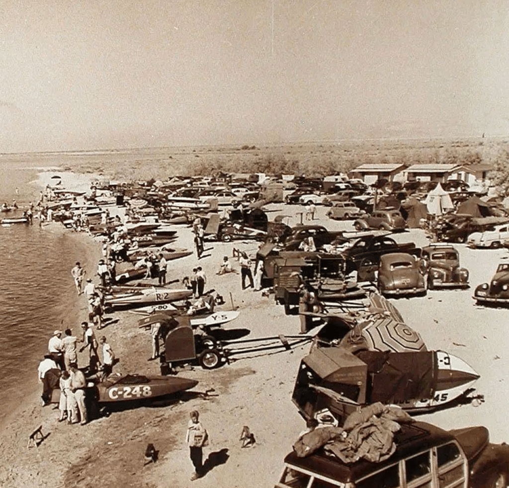
Salton Sea then…
Salton Sea now…
There’s down-side and then there’s way down-side… You either love it or find it unworthy. Even Huell Howser had a hard time with the contradictions of the of the current Salton Sea: Salton Sea with Huell Howser. Maybe that’s why we didn’t see any Instagramers.
I was aware that the Salton sink had been historically flooded by the Colorado River watershed in big snow melt seasons through the eons. I paid attention to Mr. Lemmon in my Geology class at Merced College. I was also aware that in 1905 that a temporary diversion of the Colorado River, constructed to replace water from the blocked Imperial canal–an early attempt constructed to irrigate Imperial Valley agriculture– that was breached by floodwaters and that the river, blocked by salt blocks, changed course and flowed unrestrained into Salton Sink.
Thanks to Mark Arax whose books, The Dreamt Land: Chasing Water and Dust Across California, and his collaboration with Rick Wartzman on The King of California; J.G. Boswell and the Making of a Secret American Empire, along with Mark Reisner’s Cadillac Desert are must reads to better understand the struggle to cope with water issues in the west, particularly, California.
Birth of the current lake, sorry, Sea
In 1907 the Southern Pacific Railroad closed the breach in the river. Nearly a hundred years later, after 1999, the supply of Colorado River water to the Salton Sea began to significantly decrease. This reduction was due to improved water efficiency in local agriculture (drip, drip, drip), leading to less runoff entering the lake. However, increased use of agricultural fertilizer, herbicides, and pesticides have continued to enter the evaporating body adding to the already toxic levels of salinity today.
To learn more about the troubled history of the Salton Sea check out Timeline of Salton Sea History and to learn how the once thriving beach resort has declined and is attempting a rebound, check out Architecturalafterlife.com. Oh, and Arax’s and Reisner’s books.
Why then, did I select the Salton Sea Recreation Area to camp? Well, when arranging for campsites in California’s State Parks, availability is cataloged and managed online. It so happens that there were no campsites available in the five ‘lux’ campgrounds (with water) in the Anza-Borrego Desert State Park proper. There were another nine primitive campsites available, however, since we aren’t the hard men of our youth, having water available, showers, and flush toilets are as Fred Flinstone primitive as we go these days.
The irony of the death of the Salton Sea is that the State of California maintains a camping facility and Visitor’s Center that is among the newest and best we’ve camped in. There is a natural beauty to the setting that one can only imagine with reflection on the basin’s geologic lifespan. We fit into the “love it” category of visitors.
We’ve toured or camped at several endorheic basins, basins where a river drains into a sink but does not flow out to the sea. These closed drainage basins feature water that flows into lakes, swamps, or other internal bodies of water. This water typically leaves the basins through evaporation or agriculture, leading to high mineral concentrations, prohibiting further agriculture, and are often found in desert regions or areas with low rainfall. Tulare Lake in the valley, Mono Lake, Owens Lake, and Searles Lake on the east side of the Sierra, Badwater in Death Valley and Pyramid and Hawthorn Lakes in Nevada are a few examples of endorheic basins we’ve visited. Sadly, most of these bodies are incapable of sustaining any degree of water quality much less agriculture.
As of 2024, the Salton Sea salinity is about 60 g/L, which is almost twice that of the Pacific Ocean, at 35 g/L. For reference, fresh water is about 0.2 g/L, 100x less salty. All the salt in the Salton Sea, if extracted and dried, would form a conical pile about a mile across! (Casey Handmer, Salton Sea statistics). I bet that young fellow from Nazareth could dance much less walk across that water. Likely, the disciples, who initially mistook him for a ghost, would not have been terrified to see a dancing savior. Would something like that qualify as a UAP?
The future of the Sea
Recently, lithium extraction has emerged in the Salton Sea which involves mining lithium from the geothermal brine, a hot fluid found beneath the lake bed. This process is seen as a potential way to supply lithium for electric vehicle batteries while also generating geothermal energy, but it raises environmental concerns regarding water use and further pollution. We could use a savior, dancing or not…
Back to the Ramble…
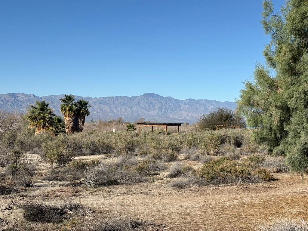
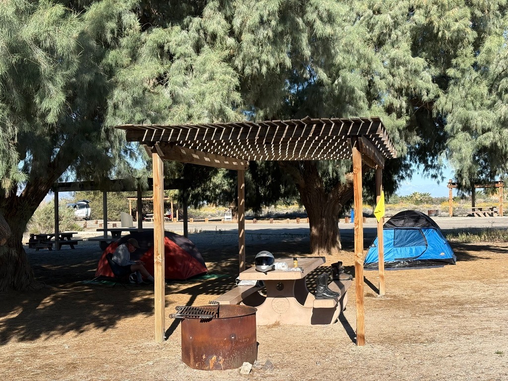
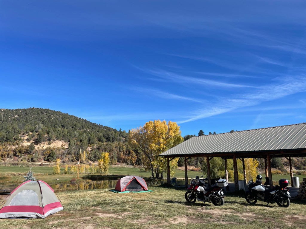
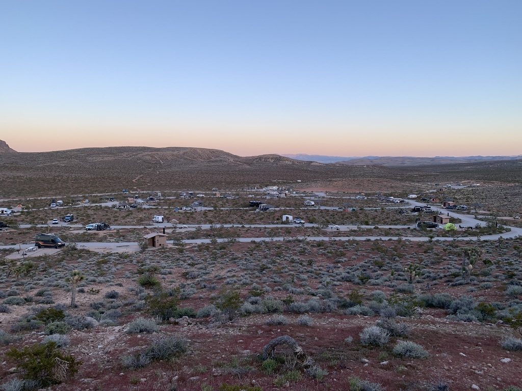
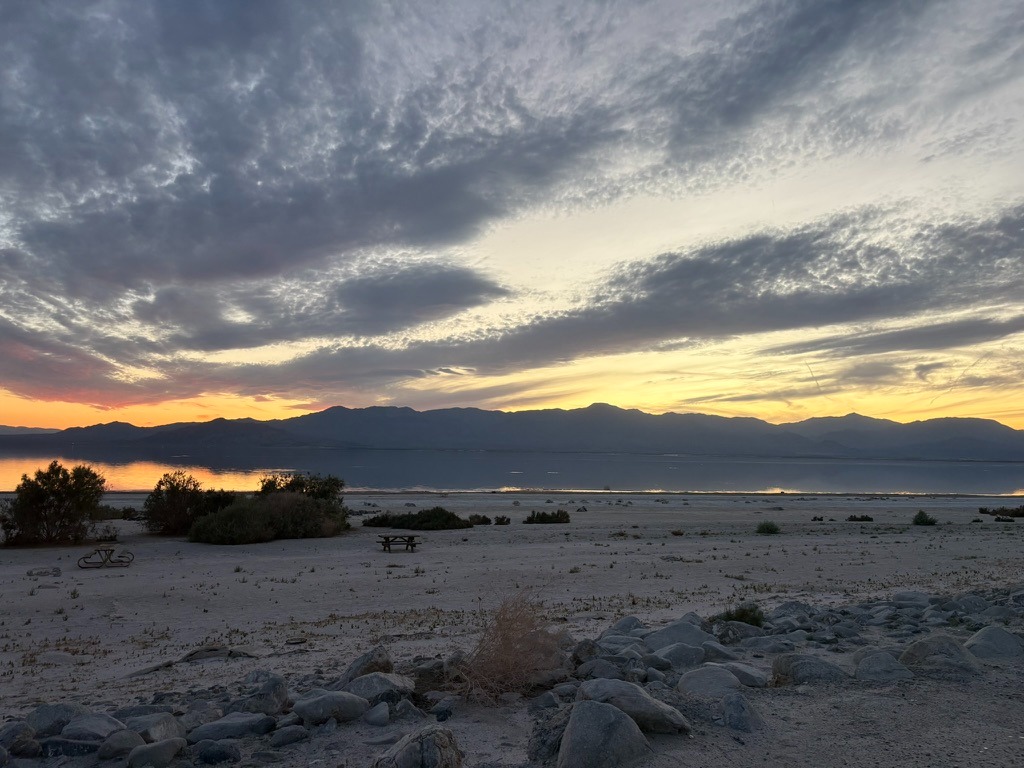
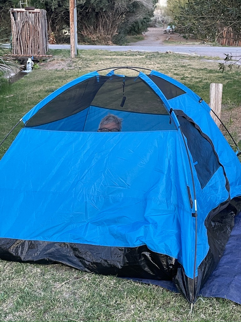
Our campsite was nestled among some ironwood trees providing relief from the harsh afternoon sun, even though the temperature was comfortably in the low 70s with a nice breeze during the day. There are 48 RV and tent sites in the Mecca Beach Campground, one of 12 such campgrounds around the sea. Our section was called the New Camp. There were maybe six campers evenly divided into small RV’s or tents throughout the dozen campsites. We were the only moto-campers.
Across from us was a woman in a nice Casita towable with Texas license plates and her two dogs. We only saw her twice in two days, each time walking her dogs in the morning and early evening. The rest of the time she presumably spent in her air conditioned travel trailer enjoying her Starlink reception.
Another fellow west of us seemed to stay close to his campsite, vigilant, standing alert to any activity in the campground. He dialed us into where we could get tokens for the showers since there was no machine to convert cash into shower tokens in the immediate shower area. None of the other showers-for-pay we’ve visited in State Park Campgrounds limit getting tokens between 9:00 am and 3:00 pm a half mile from the showers.

Anyway, apparently he’d been there for quite a while and seemed to be a pleasant fellow who spent much of his time between Anza-Borrego and the Salton Sea. He was but one of the members of the chorus of, “Ya shoulda been here two weeks ago for the bloom.” So far, the bloom was a semi-bust.
An Evening Stroll
Day two was breezy but pleasant. As the sun was setting, we set off for a stroll on the beach, but what sounded like a boisterous party was taking place on the path to the shore that suddenly quieted as we approached. The SMAP’s Sketch-o-Meter gave us pause and so we set off for the entrance kiosk to the park to see if there was an external shower token machine. It was a pleasant token-less walk.
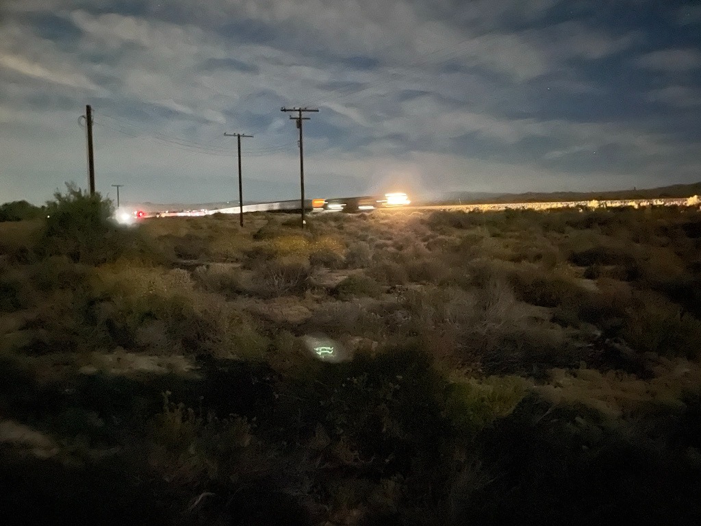
Too warm for a campfire, we nevertheless enjoyed the night sky, our 3R’s conversation, and the occasional train that passed by our campsite, just across Hwy 111. CA-111 is the route to Brawley from this part of the Imperial Valley along with the settlements along the eastern shore of the Salton Sea. A chorus of coyotes, from what sounded like just across Hwy 111 from our campsite, was fitting given that Yucca Man, a favorite oddity of the Desert Oracle, didn’t show up to entertain us.
By the time nite-nite came around, the heretofore pleasant trains and infrequent tractor-trailer traffic both became more numerous and frequent as area produce being hauled throughout the night on the adjacent highway and containers from Pacific ports moved by rail, eastward. Bummer. We didn’t see any UAP’s either…
Day 3 – Salton Sea State Recreation Area to Anza-Borrego and Julian Descriptions of Rides in the Anza-Borrego
For day 3, Wednesday March 4th, I had planned a route to Anza-Borrego that would take us to Julien on CA-78 and back to Borrego Springs on CA-79 and San Felipe and Montezuma Valley Rds. Having never been there, we didn’t know what to expect. Turns out that once again, we lucked into a great day of riding with much to remember.
The old saw, luck is when preparation meets opportunity, landed squarely in our circumstances. I’ve begun using Claude AI to research roads. Along with Google and Butler Maps (Rever), planning has been made a bit more efficient. We used only a portion of the AI suggestions on what would have been a much longer day. We might as well save something for the return trip henceforth…
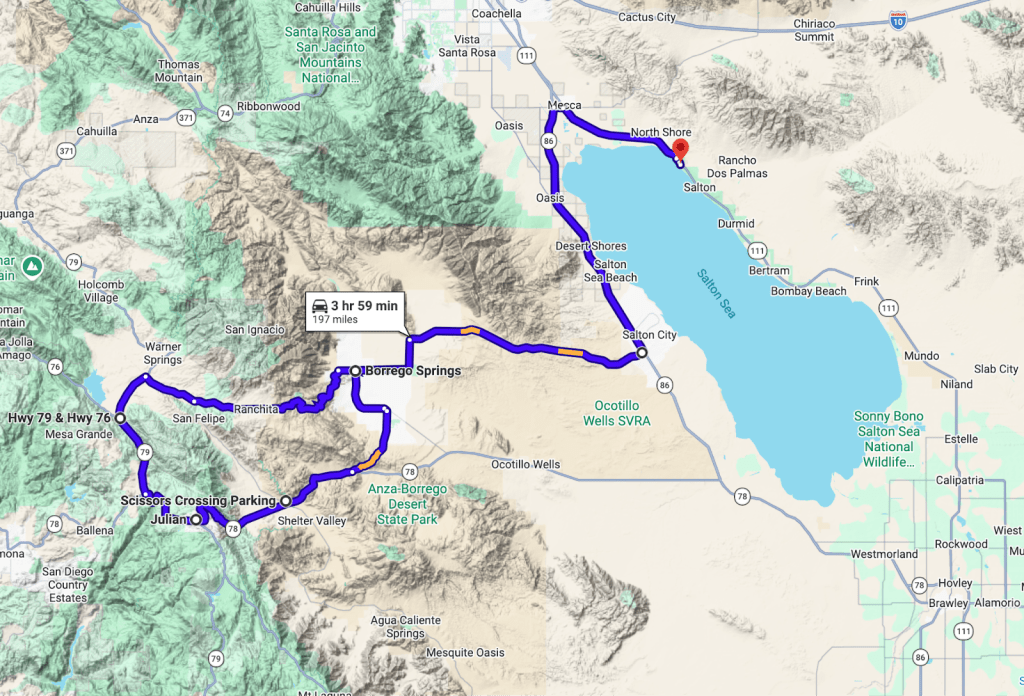
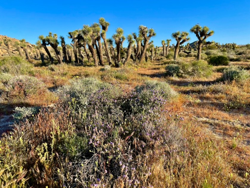
That morning, after tracking down tokens for the showers that were available only at the desk in the Visitor’s Center, which was closed before we arrived on Tuesday afternoon, we set off for Borrego Springs and Anza-Borrego Desert State Park in search of wildflowers. Once again, prolific wildflowers were pretty much a bust.
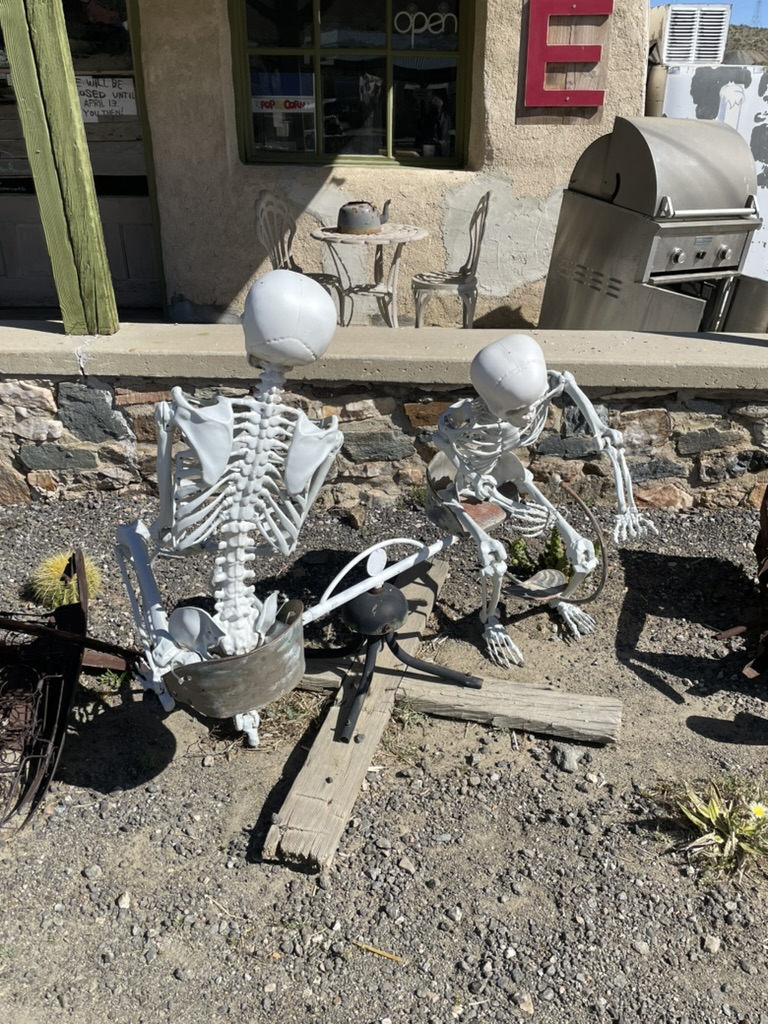
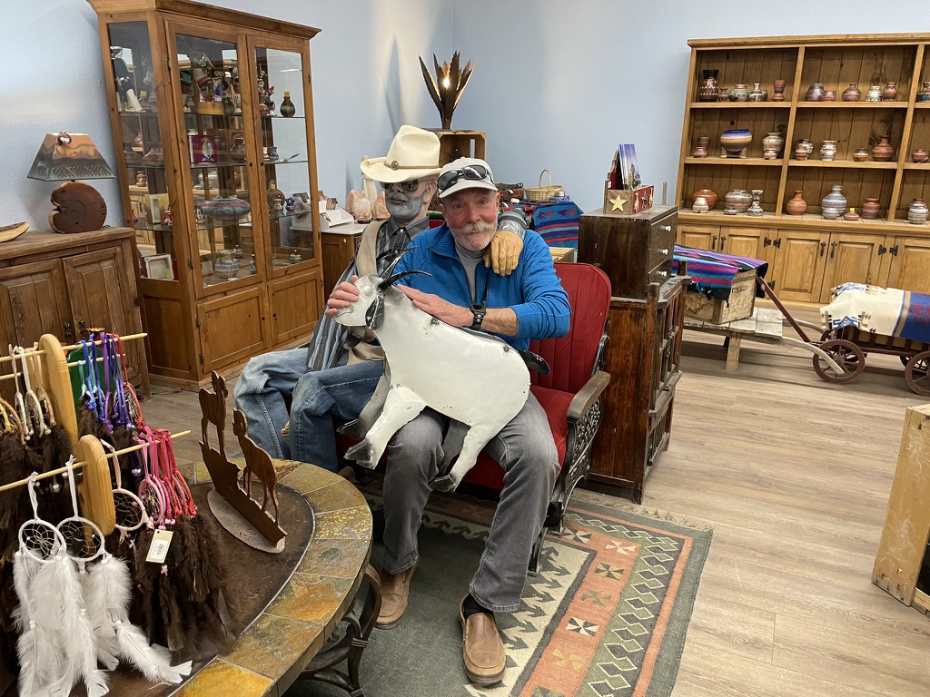
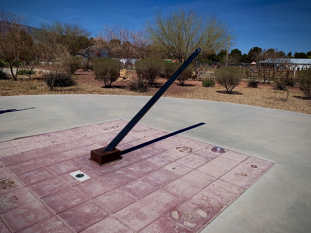
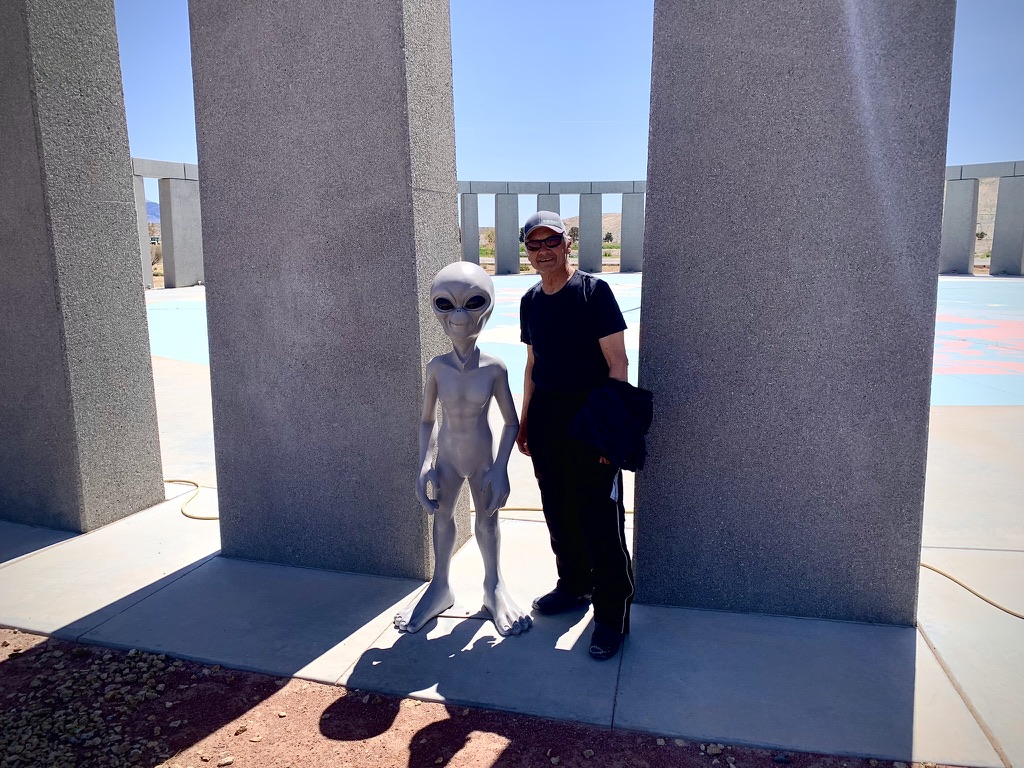
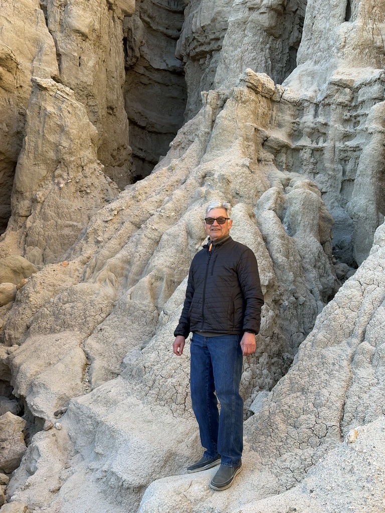
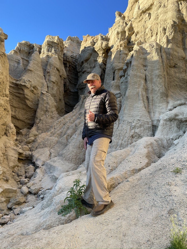
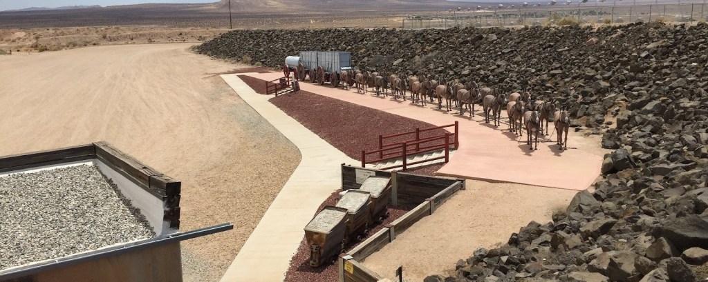
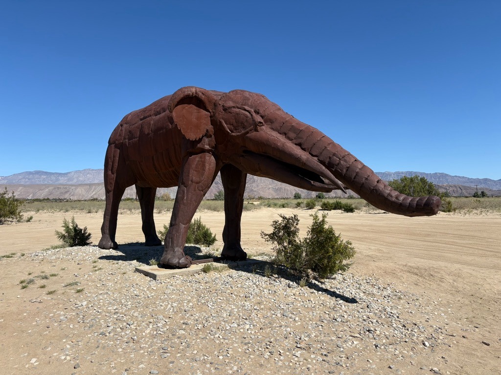
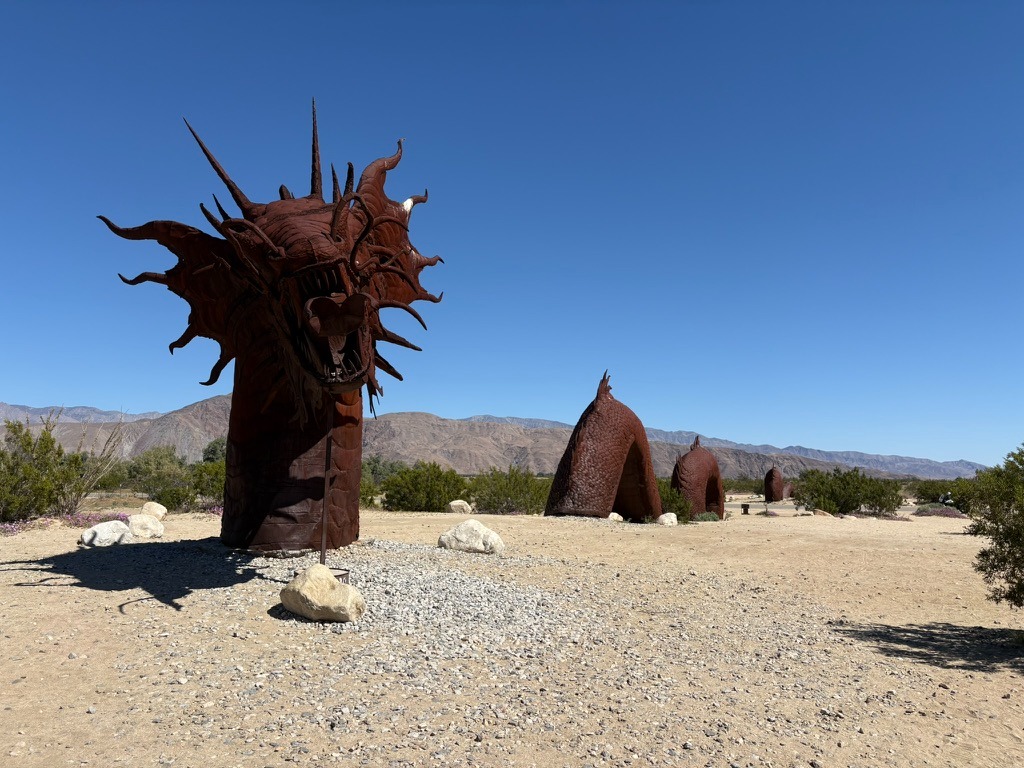
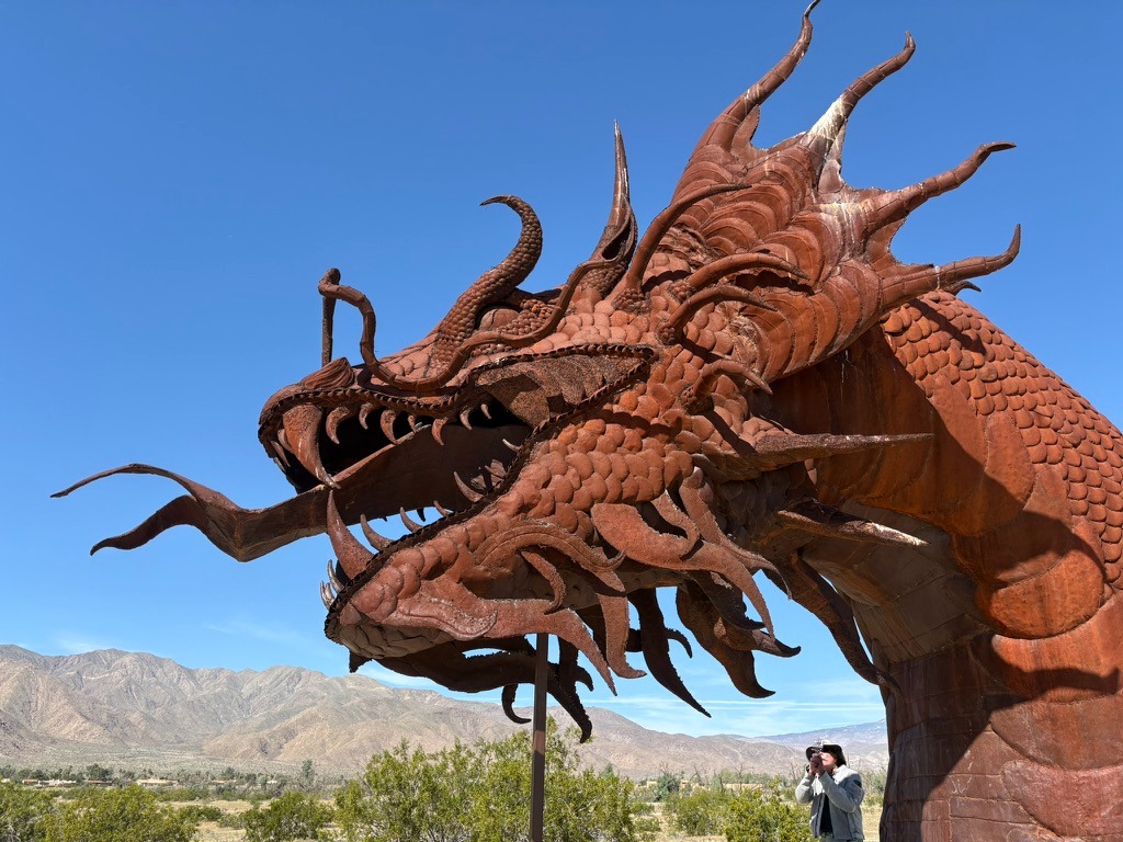
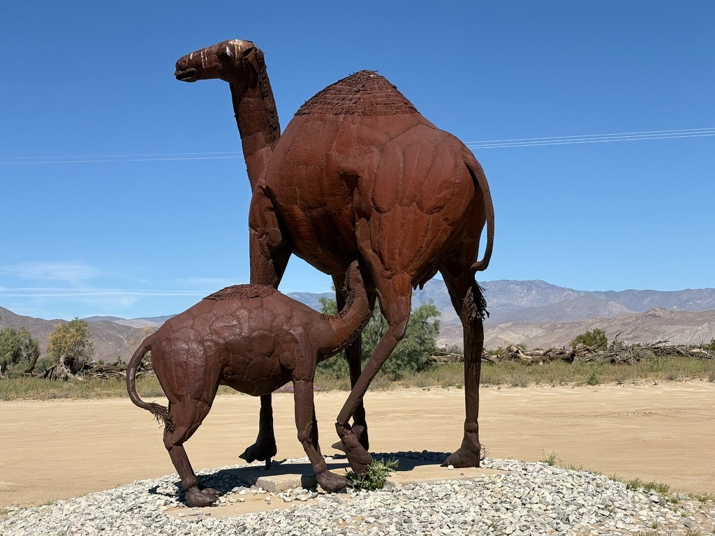
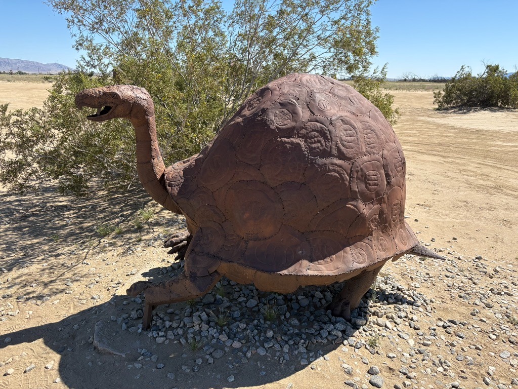
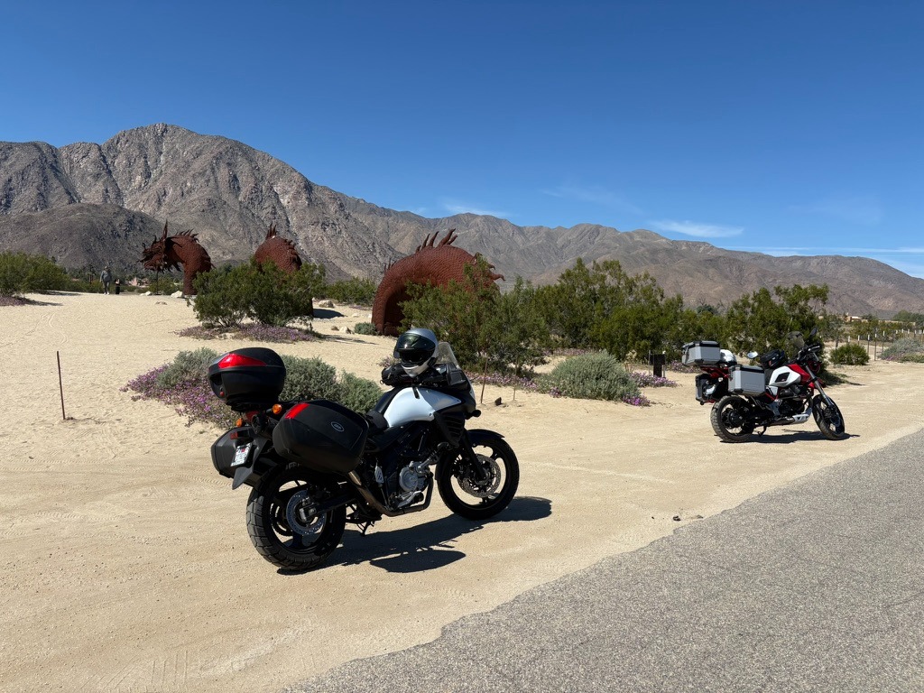
However, comfortable morning temperatures and stunning vistas incentivized exploring The Sky Art Sculptures of Borrego Springs.
As the noonish temperatures rose, we only visited a few of the 130 full sized metal sculptures that roam the Galleta Meadows Estates property nearest the pavement. The rising temps and unpaved sandy soils leading to many of the prehistoric Ricardo Breceda figures in the Galleta Meadows were more challenging than we wanted to hazard. As noted, the sculptures compensated for the absence of blooms in the lower elevation Anza-Borrego Wildflower Fields. Ya should’a been here two weeks ago, was that familiar refrain in town.
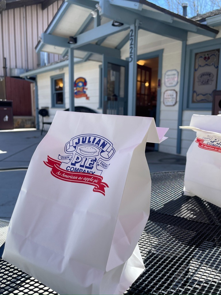
Blan B: Apple pie in Julian…
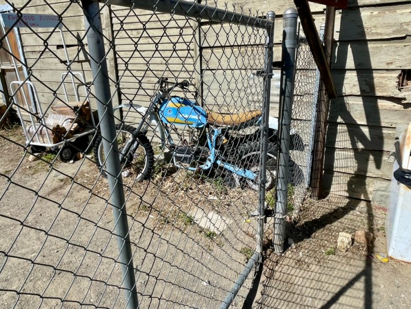
and motorcycles blooming from the desert soil
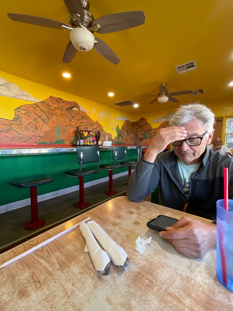
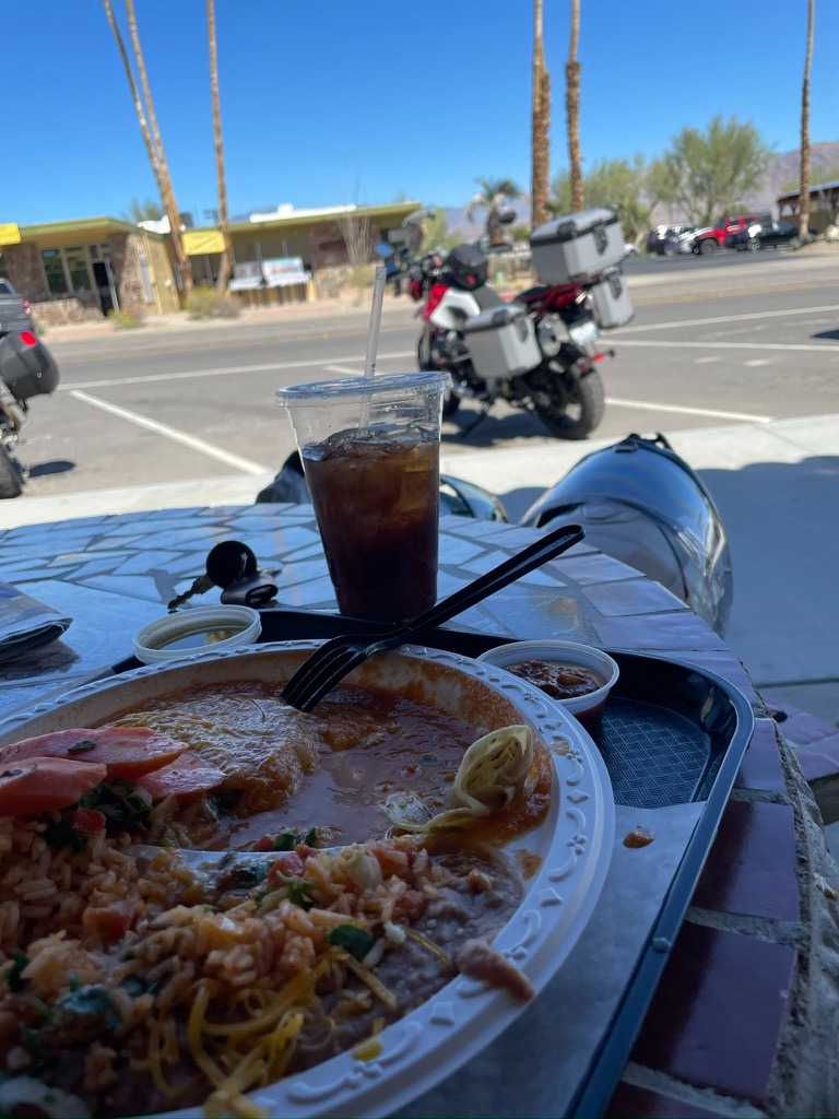
Since rising temperatures caused the collapse of the lower elevation bloom, it was off to Julien. But not before our next Mexican Restaurant, Los Jiberto’s on Palm Dr in Borrego Springs. The huevos rancheros were a solid 2nd place on the Sisyphusian Mexican Restaurant Ranking Index (SMRRI) thus far for the Anza-Borrego Ramble.

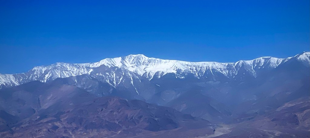
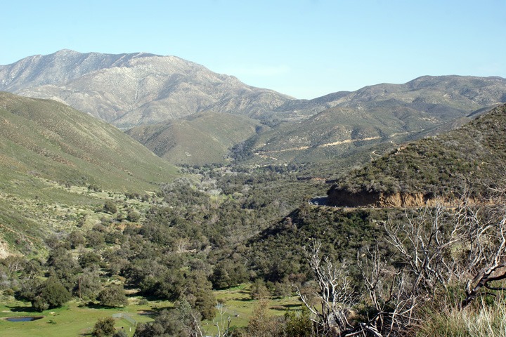
The Salton Sea is at -236 feet (below sea level). Badwater in Death Valley, the lowest elevation in North America at -282 feet. By contrast, Borrego Springs is 597 feet above sea level. Julian is 4,183 ft above sea level and in those last thousand feet of elevation gain, the Mediterranean chaparral and woodlands bioregion was much cooler than the lower Colorado Desert region. It was nothing compared to the heat warnings issued in the region as I write this after our ramble.
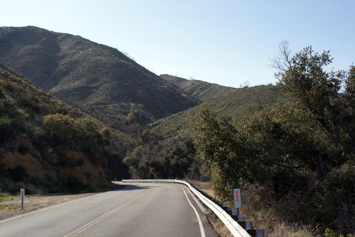
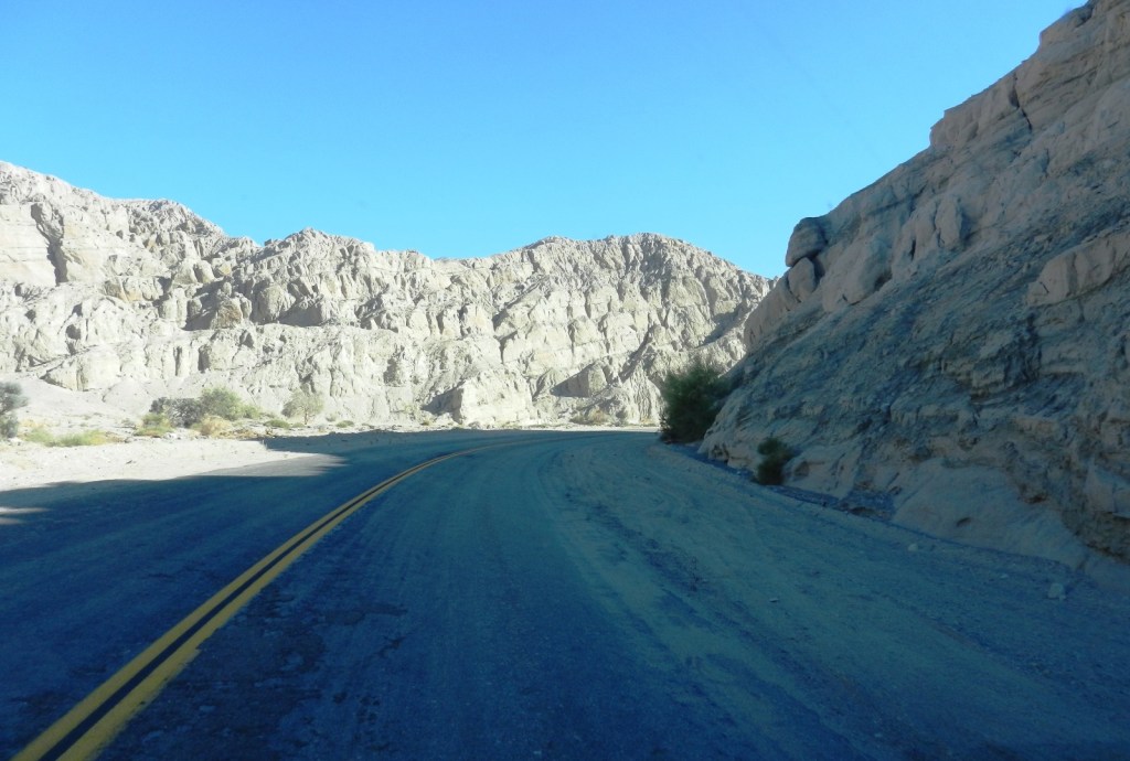
From Borrego Springs we headed out on Borrego Springs Rd to Yaqui Pass Rd that merged onto CA-78 to Julien. Great twisties and superb pavement up Banner Canyon and virtually cager free.
The plan was to get a slice of the ‘world famous, Julian Pie’ for dinner since our late breakfast at Los Jilberto’s was sustaining us on our ramble into and out of the State Desert Park. Check out Julian, with Huell Howser.
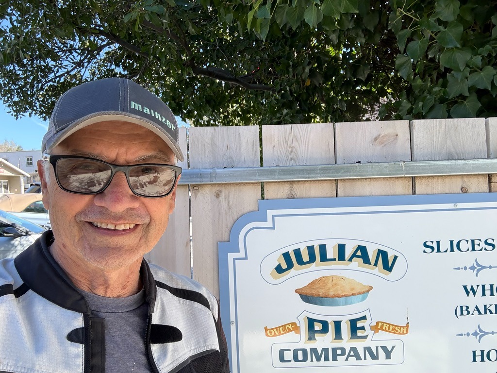
Not bad for a an “anti-influencer” with no social media accounts
From Julian we decided to loop on CA-79 through Santa Ysabel to San Felipe and Montezuma Valley Rd back to Borrego Springs.
We stopped in Borrego Springs for 3R’s camp beverages and made haste back to the campsite. We had been living with ourselves for three days on the road and a shower seemed every bit deserving haste. A stroll to the beach followed rinsing off the grime.

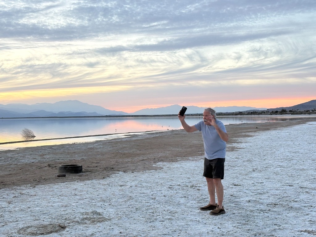
After exhibiting our lame Instagram senior influencer photo skills it was back to camp for a couple of episodes of the Desert Oracle, pausing as each train averaging 5-7 minutes in duration, rolled past. Sisyphus enjoyed a nice pinot and SMAP enjoyed his Modelo trifecta as we reflected on the day’s ramble hoping to see a UAP. As usual, we only spotted identifiable aerial phenomena. We elected to finish off the Fritos in lieu of saving the Julian pies, Dutch Crumble and Classic Apple like Grandma used to make, for breakfast.
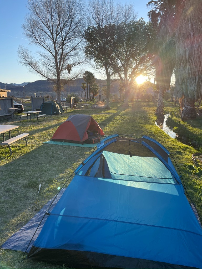
Day 4 – Salton Sea State Recreation Area to Shoshone via Joshua Tree and the Mojave Reserve Itinerary
New Camp/Salton Sea to Shoshone: 251 mile
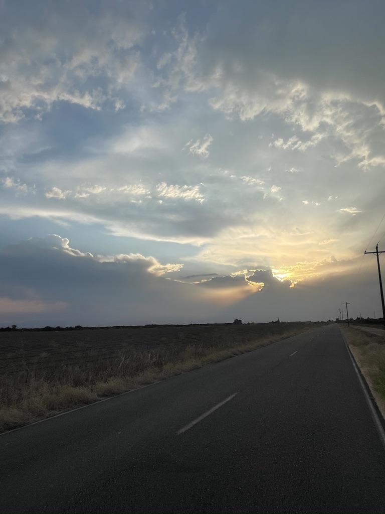
The day began with a lovely sunrise (despite the train). Pleasant and cool, not cold, but the clouds that filled the morning sky indicated a change in the weather. After a fog-lifter and delicious Julian Apple Pie, we began to break down camp as the breeze morphed into a full-blown wind (You like that?). Fortunately, what little condensation on the tents evaporated quickly.
Having decided against getting gas returning from Anza-Borrego yesterday, we had to backtrack 11 miles to Mecca, get gas, turn around, and get lost until finally finding Box Canyon Rd that would take us to Cottonwood Springs Rd and Joshua Tree by way of the southern entrance.
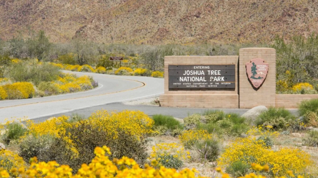
It was too windy to stop and sight see, except we had to layer up near the entrance to Joshua Tree, as wind whipped temps were quickly dropping uncomfortably as we gained elevation.
Full Blown Wind
How windy was it? I walked over to an information kiosk, hoping to shelter from the unrelenting wind, I struggled to zip my quilted vest and rain layer into my mesh jacket. Always a step-ahead in circumstances like these, SMAP emerged from the double-wide handicap equipped porta-potty where he layered up under his mesh kit to watch the Guzzi nearly tip over as it was buffeted by 40 mph gusts. I rushed over, jacket and liner flopping wildly to prop up the Guzzi.
After a harrowing costume refit, we mounted our bikes and set off on the Pinto Basin Rd across the Joshua Tree National Wind Tunnel to the Utah Trail Entrance in Twentynine Palms. When the direction of the road had the wind at our backs, you’d have no idea of how severe they were. Blasted by a cross wind, the bike handled like a bronco, intent to buck us buckaroos onto the pavement. Not wanting to focus on anything but keeping the bike upright, there was something of a blur of yellow along side the road, a bloom, perhaps? Laying the bike down in a formidable gust is not how I’d prefer testing the ATGAT performance.
We arrived in Twentynine Palms, rattled by crossing the park in wind conditions that were even more tumultuous than a trip out of Panamint Springs the year before. On that windswept day, CA-190 south was covered by sand, making the road disappear before our grit-filled eyes. At least this day we didn’t have to deal with grit and motor homes being blown across the center lines that were invisible…
Fast food? Not in Twentynine Palms
Our appetites needed pleasing and we didn’t want to waste a minute for a protracted sit-down brunch so we opted for a Subway. Because I have all of these fancy camera mounts, phone mounts, tank bags, glasses, and caps requiring my attention, I never win the dismounting contest. So, by the time I entered the shop, SMAP ordered his sandwich and was eating.
Just prior to my entering the shop, an interesting trio of customers had entered and were ordering their meals.
A middle-aged fellow who seemed to be in charge of this crew ordered a Thursday Sub-Club deal. The nice counter service woman said that the Twentynine Palms Subway didn’t participate in the Sub-Club deal (whereby you basically got one-dollar off of the cost of a 6 in. Thursday Turkey sandwich special). She then said that for the same regular price of a 6 in. turkey sandwich, you could have the bonus of a fountain drink and bag of chips. It was Thursday, so it was a Thursday Sandwich special, but not a Thursday Sub-Club deal.
He insisted he didn’t want the drink or chips, but wanted the Sub-Club deal. The cashier finally convinced him that the Thursday special was a better deal than the Sub-Club deal because the chips and soda amounted to more than the one dollar off Sub-Club deal. Reluctantly, he went ahead with the transaction, sort of. After having two credit cards declined, he finally had another patron who was apparently with him, along with the older woman and younger man, who then paid for el jefe’s meal. About ten minutes had transpired. I noticed SMAP was nearly done with his sandwich.
It was then that the older woman who was a member of this group ordered a personal pizza. Then she asked for a sandwich. As the patient counter service woman helped her through determining whether she wanted a pizza or a sandwich, the woman insisted on the pizza. Cheese. By then she was having an ongoing conversation with no other participant apparent. It sounds like she was arguing about whether to have a pizza or sandwich. I didn’t know Subway made pizzas.
Another younger gentleman, though well into his latee 30’s, who appeared to be fashionably attired in skater clothing, also a member of this band, ordered a “sandwich with everything.” The patient counter service person was able to go through all of the options for ‘a sandwich’ including ‘everything’, item by item. The fellow answered, “with everything”, each time the woman listed a topping. This went on for a minute or two because there are lots of toppings at Subway. Oh, lest we forget bread options.
He went to pay for his ‘sandwich with everything’ with a credit card but was confused about the use of the reader. The middle-aged leader of the group then intervened. He was kind of short with the fellow, grumbling about his inability to use his credit card. I thought this ironic since minutes earlier he had just had two credit cards declined. What didn’t he know about how credit cards worked?
By the time I finally ordered the Thursday ‘Not Club’ Special, 6” turkey with iced tea and vinegar chips, and sat down, SMAP was done and ready to exit. I wolfed down my sandwich listening to the fellow who ordered the sandwich with everything remonstrating about the jalapenos bringing tears to his eyes.
After having spent more time than a seven course Mexican brunch would have required, we finally made our way north through the Sheephole Valley Wilderness in the Mojave Preserve to Amboy, Donald Fagin and Nightflight serenading me.
Amboy
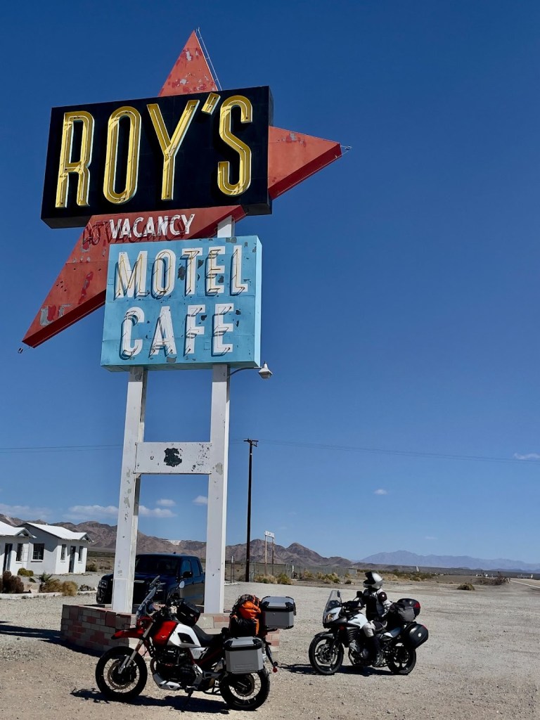
We opted for a brief nalgas stretch and a ‘Gives You Wings’ beverage at Roy’s in Amboy. If you don’t know about Roy’s I invite you to do your own research by clicking on the link.
We noticed several motorhomes and smattering of classic cars. A group of car show enthusiasts were preparing for the upcoming weekend’s Amboy’s Rte. 66 Cruisin’ Car Show | 2026 | Amboy, CA. The wind was still howling and we wondered about the scale of the show.
One of the organizers we talked to was excited to share the growing popularity of the show where last year over 300 cars attended, despite the venue being in the middle of the Mojave, 50 miles from Twentynine Palms, 74 miles from Baker, and 80 miles from Barstow. Our promoter friend traveled 136 miles from his home in Boron. Here’s a photo of this year’s event from CarCruiseFinder.com. I didn’t count the cars, so I’m not sure they exceeded last year’s gathering.
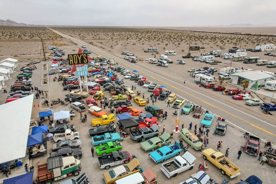
We spoke with the owner of the green Pontiac with the roof patina and the raised hood in the lower right part of the photo. He, his wife, and friend traveled from near Laughlin, Arizona. I didn’t ask, but I wondered if one of the motor homes was his. Otherwise it was a bit windy for setting up a tent. Another YouTuber, Wonderhussy filmed her appearance at this year’s show the day after. Check it out at Wonderhussy Adventures
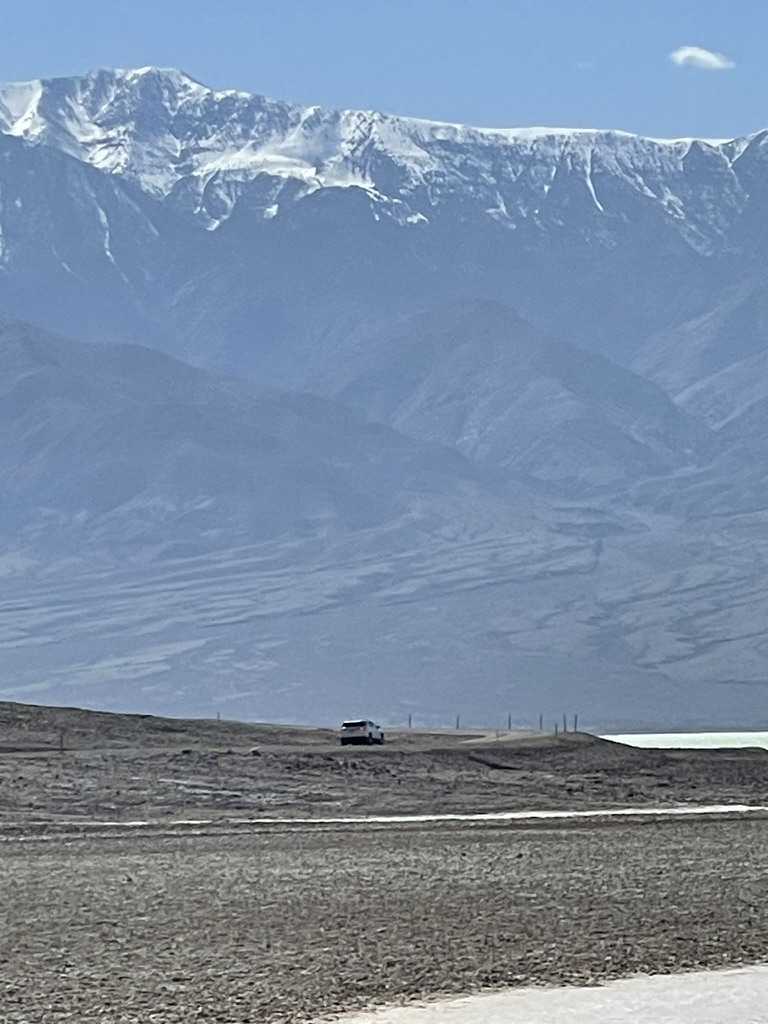
From Amboy we crossed the Mojave National Preserve passing Granite Peak, the Kelso Dunes, and the Kelso Depot, on the Kelbaker Rd. (a mash-up of Kelso-Baker) enroute to Baker where crossing under I-15 we stopped for fuel. Noting the World’s Biggest Thermometer, one of three major attractions in Baker (the other two, Alien Jerky and the Mad Greek Restuarant), it was pegged at a comfortable 74 degrees as we set off on the remaining 56 miles on Death Valley Rd (CA-127) to Shoshone.
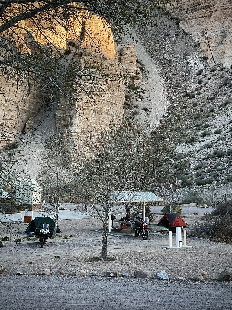
Shoshone
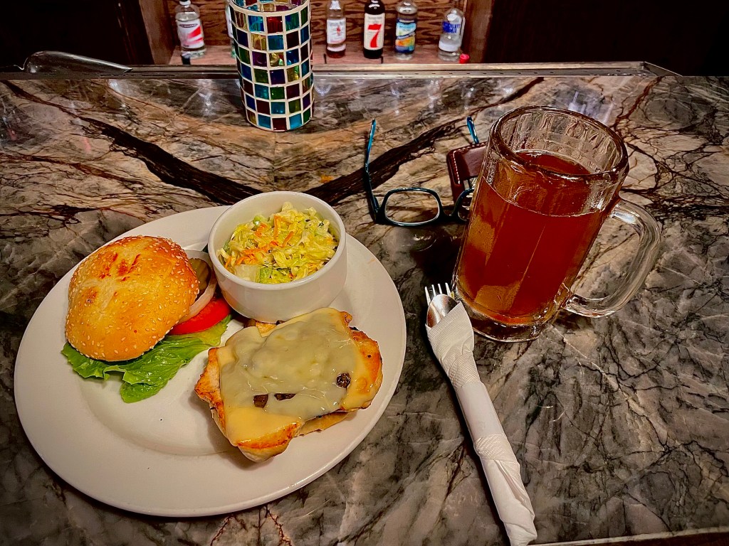
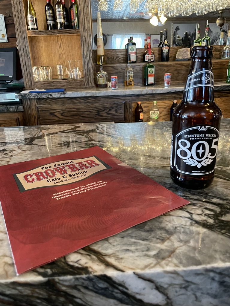
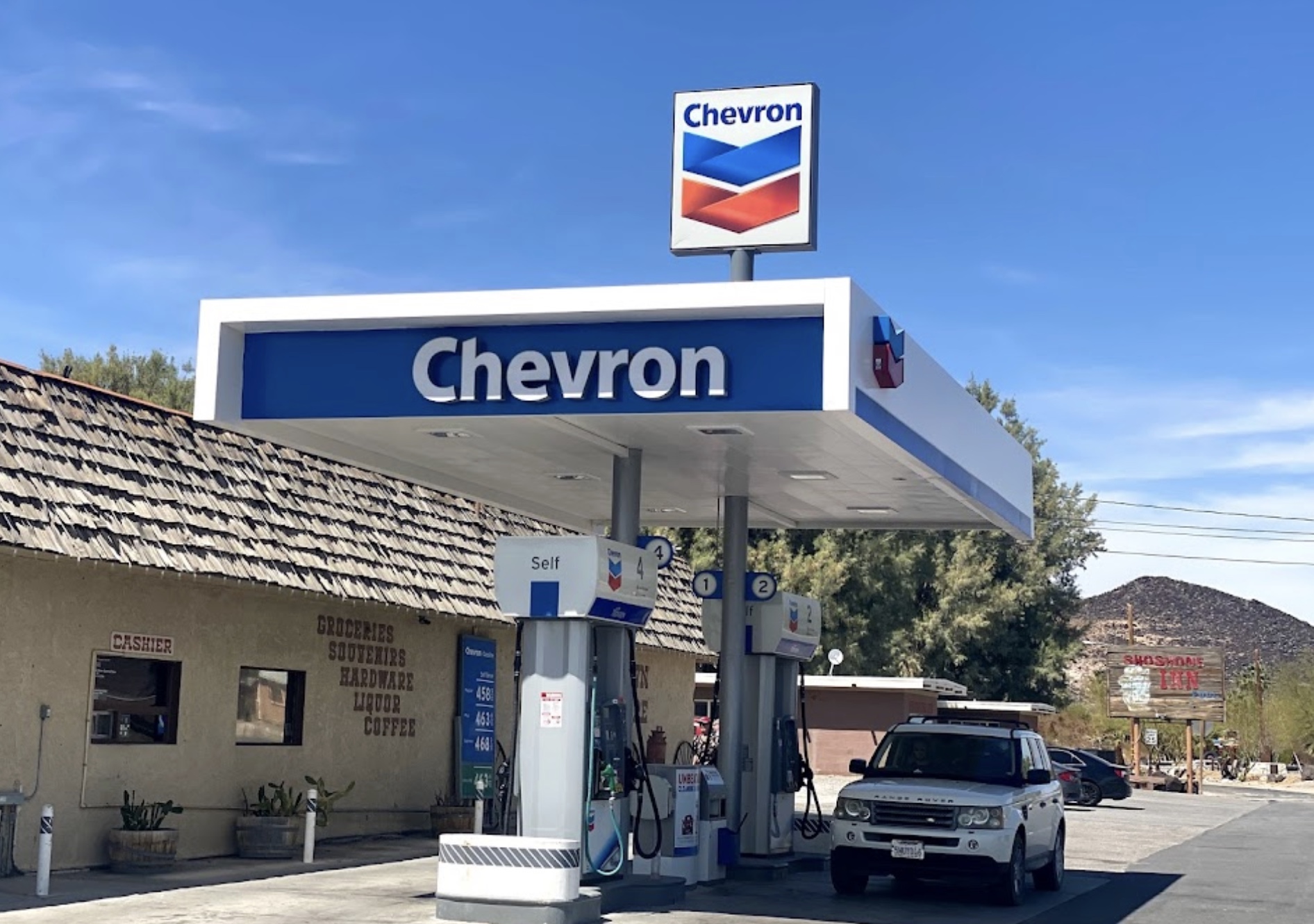
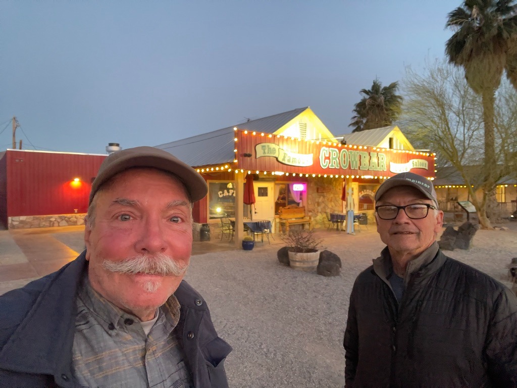
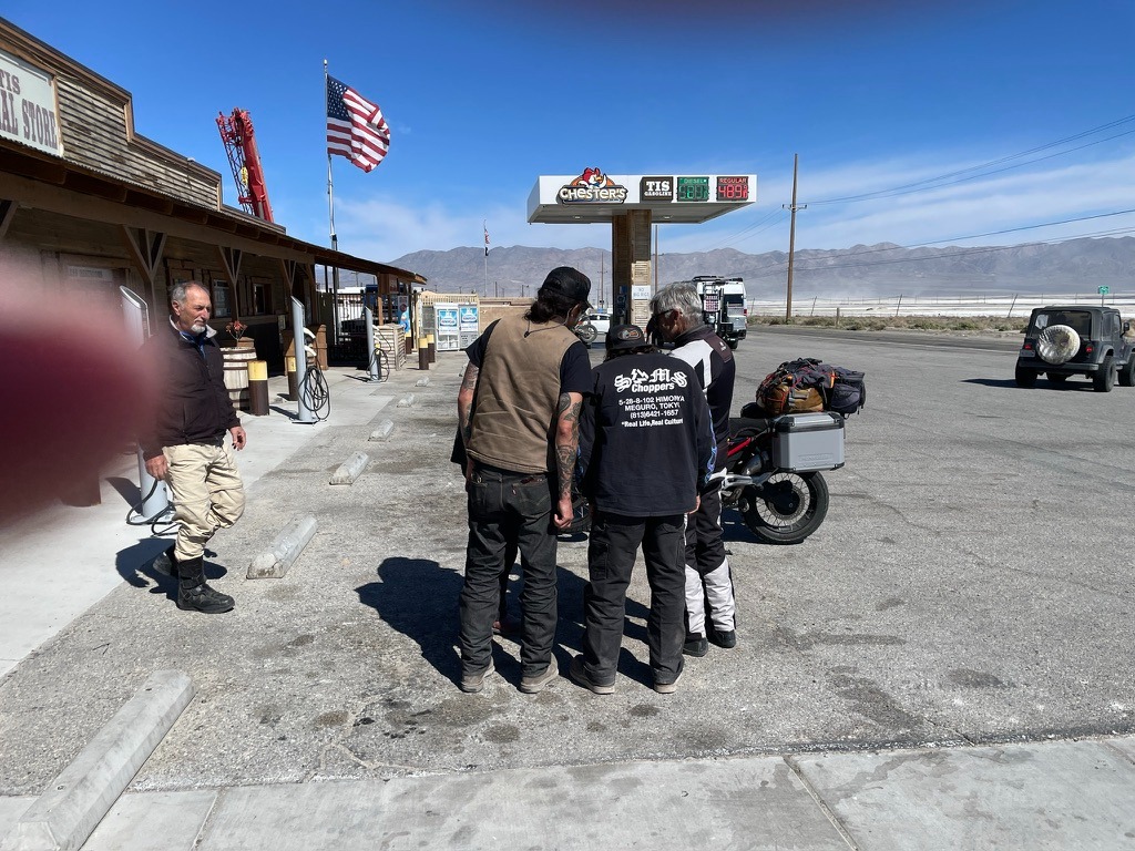
After struggling to set up camp in gusting 20 mph winds upon our arrival around 4:00 pm, by sundown, as we strolled into town population 22, the winds died down a bit. Dinner at the Crowbar is always a treat. SMAP and Sisyphus love Shoshone Village. After clicking on that link, I guarantee you that Shoshone’s appeal will find its place on anyone’s bucket list!
My eyes are red from the desert dryness. We stopped at the Chas. Brown Market to procure our 3R’s beverages and snacks. Pete opted for his usual and I upon the recommendation of the store-keeper, in his sharp navy Chevron shirt, a red blend . A wine that he assured me was “top shelf” though it was on the bottom shelf. The only shelf with wine in the store. Turns out it wasn’t too bad, my expectations somewhat lowered by fatigue.
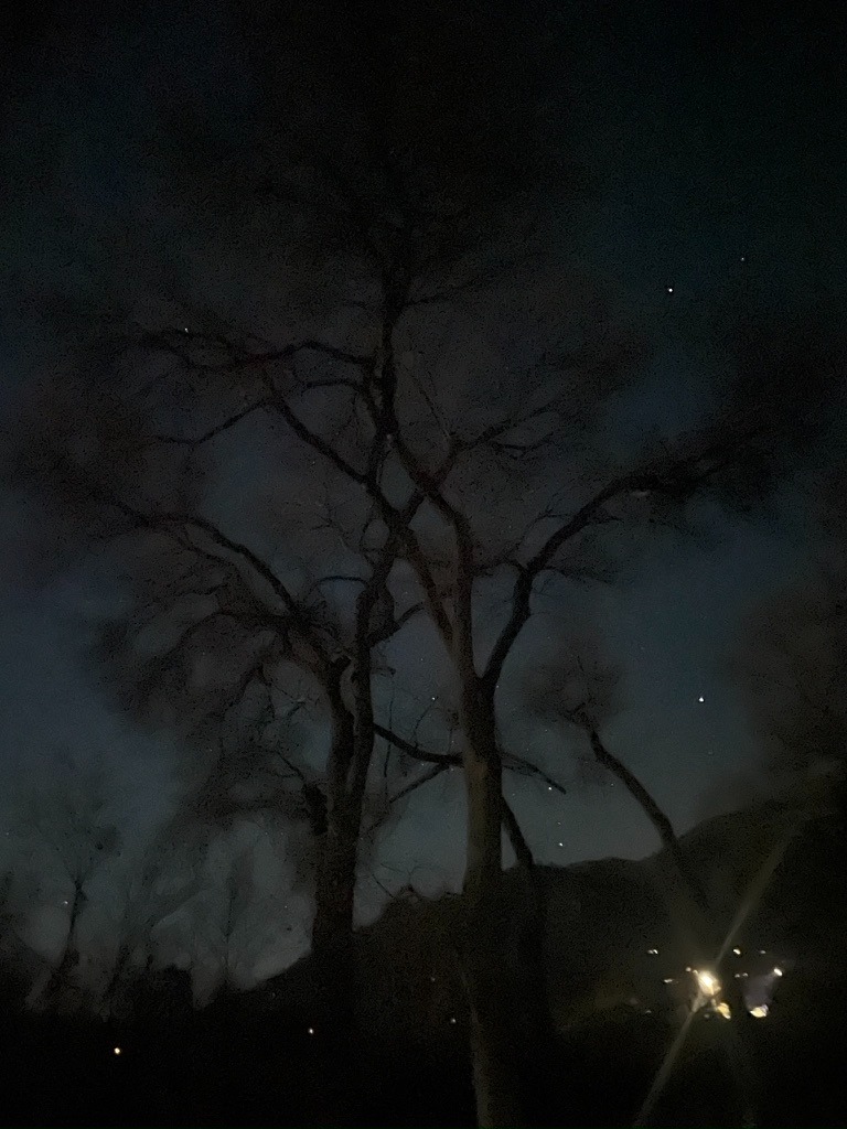
A pleasant evening watching the sun fade and the night sky reveal familiar constellations is the cherry-topper despite whatever perceived challenges were on the day that got us here, there, or anywhere on a ramble. Engaging conversation, hopeful that a UAP might be sighted, followed by a comfortable night’s sleep fittingly concludes a day in the saddle. Even when occasionally interrupted by the mule train, tolerated as the middle of the night stroll reveals an entirely different set of constellations above. If we’re lucky, a coyote’s yelp can be heard above the rustling of the palm fronds in the night’s soundscape. Perhaps even a shooting star in the periphery whereupon a wish may be granted.
First light and sunrises, sunsets and last light are favorite times of the day on a ramble. The promise of the next day’s ride perhaps topping the previous tickles our imaginations. Full moon nights are equally enchanting. What the reflected sunlight off of the moon’s surface does to illuminate the night is equal to a new moon’s revelation of the Milky Way. Then there are all of the phases in between, each providing its own unique nighttime profile.
“The moon shines bright. In such a night as this,
When the sweet wind did gently kiss the trees
And they did make no noise, in such a night
Troilus methinks mounted the Troyan walls
And sighed his soul toward the Grecian tents,
Where Cressid lay that night.”
The Merchant of Venice (Act 5, Scene 1)
At first light I reach for my camera, set up the JetBoil, and await the sunrise. It’s extraordinarily quiet save for the sounds of awakening birds, a breeze blowing through vegetation, and an occasional jake brake heard from a nearby roadway. I try to find the best vantage from which to capture those moments when the first rays break the horizon. Then I let my phone’s camera do the work that I will later savor as an image, reimagined in this blog.
Day 5 – Shoshone via Death Valley, Panamint Springs, and Walker Pass to Kernville Itinerary
Shoshone to Kernville: 241 miles
at the Amargosa Opera House in Death Valley Junction
It would not be a desert ramble if we did not pay our respects at the Amargosa Opera House. It’s only a few miles into the day, if departing, or a few miles remaining, if arriving, from or to Shoshone. It has become something of a harbinger of a noteworthy day to come or of an evening of gratefulness that our day on the bike would soon take rest, our safe travels completed.
We have apparently missed our opportunity to enjoy the funkiness of a stay at the Amargosa Inn along with the cafe suffering post Covid decline. I’ve abandoned staying in hotels whose criteria includes see-through, derm-abrasing towels and faux wood paneling. I was cured on our Santa Fe ramble when in Chama, New Mexico we stayed at the Y Motel.
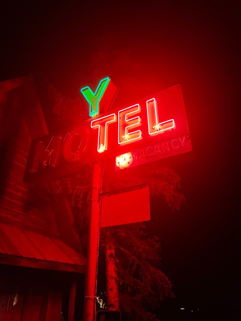
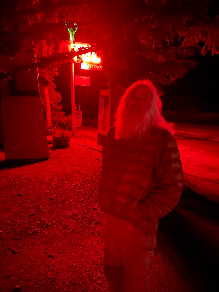
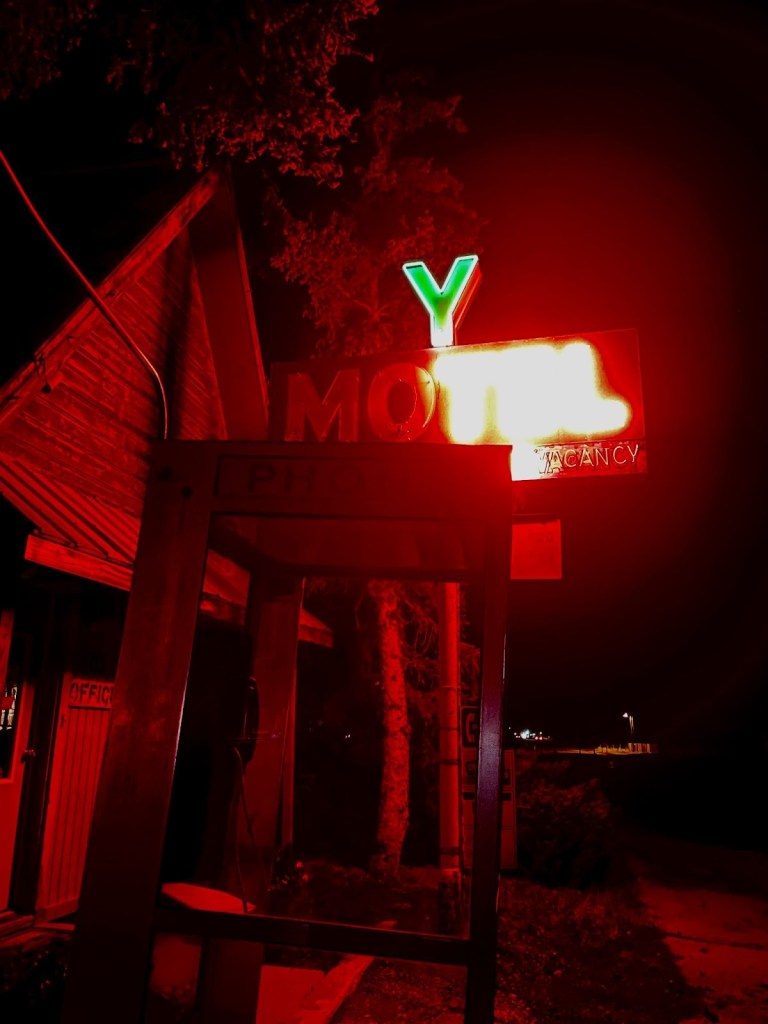
The Y Motel was a known crash site for Continental Divide Trail hikers. The gentleman above and a fellow hiker emerged from the storm-battered trail that night, claiming the last two rooms along with us. You can read about our New Mexico ramble at 2021 Fall Moto: Abbey’s Other, On-the-Road Trip, Part 1.
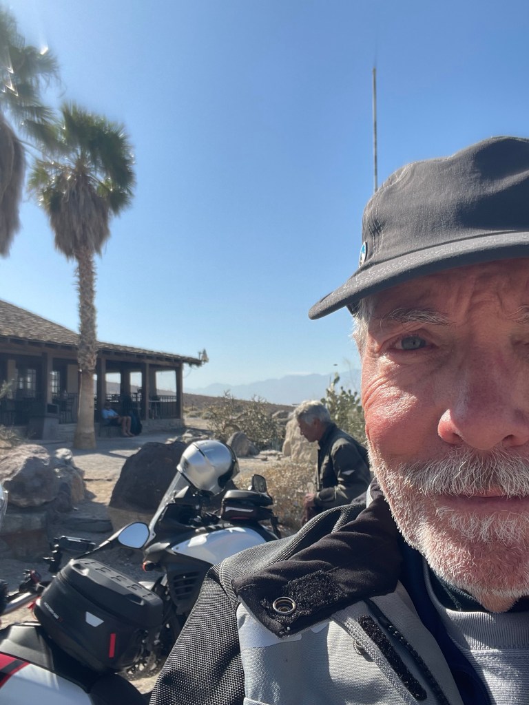
Panamint Springs Resort
Our plan was to have lunch at another favorite desert destination that welcomes motorcyclists.
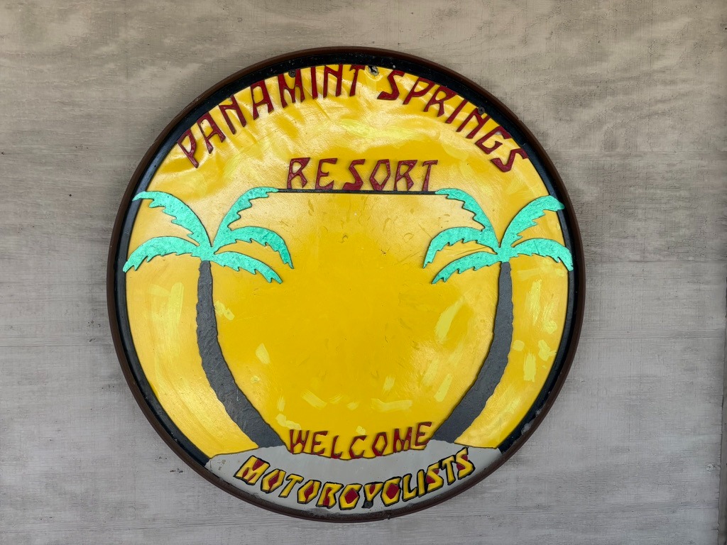
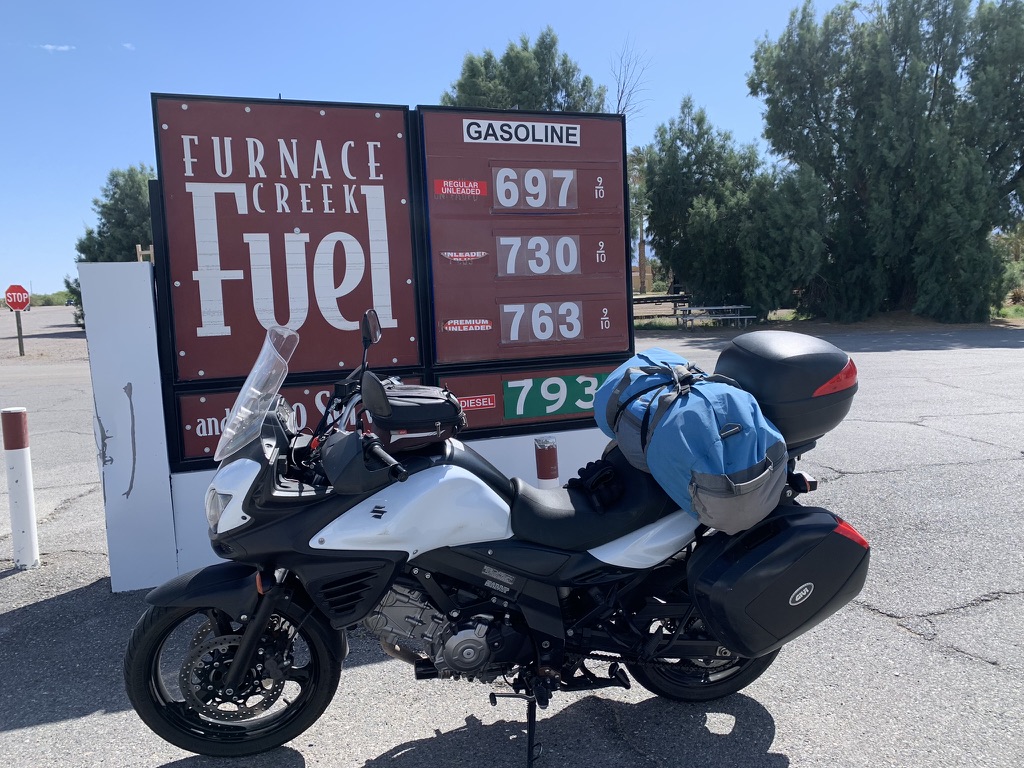
I’ve written about the “resort” at Panamint Springs in prior blogs. Panamint Springs is no Furnace Creek Inn. However, the restaurant is pub-grub solid with quite an array of adult beverages. Like the Chas. Brown in Shoshone, there is a separate store featuring the usual camping essentials and some interesting gems and of course tee shirts and caps. There are a few casitas and yurts in the campground for the less hearty visitors and a rocky campground for other, heartier visitors. Of importance, Panamint Springs has the only petrol between Stovepipe Wells and Trona or Lone Pine.
There were two other ramblers, one on a KTM 790 and the other on a Tenere 700 seated at the porch of the restaurant dining alfresco. After placing our order inside we made our way to an adjacent table and engaged in the usual banter about where we’re headed, where we’ve been, how long we have been out.
When we mentioned that we had visited the Salton Sea a few days earlier, the KTM owner chimed in with a story that his great, great, great uncle was Kit Carson. He went on to say G, G, G, U Kit had written in his diary (that KTM guy’s family possessed) that he and a pioneering party led by Carson had trekked across the dry desert playa of the Salton Sink en route to Los Angeles. This was before the Colorado River breach. KTM guy then alleged that upon his return east, Carson’s party was disoriented because there was now a sea where before there was only desert causing them to wander aimlessly for days.
Frauds, like good Mexican cuisine, is were you find them
I immediately began to question the validity of his story. First of all because I knew that Kit Carson often exaggerated versions of his exploits where many became the subject of dime novels in his lifetime. Maybe the KTM guy mistook his great, great, great, Uncle’s diary for dime novels as his primary source?
I am an avid reader of California history and the history of the West. I noted earlier in this piece that the present Salton Sea formed in 1905 when the Colorado River flooded the basin, the result of botched flood control. I also knew that before the Salton Sea, Lake Cahuilla, its Salton Sea predecessor routinely formed in the sink. I read that on a kiosk at the Salton Sea campground. The last significant filling of Lake Cahuilla occurred around 1733. By the early 1800s, the lake had already begun to dry up, with historical accounts indicating that it was likely dry by the time of Juan Bautista de Anza’s expedition in 1774.
Here’s my rub with the pompous KTM blowhard dispensing dubious historical claims on a resort porch: Kit Carson lived from 1809 to 1868, and in between 1846 and 1848 he visited southern California guiding military and delivering important messages. That is in the historical record. Also in the historical record, neither Lake Cahuilla or the Salton Sea was in existence during Kit Carson’s lifetime. The bloke on the Tenere, blowhard’s partner, must leave his ear plugs in to preserve his sanity.
Call me a skeptic. If it sounds too suspicious to be true, it’s likely untrue, unless proven otherwise. Drop the mic!
6 Days into War in Iran
Our tanks were showing two bars and so we decided to pay $6.18/gal for premium (flashy Moto Guzzi drinks champagne), rather than make our way south on CA-190 to Trona for 51 miles that we would easily be able to do with those two bars. In Trona I would have paid $5.25/gal of premium. SMAP’s decidedly not flashy Suzuki uses pedestrian grade, in Trona for $4.87/gal. Add a dollar more to each since February 28… I’m a better skeptical historian than I am skeptical of the accuracy of my fuel gauge.
From CA-190 that passes in front of the Trona High School, we were shocked to see it appeared to have been demolished. This is school whose football and baseball fields were turf-free sandlots. You had to be gritty to play football or baseball in Trona. We later learned that The Searles Valley Mineral Company that mined trona, a mineral that is a source of sodium carbonate, also known as soda ash at Searles Lake across the highway was in the process of closing. It appeared that the town was not far behind.
Soda ash is used in various industries, including glass manufacturing, detergents, and chemical processing. It seems that the Chinese have cornered the soda ash market too. The plant is closing and so massive layoffs have occurred.
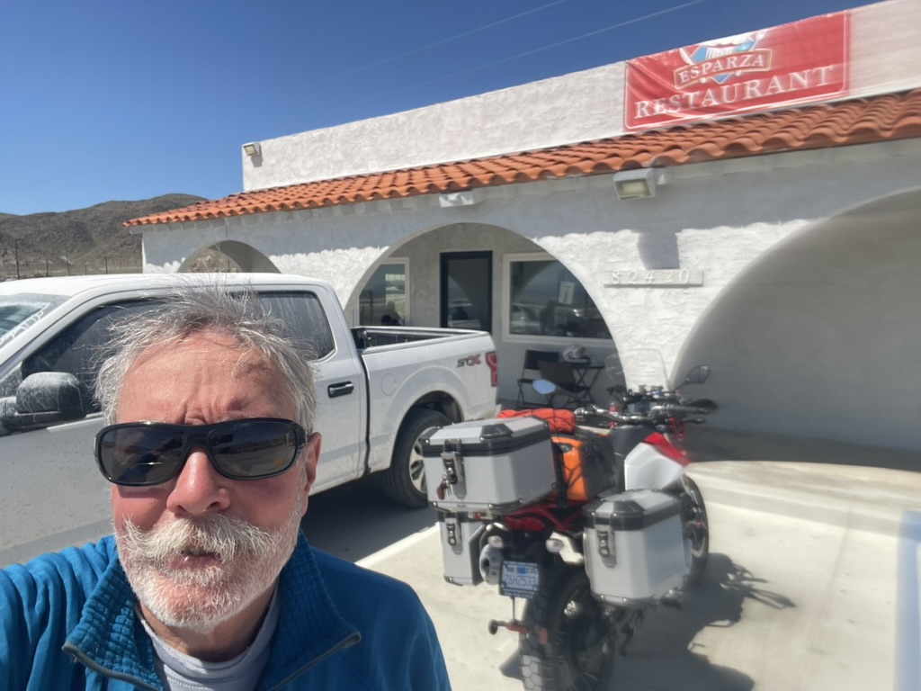
Trona seems to have bad Karma. The town was heavily impacted by a series of earthquakes seven years ago. One of our favorite Mexican Restaurants, Esparza’s, (a solid 2nd place on the SMRRI tied with Escobar’s in Kanab, UT) occupied the old Trona movie theater that was condemned following the earthquake. The restaurant relocated on Hwy 190 not far from where we stopped for a nalgas break. The future doesn’t look too bright for Trona, likely the next Eastern Sierra ghost town.
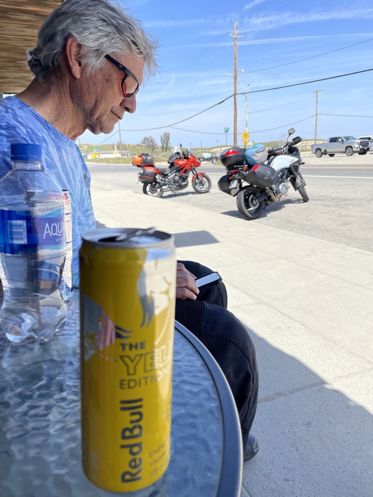
Giving the nalgas a break and throwing back a sugar-free Redbull (Ha! Sugar free, like the other soylent green chemicals in the can, are less harmful?) I’m sure we paid as much per unit for the Redbull as a gallon of gas would cost us.
Bob-Phil
Finishing up acquiring RB wings, SMAP noticed there was another Moto Guzzi that had just pulled up to the TIS gas station and General Store. The rider, who we acknowledged, was wearing a full Aerostich one-piece suit with a BMW Club patch sewn onto the chest. After exchanging amazement that we both had run into one another on a motorcycle that is rarely seen, in of all places, Trona, he went into the General Store for some Chester’s Fried Chicken. A full Aerostitch suit is also a rarity.
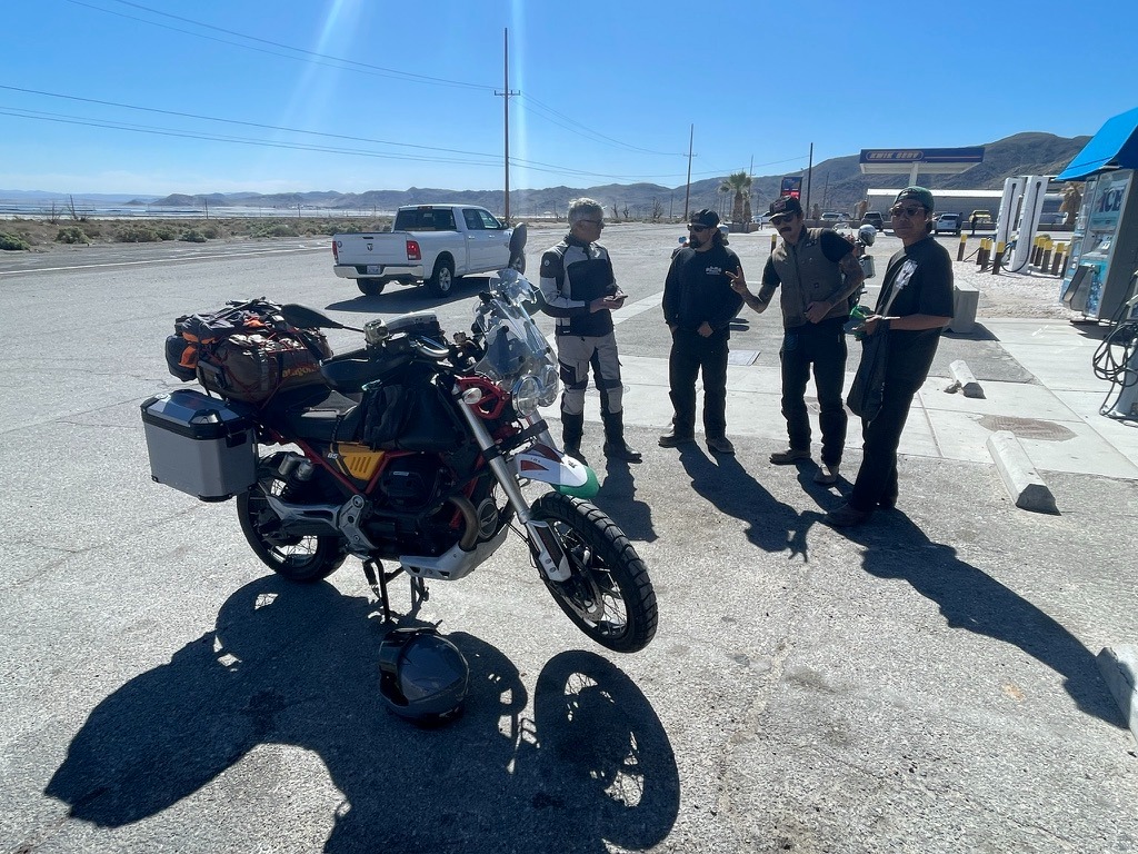
When he emerged, the conversation arose about how his 2020 Moto Guzzi V85TT and my 2022 version were similar and different. He was on his way to a BMW meet-up in Death Valley which made sense as we had seen dozens of BMW ADV bikes on the roadways since the Salton Sea.
Phil, who first introduced himself as Bob, shed the full Aerostich suit with a BMW Club patch stitched on the chest. It seemed to me to fit this character whose hand I shook, as I stated my name, to which he replied Bob, assuming that was his, who was going to a BMW meetup in Death Valley on a Moto Guzzi.
He then went on to share his harrowing incident having taken Bowman Rd, a dirt shortcut from CA-14 to CA-178 in Ridgecrest. His character fit again was seamless, like the panels in his Aerostitch outfit. It seems that he hit deep sand in a wash and dropped his bike trapped beneath its considerable weight. Fortunately a fellow short-cutter in a pick-up came along and together they dug him out of the sand, righted his Moto Guzzi, and were able to paddle-push it across the wash. Remarkably without injury. No doubt it had something to do with the Aerostitch suit. Maybe the BMW patch was responsible in some heeby-jeeby way for the Moto Guzzi fail?
More Bob-Phil character: As he’s manhandling a fried chicken thigh, gnashing on the tendons, he asks for me to start my bike to listen to the transverse cylinder exhaust grunt to compare to his modified exhaust. After listening to the jaguar-like growl of my bike, he went to start his bike, for comparison sake, and nothing. Had that been me, I would have cursed as panic would be welling up. For Bob-Phil, he calmly inspected the side stand noting that in the accidental wash-drop, the kill switch feature that won’t allow the bike to start with the kickstand down while the bike is in gear, must be malfunctioning.
After putting it on the centerstand, he remarked that he had a friend in Death Valley at the rally who could rescue him or his girlfriend back in Pismo Beach, also a rider, could bring their moto-trailer out to pick up the bike. Key on, ignition switch engaged, and the Guzzi came alive! His diagnosis of the side stand, confirmed.
A small, but enthusiastic, cheer went up by the small group who had assembled. Just then a scruffy looking desert rat in a bright pink pair of pants, pink shirt, pink shoes walks by with pink sun baked complexion, completely oblivious. As he departed, he looked somewhat disgruntled at this group gathered around the entrance to the General Store. I didn’t think we looked that sketchy.
Without a pause, Bob-Phil looks at him then looks at us and shugs. Character? Heck, he’s an Oracle!
on the left and yes, that’s me pointing to him
As all of this was happening, a group of four guys who were fueling up their pick-up, noticed the two Guzzis. They were as amazed as we were to encounter two same model, different year, flashy Italian bikes in Trona. SMAP, on his ‘decidedly not’ flashy Suzuki, sensing that all of the attention was going to the bewitching Italian beauties, whips out his phone to distract the chopper dudes with photos of his seventies era Harley Sportster and sixties Triumph Bonneville he once owned. Like moths to a flame, they huddled around SMAP, oohing and awing.
Check out his Chucks
Once the chopper guys reacting like Harley guys regained consciousness, they introduced themselves as chopper guys from LA who were taking their friend, a fellow chopper guy from Japan, on a tour of Death Valley. Like us they assumed some sort of motorcycle event was taking place conscious of the number of motorcycles heading in the same direction. One of the dudes explained that their Japanese friend didn’t speak English and none of them spoke Japanese.
Motospeak, the universal language
The Japanese guy and I had a conversation, of sorts. He uttered, “I no speak, English,” “They no speak, Japanese,” “We love motocycle,” “All you need”.
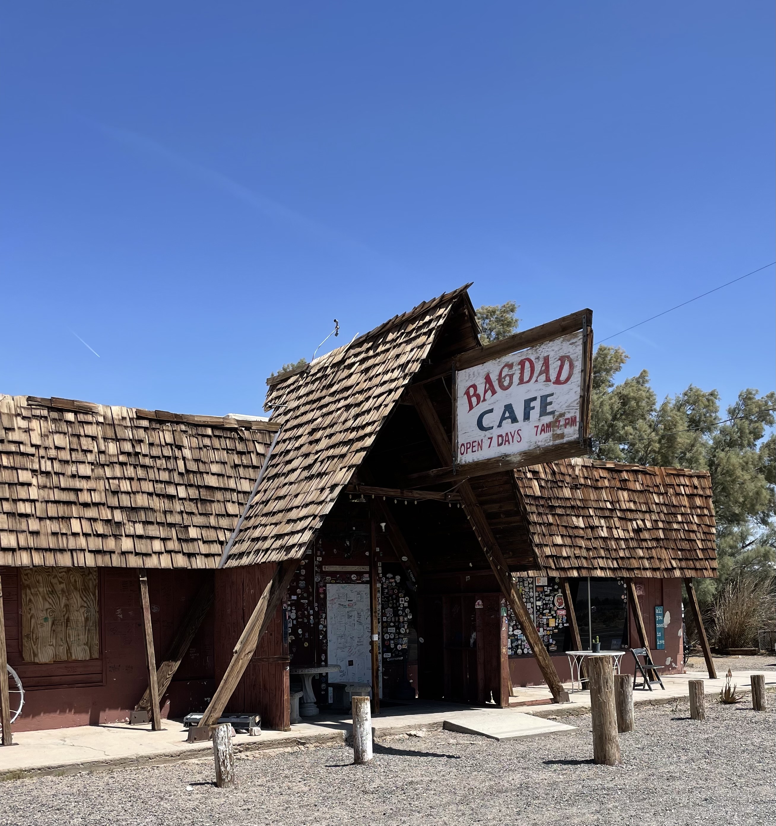
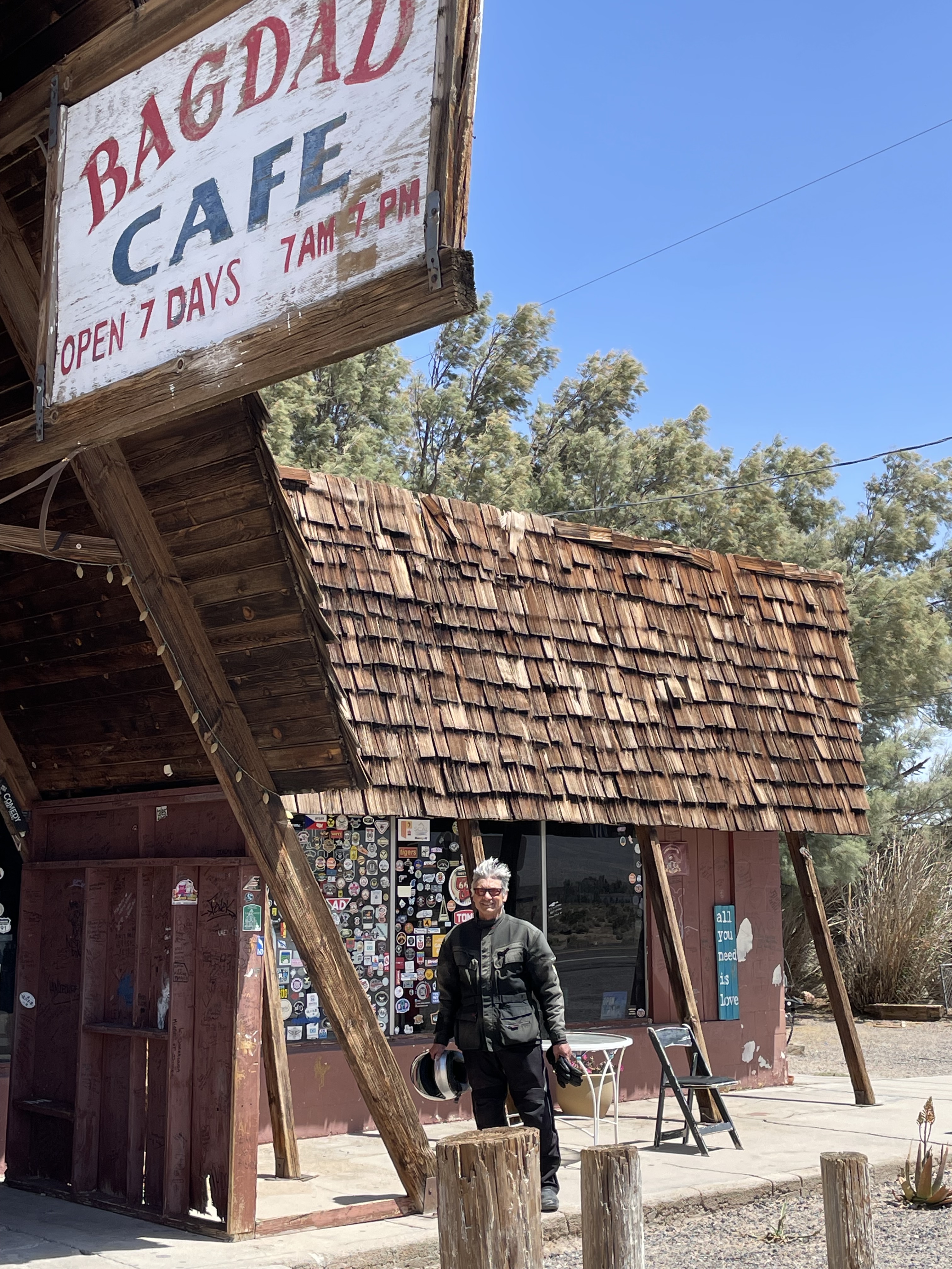
With that and a fist bump, the Japanese chopper guy’s t-shirt back, emblazoned with “Real Life, Real Culture,” made all of the sense in the world!All of this at the TIS General Store and Gas station in Trona, CA… This could have been a scene right out of Baghdad Cafe. Well, maybe the sequel…
As we parted company, I gave Bob-Phil my Sisyphus and Associates card with contact information. We had talked about the Moto Guzzi National Owners Club rally calendar. He said he’d get information about an upcoming event in Nevada out to me. He was as dedicated to the Guzzi as the BMW. Perhaps if we meet at some future Guzzi rally, I can buy him a Moto Guzzi patch for the Aerostitch suit. Perhaps to neutralize the bad BMW patch juju.
Before getting on the bikes to head to Kernville, I asked him which was it? Was it Bob? “No, I’m Phil.” He looked puzzled.
I said, “But when I introduced myself, you replied Bob.” Once again, Phil looked at me and shrugged.
I did get an email (evidence of his real name) from Phil:
Subject: Hi from Phil. You met in trona
From: Miki Dora <philterez@gmail.com>
Tue, Mar 10, 2:39 PM
to: me
https://www.mgnoc.com/rally_calendar.html
Info on mg rally. Hope you had a great ride home. I had a great ride and rally with all the guys at the death Valley rally. The lowest the oldest, the windiest and the dustiest Bmw rally.
His name may be Phil, but “You met in Trona” from Miki Dora? That Miki Dora? <philterez@gmail.com>, continues to elevate the mysterious Oracle, Bob, Phil, and/or Miki from Trona…
Onward to the Kern River Canyon
My head was swimming either from the Redbull wings or the tableau that had just occurred. Without getting turned around in Ridgecrest we continued on CA-14 to CA-178 over Walker Pass. Only a few wildflowers were in bloom on the south facing slopes up the pass. Taking the Sierra Way Rd, a back entrance into Kernville, was unexpected as the road had been closed for years as a bridge over the South Fork of the Kern, just outside of town, was being repaired.
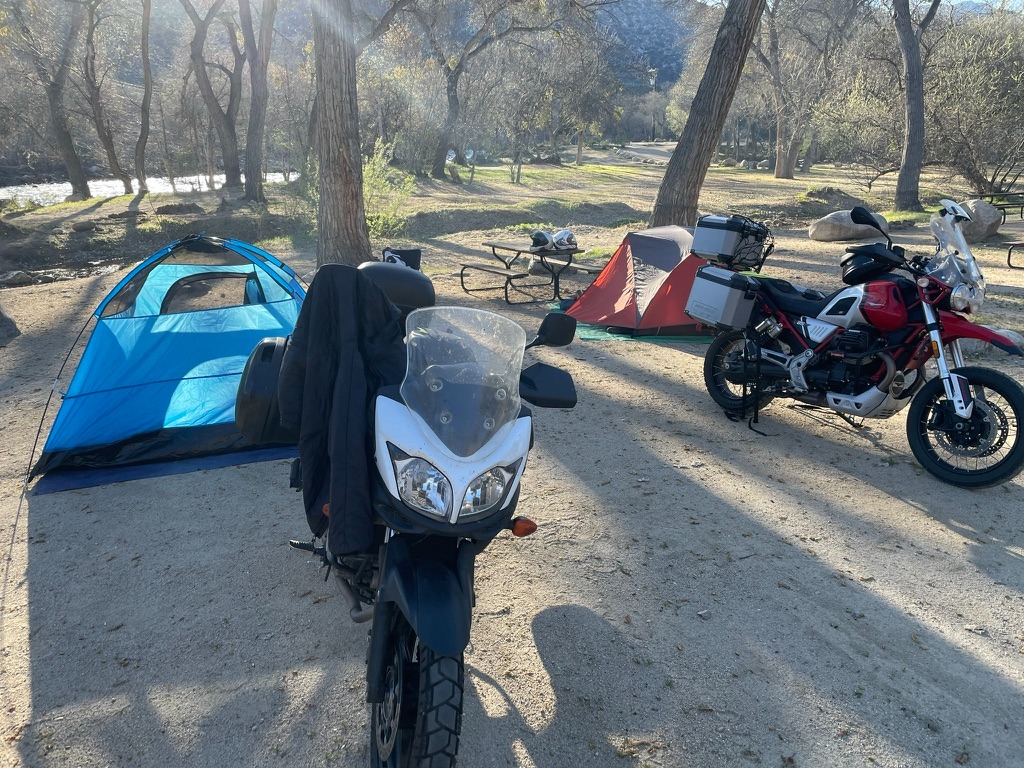
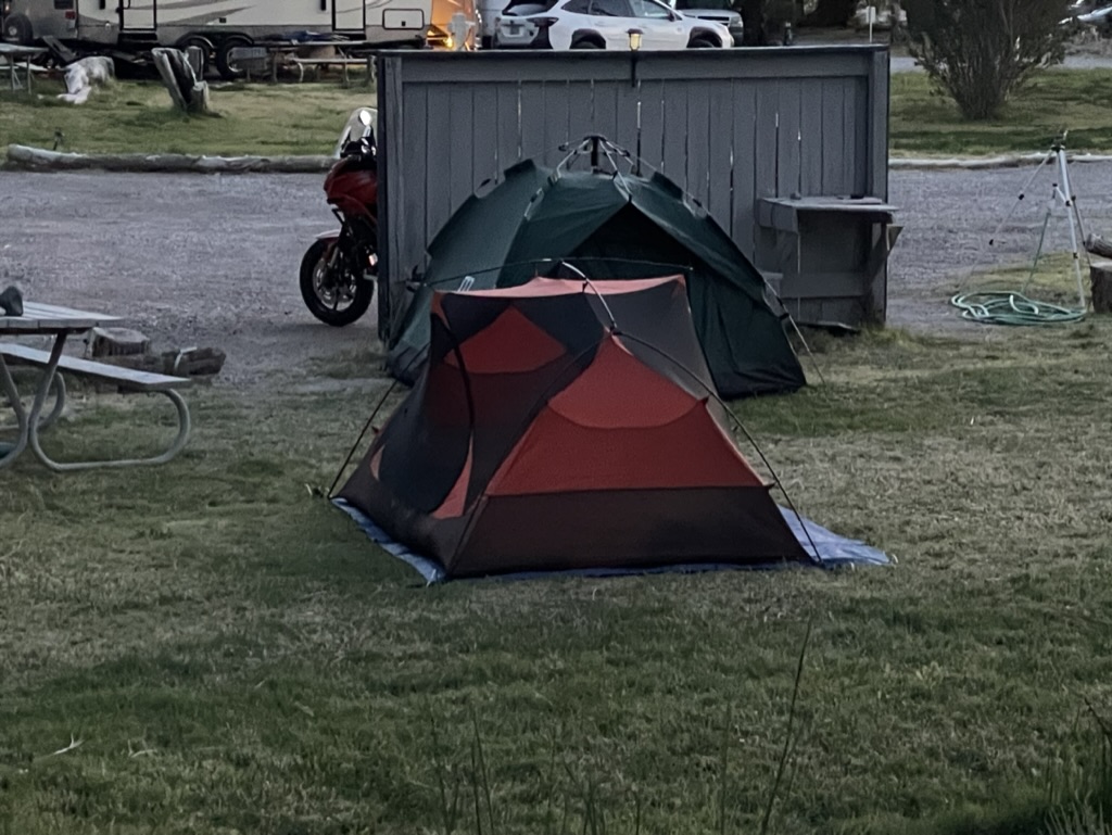
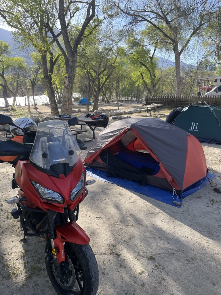
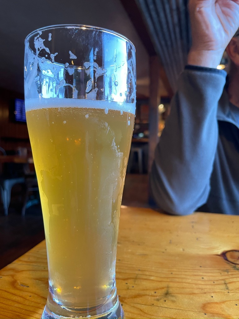
We rolled into the Rivernook Campground, and were met by a welcoming staff member who, after exchanging our deep mutual regard for Australian Cattle Dogs, gave us several options about where to pitch our tents. SMAP and I settled on a riverside campsite. We setup then headed into town for grub at the Kernville Brewing Company. SMAP ordered a classic Greek salad and I opted for a Tuscan salad, both were delicious with toothsome ingredients.
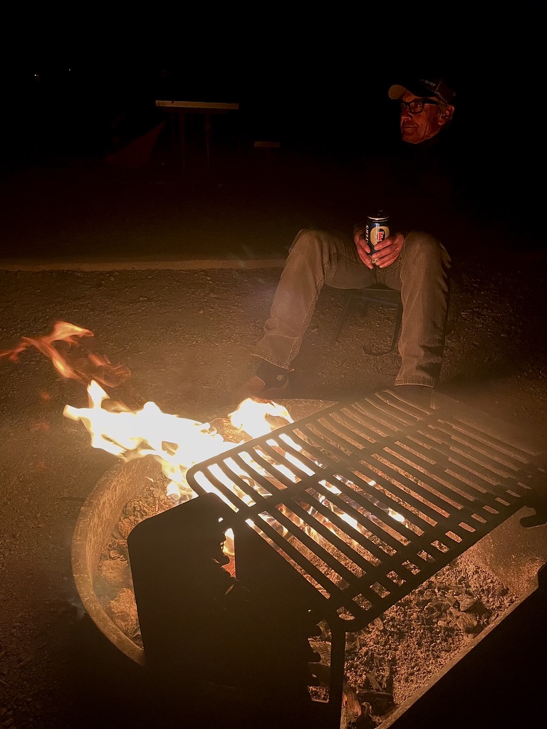
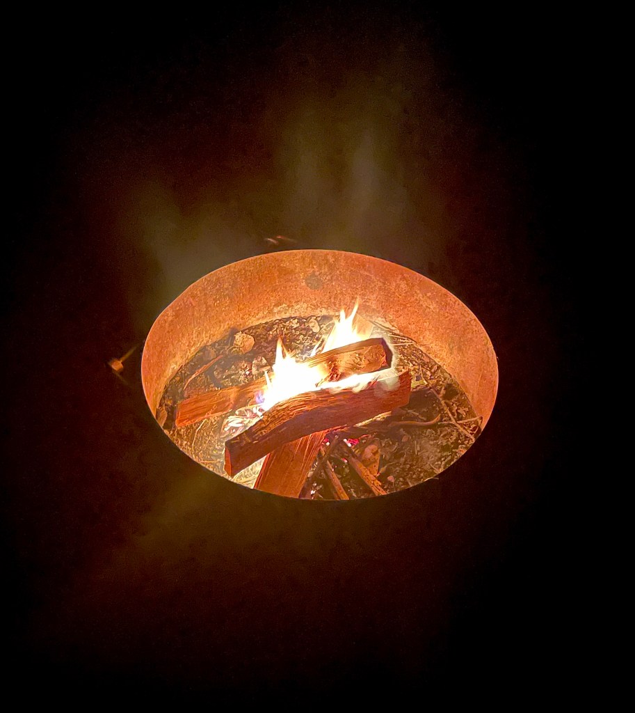
After our only campfire on this ramble and the usual 3R’s, we tucked in for the night, sweetly serenaded by the Kern River, awakening to a frosty Saturday morning.
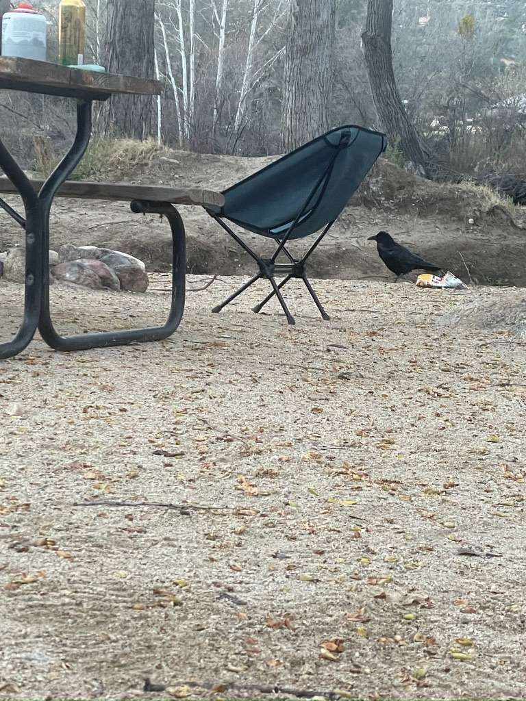
You should be accustomed to our preference of Fritos as an accompagnement to the 3R’s. Crunchy, salty, and palate cleansing, Fritos help make the medicine go down.
Speaking of Fritos, we awakened at first light to a couple of ravens arguing about something. It appears that ravens have the same taste as do we.
In Cambria, it was racoons who took advantage of our inattention
Day 6: – Homeward Bound to Merced
Kernville to Merced via Sierra Foothills: 253 miles
Kernville to Merced via the Eastside: 228 miles
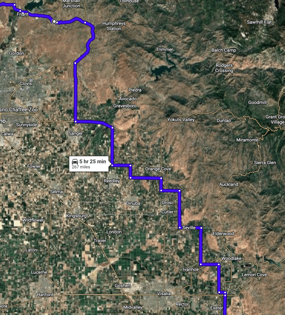
We packed up and got underway for the final leg of the Anza-Borrego, Salton Sea Ramble. Our intent was to take CA-155 into Porterville by way of Sierra Alta. After about a half-mile on Evans Rd west of Wofford Heights, just after our comms fritzed, I spotted a road closed ahead sign ahead. SMAP, who can spot a heron on the side of the road at 75 mph, or a Harley flathead from across the median on an interstate, apparently missed the sign. The Cardo’s weren’t working, but since he lost me in his rear view, he turned around. We then opted for the following route, now inspired as that would take us through Terra Bella: Kernville to Merced via Terra Bella: 267 miles.
When nothing is better than Chef Boyardee
This was a back-track through Oildale by way of Hart Memorial Park where at the entrance we stopped at a Mobile station for a snack. I had a customary Redbull (sugar-free) and SMAP, famished at this hour having worked our way through the Kern River Canyon twisties (sans Fritos) came out of the mini-mart with a can of Chef Boyardee Ravioli. We motored on to the public restrooms in the park because once again, having asked if there was a restroom available, the brusque proprietor admonished us for asking, hastily adding that the restrooms were out of order just as he had in twice, in previous patronages to his station.
No Fritos, but salted sunflower seeds paired nicely with my sugar-free Redbull. SMAP was not proud of eating Chef Boyardee Ravioli, cold, out of the can. But, that’s how to handle a hungry man decidedly not interested in culinary propriety.
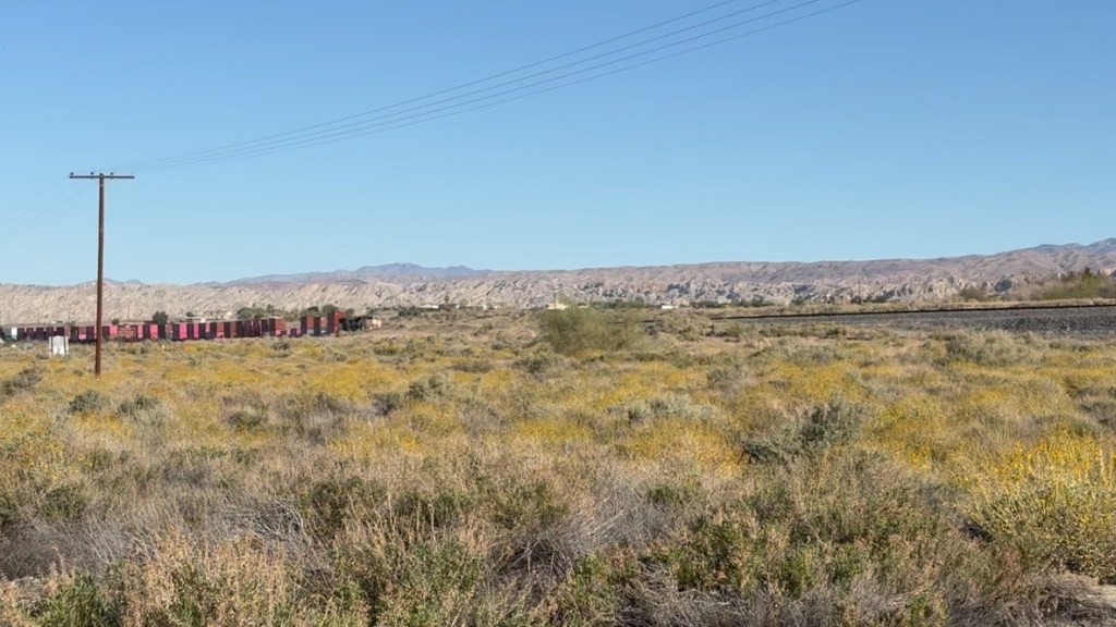
Welcome to Flavortown, Terra Bella
You might ask, what’s so interesting about Terra Bella? Earlier I noted the Sisyphusian Mexican Restaurant Ranking Index or SMRRI. It just so happens that we discovered what appeared to be David vs Goliath across from one another on Terra Bella Avenue: Amigo’s Restaurant and the enormous Seaton Farms Pistachio Processing Facility. We had stopped there on a previous desert ramble for our typical mid-day meal, the one big meal of the day that would only later be supplemented by Fritos. It was off-season for pistachio processing so the Goliath lay slumbering across the road, hardly noticed.
SMAP and I agree that Amigo’s is not only the first place finisher on this ramble’s SMRRI, but may well be, the highest ever gold-medal-ranking, podium-summit restaurant on the SMRRI–well, since Roberto’s in Taos closed. A silver medal tie goes to Escobar’s Mexican Restaurant in Kanab Utah and Esparza’s in Trona.
When we first spoke with the waitress (co-owner) recalling our previous visit a couple of years back and the outstanding hand made corn tortillas we had at the time, she claimed to remember us. After going over the menu, SMAP ordered the carnitas enchiladas with green sauce, and I the chili rellenos topped with chili verde both served with rice, beans, and corn tortillas as recommended by our gracious server.
Inspired by watching so many episodes of Pati’s Mexican Table, I asked her about the regional influence of the deliciously rendered recipes. She replied that they derive from Tijuana, and it’s all about the preparation of good ingredients that combine to make the flavors so unctuous and satisfying.
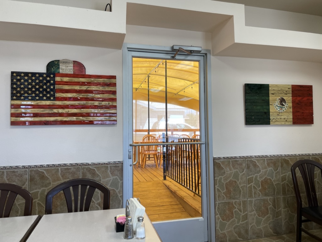
The wooden flags on either side of the door were made by patrons of the restaurant. Through the door at the back is the patio where the Tuesday and Friday buffet takes place
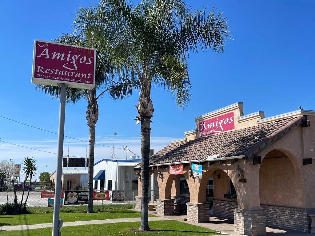
Amigo’s is a must visit!
Zagging and zigging on CA-65 through almond, pistachio, citrus, and olive orchards and the myriad small agricultural communities each about seven miles apart, we zigged and zagged even more to our next stop in Friant.
After a quick fuel stop and nalgas relief in Friant we ended our ride, safe at home, in the loving embrace of our families with memories of yet another ramble that takes its place on the mantle that if ever asked, “So, what’s the favorite ramble Sisyphus and your Associate, SMAP have taken?” Our reply, “The next one…”
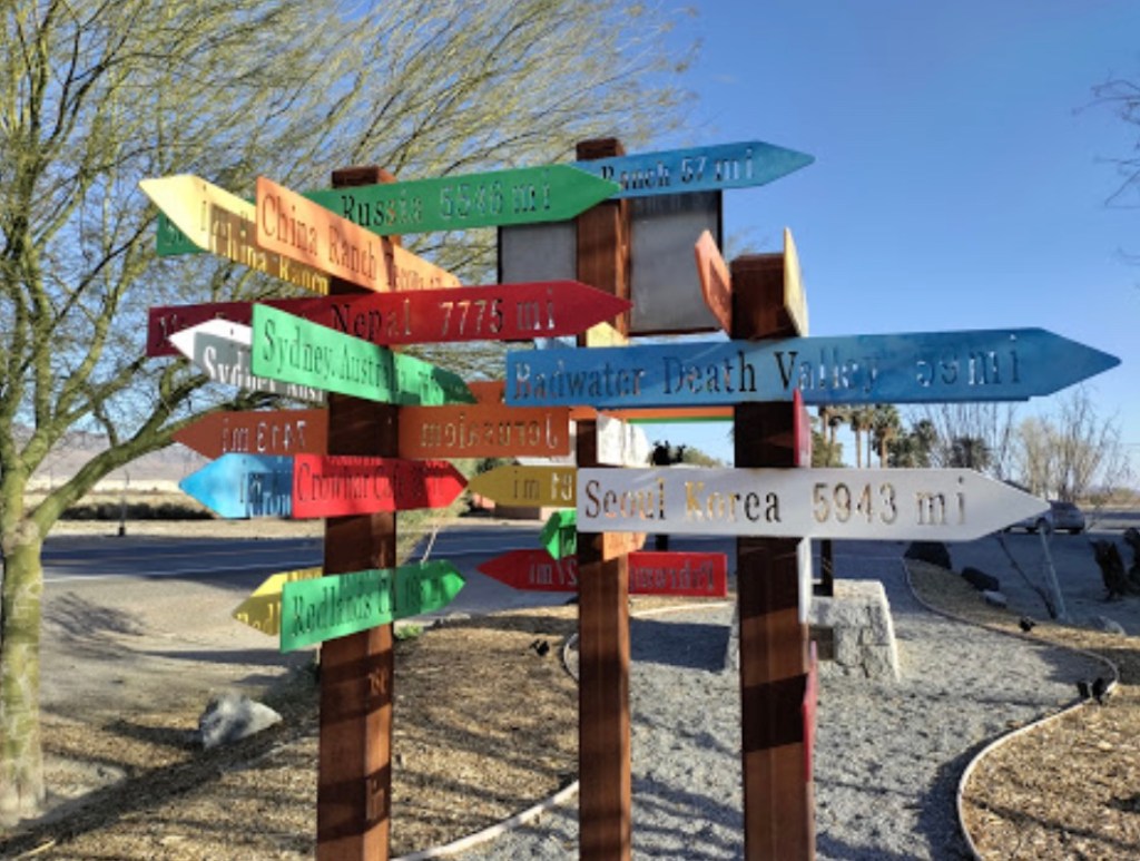
Thanks Bair, for the advice http://www.whereisbaer.com/
Epilogue
Just a few days after our return, I spotted this in the news: Train Crash Near Salton Sea
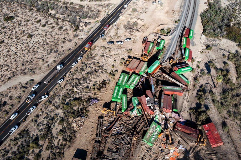
On March 19, approximately 20 Union Pacific railcars carrying 40 containers jumped the tracks near Parkside Drive and Highway 111 in the Mecca-North Shore area of the Salton Sea. The location of the derailment was virtually across from the entrance to where we pitched our tents at the New Camp Campground about a quarter mile away. Trains would lay on their horns approaching the Parkside Dr. intersection throughout our stay. So much for your Prime two-day shipping…
.