Camus said we must imagine Sisyphus happy. I'm living proof…
Author: Sisyphus and Associates
As of 6/2026 I will have taken my 72nd revolution around the sun or 26,198 rotations on the big blue marble through space. Time to share a slice of all the physics, biology, and stewardship I’m guilty of. Something of a Sisyphusian task.
In June 2024, I will celebrate my 70th birthday. Seventy revolutions around the sun (years) and 365.25 x 70, 25575.5 earth rotations (days) since my birth in 1954.
In the year of my birth as a native son, 1954, the population of California was 12.75 million (June 1954).
My birthplace, the city of Merced’s population in 1950 was 15,144. This figure represents a 49% increase from 1940 to 1950. It’s reasonable to assume at a ~5% growth rate, Merced’s population in 1954 was around 17,500(+/-).
I’ve randomly chosen three events of some importance that occurred in 1954 America:
1. U.S. tests hydrogen bomb at Bikini Atoll
2. The Supreme Court rules on Brown v. Board of Education, stating that segregation in public schools is unconstitutional
3. Joe DiMaggio wed Marilyn Monroe
Out of curiosity, I wondered what was going on, seventy years prior to my birth, back in 1884 America:
1. The Statue of Liberty was unveiled and dedicated by President Grover Cleveland.
2. Huckleberry Finn was published by Mark Twain.
3. The Washington Monument was dedicated in the Nation’s Capitol.
140 years of water under many bridges.
What will three noteworthy events might be listed in 2024?
1.
2.
3.
Go out on a limb and speculate what three events might occur in 2094, seventy years hence
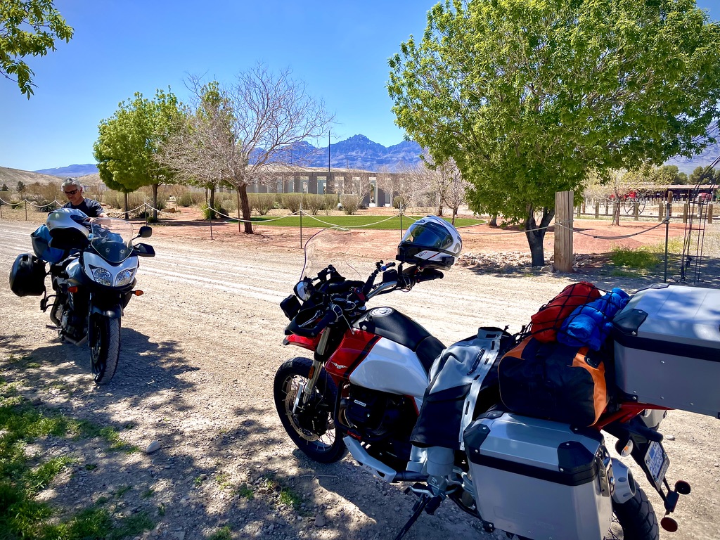
The journey of a thousand miles begins with a single step, a proverbial phrase fittingly describes the writer’s extensive desert adventure. Facing wintry challenges, they embarked on a meticulous journey, blending familiarity with the unfamiliar for an enriched experience. From Red Rock Canyon State Park in California to the Red Rock Canyon National Conservation Area in Nevada, the trip featured unique geological landmarks, encounters with motorcycling enthusiasts, and unexpected surprises along the way. Amidst the landscapes, historical sites, and wildlife encounters, the narrative captures the essence of exploration, camaraderie, and personal reflection. Reflecting on both the joy of seasoned travel and the allure of venturing into the unknown, the writer shares their aspiration for a future adventure, blending nature’s diverse offerings and the prospect of new companionship.
The content provides insights into the challenges and pleasures of the extensive desert trip, offering a captivating blend of personal experiences, historical references, and geographic details.
April 7 – 12
Red Rock Canyon State Park, Kern County, CARed Rock National Conservation Area, Clark County, NV
“A journey of a thousand miles begins with a single step” is a common saying that originated from a Chinese proverb. The quotation is from Chapter 64 of the Dao De Jing ascribed to Laozi, although it is also erroneously ascribed to his contemporary Confucius. (Thanks Wiki…)
This saying teaches that even the longest and most difficult ventures have a starting point; something which begins with one first step.
This spring’s first step took place as the holidays (Thanksgiving and Christmas, 2023) following Austin Bound, Austin Nevada That Is, launched me into planning our next winter/spring desert adventure. Winter’s heavy snowpack was still blocking the familiar Ebbitts, CA-4/Monitor, CA-78, Sonora, CA-108, Tioga, CA-120, and Sherman Pass Rd, Forest Rte 22S05, all passes we’ve taken from our home in the Central Valley of California to cross the mighty Sierra. Late winter/early spring storms threatened closing our more familiar southern routes including Alta Sierra, CA-155, and Walker Pas, CA-178. Tehachapi, CA-58 would only be considered in desperation to avoid defeat.
Timing, as they say, was everything. Variables informing my route planning included setting a week’s worth of time for a journey of a thousand miles with calendar approvals from the invitees, a cautious eye to 15 day weather forecasts, securing what has become the nuisance of a campsite reservation (given our age induced entitlement, we don’t boondock), and deciding what new features of riding, camping, and repeating would make this spring trip to the Mojave different from those of the past.
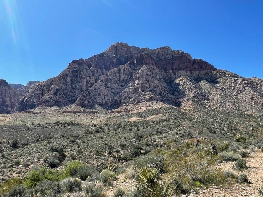
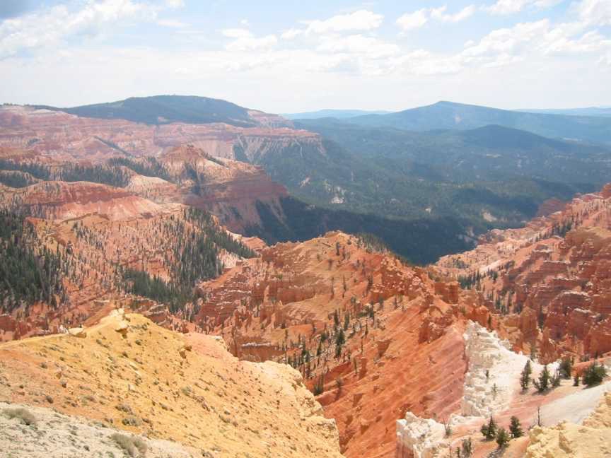
I’ve always wanted to compare California’s Red Rock Canyon State Park to Nevada’s Red Rock Canyon National Conservation Area. Note that there are “Red Rock Canyons” in California, Nevada, Arizona, Colorado, Utah, perhaps multiple-named features in each state and probably anywhere else there’s oxidized iron in the soil through which a river once flowed. Laozi would be proud of narrowing the scope of our journey of a thousand miles to just two red rock canyons in two states.
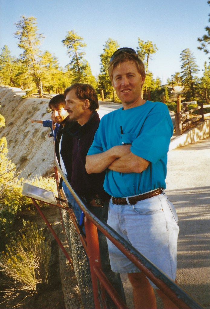
This tour’s invitees included Pete and Andy. Pete was “from-the-get-go” a go after prodding him to actually look at a calendar and check in with his partner Cheryl to clear seven days. Andy was crickets until two days before our planned departure after indicating he’d be available after his wife Toni’s birthday in early March. But he bowed out due to an odd impairment from dragging baggage in Guatemala. That’s an excuse for the books…
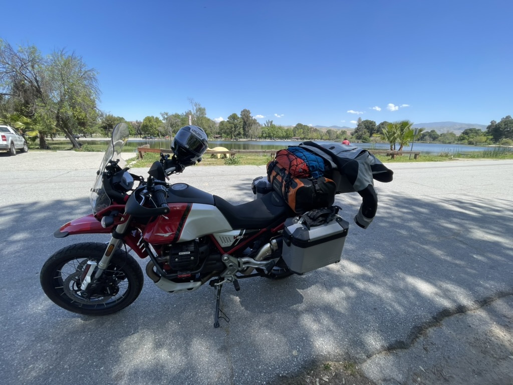
If you have followed the exploits of Sisyphusdw7.com, then you are familiar with Pete and Andy. Pete rides a Suzuki V-Strom and Andy sports a Moto Guzzi Norge while I mount on a Moto Guzzi V85-TT. You’ll also be familiar with Andy’s absence on all but one trip, Riding Under a Fool Moon, and Pete’s perfect attendance on each moto adventure I’ve chronicled on Sisyphusdw7.com since its inception in 2016. Next time, eh Andy?
Click the links of the daily headings to see the route maps.
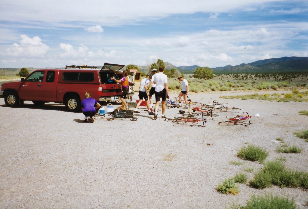
The first leg of the journey of a thousand miles began at our usual meeting place, the Chevron station on G St and Yosemite Ave in Merced. There happened to be four fellow bicycle riders who were meeting for a Sunday morning ride when I arrived to meet Pete. Loaded and ready for rambling, as is often the case describing our plan to our cycling friends, a faraway look in the eyes of one of the bicyclists was punctuated by, “I wanna go! I wanna go!”
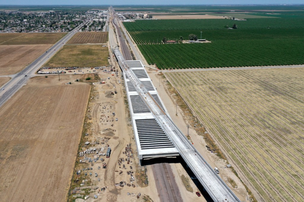
This first step of the journey included some 200 miles through the San Joaquin Valley floor skirting farming communities of Dos Palos, Firebaugh, Mendota, Tranquility, Lemoore, Corcoran, Allensworth, and Wasco. We even passed near the community of Neufeld, perhaps named for members of Andy’s farming lineage. Passing by Corcoran, a lake called “Pa’ashi” by the indigenous Tachi Yokut tribe, that had disappeared 130 years ago from California largely by way of the diversion of the Kings, Kaweah, Tule, and Kern Rivers for irrigation and to a lesser extent, periodic drought, and now, after a series of severe weather events in 2023, the lake had returned.
Images from NASA’s Aqua satellite orbiting the earth show the progression of flooding in the Tulare Lake Basin from March 2 through April 28, 2023
As a result of mitigation by stakeholder groups, the lake is now receding. What may also be receding are dreams of high speed rail in California as funding of the controversial project is questioned. Below is a drone image courtesy of hsr.ca.gov taken near Wasco in the southern San Joaquin Valley where the viaduct is being constructed to raise the rail-bed above potential flooding.
Could this become the high speed rail to nowhere?
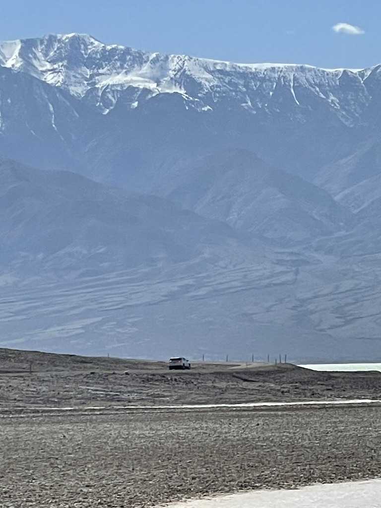
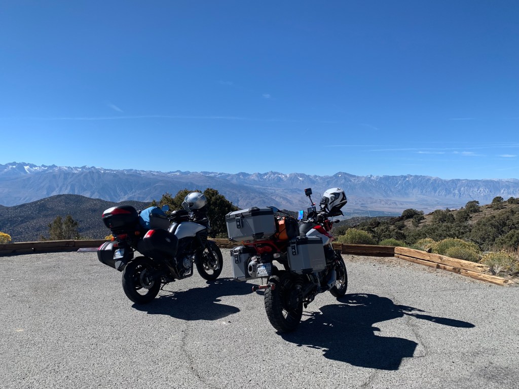
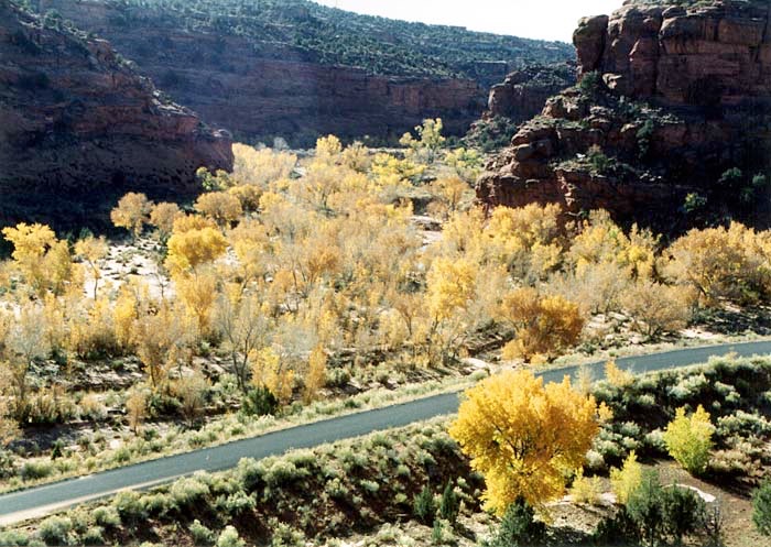
Leaving the valley, we traveled another 100 miles through the pump-jacks of the Kern River Oilfield, along the outskirts of Oildale, through the Kern River Hart Memorial Park, and then meandering through the Kern River Canyon past Lake Isabella, over Walker Pass on CA-178, to south on CA-14, all en route to our first campsite at Red Rock Canyon State Park. The California version of a Red Rock Canyon.
These images are within a mile of one another, the Kern Oilfield and Kern River-Hart Memorial Park. You decide which is which…
Many of the pump-jacks appeared to be new and they were dipping and rising en masse in what must be the expression of how us ‘Meri”can”s have nearly achieved oil independence. Who needs high speed rail when up through the ground comes a bubblin’ crude? Just in case, I’m joking. Though I ride a fossil fuel consuming motorbike, I support alternatives for mass and individual transit (high speed rail and bicycles) that don’t entirely depend on the crude.
The Kern River Oil Field covers an area of 10,750 acres (43.5 km^2) in a rough oval extending over the low hills north-northeast of Bakersfield, in the lower Sierra foothills, hills which are now almost completely barren except for oil rigs, drilling pads and associated equipment. This area is the densest operational oil development in the state of California: Midway-Sunset southeast of the Kern River oilfield, which has more wells, is almost three times as large in surface area, for a lower overall density.
There are others, like the McKittrick fields I’ve featured in a previous Super Bloom post. Yielding a cumulative production of close to 2 billion barrels (320,000,000 m^3) of oil by the end of 2006, it is the third largest oil field in California, after the Midway-Sunset Oil Field and the Wilmington Oil Field, and the fifth largest in the United States. Its estimated remaining reserves, as of the end of 2006, were around 476 million barrels (75,700,000 m^3), the second largest in the state. It had 9,183 active wells, the second highest in the state. The principal operator on the field is Chevron Corporation. (Thanks Wiki…)
The contrast between the verdant ag lands of the valley floor and the desolate oilfield, from which the last barrels of carbon were being extracted, is striking. For a detailed history and updated production figures, check out: Kern River Oilfield. Our impact on the environment for feeding our civilization is fragile when you consider that as few as 150 years ago the indigenous peoples of the region lived in relative harmony with nature.
The temperatures were just right until we began climbing up to Lake Isabella. Clouds and a passing cold front made for a chilly section of CA-178, the Kern Canyon Road. Along with a couple of “Roadwork Ahead”, “Prepare to Stop” signages as two lanes merged into a single lane, a chilling scene unfolded as we came upon a motorcyclist who was writhing on the road having apparently been thrown from his bike that was lying against the canyon wall some hundreds of yards away…
Be careful out there… (Pardon the expletive), with the Steve Miller Band, Further On Up the Road
Once we made it to the divided four lane portion of CA-178 as we approached Lake Isabella we experienced a brief respite from the twisty canyon road traffic traveling down the Kern River Valley with a lunch stop at The 178 Bar and Grill.
Eat you heart out Jamie RobinsonIn moto parlance, I believe this gallimaufry would be called a one into four…
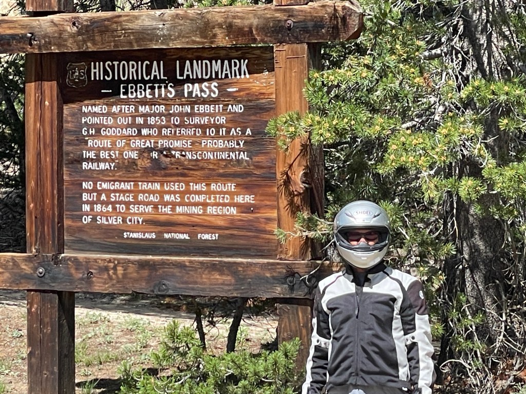
The sun broke through the clouds and we enjoyed a little thermal respite besides that transmitted through heated grips on the motos. It’s always a challenge to insulate against the cold and heat when moving from one elevation/climate zone into another, namely the Sierra to the Mojave, regardless of the season. Passing through the small lakeside communities of South Lake and Waldon, we then passed through the more rural agricultural communities of Onyx and Canebrake. It’s there we began the climb over Walker Pass (el. 5250 ft) where, coincidentally, the Pacific Crest Trail intersects.
The pass was charted as a route through the Sierra in 1834 by Joseph Rutherford Walker, a member of the Bonneville Expedition who learned of it from Native Americans. Walker returned through the pass in 1843, leading an immigrant wagon train into California. In 1845 the military surveying expedition of John C. Fremont used the pass. He suggested it be named after Walker. Walker Pass was used in 1861 by cattlemen from the San Joaquin Valley and the Tejon region of the Tehachapi mountains to drive cattle to the silver boomtown of Aurora near Mono Lake. Aside from the paved road, the pass is essentially unaltered since Walker mapped it in 1834. (Thanks Wiki…)
Join Sisyphus with Dwight Yoakam and Neil Young on a hyper-ramble over Walker Pass
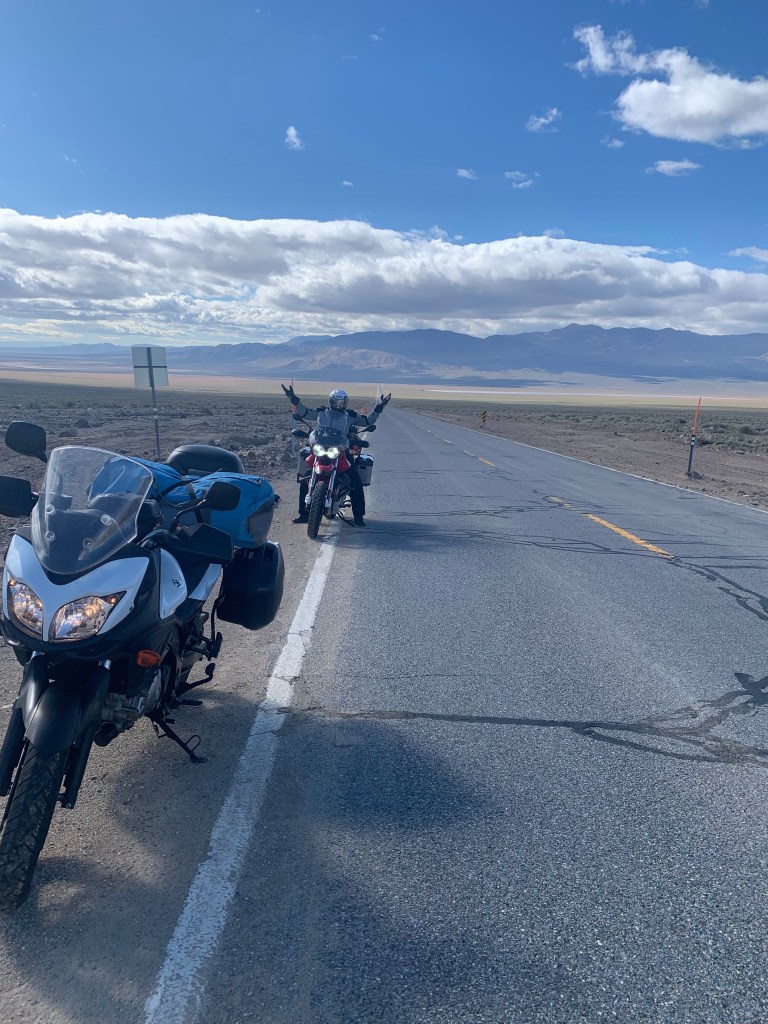
The view from Walker Pass to the vast expanse of the Mojave desert is stunning.
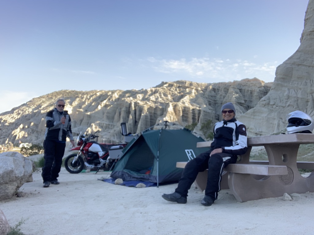
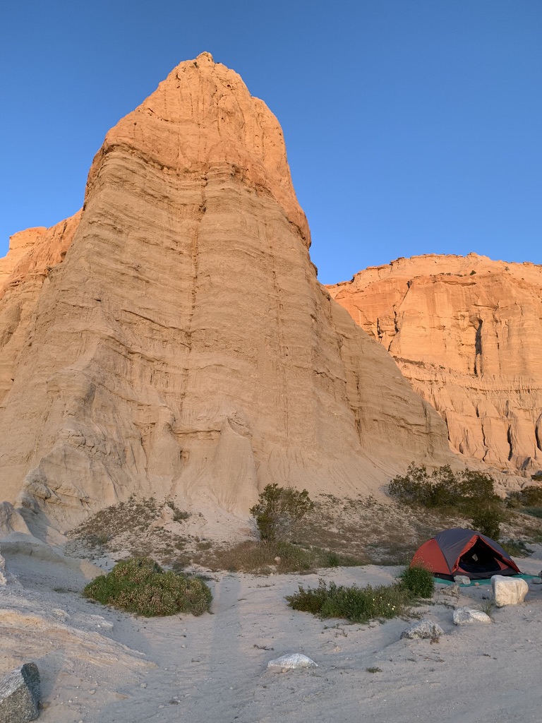
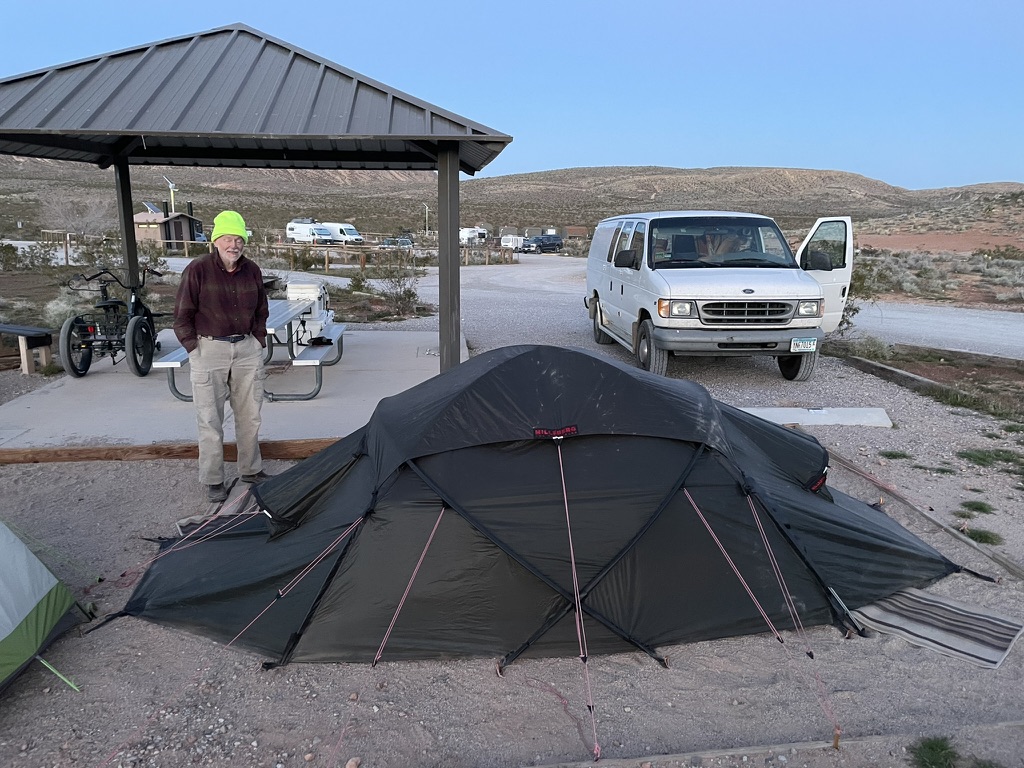
At the intersection of CA-178 and CA-14 we headed south, arriving at Red Rock Canyon State Park in just a few minutes. This state park has no reservation campsites, however, each site has a table, potable water and pit toilets are available, some even open air stalls! There is a fee that we paid, including a $2 senior discount and our reasoning that since a second vehicle added $6, our two 2-wheeled motos were the equivalent of a 4-wheeled vehicle requiring no additional fee. Having no pen or pencil we left the envelope in the drop box (duh) keeping the tag just in case a friendly ranger or maintenance worker checked in with us suspecting turnstile jumping dirtbag motorcyclists.
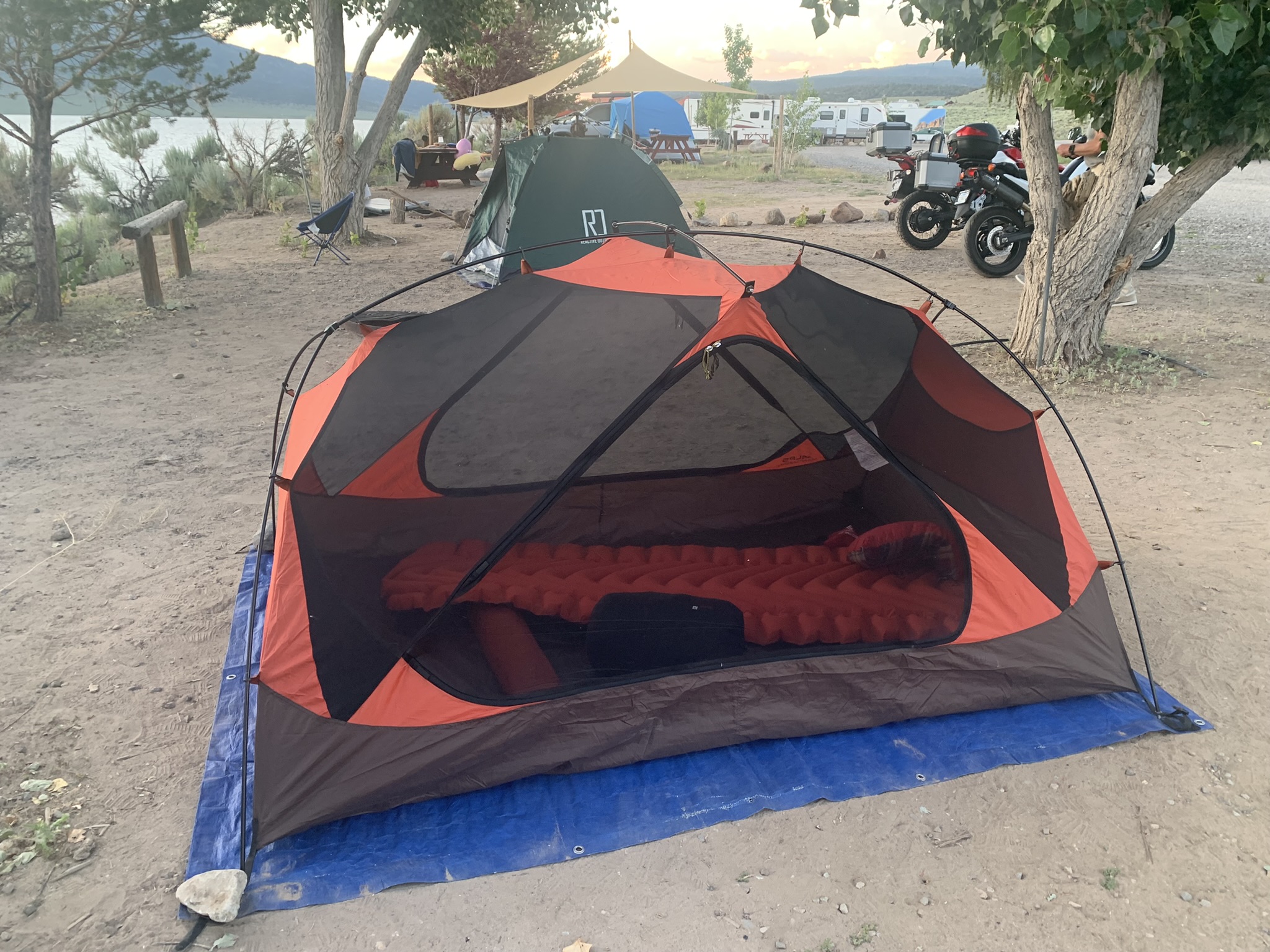
The campsite at Red Rocks State Park in eastern Kern County
The area was once home to the Kawaiisu people. Some petroglyphs and pictographs are found in the El Paso Mountains and represent ritual sites from ancestors of the Coso people were early indigenous inhabitants of this locale. They created extensive carvings in rock within the El Paso and neighboring mountains of Red Rock Canyon and conducted considerable trade with other tribes as far as the Chumash on the Pacific coast.
The colorful rock formations in the park served as landmarks during the early 1870s for 20-mule team freight wagons that stopped for water. The park protects significant paleontology sites and the remains of 1890s-era mining operations.
Providing several unique, dramatic areas, and close to Los Angeles, since the 1930s Hollywood has frequently filmed at Red Rock Canyon, including motion pictures, television series, advertisements, and music videos. (Thanks Wiki…)
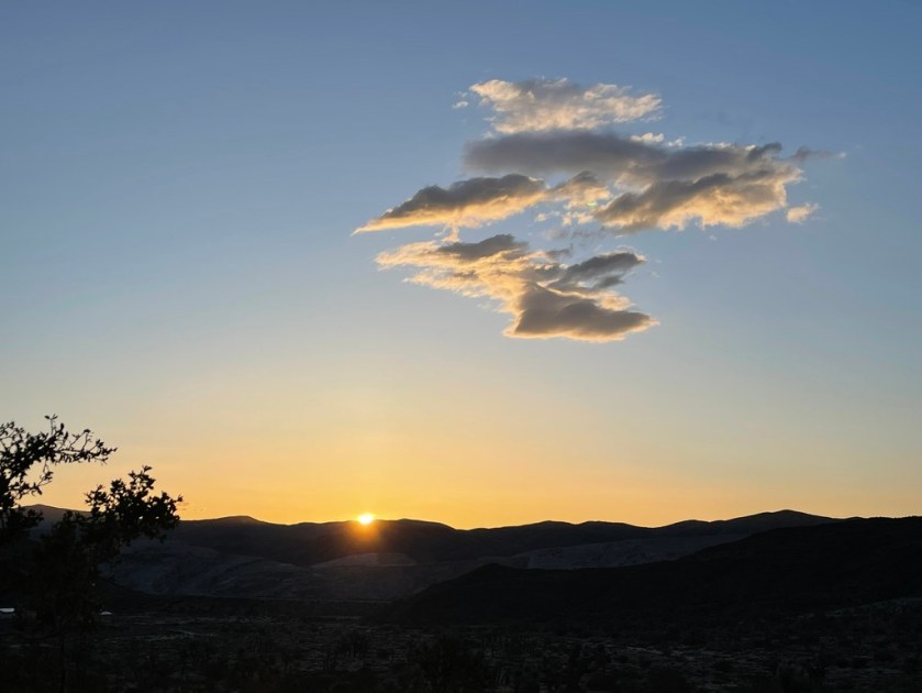
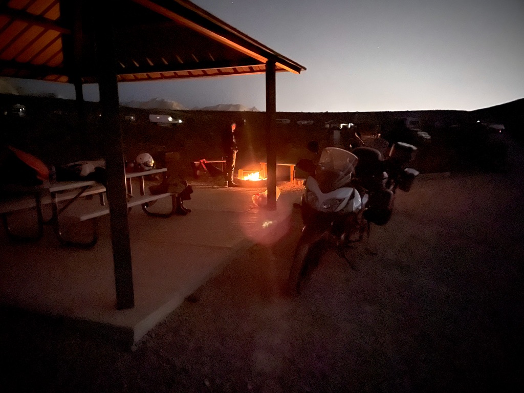
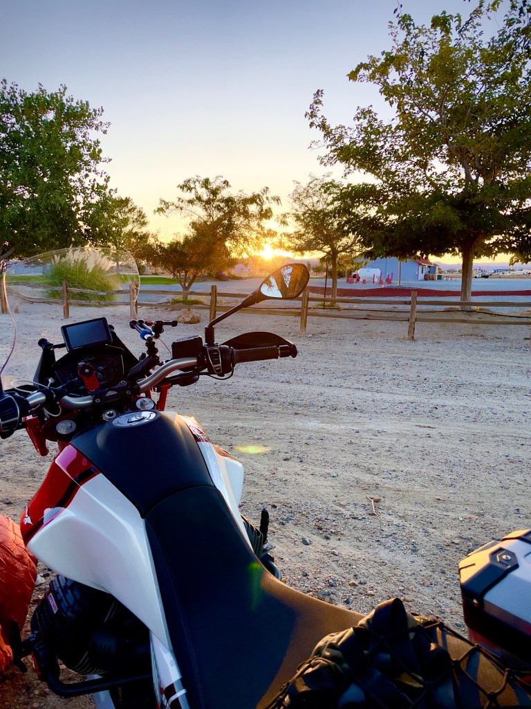
A blustery welcome to our first night campsite on the Red Rock Canyons Ramble…
Pete’s selfie-ish photo that might have broken the internet if only he had social media…
The nearest provisions were at the Jawbone Canyon Store, whose motto is, “Let them eat dirt!” around 7 miles further south on CA-14. That is where we thought we were going to get our dinner and 3R’s beverages after setting up camp. By then the wind was howling out of the south. When we arrived at the store that is popular among the ORV crowd around 5:30 pm, on this Sunday, the store was closed, so I guess, eating dirt was our option.
A quick search of Google Maps indicated that California City, about 14 miles further south, appeared to be a settlement of some consequence, so off we went battling sidewinds as the sun began to hug the western horizon.
After fueling up, procuring our favorite beverages, along with a bag of Fritos and a bundle of firewood at the One Stop Market, apparently in the midst of billion dollar lottery fever given the size of the crowd buying quick-picks, we headed back to camp after a 340 mile day. Fritos would have to do as our hearty lunch in Lake Isabella would sustain us…
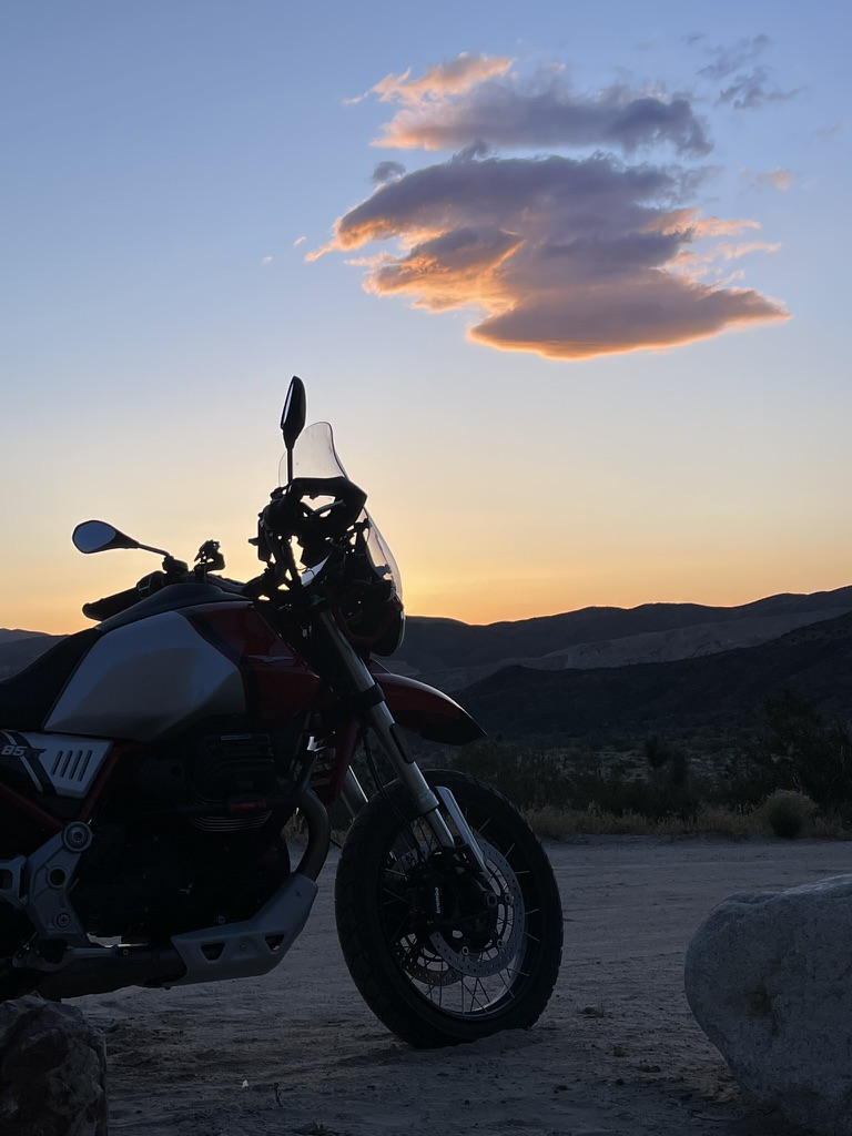
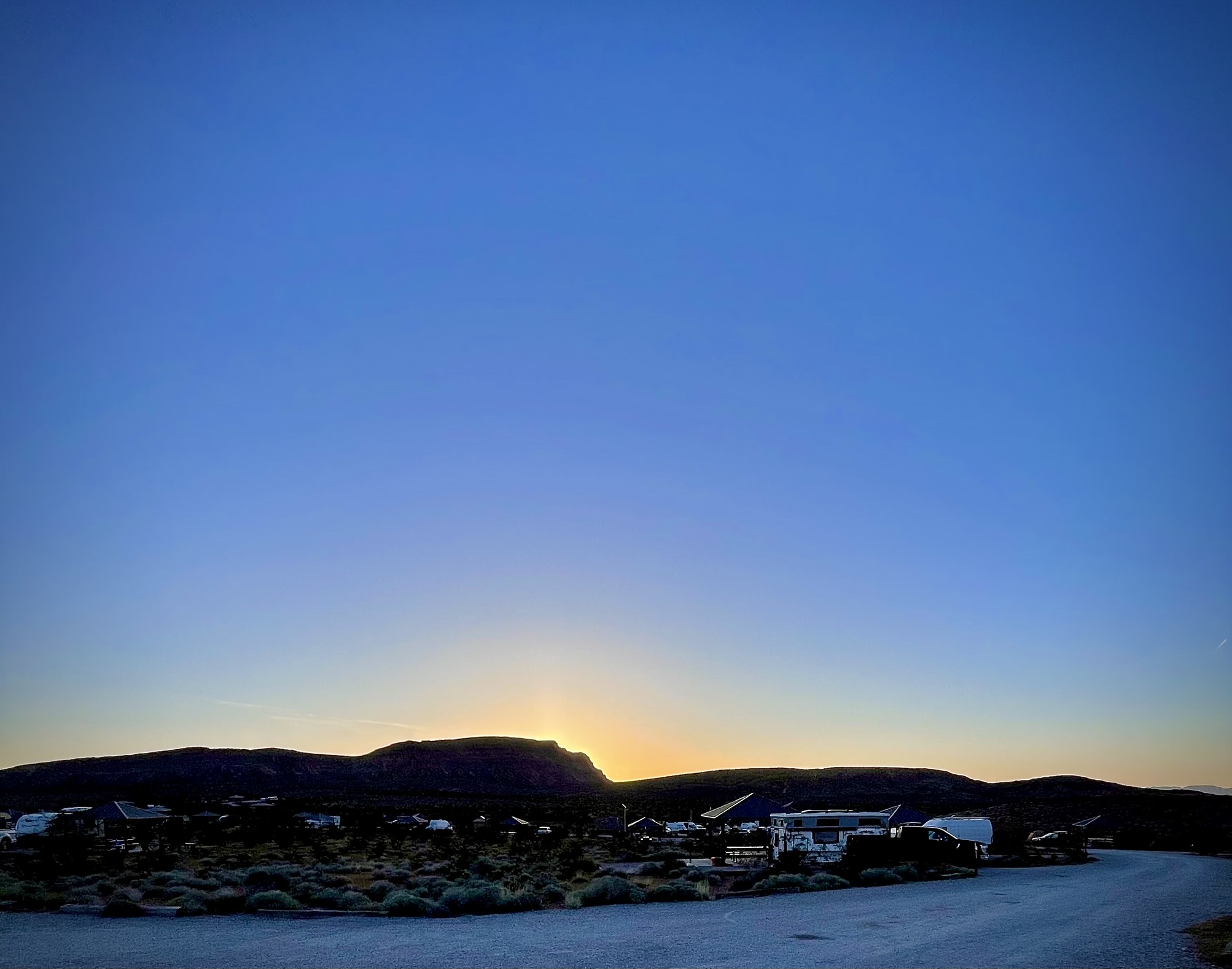
Twas a bit windy through the night, however as the sun arose on Monday morning, the wind had settled down.
Good Morning Red Rock Canyon State Park
Neither Pete nor I are paleontologists, but are both fans of the Flintstones. We agreed we had found the remains of stegosaurus rubrum…
There are some rocks worthy of being described as red…
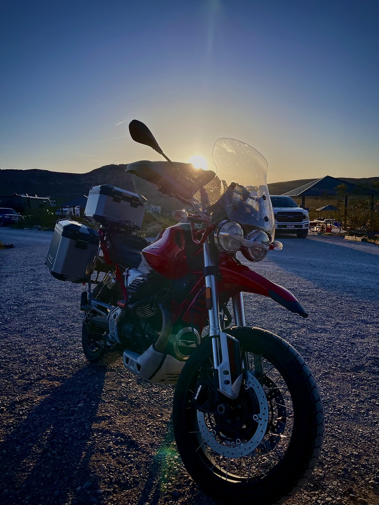
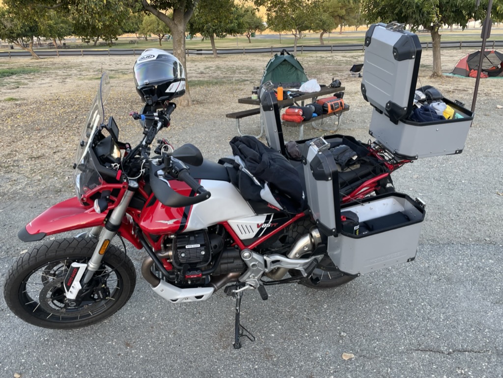
Ill mio bella rosso moto…
A shorter day by ~100 miles lay ahead as we planned to sprint south on CA-14 to Redrock-Randsburg Rd en route to dawdle a bit in Randsburg on our way across Death Valley to Shoshone, one of our favorite stops.
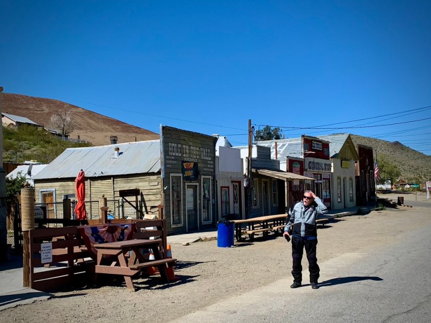
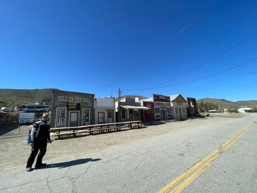
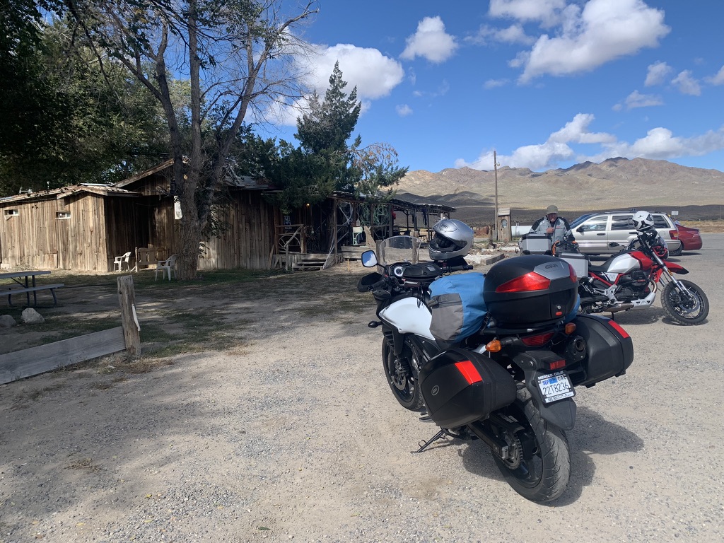
Randsburg California, or Rand Mining District as it is also known, is considered to be a “Living Ghost Town”. Holding on to the very brink of existence, this small mining community is located in the Northern Mojave. Outdoor recreation booms here: ATV, dirt bikes, 4x4s, motorcyclists. RVers & car clubs are welcomed. Weekends can be busy with tourists, local horsemen & desert dirt boys, but on week days you’ll have the place to yourself. An old fashioned soda fountain at the general store & a real old west saloon, hours vary with season. The Joint is the local bar. Randsburg is a great place for interesting desert photography. (Thanks to the Randsburg.com website, the domain for which is 4-sale)
It was around 9:00 am on a Monday morning and in spite of the promotion about how people are dying to go to Randsburg, not a creature was stirring, not even a mouse. Wait, there was a dog barking at us from afar. We did pretty much have the place to ourselves except for a couple of local spirits.
Pete was intrigued and wondered how much was that little Yamaha in the window. The Bulltaco was probably a better deal…
Is that an apparition appearing in the photo?
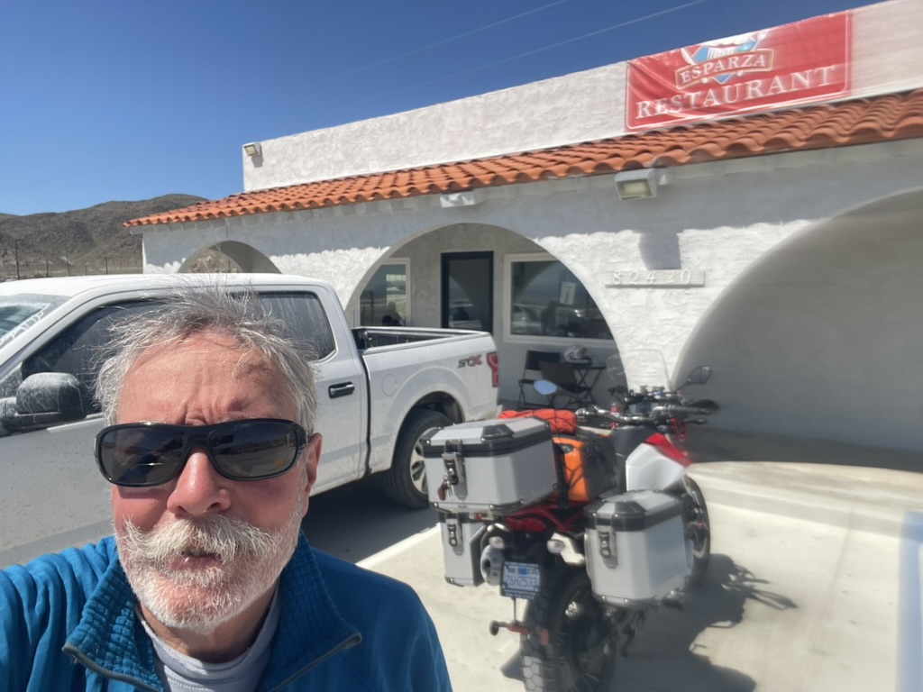
Next we were off to Trona on, what else but, Trona Rd and our favorite Trona cafe, Esparza’s for breakfast. You could consider that Exparza’s has a lakeside location. Except for the fact it’s Searles Lake. What the restaurant lacked by way of a view was more than compensated by the delicious fish tacos. I only hope they weren’t fresh from Searles Lake…
Eclipse? What eclipse?I’m here for the tacos…
From there it was off to Death Valley via Trona-Wildrose Rd with a tailwind for a change. At the intersection of the Wildrose entrance to the park and the CA-190 Townes Pass entrance, there appeared a sign warning against the faint-of-heart tackling that route. We came upon a couple who we speculated were on rented Harleys, harleying their way to Death Valley, in full Haley regalia; riveted black leather jackets with fringe and matching chaps, hers with fringe, the chap’s, fringeless. They came to a sudden and mildly confused appearing stop as we approached at customary cruising speed on those long lonesome straightaways, safely under 100 mph. We passed, losing their tableau in the rear view mirror. I hope they chose well. It would be sad if they suffered like those bleached Randsburians…
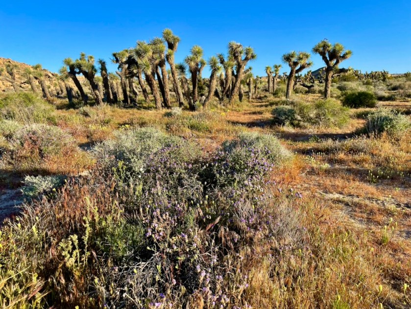
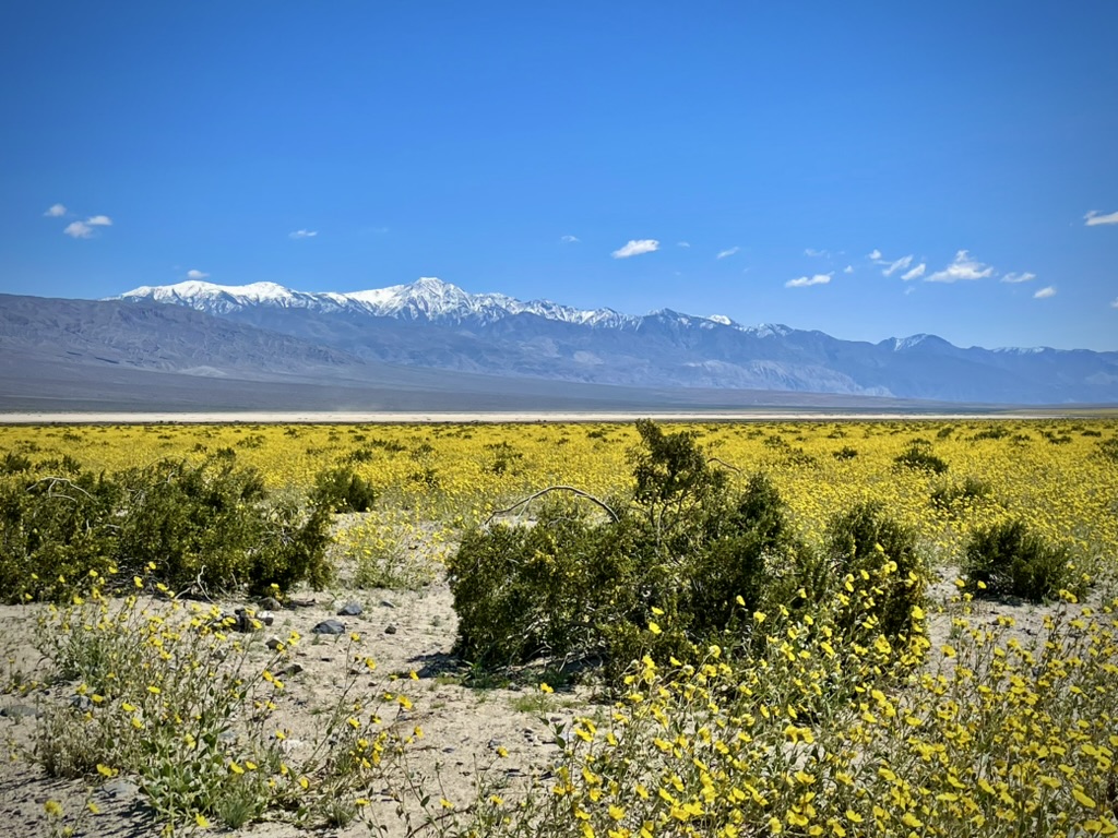
Right on CA-190 and the first real “super-bloom” was evident.
Panamint Valley superbloom
Geraea canescens, commonly known as desert sunflower, hairy desert sunflower, or desert gold, is an annual plant in the family Asteraceae that was showing off. Telescope Peak from the west, sporting some late spring snow, is still feeding Lake Manley on its eastern flank.
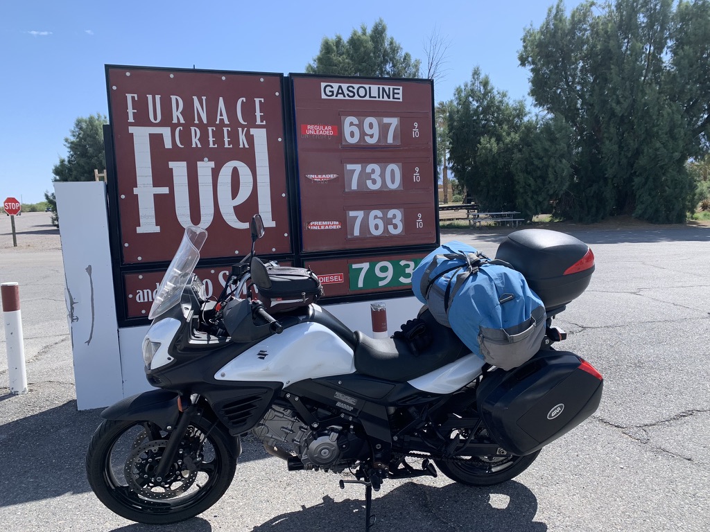
Death Valley was in the very pleasant mid-60’s when we arrived in Furnace Creek for a fuel stop. Ill Mio Rosso likes expensive stuff. Pete’s V-Strom uses the budget stuff.
Yikes! The downside of supply and demand…
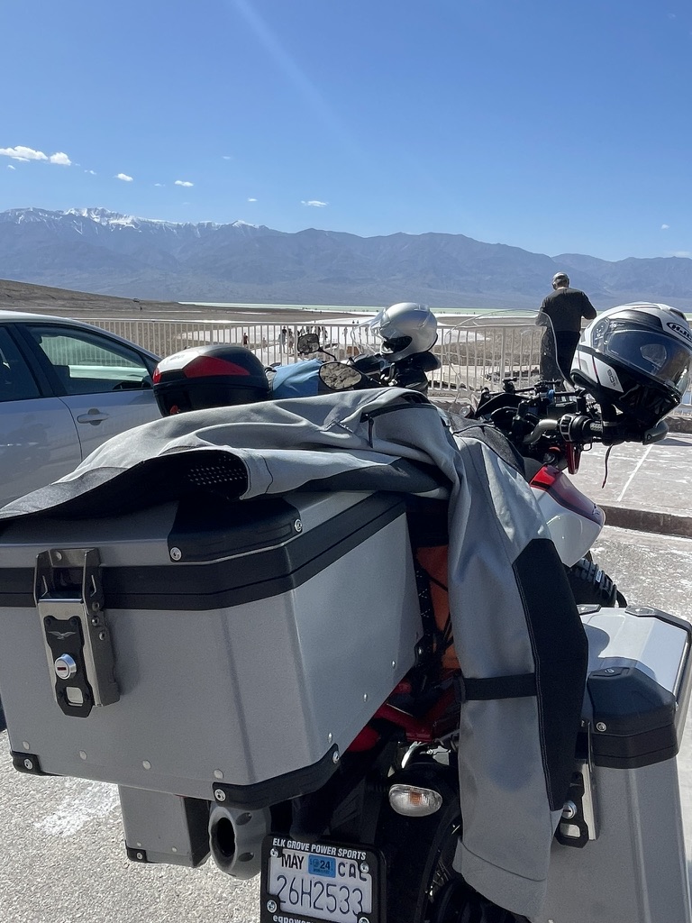
We contemplated taking CA-190 to Death Valley Junction, then CA-127 south to Shoshone. But, seeing an actual Lake Manley in Badwater was something worth the slightly added distance, heat, and traffic.
Pete channeling Ansel AdamsGet me out of that ATGATT
Channeling Ansel Adams, Pete busied himself composing a photo of the Seldom Seen Lake Maley as we pealed away layers of insulation.
It’s sometimes hard to capture the scale of the vastness of terrain, especially that of Death Valley. Below is Telescope Peak from the east at 11.049 feet taken from 282 feet below sea level at Badwater with Manley Lake in middle-ish ground.
The remains of Lake Manley’s source topping Telescope Peak in the Panamint Range
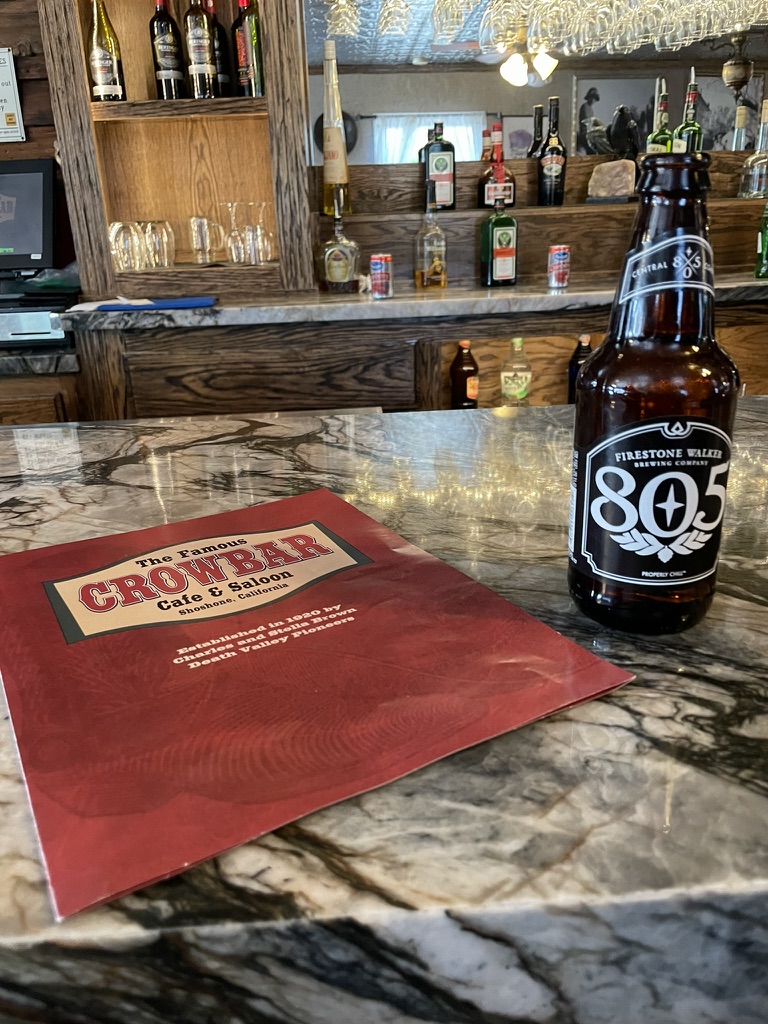
In no time we made our way on Badwater Rd to Jubilee Pass Rd, the continuation of CA-178 to CA-127 then south to The Shoshone Trailer RV Park. I’ve noted that Shoshone is one of our favorite destinations. The campground is perfect, the Crowbar has the best eats east of Trona and the Chas Brown Market can provide for all occasions including offering a geode for $2800. If I had space for it on the Guzzi, well, maybe. We settled on procuring beverages for the 3-R’s. I’ll ask my grandaughter how to take a selfie without looking at your trigger finger… The lens needs some attention.
Geezer selfies are amusingThe son whose mother raised him so well… A goat roper needs love too
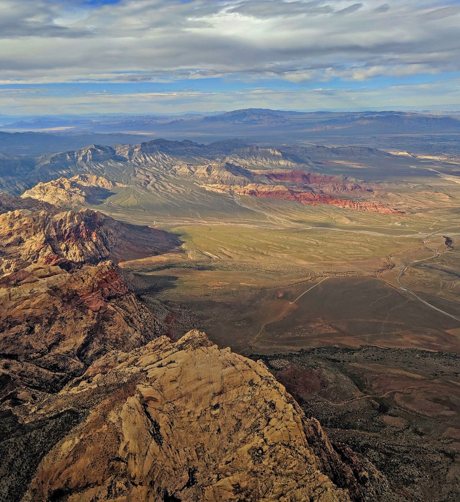
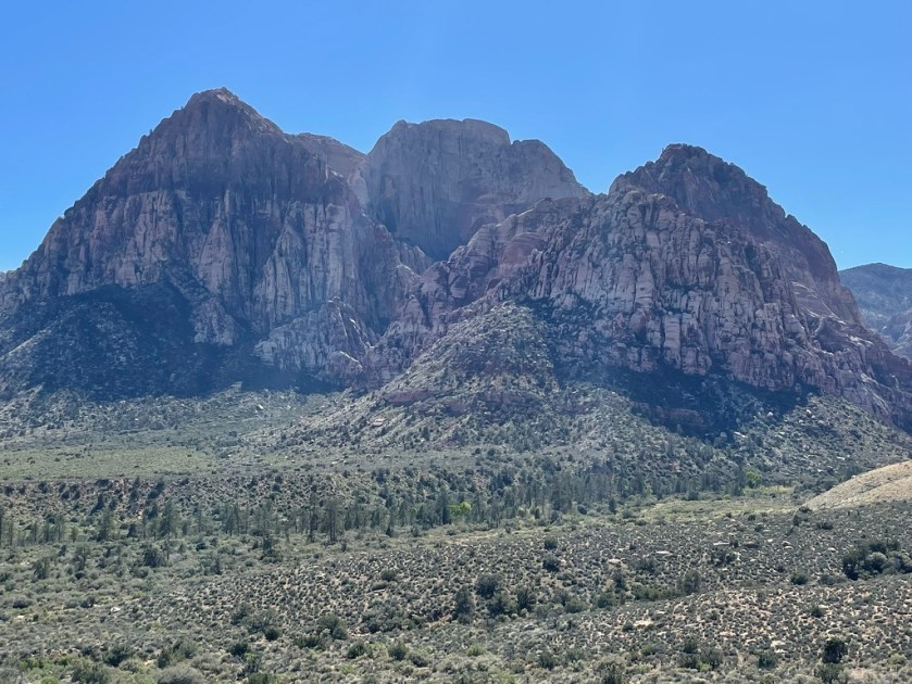
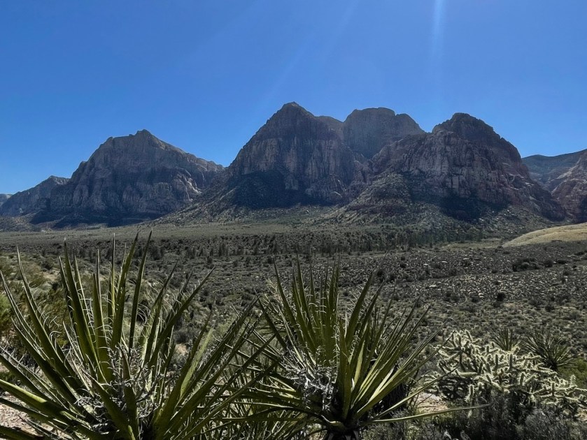
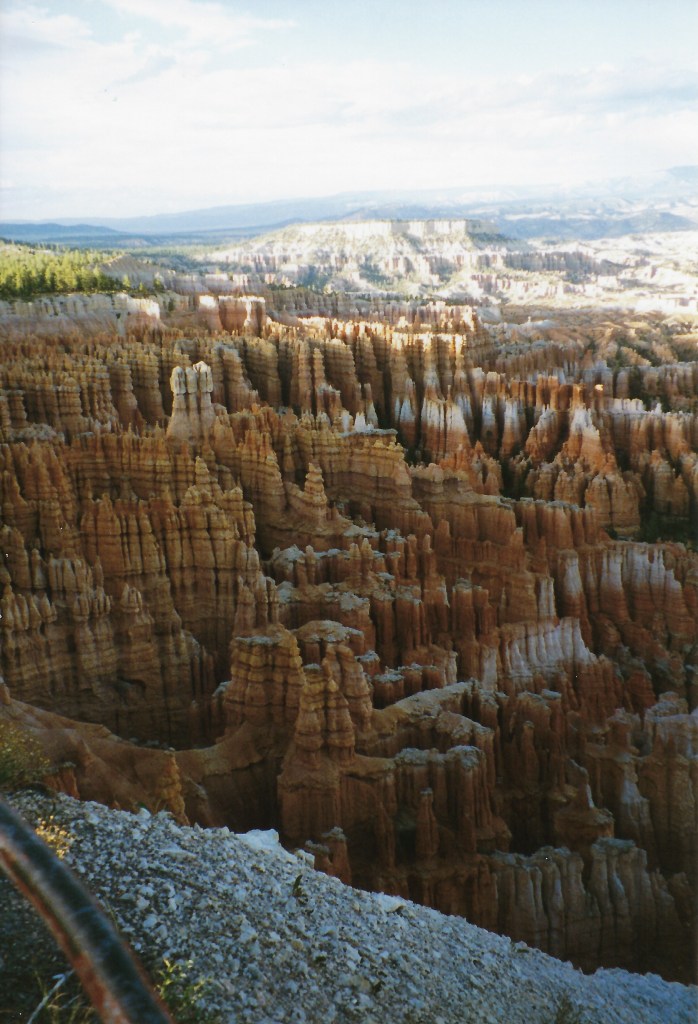
Good Morning Shoshone!Calico Hills trail (Thanks Wiki…)Aerial view of the Red Rock Canyon National Conservation Area near Las Vegas, Nevada, looking northeast (Thanks Wiki…)
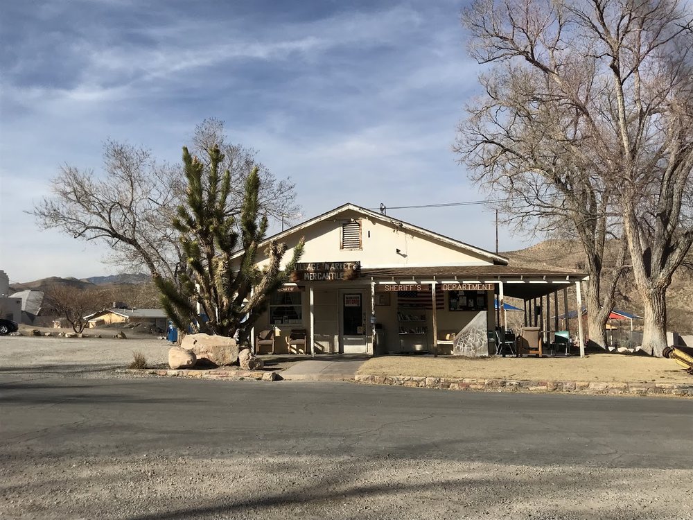
A short 86 miles to our next destination, the Nevada version of a Red Rock Canyon, commenced by heading east on the Old Spanish Trail Hwy. We soon learned there was no breakfast to be found until we reached Blue Diamond the nearest community serving the National Conservation Area. The community includes a park, private pool, library, elementary school, event hall, church, and a mercantile/gas station. The mercantile (general store) was built in 1942 and originally sold household staples and sundries to residents who were mostly miners at the Blue Diamond Mine. The store has maintained its original external look. Walls inside the store showcase many of the town’s historical photos, courtesy of the Blue Diamond Historical Society, an all-volunteer organization.
Cottonwood Station is a local scenic eatery in the historic village of Blue Diamond, minutes from Las Vegas. Near Red Rock Canyon and Spring Mountain Ranch State Park, Blue Diamond attracts many hikers, mountain bike riders, road cyclists, and guys on motorcycles, like us. There was, to our surprise, a large upscale Trek store next to the eatery. Drop by the Cottonwood Station for a latte while waiting for the wrenchers to adjust your electronic shifters and hydraulic brakes I reckon…
The breakfast pizza was killer! Pete still searching for the eclipse…
From Blue Diamond it was just a few miles to our campsite in the Red Rock Canyon NCA. After procuring a couple of whistle wetters at the Blue Diamond Market where the cashier shared that they would be closed by 5:00 because the owner didn’t want to pay her until 8:30, her preferred closing time, we strategized our dinner plans that would follow a tour of the Red Rock Canyon Loop. But first, a couple of whistle-wetters.
Onward to the Campground… with Sheryl CrowElectrolyte replacement is very importantLess sugar, more wings
Didn’t make it to Las Vegas so we didn’t need to leave. But, life was so bright on a Tuesday afternoon…
Dropping off our gear and setting up our tents, we headed for the park. We passed through an entrance station that boldly displayed a sign indicating reservations were required to enter the scenic loop through the canyon. I noted to the attendant that we had a campground reservation to which she replied that wasn’t enough. So, in my best, “You can’t possibly deny us entry into this fine geological feature of Nevada that would have to take second place to the okay geological feature of California that wasn’t even red if we cannot enter to determine its superiority” plea.
She asked if I had a park pass. I whipped out my National Parks and Federal Recreational Lands Senior Pass and with that she said, “That’s two dollars.” and waved me through.
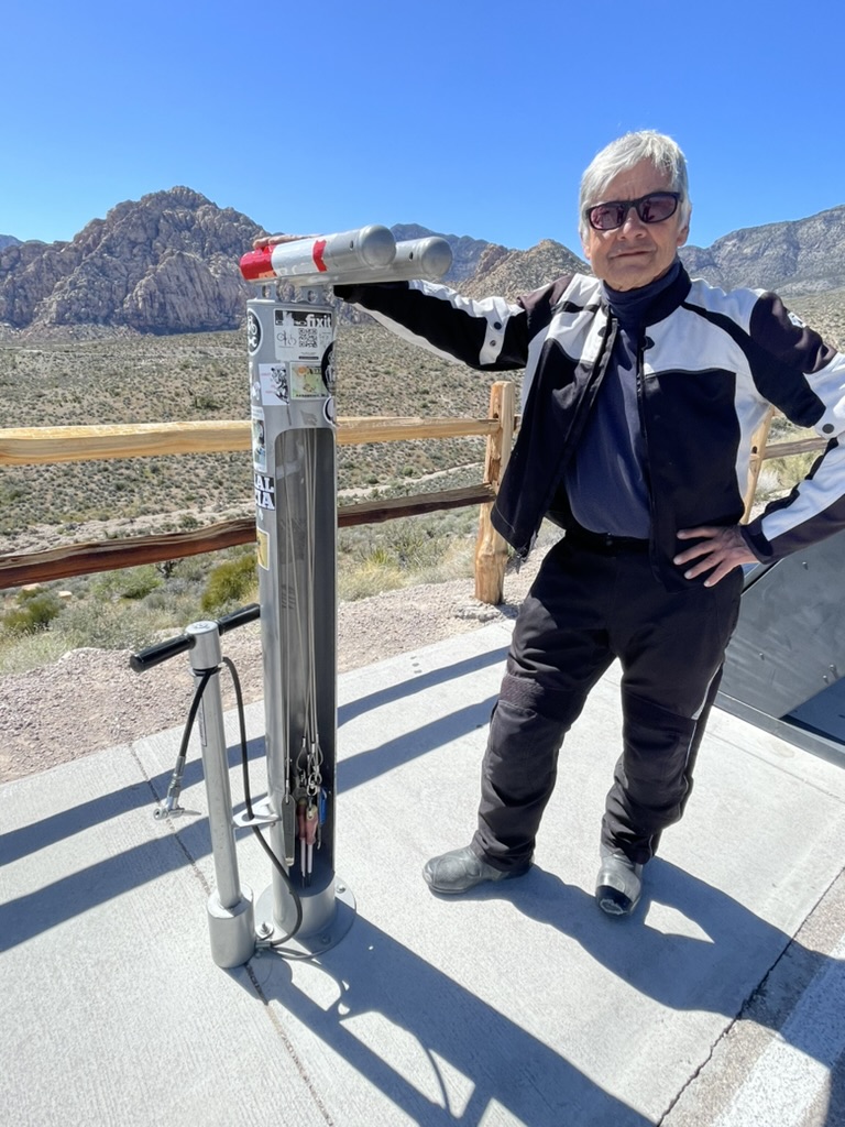
Nearly speechless, I thanked her, pressed once forward on my shift lever and moved to allow Pete to pass through. When he pulled up next to me he said that he had just paid $10 to get into the park. I later consoled him by acknowledging that his additional $8 contribution to the National Conservation Area helped to support the tricked out bicycle repair station that was installed in one of the turnouts. I assured him it was less than the latte back in Blue Diamond that he was supporting the people’s repair stand.
Still smarting having been fleeced out of $8 by the Feds
Ah yes, as advertised, Red Rocks
Always eager to make new acquaintances, I met Marlon Ma of Wu Tang Chinese Martial Arts Institute. He approached us admiring Ill Mio Rosso Bela, which, by the way, gets noticed far more than Pete’s V-Strom these days. When Pete first toured on his Triumph T120, my little Kawasexy Versys was hardly noticed despite its candy orange color scheme with matching panniers and drybags. It seems that everyone we would meet would get all misty-eyed recalling their love affair with a Triumph from yesteryear. No longer do we see misty-eyes but eyes of wonder and bewilderment as curiosity is voiced, “What’s a Moto Guzzi?”
A new friend Marlon, a Wu Tang masterAsking him to show me the first move…
Marlon was a sport bike guy who also owned a BMW and a Harley. I wasn’t going to hold that against him after I requested and he obligingly shared his first stance and move when encountering a foe that was in every way, vintage Bruce Lee. Marlon no longer lived in New York where he founded the Wu Tang Institute. He now lives in Las Vegas where, coincidentally, the Wu-Tang Clan can be found in their historic, first-ever Las Vegas residency, at The Theater at Virgin Hotels Las VegaRolling Stone Wu-Tang Residency.
This poor chap…… apparently didn’t heed the warning
Red Rock Canyon National Conservation Area Loop with Donald Fagin and Walter Becker
After moseying through the park loop, we made our way into Angel Park Ranch, a tony North Las Vegas zip code and found an Albertson’s to procure the evening victuals and, of course, the 3R beverages that would complement the grub as the relaxation, rehydration, and reflection hours awaiting.
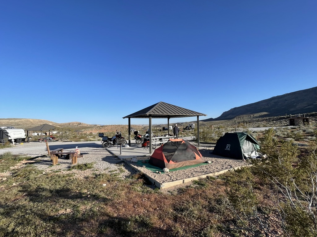
Red Rock Canyon National Conservation Area campgroundOur evening stroll took us to new heights
Descending the hillside, we ambled through the campground coming upon what appeared to be a tent worthy of gale force winds. Indeed, the gentleman who excitedly shared his tupik said that since he often camped in windy deserts, he found this Swedish Expedition Tent to be ideal. It was designed to withstand winds up to 70 mph. Though it looked somewhat complicated, he said it was a snap to set up. He had a luxurious mattress that covered the entire floor! No blustery tent flapping, rocky floor night’s sleep for this fellow. I guess he could have slept in his van, but if you’ve got a Hilleberg Tara why would you?
A man, a tent, not just any tent, a Hilleberg Tara, and pride…
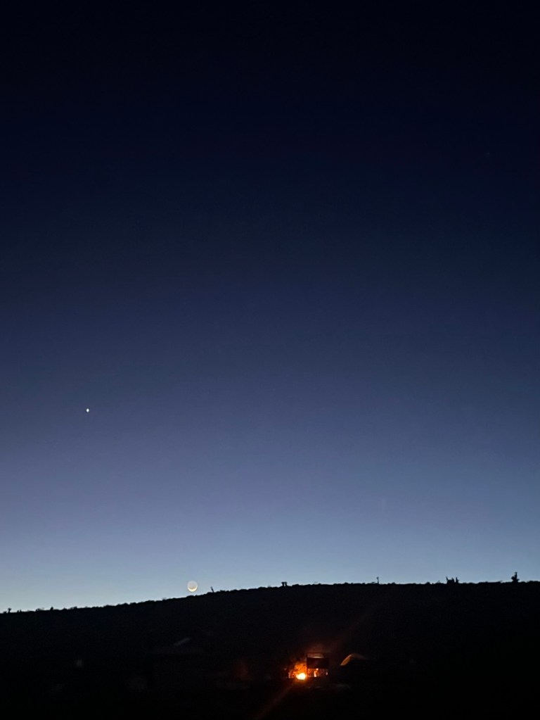
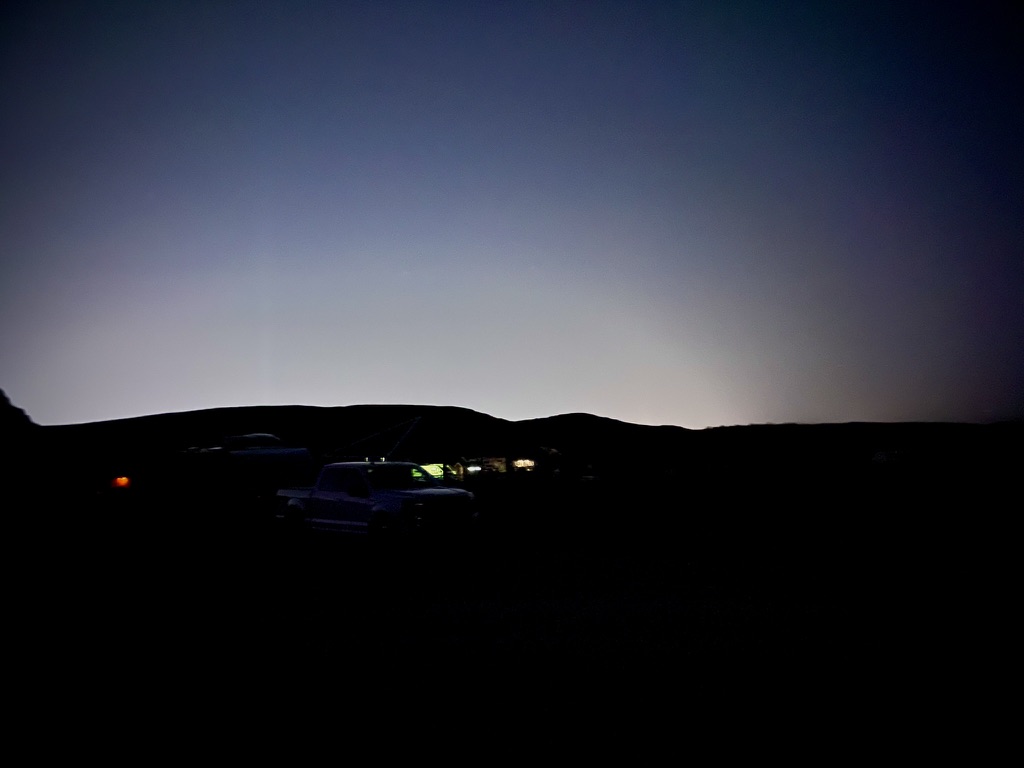
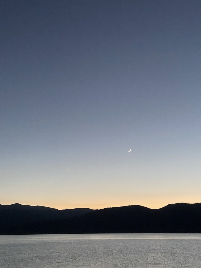
In the distance we could hear jet fighter aircraft, ostensibly from Nellis Air Force Base just a few miles to our east. As night fell, the maneuvering jets quieted having practiced their tactics, we kindled a fire and reflected as we relaxed and rehydrated viewing Jupiter and the waxing crescent moon.
On the western horizon, Jupiter and the waning crescent moonTo the east, the bright lights of Lost Wages
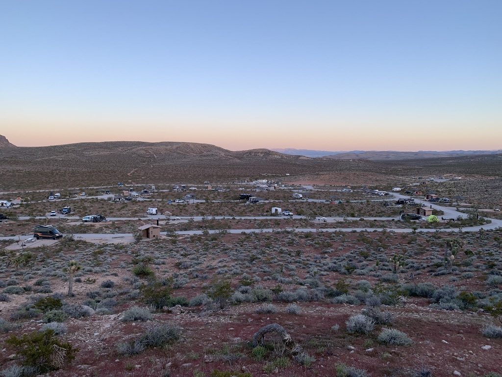
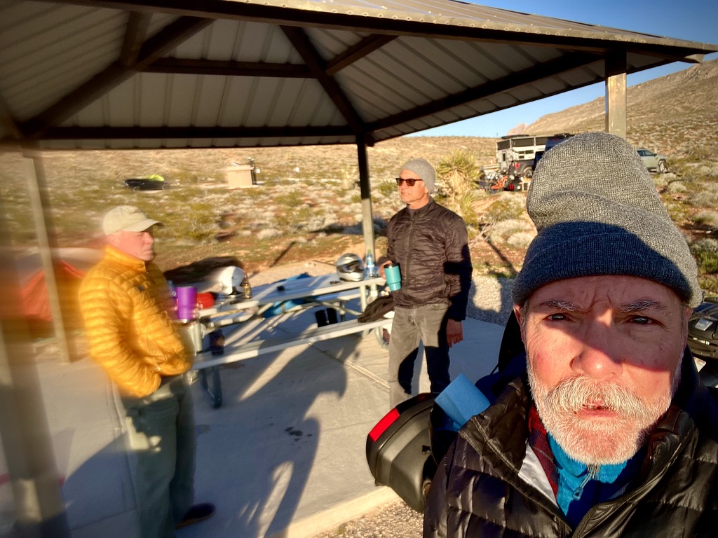
Good Morning Red Rock Canyon National Conservation Area!
A fellow motorcyclist sharing stories over coffee. That lens needs attention again..
We’re accustomed to the sound of military aircraft doing tactical maneuvers as the former Castle Air Force Base is located near our hometown in Merced. The one-time Atwater Air Force installation was home to the U.S. Strategic Air Command, a part of America’s Cold War nuclear triangle. For a time a fighter squadron occupied the base too. With the base closure in 1995 the Strategic Air Command picked up and flew the coop. Nowadays there is a commercial pilot training facility, the Castle Air Museum, UC Merced facilities, the U.S. Penitentiary Atwater, along with other portions leased to Google for development of self-driving technologies (known as Waymo), the County Animal Shelter, and a few local businesses including a brewery, The Tarmac. The fighter jet scream was familiar.
We made our way east through North Las Vegas on NV-604, avoiding I-15, skirting the Las Vegas Motor Speedway and Nellis Air Force Base, home of the USAF Thunderbirds. As noted, all the previous afternoon into the night and the following morning we heard the distant thunder of aircraft, most likely fighter jets, perhaps even the Thunderbirds, working on maneuvers, tactical or otherwise…
Satisfying our machine’s thirst for fuel, we decided to save time and look to the Loves Fueling Center store to select a “delightful” Loves Fueling Center breakfast that we ended up eating in a dog park. Rushing through a fruit cup and blueberry yogurt, we then headed up US-93, the Great Basin Highway, to our next destination the Kershaw-Ryan State Park near Caliente, Nevada.
Yum…Aside from the odor, the shade was fetching,,,
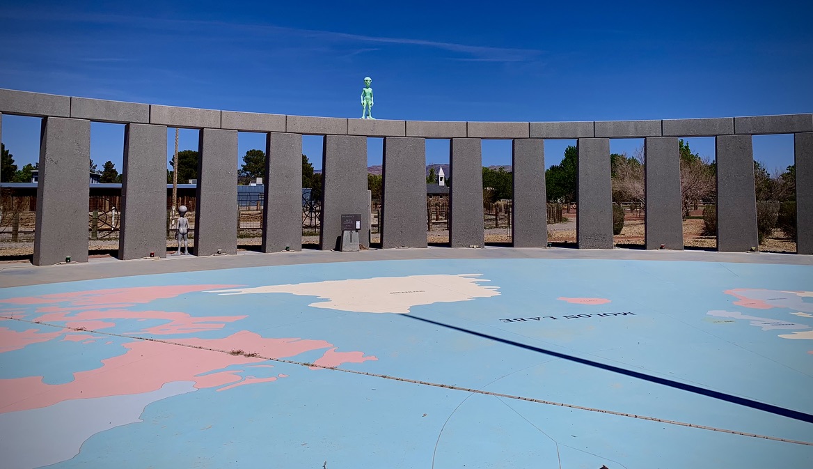
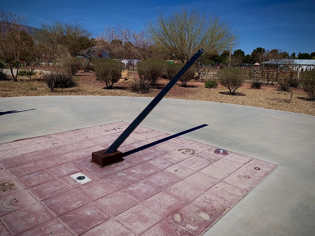
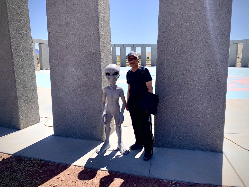
Back when considering the route, searching maps on the interwebs, taking those first steps on this journey of a thousand miles, I happened upon an Atlas Obscura Article about an interesting property next to the Western Elite Landfill that serves Las Vegas. It’s known as RyanHenge. This Stonehenge-inspired solar calendar stands alongside a landfill, in the middle of the Nevada desert. Along with the replica of the ancient Neolithic henge monument in Wiltshire, England with a twist, can be found beautifully restored rail cars once used by Teddy Roosevelt, Annie Oakley, and Wild Bill Cody. There are other vintage vehicles and an interesting collection of animals at the site, including a camel.
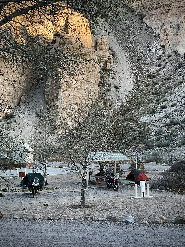
Arriving at our campground at the Kershaw-Ryan State Park, yet another novel feature of this ride of the familiar and the unique satisfied, we were disappointed to find our reserved campsite was occupied by a monster motorhome of the lumbering mastodon sort. We knocked about trying to find a ranger and searched for an alternative site checking to see if any of the reservation tags indicated a vacancy for the night. Finally, we did see that the Ranger’s vehicle was at the entrance and so it was fitting to tell him the tale of our misfortune. It all began with a faulty 404 error on the Nevada State Parks Reservation system…
Situated in a colorful canyon, with towering walls up to 700 feet high and a long, verdant valley in between, Kershaw-Ryan State Park is an oasis in the desert, a sharp contrast to the rugged landscape that surrounds it. Natural springs grow a garden of wild grapevines, white oaks, fruit trees and willows, and a spring-fed pond provides a refreshing children’s wading pool. It is not unusual to see wild horses, deer, and other wildlife come to the water. (From the KRSP website that worked…)
Back in early March I was unable to make the reservation on-line due to a glitch on the Nevada State Parks Reservation website. So I called the Parks HQ in Carson City making the reservation over the phone. The delightful parks employee I spoke with assured me that she would send a confirmation email for the site, post haste. Two days later no such email had appeared. I checked the spam folder: nada. I called back to get a different parks employee at the Carson City office who said that her computer was down (hmmm) but that she would check and resend the reservation confirmation by way of email. Just in case, I requested the site and confirmation numbers from her. A few moments later, she gave me the site number, 10. I never received that promised confirmation but my credit card had been charged. I figured that was good enough.
I explained all of this to the very helpful Ranger Evan who was on a Zoom meeting but happily left the call to check his records. I had arranged for one night at the campground. He shared his paper reservation roster that indicated that I had reserved a primitive campsite for 6 days. What-what?! He thought that unusual since they never reserved primitive sites, they were on a first-come first camp basis and besides the fee charged was $60 instead of the $10 single night fee. I was actually charged $25. What-what?!
The remedy was that he handed us the reservation list and said that several sites were available for the night that were reserved for the next couple of nights. He wink-wink, nod-nodded us commenting on the frequency of glitches on the Nevada State Parks Reservation system. He was of the opinion that a cheaper, less robust system was purchased by the State and that was the cause of all of the errors. Alas, a campsite would be found, tents would be pitched, and we would head into Caliente for dinner and 3-R’s provisions.
Take your pick of any of the empty campsites…
Found one next to the donation based fire wood shack…
Just as we departed the entrance shack with roster in hand to select our homestead for the night, an interesting “conversation” piece rolled up, right out of the Black Rock Playa… When I stepped up to the pick-up towing this unique trailer, I inquired, “That’s quite the conversation piece ya have there,” to which a passenger replied, “So you wanna have a conversation?” with a British accent.
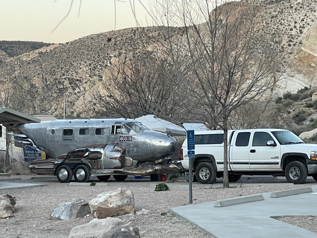
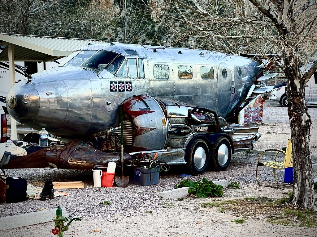
Montana Slim’s Traveling Robot Orphanage…
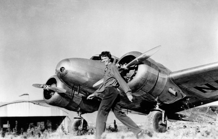
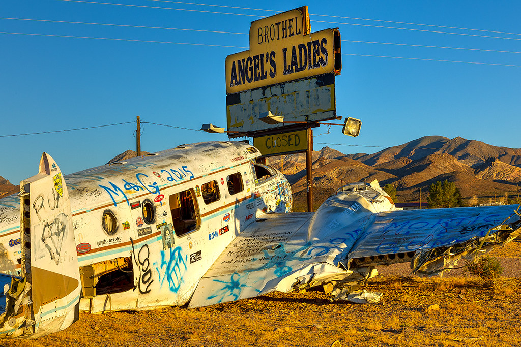
If there’s something that looks a little familiar about this aircraft converted into a Traveling Robot Orphanage by Montana Slim, well look no further…
Amelia Earhart disappeared over the South Pacific in a Lockeed Model 10 Electra. Montana Slim’s plane is a Beechcraft Model 18. Though they look alike, there were only 149 Lockheed Model 10 Electras made primarily in the 1930’s. There were 9,000+ Beechcraft Model 18 manufactured from 1937 – 1970. (Thanks for the checked facts Wiki…)
Montana Slims Traveling Robot Orphanage makes a stop at the Amargosa Hotel and the Angels Ladies brothel just north of the famous hotel.
The plane that’s full of graffiti at the brothel is the same plane as Montana Slim’s a.k.a. Sean Gurrero, a Beechcraft C-18. Check out artist Sean Gurrero’s work:
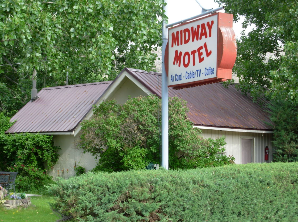
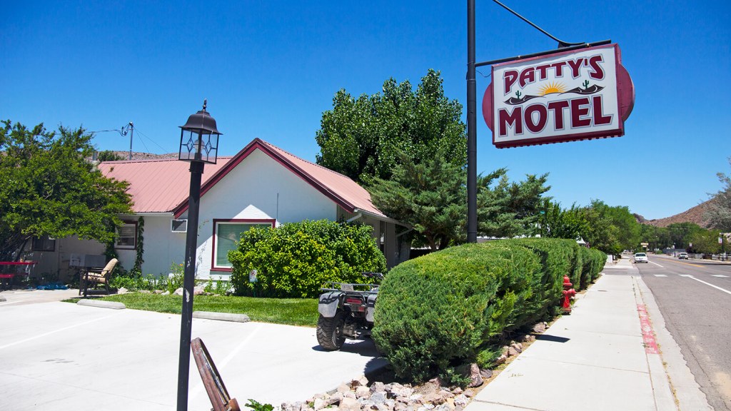
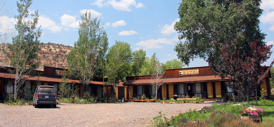
After a fine dinner at The Side Track Restaurant in the rail town of Caliente, Nevada, a charming and remote ciudad pequeña in the Great Basin of Nevada, we took a quick tour of the burgh as we made our way back to our campsite. We came upon a restored/updated motel Pete had stayed in some decades ago, formerly the Midway Motel, now known as Patty’s Motel. We met the proprietor, Patty, who seemed quite cordial inviting us to check out the venue.
Before…Patty’s Opening…Now…
We declined Patty’s invitation to stay as we were camping, however, this property is on the checklist for our next Nevada ramble! Mixing a little of the new with the familiar, I say…
All day…… into the evening, tactical maneuvers
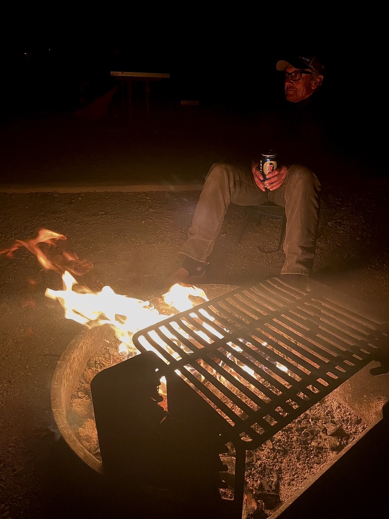
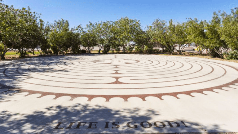
Another evening around the campfire, relaxing, reflecting, rehydrating and knowing our skies are safe! True to the labyrinth in RyanHenge, Life is Good!
Another gas station fuel-up at Dino’s Sinclair for the bike and a breakfast of cranberry juice and a Kind Bar for the pilot began the long 350 miles across what would be increasingly warm, from the mild spring weather we had thus far enjoyed, speedfest across Nevada.
I would love to have a Sinclair Dino for my grandkids to play on in our yard, in our front yard, and for all the kids in the neighborhood...
This was to have been our longest day, riding some 350 miles from Caliente on the Extraterrestrial Highway, NV-375, through Rachel dropping by the Little A’Le’Inn for a whistle wetting ginger ale and to drop off the morning rental coffee.
A new mural at the A’Le’Inn
From Rachel it was on to Warm Springs on US-6, then to Tonopah where at a stop at the Beans and Brews Coffee House for a turkey croissant samie and RedBull light, we met a fellow on a well traveled DR 650 Suzuki who had made it from Ushuaia, the capital of Tierra del Fuego in Argentina to Tonopah on an epic ramble. Except for shipping his bike from Brazil to San Diego skipping the Darién Gap, he was on a circuitous route back to his home in Salt Lake City after months on the road. He was by all accounts road weary, but given his youthfulness and efficient looking rig, I’m sure the final miles to Salt Lake City would be a fly by.
From Tonopah it was down US-95 through Goldfield, past the shuttered Angel’s Ladies Brothel outside of Beatty.
Angel’s Ladies was a 5,000-square-foot legal brothel situated on a 70-acre ranch which was located three miles north of Beatty, Nevada. It was known as Fran’s Star Ranch until it was renamed Angel’s Ladies in 1997 after being purchased by Mack and Angel Moore. It has been closed since August 2014. Prior to the 1970s, the brothel had been known variously as Circle C Ranch and Vickie’s Star Ranch. On May 28, 1977, an accident during a promotional stunt on the property resulted in the crash of a twin-engined light aircraft. The wreck has been located next to the brothel’s billboard ever since, and used as a spectacle to attract customers from the road. Mack Moore attempted to sell Angel’s Ladies in 2007, but ended up taking it over again two years later as a result of foreclosure. He subsequently sold the business again in 2010, this time for $1.8 million, and continued to run it as a leaseholder. On 10 August 2014 he retired and closed the business. (Thanks Wiki…)
I digress. Then it was west through Rhyolite (see Sisyphus and Associates Tour Rhyolite) and Daylight Pass Road into Death Valley with a quick stop in Stovepipe Wells to shed some insulation and enjoy a RedBull Light and some conversation with the proud parents of an Australian Cattle Dog, like my very own, SoBe. The trio was traveling in Death Valley from their home near Huntington Lake. I’ve written about rambles through all of the places in this segment of our ramble in previous postings in my Much Ado About Nada website, Sisyphus and Associates if you’d care to check them out. Maybe someday I can bring SoBe along on one of these rambles as a most welcomed associate…
It seems we would be just in time for the hottest part of the day when crossing Death Valley. If it weren’t for the heavy ATGATT (All The Gear All The Time) the mercury nearing the 90 degree mark when we descended into Stovepipe Wells wouldn’t have seemed fifteen degrees warmer. Visions of a cool beverage took the place of the distortion of light by alternate layers of hot and cool air as wishfulness overtook an optical illusion induced mirage…
That ain’t no mirage… We just got a jumpstart on the 3-R’s
Since this trip of a thousand miles was a blending of new roads to ramble with some of our favorite, greatest hits destinations, you can’t travel through Death Valley and not stop at Panamint Springs, just outside of the park on CA-190.
Panamint Springs Resort is a small, rustic, western-style, resort located in beautiful Panamint Valley in Death Valley National Park that provides lodging, camping and RV services, a restaurant and bar, and a gas station with a well stocked general store. (Thanks PSR…)
Just as the refreshing beverage was beginning to sate our thirst, a young mom, with a newborn strapped to her by way of a front sling, walked up the steps to the Panamint Store. I had to acknowledge how wonderful it was to see the little one getting exposed to a desert adventure. Only a few weeks old, the proud mom said that she had already been to three national parks! About the same time the woman’s mother walked up and lo and behold the conversation revealed that I began my career teaching with her mother who was at the end of hers. Furthermore, the young mom was the daughter of a rancher I knew back home. So, Kevin Bacon, beat that… two degrees of separation.
Now, I imagine for most people, when the word “resort” is used to describe a setting, this might not be what their imagination congers. I, on the other hand, could not imagine a more fitting word, defined as: a place to which people frequently or generally go for relaxation or pleasure, especially one providing rest and recreation facilities for vacationers. It ain’t the Furnace Creek Inn, but for my money, it’s every bit as satisfying! There could be fewer rocks in the campground, but alas, it’s the desert and what would the desert be without rocks?
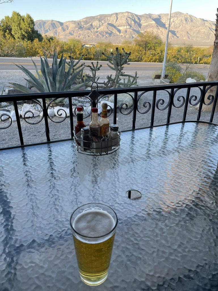
Relaxation, reflection, and rehydration on the menu at the Panamint Springs ResortIt never gets old…
No braying burros or noisy Boy Scouts or laughing religious retreaters from our last stay at the resort keeping us up throughout the night: Panamint Spring 2023
What was to be either a route to Kernville or Three Rivers adding another night to a sixth day’s travel, was now subject to a brewing spring downpour in the forecast for the following Saturday. So we decided to ride some 360 miles after a longish 350 mile day across Nevada from Panamint Springs back to our homes in Merced on our sixth of seven planned days, Friday.
Another glorious Panamint Range/Valley sunrise
We decided to ride like the wind (except it was into the wind) retracing our route back on CA-190 south to Trona for a last breakfast at Esparza’s.
I’ve written in the past about how Pete’s metabolism is remarkable. Pete had eggs, bacon, sausage, hash browns, biscuits and gravy. My chili verde was superb! I gained weight on the trip. Pete lost weight…
There was no eclipse to regale this day but we did meet a local fellow who was a resident of Trona for some 20+ years. When Pete asked what it was like living in Trona he replied that it was all right, that there wasn’t much to do, and he said that he had “caught cancer” and was in need of chemotherapy, which, not surprisingly, wasn’t available in Trona. We assumed he worked in the mineral extraction business, but who knows, living in Trona on the shores of Searles Lake is perhaps carcinogenic itself. We bid him blessings and the best of luck as we headed south to Ridgecrest.
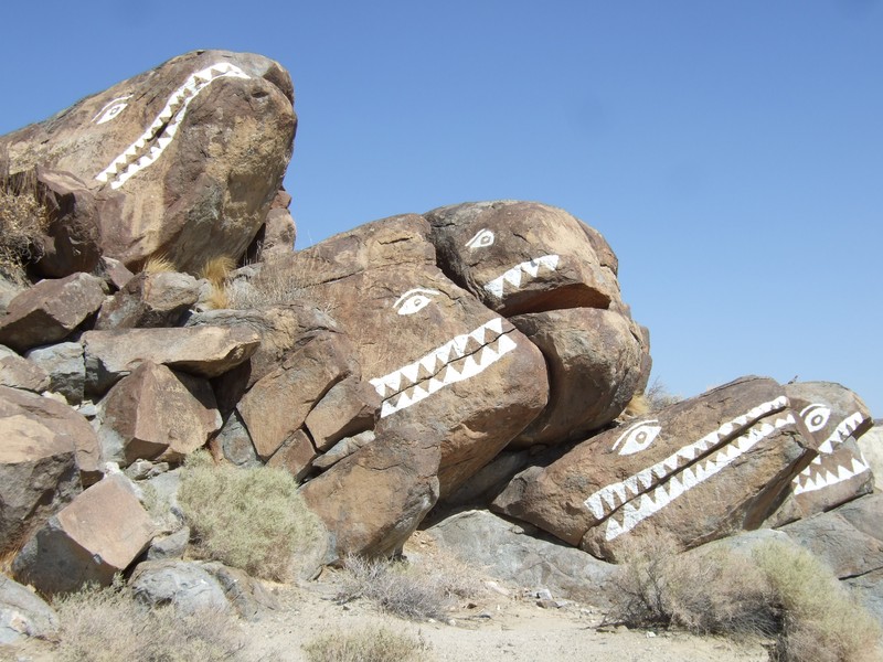
From Trona not far south on the way to Ridgecrest on CA-178 you’ll find an interesting geological feature, The Fish Rocks.
Passing through Ridgecrest, we hopped on to CA-14 south for a few miles before heading west CA-178 over Walker Pass, a reprisal of our first day’s route of this Red Rock Canyons Ramble. Figuring the pass (el. 5,250 feet) would be a bit nippy, we insulated up. It would be at Hart Lake Memorial Park just north of Bakersfield where we stopped for fuel and swallow a RedBull Light that we de-insulated as the valley temperatures were rising.
Saturday in the park, I think it was the Fourth of July… No, wait, it was Friday, April 12. We were in a park though…
North through Oildale, east to Shafter, north on CA-43 through Myricks Corner, Wasco, Neufeld, Elmo, Pond, Kernell, Allensworth, Angiola, past the Tule River Viaduct, Corcoran, Hamblin/Hanford, zig-zagging by way of the GPS through Caruthers, Raisin City, Rolinda, Kerman, Ripperdan, Parkwood, to the Pilot Travel Center on Ave 181/2 where I pulled over for fuel, but was talked out of it by Pete who was tired of stop signs every couple of miles and traffic backed up due to road construction. It had been slow going and was pretty warm, especially having to stop-and-go on several segments of the route.
I had just about enough fuel to make it home and so he compelled me to jump on CA-99, against my better judgment and where at the CA-152 and Hwy 99 exchange we were nearly run off the road by an indecisive cager who did a multi-lane change confused by the left lane exit to Los Banos and the through route north on CA-99, cutting us off and driving us to the shoulder of the road.
At that point, Pete led us to the LeGrand exit where we once again zig-zagged merrily on county roads with little traffic the rest of the way to the security and comfort of our family, pets, and homes.
Epilogue
I began this post by acknowledging that a journey of a thousand (and 212±) miles starts with the first step. For me the first step is in imagining how I might recreate the cheer and satisfaction achieved on all of the other rides I’ve chronicled while recognizing that the balance of the familiar with the unknown and how it brings the greatest ROI. I guess that as a geezer, I enjoy seasoning travel with a sprinkle of sentiment being careful not to overdo it by marinating in nostalgia.
At the same time, I reckon I’ve lost the desire to just hang it all out there and come what may, ride with abandon as I know it’s tougher to assemble a coherent narrative without taking the time to immerse in the adventure. Since on most of these rides, despite being retired and relatively free to ramble, the calendar no longer waits for procrastination or indecision. Hence, we return to the familiar to glean from the present what we overlooked in the past. As for the unknown, there’s always satisfying our curiosity with the novel, offbeat, unique, or strange. Take for instance RyanHenge or Montana Slim’s Traveling Robot Orphanage, not something you come across on a given day.
And as the calendar waits for no hesitation to plan the next moto adventure or my increasingly fidgety travel lust only marginally deteriorating with the specter of another night in a rocky, blustery, and frigid campsite or a smoke filled, sweltering, torturous lonesome highway, I can’t wait to begin planning the next, and perhaps, most epic ride. I think the next one will head north as spring meanders toward summer and where a volcano or two, some redwoods and rivers, and maybe a “popularly priced” motel populates the route. Maybe the forest floor duff will erase the memory of a stoney desert floor and we’ll hybridize our accommodations on this next foray.
As always, stay tuned for Sisyphus and his Associates next episode. Hey, just drop a line if you’d like to join us…
“When the virus of restlessness begins to take possession of a wayward man, and the road away from here seems broad and straight and sweet, the victim must first find in himself a good and sufficient reason for going.”
“There’s a wonder about traveling whether in time or space or in the mind, and if it can be both at once, why that’s the best.”
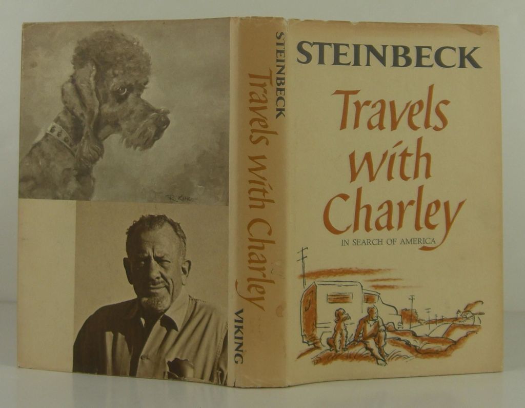
“A writer must rearrange reality so that it will seem reasonably real to the reader.” John Steinbeck, Travels with Charley
Prelude to 2023 Fall Moto V5.0
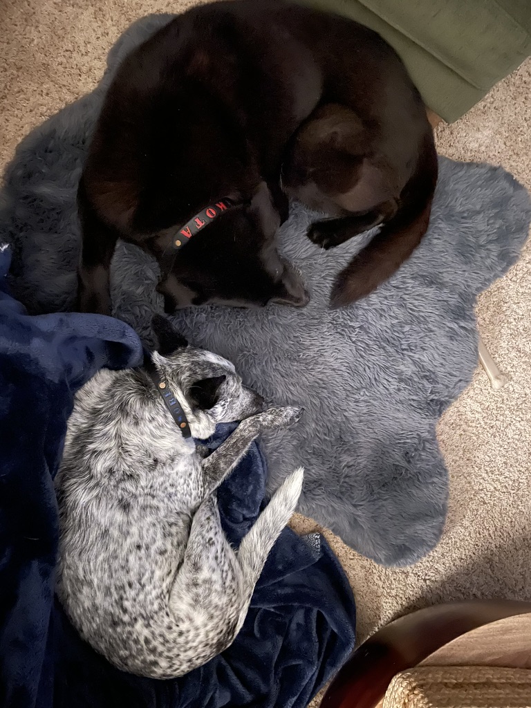
Beginning with the premise of rearranging reality so that it will seem reasonably real to the reader, back in August when 105 degree days were the norm my invitation went something like this, “Ah-hem, hey Pete, let’s make a pass at the passes before they close for the winter, eh?” Note, unlike Steinbeck, I chose not to invite SoBe or Dakota, my two curs…
The yin and yang of my canine home…
I had by mid-September pitched four different trips for the late summer/early fall touring scheduled in my mind and in Google Docs. One to the north and east through California, Oregon, Idaho, Montana, Wyoming, then south and west to Utah, New Mexico, Arizona, and home. I anticipated eleven to twelve or more days. While intriguing, that was a bit too ambitious for Pete’s crowded September calendar. Too much space, too little time.
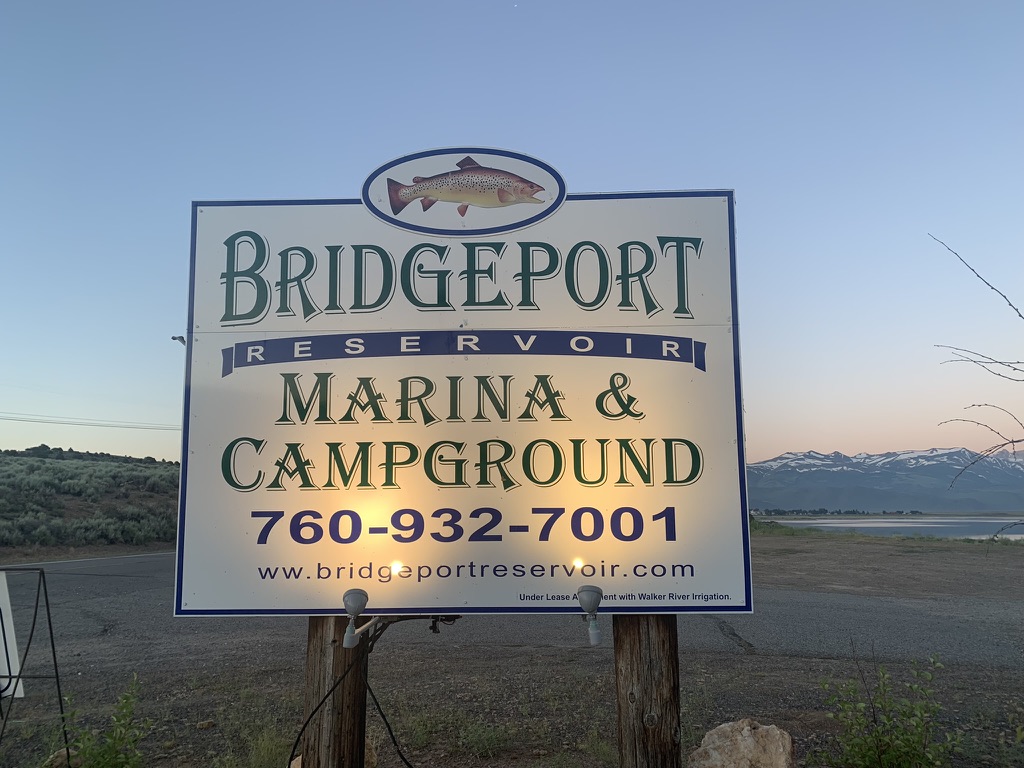
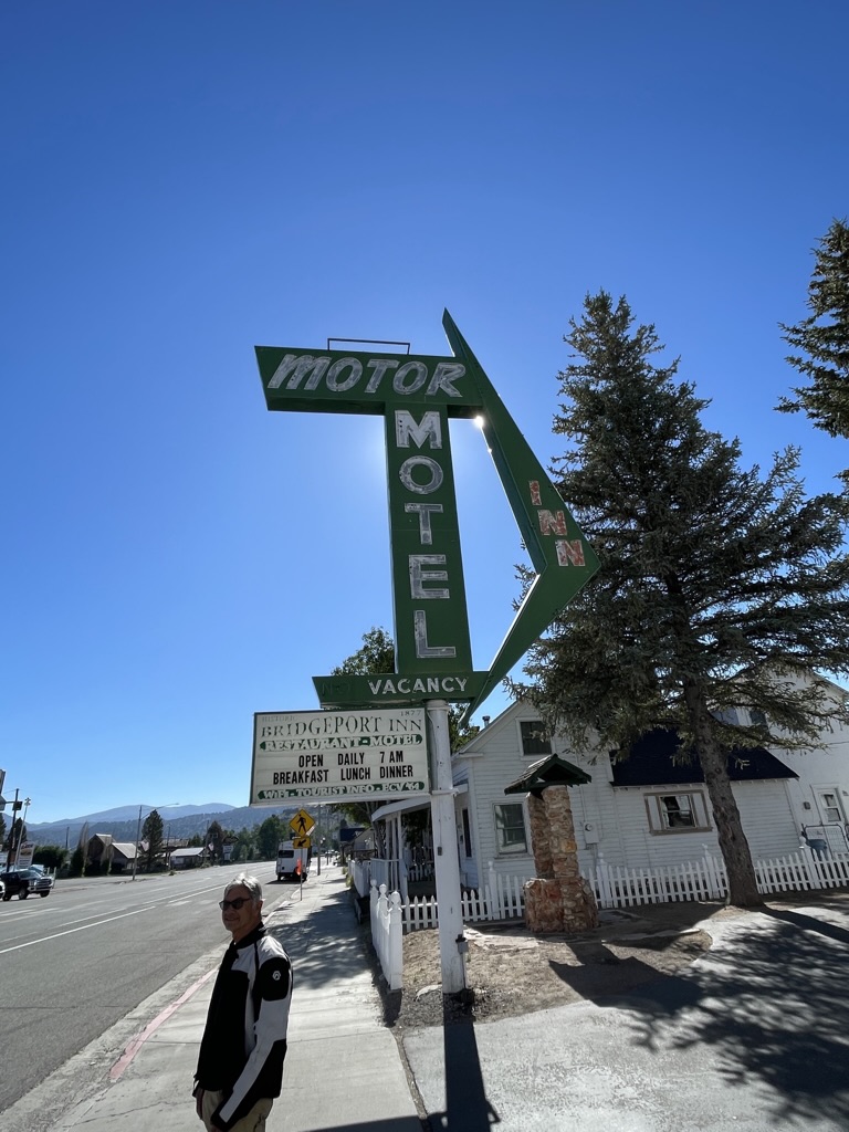
Anxious to spend some quality time on Il Mio Bella Rosso, my recently acquired Moto Guzzi V85TT in some broad, straight, and sweet roads, I was jonesing for more time and space adventure than the maiden voyage overnight to Bridgeport reported in Stairway to Heaven or Highway to Hell back in July.
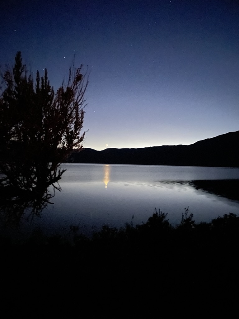
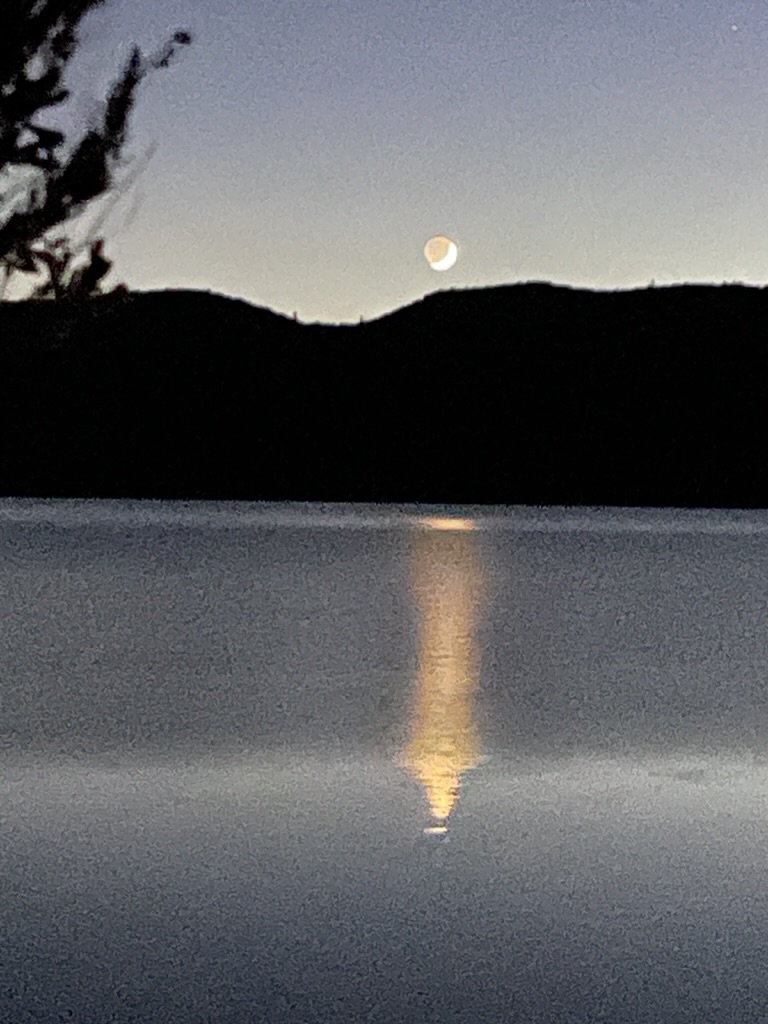
Bridgeport Reservoir, the moon, Venus and a visitor…
The next plan was for a Sierra crossing into western Nevada up to Oregon, then crossing to the Pacific, and down the Lost Coast. Upon mapping the route, I discovered the Anvil and SRF Complex Fires were fouling the air for better than half of the proposed ride. Besides, the air from my already dust fouled lungs due to the annual nut harvest was well underway. Already bracing for pneumoconiosis, I wasn’t anxious to breathe more airborne PM2.5 carbon particles. Besides, the overnight temperatures up around Goose Lake in northeastern California would assure frozen water bottles overnight…
Then there was the third pitch, let’s go for broke and head east to Moab. Again, unless we were planning on calloused nalgas from ten hour days in the saddle to keep the ride within a six day window, that same crowded calendar shelved that trip.
I then set about planning a fourth route that summited at Sherman Pass over the Sierra south of Mt. Whitney that included some Eastern Sierra side trips. However, by this time, fall had officially arrived and camping above a frosty 6,000 ft required heartier determination than both Pete and I could muster.
Finally, we mutually arrived at a 5-6 day October window in our overwhelmingly crowded calendars for retired guys. So I set about examining variables of routes, air quality, temperatures and weather. I had at last found a “good and sufficient reason for going.”
I hit upon a five day four night trip crossing the Sierra over Tioga Pass, heading to Hawthorne, Middlegate, Austin, Tonopah, Goldfield, and Dyer, Nevada to Deep Springs, White Mountains (and Bristlecones), Big Pine, Taboose Cr, Sherman Pass, Johnsondale, Success Lake, CA-245, and the golden hued fall foothills of the Sierra, home.
The ten day forecasts looked good, there were no fires in the vicinity of the route and Sherman Pass loomed large and free of snow. Aside from Austin, NV, where no rooms in the three local motels were available and overnight temps were forecasted to fall below 30 degrees, there were rooms available in Tonopah, somewhat warmer, but still a bit too chill for two chill geezers to camp. You can check out my obsessively compulsive, meticulously crafted Fall 2023 V5.0 Moto Itinerary that at last included Sherman Pass.
That’s me in the lime vest on the right (top) and blue bandana second from right (bottom). What’s with my Sherman Pass preoccupation? I had twice ridden my bicycle over the pass that runs west to east from just north of Kernville on Mountain Highway 99 to Pearsonville on the East Side at US-395. The rides began in Ventura on the Pacific Ocean and ended in Death Valley on those “back-in-the-day” two-wheeled adventures with various knuckleheads as we were grasping, and on Sherman Pass gasping, for the last vestiges of our youth.
Sisyphus (far right) atop Sherman Pass, 2006
Sisyphus atop Sherman Pass 2017 in the blue bandana
It seems I just wanted, as Steely Dan parleys in Do It Again, to “do it again” over the pass with a motor assist instead of pedaling. I’ve given up on the whole g(r)asping for vestiges thing.
Yeah, you go back, Jack, do it again
Wheel turnin’ ’round and ’round
You go back, Jack, do it again
In the mornin’ you go gunnin’ for the man who stole your water
Not to worry Pete. I had no intention of shooting you for a frozen water bottle.
And now for the “rearranged reality”
My plan is to portray the trip largely through video clips I managed to capture. The filming was episodic and by no means, not to be mistaken for epic. As a fan of motorcycle travel on YouTube, I’m amazed at the skill and technical wizardry that goes into compelling motovlogging. There are techniques and tools used to capture the essence of traveling across the country on a motorcycle that eclipse my patience, allowance, and ability to master. I like to ride and experience the terrain, make new friends, reflect, relax, and rehydrate over the day’s travels then return home and review the photos and tell a story. This time around, there will be a few more visuals to give you a sense of the movement and not just the moment in the trip.
I’ve learned a few things about YouTube that may affect what I had hoped to capture and portray. One, I filmed in HD-high definition 1080/60fps with a GoPro Seven. It takes horsepower and torque to download all those pixels on YouTube. SD, standard definition, offers an annoying facsimile of the visuals at 480p. You may need to seek the HD button in settings to click in order to override the SD option. Two, hopefully the music I’ve selected to accompany each clip isn’t prohibited by some copyrighted legal thing. I bought all of the music that I use in support of the creators, acknowledged them in the post and videos and hope that satisfies the lawyers.
The Wee Strom and the Coastie ready, set, let’s go!
Meeting as usual at the Chevron on Yosemite Ave and “G” St in our hometown Merced, California, Pete and I were anxious to get underway having postponed any one of the several rides I proposed for August and September. We were finally on the bikes on October 10th. Both the V-Strom and V-85TT were loaded for camping which included our first night along Walker Lake just north of Hawthorne, NV.
Anticipating the post Labor Day Yosemite crowds would be lighter through the Big Oak Flat entrance to the park, we set off north on “G” Street/Snelling RD, J-16/Merced Falls Rd, to CA-132 for a stretch in Coulterville. From there, Greeley Hill/Smith Station Rds to CA-120 into the park, another stretch in Tuolumne Meadows, then over Tioga Pass to Lee Vining.
With the afternoon closing in and nalgas fatigue beginning to set in, we set off on US-395 north, CA-167/NV-359, and US-95 for the Sportsman’s Beach Campground, a BLM facility at Walker Lake.
Upon arrival at Walker Lake the wind was howling, gusting at 30-35 mph. There was little in the way of vegetation and I soon discovered the campground windbreaks were not very effective. I was trying to make a call into the Whiskey Flats RV Park that we passed in Hawthorne on our way to the lake to see if any camping was available where the wind didn’t seem as angry. Pete, was entertaining a gentleman whose camper was parked nearby and whose curiosity and loneliness prompted him to greet us with tales of past adventures on motorcycles, a common bridge to conversation when we find ourselves among other geezers.
Suddenly Pete yells that my helmet, placed on the table under the windbreak, had blown off the table and was rolling down the hillside. That’s it, let’s head back into town.
Ecotourism, Nevada style…
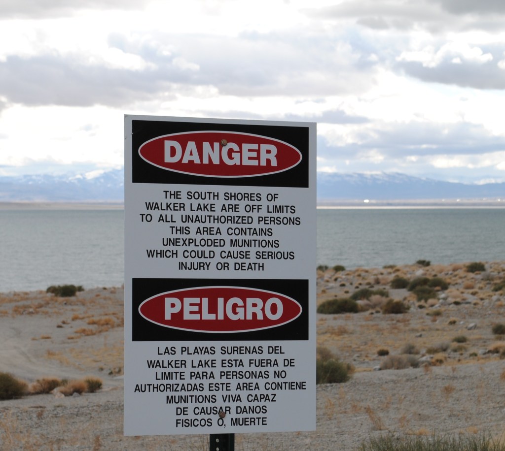
Our new friend, it seems, had cashed in the mortgage, gotten himself (along with his alleged wife whom we never saw) a fairly self-contained over-cab camper, with air conditioning and enough solar panels to power a suburban cookie cutter. In this rig they roamed the country in search of the Nomadland lifestyle, except for the hustle. Apparently his pension afforded fuel. Unlike the Instagram-YOLOing millennials whose carefully and meticulously curated van lives populate the interwebs, our friend, I’ll call him Dave, was far more pragmatic about his lifestyle. It was all about finding the best bargains, such as the Sportsman’s Beach Campground, a no fee BLM campground. It was no fee because it appears to have been abandoned by the BLM. The fact there were no unlocked bathrooms wasn’t a problem. Sure, it was 15 miles from town, on a windy unprotected shore of an endorheic basin, in the midst of the Hawthorne Army Depot, a U.S. Army Joint Munitions Command ammunition storage depot located directly south of Walker Lake. But for Dave, it was perfect despite the posted “Danger” warning.
Hawthorn is home to the Hawthorn Army Depot.The HWAD is the “World’s Largest Depot ” covering 147,000 acres or 226 sq. mi. and has 600,000 square feet of storage space in 2,427 bunkers. It is divided into three ammunition storage and production areas, plus an industrial area housing command headquarters, facilities, engineering shops, and stores reserve ammunition to be used after the first 30 days of a major conflict. Wiki.
It is only partially staffed during peacetime, but provision has been made to rapidly expand staffing as necessary. Maybe like with conflict in Ukraine, or Gaza, or Taiwan? Hawthorne did seem to be bustlin
As for Walker Lake…
A sign installed by the Walker Lake Working Group marking the water level in 1943 at Sportsman’s Beach at Walker Lake on June 22, 2023, near Hawthorne. The sign behind it shows the drop in water level less than a decade later, in 1951. (David Calvert/The Nevada Independent)
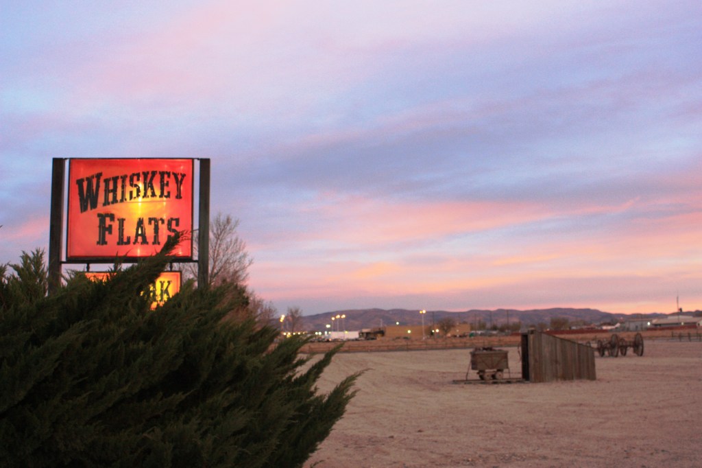
Escaping the windswept barren and dying lake containing unexploded ordnance, we secured lodging at the Whiskey Flats RV Park. When I called about tent camping availability, I was told yes, there was a large field designated for tent camping. Where we live a field is covered in some sort of vegetation. As you can see, the large field is not much more than a desolate gravel patch. Those Nevadan’s and their quirky colloquialisms! There was a fine laundromat with showers.
Hmmm… Pete, you go ahead and pitch your tent next to the mining cart. I’ll pitch mine by the wagon.
Earl was accommodating. We weren’t allowed near the manicured RV sites, but…
We managed to talk the fellow at the desk, I’ll call him Earl, into allowing us to pitch our tents near the boundary of the park, under a tree with a small table beyond the facilities and manicured RV sites. Most likely on the leach line for the laundromat and showers. The spare office was filled with an array of fittings for trailers and RV’s, a few snacks, and a choice of Buds or Coors. Not needing any fittings we settled on a couple of Coors.
What’s that smell?
After rearranging some of the larger pieces of gravel at our site, we set up our tents and headed into town for pizza. The joint was run by an East Indian family serving curried pizzas and other Indian entrees. It wasn’t bad. Oh, and there was the customary stop for 3-R beverages at the local Safeway. I challenged the young cashier to guess my age as she requested to see my ID. I interrupted the young cashier as her neighboring checker, who was closer in age to me, was invited to the guess the geezer’s age contest. The elder cashier guessed my age to be 12 years younger than actual and the younger cashier guessed two years younger. It must have been the motorcycle gear…
Whiskey Flats is situated right on US-95, a major highway that connects I-80 near Reno with Las Vegas. Consequently the truck traffic serenaded us through the night. We could have done our laundry and showered since sleep was a challenge, but it was only our first night away.
Place looks nice in the dark, like Ennis in True Detective Season 4, Night Country…
Jody Foster never showed up, we found no mysterious tongues outside our tents the next morning, and aside from the noisy trucks, it was peaceful.
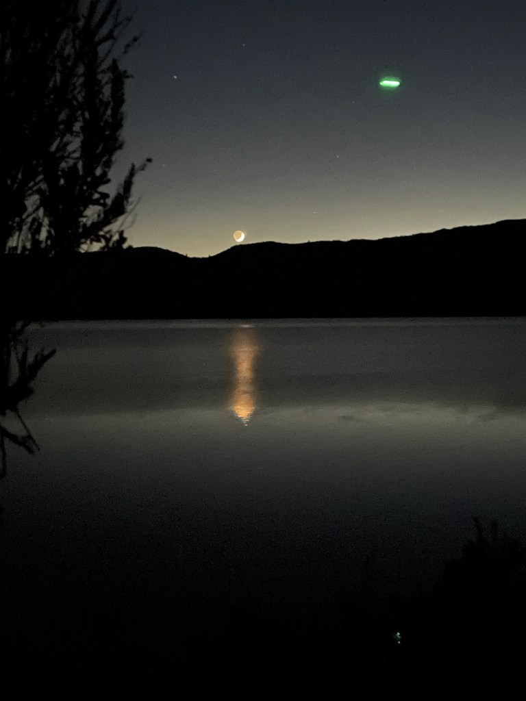
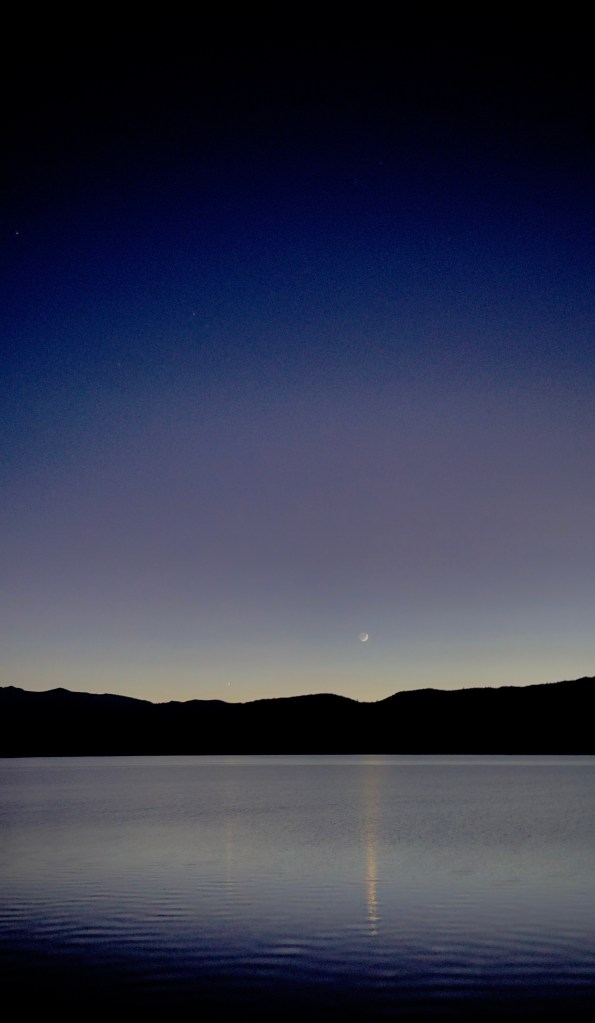
I’m a fan of first light on these excursions. Besides, sleeping in with the constant roar of triple-rigged tractor trailers, mostly UPS, just yards from our campsite, incentivised capturing the waning crescent moon and Venus before sunrise.
Hawthorne isn’t exactly a food mecca. There were two pizza joints, a coffee kiosk, a casino restaurant that was undergoing renovation, a food truck, and a Mickey-D’s. Coffee, oatmeal, and a hash brown fast break, we enjoyed this fine light repast while eavesdropping on the comings and goings of the A.M. McDonald’s Hawthorne/US-95 crowd.
There was a rather loud gentleman conducting some sort of grand real estate deal on his cell phone with absolutely no nod to etiquette. There was the young man who I believe had a crush on the young lady at the counter. He came in, got water and sat down trying to engage her in conversation about the local high school football season. After he departed, another fellow came in, sat down without ordering, and engaged the same young lady behind the counter about how she should insist on a pay raise because she was so undervalued. Maybe she could get that raise if the local customers actually bought something at the joint.
Thar’s gold in ’em thar hills…
We set out for Austin by way of US-95 and near Lunning, took NV-316 passing the Walker Lane Minerals Corp Isabela Pearl Mine, a large open pit gold and silver mining operation. Then it was on to Middlegate, followed by a short ride on US-50 past the shoe tree, and NV-2/722 over Carroll Summit to Austin.
Middlegate Station just looks better in black and white. I bet that place rocks on payday.
Thirsty machines needed quenching too, so a quick stop at the only petrol station for miles and miles and a snack for the pilots ensued.
Neat thing about motos is that you can pretty much park anywhere…
As we stood outside shivering while eating snacks and watching life pass through Austin on the Lincoln Highway, we noted how conveniently the three no-vacancy motels are located.
At least the Cozy Mountain had the courtesy of acknowledging No Vacancy…
Austin from up the road a piece…
From Austin it was a brief stretch of pavement on the Lincoln Hwy, AKA The Loneliest Road in America, to NV-376 south. NV-376 was the most perfectly, and recently, paved stretch of highway I’ve ever ridden.
Interesting spot for a stop light…
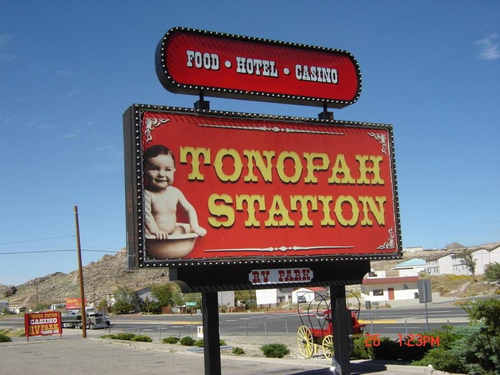
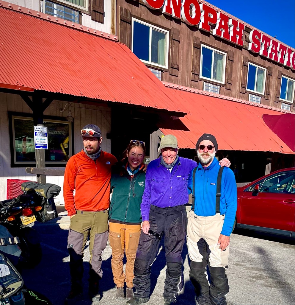
Past the mining town of Carvers we were soon at the intersection with US-6, a couple of miles east of Tonopah. We arrived in town at our lodging for the night at the Tonopah Station Hotel and Casino after 269 miles of open road.
Not sure of the marketing concept behind the branding…
Interestingly, the description of the hotel on their website includes amenities such as restaurant, casino, bar, free parking, free WiFi, a desk, a flat screen TV, linens and towels, and the “Nye Regional Medical Center is a 2 minute drive away.”
Okay, to include linens and towels as an amenity seems a bit of a stretch. Noting the location of the Regional Medical Center as just a 2 minute drive away is all you need to know about the demographic choosing the Tonopah Station, notwithstanding their signage. I think I saw courtesy oxygen tanks next to some of the slots. Wait, we chose to stay there…
Playahs! That’s a hydro-flask and not an oxygen tank in my left hand…
As we were unloading our gear we noticed a couple of bikes pull into the parking lot. One, a 1999 BMW GS and the other a 2019 V-Strom, both with Alaskan license plates. Later as we made our way to the Tonopah Brewing Co for dinner, we noticed the bikes again. We surmised, though we didn’t want to interrupt their meal, that the three occupants at a table near us were a family of moto-tourers.
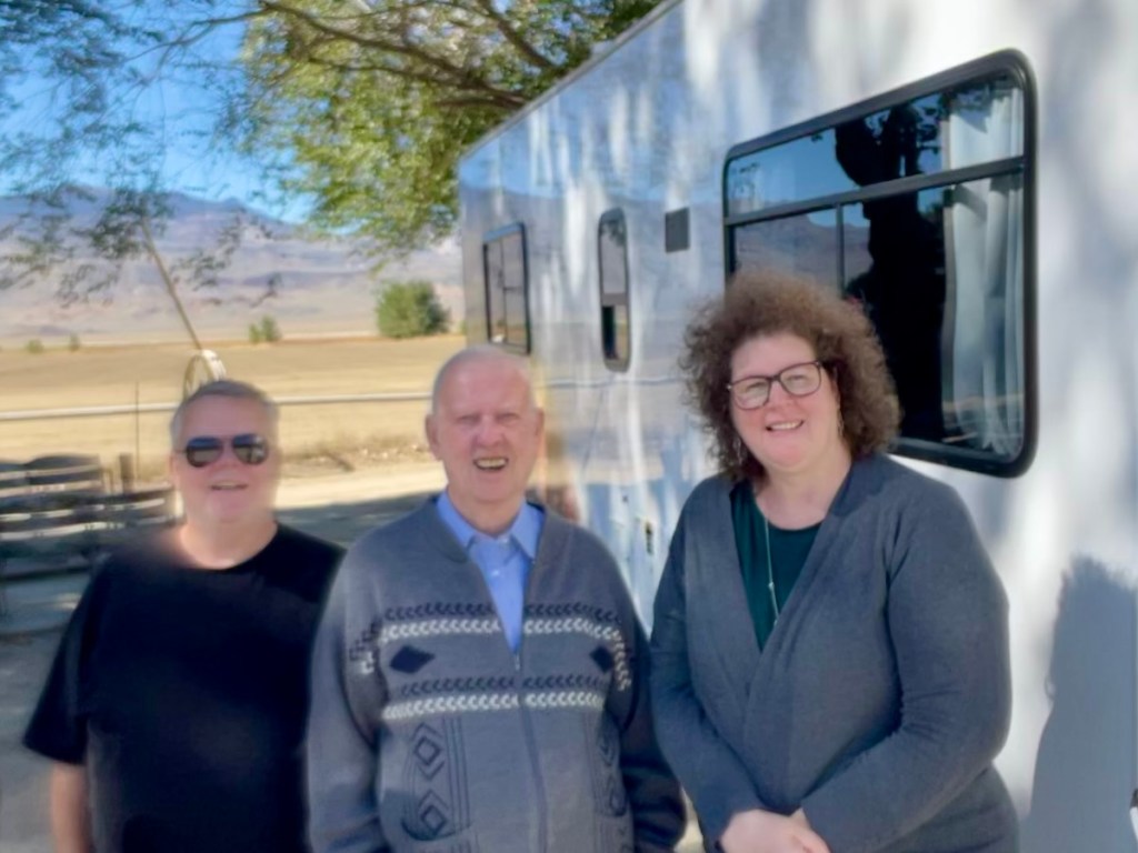
As it turns out the next morning we met Doug, his daughter Lilly, and her husband Parker who were two-up on the BMW. Doug had been on the road with Parker for a month or so making his way down from Alaska where they met Lilly in Santa Cruz and were headed for a tour of the southwest before Doug began his trek down to Argentina! You can follow Doug’s adventure on Instagram @ joyful_moto.
Parker, Lilly, Sisyphus, and Doug in Tonopah, NV (l-r)
After a delightful breakfast at the Tonopah Station Restaurant, where some 30 years earlier I fueled up with a group of seven other knuckleheads as we rode our bicycles across Nevada’s basin and range terrain, I recalled how the cuisine in Nevada caused grievous intestinal distress on hundred mile days of mile after mile of nothing but mile after mile. It seems that for the most part, the variety and quality of food that’s now available has improved. Either that or all the pedaling had something to do with the upset gut.
The third day was short, a mere 154 miles to our destination for the night at the Taboose Creek Campground. There was a sightseeing detour to the Ancient Bristlecone Pine Forest enroute. The Bristlecones are located off of CA-168 that is the California extension of NV-266. From the Tonopah Station we rode in search a couple of miles to find a Raley’s to purchase a pair of +2.0 readers at the to replace the glasses I apparently lost somewhere between Austin and Tonopah. After seeing the basin east of town spread before us and no Raley’s in site, we turned around to discover the Raley’s was right next door to our motel. Maybe I needed something stronger than readers. Well, from there we turned left, heading west for Goldfield. After about 40 miles did I discover I had once again zigged when I should have zagged. Had I headed east from the Raley’s parking lot on US-6 to NV-365, it would have taken us to the Goldfield mining “ghost town” as planned.
As it happened, serendipitously, I turning left on US-95/6 heading west and by realizing this wasn’t the way to Goldfield, we rerouted on NV-264 from US-95/6 south to Dyer, NV. Dyer is an unincorporated town located in Fish Lake Valley in Esmeralda County, Nevada. It has a population of 324 according to the sign as you enter town that serves the surrounding area’s sparse rural population of mainly ranchers and indigenous Paiute people. The town has a gas station/store/cafe (where guns, presumably open-carry or otherwise, are welcomed), a post office and an airport. We stopped for nalgas relief and patronized the store purchasing coffee and a snack. A rented RV pulled up to the entrance to the store’s parking and as Pete bid the gentleman directing the woman behind the wheel good morning, who tersely replied with a British accent, “I can’t talk just now, I’m trying to direct the camper.”
Apparently it was his wife’s first time behind the wheel and she was backing off of the pavement to park next to our bikes. Needless to say, we allowed him absolute concentration in his direction giving.
Percy, Digby, Sybil (l-r)
It turns out that Percy, his wife Sybil, and her father Digby were visiting the western US from Britain. They were a delightful trio who, ironically, were motorcyclists. Even more ironic was the fact that Percy had managed a Harley Davidson dealership outside of London. His wife, Sybil rode as well on a “Japanese Cow”, or Kawasaki. Digby, the father, was strictly a Vincent/BSA/Bonneville man whose demeanor brightened considerably when Pete mentioned that he has a T-120 at home and previously owned earlier 650 models.
We had an enchanting conversation with the English visitors and recommended some sights they might include seeing on their way to Yosemite. Since I never did get their names, I made them up to be as British sounding as my 23andMe ancestors.
Back on our bikes we continued on NV-246 that became CA-168 at the Nevada/California border. Zooming past irrigated alfalfa fields we passed through Oasis, CA where on a previous ride, Riding Under a Fool Moon, we thought we’d lost one of our fellow riders to an alien abduction. Turns out he made haste to Dyer for the lone gas station for miles and miles. Seems to be a theme in Nevada.
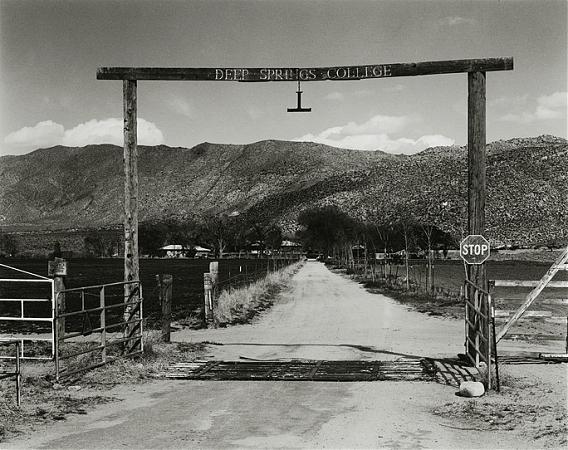
Photos courtesy of Deepsprings.edu
Had I only known then maybe Chico State would have been my back-up
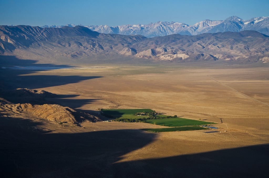
The route from Oasis past Deep Springs and over Westgard Pass is one of the best surfaces with the least traffic over undulating and sweeping curves of any road on the East Side of the Sierra. We passed Deep Springs College, an interesting institution of higher learning that, like the landscape, is spare and deeply rooted.
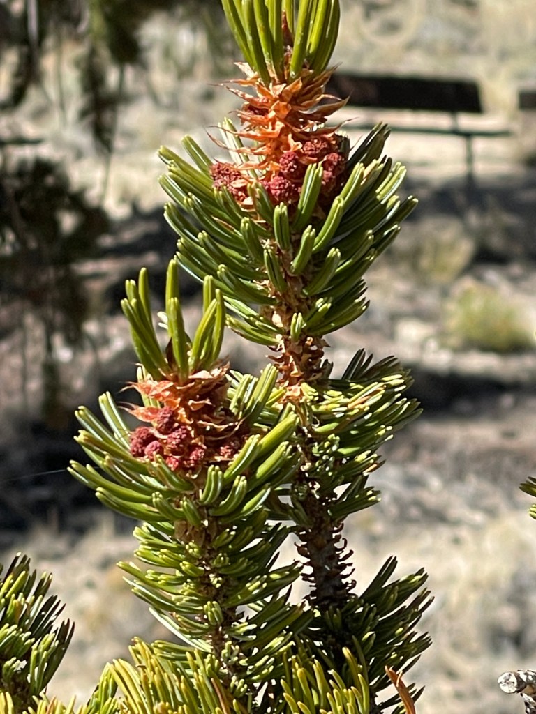
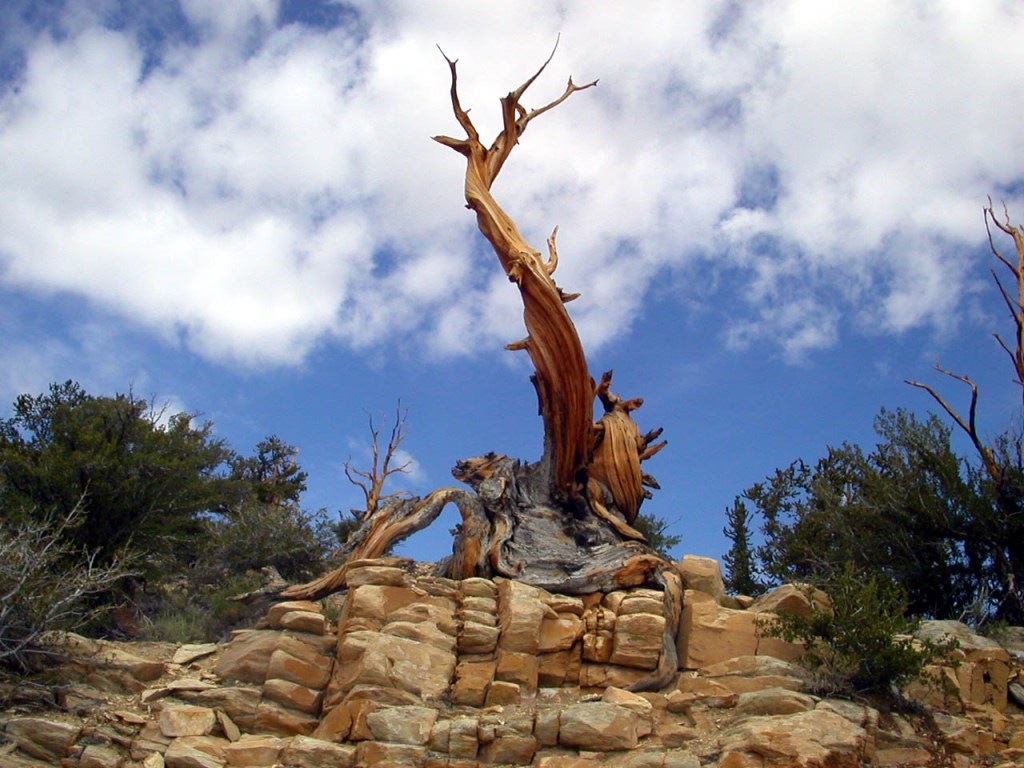
Upon approaching White Mountain Rd that takes you up to the Ancient Bristlecone Forest, you’re struck by how arid the landscape appears. The Great Basin bristlecone pine (Pinus longaeva) trees grow between 9,800 and 11,000 feet above sea level, in xeric alpine conditions, protected within the Inyo National Forest. Limber pine (Pinus flexilis) also grows in the forest. Snowfall is the primary source of water for the biome and there is evidence that climate change is impacting the forest.
And we consider ourselves geezers...
We bid adieu to the guardian Raven at the Schulman Visitors Center and departing the bristlecones we set off for Big Pine.
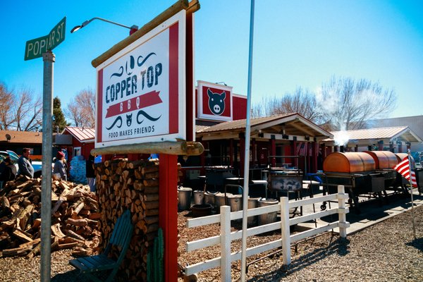
Our plan was to grab a bite to eat and provisions for the 3-R’s, you know, for the rehydration, relaxation and reflection later around the campfire. We found the Copper Top BBQ restaurant where a generous serving of tri-tip and a beer, poured from the bottom up, was served.
Add Big Pine to Kansas City, Central Texas, and Memphis for BBQ
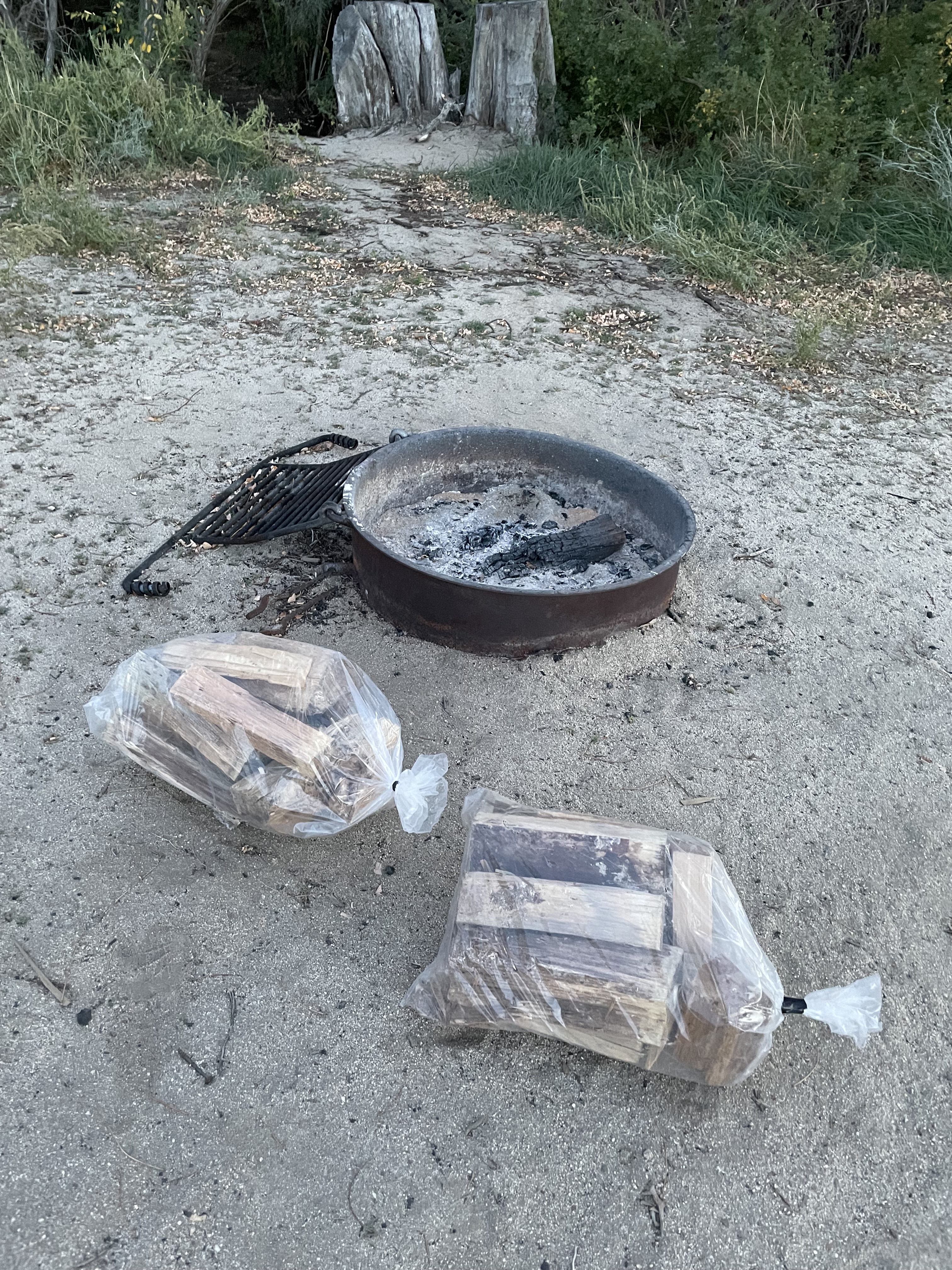
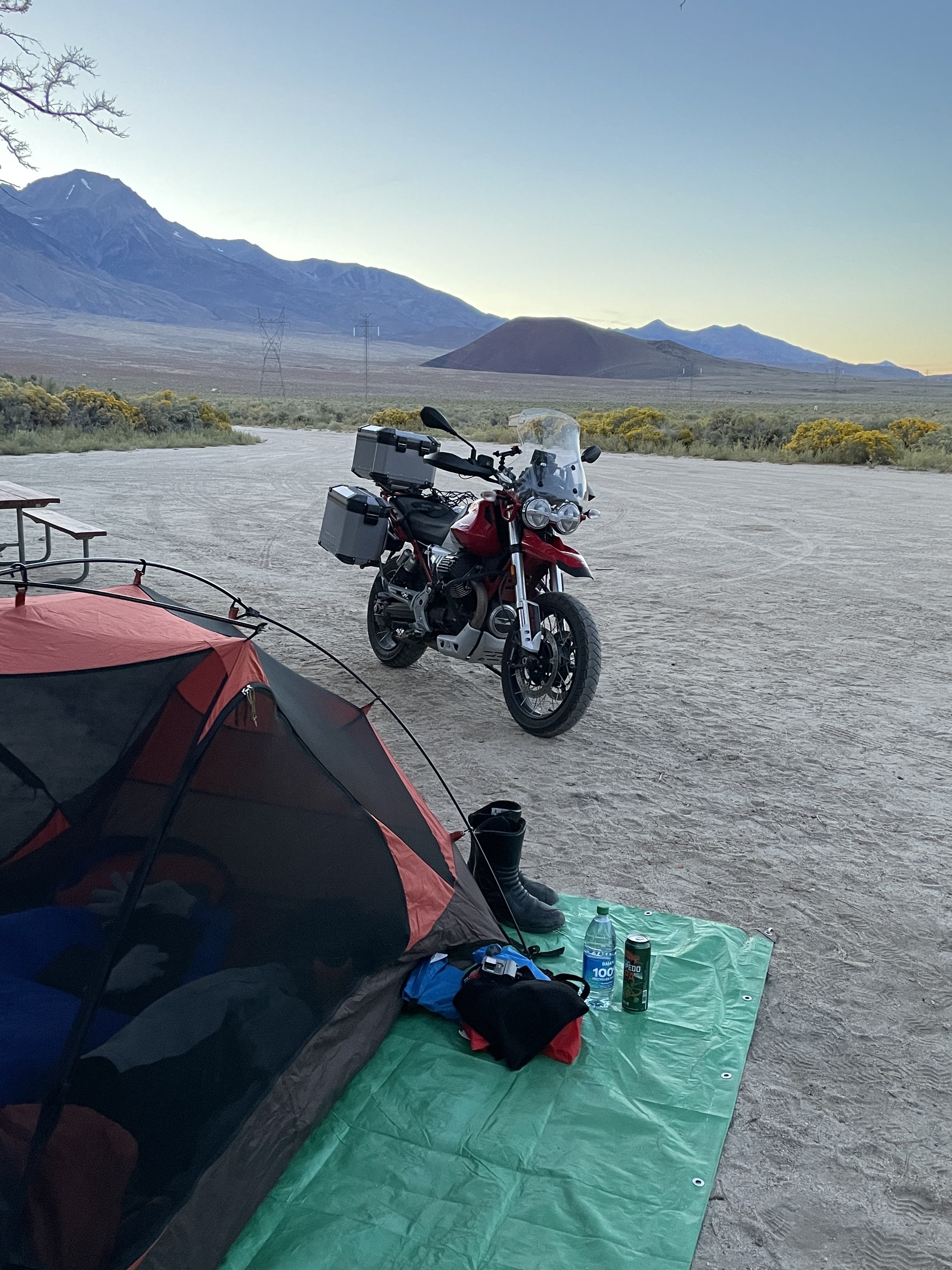
Via US-395, midway between Big Pine and Independence, we turned west on Taboose Creek Road, and it’s two miles to the campground, far enough from US-395 so that the trucks offered a distant lullaby. All of the amenities secured for the evening, we set up camp.
The 3 SECONDS TENT = “The #1 easiest, fastest 1-Person setup camping tent…”
The 3-seconds Tenton the right. The half-hour tent on the left
It never ceases to amaze me that in spite of paring down gear on each subsequent ride, I still manage to carry a “BIT-O-GEAR”.
If only my garage was this organized…
After reflecting on the day’s ride, warmed by the fire, mesmerized by the night sky, and enchanted by the Milky Way we called it day and turned in. Besides, the rehydrates, having sufficiently relaxed us, completed the 3-R hat trick.
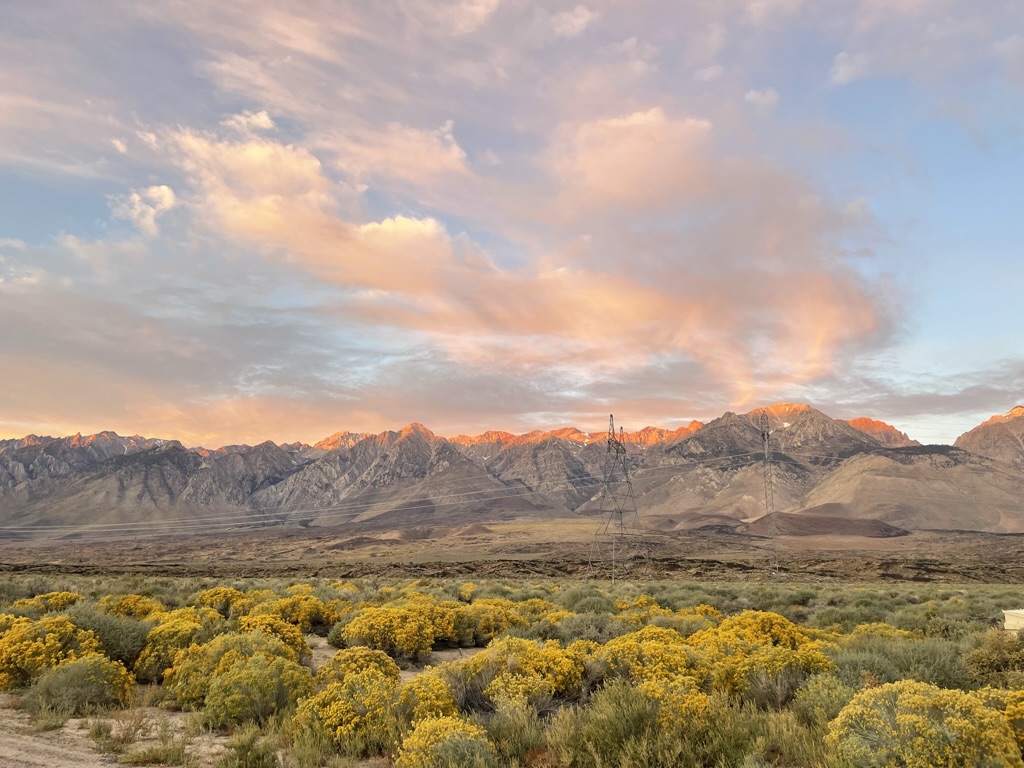
We awakened to a glorious sunrise, the air crisply chilled and clear. The angle of the sun’s rise, the sparse and wispy clouds filtering the light, and the vantage of the direction of the photo displayed how the Sierra Nevada, whose literal translation from Spanish is “snowy mountains”, is as John Muir noted more aptly, the Range of Light.
“Well may the Sierra be called the Range of Light, not the Snowy Range; for only in winter is it white, while all the year it is bright. —John Muir, in “Our National Parks” 1901.
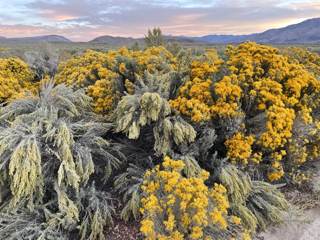
Rabbitbrush is a common name for shrubs, principally of the western United States, in three related genera of the family Asteraceae. The rabbitbrush below is one of the three of the genera, yellow rabbitbrush.(I hope no fellow California Naturalist notes my laziness in correctly, not necessarily incorrectly, identifying the plant).
It’s yellow for sure…
After our customary wake-me-up/warm-me-up/pack-em-up mochas, we bid our campsite adieu noting that it will become yet another campground deserving a future repeat stay.
If that’s all it did, wouldn’t it be worth having?
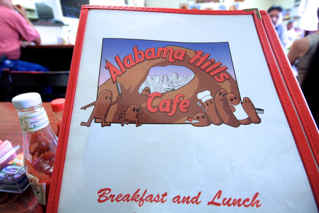
Lone Pine was a mere 30 miles south of our 225 mile day so we sought breakfast at the Alabama Hills Cafe.
You decide on the menu art. Spheroidal weathering of exposed granite or chocolate yard bunnies left by Fido?
From Wiki: The rounded contours of the Alabamas contrast with the sharp ridges of the Sierra Nevada to the west. Though this might suggest that they formed from a different orogeny, the Alabamas are the same age as the Sierra Nevada. The difference in wear can be accounted for by different patterns of erosion.
That’s how SoBe and Dakota tried to convince me that I was more of a geologist than sanitationist as my twice-a-day field studies yielded “forms from a different orogeny” in our backyard.
The menu art notwithstanding, the breakfast was delightful with the cafe populated by as many locals as REI booted, Pataguchied, Sprinter Van tourists. Pete is pictured “incognito” the glasses adorned to keep patrons of the cafe from mistaking him for Humphrey Bogart (of High Sierra fame) or Jack Palance (of the remake of High Sierra, I Died a Thousand Times fame) despite their deaths years ago. See a previous post, https://sisyphusdw7.com/2019/11/27/riding-under-a-fool-moon/, for a brief but spectacular guide to movie making in the Alabama Hills.
From breakfast it was on to 9 Mile Canyon Road south on US-395 but not before topping off at the Shell Station just a five iron further south of our turn-off.
Maybe a mile of 9 Mile Canyon Rd…
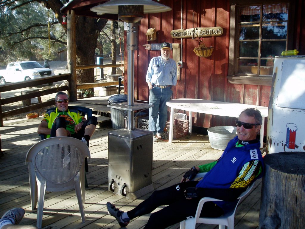
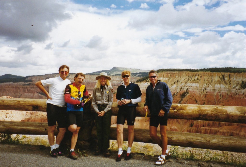
Sisyphus (L) & Associate John B. at the Kennedy Meadows store in 2006. We’re in bicycle ATGATT. The proprietor, who I’ll call Bud, is in the background
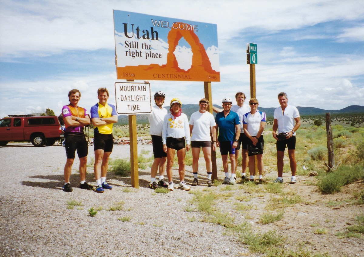
I was fortunate enough to have among my friends a group of cyclists (of the pedal variety) in the years prior to reviving my motorcycle diversion. We twice rode from Ventura on the California coast across the state to Death Valley as well as across Washington, Oregon, Idaho, Montana, Wyoming, Nevada, Colorado, Arizona, and New Mexico. Oh, and twice across Utah. The group was lead by Larry Johnston, sadly now deceased and very much missed. You can see his influence in my desire to organize two-wheeled tours in: When We Were Younger where I shared a typical itinerary, this from our Utah ride, Larry would provide us knuckleheads. From that ride, the Burr Canyon will forever be stitched into the fabric of my memories as one of the most sublime experience ever. Utah remains as one of our favorite riding destinations, several posted on the site.
Crossing Sherman Pass(video link) Apologies for the SD (Standard Definition) replay. I downloaded it as a 1080p/60fps file but the YouTubes apparently exhausted any love for me in earlier links.
After a jolt of pressed java at the Grumpy Bear’s Retreat at Kennedy Meadows, a popular resupply stop for PCT hikers, we continued on to the actual Sherman Pass.
We reached our destination for the night, Success Lake, descending through the Southern Sierra Foothills on M-50, Hot Springs Dr. and Old Stage Rd to Porterville where a right turn put us on CA-190 to the Tule Campground. The lake, or rather reservoir, still brimming from Winter of ’23 Tule River watershed runoff appeared to be one of those California foothill “recreation reservoirs” where any number of mechanized forms of recreation seasonally populate the waters and campsites. In October there were a number of campers and a few fishers (not woke, but also not wanting to assign gender to the noun that describes the verb with or without an object, I invented “fishers”) not so many jet skis or wake boats.
The Guzzi open for business…
After a modestly satisfying meal down the hill (I don’t remember where or what but the “modestly satisfying” pretty much sums it up). We procured the 3-R’s beverages at The Success Market where a chap festooned in Harley apparel paid for the gas to fill his VW Bug in coin. I vaguely recalled what coins are since I seem to only receive them as change for cash purchases on moto tours that ends up in the little coin tray near the register. Those that do subsequently make it into my in my jacket pocket then end up in a vase on my chest-of-drawers (I learned in my teens that some guy named Chester, who was apparently a furniture maker, was a malaprop). I bet a chunk of the deficit could be eliminated if people donated the content of what I imagine millions of jars filled with coins languishing on Chester’s Drawers.
The campsites were barren. There was a nice bathroom/shower facility, however, you had to traipse through millions of goatheads to get to it. Another feature of the campground was the group of campers who set up their amplified instruments across from us. I regret not filming the affair as they began their performance, likely a practice. I have been the drummer in a couple of bands; Staff Infection, MC^2, and Timeless Flyte; a blues, fusion, and Byrds/Burrito Brothers tribute band respectively. I kinda’ know that when practicing, rehearsing is the official term I believe, mistakes can be made so that when it’s time to hit the stage, you don’t embarrass yourself. As Mozart noted, “The music is not in the notes, but in the silence between.”
These guys were cringeworthy bad. They sucked. Their musicality would have been much better had they eliminated the notes and stuck with the silence between. It was embarrassing to listen to their arrhythmic, non-metrical, discordant decidedly unmelodic playing, complete with shrill atonal vocals. (I’ve been watching Loudermilk on Netflix which unmistakably has influenced my critical music vocabulary and attitude).
Pete and I enjoyed Jupiter as the sun set, despite the cacophony...
Thank goodness the jangle ended around 10:00 pm as we turned in having enjoyed a lovely sunset and our customary 3-R’s. Unfortunately, that was when the adjacent campsite’s occupants began an audible conversation that lapsed into a drunken argument inside of their 500 sq. ft. tent. I liken the strength of their arguing in that voluminous tent to that of the storm raging on Jupiter’s enormous surface. Their arguing was only exceeded in volume by the crying infant, no doubt disturbed by the f-bombs exchanged by the foul mouthed adults. I pause to label them parents, as their behavior bordered on abusive in a way no legitimate parent would behave.
I might have slept better on Jupiter…
So much for sleep. I finally managed to fall asleep as the infant ceased crying and the grown-ups had apparently passed out sometime after 2:00 am. About a half hour later, as I am a man of a certain age, I needed to “see a man about a mule,” a familiar refrain I learned from my pops. The next morning I plucked about 2,357 goatheads from the bottom of my Heydudes. Each.
Once again, “If that’s all it did, wouldn’t it be worth having?”
Our homeward bound route found us on familiar tarmac. The Sierra foothil roads are just one of the great rewards of motorcycling in California, available year round. From Lake Success to Porterville, instead of our planned route that would take us up to Springville and Yokohl Drive to CA-198, we had to detour as the severity of the massive ” ’23 runoff” that had refilled the dormant Tule and Tulare Lake basins, had caused flooding and several washouts on our preferred route.
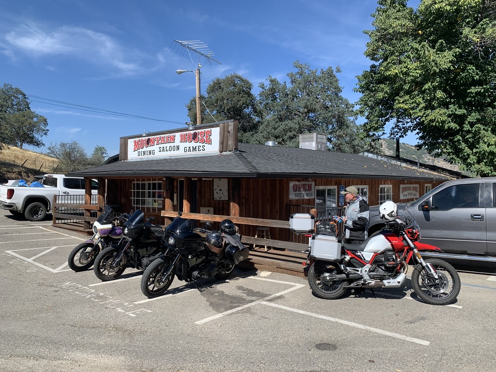
From Porterville we rode CA-68 through the valley towns of Lindsay and Exeter to CA-245 missing the intoxicating springtime citrus blossom aromas of surrounding orchards. Through Woodlake and Aukland we made our way to Badger and the Mountain House Saloon for lunch, a popular moto roadhouse.
The Coastie making a bold aesthetic statement…
After seating for burrrrggggaaaahhhhs (*see Jaime Robinson @ https://www.motogeo.com/) several sportbikes arrived. I’m sparing your having to watch yet another 10x speed nausea inducing video on the noteworthy twisties of CA-245 in Fresno County. I hope my choice of music, if YouTube hasn’t taken down the videos because of some sort of copyright violation, made them worthwhile.
The remainder of the ride home was quite pleasant as the roads (described in previous posts), the weather, and Pete’s companionship made for yet another dandy experience on two wheels.
Tom had me on, “The Moto Guzzi v85 Adventure is loaded with charm: A steel trellis frame. More steel in front and rear trellis subframes. Dual round headlights. Right and left side eagle emblems on the tank, both looking forward. Cylinders sticking out on both sides. Air cooled, pushrod valve train. Weird controls with no red buttons. Using the start button to change riding modes. Using the mode button to change the display. Low to middleweight power with middle to heavyweight mass. While other adjectives apply, I choose to consider this mix of characteristics as charming.
He goes on to deliver what must be the most comprehensive review of the features of the bike I’ve read or seen to date. He does it with a conversational ease, though he goes deep into the weeds of some of the more technical aspects of the machine, its operation, and features never straying far from my largely emotional regard for those attributes and appreciation for the technical. I have a great regard for his observations and ability to convey the story of his 21 Day, Coast to Coast as thoroughly compelling.
What’s next?
Well, let’s see. It’s winter so the desert beckons, followed by spring with the Four Corners whispering, late summer shouting, “go north and east young man,” and the Lost Coast challenging. As always I’m in search of my next favorite ride!
Maybe Sisyphus won’t put off pushing that enormous blog bolder up the hill as he did with this tardy post from a ride some four month ago.
Sisyphus, January 2024
Timeless Flyte: Turn, Turn, Turn. Sisyphus is on the kit. Click twice for the audio.
Sisyphus isn’t frowning, he’s just trying to keep the tempo, you know, like rolling on the throttle to that proper mix of speed, sound, and wind then setting cruise control…Sounds okay to me! The Guzzi produces the same reaction…
I’ve decided to continue the tribute to Larry in both his words from the itineraries he provided pre-ride and my commentary when synapses are activated to recall my personal experience as the ride unfolded.
Tour de Ute 1997
The Burr Canyon
August 12 – 17 1997 4.5 days cycling L-R Larry Johnston, Lance Vaughn, Chuck Satterfield, Don Lundberg, Chuck Thuot, Richard Vaughn, Glen Rothell, John Holbeck, Coucou, c’est moi !, and Ron Burien (taking the photo)
In this first episode of Part 2, I’m going to use Larry’s detailed itinerary that follows and that we all received prior to the ride. I only hope the correspondence that Larry and I had prior and post ride are in some box in the garage that my wife insists that I toss. These notes are postmarked 25 Mar 1997, Mojave, CA.
Tour De Ute “Toor do ü-tay”
When: August 12-17 1997 (Tuesday, Wednesday, Thursday, Friday, Saturday, Sunday); 4.5 days cycling.
Where: Across Utah State beginning at Uvada (about 150 miles northeast of Las Vegas), ending at the Utah-Colorado border near Hovenweep National Monument. Best map: “Indian Country” by AAA. [ed. note: maps were those origami paper things that preceded GPS]
Sag Vehicles: Glen’s Suburban, John’s Tundra
Day 1: Travel to Panaca, Nevada for 1:00pm rendezvous; proceed east in sags on Hwy 319 to NV-UT border at Uvada (el. 5,500’±) and ride via Hwy 56 to Cedar City (el. 5,600′). Stay that night at the Super 8 (#30± per person). Distance: 58 miles
Larry engaging a Ranger. He had a penchant for natural history and blond rangers.
Day 2: Ride Hwy 14 east and up, up, up to Midway Summit (el.9,896′) – a definite “Vaug-han”. Check out nearby Cedar Breaks National Monument. Proceed down then up to Long Valley Junction (el. 7,900’±). Turn North on Hwy 89 to Hwy 12. Ride east on Hwy 12 through the tunnels, over the “summit” (el.7,619) to Bryce near Bryce Canyon National Park – stay that night at the $30±/person Fosters Motel (you know, Al Foster’s place). Distance: 70 miles (don’t you love it?). Terrain: Big climbs, big descents; watch out for tourists.
Bryce Canyon
Day 3: Follow Hwy 12 east and north through Escalante and the new national park to Boulder (el. 5,000′?). Stay at Pole’s Place$25±/person. Distance: 72 miles (don’t you love it even more?). Terrain: Up and down and all around; time to play…
Boulder, UTPole’s Place
Day 4: A short cut’s in store, who could ask for more? Ride east from Boulder on the “Burr Trail” and shuttle the 20± miles through Capital Reef National Park. Ride south to the ferry at Bullfrog Basin; swim or take the ferry across Lake Powell ($9/car – free/swim) before heading east on Hwy 276 where the day’s adventure can end at Hwy 95. Shuttle northwest on Hwy 95 to the only place to stay for miles, the Fry Canyon Lodge (it’s near Natural Bridges Monument); maybe $40+ a piece… it ain’t cheap. Distance: 103 miles not counting the shuttles and ferry; bring paddles/swim suit. Terrain: the Lake Powell crossing will be flat.
Grinding gravelThe Burr CanyonThe Burr Trail
“Some parts of ALL the rides leave edible memories, but that morning in Utah riding with you (…we were first out together) when we both dropped in to the entrance of that canyon on the Burr Trail was, for me anyway, perhaps the most ‘spiritual’ moment I’ve ever known in a wilderness setting (… and that’s after traveling on all 7 continents). At that moment I felt like I shouldn’t even speak so as to not desecrate experience. I remember us stopping and observing with profound awe at our stunning surroundings without a word be said between us…. thanks for being there !!” Chuck Thuot from a conversation prior to his passing…
Day 5: Spin 12 easy miles back to Hwy 276 and continue east on Hwy 95 past the Natural Bridges cutoff (Hwy 275), the Mule Canyon Ruins, the Arch Canyon Ruins, and the Butler Wash Ruins to Hwy 191 at Blue Mountain (el. 6000’± just south of Blanding. Take Hwy 191 south to White Mesa. Turn left (east) on Hwy 262 for a while (9± miles) then take the road that leads to Hovenweep National Monument (more ruins) on the UT – CO border. Pack ’em up and head south and west through Monument Valley, Page, and Zion National Park to St. George or thereabouts. Find a place to stay… Distance: 93 miles, it’s more or less 396 miles total. Terrain: It’s probably all paved… rock and roll, watch out for Navajos.
Day 6: Return to place of origin.
Communication was as important to Larry as the planning and logistics. What follows is an update received postmarked 05 August 1997 Mojave, CA:
All is in a go mode for les Tour! There are 11 participants. The sag vehicles will be provided by John Holbeck (south vehicle) and Glen Rothell (north vehicle). Sag drivers pay no gas.
Logisticas are looking like this:
On Monday the 11th, Lance vaughan will proceed to Waterford from the Bay Area with his bike, John Adam’s bike (John A. please coordinate with Lance on bike transport) and probably Chuck Thuot, but not his bike (Chuck T. may find his own way to Waterford; Chuck, please coordinate with Lance and Richard). They will rendezvous with Richard Vaughan (of “Vaug-han” fame) and Don Lundberg at Richard’s house in Waterford, hopefully around 4 pm.
Leaving Richard’s house at 4:30 pm, they will proceed (with 4 bikes and gear) to Crane Flat where they will meet Glen Rothell and Tom Jones at 6:30 pm. Tom Jones (from Merced) will have earlier joined with Glen Rothell in Mariposa and helped prepare Glen’s Suburban with racks for 8 bikes (Tom and Glen please coordinate departure from Mariposa to be at Crane Flat by 6:30 pm). Richard’s vehicle (or whoever’s) will be left at Crane Flat, all proceeding to Larry Johnston’s house in Mammoth Lakes, arriving around 8:30 pm; all will stay the night at Larry’s house (voulez-vous acouches avec moi?)
On Tuesday the 12th Chuck Satterfield (from Mammoth) will arrive at Larry’s at 5:30 am and join the rest of the north contingent in leaving Mammoth Lakes no later than 6am. Breakfast will be enroute, maybe in Tonopah. The north group will arrive around noon at Panaca, NV. There’s a small restaurant on the southeast corner of the intersection of Hwys 93 and 319. Lunch and rendezvous with the southern contingent will be there.
Meanwhile on Tuesday morning, John Holbeck and Ron Burien will leave (with 3 bikes; John H. will be be bringing a bike for Chuck T. along with extra bike shoes) from Calimesa in time to get to the Las Vegas airport by 9:25 am. This is the time John Adam’s plane arrives from the Bay Area. From Las Vegas, they will proceed to Panaca and meet the north contingent at the restaurant on the corner of Hwys 93 and 319. After lunch all will proceed to the UT border and bike to Cedar City as planned.
The Pine Tree Inn and Bakery, Panaca, NV
There are a couple of notes on the remainder of the trip:
First, the 2nd day’s route will be slightly different. Instead of continuing on Hwy 14 from Cedar City to Long Valley Junction, the route will turn north on Hwy 148 at Midway Summit through Cedar Breaks National Monument and then on Hwy 143 to Panguitch. From there, it will proceed south on Hwy 89 to Hwy 12, then to Bryce.
At Bullfrog Basin (at Lake Powell), the ferry supposedly leaves on the odd hour; 9, 112, 1, etc.
Lodging has been reserved on Saturday the 16th for 11 people at the Best Western Travel Inn in Saint George (Exit #8 from I-15). There will be 3 – 3 bed rooms and 1 – 2 bed room; around $30 per person.
The south and north vehicle people have each been asked to provide a large water container (5+ gallons), bike tools, two ice chests and a floor pump. The south vehicle has been asked to provide an extra set pf wjee;s (one front, one rear). A CB radio will be available for each vehicle at Panaca (via Larry).
For the north vehicle, baggage space will be at a premium; please go light.
“The day I keep my gratitude higher than my expectations, I have a very good day.” Ray Wylie Hubbard on the attitude of gratitude.
Climate Change or Climate crisis? New Bike Shakedownor…
Searing Valley heat or refreshing mountain breezes? Two days of riding or dreaming of two days of riding? Overnight in my home with my lovely wife or overnight in a campground with fellow dirtbag Pete? Initial service on the Moto Guzzi prematurely or put some miles on the thing to meet the mileage requirement? Let’s check in on Sisyphus’s attitude.
If you presumed the entrée into this discourse reflects what has up to this point been the nature of my blog, you would have correctly identified my choices as mountain breezes, two days of riding, and overnight with a dirtbag over searing heat and dreaming of riding. As for choosing to spend overnight with a dirtbag, until my lovely wife agrees to join me on an overnighter two-up, well then Pete on his own bike will have to do. As for the oil change, read on.
Picking up Bella Rossa, a beautiful Moto Guzzi V85-TT E5 Adventure on April 27
Though things were heating up, we had enjoyed an uncharacteristically mild late spring after a brutal winter. That’s brutal for California. You might say the spring was yielding perfect riding weather (see Where Has Sisyphus Been? https://sisyphusdw7.com/2023/06/17/where-has-sisyphus-been/).
At that time, the beginning of April, the Moto Guzzi was merely a dream. Little did I know the 2023 Super Bloom would be my last ride on the venerable Kawasexy Versys. You see, after appealing to my wife in a four page single spaced, 10 point font essay, Life is Too Short for Later, and yammering about “my next bike” for over a year, I had finally convinced her of the intersection of my wants, needs, and deserves. Wallah, I purchased a 2022 “new” Moto Guzzi V85-TT on April, 27 in Elk Grove, 114 miles north of my home in Merced. As part of the negotiation with my wife, it was determined that the garage wasn’t big enough for two motorcycles. The Kawasexy would have to go (see way below).
A busy May traveling, and a June filled with Pete’s obligations, my appointments, a birthday, Father’s Day, and family gatherings took a bite out of moto adventuring. Funny how life interferes with moto adventuring. All of these interruptions prevented taking the new V85-TT out for more of an adventure than a trip back to the dealership. It was now nearly two months later and I had only put 400 miles on the bike, all of them in bringing the moto home and returning to have some OEM farkles (accessories) installed six weeks after signing on the dotted line, coincidentally on my birthday. Apparently airplanes bearing motorcycle parts from Italy travel at the same speed as slow boats bearing motorcycle parts from Italy aka supply chain issues.
Since the all important first service on the bike would need to happen after 1,500 km (It’s an Italian bike and while the Owners Use and Maintenance Manual is in English, all measurements are Eurometric, so, (to convert 1,500 km × by 0.62137119223667 = and yield, 932.056788355 miles), I needed to put another 500ish miles on the bike to reach the 932 mile first service milestone.
I had been planning a major ride of nearly 5,000 miles up the eastern side of California into Oregon, across Idaho, Wyoming, into South Dakota, back down and across Wyoming, Colorado, and Utah then across Nevada to return home for late summer/early fall given our changing climate. Before I could do that, the bike needed to visit the fine mechanics at Elk Grove Power Sports. As I am want to do, I proposed an overnighter to Bridgeport, CA to capture those 500ish miles. I could then get the initial service done by the dealership roughly keeping it within the mileage requirement and the bike would be ready for the 11 day ride across the Western US.
What Happened to Uncharacteristically Mild Late Spring and Early Summer?
We set off from our meeting spot at the Chevron on the corner of G Street and Yosemite Avenue on Wednesday 07/19 at 7:00 am. Since it was an overnighter and we were quite familiar with crossing the Sierra to get to the East Side, I hadn’t done my usual deep dive into logistics. Tioga Pass was still closed and besides, the traffic into the park was chaotic. That left Sonora Pass on CA-108 or Ebbitts and Monitor Passes on CA-4 and 89, respectively.
From Merced to Bridgeport is roughly 150 miles or about 3-4 hours over Sonora Pass on CA-108 depending on how many nalgasrelief stops (NR‘s) were made. We were leaving Merced predicted to reach 108 degrees on that day to arrive in Bridgeport which was predicted to reach 92 degrees. Since going over Ebbetts Pass (8,730 ft. elev.) and Monitor Pass (8,314 ft. elev.), toss in a side trip to Markleville for lunch and a fuel stop in Topaz, it would be 189 miles and take about 4 hours, more or less including for NR‘s. We though it a better more forgiving route over CA-4 and 89, temperature wise because of more sustained elevation, plus we’d arrive in Bridgeport a little later when presumably it would be cooler.
Approaching the Stairway to Heaven
First stop at Camp Connell at 4,760 ft. elev.
If there’s no rain or snow falling from the sky and you’re not in a cloud, the temperature decreases by about 5.4°F for every 1,000 feet (9.8°C per 1,000 meters for the Euros) up you go in elevation. We set out on a comfortable 64 degree morning. By the time we reached Jamestown, 1,427 ft/435 m, the temperature had risen to 85 degrees. Since Merced is at 171 ft/52 m we had gained 1,256 ft of elevation, so the temperature should have been around 77 degrees (85-7.7058 degrees). Hmmm. I doubt I have many Eurometric followers so I’ll dispense with the metric figures. It wasn’t until we reached Camp Connell, (4,760 ft. elev.) above Murphys (2,172 ft elev.) and Arnold (3,999 ft elev.) that we began to feel the temperature dropping. It was nowhere near 25 degrees cooler according to the 5.4 degree decrease factor per 1,000 feet of elevation gained. It was more like 65 degrees, pretty much what it was when we set out from Merced a couple hours earlier, of course, relative to the rise in temperature back home as Earth rotated.
I bought a Mega Millions Lottery ticket with the prize nearing a billion dollars at the Camp Connell Store. I figured my luck was changing because it was getting cooler. Maybe if I won the lottery I could chase cooler weather around the globe. At least I could make the owner of the Camp Connell Store giddy since our guitar solos didn’t. Sadly my changing luck only included the brief respite from the searing heat on this trip. The only thing changing is the climate and without a great deal of concerted effort, will our grandchildren and their children not suffer what is beginning to manifest itself with greater and greater extremes of weather events.
Yes, it’s summer and higher temperatures are expected, but, even higher temperatures we have seen of late have set all time recorded temperature records. And, temperatures are expected to be record setters in August into September as El Niño strengthens. Don’t believe me? Go outside. Or, check out: Dr. Daniel Swane at https://weatherwest.com/ for “just the facts, ma’am.”
Too bad Joe Friday isn’t around to convincing folks of the factualcrisis nature of our changing climate.
Not to waste all the mathing I did earlier, in crossing Ebbetts Pass we did not experience a 46 degree decrease in temps from lower down the west slope. But, it was cooler and very pleasant.
We stopped in Markleeville for a return to the Cutthroat Brewing Company for lunch. It was warm, having lost elevation from Ebbetts Pass, bordering on 90 degrees at 5,531 ft. elev.. Fish tacos and a BLT later, we decided to head to Topaz Lake, NV, but not before a fellow with what I believed was a German accent on a BMW 9T paused to admire the Bella Rosso. He noted the Guzzi’s beauty and said he had toyed with the idea of getting a V-85 TT, but replaced his old BMW with a newer BMW. I told him that since my bride was a beautiful Italian, there was only one motorcycle for me. He turned, put on his helmet, started the bike and rode off. I suspect he was feeling a bit envious if not down right covetous of my Italian bride inspired bike over his Brünnhilde…
Try the Cutthroat in Markleeville
More Mathing, Climate, FWLS and Navigation
Fuel Warning Light Syndrome (FWLS): 44.6 miles is cutting 50 miles a little too close for comfort
My fuel gauge showed only two of seven bars and the little fuel pump warning light had come on somewhere between Ebbetts Pass and Markleeville. I hadn’t had the opportunity to test the fuel capacity to mileage aspect (FC:MA) of the V85-TT though I remembered reading on one of the forums that you’ve got at least 50 miles, maybe more, to empty when the little light comes on.
Turns out that in Topaz, I filled the 6.076 gallon tank with 4..06 gallons of fuel. So, I had a little over 2 gallons in the tank. At Moto Guzzi’s User’s Manual estimated 48 mpg, I had another 96 miles before empty. The Guzzi TFT was telling me I was getting 51 mpg. At the more conservative Guzzi estimated 48 mpg x 6.076 gallons, that would net 291.648 miles on total full tank cruising range. Since our fuel stop was 173 miles from Merced, and I began the ride that morning with 6 of 7 bars showing on the fuel indicator display, I would have theoretically had 118.6 miles left with the last two bars and fuel light displayed.
That begs the question, what does a bar indicate on the fuel gauge? Nowhere to be found in the User’s Manual. By way of arithmetic wizardry, if I divide 6.076 gallons by 7, the number of bars on the gauge, then each bar would represent 0.95371429 gallons per bar provided the bars represented equal volumes. With two bars displayed, that would amount to 1.90742857 gallons remaining in the tank. At 48 mpg, I could make it 91.5565714 miles before running out of climate changing fossil fuel. User’s Manual, forums advice, or my arithmetic assumptions? How’s that attitude shaping up?
We decided to spare me of FWLS (Fuel Warning Light Syndrome) after lunch and travel the 27 miles to Topaz since I only worked out the mathing as I sit here a week later…
Near Monitor Pass… Yup, that’s snow on the distant peaks
Bridgeport Reservoir Marina & Campground
From Markleeville we backtracked on CA-89 up and over Monitor Pass. Again, in conserving the mathing I did earlier, as in crossing Ebbetts Pass we did not experience a 46 degree decrease in temps from lower down the west slope. Neither did we experience a 43 degree decrease crossing Monitor Pass. But, it was a tad cooler, and again, very pleasant.
We dropped down to US-395 heading north to Topaz Lake in Nevada (5,059 ft. elev.). Preparing to stop for road work ahead, I contemplated the sweat beginning to saturate me and whether I might fall unconscious due to heat stroke waiting for the pilot car to take us through the construction zone. It was at least 100 degrees as we waited. Fortunately, the wait ended after several sweltering minutes balancing the bikes on the heat absorbing tarmac and heat reflecting road-cut wall.
After fueling and deciding to avoid yet another prepare to stop episode, a quick Google/Apple search revealed an alternative route roughly parallelling US-395 that would take us directly to our destination, the Bridgeport Reservoir Marina and Campground.
A pleasant detour through rural Western Nevada
Our only reservation was in viewing the not-so-distant thunderheads and flashes of lightning in the easterly direction of NV-208 that became NV-829 in the little community of Smith Valley where we were headed. A few welcomed raindrops began to fall just outside of Smith Valley along with the cloud cover, cooling the route. About 4/5 of the way on NV-208 we came upon a public utility vehicle with flashing lights and a sign that cautioned: Incident Ahead. Figuring there was some sort of vehicle accident we were surprised to see the road ahead had been washed over near Water Canyon as a flash flood had appeared to have just raged across the road, burdened by mud and gravel with trees and limbs held back by what appeared to be a retaining fence up canyon. It’s always the weather upstream that presents the danger of a flash flood downstream.
The Walker River begins in the Sierra Nevada as the East Walker River and the West Walker River. In Mason Valley, just south of Yerington, Nev., the rivers converge to create the the Walker River. The Walker River terminates in Walker Lake. Walker Lake is a terminal lake, meaning that the lake has no water that flows out from it. Since 1882, the level of Walker Lake has declined more than 150 feet. This decline in lake level has caused an increase in dissolved solids making the lake much more saline. The rise in salinity has made it difficult for fish and other wildlife to survive in the Walker River Basin.
The ecosystems and recreational uses of Walker Lake and other terminal lakes in the Great Basin have become at-risk due to consumptive water use. USGS provides scientifically sound data and investigative studies in the Walker River Basin so stakeholders can evaluate alternatives for supplementing flow to Walker Lake while maintaining a healthy agricultural economy.https://www.usgs.gov/centers/nevada-water-science-center/science/science-walker-river-basin
This appears to be a case of the euphemistic “consumptive water use” doing to Walker Lake what the LADWP has done to Mono and Owens Lakes in downstream activity (diversion for “consumption”) presenting a danger to the ecosystem of the basin. From the Bridgeport Reservoir and Marina website:
Established in 1924, the [Bridgeport] reservoir was constructed to aid farmers and ranchers downstream in Nevada. Soon after, it was realized a strong fishery could occur here too. Today, it sustains a population of Rainbow and Brown Trout as well as some Sacramento Perch. A rich ecosystem, similar to Crowley Lake, provides an unlimited food supply for the fish to grow and populate. The Reservoir provides anglers of all ages and skill to catch fish, whether one is Trolling, Still-Fishing or Fly- Fishing.
Shortly after our arrival at the reservoir, a couple and their infant showed up in the tent site just down from us. Dad was apparently a serious fisherman because he had one of the most tricked out fishing kayaks I’ve ever seen. I’d be surprised if he couldn’t catch every last Rainbow and Brown Trout in the reservoir. Good thing CDFW limits catches to 5 trout a day. On the other hand, he may just be a catch and release fisherman and trout could live to fight another day.
The scent of sage filled the air as we set up camp before heading into town for rehydration and dinner.
A quick whistle-wetter at the Big Meadow Brewing Company under misters and shade cloths that made the outdoor seating tolerable if not downright pleasant. Then it was across the street to Rhino’s for comestibles and the place was packed. Pete and I sidled up to the bar to order the night’s meal and this is where I met my new best friend, Brad who joined us by way of an adjacent stool.
It seems Brad is like Pete and me, retired. It also seems like Brad spends a good deal of time at Rhino’s seated at the bar. I engaged him in conversation by apologizing for taking up real estate at the bar by putting my helmet and jacket on the stool next to mine. He replied that we could have left them on the bikes out front because no one in this honest town of some 509 souls would think of taking them. “Besides, if someone would take them, we’d see to it they would never take anything that didn’t belong to them again…” as he snickered, no doubt amused by his reassuring us that the law abiding citizens of Bridgeport were not above or below taking the law into their own hands ala Jason Aldean.
He waxed on and on about his life on the East Side, about the horrendous winter snowfall of 22/23 that was causing him to have to rebuild his home on the reservoir; about his retirement from the Mono County Road Department; about his wild motorcycle antics on his Harley Dyna and KTM Super Duke; about his mountain biking misadventures; and about how he only needs to go shopping in Reno once a month for supplies.
I managed to eat about half of my Rhino salad listening to his Brief-But-Spectacular-Life in Bridgeport. I have to admit that I did envy his living in such a magnificent setting on the East Side. I had respect for what it must take to eek out a living, own property, survive the harsh winters, and enjoy a “Norm” like personage at the local watering hole. And the bartender/ waitress was correct in suggesting the mild buffalo sauce on the grilled chicken in the Rhino’s Salad. I left feeling that Bridgeport really is the kind of place,
Where everybody knows your name And they’re always glad you came You wanna go where people know People are all the same You wanna go where everybody knows your name
Brad was not the only local “color” we witnessed in Bridgeport. We noticed that several stately looking gentlemen who appeared to be conducting some sort of official business while enjoying cool canned grain and hops derived beverages in their plaid rolled-up long sleeved shirts, tractor and cowboy hats. They were seated on the curb near the Superior Court Building and leaning on the bed of a pickup in the parking space in front of Ken’s Sporting Goods. They were there when we arrived hardly noticing our arrival on motorcycles and had yet to conclude their business when we prepared to depart after dinner. Since Ken’s Sporting Goods and The Bridgeport General Store and Market were closed, we noticed an ice-chest had appeared. I suspect this counsel was considering important civic issues and were deliberating in the cool evening air as the Courts building, built in 1880, likely didn’t have air conditioning. There must have been a particularly vexing civic issue under discussion to require an ice-chest intervention…
Nighthawks
Nighthawks or Night Owls?
Edward Hopper said that his painting “Nighthawks” was inspired by “a restaurant on New York’s Greenwich Avenue where two streets meet.” He noted that, “unconsciously, probably, I was painting the loneliness of a large city.”
The waxing crescent moon and Venus at twilight
There doesn’t appear to be anything lonely about the expanses of a rural high desert lake at sunset when the Goodnight Moon, Venus, Mars and Common Nighthawks are present. I was filled with a comforting sense of the organic order of the elements: the water, the fauna, the mountains, the fading sunlight, the sage scented air, and emerging heavenly bodies. There was too much going on surrounding me to feel lonely.
Having procured a few ounces of Three R’s Elixir which stimulates rehydration, relaxation, and reflection it was time to enjoy one of the best parts of moto-camping: The setting sun, the calming 15 mph winds coming off the lake which provided natural air conditioning at our campsite and emergence of the Common Nighthawks, chordeiles minor. The Nighthawks took to wing, their sharp, electric “peent” call the first clue they were overhead. In the dim half-light, the long-winged birds flew in graceful loops, flashing white patches out past the bend of each wing as they chased insects. Along with mosquito repellent wipes, we were fortified against the Great Sierra Mosquito Plague of 2023, reassured that our ariel foraging friends would spare us from annoying little aedes and culex buggers or any of the other 3,500 species described in scientific literature.
Chordeiles Minor courtesy of Wiki
On a previous summer evening, when Pete and I had camped in the same campground, we witnessed the male Common Nighthawk’s dramatic “booming” display flight. Flying at a height slightly above the lake, he abruptly dove for the shore. As he peeled out of his dive (sometimes just a few feet from our heads) he flexed his wings downward, and the air rushing across his wingtips makes a deep booming or whooshing sound, as if a racecar has just passed by. These dives may be directed at females, territorial intruders, and even people since they were flying just above our heads. On this night I guess we weren’t confused as female Nighthawks or territorial intruders. I guess with all of the bad press the Orcas and Sea Otters are getting the Bridgeport Nighthawks felt compelled to leave us be.
UFO or UAP?
In the series of photos above, the moon, Venus, and Mars are visible. At least they were on the shore of Bridgeport Reservoir. Pete and I often remark that every object that registers a different color against the backdrop of space and the distant galaxies or can be determined to be moving, is a UFO. At the lower right is the first real photo I’ve taken of this new unidentified aerial phenomenon. Unfortunately it was neither a UFO nor a UAP, but an IAD, Identified Aerial Drone that belonged to fellow camper.
Our campsite neighbor in space 17 was a woman of considerable moxy who was traveling from Seattle to spend some time with her daughter who was spending her summer camping along the East Side of the Sierra. Our neighbor had two dogs, one small and one medium sized. The small dog yapped as small dogs do to announce their ubiety. The medium dog snarled as dogs of greater statute do to announce their assertion of boundary. Since she was traveling solo, I’m sure the dogs provided some measure reassurance from any malfeasance as well as company. She was sleeping in her Honda CRV, snuggling with her curs. We exchanged campground pleasantries sharing our respective journeys as she produced a clutch of firewood purchased at the Marina Store. She had little idea about how to start the fire as she had place a small box that contained what might have been her dinner that evening under the split pine logs as kindling. Luckily, I had stashed some paraffin fire starter bricks that I bring along for just that sort of occasion. The wind had abated so her fire, with a little coaxing, crackled pleasantly casting a dome of soft golden light dancing over her’s and our campsite.
What would Melanie Daniels aka Tippi Hedren think?
Disappointed about the fake UFO/UAP, we allowed ourselves to suspect these were alien intelligence collecting craft (AICC) made to appear to be Nighthawks. But as our neighbor’s campfire faded and our imagination inducing elixir was kaput, it was time to turn in concluding that our Nighthawks were really our companions to take the edge off of any perceived loneliness on the shore of a rural high-desert lake on the Eastern Side of the Sierra.
Homeward Bound Over Sonora Pass: Highway to Hell
Awakening the following morning after cranking up the JetBoil for a quick mocha before breaking camp, we were faced with a dilemma. It would likely be cold, as in cold, at the beginning of our homeward bound leg over California’s second highest paved pass. It was a mere 19 miles to Sonora Junction at 6,919 ft. elev. where US-395 intersects with CA-108 over Sonora Pass (9,623 ft elev.). Here’s the dilemma: When would we begin to encounter the oppressive heat that was forecast for the day? Pete’s solution, let’s eat. So we made our way to the Bridgeport Inn for breakfast.
The Bridgeport Inn, a beautiful historic Victorian Inn, built in 1877
It’s not getting any cooler Pete, although you do look kinda cool…
The Inn has a quite fascinating history. Sometime after it’s construction in 1877 the Old Leavitt house became an Inn. The tragic story of Sarah, a young woman distraught by her fiancée’s accidental death a short time before their planned wedding, allegedly roams the Bridgeport Inn in Room 16. It was there, dressed in her white wedding gown, that she hung herself. We both ordered eggs, hash browns, and wheat toast, Pete’s eggs were over medium, mine over easy. https://thebridgeportinn.com/index.php/area-history/
Time to add a layer at the Sonora Junction
Sonora Pass from the East Side is gnarly. It is the second-highest pass with a paved road in California and in the Sierra Nevada. It is 321 feet lower than Tioga Pass to the south. State Route 108 traverses the pass, as does the Pacific Crest Trail. The highway over the pass is extremely steep (exceeding 8% for most of the traverse, and up to 26% grades in some locations), narrow and winding between Kennedy Meadows on the west side and Leavitt Meadows on the east.
Fortunately the pass had opened on June 9 and it was July 20, coincidentally the day that Tioga Pass opened, so traffic wasn’t too bad. I wrote about a section of the road and an unfortunate series of events on a pervious adventure. More luck than skill, I avoided a crash when I lost power to the rear wheel missing a downshift to first gear and stalling in neutral around a posted 10 mph hairpin. You can read about the harrowing event in the conclusion of our Utah tour featuring the Burr Canyon: https://sisyphusdw7.com/2020/10/21/burr-trail-here-we-come/
Keeping it low and slow
There’s nothing like following a travel trailer or motorhome on a two-lane double-yellow downhill road. The western slope isn’t as severe as the eastern approach. Slow though it was, especially on CA-108 from Twain Harte to the J-59 La Grange Rd exit, as vacation and truck traffic increased along with temperatures. That despite exposure to a 50 mph breeze on the bike which failed to cool us. It’s the inverse of the chill factor when riding exposed to cold where an increase in wind exaggerates the apparent cold. The heat factor causes one’s sweat to evaporate quickly, without the cooling effect of a more gentle breeze on the body’s cooling system. Now all I need to do if find where I stashed my cooling vest..
I guess we have Lloyd H. Haigh to thank for the route the the Clark-Skidmore Party didn’t enjoy; the two lane, double yellow, slow moving traffic, heat discomfort notwithstanding. After six or so hours we had returned to the air conditioned comfort of our homes, only slightly the worse for wear.
WuMo by Wulff and Morgenthaler
Fortunately at 45 I had opted to stay with the bicycle that I have ridden since a wee lad and which had never been crisis inducing. My sailing, skiing, kayaking, and backpacking phases, all considered good fortunes, are merely dormant. The moto was more of a retirement breakthrough than crisis or a phase for that matter. Though early in my campaign to get a moto, my wife did threaten to divorce me until I convinced her of my insured value. Until then I suspect most friends didn’t take my moto-lust seriously thinking there goes Tom again, Peter Panning. I never considered the unicycle and since I was retired, I couldn’t be fired. Crazy? Nah. Guys just want to have fun and documenting these adventures keeps me out of trouble…
“The day I keep my gratitude higher than my expectations, I have a very good day.” Ray Wylie Hubbard on attitude of gratitude.
By the way, message me if you’re interested in the Kawasexy:
2016 KAWASAKI VERSYS LT with ABS FOR SALE
I’m the original owner of this KAWASAKI VERSYS 650 LT VIN# JKALEEF106DA13018, purchased in 2016, brand new at Hollister Powersports. I’m asking $4,200 for this like-new Versys LT with the following touring features: Its comfortable upright riding position on a comfortable saddle, adjustable windscreen, a 5.5 gallon tank averaging 50+ mpg, and adjustable long-travel front and rear suspension.
The Versys comes with its OEM side cases. I’ve added Oxford heated grips, a T-Rex engine guard and a T-Rex center stand, an SW-Motech Street Rack and Alu-Rack for additional dry bags, a Kaoko throttle lock, a Givi Rear Mudguard, and a Kawasaki Relay for a dual USB port. I will include the tank bag and tail bag as seen in the photos below.
The bike has 28,440 miles with a documented history of excellent maintenance. There are a few scratches on the cases and fairing as the bike has toured the Western US but as you can see, they are minor. It is in excellent mechanical condition. It’s nimble and sporty and not too heavy.