2023 Late Spring: Travels by Land, Sea, and Air

Near the Carrizo Plain on CA-58

Where Has Sisyphus Been? 2023 Late Spring Travels by Land, Sea, and Air the air, on the road, and in the sea…

Following our winter Desert Pilgrimage last reported in a series of posts beginning with https://sisyphusdw7.com/2023/03/01/2023-desert-pilgrimage-day-1-merced-to-three-rivers/, March found Sisyphus and Associates in Atlanta attending the wedding of our dear niece, Rachael. With the arrival of spring the city was enjoying most hospitable weather as blossoms and blooms were emerging and the forest canopies were leafing out.

Mr. and Mrs. Sisyphus, my wife’s sister and her daughter Meg, another lovely niece, enjoyed witnessing the bond consecrated between two splendid young people at The Trolly Barn with an enchanting brick patio surrounded by lush gardens and graceful granite steps where vows were exchanged. The inside of The Trolley Barn with its 30 foot ceiling spanned by the original 1889 beams is where we delighted in meeting other family members and friends of the brides’ in celebration of their nuptial, dancing away the night on a mesquite wood floor at a raucous reception that followed. Raucous (rock-us) in the most courteous manner considering this was the South…

Following the wedding day, the Westies from California joined cousins Margaret Gale and Linda from Colorado, delighting in the hospitality of our hosts, the Floyds. Their beautiful Buckhead home was the scene of a series of late nights savoring family, those of the present and memories of those of the past, with an eye cast to a promising future.

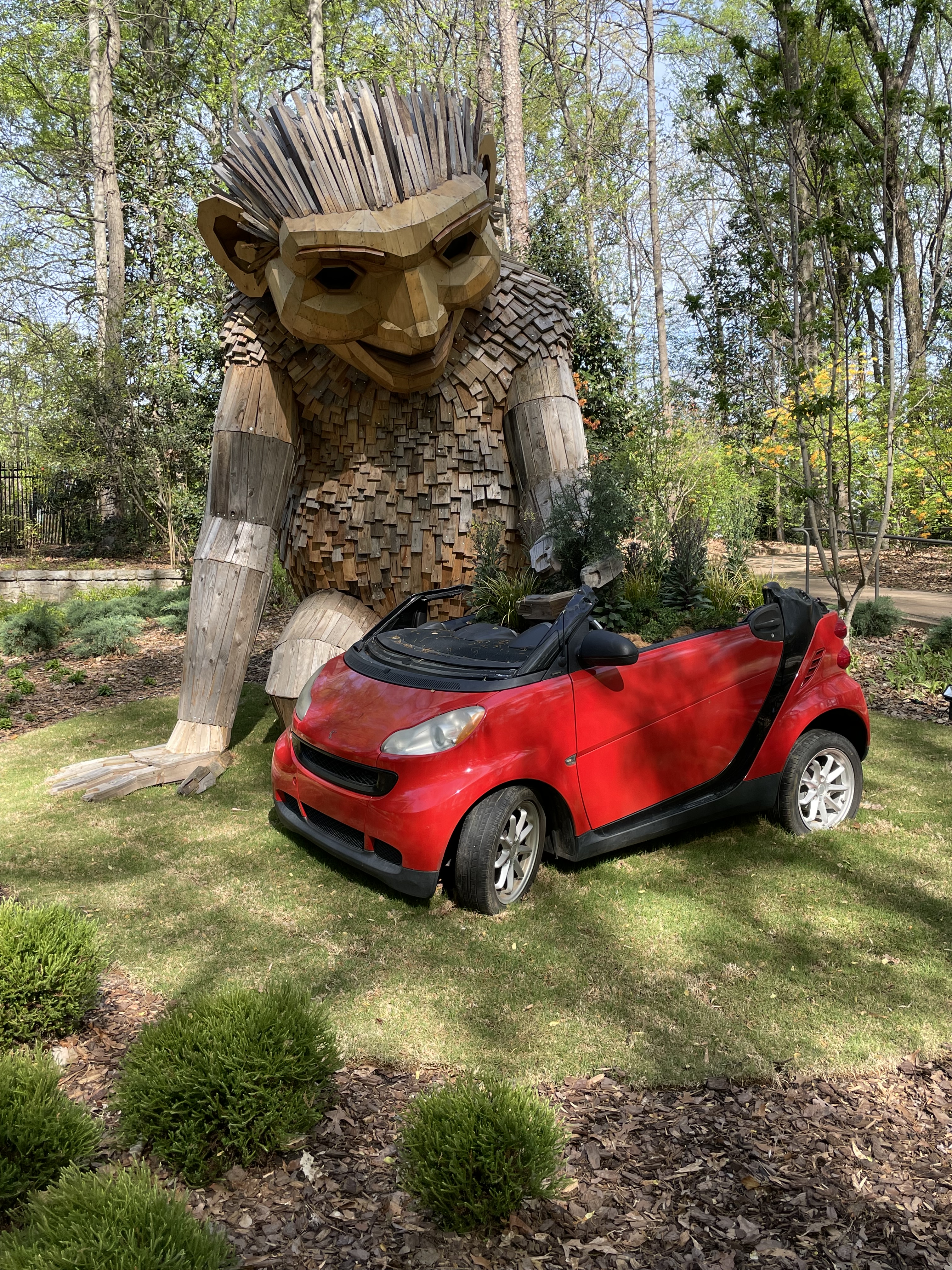
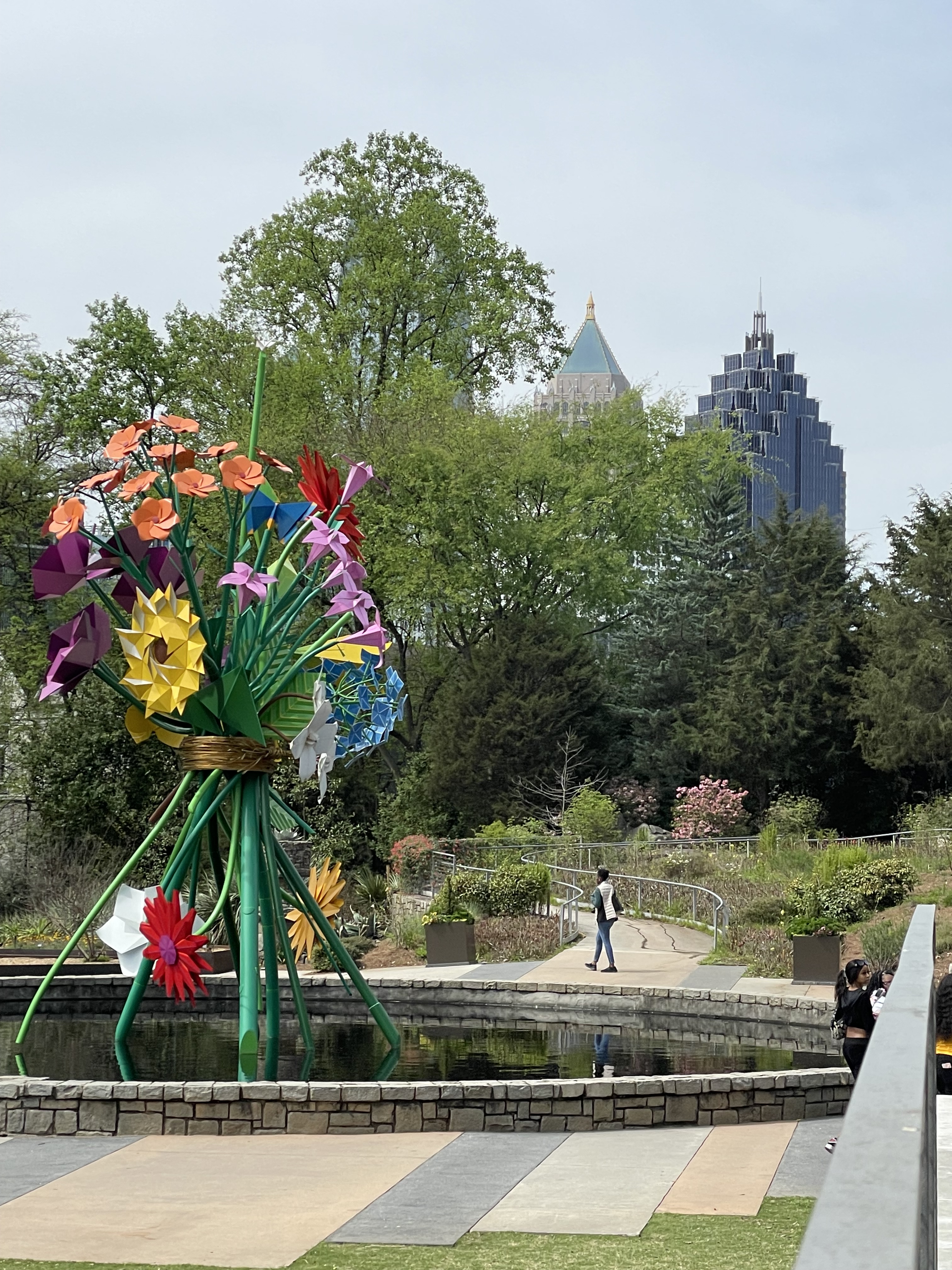
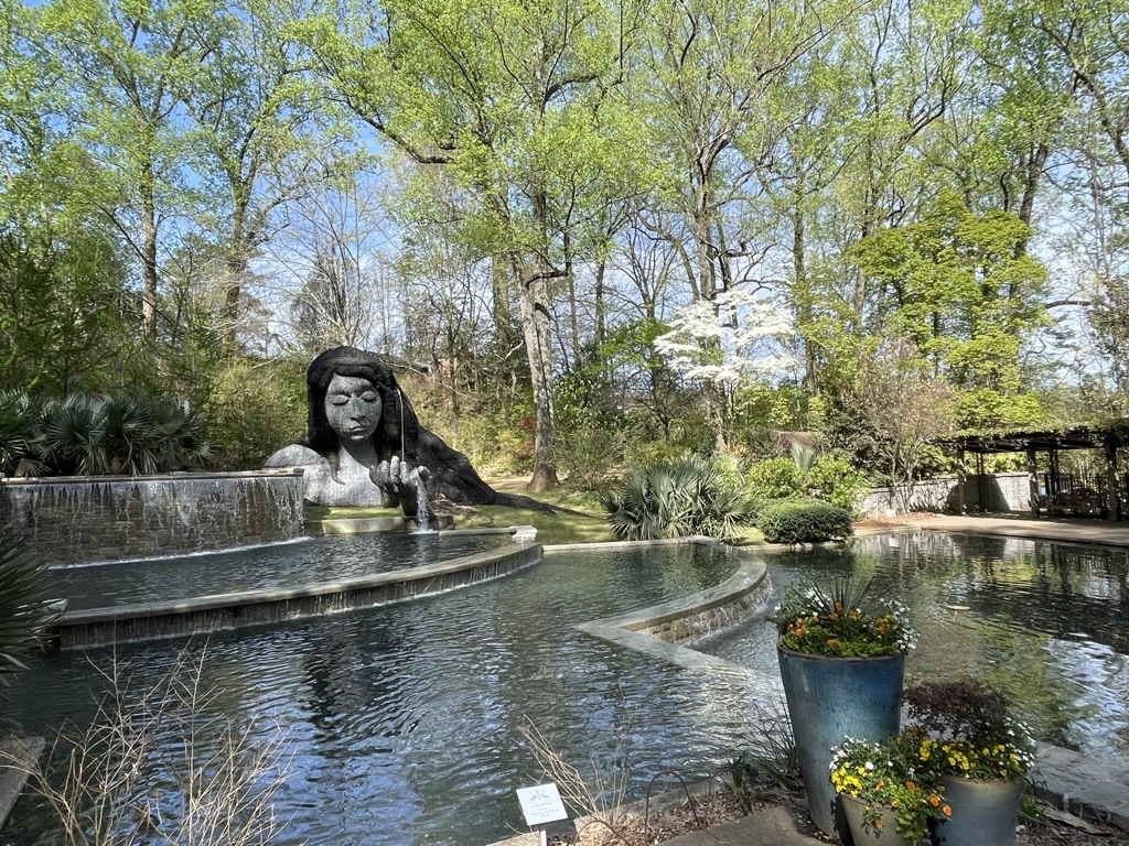
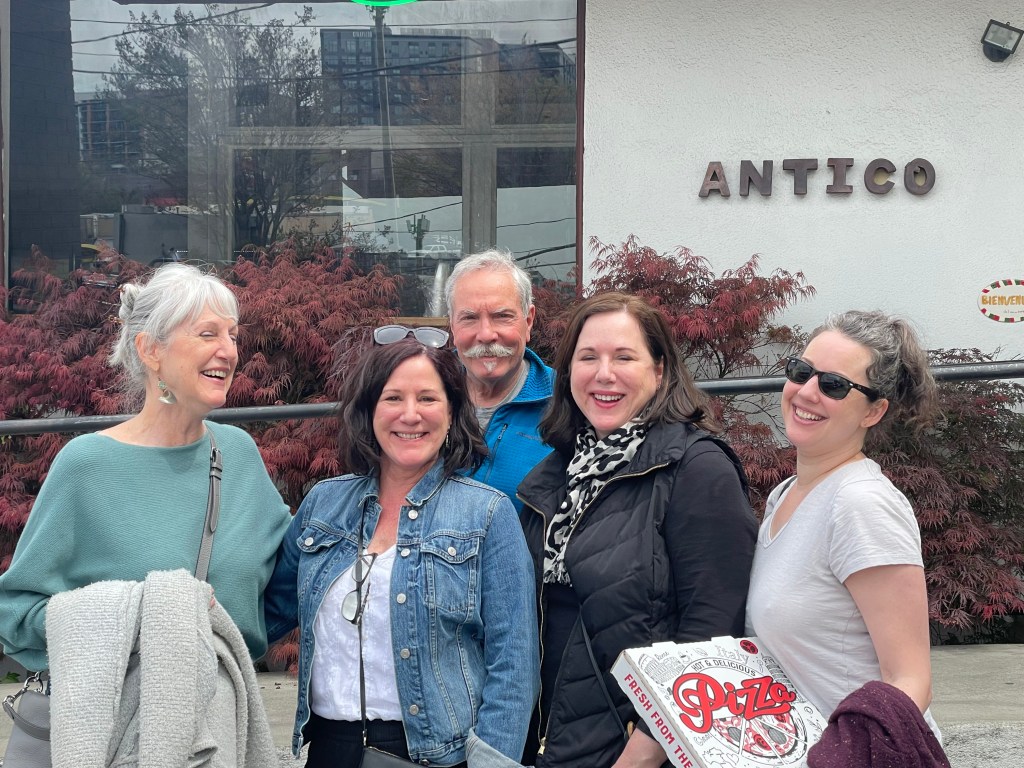
We were there for a week and managed to sample some of Atlanta’s great food and beverage scene at The Lantana Lounge in the Mid-Town Starling Hotel where we stayed the first two nights. The extended families dined at South City Kitchen for a pre-wedding dinner. Later lunches at Serena Pastifico, the Anis Cafe & Bistro, The Treehouse, pizza at Anticas, tacos at Tuza, and and dinner and drinks at Local3 were had in between exploring Buckhead and a stroll through the Atlanta Botanical Garden. And let me not forget to mention the notable meals prepared by my “Sister-Wife,” Lonna, Toni and Ginger’s youngest sister, that were exquisite as we dined in their charming home.

Left to right, Sisters G, T, (Sisyphus), L, and M, G’s daughter, our niece.

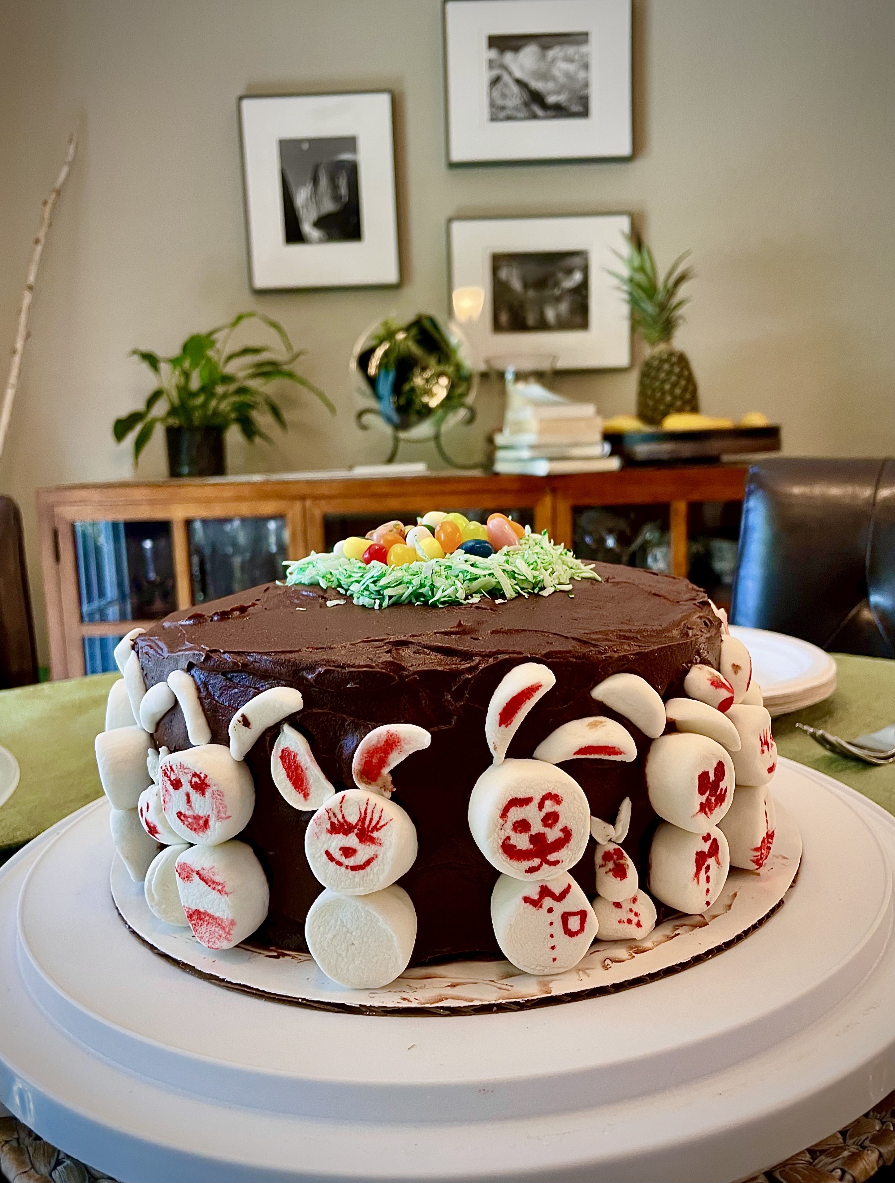
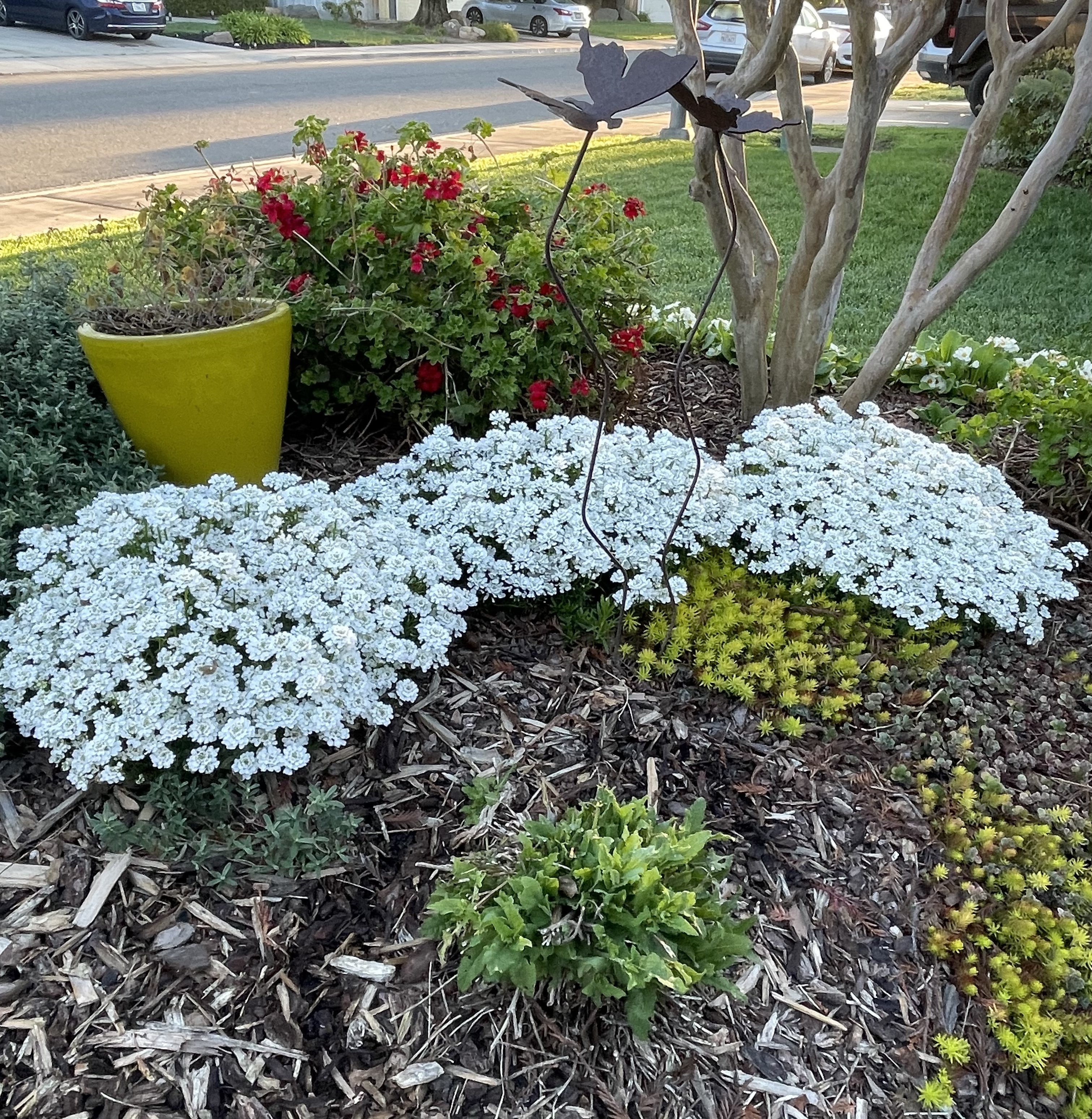
Upon returning to Merced from Atlanta signs of spring were bursting out everywhere. Vernal pools in the countryside, tulips, Japanese maples, and camellias in our yard, Mrs. Josephine Rabbit, Mr. Rabbit, The Bunny Cake in our home, and fiddlenecks along side of South Bear Creek Drive. All of the evidence was in. Our challenging winter was capitulating to a softer spring.

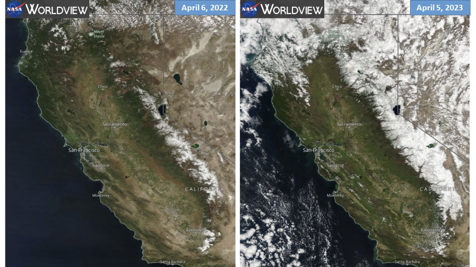
Since we were scheduled for Maui in May, that left April for Sisyphus to get on the moto, and with Pete, check out what was rumored to be a super-bloom throughout California and parts of the parched West. California had received bountiful precipitation over the winter into the spring causing hardships where flooding took place but nourishing the flora that had suffered consecutive years of drought.

Before and after

Almost to the day, four years ago Pete and I set off in search of the 2019 Super Bloom https://sisyphusdw7.com/2019/04/. Our plan now was to retrace part of that journey to witness the 2024 version of the bounty that water brings to the thirsty hills and dales of California’s central coast, the Mojave, and the Sierra.

Super Bloom 2023

Our son and granddaughter in Antelope Valley in April of 2023

As Pete and I were preparing our route, my son and his family had made their way to see the splendor of the Antelope Valley Poppy Reserve. That was all I needed to set about planning for five days on the motos on the road.

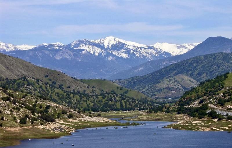
This would be something of a reprisal of the 2019 Super Bloom Tour, following a familiar route that took us across the Central Coast Range over Panoche Rd, through the foothills of the Gabalan and Santa Lucia ranges to our first night near Cambria. From Cambria it was east bound up and over Mount Pinos in the the Los Padres National Forest and down to into Antelope Valley, Lancaster, to our second night at Saddleback Buttes State Park. Then it was across the Mojave to for our third campout in Shoshone. From Shoshone it was westward back to the Sierra Foothills through Death Valley to our camp in Kernville before returning home along the familiar roads of Kern, Tulare, Fresno, Madera, Mariposa, and Merced Counties: https://go.rever.co/sS8ZMN3OMyb. The route I linked was amended as an exploration here, or a left or right turn there, got us to each night’s planned camp.

Day 1 Cambria

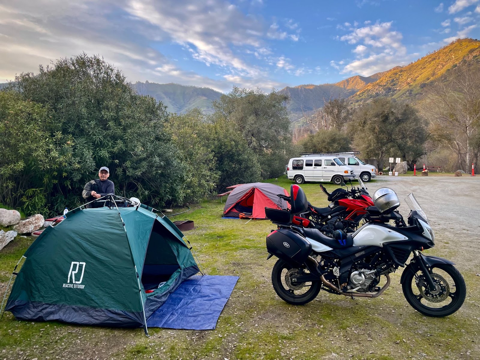
A reunion of sorts took place in Paicines as we made our way through some fog over Panoche Summit. We landed in Cambria where we made our way to The West End Bar and Grill followed by our first night at the Hearst-San Simeon State Park Washburn campground, making new friends along the way.

Our customary route to the coast combines several back roads through the San Joaquin Valley and across the Coast Ranges that I’ve documented many times on previous trips. For this journey we serendipitously encountered three gents on motos, two of whom we met in the spring of 2021 on our trip to Joshua Tree (https://sisyphusdw7.com/2021/04/) at the same little Paicines Store. They were out for a Sunday ride and were debating continuing because it was a tad foggy and they were chilled.

We bid our adieus and continued south on CA-25 riding out of the fog just a few miles down the road near the Pinnacles. Still cool, the warming sun took the frigid sting out of what couldn’t be warmed by the heated grips. The ride into Cambria had us passing through Paso Robles where my wife an I enjoyed some grape and hops tasting last fall. Winter storm damage closed our Santa Rosa Creek back road entry into Cambria, a delightfully narrow two lane road that winds itself through vineyards and oak woodlands that feature valley oaks, blue oaks, coastal live oaks and many more, all interspersed are laurels, madrones, and chaparral including chamise, manzanita, and ceanothus. Grasses are abundant and given the climate, fire is an ever present danger even in a wet year as the long hot summer beckons.

We are apparently creatures of habit as our favorite dining spot in Cambria is the West End Bar and Grill where we re-introduced ourselves to the owner who greeted us on the Moment’s Inattention post from last spring , under considerably less favorable conditions. (https://sisyphusdw7.com/2022/05) Gary, the proprietor, is quite the jovial fellow as one must be as a pub owner.

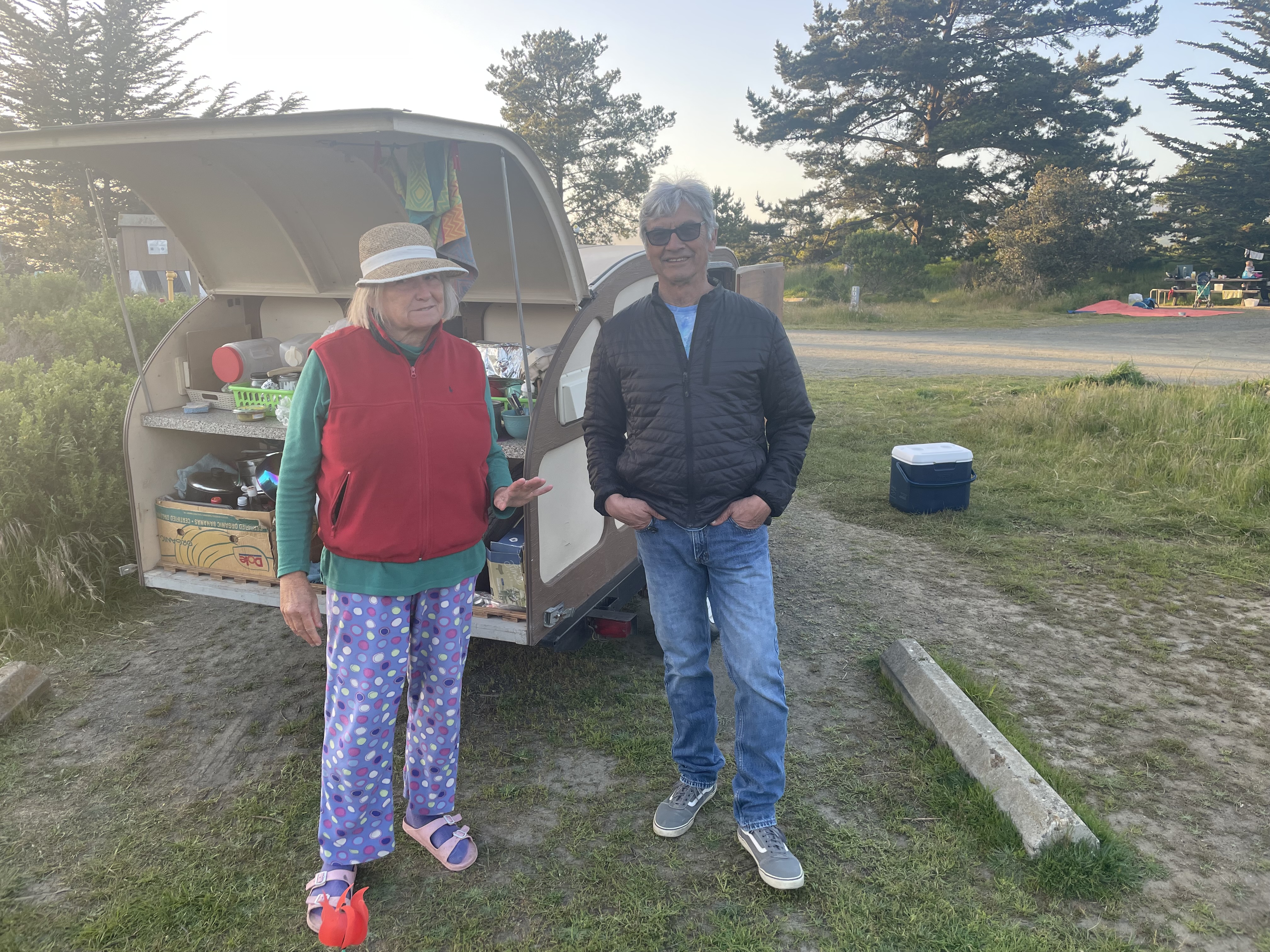
As a feature of the Three R’s of Moto Touring: Rehydration, Reflexion, and Relaxation, we found ourselves taking our customary evening stroll through the campground since riding a motorcycle all day requires at least some movement. We came across an interesting character who had to share her story of wanderlust. A bit eccentric and perhaps a bit lonely, she regaled us with the tale of her teardrop towed behind a Camry, both completely filled with what must be her worldly possessions. She was from Seattle and had been on the road for some time traveling from National Parks in the southwest in search of, well, we weren’t sure. As far as that goes, upon reflection, we weren’t sure of what we were in search of. Maybe that was because of the rehydration that had taken place…

Day 2 Saddleback State Park

Early the next morning as we prepared our eastward departure, we discovered that a critter, likely a racoon, had invited itself to the remaining chips from last evening’s snacks. I believe that smudge on my nose is sunscreen and not ranch dip.

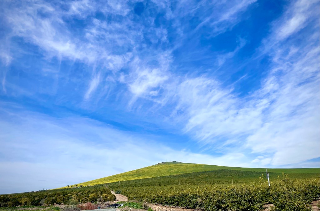
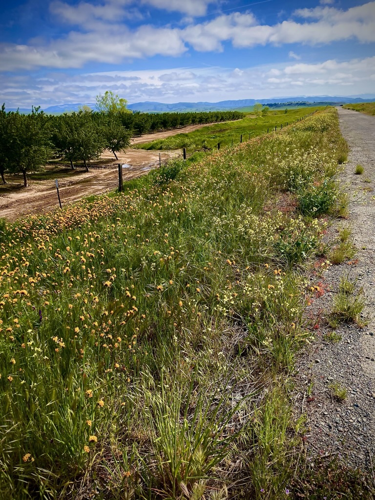
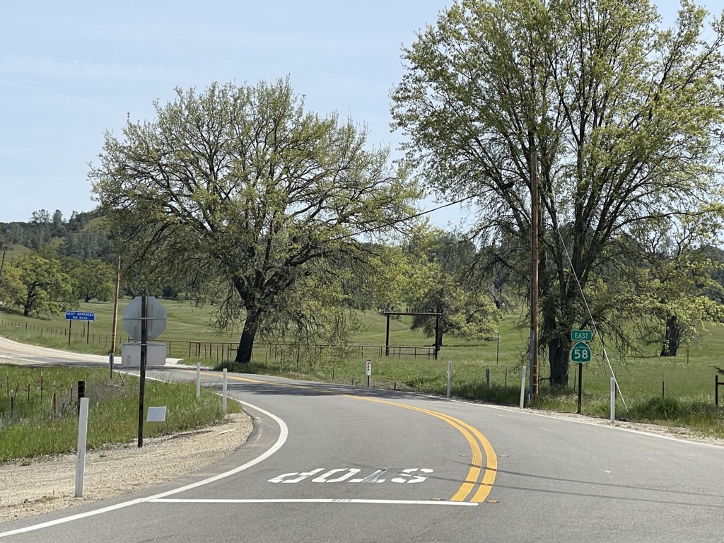
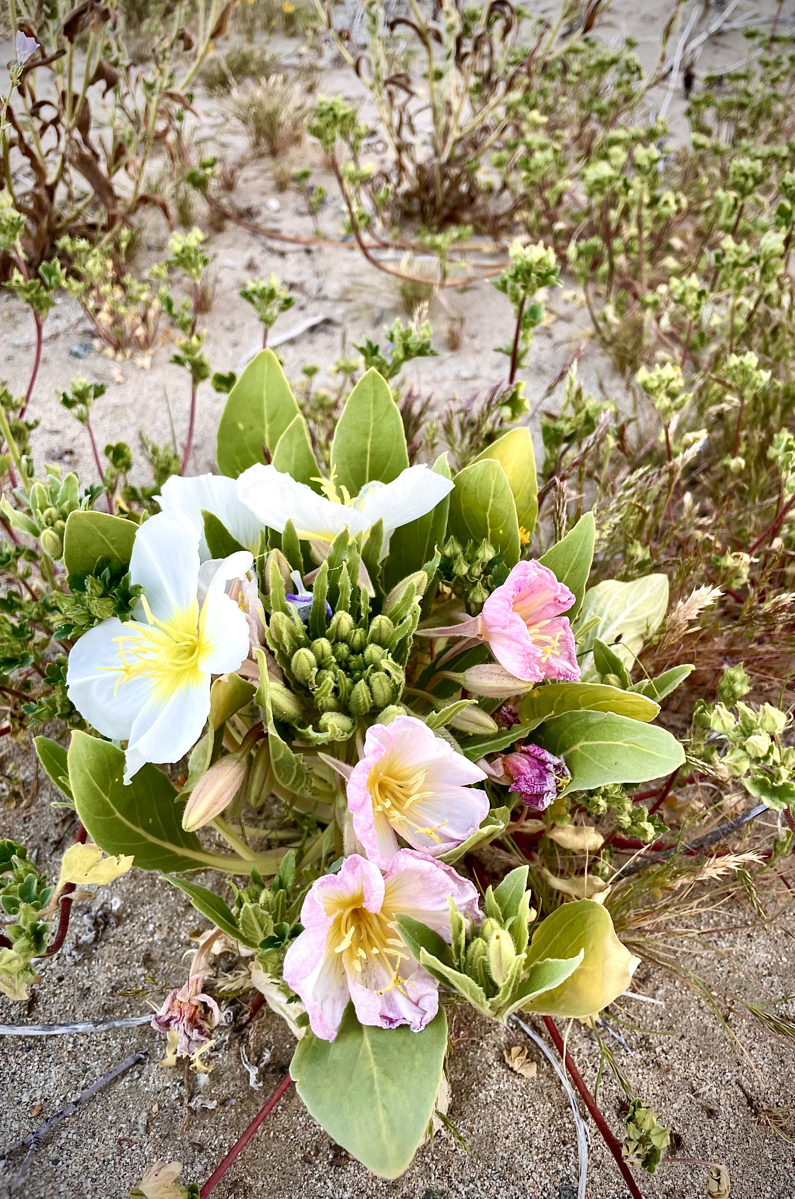
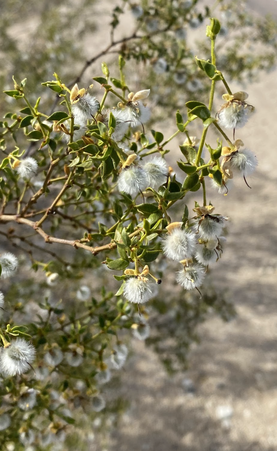
Departing via CA-1 south to Morro Bay, we headed east on CA-41, A.K.A. the Atascadero-Morro Road, then south on US-101 to CA-58 east. While the verdant spring had been expressing itself upon entering the Coast Ranges, we hadn’t yet seen the evidence of a Super Bloom but more or less a typical spring bloom in fields of meadowfoam, fiddlenecks, and lupine.

Lots of green, not many wildflowers.

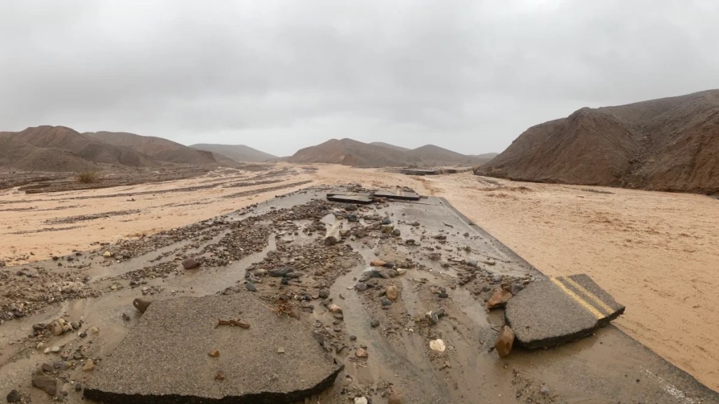
For some botanists, “super bloom’ is a vexing term. There is no scientific definition, only the eye test–you know it when you see it. There was no short supply of media trumpeting the one sublime aspect of a burdensome winter, a super bloom, however, we just weren’t seeing it. We were still a few degrees of latitude north for the Super Bloom variables to manifest themselves at this time, this year. What we did see was lots of evidence of damage to road infrastructure, much in repair. We must have encountered a dozen, “Prepare to Stop”, “Road Work Ahead” signs on this trip.

Blossoms and fruit destined to become guacamole

As we were entering Santa Margarita we noticed orchards that appeared to be blooming with an interesting blossom, but also heavy with fruit. Signage along the roadside at the entrance to one such orchard solved the mystery: avocados!

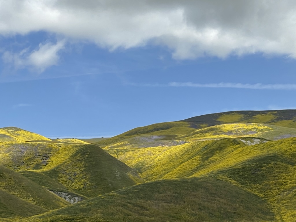
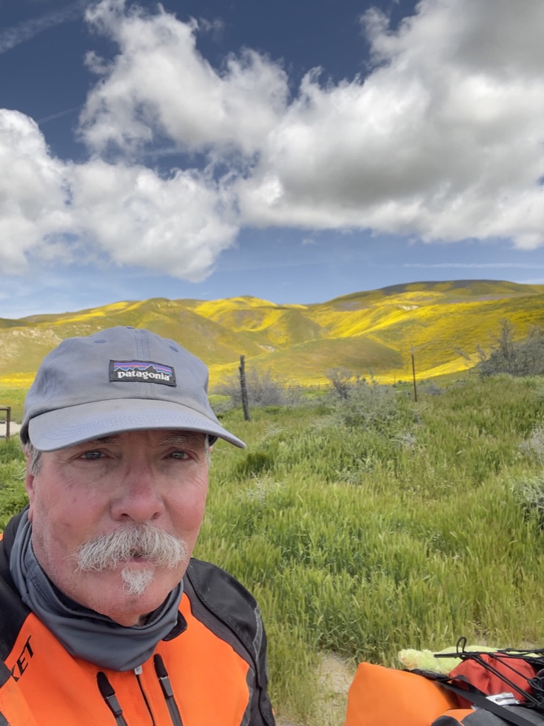
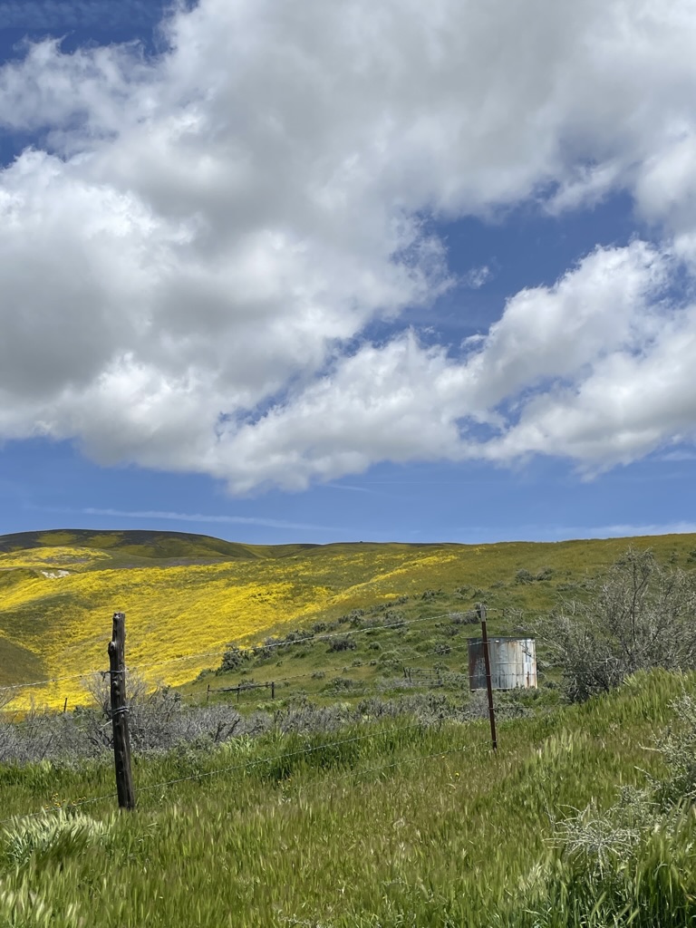
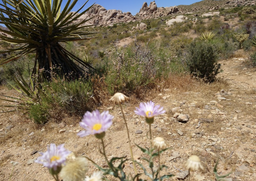
Highway 58 took us just north of the Carrizo Plain where blooms from space could be seen. The hills just north of the monument’s dusty topography had erupted in Super Bloom color: yellow from the hillside daisies, goldfields, and tidy tips, whose ends are frosted white; purple from the phacelia and wild hyacinth; azure splashes from the lupine and baby blue eyes and orange fiddlenecks and poppies. Ah yes, we were in the midst of the 2023 Super Bloom!

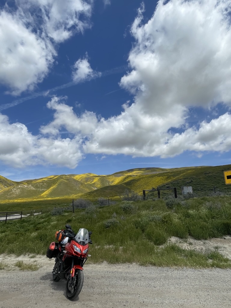
I had intended to chronicle all of this remarkable color from a GoPro mounted on my handlebars. Technical difficulties and user error, however, botched the video and I wasn’t able to get the most dramatic of the bloom as we crossed the Temblor Range into McKittrick, the vast orange sea of the Antelope Valley Poppy Reserve, or the dramatic CA-58 canyon along the raging Kern River. I guess there will be yet another spring trip to film when I figure out the camera… I humbly offer the following:

The beginning features some of the bloom near the Carrizo Plain

McKittrick and checking the investments

I didn’t know at the time, but as we were traveling through the Antelope Valley Poppy Reserve along with thousands of other bloom seekers, I thought the GoPro was capturing what the Spanish sailors in the 18th century first had laid eyes on along the California coast, declaring it la tierra del fuego, the land of fire. They had arrived as a giant super bloom of flaming orange poppies, which would later be named the state flower, glowed from the hillsides.
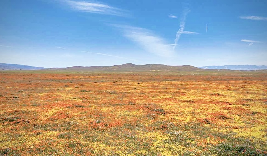
La tierra del fuego

By the 1870’s the poppies were so threatened that the state government and a group of concerned citizens, led by the Great Poppy Lady, Jane Pinheiro, were working to establish a preserve to ensure the blooms would live on. That effort became the Antelope Valley California Poppy Reserve, an island of native flowers among encroaching development and creeping invasive species. Even after the 1,800-acre park was founded, the pace of growth persisted, bringing cookie cutter suburbs, vast solar farms, and nonnative plants that crowded out other species.

Oh, and then there’s Adelanto, a desert city in California’s Mojave as it tried to transform itself from a bedroom community of affordable housing in eastern Los Angeles county and a city of prisons to a metropolis of pot… Check out the Crooked Media Podcast, Dreamtown: The Story of Adelanto where ever you get your podcasts: https://crooked.com/podcast-series/dreamtown-the-story-of-adelanto/

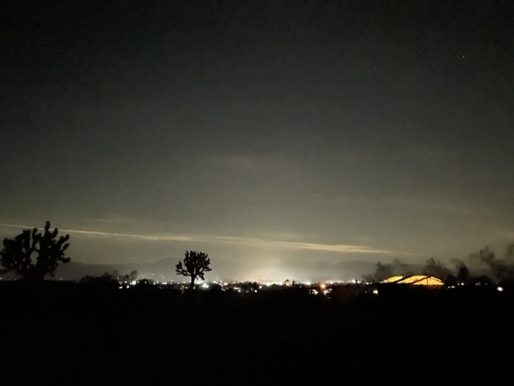
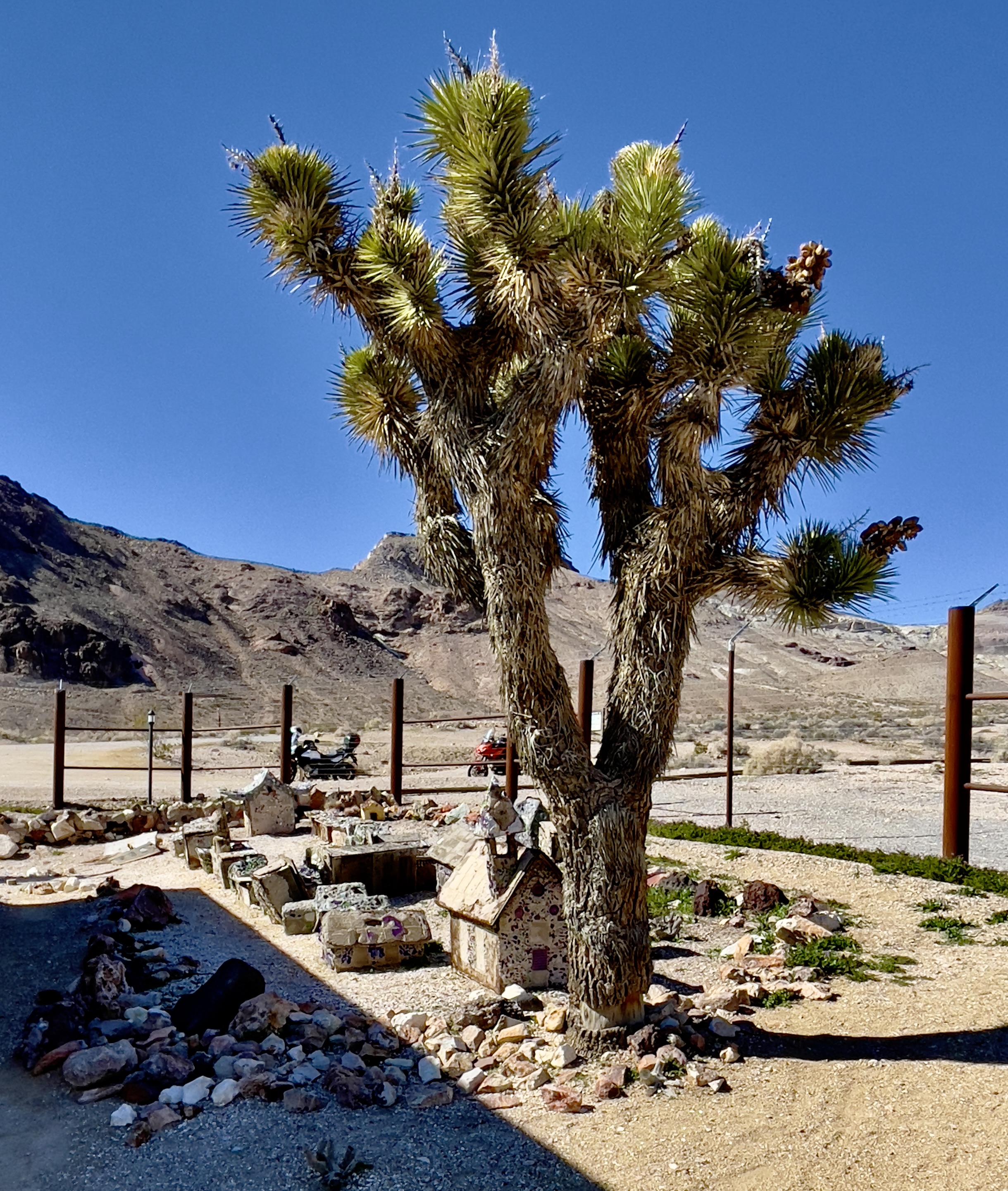
Saddleback Butte State Park includes over 2,955 acres (4.617 sq mi) of land, and was created in 1960 to protect the area’s Joshua Tree (Yucca brevifolia) desert habitat. It’s the OG Joshua Tree Park, formerly a monument. The lights in the distance are from Lake Los Angeles. But Lake Los Angeles has no lake. Instead, the now-nonexistent lake is a remnant of the town’s manipulative speculative real estate history. It seems the desert fancies drifters and grifters trying to convince folks of putting down roots. Roots that die of thirst and dreams that evaporate.

I arose the next morning to catch the first rays of the sunrise and noted the desert flora showing off.

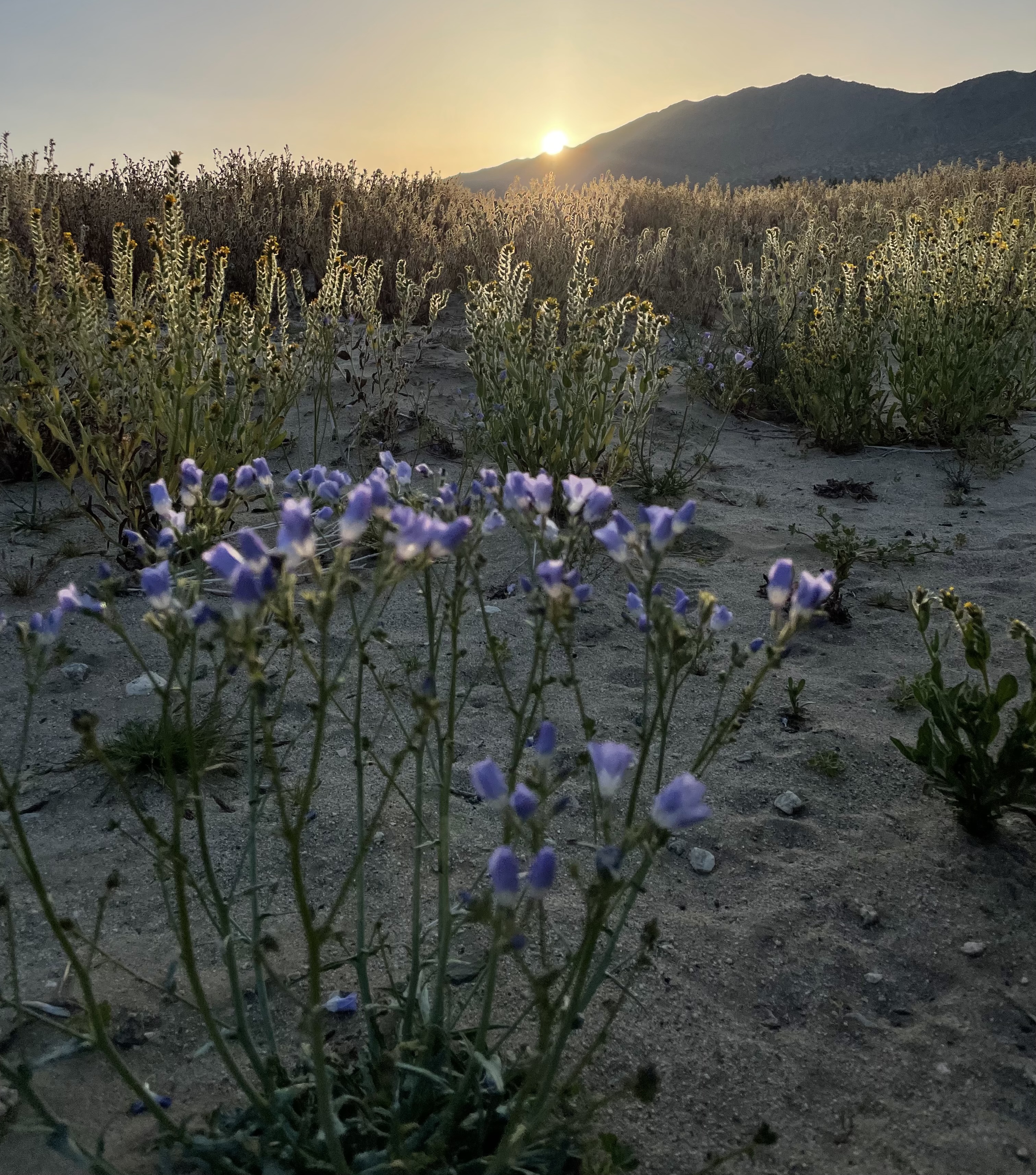
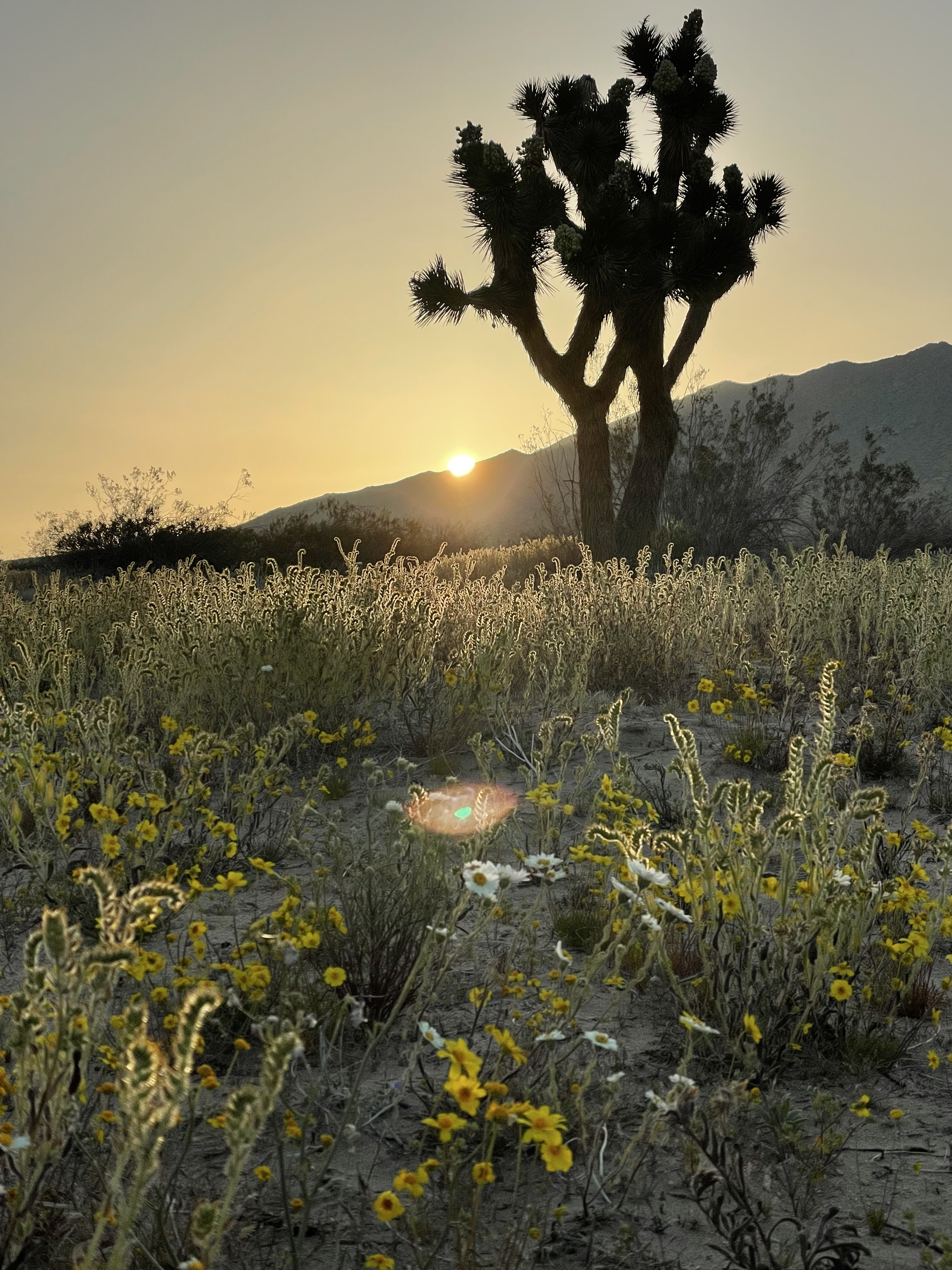
A Butte and a Joshua Tree

We only come to the desert as visitors who appreciate the complexity of an environment. While hostile to hominids, the Mojave has an incredibly robust ecology should you take the time to look and listen and learn. Perhaps eco-tourism will at least compel people to consider there’s more there than meets the eyes, eyes focused on exploitation of a fragile landscape.

Day 3 Shoshone

As we planned the day’s ride, rather than retrace a previous route the trusty Butler Map indicated a more direct route to US-395 by heading east on Avenue J. We were still in Los Angeles County when we set off and after 8 miles we encountered the San Bernardino County line where the pavement ended despite our Butler Map guidance for the most direct route. It would be 15 miles on dirt to US-395 and another 9 miles, on dirt, to Helendale where we hoped to join the Mother Road, Route 66 rather than the longer route through Mirage, Adelanto, and Victorville, another desert prison town. Hence, the less direct paved route would have to do.

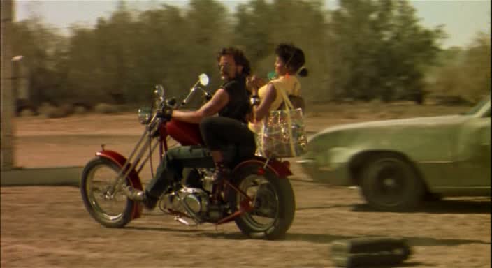
After getting gas at a sketchy Arco station adjacent to I-15 in Victorville we hopped on the interstate for 10 miles to Daggett where we picked up the National Trails Hwy, Route 66 east. A lunch stop in Newberry Springs where the wind was gusting at 25+mph and I found myself eavesdropping on the conversation of two local residents. I asked if the “desert road from vegas to nowhere, Some place better than where you’ve been, A coffee machine that needs some fixing, In a little café just around the bend”… was open just down the road. One of the lady’s eyes lit up as she shared that she and her husband were extras in the movie, her husband on a HD chopper with Brenda’s carefree daughter, Phyllis, below…

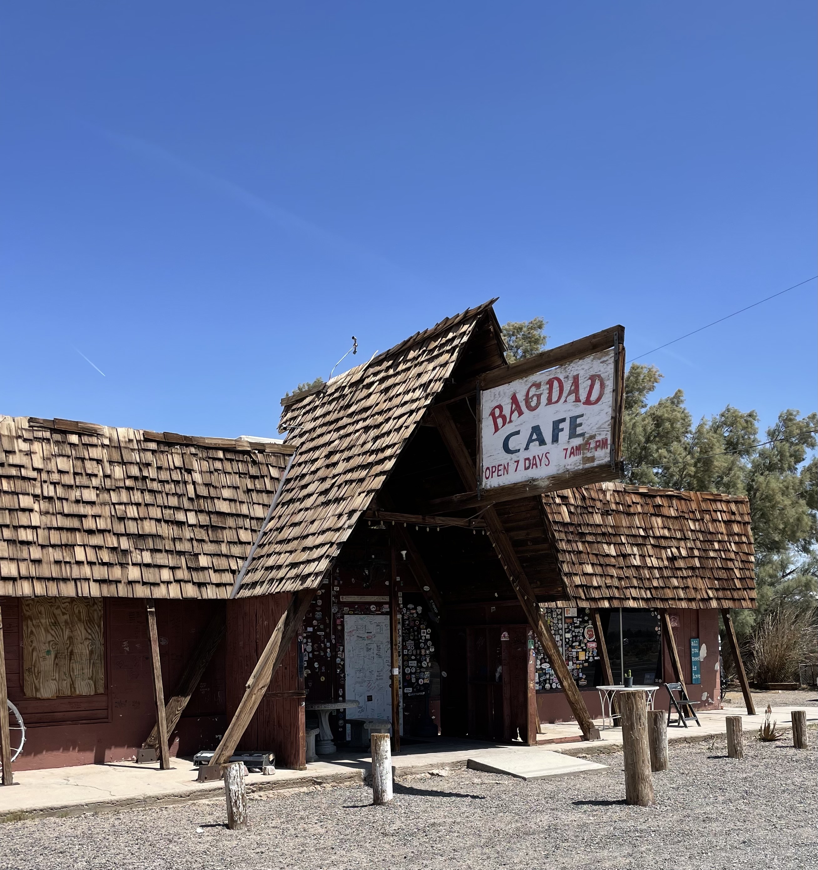
Bagdad Cafe, 1987 and the trailer for the movie https://youtu.be/4G2MEszpox0

When I first saw the movie, I loved the eccentricity of the characters and wagish storyline. Even more appealing was the haunting Bob Telson composition, Calling You, https://youtu.be/IZ0e5AHdDXw . Jevetta Steele recorded the soundtrack for the film. Here’s an update with a beat that features Ms. Steele, however some of the melancholy of Telson’s original, IMHO, has been lost, https://youtu.be/e7dZq8NYZwg.

Today , the Bagdad Cafe is a tired, melancholy roadside attraction.

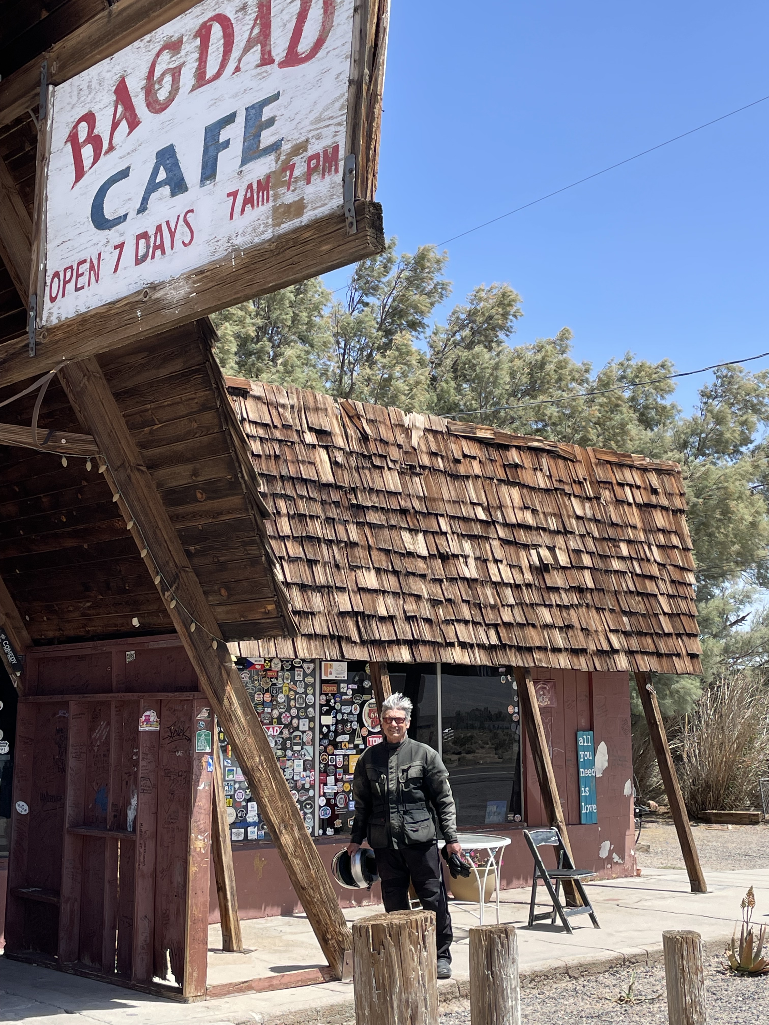
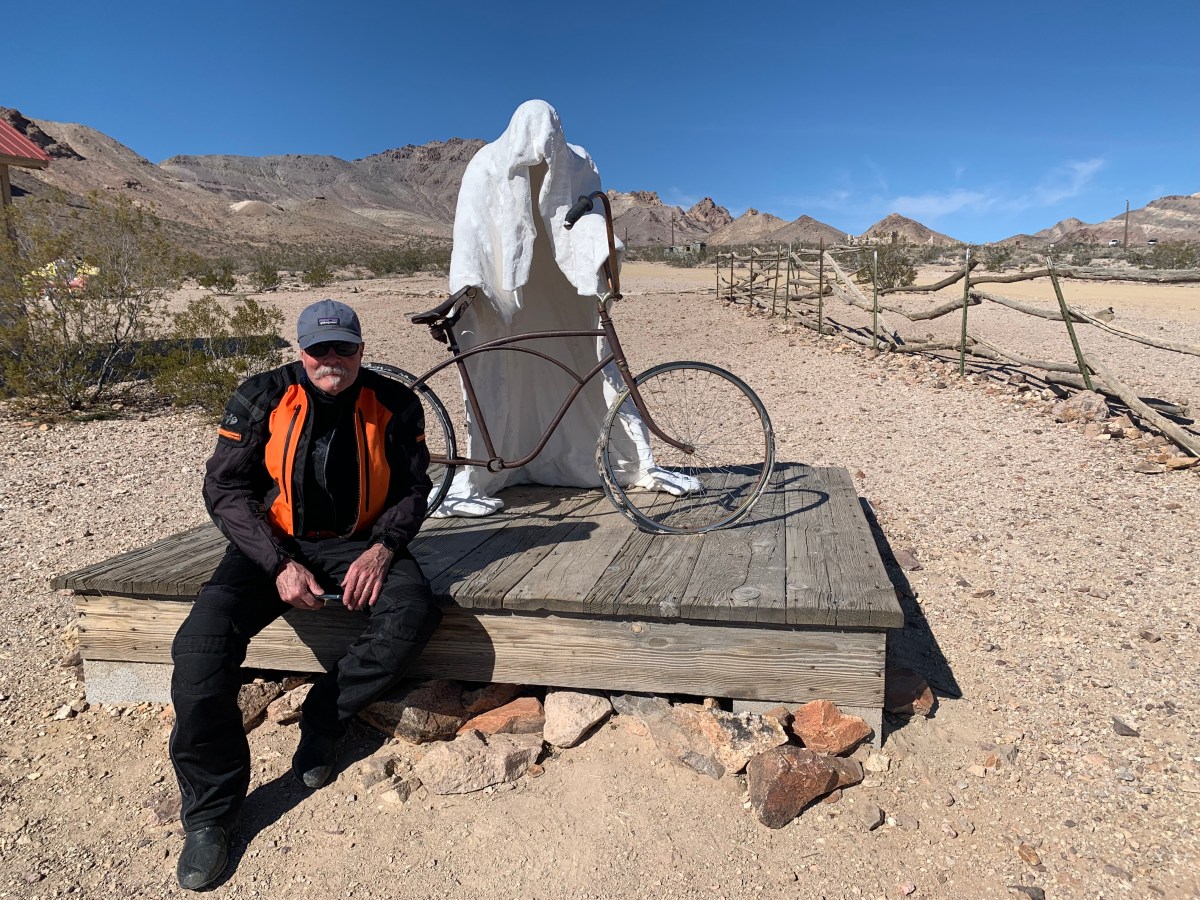
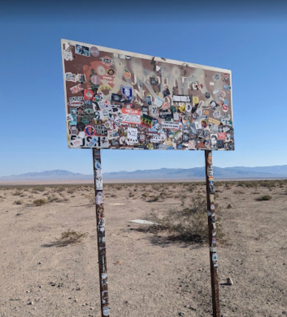
Having decided that the memories of a whimsical movie about a little cafe just around the bend, are better than the actual cafe of the present, we set off for Amboy and the Kelbaker Rd intersection. You can’t miss it as the Joshua Tree Sticker sign notes the turnoff…

Looks like a lift tower on Chair 7…

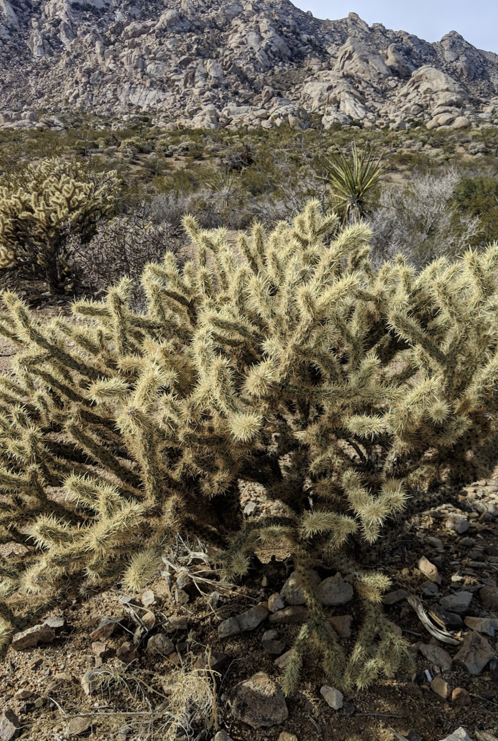
From the sign we had another 125 of our 280± mile day’s ride to our destination in Shoshone before us. Kelbaker Road features some interesting desert flora and the granite outcrop in the Boulder’s Viewpoint area is worth a stop.

A controversial mega-solar energy project that would extract massive amounts of groundwater from the area around the Soda Mountains in the vicinity of Baker would also impact the dwindling bighorn sheep population that once flourished in the area. I-15 and I-40 has already interrupted ancient migration trails. Desert bighorns once thrived in the serrated mountain ranges across the Mojave Desert, where they formed a “metapopulation” of groups connected by these ancient trails. Today, their survival is threatened by disease, drought, interstate highways and now, renewable energy.

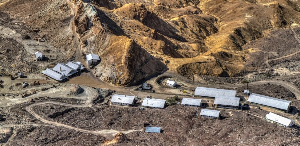
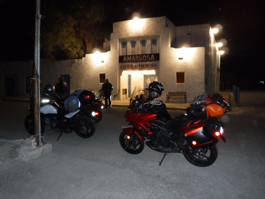
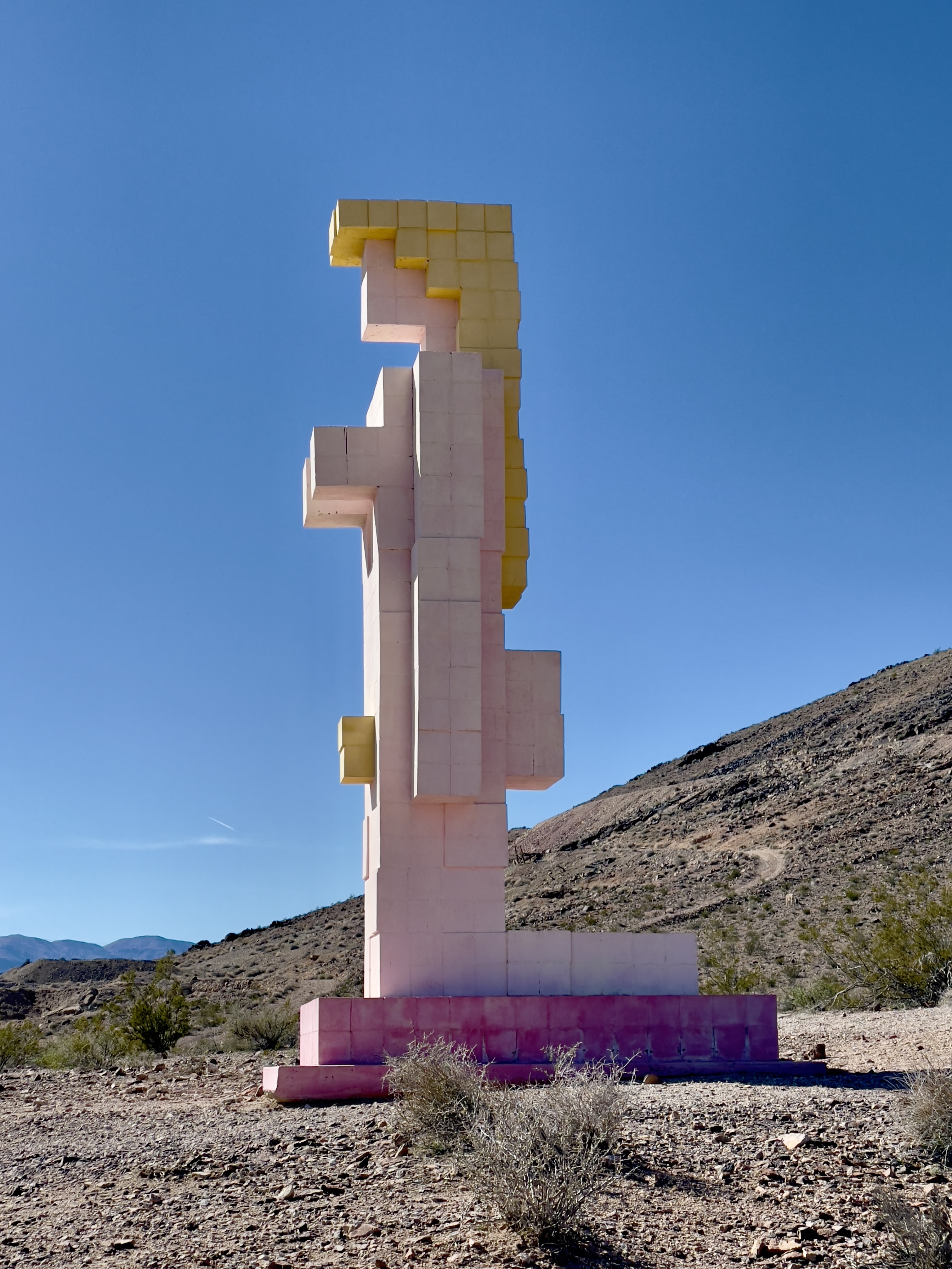
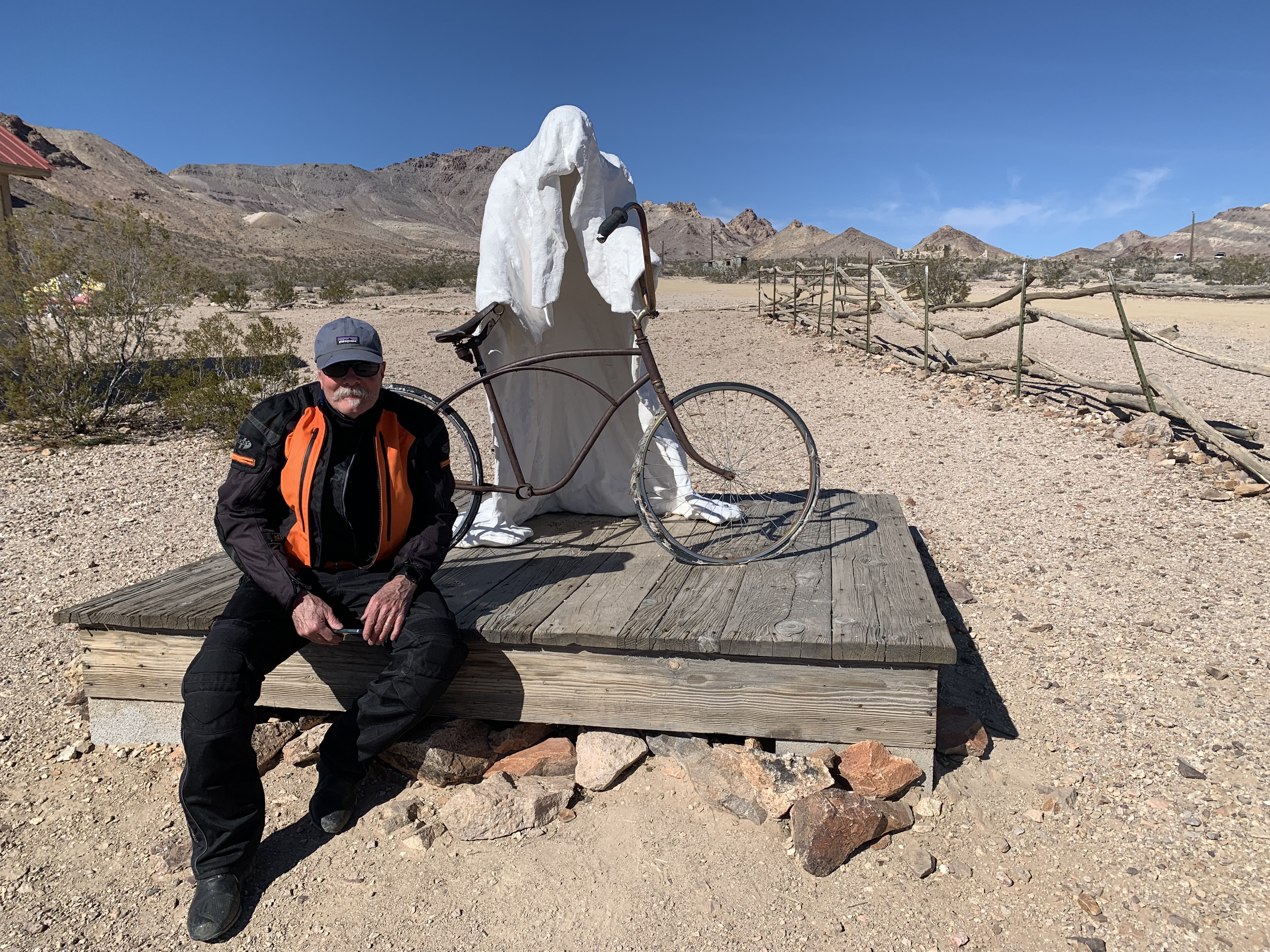
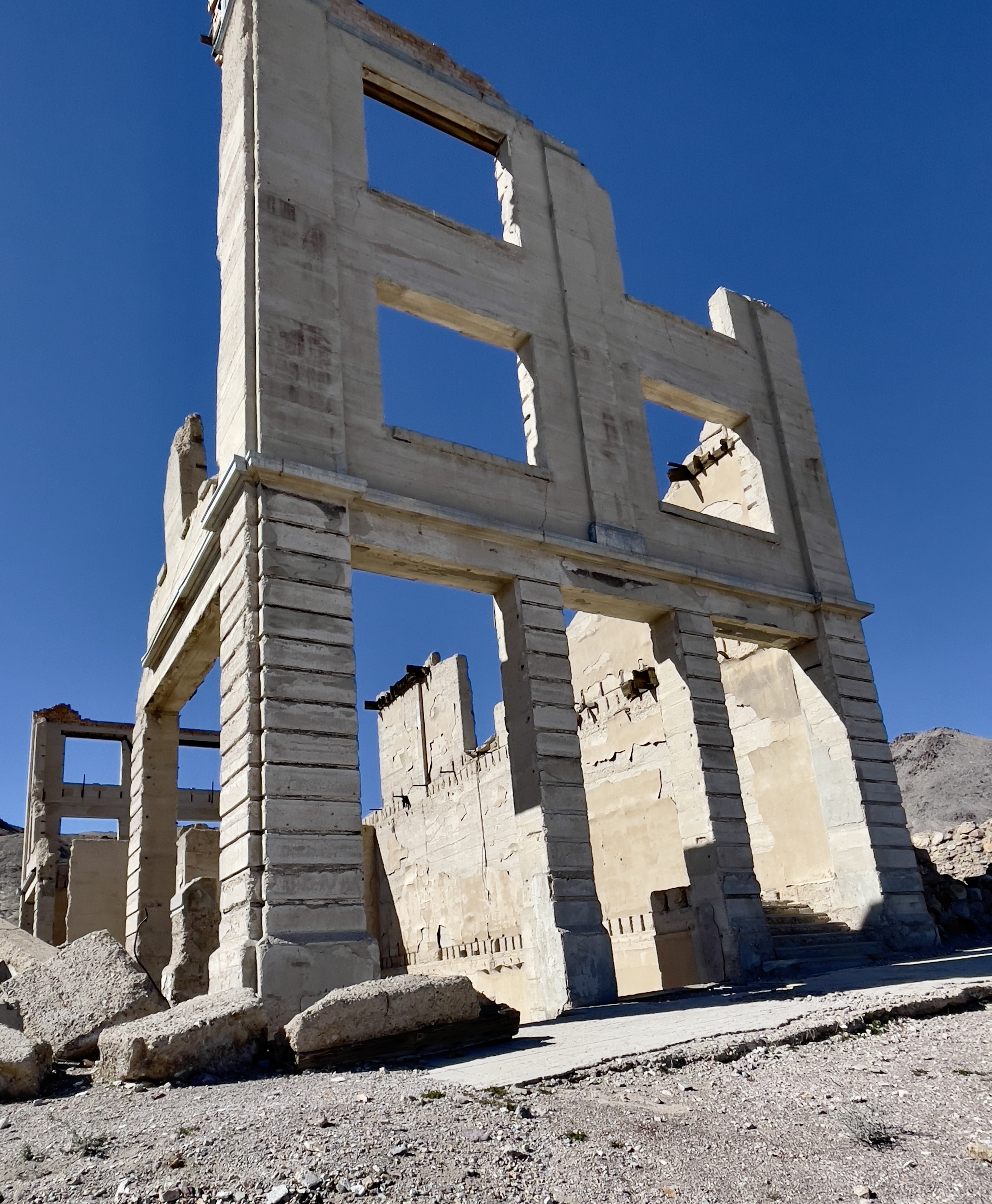
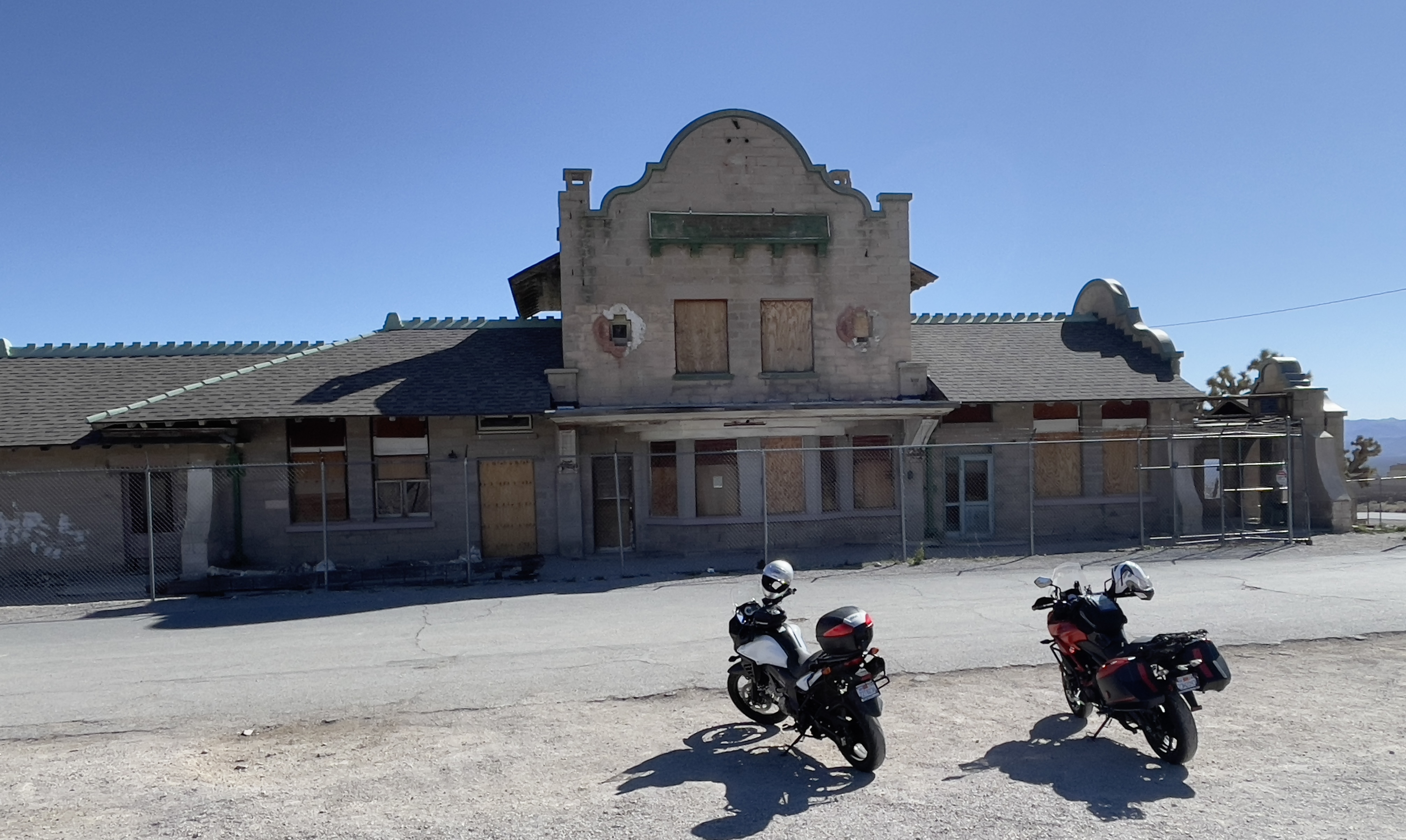
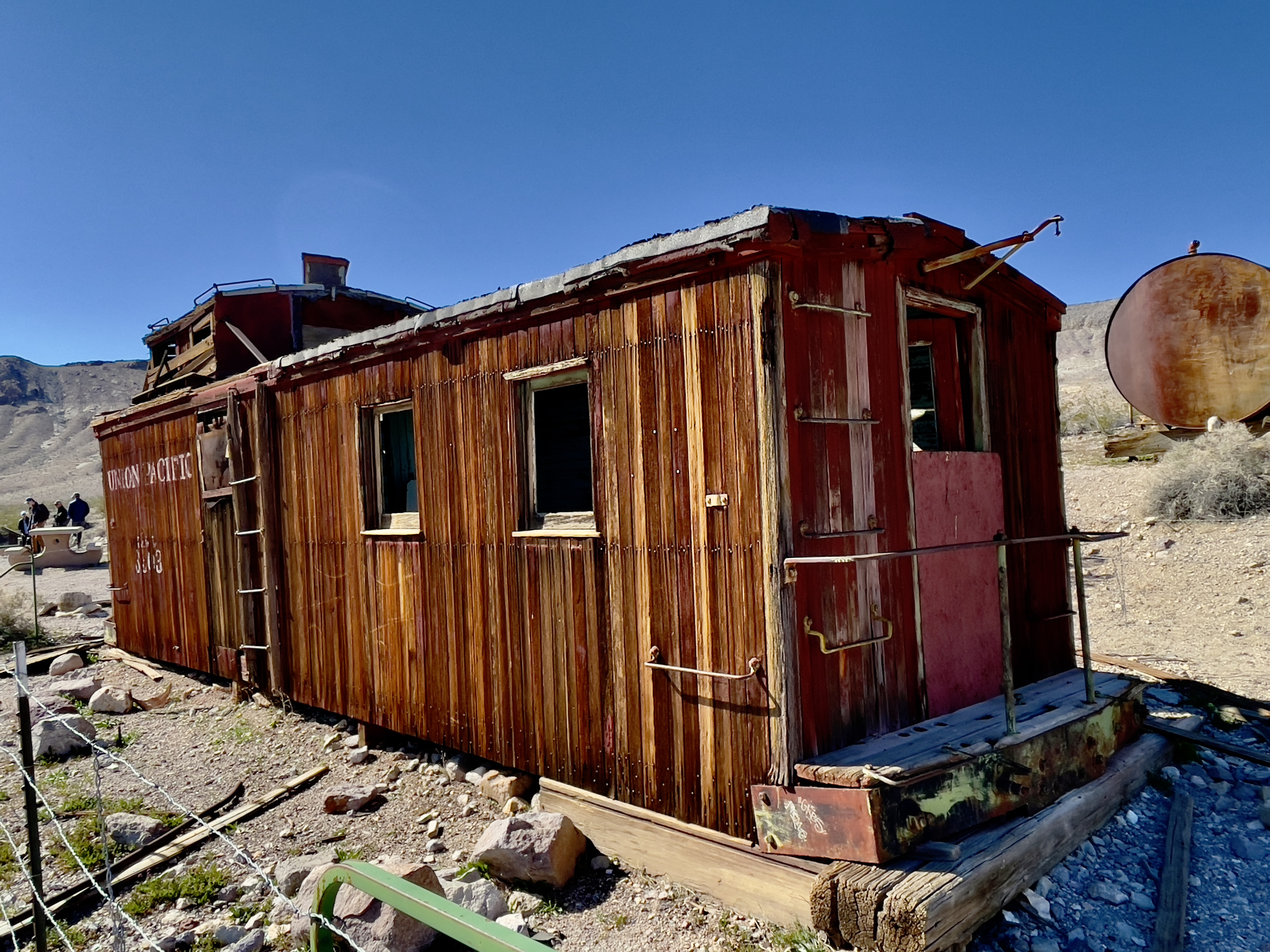
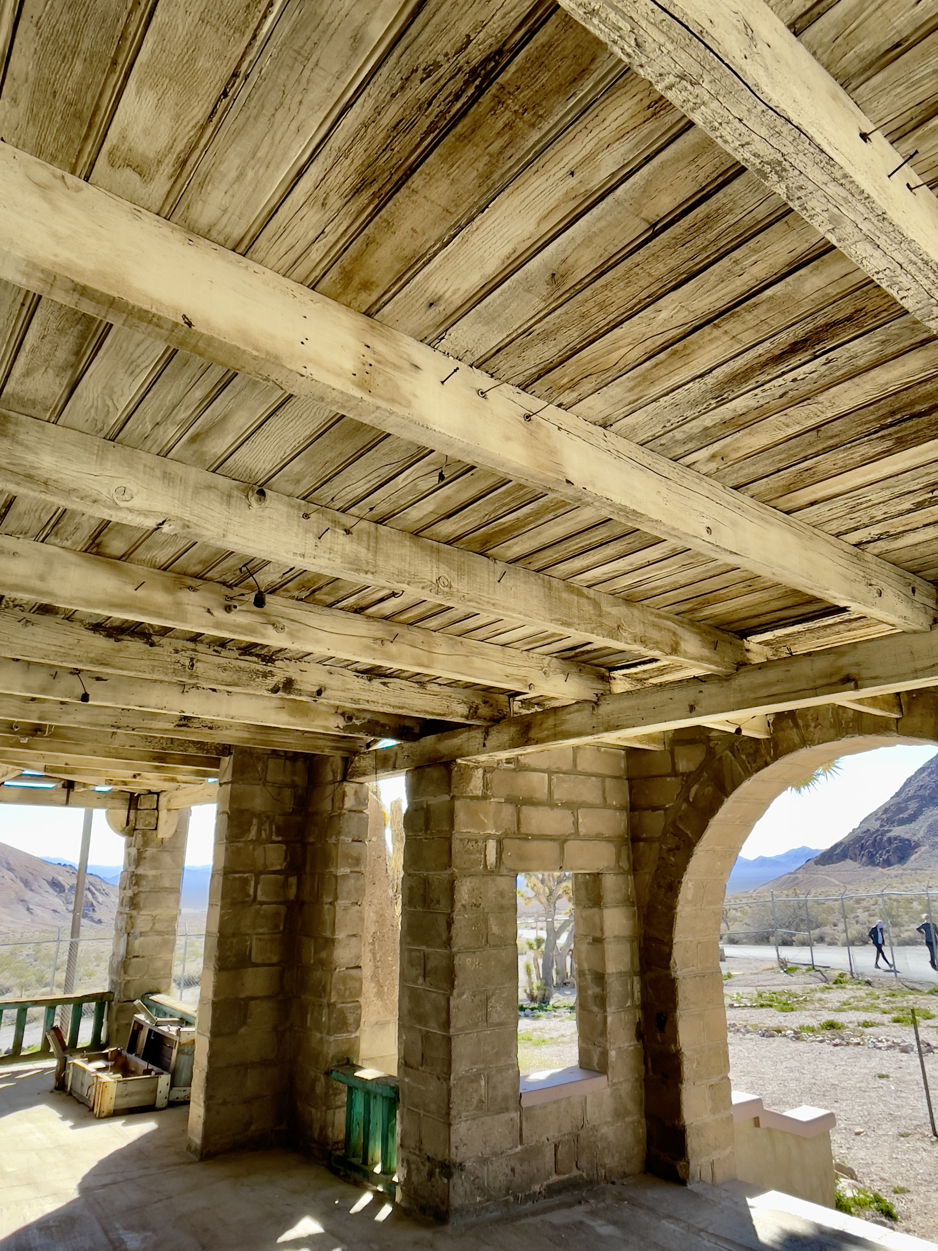
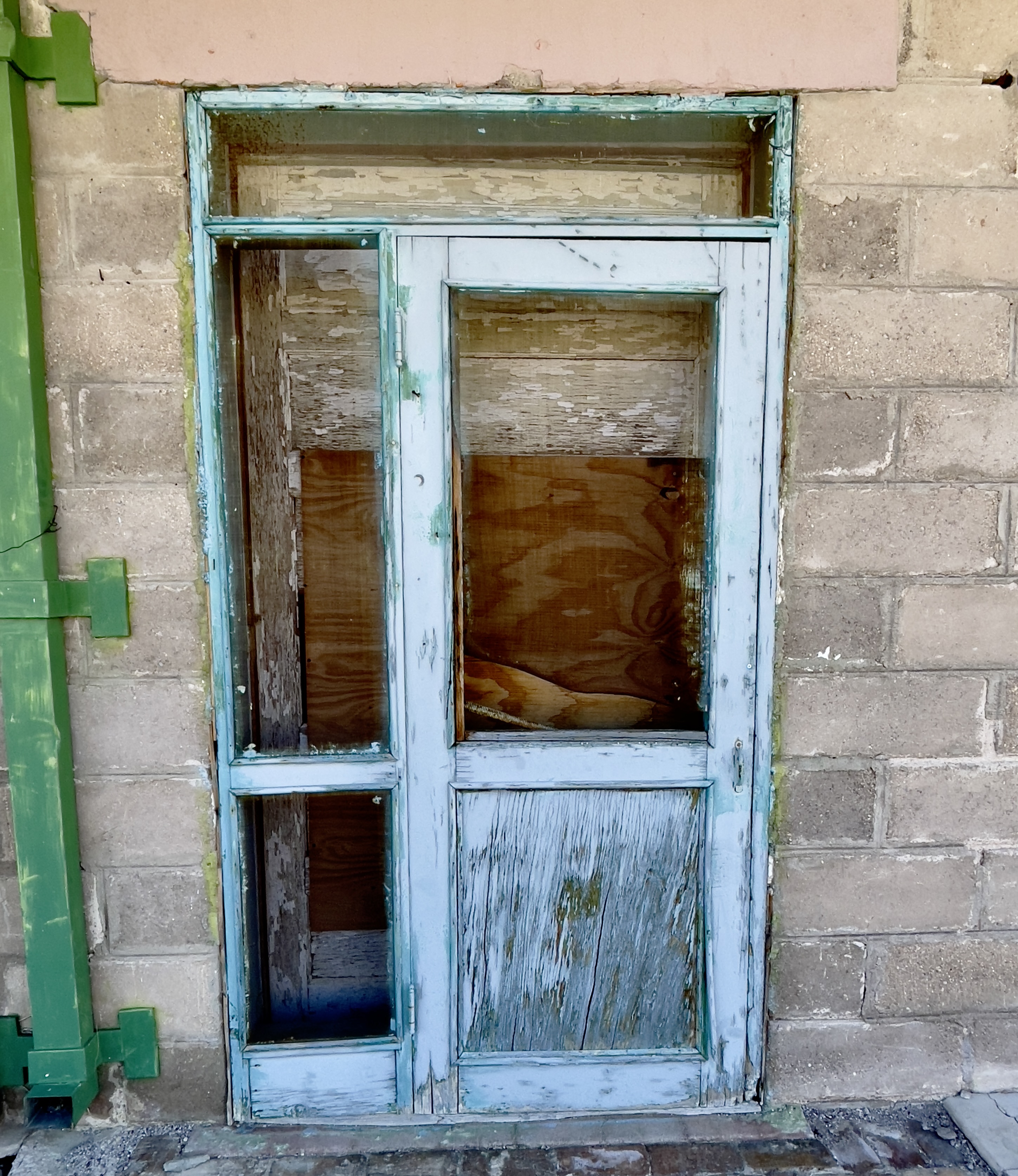
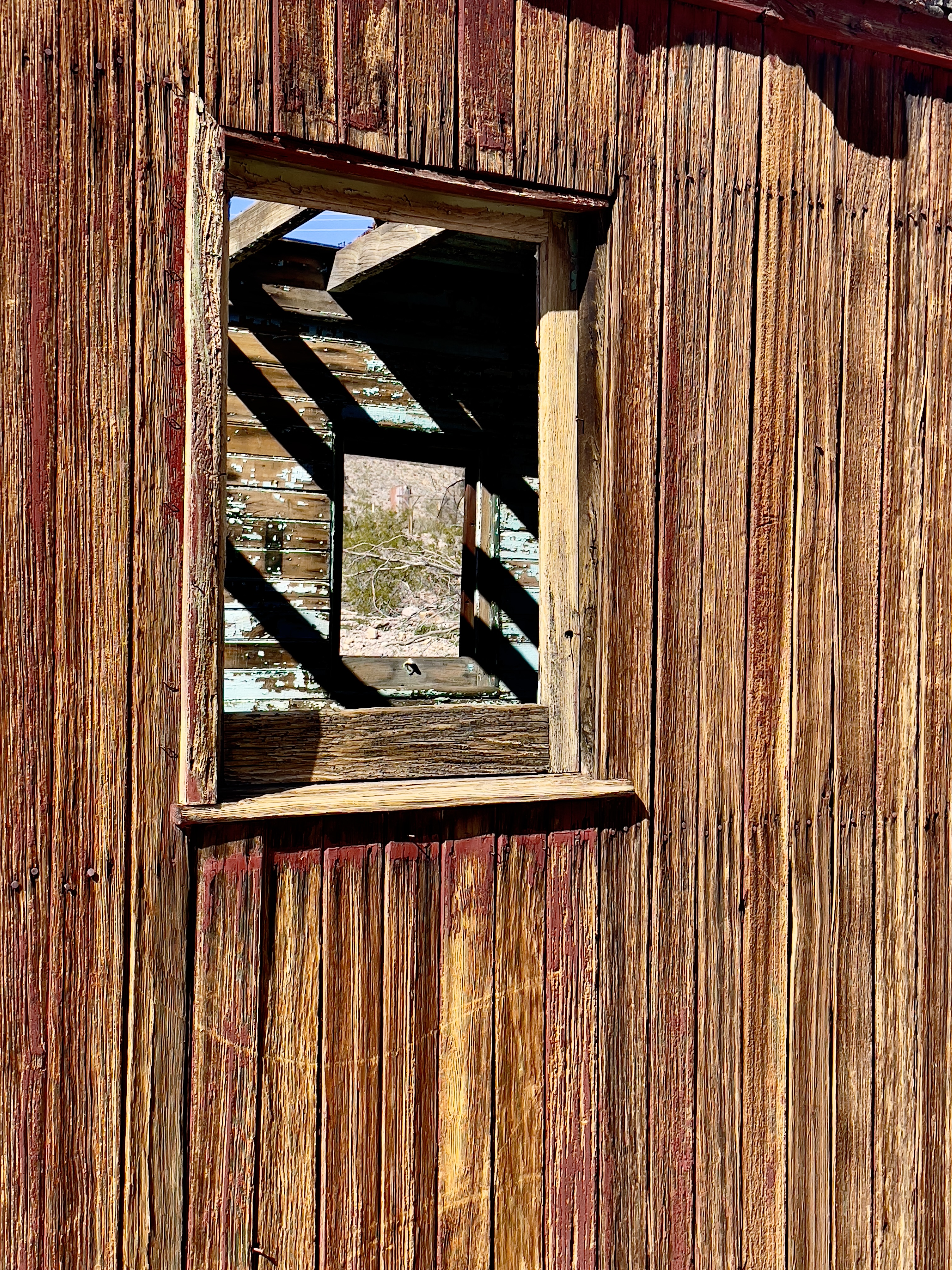
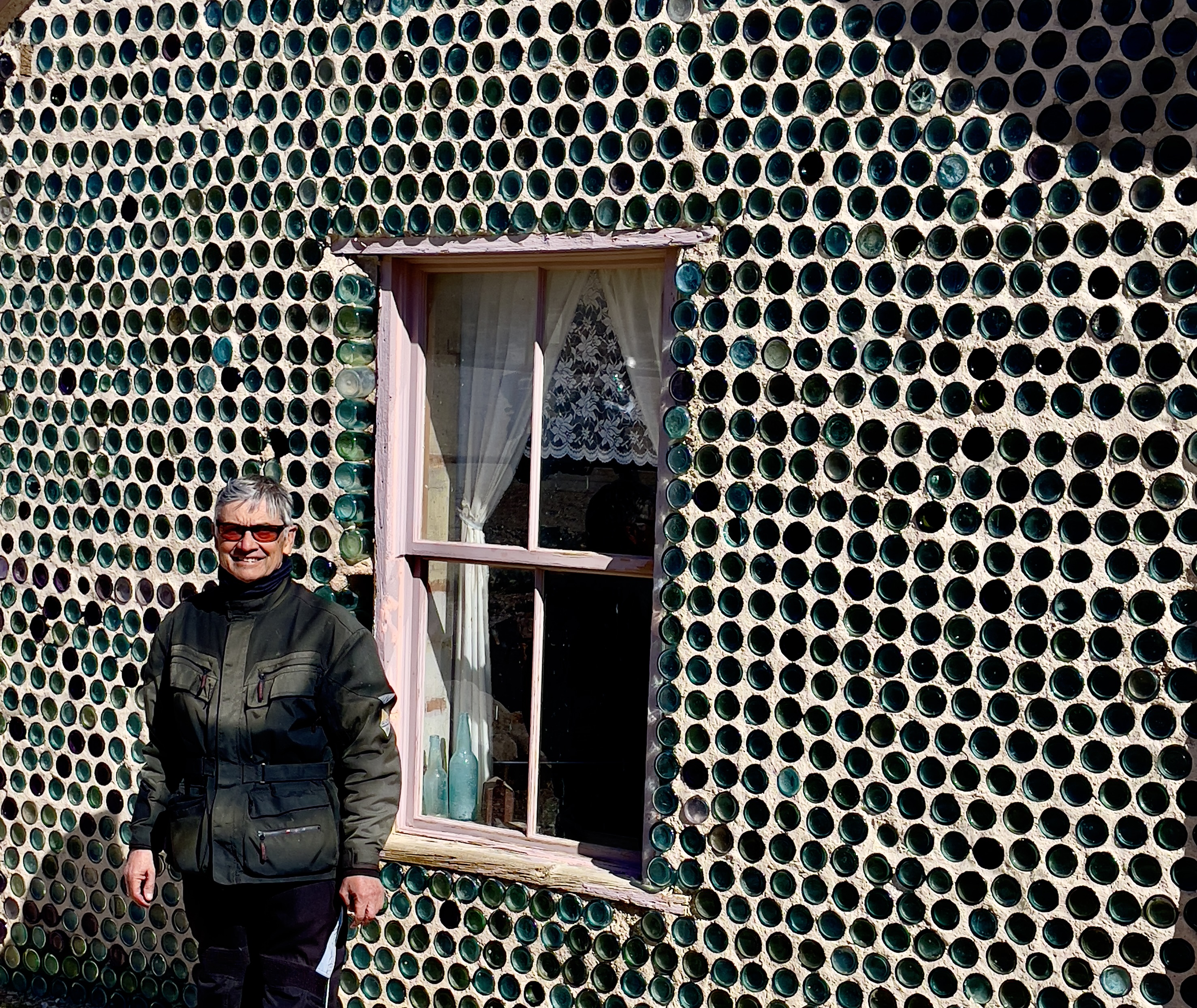
Flying through Kelso and Baker we made our way through the Mojave National Reserve, arriving in what is our favorite little town of Shoshone, just outside of Death Valley NP.

It’s impossible to get lost in Shoshone

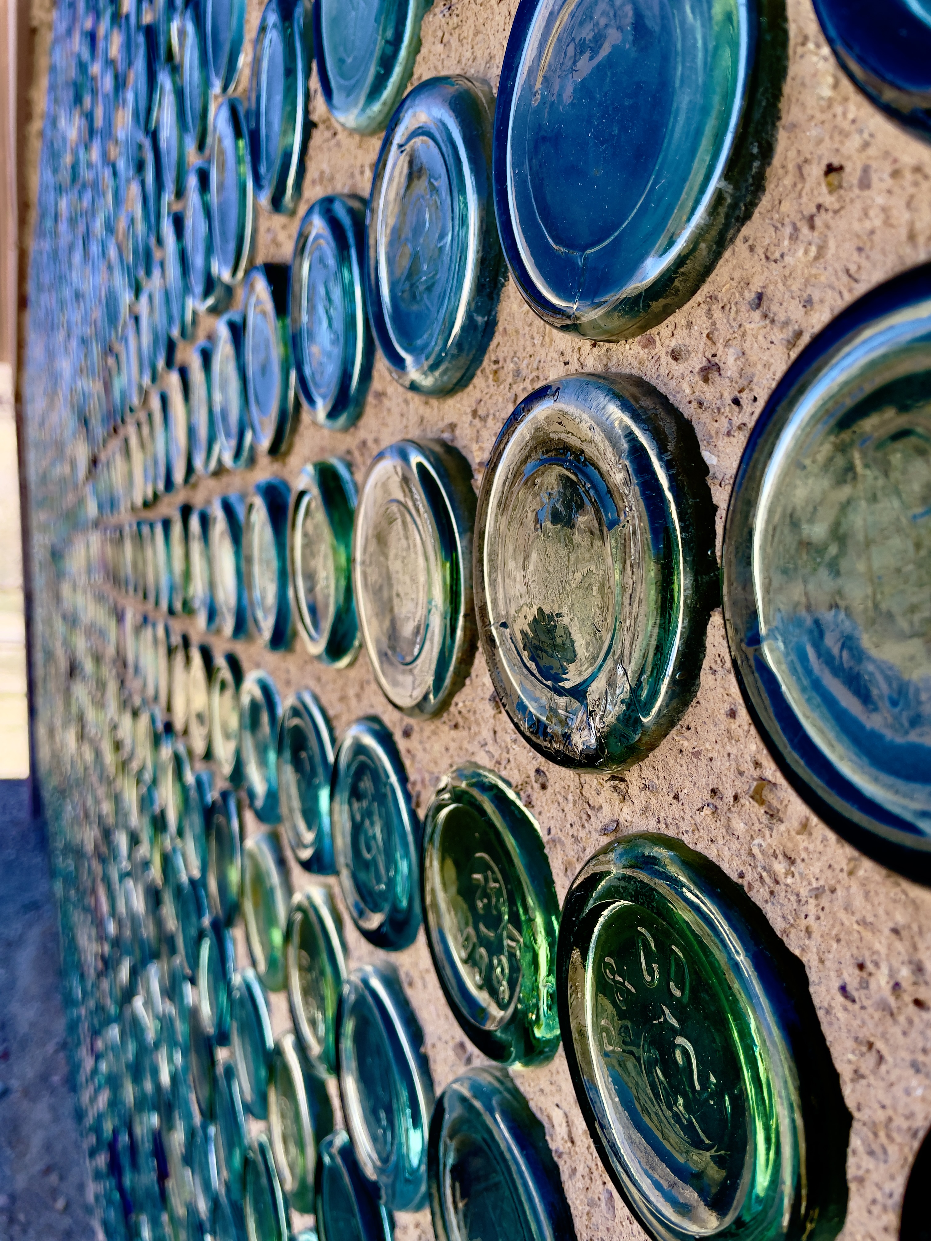
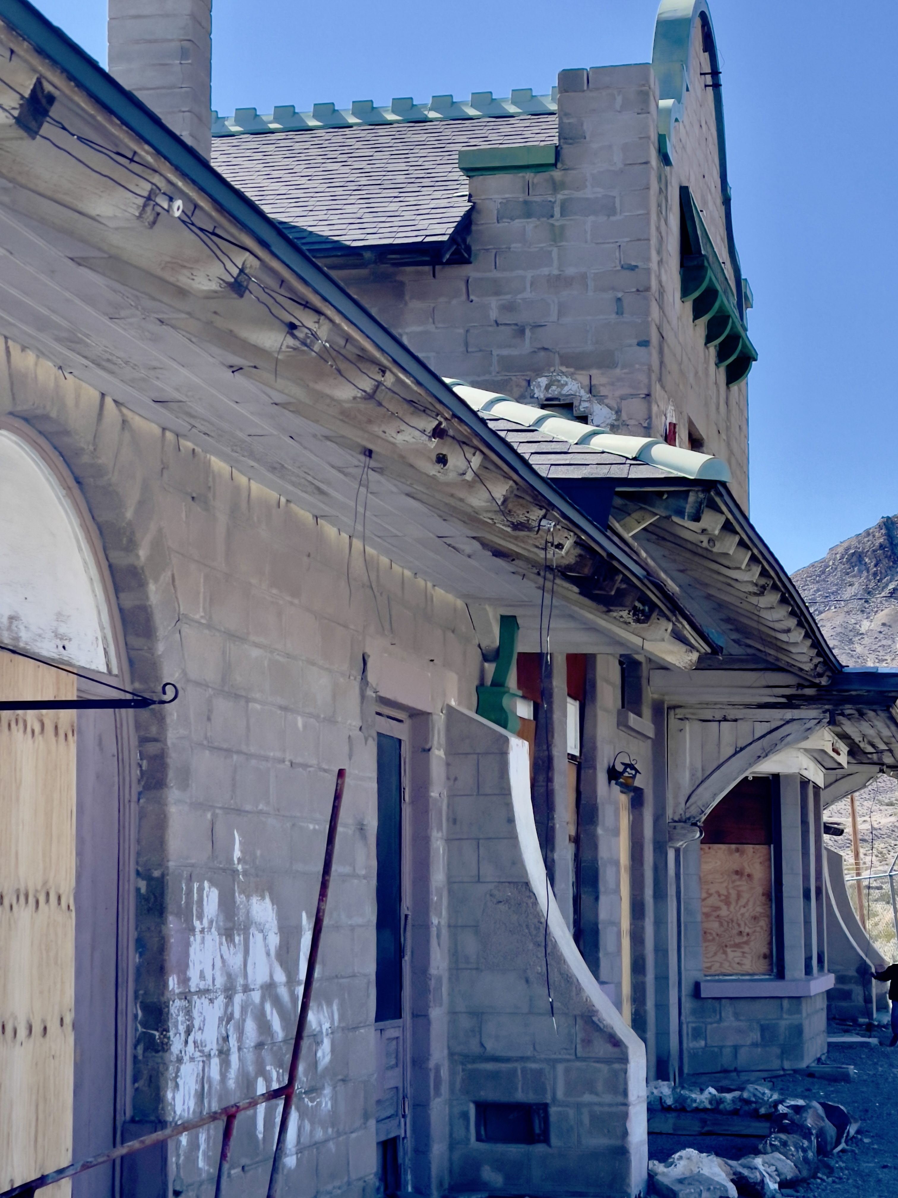
After setting up camp and checking directions, we strolled down Old State Highway 127 which runs parallel to the new state highway past the school and ‘Sorrells House’. I’ve noted in previous posts that the house was designed by Richard Neutra and is now occupied by the surviving daughter of the family whose great-grandfather founded the town and whose family has owned the town, lock, stock, and other revenue generating venues, now with a nod to ecotourism rather than strip mining, solar farms, malls, and subdivisions. That, and there’s a natural hot springs that keeps the community pool at a comfortable 89 degrees year round!

A raucous Tuesday night crowd had gathered at the Famous Crowbar Cafe and Saloon where we enjoyed dinner and a whistle wetter or two. Our server who was working solo serving a capacity crowd at the bar and tables managed to restore our whistles while awaiting victuals from the solo line cook in the kitchen. Somehow the wait didn’t matter. More impressive is that she didn’t write anything down.

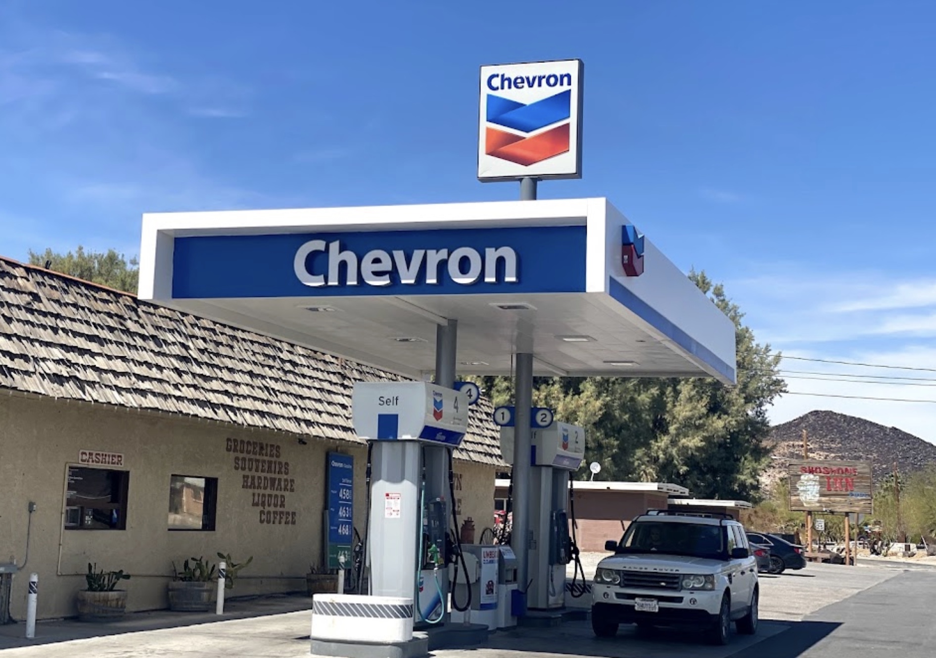
Following a delicious grilled Ortega chicken sammie and salad, we checked out the antique Chevron gas pump in the museum area adjacent to the cafe, a relic of a distant past that displayed a three digit price display as in: “_._ _”. We then strolled across the new State Highway 127 to the Chas Brown Market for procuring the first “R” of the hour of rehydration, relaxation, and reflection that beckoned. Pete made a new friend in the market while discovering that beer, by volume, costs more than gasoline. The new Chevron pumps in front of the market, that had sold a $1.9 million dollar Mega Millions lottery ticket in 2020, sported considerably higher prices with updated displays to several digits. You might just be able to fill your Range Rover’s tank with those winnings.

From its headwaters north of Beatty, NV, the Amargosa River flows underground in a southerly direction. Near the Dumont Dunes south of Shoshone and Tecopa, it makes a big u-turn and heads north into Death Valley National Park, finally terminating in Badwater Basin, the lowest point in the United States. The very same water that fills the campground pool and rises to the surface in the wetlands restoration areas, mostly flows beneath the desert surface and is warmed by subterranean thermal activity.
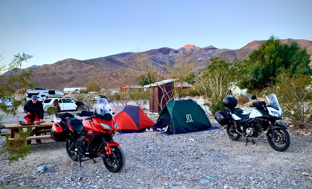
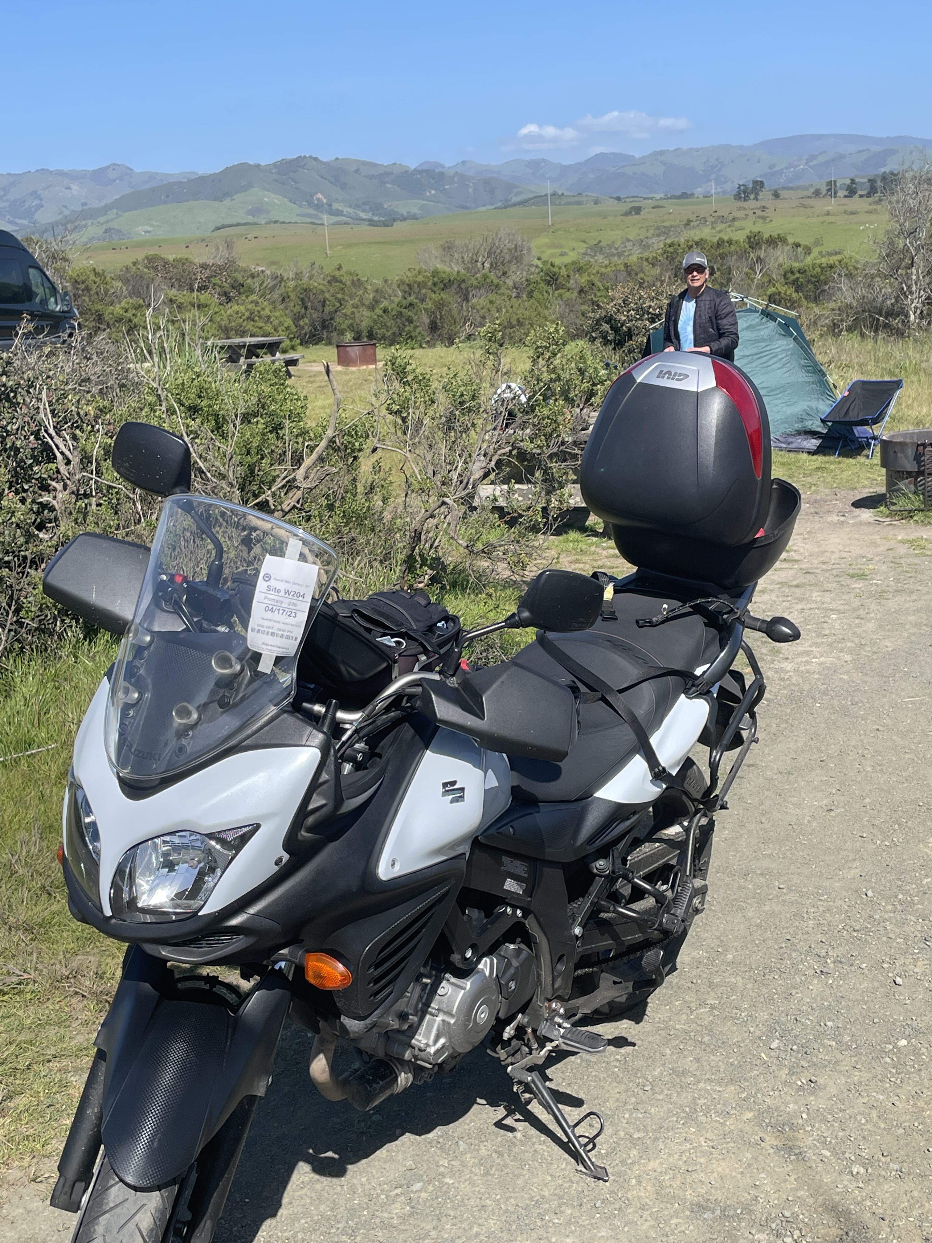
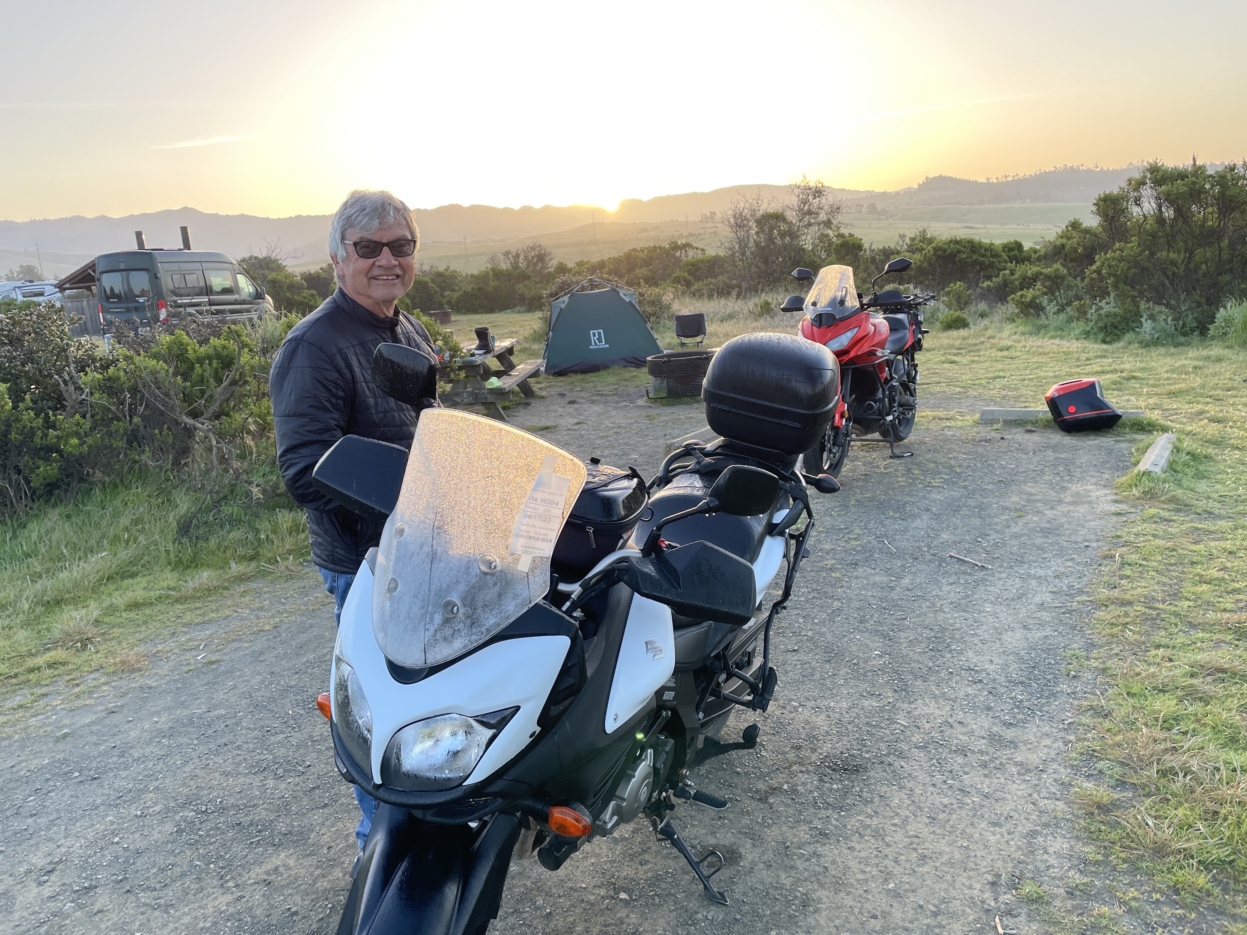
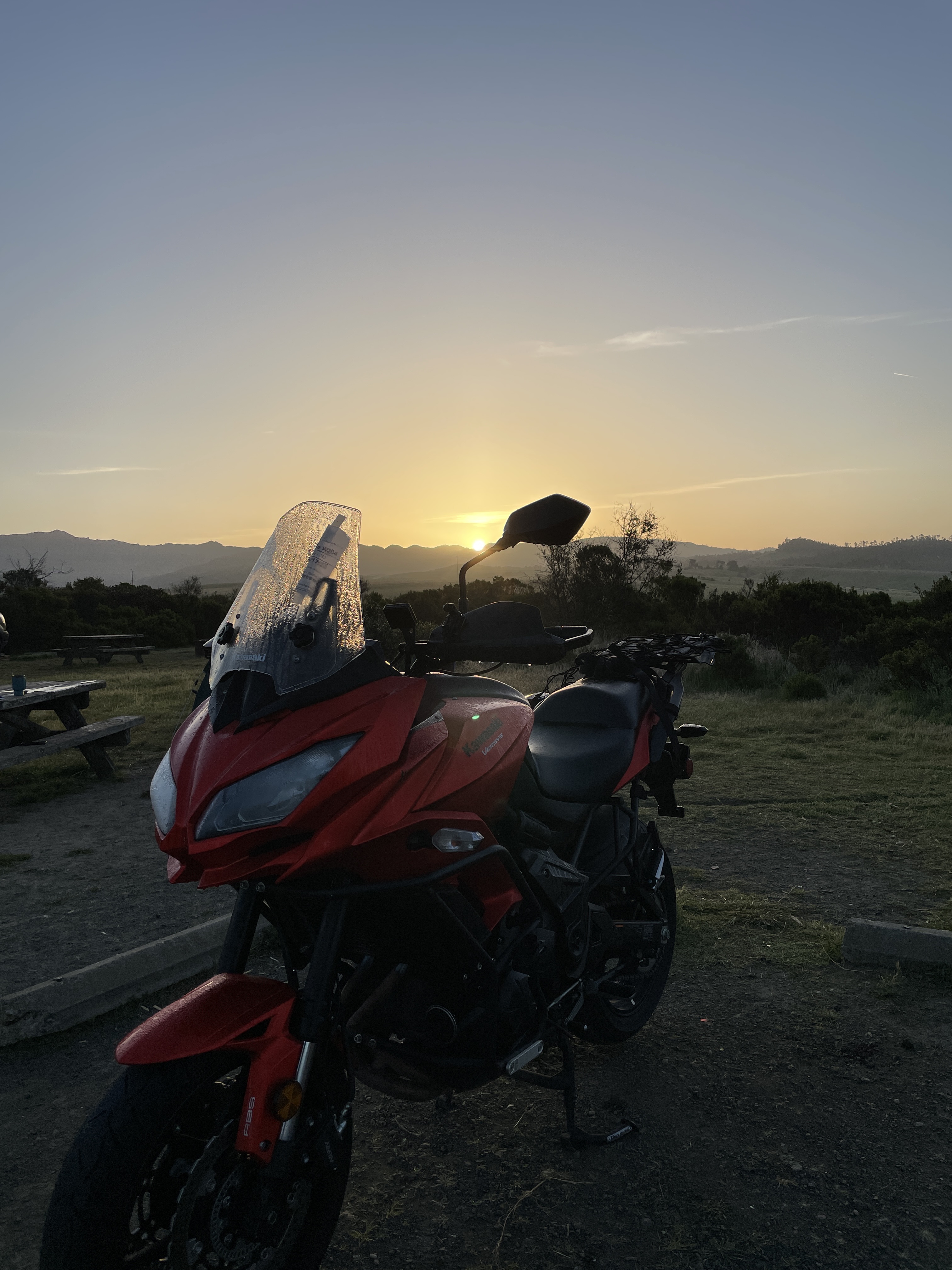
Day 4 Kernville

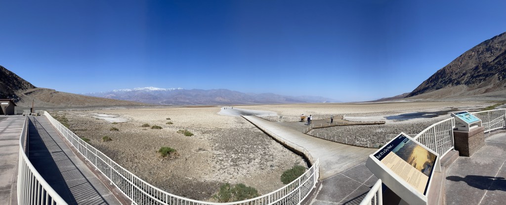
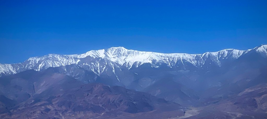
We decided to take CA-178 into Death Valley. The last time we rode this route was at night and is featured in the Riding Under a Fool Moon post from 2019 https://sisyphusdw7.com/2019/11/ . The route took us through Badwater Basin, the lowest elevation below sea level in the US. The snow capped mountain is Telescope Peak in the Panamint Range and summits at 11,043 feet above sea level. The photo at the bottom shows the sign from the basin viewing area to sea level, some 282 feet above the road.

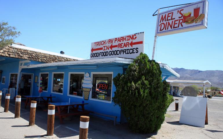
We decided to forgo the hustle and bustle of Furnace Creek to stop at Stovepipe Wells for a mid morning snack before heading to another of our favorite spots in the desert, the Panamint Springs Resort. We stayed there earlier in March on The Desert Pilgrimage Tour, https://sisyphusdw7.com/2023/03/. This day it was just for lunch before heading up and out of the lowlands on CA-190 to the high desert, US-395 and CA-58 over Walker Pass to our destination for the night in Kernville.

At the Father Crowley Overlook we stopped to view the colorfully striped canyon created by ancient volcanic activity. In Panamint, the market cashier said that Tom Cruise had a few weeks earlier, flown into Panamint Springs to check out Rainbow Canyon that was a location for filming the first, pre-CGI Top Gun. The canyon was nicknamed “Star Wars Canyon” by visitors who came to observe and photograph the military test flights which occured in the vicinity. Star Wars Canyon is part of the R-2508 Complex, which has been used by the military since the 1930s. Unfortunately a jet crash in the canyon in 2019 resulting in the death of the pilot and injury to several visitors in the area, put an end to training flights through the canyon.  We did meet two delightful couples, one from Britain and the other from New York by way of France who were curiously hoping for an F-16 to rip through the canyon. We had an enlightening exchange of cultural perspectives of our respective travels.

As Rick Steve’s says about travel: Globetrotting destroys ethnocentricity. It helps you understand and appreciate different cultures. Travel changes people. It broadens perspectives and teaches new ways to measure quality of life. Many travelers toss aside their hometown blinders. Their prized souvenirs are the strands of different cultures they decide to knit into their own character. The world is a cultural yarn shop. Back Door Travelers are weaving the ultimate tapestry.

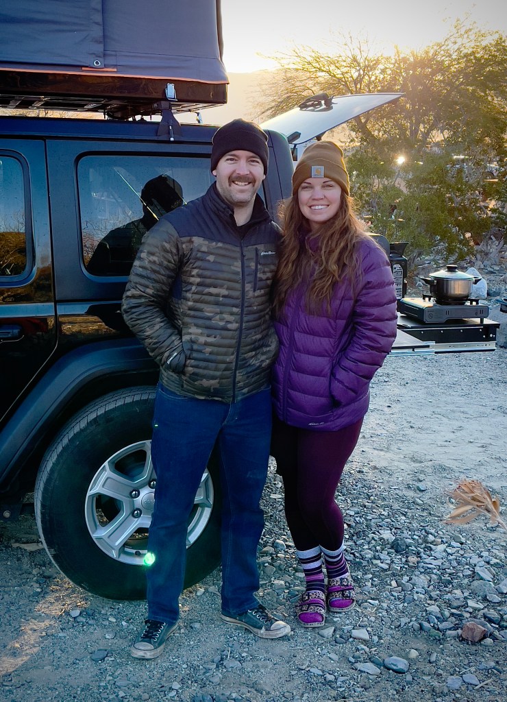
Ian and Melissa at the Father Crowley Overlook

“Rainbow Canyon” isn’t quite as colorful in the midday light. It was however green from spring rains.

We continued up past the turnoff to Darwin and over the Inyo Range to Olancha. The Owens Lake was beginning to show signs of life as water from the winter storms and the beginning spring runoff was making its way downslope.

Before crossing over Walker Pass on CA-58, Pete and I pulled over to stretch following a fuel stop in Ridgecrest at the intersection of CA-58 and CA14 where we were warned by a passing motorist that there was an unsafe driver ahead. This after a brief conversation with another solo motorist in an “all earthly possessions on board” van who was headed west, back to civilization after an extended desert stay. I guess unsafe drivers are a feature of civilization.

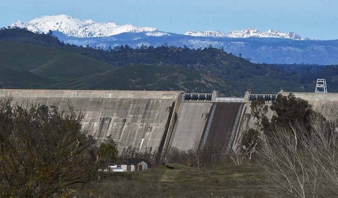
We made our way the Rivernook Campground in Kernville passing by the recently upgraded Isabella Dam. You might find this video recently posted by the Kern County Fire Department interesting as the project overview is examined in the context of this year’s river flows https://youtu.be/cDwY4sWs9MU .

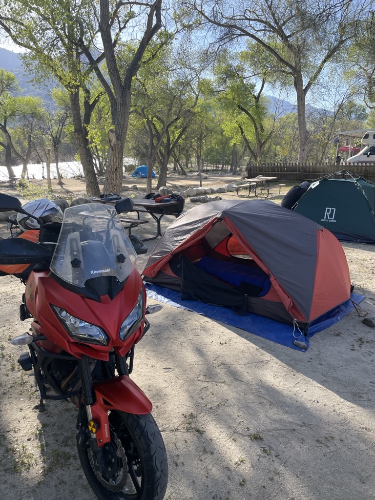
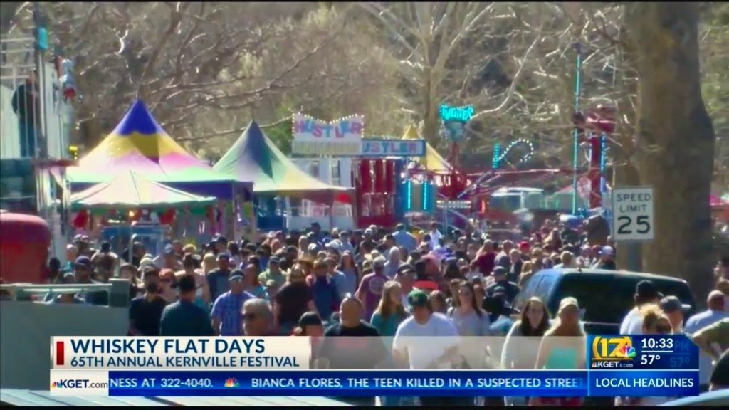
After a fine meal at Kern River Brewing we were pleased to have a bit mellower experience than when we were in Kernville last February during the community’s Whiskey Flat Days celebration (below) where winding our way through the SRO crowd to get to the gas station was the most daunting aspect of that 5 day ride.

Try riding a motorcycle through that crowd

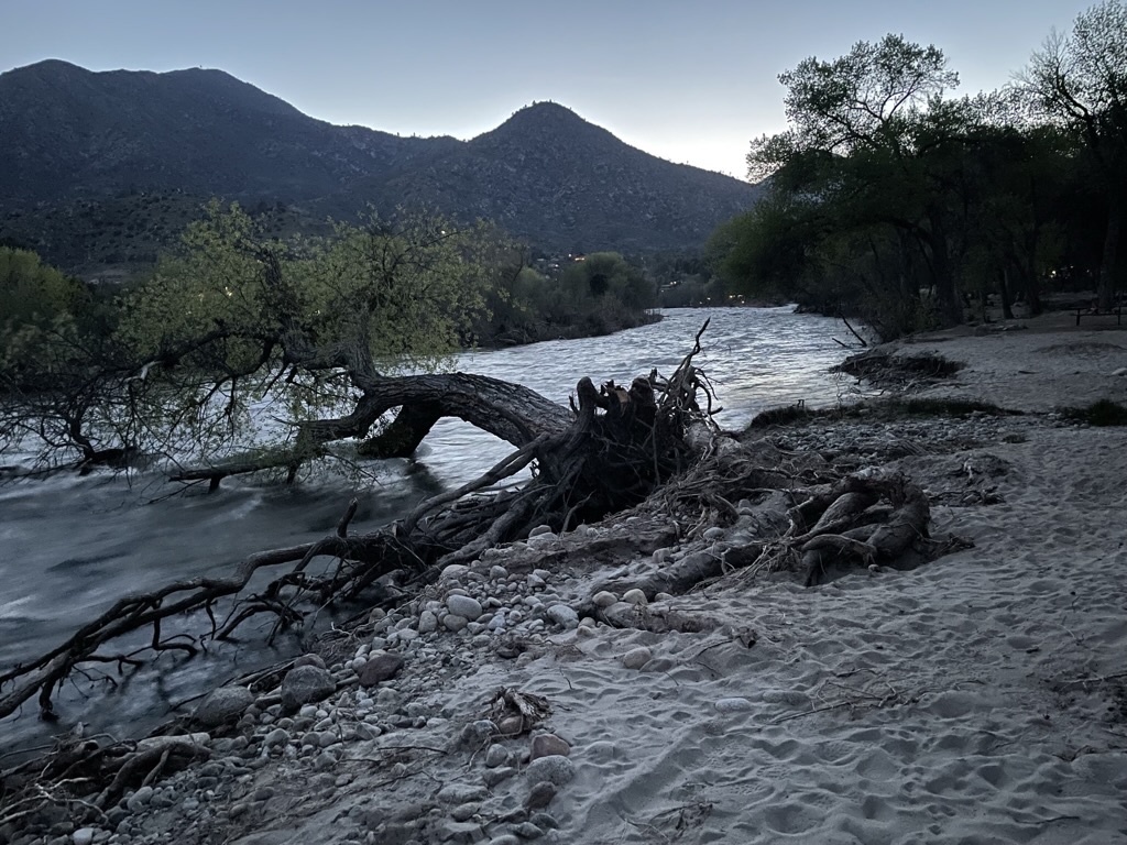
I had a brief clip of the Kern River as it raged near our campsite, but once again, my technical expertise (and budget) doesn’t permit purchasing format conversion to make IPhone video in HDR into a YouTube friendly format. Not sure who the villain is in this, WordPress, Apple or YouTube. I know who the victim is… You, my audience, who can only appreciate the still photo above https://youtu.be/LukyMYp2noo .

Day 5 Homeward Bound

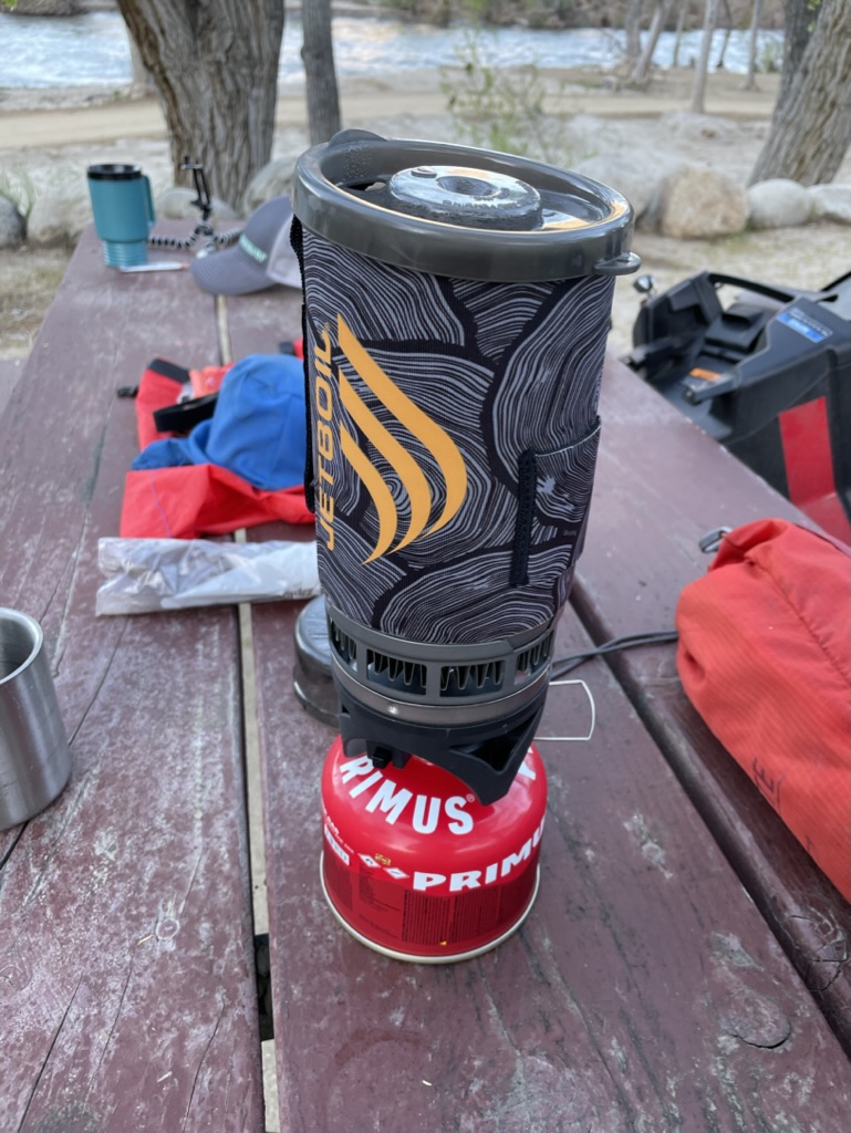
Good Morning Mr. Jetboil

One of the subtle calibrations one makes when “roughing it” is how to maintain the adventurous aspects of unpacking and setting up camp, not showering for consecutive days, making a fire to keep warm while enjoying the Three R’s after riding a motorcycle for 300 miles, sleeping on the ground, awakening to a frosted campsite, only to break down and pack up camp again. How to ameliorate those “hardships” without seeming to be too much of a wuss? A warm cup of coffee, mixed with some chocolate is the solution to the fine recalibration from discomfort to comfort. In fact, it seems like beverages, both associated with the Three R’s and morning reverie, more than compensate for any of the major and minor nuisances of motorcycle touring.

Our route home found us rolling over some new roads through Bakersfield to Oildale because of the closure of foothill roads east of Bakersfield due to winter storm damage. After riding through Kern River County Park into Oil City then out, the contrast of the two could not be greater.

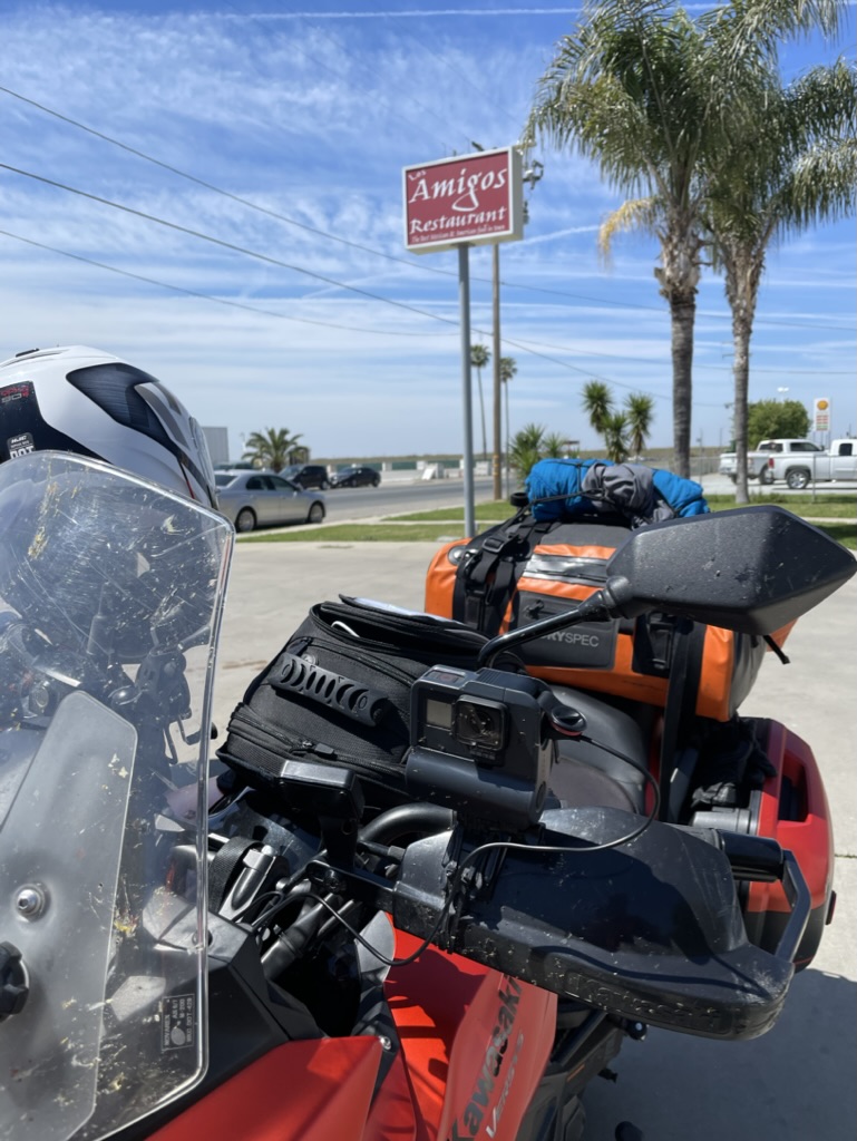
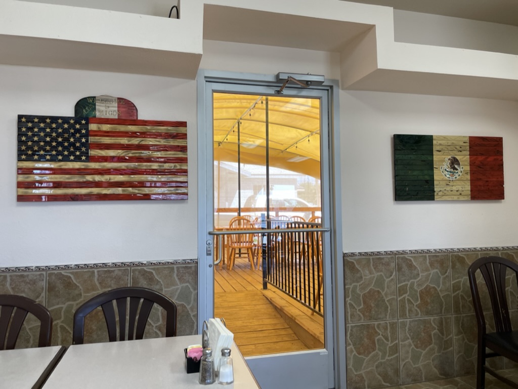
Once through the sucker rod pumps of Oildale we headed north on CA-65 stopping in Terra Bella for one of the best Mexican breakfasts we’ve ever had. The tortillas, flour and corn, were handmade and the huevos rancheros with chorizo were incomparable. The Amigos Restaurant reflects the very best of determined sisters to operate a treasured eatery in the rural Southern San Joaquin Valley.

In Porterville, where once again foothill road closures kept us rolling through the citrus groves Strathmore, Lindsay, Cutler, Orosi, and Orange Cove we made it to CA-168, Tollhouse Road by way of N. Academy Avenue in Fresno County. Our intent was to make our way to Friant and then drop down into Raymond and home. Now, I’m not the greatest navigator once we’re on the road as my issues with Butler Maps, Google Maps, Apple Maps, and Rever have all been documented in previous posts. So, I decided to turn over the last leg of the trip to Pete, acknowledging his ancestral Basque heritage in proximity to Portugal, a nation that once ruled the seas. You had to know a thing or two about navigating to rule the seas.

Our left turn onto CA-168 wound up taking us into the heart of of the 5:00 Fresno slab commute as we merged onto CA-180 followed by CA-41 merge. It was white knuckle, bumper to bumper traffic at 80+ miles per hour until we exited onto CA-145 and Rd-406 that took us on winding foothill roads devoid of crazed cagers at the foot of Hensley Lake and eventually to Raymond on Rd-600. From there it was Raymond Rd to Ben Hur Rd to Buckeye and Yaqui Gulch roads to CA-140 and home. I highly recommend a Sunday afternoon drive on any of the aforementioned foothill roads. Try to avoid becoming a crazed cager, or at least avoid crazed cagers anytime you can.

Epilogue

Extroverts have more fun. If your trip is low on magic moments, kick yourself and make things happen. If you don’t enjoy a place, maybe you don’t know enough about it. Seek the truth. Recognize tourist traps. Give a culture the benefit of your open mind. See things as different but not better or worse. Any culture has much to share. Rick Steves

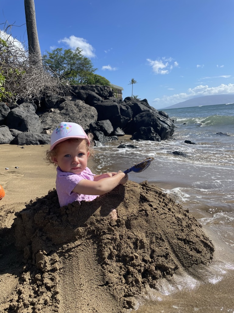
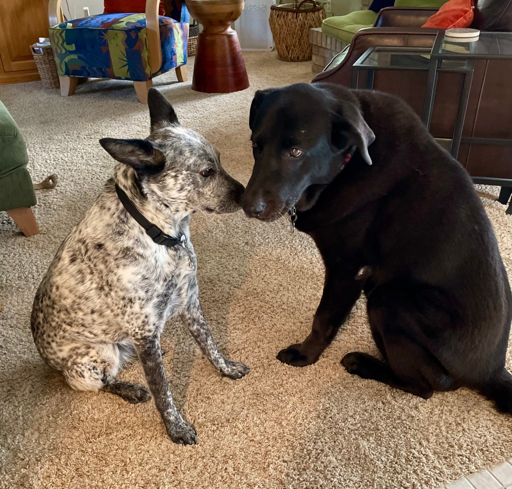
What creature appears to be washing ashore? Could it be a descendant of Wilson?

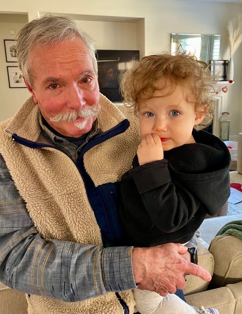
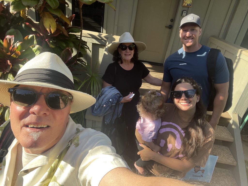
Just prior to a delightful week spent in the company of my wife, our son, his wife and their beautiful little daughter in Maui, a new member of Sisyphus’s family arrived…

Two beautiful Italians and a hillbilly

So, if you are interested, or know someone who may be interested, in purchasing the 2016 Kawasexy Versys 650 LT loaded with several touring-friendly features and lovingly maintained with a mere 28,440 miles, message me. Both Italians insist on moto-monogamy!

Addio mia bellezza arancione!

Ciao…

2023 Desert Pilgrimage: Day 5, Homeward Bound

Day 5, Homeward Bound Tuesday, February 21, 2023 

Three Rivers to Merced 

Expanded Meaning or Personal Transformation?  

You be the judge… The final leg of our Pilgrimage was approximately 190 miles over a variety of terrain beginning with the winding Sierra foothill roads, CA-198 and CA-216, to reach the straight and narrow roads, CA-245 and CA-201, of the San Joaquin plain.  We traveled across the valley floor through the small unincorporated towns of Woodlake and Elderwood, Seville and Yettem, Calgro and Oriosi all breaking up the monotony of thousands of acres of orchards all aglow with lemons, oranges, tangerines, and grapefruits hanging heavily on the verdant foliage of late winter citrus trees nearing harvest. 

Citrus orchards near Orange Cove

Dams and reservoirs hold back the waters of the Kern, Kaweah, Tule, St. Johns, Kings, and San Joaquin Rivers of the southern and central Sierra to sustain the powerful and abundant agricultural interests in the region.  Small hard scrabble rural farming communities of Lemon Cove, Orange Cove, and Navelencia identify the namesake agriculture of the area.  

Let’s eat

Orange Cove was our brunch destination on this and a previous desert pilgrimage.  Stopping at the El Monterey because El Bukanas was closed, a local patron recommended the carne asada.  Pete took her advice as I opted for a huevos, tocino, papas, arroz y frijoles burrito.  If ever you happen to find yourself in Orange Cove, CA, we highly recommend El Monterey, a family owned and operated restaurant for authentic Mexican fare.  And across the street, where else but in Orange Cove might you find a Blacksmith posing as a Machine Shop? 

A future brew pub?

I use Google Maps, Rever, and Scenic apps to plan these trips and use them as nav guides while underway.  They work fine as long as you’re within cell service range. Sort of. I have a Garmin Nuvi as a last resort if we’re out of range of the nearest cell tower or in the midst of a Google Maps fail.  Google Maps is fine for planning but I find it unreliable when riding, especially as we prefer back roads to the Google algorithm’s insistence on finding the fastest route from A to B.  By the time three or four options are offered and you “start” your route, the app sets about providing unsolicited “reroutings” that invariably have you traveling in circles.  What to do short of getting out the GPS?  The last resort: Apples or oranges?  Apple Maps to the rescue!

I had dismissed Apple Maps after less than stellar reviews were given upon its launch, but that was back in 2012 and I’m sure Tim Cook has long ordered the kinks straightened out.  So, to make our way through the Public Land Survey System sectioning of eastern Tulare and Fresno counties into large square tracts of land intersected by countless country roads transecting quarter sections, we needed reliable data to not get lost and perish in the ice-age storm that was forecasted to wreak havoc on California travelers in the coming hours and days. Worst case scenario, I’m sure we could have subsisted on oranges and tangelos until CalTrans cleared the drifts of snow impeding our progress.  

Alas, Apple Maps delivered clear and concise turn-by-turn directions to make our way through the labyrinth of groves and orchards in the eastern San Joaquin Valley, and suburban wilderness of eastern Clovis, saving CalTrans the effort to rescue us.  CA-180 took us through Minkler and Centerville to N. Academy Ave skirting the suburban backcountry of eastern Clovis. With a zig on CA-168 to E Shepherd Ave, we zagged on N Willow Ave before making our way back into the foothills heading north on North Friant Rd to, yes, Friant, home of the Friant Dam and Millerton Lake.  


Stopping at the Shell Station for hydration and nalgas relief, we met two cyclists, of the pedal variety, presumably stopping for the same reason.  After the standard conversation starter where I declare my preference for twisting a throttle to pedaling uphill, though in truth I like climbing on the Seven, we were invited to join them on their Saturday group ride that begins in Covis up to Friant and winds through the hills above.  That would require that Pete and I actually ride in the hills, something we haven’t done in several months of riding the flats. I guess the twisting throttle conversation entrée was a Freudian slip of sorts…

As we prepared to depart Friant I insisted that Pete show us the way home.  Riding the flat straightaways yielded to the undulating twisties of the eastern Madera foothills.  CA-145 (Rd-211) took us to O’Neal’s where we intersected with CA-41 to Coarsegold.  From Coarsegold it was Raymond Rd (Rd-415) and Rd-613 to Ben Hur Rd.  

The photo is of a rock wall visible from Ben Hur Rd we’ve seen on many hill rides on our bicycles.  

And now for some history:  

Quick Ranch Stone Wall, near the town of Mariposa and made of uncut stones, was built in 1862 to enclose 640 acres of the Quick Ranch. This wall is one of the most completely documented Chinese-built stone fences in the state, as the result from the ranch being in the same Quick family since in 1859. Because of the completed documentation, we know for certain that the Chinese built the wall and that this wall can be taken as a prime example of Chinese stone masonry technique. Most of the Chinese workers came from Mormon Bar, and this site shows one of the great contributions of Chinese Americans to the development of California with their stone masonry skills.  (exploreapaheritage.com)

After a brief stop to admire the Quick Stone Wall, stretch, and contemplate the brewing storm clouds, we set about on the last 45 mile leg of our 2023 Desert Pilgrimage, the final stretch of Yaqui Gulch Rd to CA-140 and be-it-ever-so-humble, home sweet home.

Bringing it Home

SoBe and Dakota

I began this post by describing it, somewhat in jest, as a pilgrimage with a lofty characterization as:

A [pilgrimage] journey, often into an unknown or foreign place, where a person goes in search of new or expanded meaning about one’s self, others, nature, or a higher good through the experience. It can lead to a personal transformation, after which the pilgrim returns to their daily life.

Now that I’m back to the “daily life” grind of chores, including documenting the ride, and the delightful company of my family and companion perras SoBe and Dakota, I can say that my already expanded life gained a bit more meaning through the experience of meeting new friends, others; experiencing nature, the foothills and mountains of the Sierra and Death Valley and the Mojave; and the higher good of the friendship in my travel companion Pete’s company.  
My wheels are already spinning as I will give this trip a few days before committing it to the archives as I anticipate and plan for the next, and maybe best tour: to immerse myself in the California spring superbloom between a niece’s wedding in Atlanta in March and the beaches of Maui with my beautiful wife, our youngest son, his lovely wife, and adorable daughter Aubrey in May.  Toodle-oo!

Post Script

It’s now April and the super bloom, nourished by unrelenting winter’s rain, will be full-fledged in the coastal mountains of California. Mountain passes, now buried in snow, will likely be closed until early summer before the migration of the bloom moves upslope. Our “Desert Pilgrimage” followed the January atmospheric rivers as we ended our ride on the cusp of the late February and March weather that has caused great flooding throughout Central California and record snowfall in the Sierra. Vernal pools have begun to form their concentric rings of varied species of CLF’s (colorful little flowers).

I chronicled the 2019 super bloom in the post, Super Bloom on Two Wheels https://wordpress.com/post/sisyphusdw7.com/352 just prior to the explosion of the Covid pandemic. I’m excitedly planning to revisit the tour with the exception of an infamous descending decreasing radius turn on Lake Nacimiento Lake Dr where just about one year ago, a moment’s inattention resulted in a tale I will consider avoiding repeating…

2023 Desert Pilgrimage: Day 4 Panamint Springs to Three Rivers

Monday, February 20, 2023 

Panamint Springs to Three Rivers 

Different Direction, Different Sights, Same Mistakes

Departing Panamint Springs and Death Valley for Three Rivers, our first and final night’s destination, we retraced our route back to Ridgecrest where a veggie omelet at a packed Denny’s took waaaay too long to arrive at our table.  A single server with a Presidents’ Day crowd was the issue.  After thanking the wearied waitress who apologized several times, we left, appetites sated. 

Deciding we likely had enough fuel to get back to Lake Isabella and wanting to make up time, Christopher Columbus here zigged when I should have zagged leaving Ridgecrest heading south on US-395.  After about 30 miles or so I realized we were headed to Victorville and not Walker Pass.  Embarrassed and now distracted by a flashing low fuel indicator, we turned tail and headed 30 or so miles back to Ridecrest to correct my directional error and fuel up.  It was at the gas station that Pete reminded me that we, rather I, made the very same navigational error when we departed Ridgecrest on our last Death Valley pilgrimage.  Hmmm.  Lightning strikes twice, again… 

Morro Rock

This time we hoped to make up the mileage faster than when we funorkled our way two days ago to Panamint Springs late, only to find a full campground.  Three Rivers didn’t have the Death Valley attraction this time of year, especially as the weather was changing and winter storms were headed our way so I wasn’t worried about any no-vacancy.  

We decided to skip Kernville as the Gunsmoke and Petticoats revelers were still in full revelry.  Heading back over Alta Sierra from Wofford Heights we skipped stopping at the crowded Saddle Sore Saloon in Glenville.   

Meadowfoam and fiddlenecks along Yokohl Rd

Once down on Yokohl Rd, the hillsides presented emerging blankets of spring color with patches of meadowfoam, fiddlenecks, lupine, and poppies leading the bloom.  The increasingly menacing skies foretold the oncoming late winter storm with apocalyptic warnings of gusting winds, rain, and snow that compelled our hasty departure from the mountains.  Even at that we saw a couple of intrepid bicyclists who were uphill bound for a Washington’s birthday cycling challenge.  

We had planned to stay at the Sequoia Campground and Lodge just as you enter Three Rivers on Sierra Dr, however, the entrance was blocked with a sign indicating Campground Closed.  It looked abandoned.  In checking their FB page, the last post was from 2021.  Perhaps it was the summer fires smoking out the tourists, Covid, or the recent heavy winter rains that appeared to have flooded the campsites since there did appear to be lots of flotsam strewn about.  

After setting up camp it was back to the Totem for a delicious meatloaf sandwich dinner and a bundle of wood for a campfire.  Calling it an early evening, we retreated to our tents after fighting to get somewhat wet firewood to burn to our elevated Smokey Bear, smokeless campfire standards.  


We awakened the next morning to a saturated campsite unlike the frosty morning three days prior.  After drying the gear as best we could it was time to get on the road back home.  First stop, Orange Cove for brunch.

Coming up: 2023 Desert Pilgrimage, Homeward Bound Tuesday, February 21, 2023 

2023 Desert Pilgrimage: Day 3 Death Valley, Amargosa, & Rhyolite, Sunday, February 19, 2023

The WeeStrom and Kawasexy

Death Valley, Amargosa, & Rhyolite

On Seeing Things for the First Time, Again

The next morning, sunrise beckoned as did a visit to see a man about a horse.  That’s when we first heard a gawd-awful, shrill, please-put-the-beast-out-of-its-misery noise coming from the direction of the Scout camp.  After about twelve bars I recognized:

I can’t get ’em up

I can’t get ’em up

I can’t get ’em up this morning;

I can’t get ’em up

I can’t get ’em up

I can’t get ’em up at all!

And tho’ the sun starts peeping,

And dawn has started creeping,

Those lazy bums keep sleeping,

They never hear my call!

(Repeat, ugh)

Good morning Panamint Valley

Pete and I usually ride from point A to B to C and call it a day.  On this tour we decided to spend two nights in Panamint Springs, using the extra day to refresh the sights and sounds around Death Valley we’ve grown to enjoy.  

After the August 5, 2022 flash flood

Hopping back on to CA-190 we headed towards Stovepipe Wells over the highway that was previously closed due to the “1000 year monsoonal flood” back on August 5, 2022 (above).  It appeared that any damage to the road had been repaired and evidence of the flooding had been cleared.  I remember watching YouTube videos of travelers who were making their way out of the park over the damaged roads after the flash flood waters had receded.  Death Valley is WRECKED @SufperfastMatt… Gnarly. 

On this 2023 President’s Week holiday, the entrance to Death Valley National Park was crowded with vacationing travelers.  Stovepipe Wells was teeming with activity as was Furnace Creek.  Our plan was to make our way to Death Valley Junction to see if the Amargosa Hotel restaurant was open and perhaps check out Zabriskie Point and Dante’s View along the way.  No way!  Cars in the parking lot to Zabriskie Point spilled over to parking alongside CA-190.  We figured Dante’s View would likely be the same.  Maybe next time we’ll choose a non-holiday week.

Passing Dante’s View Rd I noticed some buildings on a mountainside that I had seen in the past figuring they were some sort of mining operation.  I just learned, according to the Death Valley Conservancy, that the structures are from a mining operation, “begun as Lila in 1907 which produced colemanite for the Pacific Coast Borax Company. The town was named by its owner William Tell Coleman, after his daughter, Lila C. Coleman. Soon after its completion, the community of Lila C became known as “Ryan“, in honor of John Ryan (1849–1918), who was General Manager of the Pacific Coast Borax Company and a trusted employee of “Borax” Smith until his death in 1918.  The Death Valley Conservancy writes: “Ryan was a luxurious mining camp by any standards of the day – with electricity, steam heat and refrigeration it also boasted a school, a hospital, post office, recreation hall/church (shipped down in sections from Rhyolite) and a general store.”    

Ryan now (Wiki)

“After borax production had stopped in 1928, in an effort to increase revenues on the Tonopah and Tidewater Railroad which had carried the borax ore, Pacific Coast Borax converted the miners’ lodgings into tourist accommodations and gave tourists visiting Death Valley trips on the narrow gauge rail line into the mine. The Death Valley View Hotel operated full-time from 1927 until 1930, the year the Death Valley Railroad ceased to function. After 1930 the hotel was used as overflow accommodations for the Furnace Creek Ranch and Inn through the 1950s.”

Ryan, or Lila, then (Death Valley Conservancy)

While Ryan is closed to the general public for safety and historic preservation reasons, the Death Valley Conservancy offers occasional public tours. Tour participants can be selected by signing up on the Death Valley Conservancy’s website, https://www.dvconservancy.org/ryan-camp/.

Amargosa

Our next stop was the Amargosa Hotel and Opera House.  I’ve shared previous stops on earlier posts about the history of the hotel.  We were hoping to have lunch at the Amargosa Restaurant only to find it was a victim to Covid.  According to the hostess, the hotel fills nightly and reservations are recommended.

Can’t quite read this sign from CA-127

The Amargosa Opera House under the fullness of sunlight

We met a couple of fellows on KTM thumpers who were touring the area following off-road trails on their navigation who were from San Diego.  Apparently their tour was not for the faint of heart as the conditions of their ride can best be described as gnarly.  They were hoping for a tour of The Opera House, which was made famous by Marta Becket, an eccentric American actress, dancer, choreographer and painter. She performed for more than four decades at her own theater, the Amargosa Opera House where in 1967, due to a flat tire, she discovered this theater in Death Valley Junction and decided to stay until her death in 2017. 

Lobby of the Amargosa Hotel

The shady veranda of the Amargosa Hotel

Here’s a film by Poppy Walker, Dust Devil, that captures the essence of Marta Becket:  Dust Devil (YouTube).

Opera House interior (The Desert Sun 2017)

From Wiki: When the town of Amargosa was booming due to the Borax mining business, and its position at the terminus of the Tonopah and Tidewater Railroad, about 350 people lived in the town. The hotel served as a very nice place to stay for both company executives and visiting investors, who were met at the train with white-gloved valets after a long and hot train ride. In addition to the hotel rooms, the cafe and a restaurant within the hotel, other rooms were bunkhouses for workers, an infirmary, a general store and what is now the Opera House, which was mostly used for showing films. A large gas station and garage across from the cafe was the only location in the area for repairs of trucks hauling borax out of the mines, in addition to passenger car repairs. When the Tonopah and Tidewater Railroad ceased to be economical in 1942, the tracks were torn up completely and sent to Egypt, where the railroad was set up again to aid the Allies military effort in Egypt. Once the railroad stopped, the Opera House, Hotel and about 250 acres of land changed hands many times, until Marta Becket arrived on the scene.

The Opera House Under a Fool Moon, 2019

The photo of the Opera House at night was from our October 2019,  Riding Under a Fool Moon, tour began on Friday, October 13, from Merced to Mammoth. From Mammoth it was a frosty night ride after a late afternoon stop in Panamint Springs. The idea was to ride under the full moon to Beatty, NV and spend the night at the Atomic Inn.  It’s doubtful that you’ll ever need reservations for the Atomic Inn, but I would recommend the Inn for your next stay in Beatty.  From the website:  Miss Cindy wants a sweet roll or carrot cake!  Anyone stopping in Seligman, AZ at Westside Lilo’s bring her one, and receive a substantial discount!!

Andy in 2019, ailin’ not alien at the Atomic…

Worth a stop when next you’re in Beatty, NV

Rhyolite

After a surprisingly appetizing grilled chicken Greek salad brunch at Mel’s, we headed west on NV-374 to Rhyolite, a ghost town that began in early 1905 as one of several mining camps that sprang up after a prospecting discovery in the surrounding hills. During an ensuing gold rush, thousands of gold-seekers, developers, miners and service providers flocked to the Bullfrog Mining District. Many settled in Rhyolite, which lay in a sheltered desert basin near the region’s biggest producer, the Montgomery Shoshone Mine. 

You can learn all about Rhyolite in my very own YouTube video:  Rhyolite, Nevada with Tom and Pete.

Some snaps of Rhyolite

Camp and Großes Biers Beckon

Home sweet home with an en suite…

Why do Pete and I enjoy these trips so much?  It’s because we get out into the world on a vehicle that demands attention to the terrain, through which that attention demanding road runs. It’s that we get to see new places, meet new people, and enjoy an experience you just don’t get any other way.  All of which contributes to that notion of a journey, often into an unknown or foreign place, where a person goes in search of new or expanded meaning about one’s self, others, nature, or a higher good through that experience. It can lead to a personal transformation, a pilgrimage, after which the pilgrim returns to his daily life of dirty laundry, household chores, YouTube motorcycle videos, and planning for the next, and possibly greatest, ride. Oh yeah, and the reunion with our enchanting families!

On this afternoon we struck up a deeper conversation with our neighbors, Mike and Marissa from Toronto.  After obtaining that it was okay to address them Canucks even though they weren’t from Vancouver, we learned that Miike was a paramedic-firefighter and Marissa was a marketing consultant who were, like our encounter with the Montreal fellow in Three Rivers, escaping mid-winter Canadian temps for some early spring desert chill.  Their camp setup was an incredibly swagged out Jeep Wrangler rental featuring a Roofnest pop-up rooftop tent and a custom-built trail kitchen that included a portable stove, a sink with 2-gallon water tank, a foldable countertop, an electric/powered cooler and a solar shower with a 2.5-gallon water capacity. 

Mike and Marissa, Canucks to the core

They generously invited us to share their post dinner campfire and so after another fine appetizer of Simply Nature MultiGrain Tortilla Chips it was off to the Panamint Resort Restaurant for a breaded cod sandwich and großes bier, “bigga-beer”.   After a delightful laugh-filled evening of conversation with our new Canadian friends where we shared stories of adventures and families that both entertained and informed us, we turned in.  

Around midnight the first braying of feral donkeys near our campsite began.  The group of spiritual women retreaters who were camped next to us awakened, startled at first, but after one of them suggested that the sound was that of an elephant, proceeded to giggle for the next hour or so presumably about their “wilderness” experience. 

The next morning, reveille was sounded for the second morning, this time recognizable by around the eighth bar, after the first three bars of You gotta get up, You gotta get up, You gotta get up this morning.  The leader of the scout troop from Chino camped in the adjacent group site later apologized for the novice buggler’s rendition.  I thought it was full of character, not unlike the braying of the mules the night before…  

After packing up we bid adieu to our new friends inviting them to check out sisyphusdw7.com and should they ever return to California to visit Yosemite, to message us so that we might host them on their journey, perhaps accompanied by the child they intended to have… Awww!

2023 Desert Pilgrimage: Day 2 Three Rivers to Panamint Springs Saturday February 18, 2023

Where Tom and Pete find themselves in Panamint Springs

2nd Installment of the 2023 Desert Pilgrimage

Three Rivers to Panamint Springs

Lake Kaweah

Two Wheeled Backroads

There were a couple of backroad options for the day’s ride and so we selected a new route, Yokohl Drive to Springville.  New for me, but not for Pete who 20 years earlier took the same road Death Valley bound with his late pal Steve Walstad.  Kind of a tribute to a lost friend.

From Three Rivers we headed back on CA-190 through Lemon Cove to Exeter where we had a delightful breakfast at the East Meet West restaurant.  From the “City of Exeter” webpage:  “Exeter is known for growing the sweetest oranges in the world and as the “Citrus Capital of the World”.  How sweet!

Citrus Capital of the World

From the Citrus Capital of the World we took Yokohl Drive headed to Springville.  Fiddlenecks and meadowfoam, lupine and poppies with the backdrop of snow capped Blue Ridge beckoning, we noted a number of bicyclists, kitted out exhibiting an array of fitness levels, heading up to and down from, higher elevation.  It was some sort of organized ride, perhaps a club enjoying this early spring appetizer. The road surface was comparable to Mariposa’s Old Highway 140 we often enjoy on hill rides ourselves, roughly 20% original pavement, 60% patched potholes, and 20% potholed.  At one point in the road, as we began a steep climb, I was glad to have throttle assist and shock absorbers on our two-wheelers.  Check out the street views on Three Rivers to Panamint Springs

Beginning to bloom

I learned the hand on hip move from my granddaughter

From Yokohl Drive to Springville, it was CA-190 to just east of Porterville where we rambled over Old Stage Rd to White River and White River Rd to Glennville.  Glennville lies just west of the Alta Sierra Pass on CA-155 that drops down to Wofford Heights/Lake Isabella.  It’s a very popular road attracting riders from far and wide who congregate at the Saddle Sore Saloon (pics from a 2021 tour).  This tour included lively bike conversations with four gentlemen sitting on the deck of the Saddle Sore, all of whom were of our vintage, riding a V-Strom identical to Pete’s, a Honda NC-750, and a Tiger 850. I think the fourth bike was a Yamaha

Saddle Sore Saloon, Glennville – Note the anti-saddle sore gel pad on the Kawasexy

After exchanging pleasantries, we mounted our steeds as another vintage fellow threw a leg over his Kawasaki Vulcan Vaquero bagger, who warned us to be careful of the sand near the summit.  Indeed, the road was sanded and for a stretch, slushy from the melting snow of the most recent storm. Up and over Alta Sierra Pass descending from an elevation of 5,718 ft the road was clear as we headed to Kernville for gas and a stretch.

At the intersection of CA-155 and Wofford Blvd in Wofford Heights, it’s 4.3 miles to Kernville.  Turning, we started seeing cars, trucks, and motorcycles parked on either side of the road for at least a mile from Kernville.  Little did we know as we stop-and-went for that longest mile into town for fuel at the Shell station that it was the 66th Annual Whiskey Flat, Gunsmoke and Petticoats celebration established in 1957 and sponsored by the Kernville Chamber of Commerce.   (https://whiskeyflatdays.com/). Below is a screen capture from last year’s event.  Needless to say, my hands were firmly attached to the handlebars and I wasn’t going to try to take a picture…

No reaching 25 mph in this crowd

Since 1957, this event commemorates the old Kernville of the 1800’s that was named Whiskey Flat.Just a short 3 hour drive from Los Angeles to the Lake Isabella recreation area, you will find the quaint town of Kernville, home to Whiskey Flat Days (50 miles east of Bakersfield on Hwy 178). Whiskey Flat Days is held every Presidents Day Weekend. It is a leap back to the good ol’ wild west days when the area was settled by gold miners, cattle ranchers and trappers. Join us when Kernville reverts to its old name “Whiskey Flat” for four nostalgic days of fun for the entire family. Parade, Wild West Daze Rodeo, Wild West Encampment, Carnival Rides, Frog Jumping Contests, Whiskey Flat Mayor Contest, Food and Craft Booths, Epitaph, Costume and Whiskerino Contests, Line Dancing, Pet Parade, BlueGrass and Country Western Music, Art Show, Gunfighter Skits, Kids Activities, Games, and much more! Kernville Chambeer of Commerce

All we saw on our fuel stop were impatient drivers ignoring that fact parking was likely unavailable any closer than a mile back, and hundreds, maybe thousands, of beer swilling but good natured, revelers making any low-speed, high-center-of-gravity, Kawasexy manuevers terrifying as we attempted getting into and out of the Shell station dodging likely inebriated pedestrians and distracted drivers searching for noted non-existent parking.  

From Kernville we sailed through Mountain Mesa, Weldon, Onyx, and Canebrake to whip over Walker Pass on CA-178 (el 5,246 ft).  It was chilly, but clear of ice. Behold the east side.  This descent is almost as breathtaking as the descent from Kennedy Meadows over Sherman Pass, just to the north, down 9 Mile Canyon Rd that I have only ridden on my other two wheeler, the Seven Axiom.  Maybe it’s the extra mile that gives 9 Mile Canyon Rd that extra something.  Or perhaps it’s the 56 mile climb to get to the 9 Mile Canyon Rd descent.  Again, on this day, it was nice to have throttle assist.

Close to where the Pacific Crest Trail crosses CA-178

Short sections of US-395 and CA-14 took us through Inyokern to Ridgecrest where we joined CA-178 through Searles Valley, Trona, and Valley Wells on the Trona-Wildrose Rd, past the Ballarat Monument to the Panamint Valley Rd and our destination of the Panamint Springs Resort.

From Ballarat the Barker Ranch is only 21.8 miles

From 1897 to 1917 Ballarat served as a supply and recreation center for miners in the Panamint Mountains and Death Valley. Ballarat springs, cemetery, and remaining ruins of adobe, tin and wood buildings are featured. At its peak the remote outpost boasted 7 saloons, one school, and no churches. 

Seems like a reasonable ratio of civilization:recreation…

Panamint Springs Resort Restaurant sporting 150 beers to choose from

We raced to make the campground at Panamint Springs before sunset.  Upon approaching the campground I had the sinking feeling of approaching the Joshua Tree National Park entrance with “no campsites available” posted in 2021 (https://sisyphusdw7.com/2021/04/29/mojave-moto-spring-2021/). Then, it was our incredible good fortune to have meet Andres and Pablo, two motorcyclists in their 4-wheeled vehicles, who shared their Jumbo Rocks campsite with us.  The frazzled lass at the Panamint General Store where campsite registration is made said she was 100% sure there were no sites available.  Pete and I have been to this campground on several past trips and we’ve never, ever, seen it close to capacity.  In fact a year ago, it was closed in October and had been closed because of Covid since 2020.  

Panamint General $tore

It was at that moment that Mike, the frenetic Bostonian who also worked the counter, was furiously searching their computer database for something that might wipe the desperation off of my face. I contemplated boondocking in Panamint Valley as he seemed to be acknowledging no-vacancy.  It was also at that moment a gentleman behind us serendipitously announced that he wanted to cancel a campsite (#32) that he didn’t need as he and two other gentlemen had their daughters/goddaughters snuggled away in a “glampsite” at the “resort” and since their wives declined to join them, they didn’t need the extra campsite.  Can you believe it?  Lightning in the desert struck twice!  I guess our search for new or expanded meaning about ourselves, about others, about nature, and about higher good through the experience, was manifesting itself.  

This is what campsite #32 at a resort in Panamint Valley looks like

We hastily set up camp and made our way to the Panamint Resort Restaurant for my second BLT where we, Pete and I, had the opportunity to enjoy großes bier, “big-ga beers,” and thank all of our campsite benefactors who arrived for dinner as well.   

Strolling back to our campsite, our survey of the campgrounds indicated a large group of Boy Scouts in the group site to the east of our spot and a group of about 25 women adjacent to us in REI rental tents who were having themselves a time with lots of chatter and laughter.  That’s when we met Mike and Marissa who had pulled into the adjacent campsite #33, our new neighbors from Toronto for the next two nights. They were spending the following day checking out the Scenic DV’s Greatest Hits and then were off to Joshua Tree. I was proven wrong about what I thought was wine induced merrymaking when I learned from Mike and Marissa the following evening that the merrymakers in the REI rentals were a religious group on some sort of retreat. That and the morning prayer circle gave them away.

You meet the nicest people on a Versys

In addition to the Scouts and Merrymakers other campground occupants included several RV’s, camper trailers, vans, tent campers, along with a few like minded moto travelers, all of whom rounded out the caravansary.  In fact, there were several EV’s sporting about DV and even camping causing Pete and I perplexity as we wondered where they plugged in, in this infrastructure starved expanse.  That is if you don’t include “bigga-beers” as infrastructure…

Mesquite Flats Dunes, home of the Chino Boy Scouts Sand Surfing Grom Championships

As the sun had set, the scouts, though tired from sand surfing the Mesquite Flats Dunes, were merrily chatting away while listening to whatever popular music coming from whatever amplified device brought from home to ostensibly ward off homesickness.  They were outlasted by the adjacent REI rental retreaters whose leaders apparently weren’t enforcing the campground 10:00 quiet rules.

Alas, adult mirth beats adolescent music, homesickness inspired or not, IMHO for violating campground quiet rules… A few distant bleats, not quite brays, from the local donkey patrol closed out the evening’s festivities.

Once the campground became quiet, the wind picked up setting up the percussive flapping of the tent making for a restless night. That’s okay. I was given time to consider our journey thus far, often into mostly known places, where a person goes in search of new or expanded meaning about oneself, others, nature, or a higher good through the experience. Not sure I had met the personal transformation criteria, I wasn’t willing to return to my daily life until I had given another shot at transformation. And not the moment’s inattention transformation from the previous pilgrimage on the Kawasexy…

Day 3 ensues…