April 7 – 11, 2025
Preface
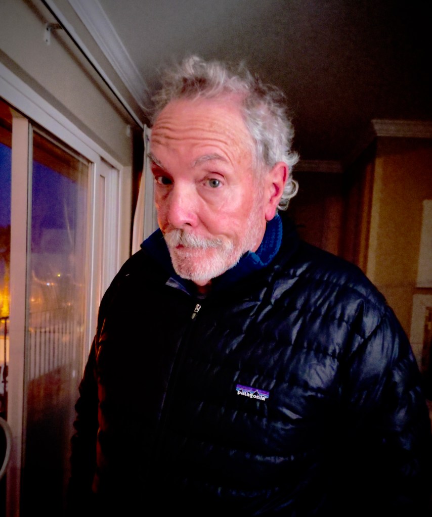
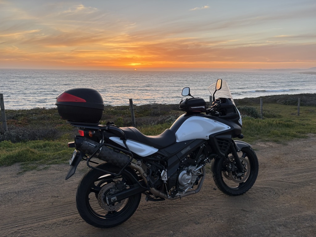
The only intelligence used in creating this post was mine as Sisyphus, my pseudonym. Well, the final photograph was a mashup of two of my photos I tasked ChatGPT to make. Any artificial intelligence that might have been used in editing for clarity and brevity was roundly rejected. Set-up is the key to landing the punch line. My inspiration is the work of Jean Shepard and Bill Bryson with a nod to Peter Egan. If you’re not patient enough to read what I’ve written, then switch to TicToc and watch some hipster posing at a Starbucks.
Introduction
Itching to get on the Guzzi for a spring getaway, I pitched SMAP (Sisyphus’s Moto Associate Pete) a pre-emptive ride as we were considering a longer ride north for late spring/early summer.

Our late October 2024 ride to Zion seemed like an eternity ago and the only thing prohibiting a winter ride was procrastinating getting the Guzzi serviced and slapping on a new rear tire. Oh, and unsettled winter weather that fellow Minnisotan Motoists would dismiss as “much ado about nada.”
The nearest Moto Guzzi dealer is in Elk Grove. Servicing the air cooled 853 cc engine and a tire install would require leaving the bike overnight according to Harry the service writer. As for the weather…
It seems that Elk Grove mechanics apparently aren’t partial to dealing with an engine heated by rolling over 110 miles of California backroads, the distance to get to the dealership from my home in Merced. So, a trip to and fro the dealership is complicated as can be the weather–not to mention expensive.
Such a trip involves having someone follow me to Elk Grove who would then give me a ride home (there and back in SMAP’s vehicle @220 miles + 1 my moto’s mileage to drop off, 110 miles = 330 miles). Then turn around the next day* to get a ride back to the dealership (there and back in my wife’s vehicle @ 220 + bringing the Guzzi home 110 miles = 330 miles). Had it all worked out that would be approximately 660 miles (@ $5.11/gal x 37.5 avg mpg for all vehicles = ~$132.14 in fuel cost). I told you it was complicated. Look at all the mathing.
Or, I could stay overnight at the Sky River Casino across CA-99 from Elk Grove Powersports. Besides risking my life crossing the 99 as a pedestrian, given my luck*, the casino would lighten my wallet even further. Room service isn’t cheap.
(*probability, more math)
Or I could rent a trailer and tow a cold bike and wait for 6-8 hours at the dealership or casino (see above) for the service to be performed as I did in 2023 with the initial service. Or like the next trip to the dealership for the installation of various accessories (BTW that took 2 months to arrive due to “supply chain issues” from their Italian suppliers).
*There’s always a backstory. Fortunately this one ended well, well, even more expensive anyway. Pete of SMAP fame gave me a ride home from dropping off the Guzzi on Friday. The next day my wife agreed to drive me to pick up the bike.
I got a call from the dealership when we were about 10 miles from Elk Grove from Harry the Service Writer. Harry explained that the bike was not ready because when the mechanic removed the rear tire to mount the new tire, “the screw that mounts the speed sensor on the rear wheel broke.”
I asked how it broke since no subject for the predicate in the sentence was identified unless the screw was the subject and broke was the predicate. Harry replied something about that there was Loctite on the screw that broke when the rear tire was removed.
Thinking I needed to be a little more direct, I asked, “So the mechanic (subject) broke (predicate) the screw (object) removing it to mount the tire, is that correct.”
Harry was good, he said, “That’s correct, the screw was broken.” He went on to say that to get the OEM screw, it would take a week longer. Apparently Loctite shouldn’t be used to secure the speed sensor on the rear wheel assembly on a Moto Guzzi V85TT. Not sure how the Loctite got there unless it was because the local garage that removed the tire to plug it after running over a nail so that I could get the bike to Elk Grove to mount the new tire… was a whole other drama. At that point, somewhat discouraged, my wife and I returned home.
A week later, I called to ask about the status of the bike. Harry was all, “Oh yes, we have replaced the screw and the bike is ready.” Harry assured me that he would call when the bike was ready. Needless to say, my review of this service experience was unfavorable.
By the numbers (I’m a retired middle school math teacher so forgive me) the hourly shop rate of $198/hr x 3.4 hrs = $673.00. Add $200.73 for parts, and BTW, I supplied the tire and the dealership charged me $127 to mount the Michelin Anakee tire, check the brake pads, balance the wheel, lube the chain–What? It’s a shaft drive?–so the subtotal is now = $1,000.73. Add the tire cost of tire itself $316.74 + fuel for seven trips, too and fro = $130.63 , it cost $1,448.10 to prep for a 5 day ramble. Oh, add the cost of the speed sensor screw, $2.91 and toss in SMAP’s lunch for a grand total if $1476.01. Yikes, I hope my wife doesn’t read this!
I need to watch more Cubby Sue Moto Guzzi maintenance YouTube videos. My only victory in any of this is that the dealership didn’t charge me a storage fee for leaving the bike pending getting [the] screw(ed) for the week…
Thanks to my lovely wife (in case she does read this) for the lift to pick up the Guzzi and only modestly complaining about the invoice. What a woman. She didn’t even get lunch out of the deal. We did drop in on the grandkids on the way home.
That only took about two weeks out of the calendar. The real wrench in the ramble was that the remaining spring calendar was not quite open. If you’ve followed Sisyphus and Associates (www.sisyphusdw7.com) you know that even though Sisyphus and his Associate (Sisyphus’s Moto Associate Pete henceforth, SMAP) are retired, the most challenging aspect of any of our rambling is capturing the necessary number of days between the two of us and our modestly complicated lives during which time a desired ride can take place. Birthdays, visiting guests, medical and dental appointments, holidays, vacations, house setting, graduations, moto servicing, and concerts are the usual culprits.
Three day rides are fairly simple to arrange. Five day rambles increase in difficulty arithmetically. Seven to ten days on the road increase in difficulty geometrically. Eleven or more day tours are logarithmically more difficult since neither Sisyphus nor SMAP know how to calculate logarithms.
So, in lieu of calculating the number of days to head north and to the east, considering weather was kind of still a factor in April, I pitched five days and four nights on some familiar roads along the Central Coast of California. As for the weather, a non-factor… The weather cooperated beautifully. Take that Minnesota!
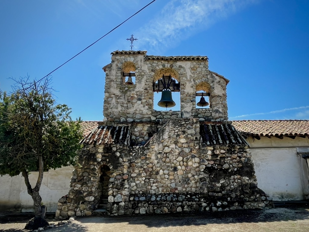
Day 1, Arroyo Seco State Park
Merced to Arroyo Seco State Park

Our first day on April 7 would be a reasonable ~175 mile ride from Merced in the Central Valley to west of Greenfield and King City in the Salinas Valley of California’s Central Coast.
We rambled over our preferred route on CA-59 south to CA-152 east to Indiana, Brannon, and Merrill Rds, south to Shain Ave and 7th St in South Dos Palos to N Russell Ave continuing south through westside ag lands to West Shields Ave. Continuing west we crossed the Little Panoche Valley passing the Mercy Hot Springs Resort on Little Panoche Rd. Once a stage line and since having been originally paved is now amended by patched potholes rivaling the pavé of the Spring Classics in Europe or 85% of the roads in our community. Check out the Mercy Hot Springs Wiki page.
Summeting Panoche Pass in the Diablo Range found us sweeping our way downhill with comfortable spring temps over reasonably surfaced tarmac to our favorite market in Paicines for chile verde and carne asada breakfast burritos. Rambling south over CA-25, the Airline Hwy, would be the envy of any Minnesotan Motoist; little traffic, verdant vistas, clear skies, and incomparable spring temperatures…

In attempting to arranging the Arroyo Seco campsite online, I learned there was no water available for showers and toilets at the campground. I couldn’t reserve a campsite either. Porta-Johnnys solved the latter problem while stopping in Greenfield for supplies before heading to the nearly deserted campsite would solve the former.
Simple enough, right? That is, after we stopped for directions to a “supermarket” in Greenfield. At first, SMAP pulled over to ask three strolling farmworkers appearing to be in search of a “day ender.” In Spanish, SMAP asked if they knew the location of a Safeway or SaveMart. After rephrasing of our request several times in Spanish trying to explain what a Safeway or Save Mart was, his attempt for directions failed as their insistence that they were merely humble workers, unfamiliar with the community and not cartographers with knowledge of an “una forma segura” (Safeway) or “salvar el mercado” (SaveMart) . Surely Mr. their ignorance was “comprensible.”
We bailed and pulled into a nearby “poco mercado”, the Mendoza Market, thinking this might just have to do for securing the night’s provisions.

Upon purchasing a gallon of water as fair compensation for directions (el mercado’s “pequeño las 3R’s selección de bebidas, fue decepcionante”) we asked the cashier about the location of a supermarket and were given something of a route to Rancho San Miguel Market, a super mercado in Greenfield.
Apparently left and right are sometimes confused in Greenfield, perhaps the result of using the wrong vernacular. Izquierda o derecha may have been more prudent. Which brings up how I feel about left and right as directional indicators as opposed to using the cardinal north, south, east or west (Norte, Sur, Este u Oeste). Just ask SMAP. Cardinal directions are true no matter which way you’re facing. Left and right, not so much.

The cashier insisted that we head toward the Chase Bank and turn left, pointing in several conflicting directions. After following her directions that clearly led us out of town into the hinterlands, a kindly police officer who was presumably conducting official business with lights ablaze, noting our confusion, paused his official business and corrected our heading in the opposite direction, derecha (este) not izquierda (oeste).
Unlike our last experience shopping at a small mercado in Coalinga, our Rancho San Miguel Market meal was a considerable improvement over SPAM (the questionable tinned food–not to be confused with SMAP–Pete’s pseudonym), smoked oysters, and Fritos from the Coalinga Market last fall. In fact at the Rancho San Miguel Market, I was able to purchase two pounds of dried pinquito beans that are only grown on the Central Coast for our upcoming Santa Maria Tri Tip BBQ themed Easter back home 👊!
Heading west on Elm Ave that becomes Arroyo Seco Rd crossing the Arroyo Seco River Bridge we entered the gorge en route to our home for the night.

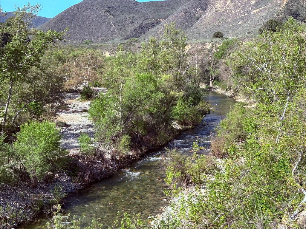

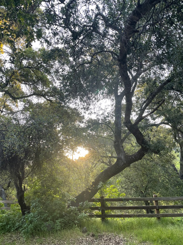
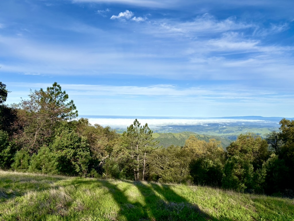
The Arroyo Seco State Park Campground situated next to the Arroyo Seco River, also known as the gorge at an elevation of about 1,200 feet, offers views of the Ventana Wilderness mountain peaks and one small lake water levels depend on the season*. It is nestled into the hillside, surrounded by abundant shrubbery and large oak and madrone trees. A variety of birds and wildlife make their home in the area.

Upon arriving at the park entrance, we met Orlando the campground maintenance guy. There was also a fellow who lived nearby in the gorge that was home of several small-scale wineries in spite of the above signage pointing out wineries in the opposite (derecha o este) direction towards Soledad. He had a ranch, presumably a winery, along the Arroyo Seco River and had a residence in Soledad where he was apparently the owner of a Chevrolet dealership as well.

An affable fellow, Mr. Chevrolet shared that the gorge was subject to flooding during atmospheric river events and that his home was nearly flooded in 2023. I guess that leaves the fine alluvial soils for the new vineyards that blanketed the floodplain. We would later find out that the sinking of wells to irrigate these vineyards below the campground was likely the cause of the water issues at the campground upstream*.
Noting an ice vending machine at the entrance, we asked to purchase a bag, along with campfire wood, to keep our 3R beverages and salads cold for the evening Relaxation, Rehydration, and Reflection, 3R’s campfire ritual. After convincing the camp hostess (What was her name… Yarrow, Aspyn, or Willow?) with coaching from Mr. Chevrolet and Orlando, she threw in a bag of ice and firewood in lieu of not giving us the senior discount for the campsite. A much better deal that that I got at Elk Grove Powersports.
Apparently the ice machine was malfunctioning and the ice was partially melted and she didn’t want to hassle with dissatisfied customers. Needless to say, we had a most satisfying stay at the Arroyo Seco State Park Campground, partially melted ice notwithstanding!


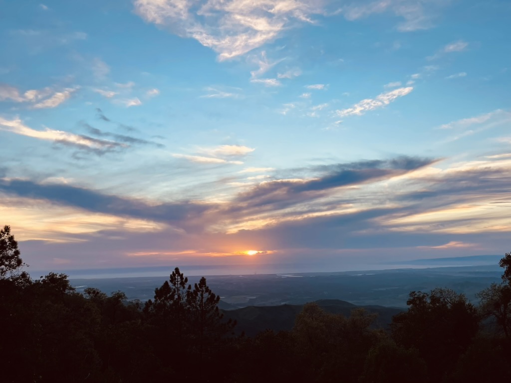
All set for the 3R’s, the only thing missing was the sunset
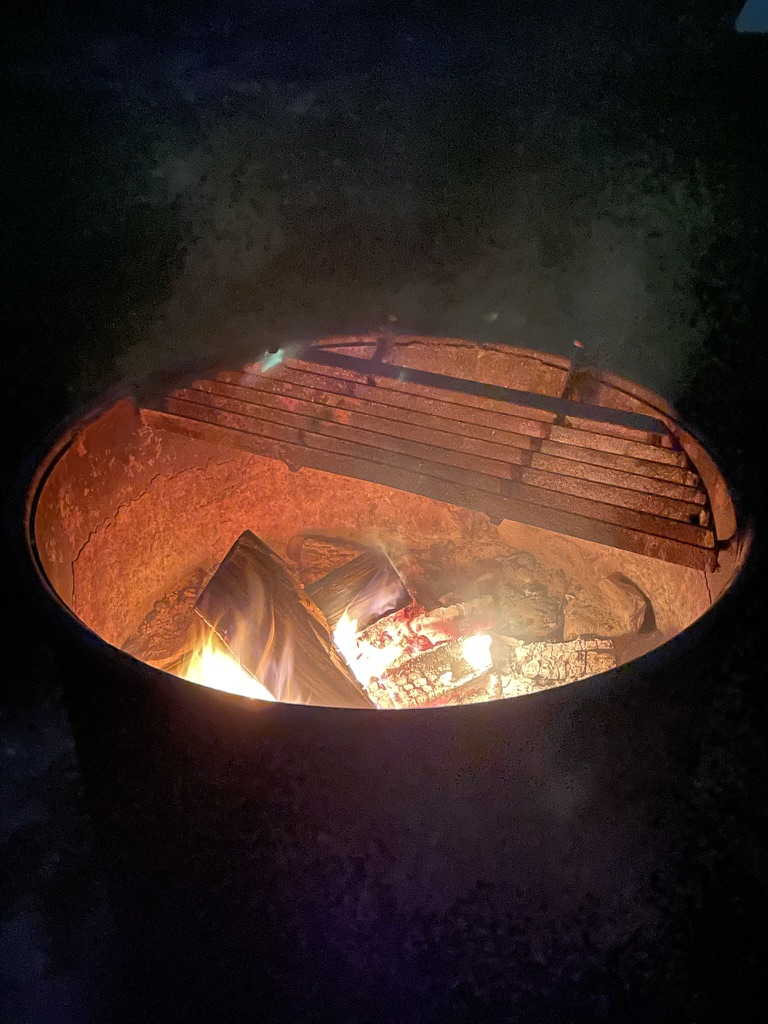
The salad with sliced chicken paired well with the Sierra Nevada Atomic Torpedo and the side of Fritos from Rancho San Miguel Market. A pleasant night of hooty-owls voicing their contentment and the sound of scurrying littles about the Arroyo Seco campsite avoiding those hooty-owls, our sunrise Jet-Boiled mochas set the tone for the day.
Day two would be along the infamous route to the San Simeon State Park through Lake Nacimiento where an unfortunate event, once upon a time, spoiled a ride…
Day 2, San Simeon State Beach Arroyo Seco to San Simeon State Campground

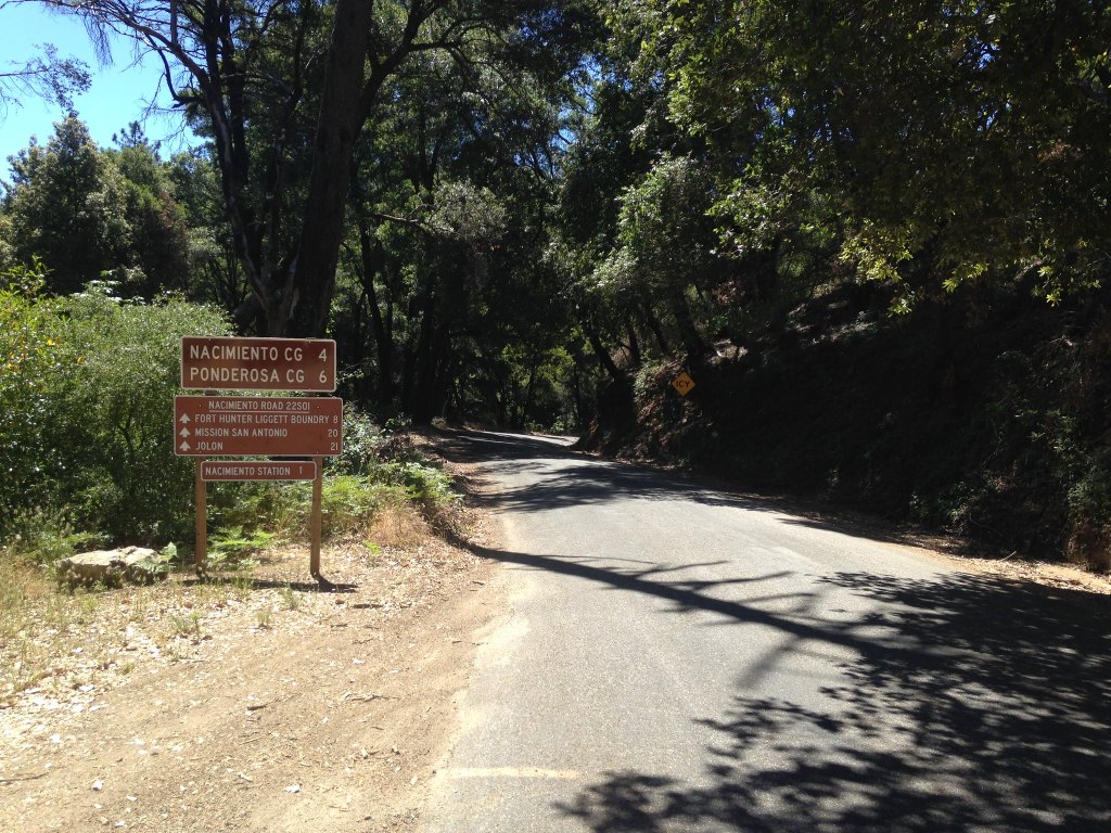
Our ~125 mile route to our Day 2 destination, San Simeon State Park, backtracked down Arroyo Seco/Elm Rds to Central Ave. From there a short run on US-101 to Jolon Rd. Jolon Rd past Fort Hunter Leggett to Interlake Rd and Nacimiento Lake Rd to Godfrey Rd, all on G-14.


Passing the scene of the incident right where the G14 marker is on the hairpin (Blue) above and the unfortunate route I took (red), I neither felt anxiety nor trepidation. Unlike that fateful day in April three years earlier, I was fresh and on a Moto Guzzi V85 TT.
Spring, sprang, sprung… A Moments Inattention
Hairpin? No problem on this day with the low-end torque of the Guzzi on the compound curve similar to the same compound curve on CA-4 that a sudden stall of the Kawasexy Versys resolved without incident a few years before. I think I now have a sound approach to hairpins on a bike less twitchy than the Kawasexy.
We wound through the west Paso Robles wine country on Chimney Rock Rd to Adelaida Rd then south to Vineyard Dr and Jack Creek Rd west. We passed Sirena, DAOU, Tablas Creek, Thatcher, Brecon Estates, Oso Libre, Paix Sur Terre, Willow Creek, Opolo, Jada, Justin, Niner, and Denner wineries enroute to CA-46/Green Valley Rd. We had intended to take Santa Rosa Rd, a backdoor into Cambria, but alas it was CA-46 to US-1 due to the Santa Rosa Rd closure. As detours go, that’s not a bad one.
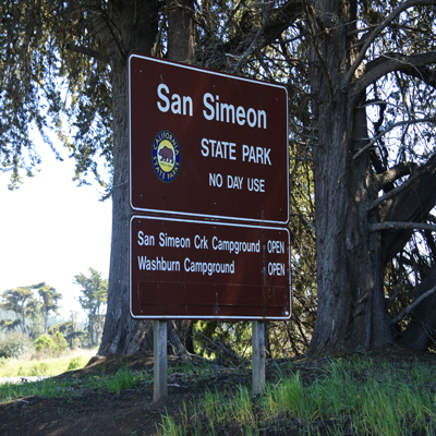
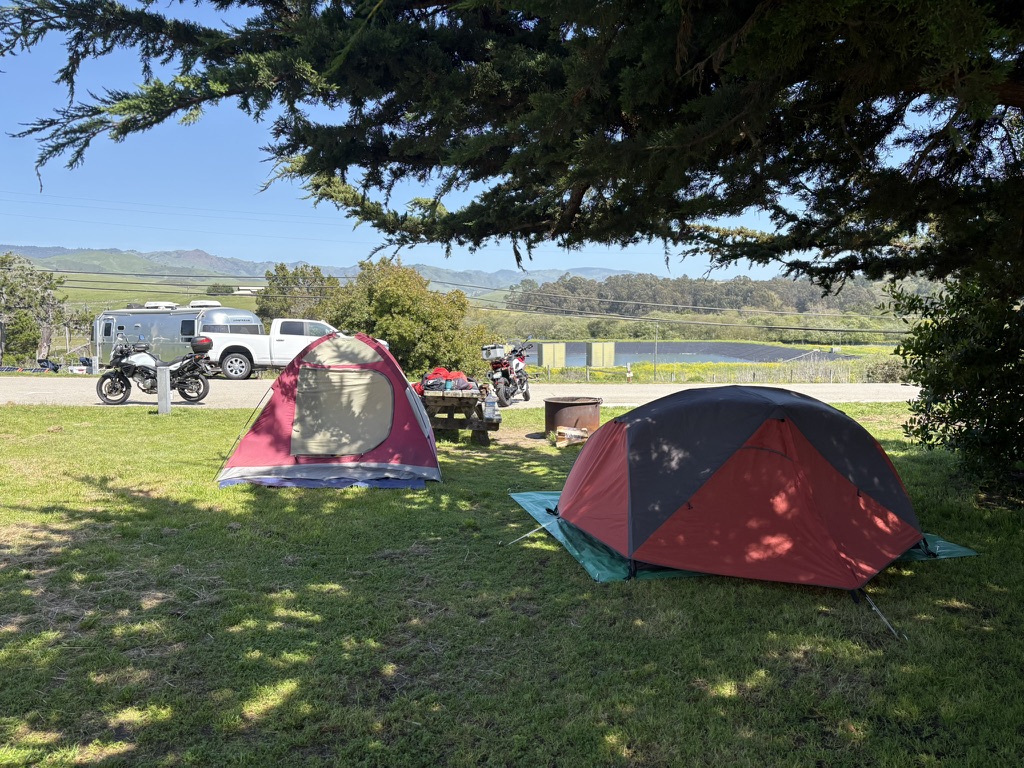
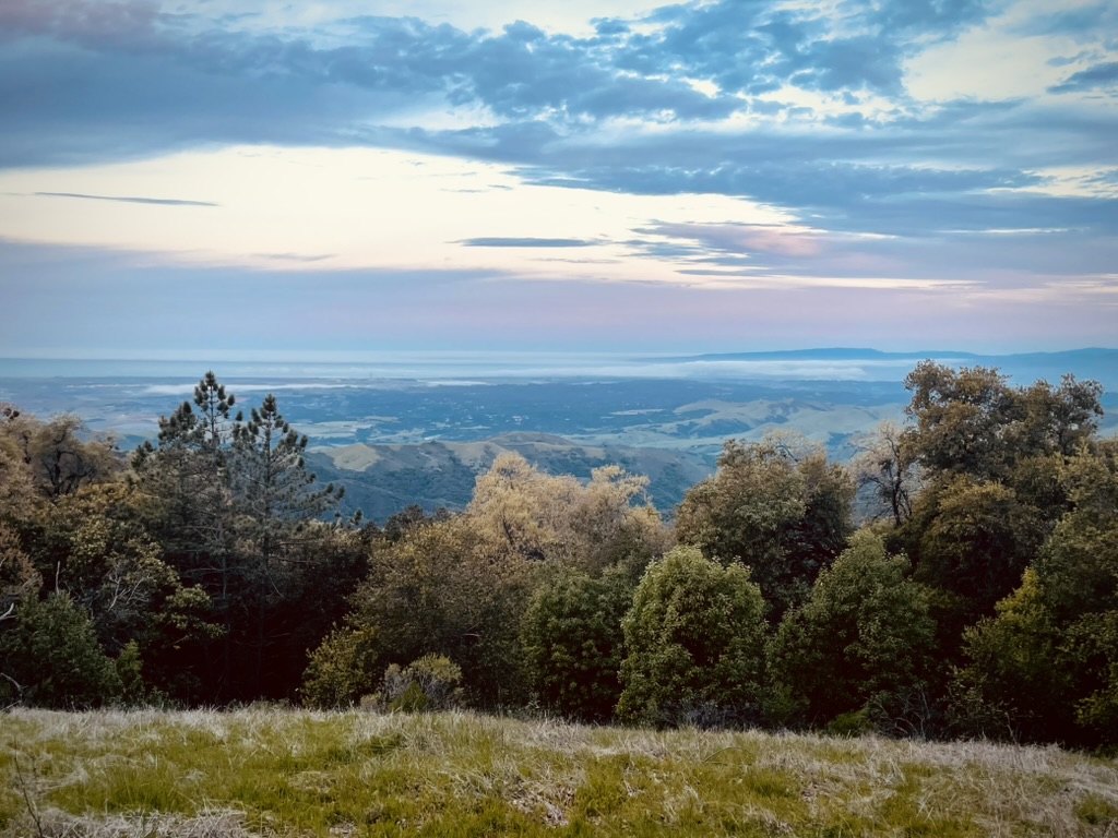
The San Simeon State Campground situated on the Pacific oceanfront just north of Cambria is one of Sisyphus and Associates’ favorite places to camp. Running water, showers, and clean operable commodes in an orderly setting with affable camp hosts and a variety of interesting Spring Break campers made for an enjoyable two-night stay. Our plan for our first night was to relax around camp, shower and run into Cambria for dinner and 3R beverages.


Since we had made our way through wine country I thought that rather than a pilsner or IPA for the 3R’s I’d opt for a bottle of red. After chicken mole enchiladas at Las Cambritas, we traipsed across the street to Bob and Jan’s Bottle Shop where I selected a Niner Bootjack Red.


After borrowing a corkscrew from our neighbors who were heading home the next day to Boise with their adorable Golden Retrievers, I was able to enjoy this full-flavored red blend of Cabernet Sauvignon, Malbec, Cabernet Franc and six other grapes. It paired wonderfully with the campfire. Goldies and forgotten corkscrews are the universal spark to introductions and making new friends…

A walk around the campground at sunset tipping hats as we greeted fellow campers, a cozy campfire made possible by wood delivered by our camp hosts, SMAP and his preferred 24 oz Coors and my Bootjack Red capped off what is at least 40% of what is most satisfying about rambling on a motorcycle; the 3R’s.

Day 3, Romp on the “Nasty Fergie” Big Sur Nacimiento-Fergusson Rd Loop

The next morning we set off north on US-1 on a 145 mile ramble over the acclaimed Nacimiento-Fergusson Road. When we last tried to take this famed motorcycle road a fairly frequent winter washout forced its closure until Monterey County could make repairs.
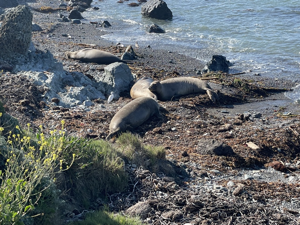
Along the way we saw several slumbering elephant seals on the beach.

It was open throttle past Hearst’s Castle at San Simeon on an open, but truncated leg of US-1 due to another highway closing slide above Lucia. The weather was perfect, calm breezes, cool and clear. En route to the Nacimiento-Fergusson Road, we continued north on the Cabrillo Hwy past Gorda (Spanish for “Fat”) a hamlet in Monterey County, California. Along with Plasket, it’s one of the three small settlements of gas stations, restaurants, and motels located along State Route 1 on the Big Sur coast.
We stopped at Ragged Point for breakfast on the recommendation of our camp hosts. We dined alfresco perched on a rocky headland that marks the southern end of the small bay where San Carpoforo Creek empties into the Pacific Ocean. The Ragged Creek Inn Resort was built by Wiley and Mildred Ramey starting in the late 1950s on property that was formerly part of the Hearst Ranch. Our breakfast was only exceeded by the view from the rugged cliffs above the Pacific.
No Smuckers at Ragged Point Inn…

After breakfast we met a fellow rider on a newish Kawasaki Versys 1000 who had stopped at the inn. It was a handsome bike, the bigger sibling to my Kawasexy Versys 650. It was equipped for touring and the gentleman was up from his home near Los Angeles for a couple of days-getaway.
SMAP engaged the Kawi rider in motorcycle banter for several minutes as we got the lowdown on the Versys and the Nasty Fergie. The gent noted that he spent most of the ascent in second gear and cautioned us about some sand in the hairpins. I suspect the Versys 1000 cc motor lacks the Guzzi’s low end grunt. Sand in a hairpin corner doesn’t acknowledge low end grunt.
Crossing the Mill Creek Bridge we turned east on the Nacimiento-Fergusson Road, aka, the Nasty Fergie…
On May 20, 2017, the largest slide in the Big Sur Coast Highway’s history at Mud Creek buried more than a quarter-mile of Highway 1 1 mile (1.6 km) southeast of Gorda. The highway was closed for more than a year. This had a considerable negative economic impact for tourism between Monterey and Morro Bay. A CalTrans study concluded that rerouting the highway around the slide was preferred over other alternatives. The only route in and out of Gorda beginning in the south was via a lengthy detour over the narrow, winding Nacimiento-Fergusson Road. (Wiki)
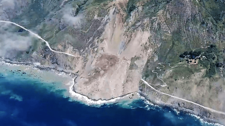
On August 2, 2017, CalTrans decided to rebuild the highway over the slide instead of clearing it. It was reopened on July 18, 2018, at a cost of $54 million (Wiki).

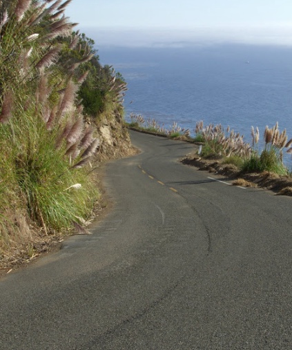
The Nacimiento-Fergusson Road is the only road across the Santa Lucia Range on the Central Coast of California, connecting CA-1 and the Big Sur coast to US-101 and the Salinas Valley. The road is well-paved and maintained over its length, subject to seasonal closures, and is winding and has precipitous drops at times narrowing to a single lane. It is widely regarded as one of the best motorcycling roads in central California due to its ocean views and forest setting.
I admit that my skills as a videographer are limited. Most likely because of presbyopia, a common age-related condition that affects the ability to see close objects clearly, typically starting around age 40. Given that I’m 30 years into blurry-close-up vision, tasks like starting the video recording on my Hero 7 with a screen and buttons designed for eyesight and dexterity under the age of 40 is challenging. Though I stopped at the base of the road to start recording, I apparently didn’t press the record button sufficiently. Maybe it’s time for an Osmo DJI or an Insta360 voice command enabled to back-up the Hero…
Climbing up the steep flanks of the mountains, the western part of the road near the coast has more than 100 turns before it reaches the summit 7 miles from the coast at an altitude of 2,780 feet, where it crosses the unpaved Coast Ridge Road. I was able to keep Bella Rosa in third gear most of the time, even through the sandy corners.

Another motorcyclist we met described his recent ride up the Nacimiento-Fergusson Rd along the Coast Ridge Road at night… Balls bigger than cantaloupes or a brain smaller than a pea says I.
From the summit, the road descends through hillside chaparral and dense oak groves on the eastern side of the ridge, which offers a few views, and passes through the U.S. Army’s Fort Hunter Liggett. And like the ascent, the descending road is steep, winding, sometimes only wide enough for one vehicle, and has precipitous drops at almost every turn unprotected by guard rails.


As the temperatures on the lee side of the Santa Lucia’s were nearing the 90’s, we stopped at the Fort Hunter Liggett entrance to shed layers.
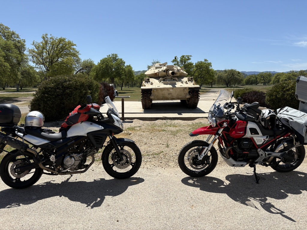
A tractor trailer rig pulled up and its operator, Gary, began inquiring about our bikes, noting my eagle badged Guzzi V85TT. Of course anytime this happens, SMAP, whose encyclopedic knowledge of all things motorcycle (PeteMotoWiki), can dig deeply into the weeds of motorcycle ownership and appreciation. Gary was describing his bikes, one a Moto Guzzi V100 and we exchanged stories of common bikes, past, present, and future…

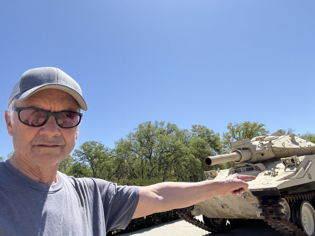

Oh yes, the old lets plug the barrel of the M55 1A1 with an index finger gag. It never gets old…
Meanwhile, I was sweating, anxious to make our way back into Lake Nacimiento, excited to confront the Moments Inattention hairpin on G-14, the Lake Nacimiento Rd for the second time in two days. I was also parched wanting to purchase an energy drink for the trip through the vineyards to CA-46 and US-1 to Cambria back to our campsite.
We returned to the campground, showered and prepared to run into town for dinner and supplies. We’ve dined several times at the West End Pub, a laid back place with as many locals as tourists enjoying the simple pub fare and selection of beverages.


Après dinner at the West End, we returned to Bob & Jan’s Bottle Shop for the 3R beverages and discovered Lombardi’s Pasta and Pizza Restaurant across the street. Deciding that our next trip to Cambria would include Lombardi’s on the itinerary, we returned to camp now equipped with a corkscrew to open a Castoro Whale Rock pinot noir, recommended by Michael the cashier. SMAP opted for a couple of domestic 24’s.
“If anyone orders Merlot, I’m leaving. I am not drinking any fucking Merlot!”
“Only somebody who really takes the time to understand Pinot’s potential can then coax it into its fullest expression. Then, I mean, oh its flavors, they’re just the most haunting and brilliant and thrilling and subtle and… ancient on the planet.” Paul Giamatti – Miles from Sideways.
Campground conversations with neighboring dads on Spring Break with their families gave rise to more motorcycle inspired camaraderie. It must be that seeing two fellows of a certain age “roughing it” in tents and sleeping bags on motorcycles renders us a harmless curiosity to probe and understand by the millennial and gen X & Z’ers whose idea of roughing it is in a $150,000 overland Sprinter or a $200,000 heavy duty pickup and Airstream. We managed to muster that envious faraway look as the dads would shift their glances to and fro their accommodations and ours. Even the geezers in those ritzy retirement rigs would become misty-eyed as they remembered youthful rambles on Bonnevilles, Goldwings, or Harley dressers…
The myriad camping dogs found us worthy of tail wags in yet another invitation to exchange stories with their humans. From the Belgian Google engineer married to the Spanish educator and their two delightful children with impeccable manners and their dog Gordo, a friendly Bulldog, to the two women wrangling a half dozen feral children in the making of smores, presumably their respective broods, to the not-so-nearing retirement special ed teacher (and family) whose classroom experience remained relatable to this grizzled veteran, all contributed to the camping community of San Simeon State Park Campground on those two spring days. (I think I just set the record for the longest most rambling sentence in the history of Sisyphus and Associates!)

Day four began with a glorious sunrise as did days one, two, and three. Mochas fuelled breaking camp as we prepared for the ~161 mi ramble north to the Fremont State Park Campground.
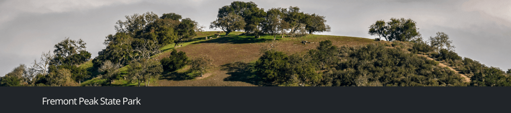
Day 4, Fremont Peak State Park San Simeon to Fremont Peak
Passing through San Miguel on Mission Rd we stopped to visit Mission San Miguel.


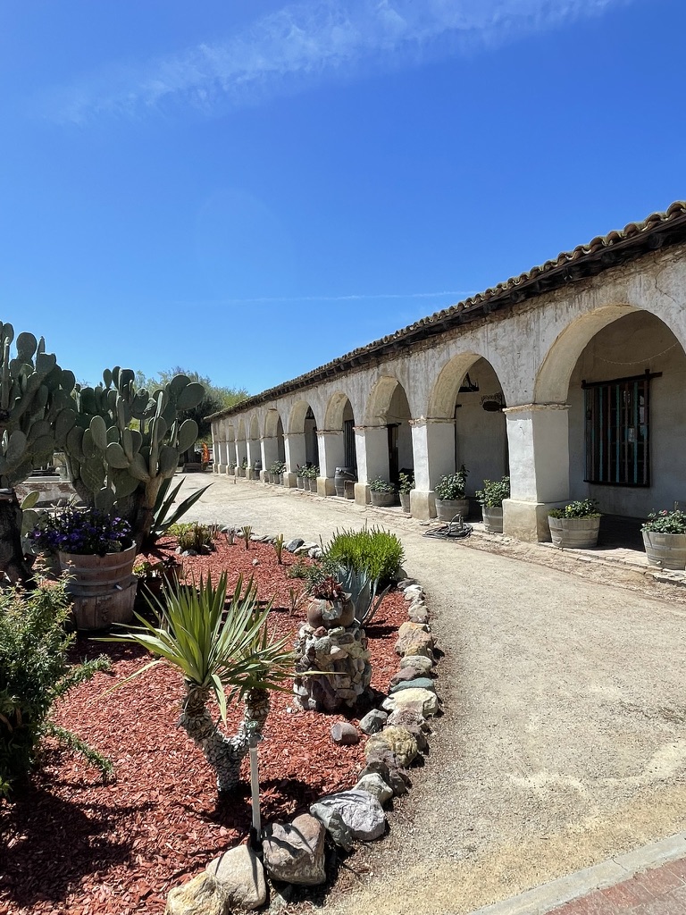

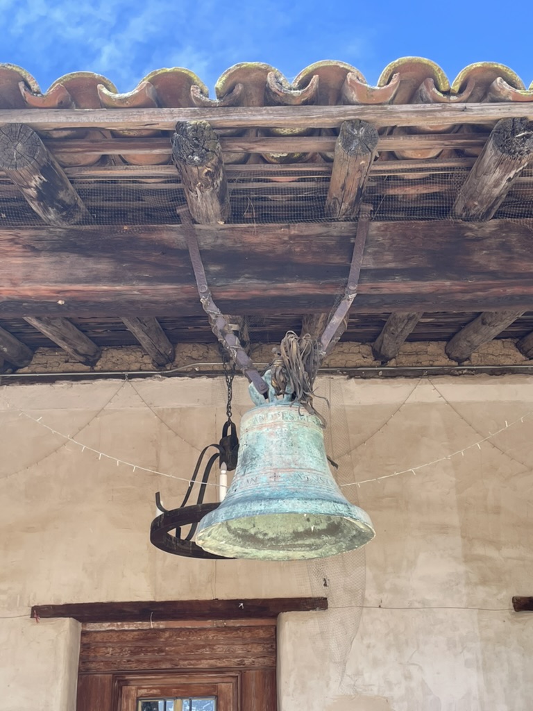
Mission San Miguel Arcángel is a Spanish mission that was established in 1797 by the Franciscan order on a site chosen specifically due to the large number of Salinan Indians that inhabited the area, whom the Spanish priests wanted to evangelize.
At one time, San Miguel Arcángel Mission controlled lands up and down the Salinas River for 50 miles and operated a rancho at San Simeon on the coast.
Eventually, Mexican settlers first took over all mission valuables, followed later by American immigrants. The last Padre left San Miguel in 1840, and mission buildings were sold shortly thereafter. The monastery became a shopping center, including the most popular saloon on El Camino Real.
Cheah!
Today the mission remains in use as a parish church of the Diocese of Monterey. After being closed to the public for six years due to the 2003 San Simeon earthquake, the church reopened on September 29, 2009.

For a perspective of the cultural impact of the Mission San Miguel Arcángel, check out: California Missions Native History
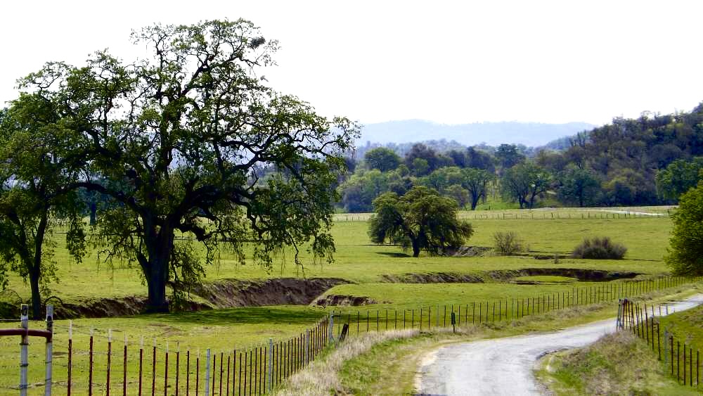
From the Mission we headed north on North River Rd to the “two lane” Indian Valley Road below. This remote oak savanna ranchland featured live oaks and was carpeted by lush grasses. Because of the past winter’s scant rainfall, there was only a modest display of wildflowers.
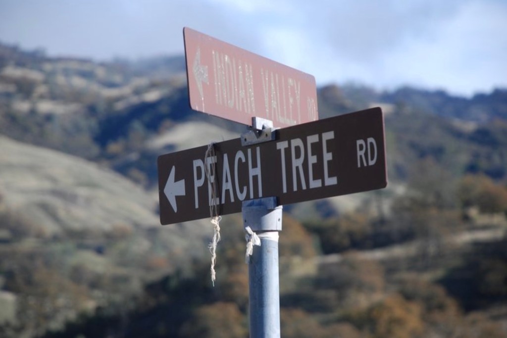
Indian Valley Rd intersects Peach Tree Road and at Bitterwater joins CA-25 all adjacent to the San Andreas Fault.
Rejoining CA-25 we passed the Pinnacles National Park. Around 23 million years ago, a series of volcanic eruptions shaped the landscape that is now Pinnacles National Park. The remnants of these ancient eruptions have formed a striking terrain of rocky spires and deep canyons. The campground is virtually reserved through the spring into summer.
The Park’s landscape provides excellent habitat for the California Condor, the largest bird in North America. SMAP and yours truly enjoy sighting Condors just as we enjoy UFO/UAP’s sightings. In other words, any large bird from a crow to a turkey vulture, even a roadside chicken, will be identified as a Condor just as any moving object in the night sky is a visitor from outer space. It simplifies trusting one’s vision in a less distressing way than acknowledging one’s age and declining mental acuity.
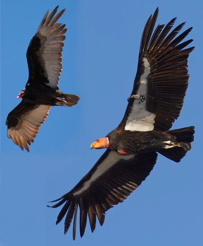
The link to the National Park Service’s condor ID page should demystify any confusion about our propensity for exaggeration. One of these two birds is a Condor. The other is an imposter.
Passing Paicines and Tres Pinos we encountered traffic headaches due to the realignment of CA-156 from north and west of Hollister to San Juan Bautista. Our plan was to head up to Fremont Peak, set up camp, head back down to San Juan Bautista and Doña Esther’s for dinner. We would stop briefly at the Windmill Market in SJB for a road soda to whet our whistles while setting up camp. But we had burned a bit of daylight getting to our destination so we debated just having an early dinner then head up the hill to set up.
Much to my chagrin we learned that Doña Esther’s had permanently closed, likely the victim of the covid shutdown, changing demographics in the area, and post-covid highway construction prevented the local support the restaurant depended upon for survival. So a sami and burrito from the Windmill’s exceptional deli and the requisite 3R’s beverages would have to tide us over. Victuals loaded on the bikes we headed 12 miles up San Juan Canyon Rd to the Fremont State Park Oak Point Campground.
Upon arriving at the campground, in another chagrin producing episode, we encountered a family ensconced in the epic view site, C-25, that I had reserved online.
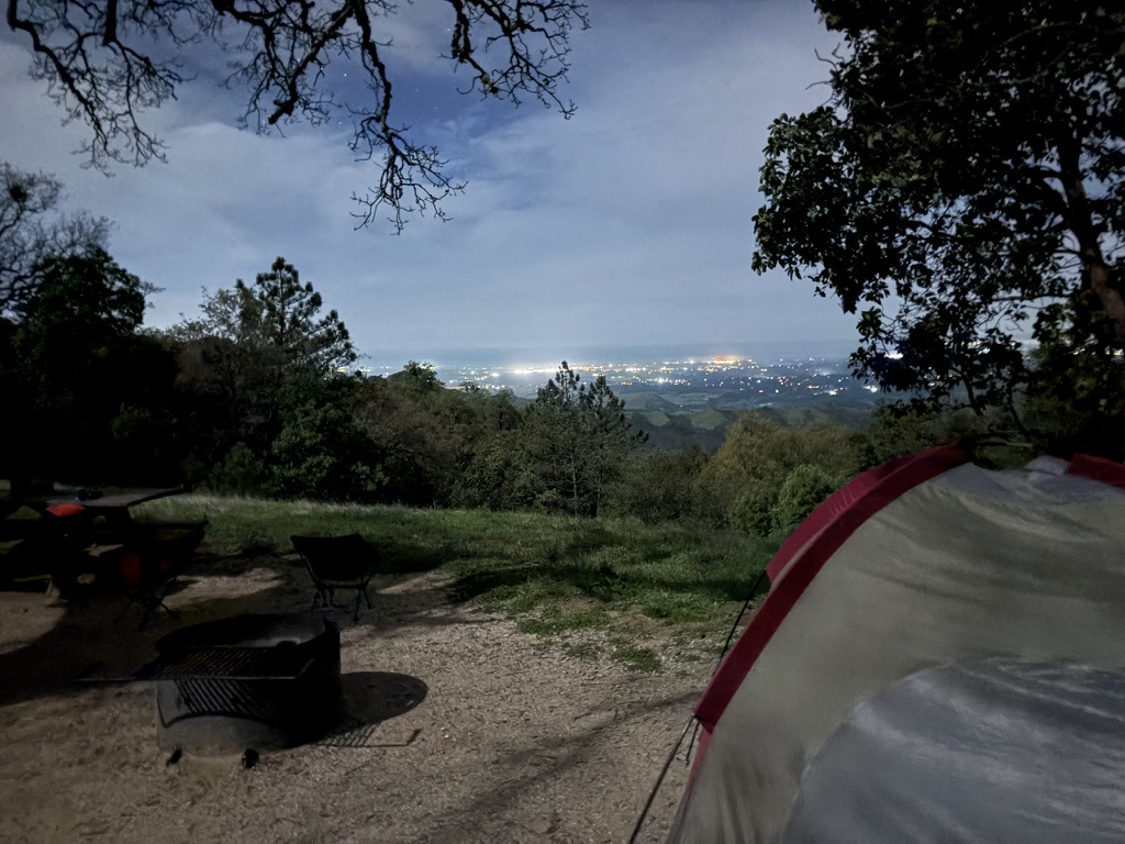
When I noted that we had reserved the space, the multi-generational family hesitated, claiming that there was no reserved tag on the site kiosk. About that time a California State Parks pickup came down the road from the sites above where an employee stepped out of the vehicle and clipped a tag with, “Reserved: Jones.” The family accommodatingly begin moving their gear to an adjacent site. Territorial dispute resolved, we set up camp and enjoyed our sami and burrito with a spectacular view of Monterey Bay.


The view of Monterey Bay from Fremont Peak is astonishing!
As the sun was setting a State Park Ranger pulled up and had a lengthy conversation with the adult daughter of our neighbors who was apparently responsible for securing their site and the “trespass” we encountered. Apparently others were joining them and while the campground didn’t look full, there were no additional open sites available near theirs to accommodate the late-comers. The even-tempered ranger resolved all issues to everyone’s satisfaction.
He strolled over to check in with us and we had an unanticipated conversation about his son attending the University of California in our hometown, Merced. He mentioned that he and his wife had bought a house for their son to live in while attending the UC and, pending his retirement from the State Parks System, Ranger Dave and his wife would occupy the home.
He noted that he and his wife found our community to be warm and welcoming with just the right blending of rural and suburban living that differed greatly from their residence at the Henry W. Coe State Park HQ, a nearly 60 mile commute over some pretty windy roads just east of Morgan Hill where real estate values doubled, tripled, even quadrupled those of Merced.
It’s always nice to have an outsider find aspects of your hometown to be worthy that as a resident one might take for granted. All of those nice features sometimes get overlooked by contending with a growing population, sprawling development, and declining infrastructure, not to mention an increasingly aporetic populace convinced that the very thing that preserves the best of our community, like thoughtful planning with a nod to a changing climate, is perceived as somehow an infringement of one’s personal freedom… I digress.


Day 5, Homeward Bound Our Intended Route Back Home Our Actual Route Back Home


Another miraculous sunrise and our last mocha-eye-openers and it was time to pack up on Day 5 of a splendid ramble along California’s Central Coast.

We made our way down to San Juan Bautista for breakfast at the Mission Cafe, now known as JJ’s Breakfast and Burgers. Our waitress was quite delightful as she sprightly and single-handedly handled the morning breakfast rush. It seems that everyone out and about on that fine Friday morning in April knew one another by name.
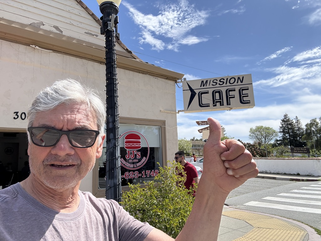
We met the affable owner of the cafe, Jesus, who offered a warm greeting and gave us the lowdown on the difficulty San Juan Bautista was having recovering from the covid shutdown, changing demographics of the area, and the Highway 156 realignment. Several businesses had closed with few struggling businesses taking their place. The JJ’s was in a new location in a shuttered legacy cafe and just managing to get by.
There were fourth graders from Salinas touring the mission as this remains a quintessential California history field trip. But 10 year olds don’t spend the cash necessary to sustain restaurants and shops of this quaint town of just over 2,000 souls. Hopefully when the highway construction is completed, tourism will again flourish.
While SAMP was engaging another local merchant in moto-reminiscence, I checked-in with my wife who was ordered to have an ultrasound for a knee issue that we hoped was not a DVT. She had been struggling with pain for weeks and was was finally able to schedule an appointment with her NP, but not an ultrasound.
Since it was Friday afternoon, after finally seeing her NP, it was recommended she go to an emergency room, stat. In that instant I told SMAP that we needed to take CA-156/152 over Pacheco Pass to shave the additional 31 miles and 1 hour from returning to the valley over our intended 2-lane Panoche Pass route .
I’m nervous enough crossing Pacheco Pass in a four wheeled vehicle surrounded with structural crash mitigation and air bags. That is nothing compared to the terror I felt passing downhill between speeding tractor trailer rigs and concrete jersey barriers at 85 miles an hour with racing Dodge Chargers and Ford Raptors weaving between cars bearing down on me at 90+ mph… SMAP’s advice, “Get in the left lane and be aggressive!”
At that time I regretted SMAP having the Cardo communicator I’d finally coaxed him into getting.
Needless to say I’m sitting at my computer putting together this blog so nothing but a fading memory of that terror remains. It so happens that my day ended at a Turlock Emergency Room waiting 6 hours for 15 minutes during which time my wife’s vitals were taken and an ultrasound administered. Her portion of the ER bill was 183 x what our four nights and five days cost. Fortunately no DVT. I’ll remind her of that when I plan our next ramble.
Or not!
Trip Itinerary Three State Campgrounds in Five Days