It began as it had for the previous four weeks with a text to Pete on Tuesday April 28, 2020, “So, up for a ride? Tomorrow? Thursday?”
Pete’s terse response, “Thursday”.
It’s kind of like fishing. I toss a small bit of bait out by way of text and wait for a nibble. I reply to Pete, “Okie Dokie… Thinking about heading up into the higher elevations.”
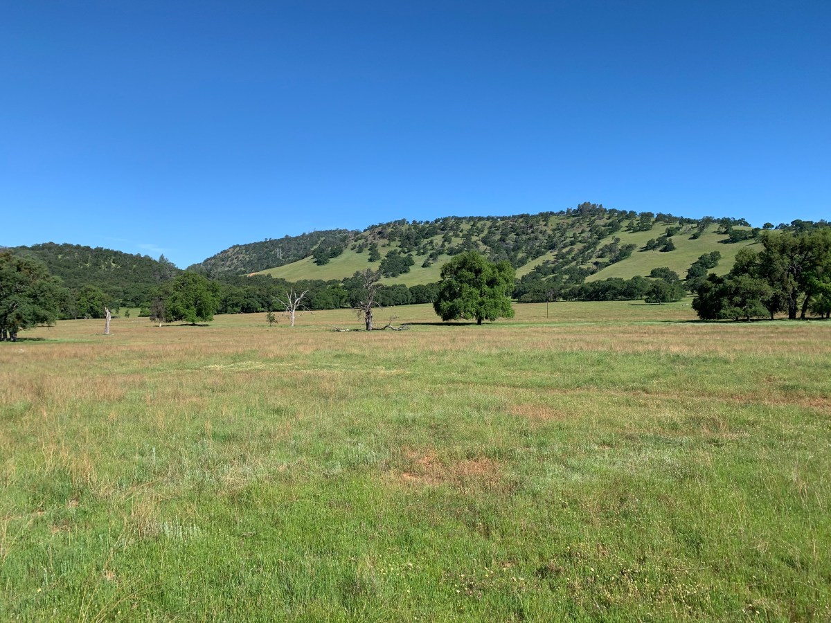
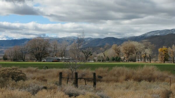
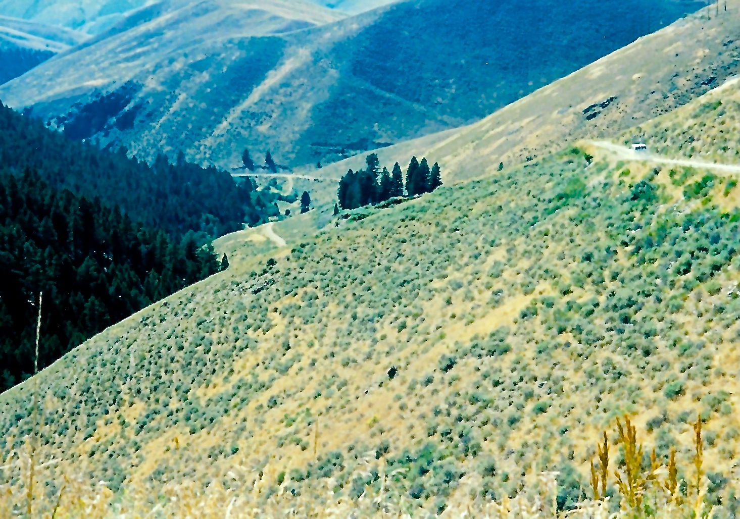
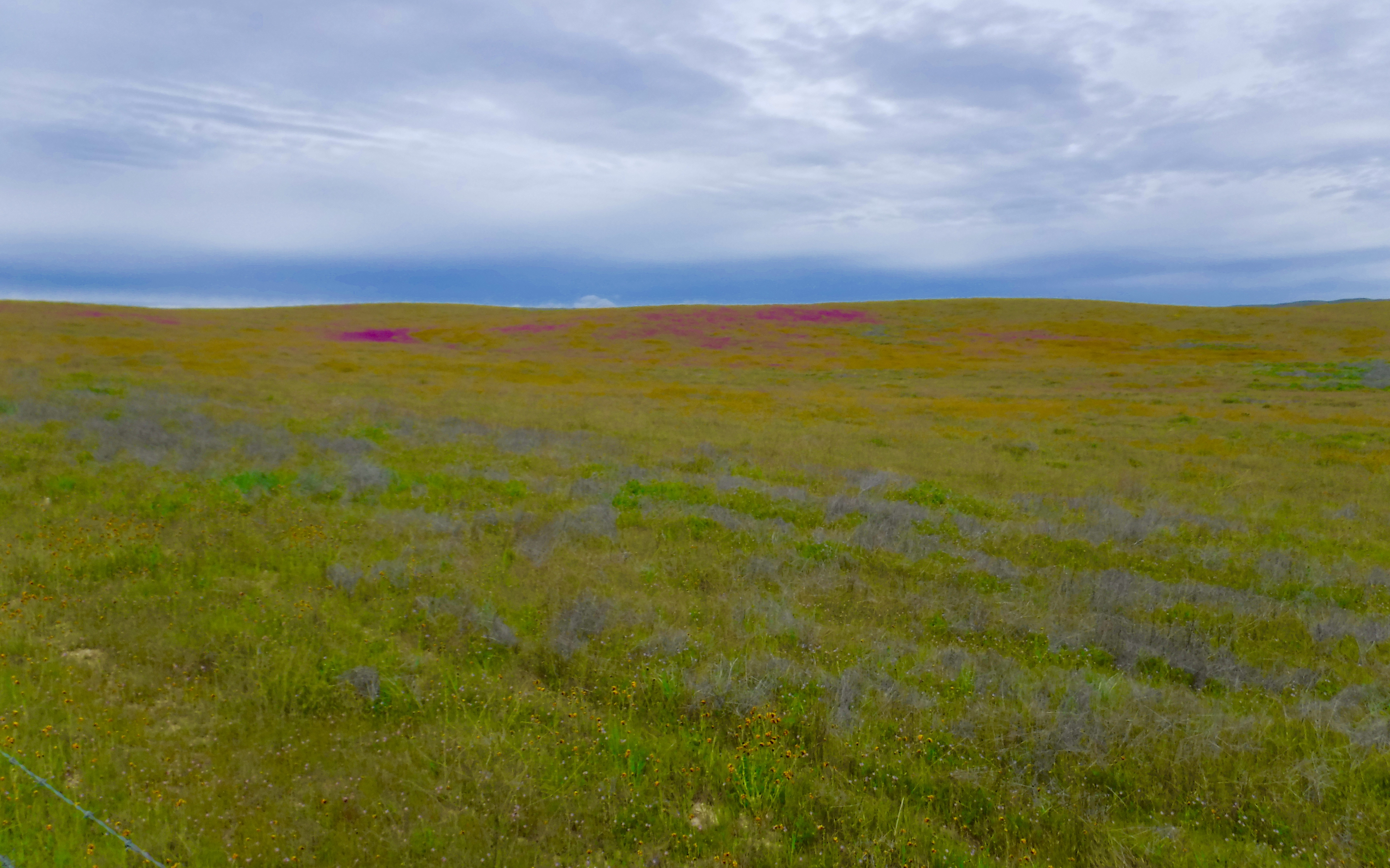
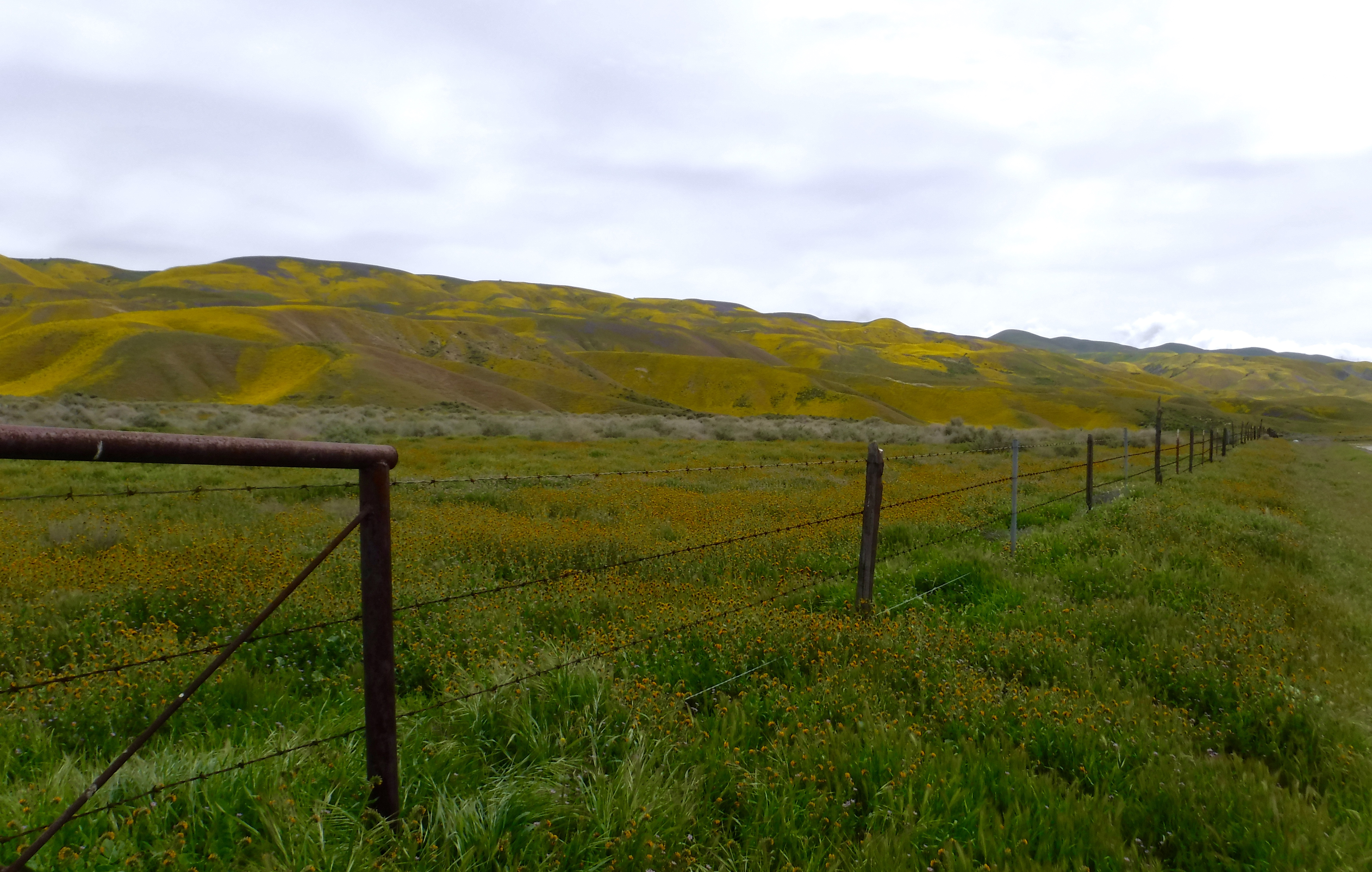
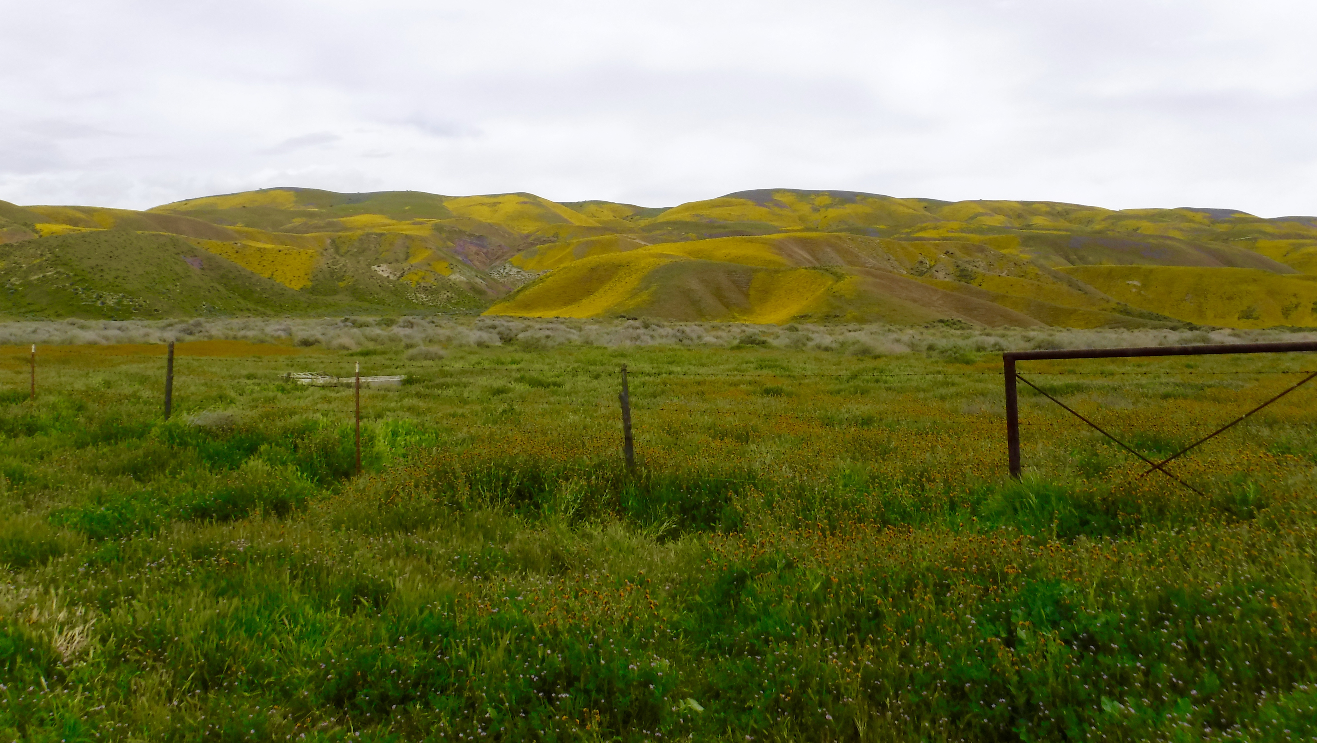
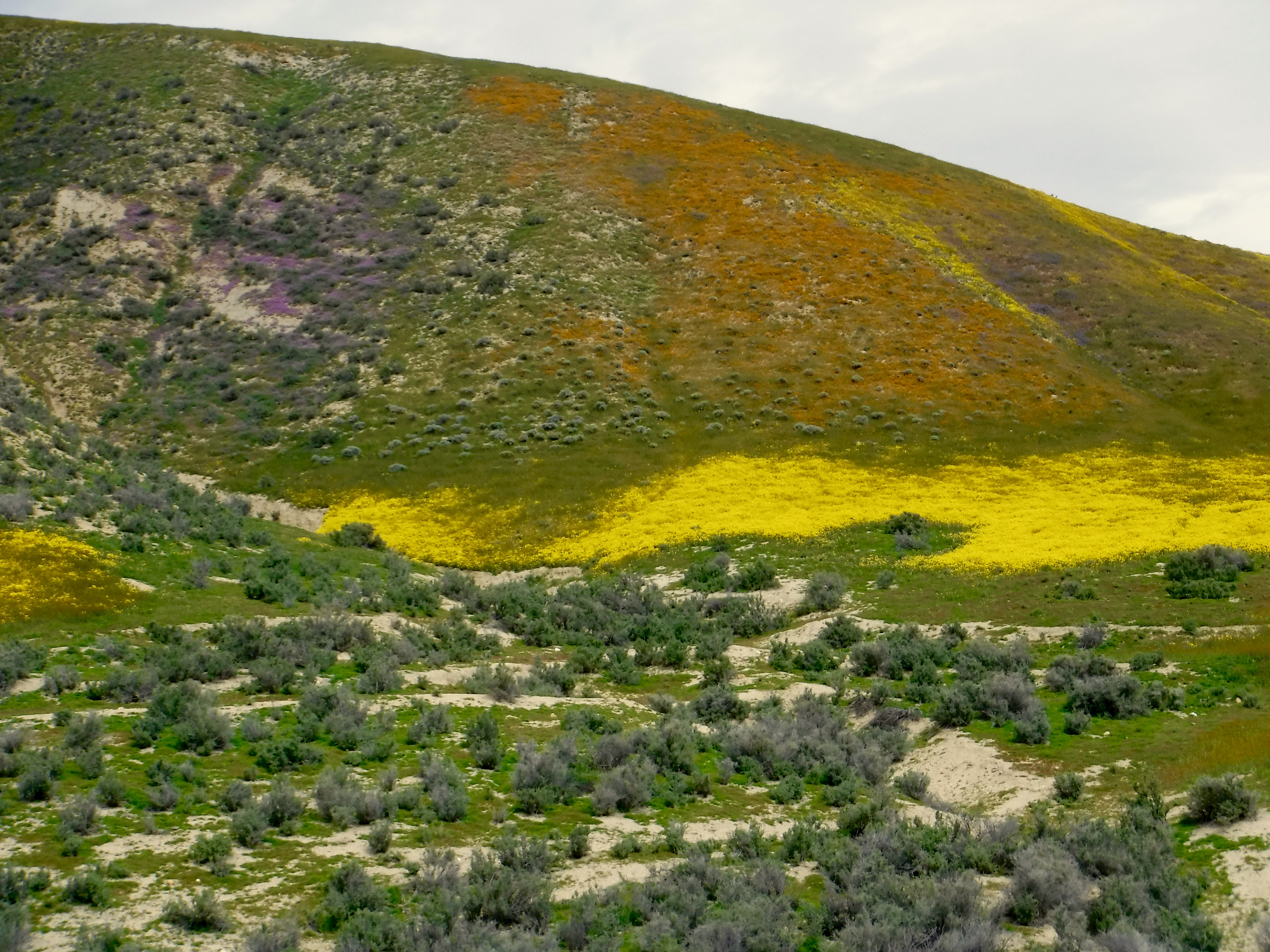
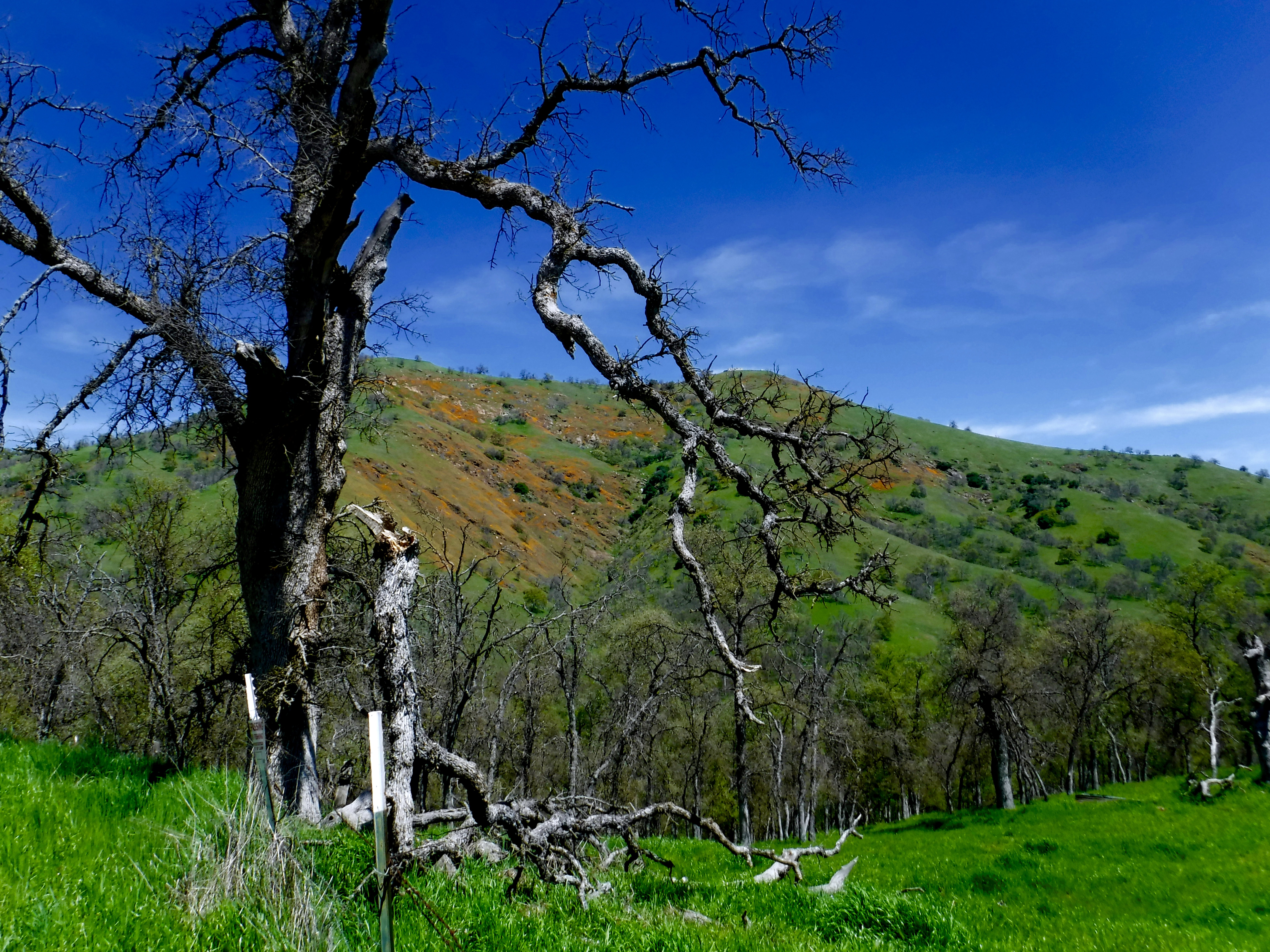
Blanchard Rd to Marshes Flat Rd not yet baked golden by summer’s heat
We’ve been getting out, beyond the confines of our homes and dog walks about our respective neighborhoods, in a series of semi-spontaneous “neighborhood” moto tours in this new age of sheltering, social distancing, mask wearing, and sanitizing, all in an effort to avoid the Coronavirus plague while maintaining our sanity and only slightly and with no malice or virus, veering just a bit from the California Coronavirus (COVID-19) Response webpage regarding recreation: “You can walk, run, hike and bike in your local neighborhoods as long as they continue to practice social distancing of 6 feet. This means avoiding crowded trails & parking lots. Californians should not travel significant distances and should stay close to home.”
With no disrespect for those whose suffering is real, accustomed to unfettered retirement freedom, these restrictions on exercise and travel have been a challenge for my gaggle of sorta-fit retired adventure seeking pals. Especially since the moto “gang” (see my post Riding Under a Fool Moon) had to cancel our five-day spring trip scheduled to depart on April 8, 2020 to the Mojave when state parks and businesses were suddenly shuttered as we awoke to the reality of the plague.
From Ken Layne, The Desert Oracle, whose spring photos from the vicinity of Joshua Tree are what inspired us and what we missed! Check out The Desert Oracle podcast: https://www.desertoracle.com/radio/.
So we have interpreted staying close to home to mean one day rides with no stopping for commerce (except to purchase fuel), practicing hyper-social distancing, though there are only two of us, and using sanitizers as necessary. A motorcycle helmet paired with a kerchief is perhaps equally protective from receiving or transmitting a virus. At the conclusion of the ride, all gear is treated and my bike has never looked as clean.
Wednesday rolls around with no reaction from Pete. I text out a bit more bait, “Que hora manana?” and Pete replies with another terse response, “8:00 Chevron”.
My thumbs up emoji in response gets one right back from Pete. Two thumbs up and the ride is on, sort of an homage to “two hits and the joint turned brown,” perhaps how we may have dealt with these challenges of existential threat in our youth… These days we hoist a Corona, in lieu of bleach, to toast the defeat of the virus!
Corona with lime, yes. Clorox, uh, with or without lime, no…
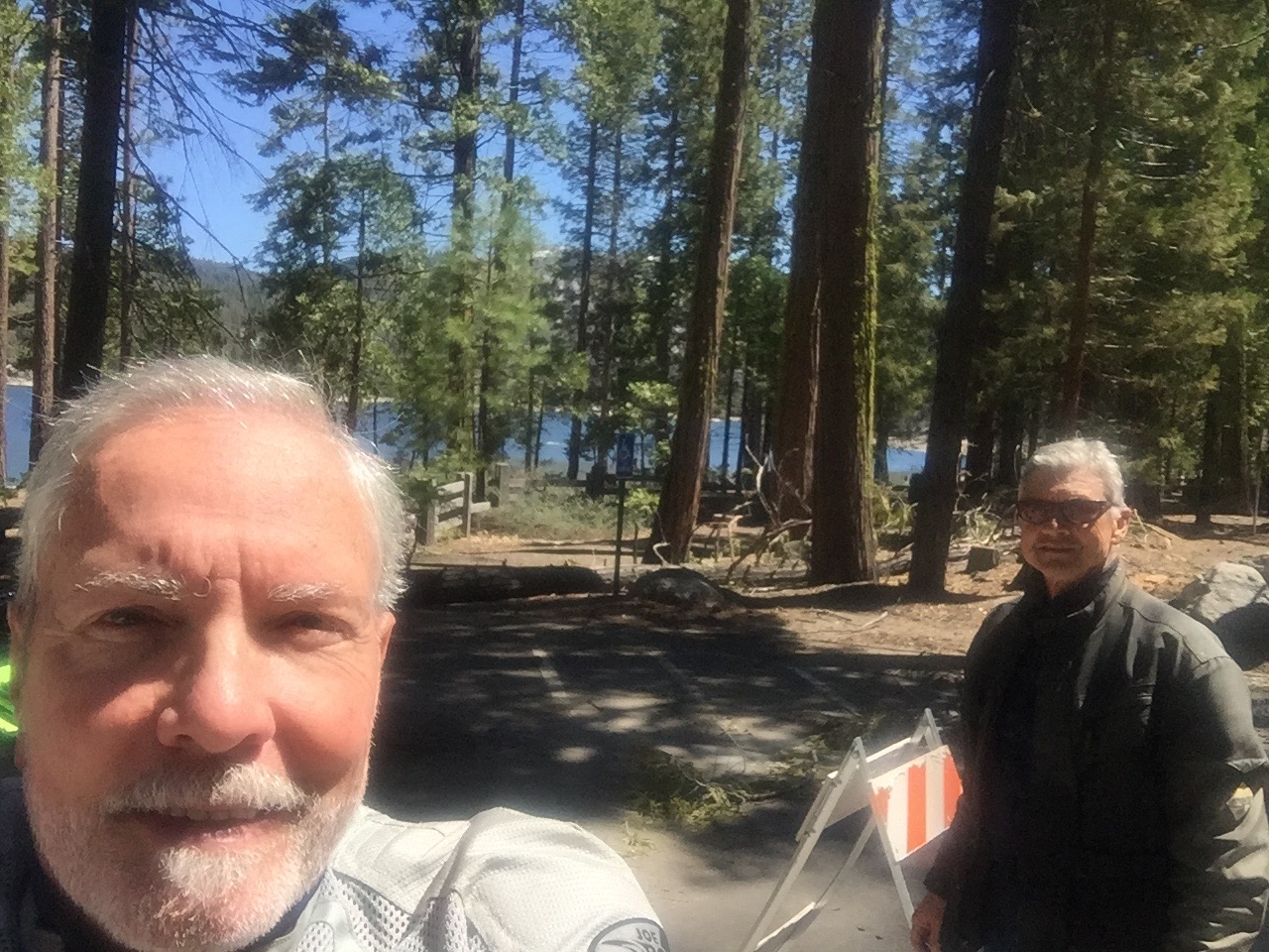
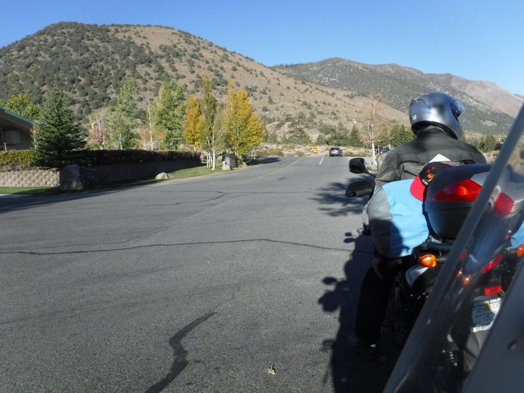
On Thursday morning at 8:00 a.m. we met at the Chevron on Yosemite and “G” with no particular plan as thus far our Covid-19 Tours have been meticulously planned because I suffer from OMD, obsessive map disorder. I said they were semi-spontaneous, right? Planned insofar as I’ve been sheltering at home and with hours to while away and what better enterprise than to meticuolously plan motorcycle escapes. This would be our fourth “local” ride since Governor Newsom imposed the statewide “lockdown” or “stay at home” orders in California.
And with that preview, the following are brief descriptions of the trips with maps and directions, and a few visuals for your enjoyment. You’re welcome. The first three were put together prior to riding and the last ride I pieced together after the fact. Note: Every ride I take I think about how I need to photograph more of the ride, namely the bikes and scenery, the visuals part. Afterall, who wants to look at a couple of squinting geezers out playing like a couple of kids…
Covid-19 Moto Tour #I to West Point, CA ±226 miles
Our first trip on April 2nd was a backroads trip over familiar roads with a couple of new avenues to San Andreas and West Point, returning through Copperopolis to our home in Merced. Since the five day trip to the Mojave was cancelled, we figured (okay maybe we rationalized) a day trip through sparsely populated rural areas with stops only for fuel and to stretch, as we brought along snacks and water to enjoy while social distancing and of course hand-sanitizing, what could be the harm?
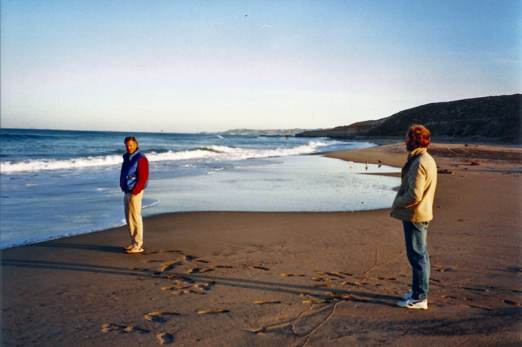
Note we appear to be the only souls in West Point. And we’re at least 12 feet apart.
A note about Google Maps… It seems that the fine folks who code for Google Maps have decided that when you plot a route, save the URL to embed to give others access to your route, and link the route, as you designed it for use in a blog intending to share the exact route, the map randomly reverts back to what some algorithm directs is a more time saving route over busy roads that are uninteresting to this motoist author, <IMHO>.
The first leg of our route took us over rolling hill county roads we often ride bicycles on through orchards, vineyards, rangeland, and a dairy or two along Keys, Olsen, and Los Cerritos Roads while crossing the Merced and Tuolumne Rivers.
Dry Creek expressing irony
That’s Dry Creek from just off Keyes Rd above. As you might infer, it might just as well be called Wet Creek this time of year. Okay, so photographic failure #1: squinting geezer with moto in background instead of foreground (top), and photo-fail #2, moto should be in the foreground of the scenery. I did, however, avoid the squinting geezer.
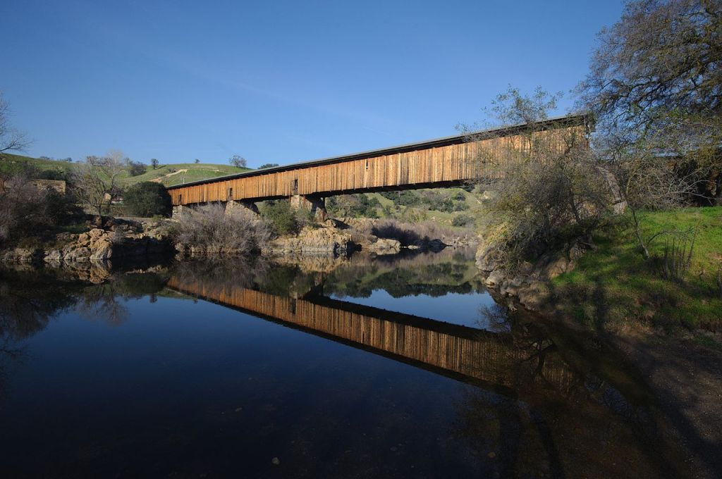
The ferry is now a covered bridge and a very nice one at that
We crossed the Tuolumne on the Robert’s Ferry Covered Bridge where you can stop, though the new Roberts Ferry Bridge isn’t historical, it replaced the original bridge built in 1916 but it still commemorates the regional history. A short historical walk down each side of the bridge features a series of interpretive markers, each telling the region’s story. The whole tale is there, from the Native Americans who first called the land home, to Robert’s heyday, to the fertile farmlands of Stanislaus County today.
Continuing on Crabtree Rd to Williams Rd you arrive in Knight’s Ferry. We took Sonora Rd north, spanning the Stanislaus River but just a short distance upriver from the modern Sonora Road bridge you come across the Knight’s Ferry Covered Bridge. This is an historical bridge. It is almost 379 feet (116 m) long, with a total of four spans set on stone abutments and piers. In addition to spanning the river, the bridge crosses a historic millrace north of the river. The bridge sections consist of Howe trusses formed out of wooden planks bolted together, with wrought iron tension rods, all joined by wrought iron bearing blocks. The exterior of the bridge is finished in vertical board siding, with a metal roof. So, make the turn north on Shuper Rd, just before the Sonora Rd turn and you will find the Knight’s Ferry Bridge. (Wiki)
The Knight’s Ferry Bridge is a historic covered bridge spanning the Stanislaus River at Knights Ferry, California. Built in 1863, it is one of the best-preserved 19th-century wood-iron Howe truss bridges to survive.
An interesting part of that ride aside from the terrain and landscape was how effectively the stay-at-home orders reduced traffic on the lowland county roads as they were largely deserted save the usual ranch/farm traffic. E Sonora Rd and Milton Rd to Jenny Lind were a bit more active. But stay-at-home didn’t seem to affect traffic as much on Hwy 26 to Valley Springs and Hwy 12 to San Andreas. Rejoining the busy Hwy 49 in Mokelumne Hill, traffic seemed normal for a weekday. Traffic tapered again on Hwy 26 up to West Point. The one/two-lainers, Railroad Flat Rd and Mountain Ranch Rd, back to San Andreas were pretty vacant.
The verdant spring grasses and wildflowers were a visual feast. We took Pool Station Rd back to Hwy 4 and Copperopolis where the traffic was equal to that on Hwy 49. O’Byrnes Ferry Rd skirted Lake Tulloch to Hwy 120. Hwy 120 to J-59, La Grange, Snelling, and home.
Hill folk live in the hills for many reasons and I suspect chief among them is to live free of the hustle and bustle of towns and cities.
This is how Humphrey Bogart socially distanced in the hills of the Sierra Madres.
Since most of the roads we take, regardless of a pandemic, are rural, through sparsely populated areas, unless you consider the population of cows, there was still little activity at the street level at most of our stops in the little towns we rolled through. At times, we almost felt as though we were trespassing. Riding without distractions of country road traffic and yet always aware of various other road hazards like potholes and guinea and pea fowl, kept us on the bikes with little urge to stop and take photos having traversed these quaint gold country roads for so many years. I’ve listed the roads and you have a map so if you like, you can take the tour and your very own photos. Just don’t linger around too much. You never know when you may be ask to show your badge…
Disclaimer: The clip from Treasure of the Sierra Madre isn’t intended to disparage people of Hispanic descent or hill people. It’s a joke, based on a classic Humphrey Bogart film directed by John Huston, illustrating the lengths to which the characters in the 1948 film wished to distance themselves from one another the result of another pan-demic, gold fever! Having taken the edge off of my attempt at Covid humor, I’m not going to explain the pun.
Covid-19 Moto Tour #II to Coalinga, CA±275 miles
A fine example of Pete’s artistic expression
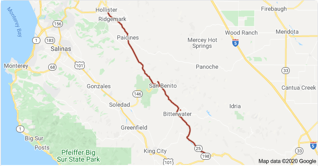
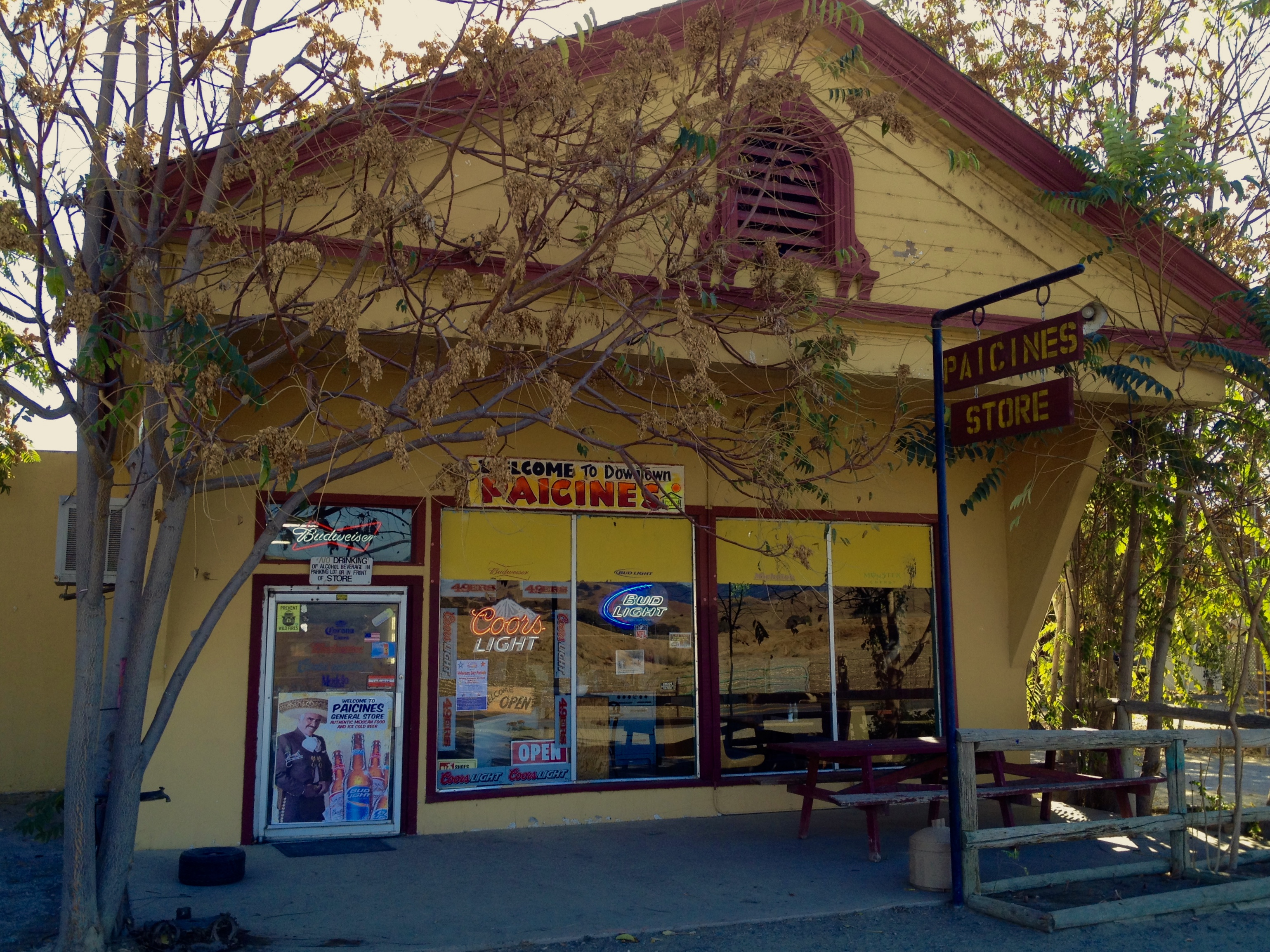
The next trip on April 16 took us again over familiar and novel roads* to Coalinga via Panoche Rd to Paicines, Hwy 25 to Coalinga Rd, then Hwy 33 back home.
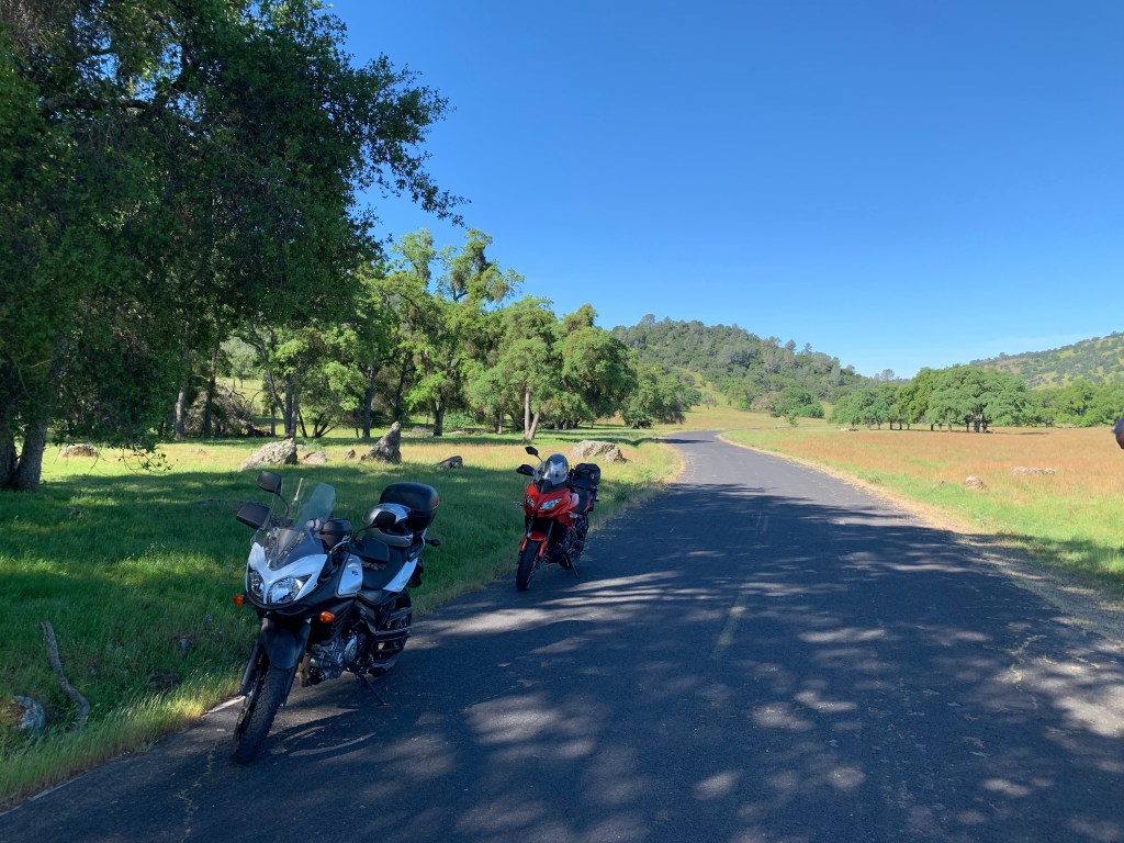
Bikes foreground, scenery background, no squinting geezers… Check!
Sadly, our traditional burrito breakfast at the Paicines Store was foregone in observance of the plague. This was just a “stretch” stop after the 18 miles of twists and turns of Old Panoche Rd. We have in the past had to head north a few miles to Tres Pinos for fuel when heading down Hwy 25 on previous trips when Pete was traveling on his volume challenged Bonneville T-120 gas tank. Confident that our 5.5 gallon tanks on the Kawasaki Versys 650 and Suzuki V-Strom 650 could get us all the way to Coalinga from Merced, we headed south on Hwy 25, aka the Airline Highway, via the Coalinga Rd to where else ? All the while, *novel virus free.
I have often wondered why the stretch of Hwy 25 is also known as the “Airline Highway”
Airline Highway AKA CA SR-25
Now we will all know: “The Airline Highway Association was organized in 1933-34 and was composed of representatives of Alameda, Santa Clara, San Benito, Kern and Kings Counties. Its purpose was to establish this “Airline Highway”.
In the Oakland Tribune article, (Tues. June 19, 1934 page 5. “NEW AIRLINE, HIGHWAY TO L.A. PLANNED”) it states “the highway would follow the air line between the northern and southern part of the state as closely as possible”. The use of the word Airline is confusing as we associate it with modern-day transportation. In this sense it is defined as an Americanism dating back to 1805 meaning “traveling a direct route”. (Wiki)
I’ve been experimenting with a GoPro 7 trying to figure out the best way to mount the camera and capture interesting video. Well, maybe not as interesting as Jamie Robinson’s MotoGeo videos on YouTube or any of the other thousands of talented and dedicated moto-vlogers, but illustrative of the essence of why I love to ride a motorcycle. At least Jamie and I have that in common.
Besides filming. editing video is something of a challenge for this old dog, but I’m slowly learning new tricks. I whittled two hours of video into the following 30 minute unnarrated clip featuring Panoche Roads (New and Old) and Coalinga Rd. To the uninitiated, it might appear monotonous. To the smitten, eat your heart out…
Remember, Jamie Robinson I’m not.
I have never encountered an Uber moment on my Kawasaki. Maybe it’s the Ducati?
Sparing your having to read a list of roads, you can just sit back and enjoy the ride. Hint, these back roads took us to our destination and fuel with only slight pucker fatigue as empty fuel warning lights began blinking at least 30 miles from Coalinga. The flashing light does a good job of keeping your thoughts trending on how to deal with running out of fuel with no signs of civilization on a road much less traveled by plague reduced traffic. I have determined that when the Kawasaki’s fuel warning light comes on and the fuel range indicator showing 30 miles til empty disappears, I have roughly 1 gallon of gas remaining. If the average miles/per/gallon indicator is accurate, I have at least 58 miles, okay, maybe 50, remaining before empty. Therefore when the fuel light comes on I have at least 80 miles of fuel. There was no measure of conciliation in the number of oil rigs that began showing up sporadically in the last 15 miles into Coalinga.
Oil, oil everywhere, but not a drop refined enough to pump…
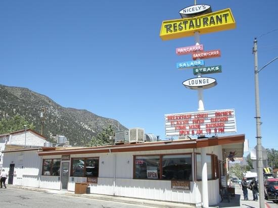
We arrived in Coalinga and our first stop was a Chevron station on Hwy 33. Topping off our nearly empty tanks, we reflected and gave our thanks for the dinosaures whose sacrifices made our combustion engines possible. Speaking of dinosaurs (ouch!), we serendipitously met a friendly group on a variety of HD baggers and a Spyder who were affiliated with the ROMPs group from home. Like us, they were out for the day, perhaps attracted to Coalinga by the aroma of tri-tip grilling. A friendly group who seemed to be practicing social distancing… Or maybe they just though us to be peculiar on our modest touring Japanese motos.
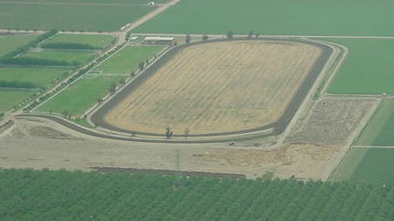
There is the beef. Where are the bikes?
The ramble home was uneventful. Mostly “airline” roads, Hwy 33 through Westside farming communities of Three Rocks, Mendota, and Firebaugh. We passed by Harris Farms Horse Division on the Coalinga-Mendota/South Derrick Ave frontage to the Westside Freeway/Hwy-33/I-5. It appears that naming roads in the region is ripe with redundancy. This ranch is where the Harris Farms training track, an immaculately groomed 7/8-mile facility, is located along with the breeding shed that is the home of “world class stallions and Grade I sires claiming an annual conception rate hovering above 90%”. Hmmm, I wonder what the attempts at bat number might be… And you thought the only Harris Farms interprise was the resturant and stinky feed lot along I-5.
I remember being introduced to the sport of thoroughbred racing at the training track by a gentleman with whom I worked a couple of summers in the early 80’s as a field rep during the tomato harvest for Tri-Valley Growers Cooperative as a summer job supplementing my elementary teaching gig. Jim, who worked as a dispatcher for one of the trucking firms hauling tomatoes, was a connoisseur of tracks, county fairs, and racing forms. He attempted to explain to this greenhorn the nuances and subtleties of how to evaluate a horse and the art of wagering respectively. Of course this was all wasted on me. I was trying to deal with wazillionaire westside growers who were never satisfied with the news I delivered about how at the peak of the harvest our canneries couldn’t take their excess production from the more lucrative spot market buyers who were refusing them. You can’t squeeze another tomato into a cannery that’s at capacity I tried to reason. It’s a little unnerving to have a pistol wielding ranch supervisor threaten one about “sending” a message to my supervisor. Especially since I was on summer vacation from my fourth-graders. Needless to say, I never developed a passion for horse racing nor am I a big fan of industrial grade agriculture. This despite the gift of an apologetic Harris Farms sweatshirt and fifth of bourbon following the incident. That’s why we buy most of our fresh seasonal produce from Yang’s, a local Hmong farm/stand. I since went on to teach middle school kids. I could probably have handled the posturing of that incensed supervisor if I knew then what I now know these days…
The rest of the ride home on Hwys 33, 152, and 59 was it’s usual windscreen-bug-splatter-art producing commute, however, with a little less traffic.
Covid-19 Moto Tour III to Bass Lake, CA ±169 miles
A week later on Friday, April 24th, we rolled to Bass Lake over many familiar roads but with a rearrangement of segments and directions making it a semi-new ride. That’s the beauty of two wheels. You face forward peering into the future, a future that may hold any number of road conditions, migrating animals, unfocused motorists, or errors in judgement distracted by splendid scenery, any one of which just might end an otherwise beautiful day’s ride permanently. The pitch of the landscape changes on the return trip creating a new future only slightly associated with rolling over the very same of the recent past. Curves with mountain sides to the right and precipices on the left are now curves with precipices on right and a mountain sides on the left. Eyes remain keenly focused for any sign of the aforementioned hazards or distractions as well, even though it’s an out and back only traversed minutes before. If it’s a loop ride then only the future lies ahead.
Sadly, as you can see, this photo features yet another photo-fail. The scenery and moto are secondary, overwhelmed by the grizzled photo bombing geezer. At least you can’t see the squinting eyes masked by the glasses. Willow Creek that empties into Bass Lake in the background was the star of the photo. More of the motorcycle in the foreground with more of the starring background scenery (and none of the geezer) would have garnered the supporting actor honors for the bike.
I don’t know what possesses me to take a selfie when I know that in viewing the photos later I’m profoundly disappointed. Especially when that selfie is the only photo either you or your partner Pete took to commemorate the ride… Did I mention I’m no Jamie Robinson?
On this ride our route took us from Merced East on Hwy 140 to Agua Fria with a right turn onto Yaqui Gulch Rd to Buckeye and Ben Hur Rds to Mormon Bar where we jumped on Hwy 49 through Bootjack, Nipinnawasee, Ahwahnee to Oakhurst. Road construction and bumper to bumper traffic on the very busy Hwy 41 that bisects Oakhurst found us taking Crane Valley Rd to The Forks on Bass Lake. We whipped around the lake on Rd 222 to North Shore Road to check on Pete’s partner Cheryl’s recently sold cabin and returned by way of Rd 222 and 221 to North Fork Rd, Finegold and O’Neals. Bombing down Hwy 41 we turned west on Hwy 145 to Rd 400 taking us along the southern shore of Hensley Lake that looked pretty empty for this time of year. Road 603 through Daulton, Rd 29 and Ave 26 back to Santa Fe Ave got us to Le Grand where our bicycle zig zag on E Savana, S Burchell Ave past Jay’s to Childs Ave, Planada, then Plainsburg Road to South Bear Creek drive (not far from where SoBe found me) took us home.
SoBe, Sisyphus’s associate named for South Bear Creek (and not tea), where it was love at first sight. But that’s another story…
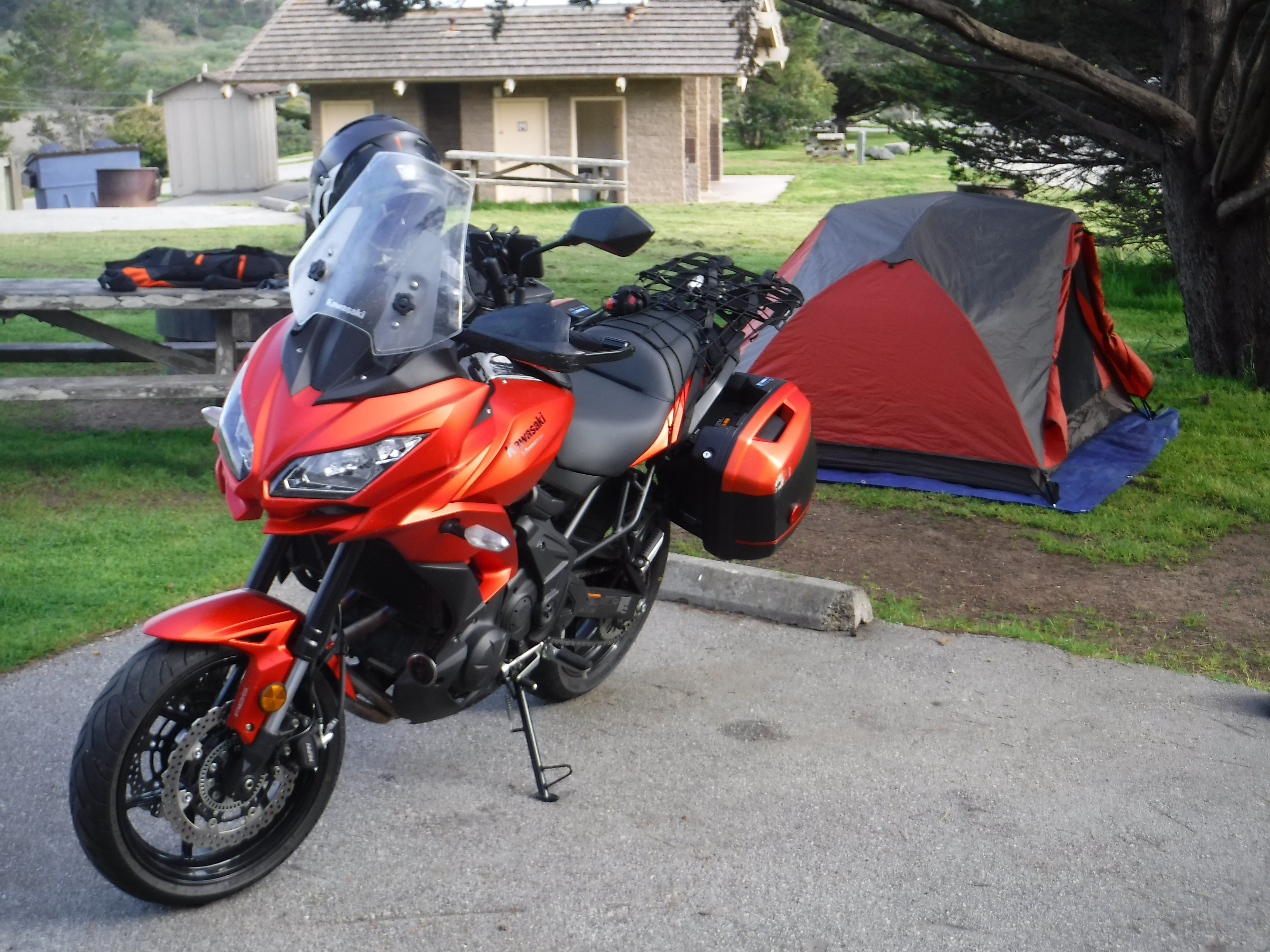
Covid-19 Moto Tour IV to Pinecrest Lake, the Clavey and Tuolumne Rivers ±248 Miles
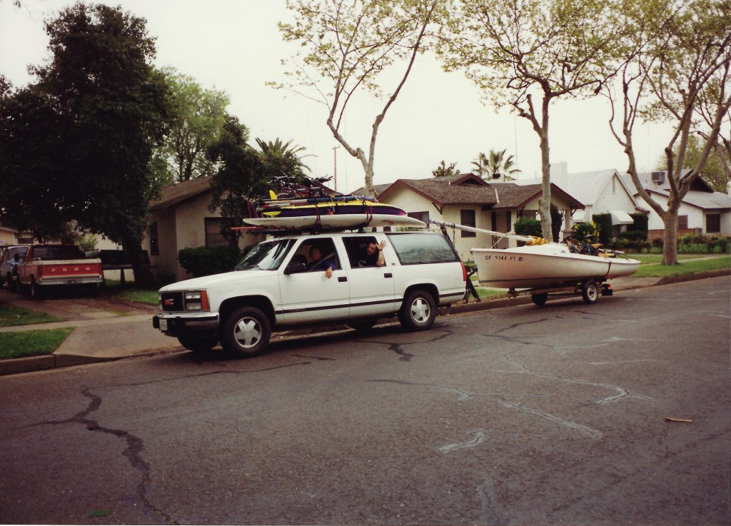
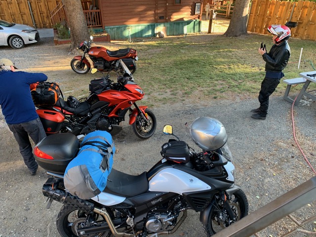
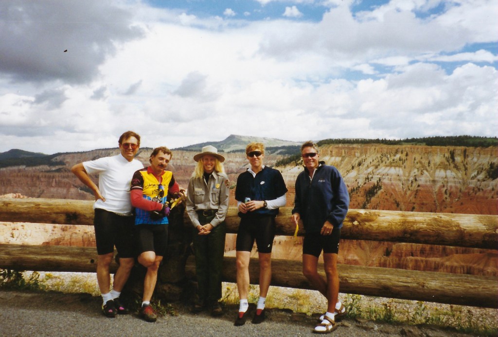
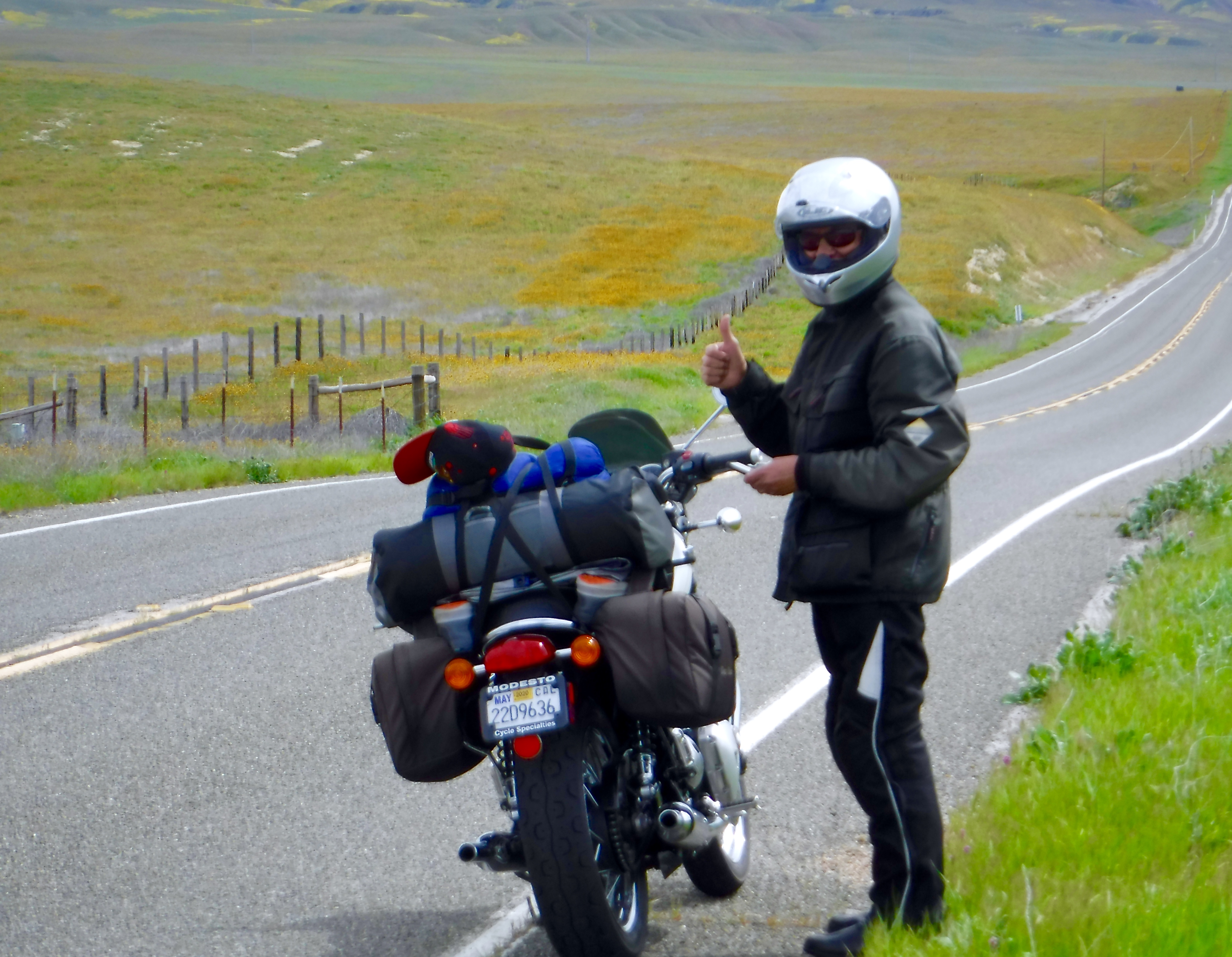
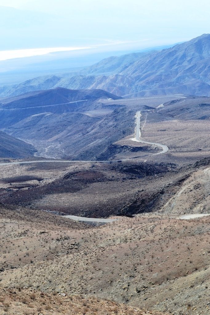
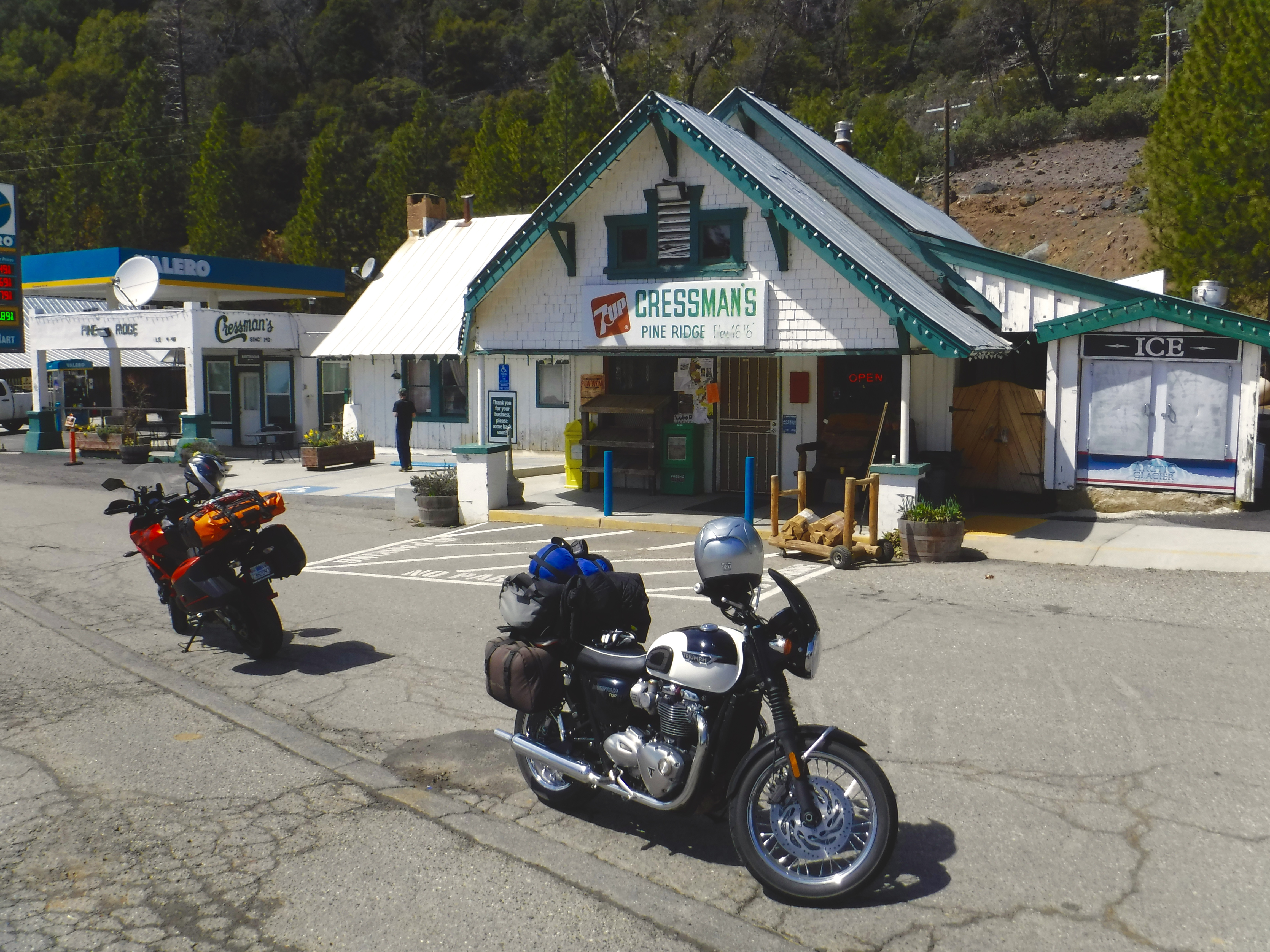
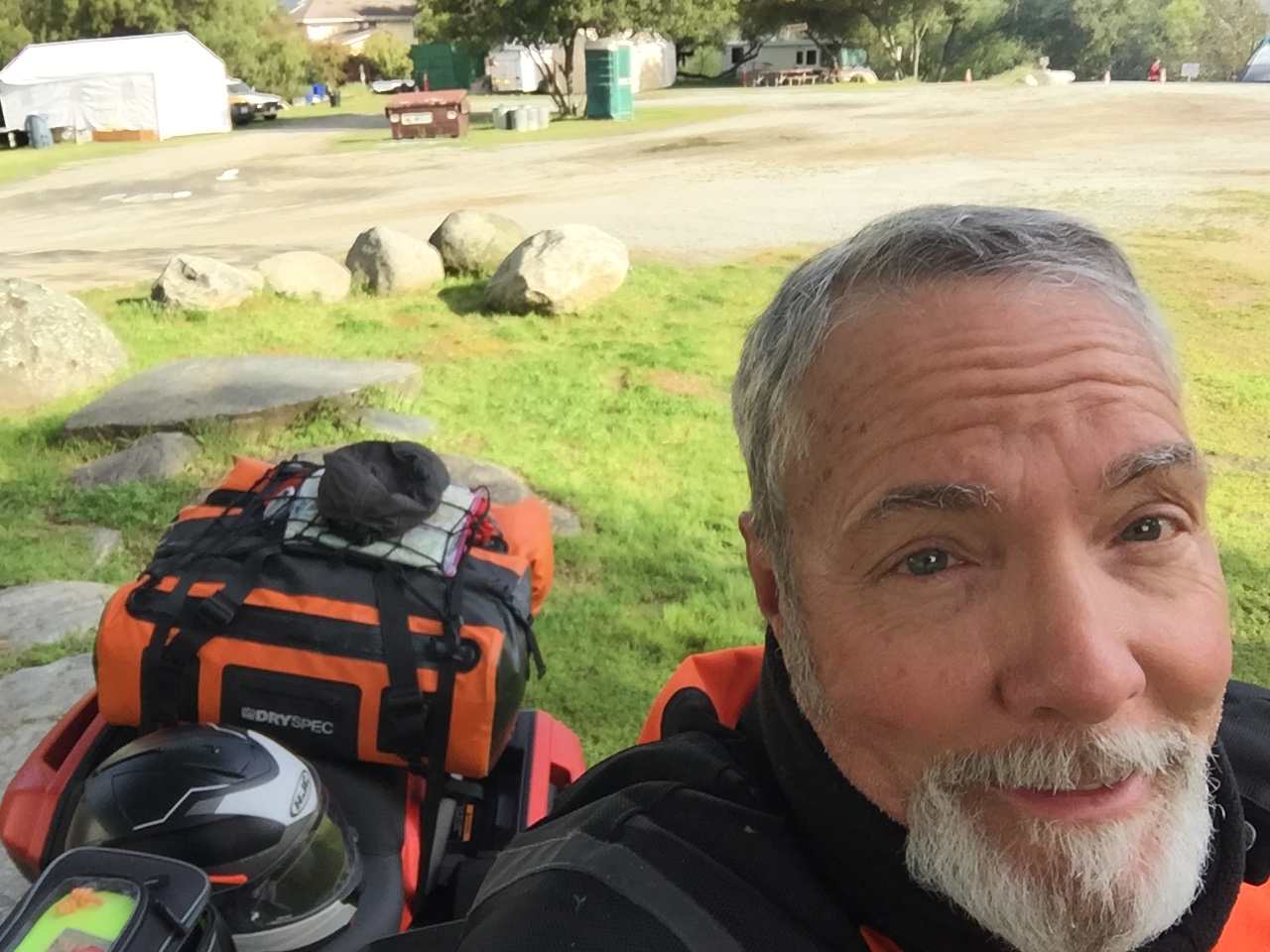
That brings us to where this installment all began back on Thursday, April 30. On the spot, after fueling up at the Chevron, getting a shocked expression from Pete that I had formulated no explicit plan with step-by-step Google directions, I suggested we go up to the Donnell Lake Vista or Dardanelle on Hwy 108 near where Hwy 108 over Sonora Pass is closed for the winter. Mind you I was in my mesh gear because we were experiencing something of a heat wave (temps in the 90’s) in the Valley and I only had a t-shirt as my base layer and shorts under the armored mesh pants.
Pete’s wheels began turning as we tossed about a route to take since his catalogue of the local “backroads” has been honed over some 50 or so years riding motorcycles. We agreed on a route that would avoid most of the highways even though, because of stay-at-home orders, traffic was considerably reduced. We simply prefer back road touring. There’s a purity or authenticity to the experience when you can ramble through an area or region away from the monotony of the slab and cookie-cutter boulavards lined not by repetitively interchangeable chain stores and eateries, but interesting “natural” landscapes. Not much is natural about rows of almond trees or cows on pasture but it has an aesthetic value superior to strip malls <IMHO>. That is not to say I don’t enjoy the convenience of shopping centers or an occasional burger at In and Out, or tacos from Ramon’s or M&D, it’s just that battling traffic doesn’t enhance the motorcycle experience, <again, IMHO>.
The trip took us through the foothills into the Sierra above Sonora on back roads including Algerine-Wards Ferry Rd to Tuolumne Rd past Black Oak Casino, closed due to the Covid-19 pandemic. I guess even casinos aren’t willing to gamble by permitting their Social Security slot playing patrons to mingle in the confines of the 50,000 square-foot gaming floor with 11,000 square-feet, smoke free. I wonder what the odds are on dying from smoking related diseases compared to death from Covid-19. I suspect the timeline is a factor and that the casinos have calculated there to be limited liability…
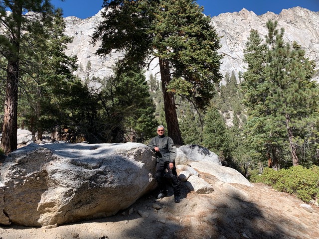
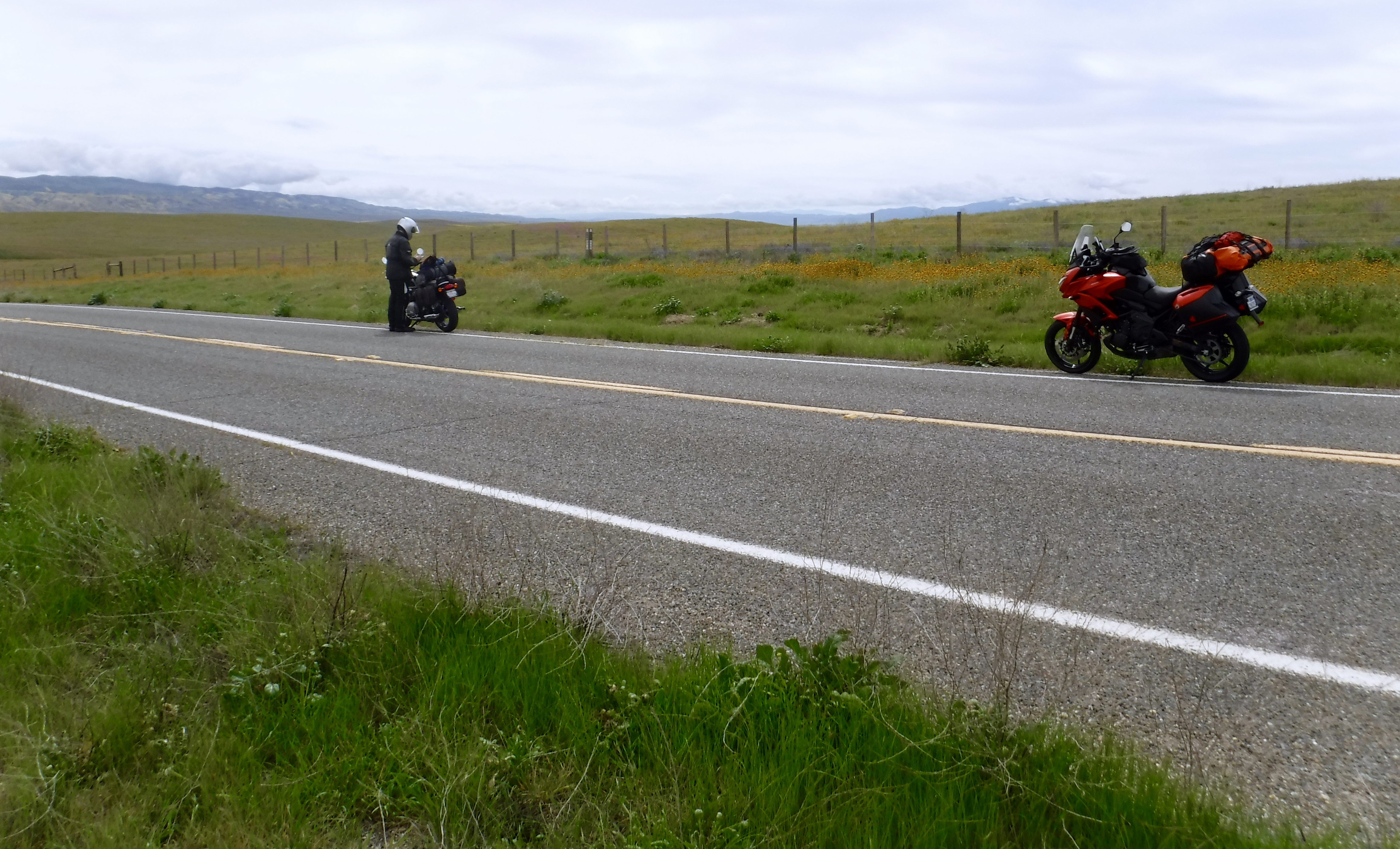
I know. The May rides will be better. More moto and scenery, less squint and repetitive video. Left to right, Marsh’s Flat (again), dual selfies at Marsh’s Flat and Pinecrest Lake.
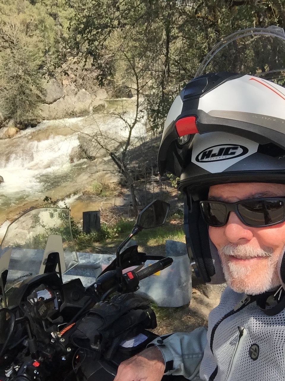
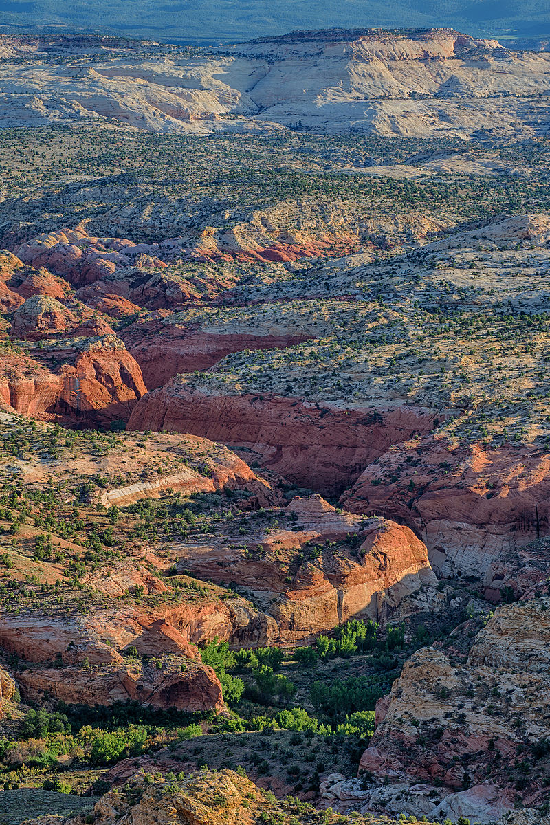
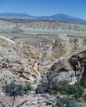
We took the Kelley Grade portion of Marshes Flat down to Moccasin and west on Hwy 49 to Jacksonville Rd where we headed north to Stent Cut-Off Rd (wait, doesn’t a stent increase flow?) to a lovely wooded country Algerine Rd that became Algerine/Wards Ferry Rd popular with the bicycling crowd. More twists and turns on Wards Ferry Rd north to Tuolumne past the aforementioned Black Oak Casino to Hwy 108 and Pinecrest Lake which was “closed” except we were able to ride up to the lake as roads through the community of cabins allowed us to access Pinecrest Lake road. A stretch, walk down to the lake, and some snacks from our top boxes allowed my fingers, numb from the cold, to restore feeling.
Pinecrest Lake, not yet filled for the summer season
The turnoff to Pinecrest Lake also includes Dodge Ridge Rd where the ski resort, our family’s favorite, is buttoned up for the summer.
I’m not sure what the winter geezer rules are for photos…
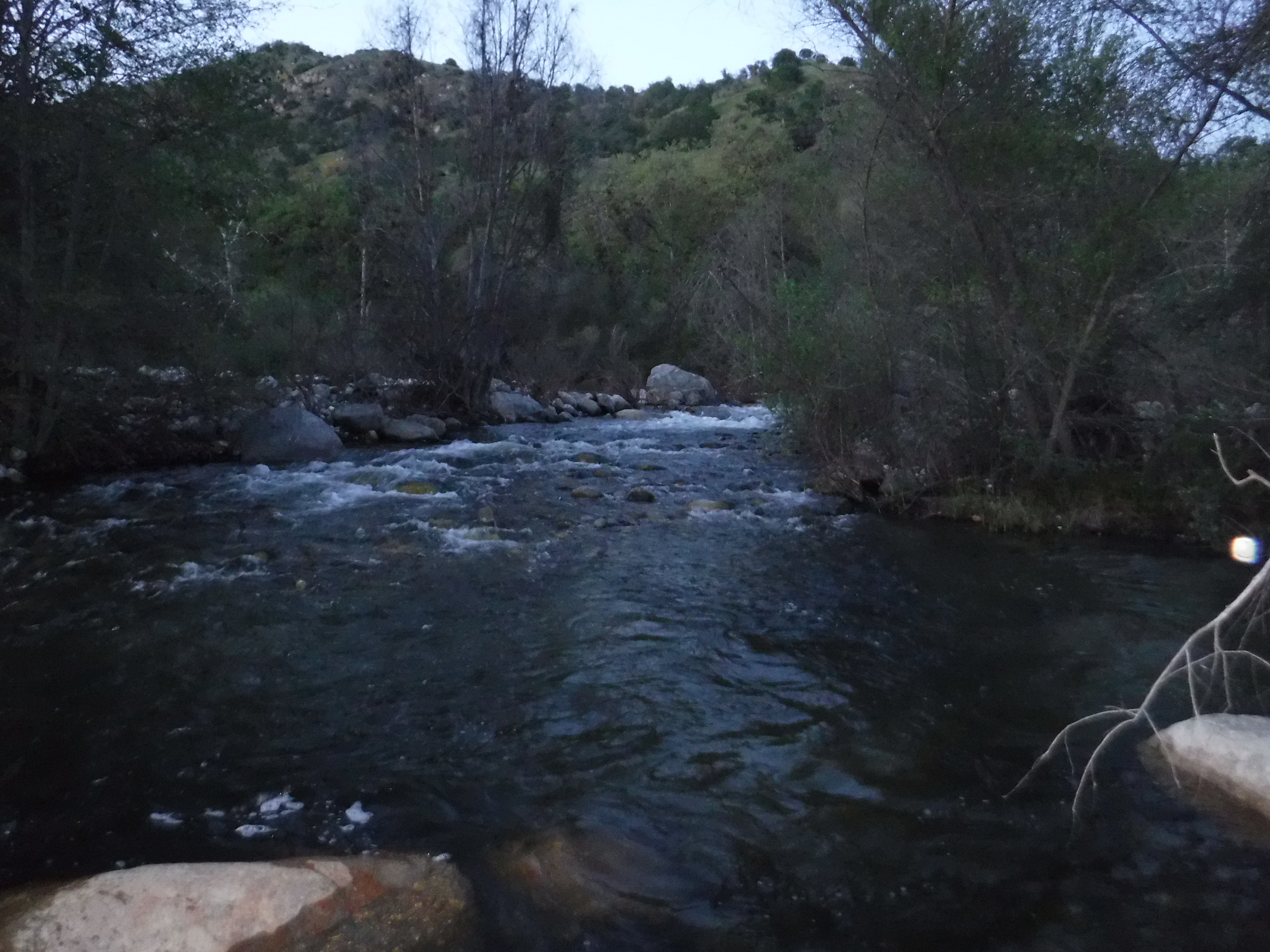
We decided to forego gaining more elevation as the temperatures were dropping pretty quickly from Cold Springs so we reversed our course and headed back down Hwy 108 for the town of Tuolumne where we then headed east in the direction of Cherry Lake by way of Buchanan Rd/Forest Route 1N01. The road is well paved and is filled with superb twists and turns down to the grand Clavey and Tuolumne Rivers in fine spring runoff form.
Pete is preparing to take a photo of the Clavey River so since it’s a picture taken of him, and so it isn’t a selfie and there is a moto in the foreground. The photo on the right is self-captioned. In chalk.
Technically, this isn’t a selfie. Part of the moto is in the foreground and the scenery is stunning, the Clavey in splendid spring runoff A shadow of a mirror and handle bar in the lower right corner, sort of qualifying as a moto in the foreground, featuring the Grand Canyon of the Tuolumne.
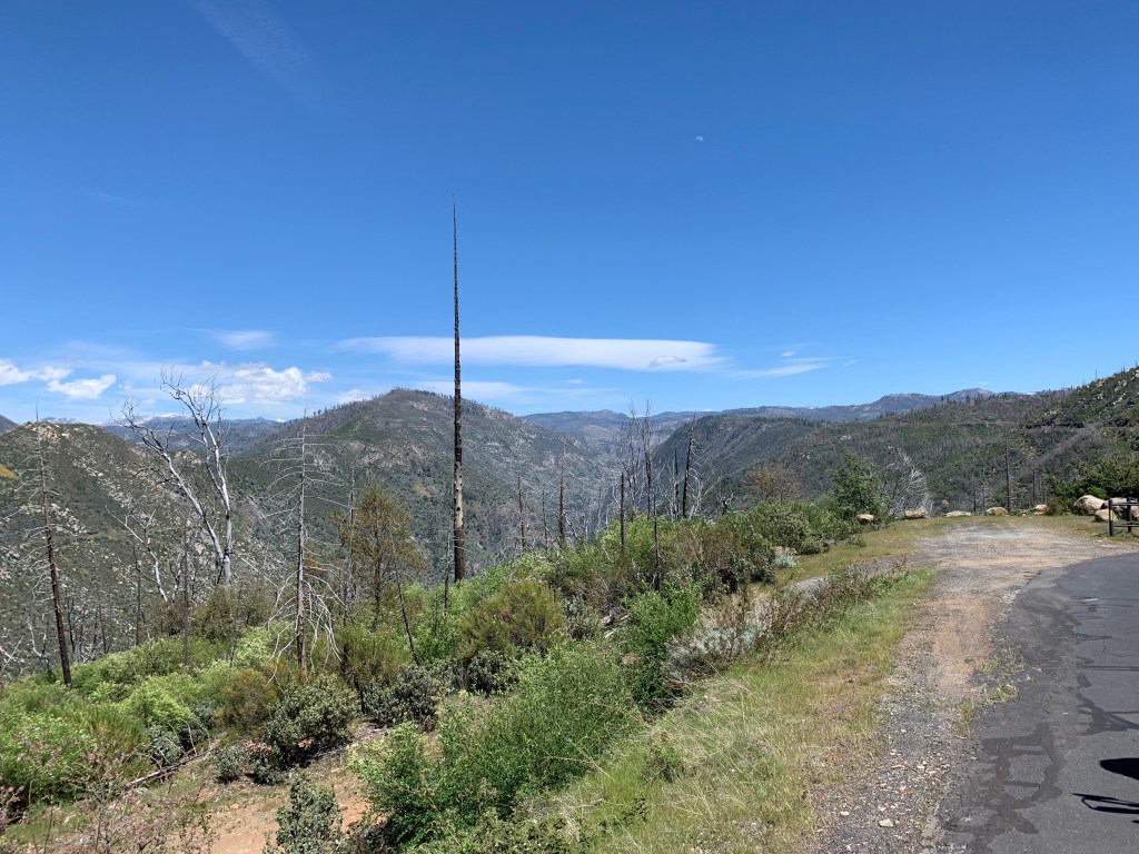
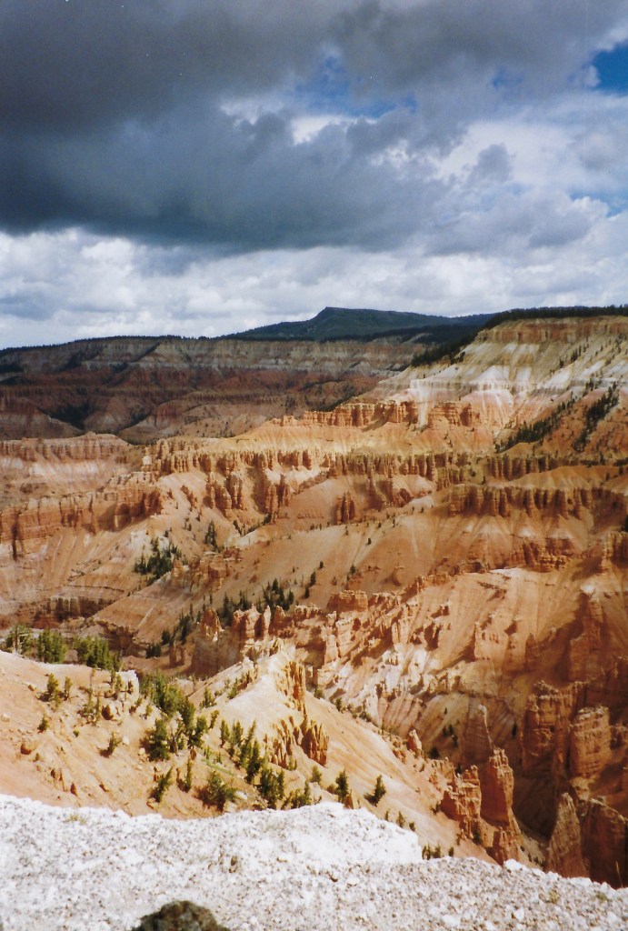
The photo above is a view of the Rim Fire burn scar taken from Cherry Lake Rd above the Tuolumne River Canyon. The fire started on August 17, 2013, during the 2013 California wildfire season and grew to be (at the time) the third-largest wildfire in California’s history having burned 257,314 acres.
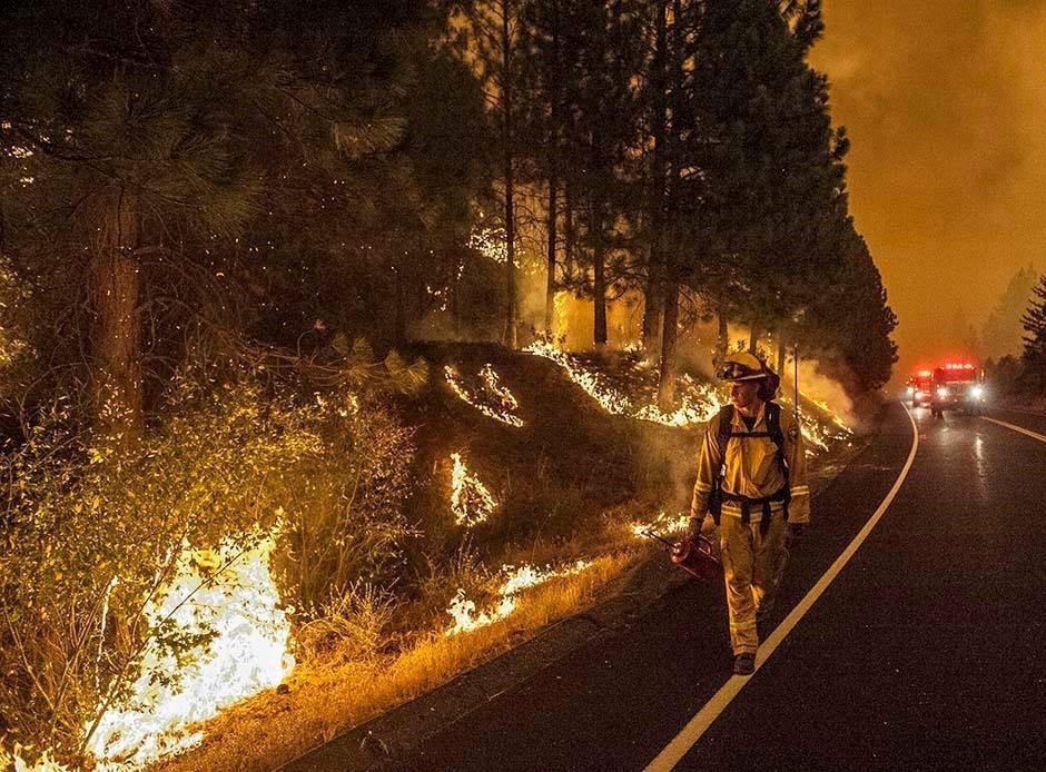
This is our son Derek igniting a backfire when he worked the Rim Fire with CalFire
The inferno was caused by a hunter’s illegal fire that got out of control and it was named for its proximity to the Rim of the World vista point, a scenic overlook on Highway 120 leading up to Yosemite.
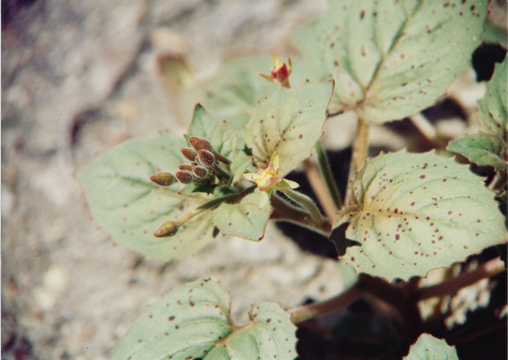
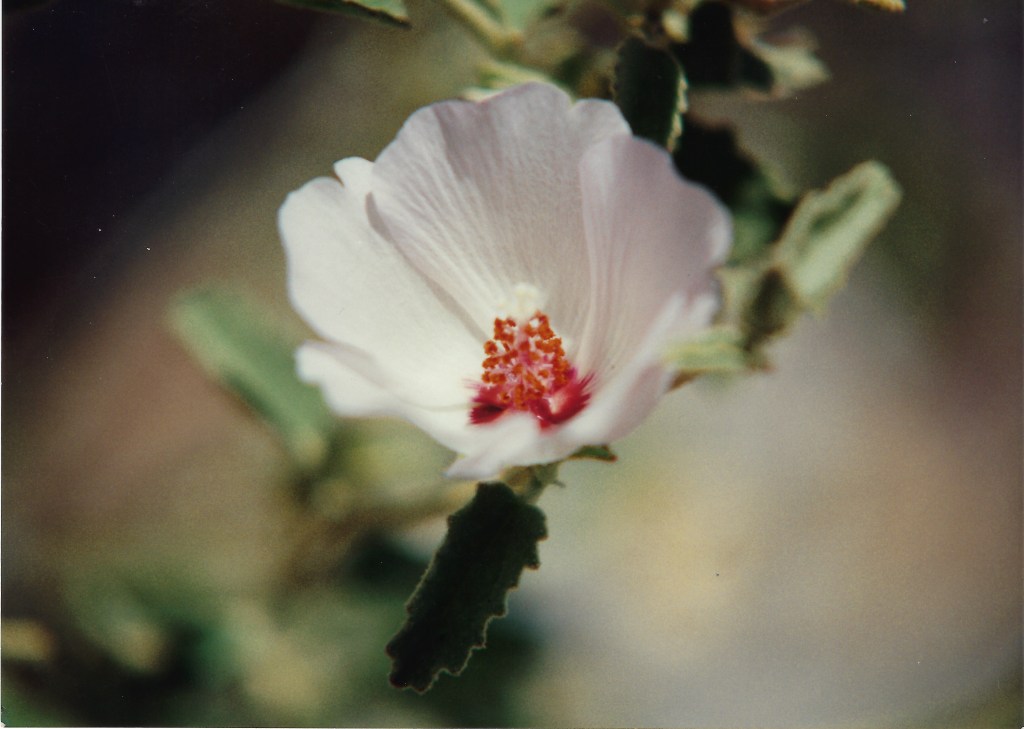
Chamise (Adenostoma fasciculatum) was in abundance along with a number of other native wildflowers (excluding the invasive Scotch broom front left) covering the burned hillsides of the Tuolumne River canyon and the fragrance that afternoon was intoxicating. Unfortunately chamise is oily and highly flammable as the season wears on and conditions dry. On the other hand, it is an excellent plant to stabilize the fire ravaged hill sides. It’s just like nature to giveth and taketh away…
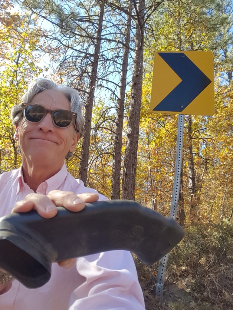
Speaking about “taketh-ing” away, back on Hwy 120 from Cherry Lake Rd to our turnoff, the return ride made its way past the Dead Toenail curve near the intersections of Smith Station and Greeley Hill Roads about 8 miles north of Coulterville without incident. It seems we have exorcised the bad juju from that curve that was earlier referred to (never again to be mentioned) in my Riding Under A Fool Moon post. Did I mention that earlier?
The scene of the incident and Andy’s successful return visit. He found it! The air intake collar, not the toenail…Does a semi-selfie count? At least I’ve spared you the squinting
Pete’s expression pretty much summarizes what he’s anticipating I will eventually write about the ride. After a brief stop in Coulterville, again practicing social distancing, we avoided stopping at the Coulterville Cafe and General Store for our usual ice cream bar and stimulating coffee beverage. After a brief stretch, we made our way home on the usual roads reinvigorated having gotten out of the house for a couple of hours doing what we love.
Stay tuned for May’s rides as loosening restrictions may make for an overnighter. Until then, stay safe all!
Let us go, we said, into the Sea of Cortez, realizing that we become forever a part of it; that our rubber boots slogging through a flat of eelgrass, that the rocks we turn over in a tide pool, make us truly and permanently a factor in the ecology of the region. We shall take something away from it, but we shall leave something too. John Steinbeck, The Log from the Sea of Cortez
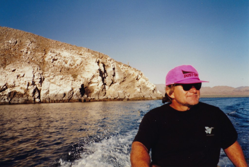
Bahia de Los Angeles
In the late eighties and early nineties I was fortunate to have worked in a school district that, at the time, was on a “year-round” academic calendar. That meant that rather than school recessing for the traditional June through August summer recess, tracks would rotate breaking up the traditional summer vacation such that recess would occur during seasons other than the summer as one of four academic tracks would be “off” at any given time. I was on “A-Track” so my off-track periods were late October through November, late February through March, and late July through August. The fall and spring breaks afforded me the opportunity to spend time with a group of friends, whose calendars were also flexible, in Baja California during its most hospitable seasons. My summers were for sailing, bike riding, and hiking to prepare for the Baja trips.
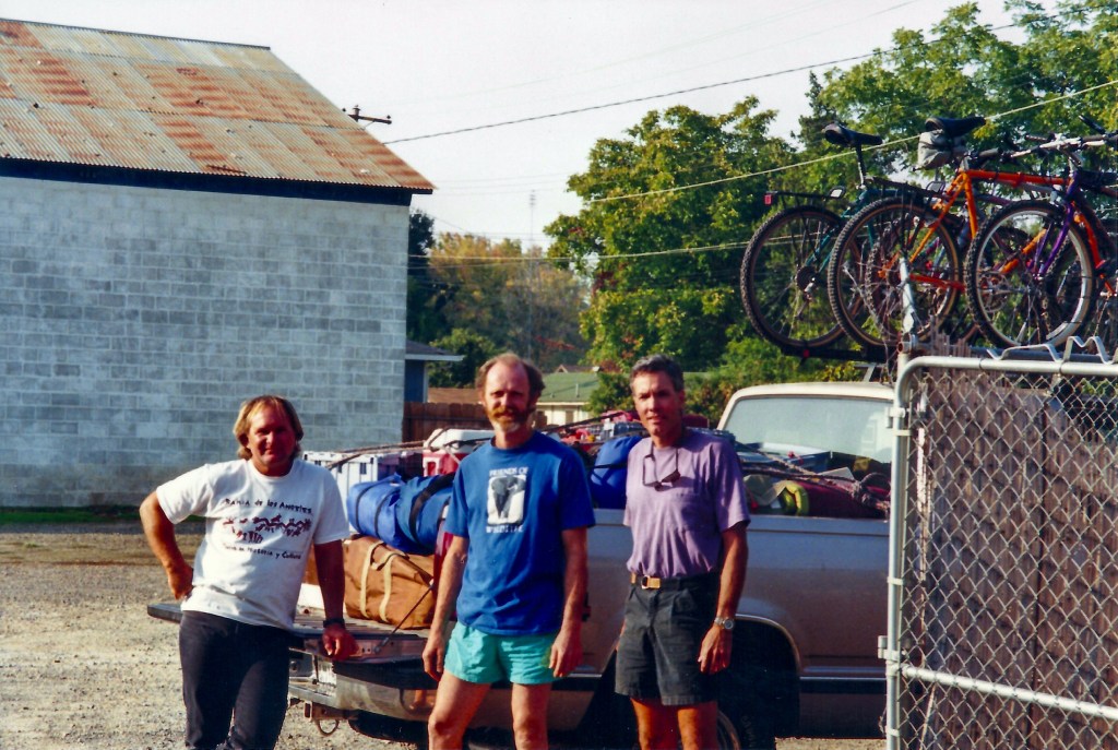
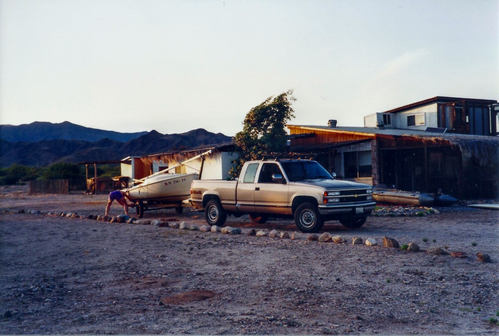
My friend Bob Randolph had a small casita complete with palapa on the beach known as La Gringa north of the small village of located at the coastal bay along the eastern shore of the Baja peninsula. Dave Medley and Dwight Wigley rounded out The Boys’ Pleasure Club whose Thursday night and weekend beer can sailing race/potlucks on Lake Yosemite and never-planned-more-than-24-hours-in-advance-semi-spontaneous-bicycle-rides around Merced at twilight were our primary club endeavors according to the club’s unwritten, and except on Wednesday evenings, unspoken charter.
Pre-loading burritos before a spring trip south in Bob’s rig (l-r Dave, Bob)Tom’s rig loaded for a fall trip minus the O’Day (l-r Dwight, Dave, & Tom)
Though inspired by rereading The Log from the Sea of Cortez but in the context of my middle-thirties, divorced, and obsessed with sailing and riding bicycles (motorcycles were to come later), there was little hesitation in deciding to abandon families, stowing boots, beer, and some other worthy provisions, lashing boats, bikes, and boards to our rigs for week or longer excursions along the coasts, into the mountains, and across the deserts of Baja. Expanding the geographical reach of the Boys Pleasure Club, along with a little re-branding, these trips became the annual spring and fall southern pilgrimages of El Club de Placer de los Chicos.
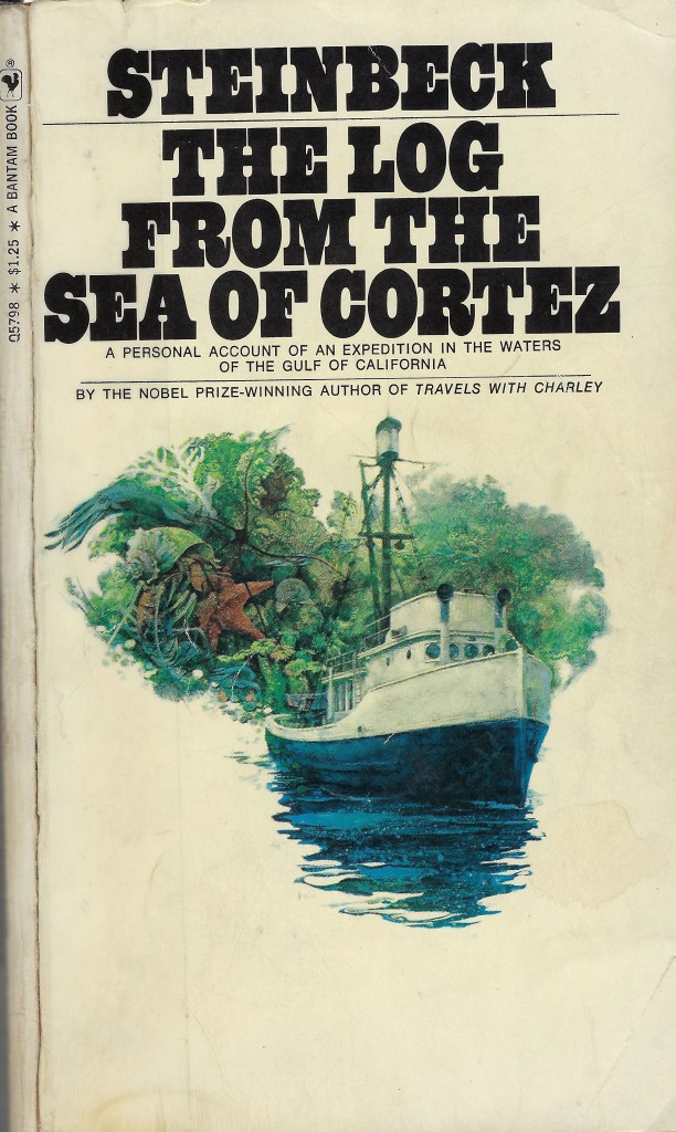
First and second editions along with my well worn 1971 Bantam Paperback reissued with the profile, “About Ed Rickets”
A Personal Journey of Discovery
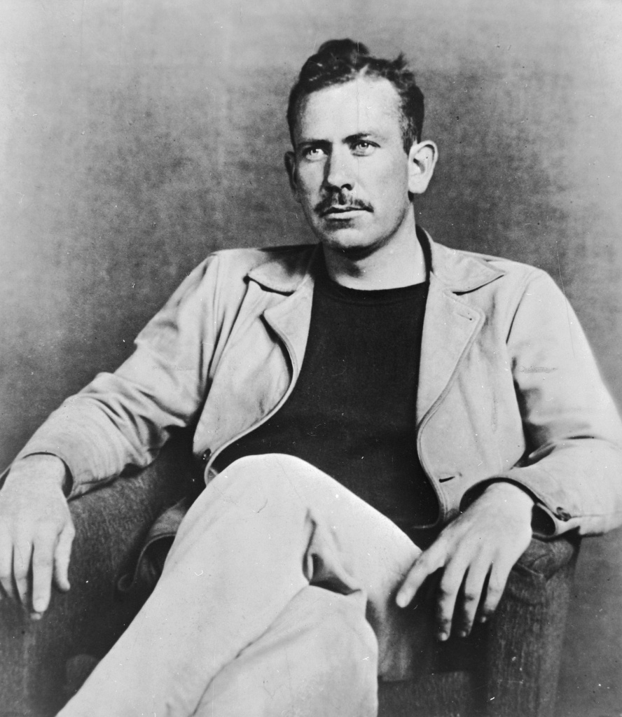
I, like most of my contemporaries, was introduced to John Steinbeck at Merced High in my freshman English class by Mrs. Russell. It wasn’t until I was in college and had exhausted reading nearly all of Steinbeck’s
fictional catalog that I discovered The Log from the Sea of Cortez. I was aware of Steinbeck’s characterization of Ed Ricketts from The Long Valley, Cannery Row, and Tortilla Flats. I believed him to be yet another fictional character, a blend of Steinbeck’s imagination and experience. It was only after visiting the Pacific Biological Laboratories on Cannery Row, a remnant of the past swallowed by the themed tourist attractions along the row of converted canneries Steinbeck made famous in his work, that I believe I intellectually grasped the basis in reality of his Doc Ricketts character.
The experiences on board the Western Flyer opened my appreciation for exploration and from that time forward I formed a personal ‘mental peg’ on which to hang my experiences on our latter day expeditions. I began to formalize my focus in teaching to value how first hand concrete experiences, in concert with previously acquired knowledge, could dramatically facilitate and expand one’s understanding of the world. It seems to me the voyage of Steinbeck to the Sea of Cortez distilled how important it is to provide opportunities and experiences in classifying and grouping information, using outlines and hierarchies to facilitate the assimilation of new information with previously learning, to gain further understanding of complex ideas, all the while developing deeper logical analytical thinking of part to whole and whole to part relationships. That was in fact the evidence I gained that reassured my effort to promote Developmental Learning as the basis for my classroom practice rather than cultivating disparate facts.
Clockwise from upper left: John Steinbeck, Ed “Doc” Ricketts, Pacific Biological Laboratories back-in-the-days of The Log, and now (Credit: The Interwebs)
Steinbeck wrote of the brief stop of the Western Flyer in Bahía de los Ángeles, our destination and the northernmost reach of his voyage, which he regarded as having a sinister feeling as though, “we were interfering with something, that some kind of activity would start only when we left.” We never once felt unwelcome on any of our later day visits, even once when Bob flew in to meet us and four uninformed gentlemen in a pickup with automatic weapons showed up to watch us unload his gear from the Beechcraft. They quietly left when they were satisfied we were harmless gringos, too goofy in our seeming frivolous preoccupation to regard.
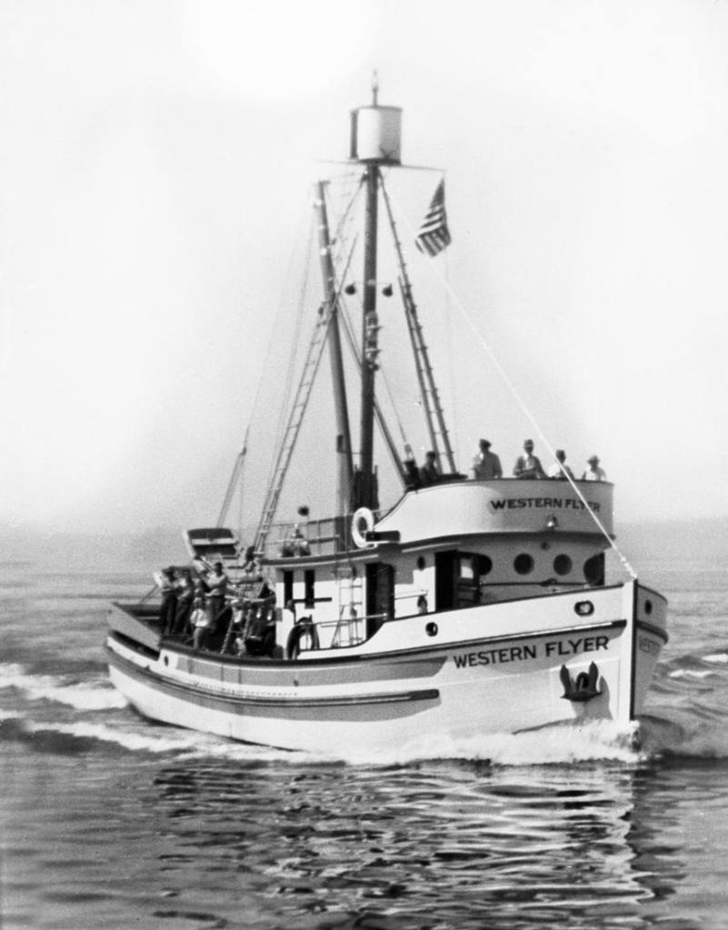
Specimen collection on the voyage of the Western Flyer began along the eastern coast of Baja beginning at the southern tip of Baja at Cape San Lucas then proceeded north along the western shore of the Sea of Cortez up to Puerto Refugio on Isla Ángel de la Guarda, the nautical midpoint of their voyage and the relative conclusion of their mission of specimen collection before returning to Monterey. The book details their six-week marine expedition made in 1940 from March 11 – April 20 where Steinbeck was accompanied by his friend Ed Ricketts, a marine biologist, and his four man crew, Tony Berry the captain, “Tex” Travis the engineer, and two able seamen, “Sparky” Enea and “Tiny” Colletto. Though there is no mention of her at all, Steinbeck’s then wife Carol was also on the voyage.
Aboard the Western Flyer, Steinbeck (second to the right) stands behind his wife Carol and other friends and crewmembers in 1940 before embarking to the Sea of Cortez. (Credit: Ed Ricketts Collection/Courtesy Western Flyer Foundation)
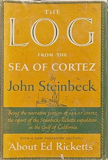
In 1951 The Log from the Sea of Cortez was published and was remarkable in that it was Steinbeck’s first non-fiction work which coincidentally laid the basis for understanding the emerging discipline of ecology, the branch of biology dealing with the relations and interactions between organisms and their environment, including other organisms. It seems to also give rise to his desire to reflect on what was a changing nation and world with the publication of A Russian Journal, Once There Was a War, Travels with Charley, and America and Americans. Not bad for a 1962 Nobel Prize winner in literature. Here is his acceptance speech, worthy in these days of uncertainty to think about: https://www.nobelprize.org/prizes/literature/1962/steinbeck/25229-john-steinbeck-banquet-speech-1962/
Ecology, this new way of connecting the varied life forms to their environment and the effects of competition for resources and survival about which Steinbeck lays out in The Log was greatly informed by his collaboration with Ricketts. But the work is also as much a book chronicling Steinbeck’s relationship with and his high regard for Doc Ricketts as he illustrated their thoughts on philosophy, science, culture, society, and politics. This was to become the well from which Steinbeck’s subsequent fictional and non fictional writing would spring. It is widely viewed as Steinbeck’s personal favorite endeavor.
The voyage and the converted purse-seiner, Western Flyer (Credit: Wiki)
When I first read The Log it was my introduction to citizen science as from Steinbeck’s perspective; his fascination by his friend’s understanding of the complexity of intertidal zones and his, Steinbeck’s, ability to write sublimely about the natural world and our human interface as Rickett’s secretary. Just as Wallace Stegner, Edward Abbey, and John McPhee have informed my construct of the West, Steinbeck opened my thoughts of the concept of Baja and direct experience. The Log’s narrative went beyond the dry taxonomic classifications of organisms found in an environment, broadening the scope of observation to include the interaction of organisms with one another and their environments along with the impact of the observers on these processes. Can the whole exist without the parts? Do the parts exist disunited from the whole? Questions of that sort and some beer drinking provided the perfect philosophical latitude and longitude as the waning days, absent the distraction of electrically powered devices, left us open to emulate “Western Flyer contemplation”. All that was missing was the bobbing of the casita, anchored on terra firma.
It is advisable to look from the tide pool to the stars and then back to the tide pool again… from The Log from the Sea of Cortez (1)
Los Chicos de Club del Placer In Pursuit of Adventure
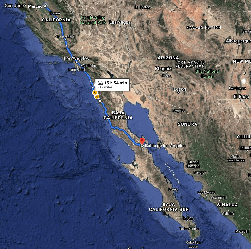
Destination: BOLA (Google Maps)
Finding our trips to be without a pretense of regard for science I couldn’t help but quietly view our experiences through the lens of the citizen scientist, unburdened by formal nomenclature, but with appreciation for some organization, to look beyond the pursuit of activity and recreation to try to relate to purpose of expanding understanding of the natural world as did the voyage of the Western Flyer some fifty years prior.
The Western Flyer sails again!
We had no urge toward adventure. We planned to collect marine animals in a remote place on certain days and at certain hours indicated on the tide charts. To do this we had, insofar as we were able, to avoid adventure. From The Log from the Sea of Cortez.
Come aboard with Emmy-award-winning actor and comedian Nick Offerman for a fun new look at the life, near-death, and resurrection of the famous old fishing boat in John Steinbeck’s The Log from the Sea of Cortez (1951). The Western Flyer with Nick Offerman
From the coast to the deep sea and from the tide pool to the stars, the nonprofit Western Flyer Foundation stirs curiosity using a blend of science and art inspired by John Steinbeck, Ed Ricketts, and their 1940 journey on the Western Flyer. Learn more about the vessel’s history, adventures, and exciting future or marine science and education at https://www.westernflyer.org/
The Pleasure Club rides again!
I suspect we achieved something of an inverse of the Western Flyer’s 95% observation to 5% adventure ratio finding brief opportunities to observe 5% of the time while “adventuring” the other 95% of our stay. The only marine animals we collected, we ate. Those we observed we respectfully admired.
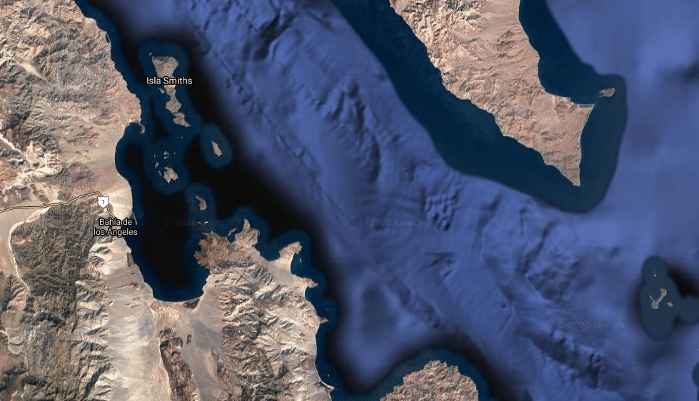
From space, BOLA (Bay of LA just to the left of the almost Mid-peninsula Isla Ángel de la Guarda), looks pretty deserted and awfully dry (Credit: NASA)
The 812± mile trip south was generally a two day affair where stops in Baja at a variety of humble communities were made. I do remember one non-stop, pedal to the metal trek when Dave, Dwight, and I drove through the night to meet Bob who would fly down after our arrival. I wasn’t sure if he just did that to impress us or if he really did have a major deal in the works that would keep him from joining us for the drive…
A quick stop in Ensenada to check out La Bufadora (Credit: Tj)
On another occasion, after a late start from Merced, we made a stop in LA to spend the night in a vintage Silver Streak at a trailer park on a bluff overlooking the Pacific. This after picking up the keys from Bob’s attorney in Beverly Hills whose “Silver Streak getaway” it was in which we stayed the night and whose primary residence where we picked up the keys was just across the way from (Aaron 90210’s) Spelling Manor. I guess Bob was a major wheeling deal maker…
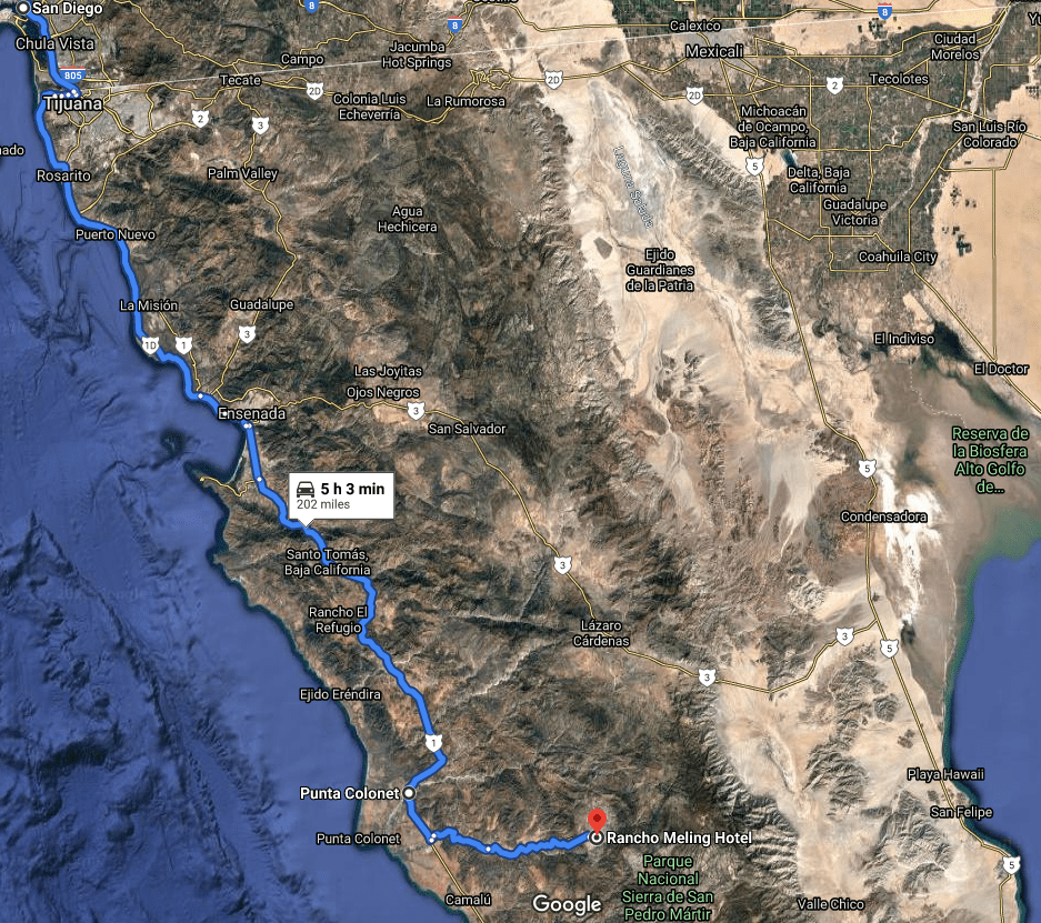
The next morning, and on other subsequent “non-major-wheeling-&-dealing” trips south, we were off to San Diego for the last reliable tank of gas which would then be followed by another 12-14 hours traveling on Carretera Federal 1 as the real adventure was to commence.
Crossing the border and leaving the rat race and fuel from known sources behind
Making our way through Tijuana as quickly as possible delayed stops until Ensenada or Punta Colonet. On one occasion, just south of Punta Colonet, we headed east to Rancho Meling, a legendary stop for endeavoring thumper and dual sport riding tourists and wannabe racers traveling the famed Baja 500 or 1000 routes. We spent night at the Rancho located at the base of the Sierra San Pedro Martir Mountains. To get there, at about 140 km (86± miles) from Ensenada you come to the small village of Ejido Diaz Ordaz where you turn left when you get to the signs for the Observatorio Astronomico Nacional and the Parque Nacional Sierra San Pedro Martir, the actual reason for the detour. Drive another 50 km (30± miles) east on a paved road until you get to the Rancho Meling entrance then turn right down the dirt road about 2 km (a bit over a mile). You have arrived.
Don’t expect the Ritz, but Meling Ranch is definitely the place for anyone seeking a taste of “Old Baja” (Credit: J and D’s Corner, looking east, from the Interwebs)
There we enjoyed horseback riding, great food, cold beverages, and a failed trip to the Observatorio. We aborted our effort to visit the observatory because we were stuck behind a broken down flatbed with sacks of cement, a mixer, and other materials bound for the observatorio on a very narrow single lane road. After watching the three members of the truck’s crew getting the truck started, running around to remove the rocks from behind the tires to keep the flatbed and cargo from careening backwards downhill, stalling the truck again, then running back to replace the rocks behind the wheels to keep the truck from, once again, careening downhill… We witnessed this at least half a dozen times, even getting out to help with the rock toting to prevent careening into Bob’s Suburban sending both vehicles and rock toting occupants from careening downhill. But BOLA called and we safely backed our way down the mountain, engine and brakes intact with no careening, intending to return to the observatory another day.
Observatorio Astronómico Nacional(Credit: Wiki)Parque Nacional Sierra de San Pedro Mártir… There’s an observatory rumored to be somewhere up there (Credit: the Interwebs)
Next stop along the way would normally be in San Quintín, some 600± miles from home. Here I recall we stopped for a delicious lunch of fresh langosta (neither a lobster or a prawn) at the The Old Mill. San Quintín had by that time become a multinational corporate agricultural region and destination for Americans to live part-time. Historically, People inhabited this area more than 10,000 years ago. Later they would be known as the Cochimi Indians. They learned how to live and survive on native plants, fish and wild game. In the more recent history, a British owned company had an idea to grow wheat that they would then transport by railway. Nearly a hundred English colonists bought tracts of land, planted wheat and built the gristmill. In the 1880s a train track was being laid, meant to hook up with the Southern Pacific RR in California. But the idea of wealth from this venture began to fall apart as a severe drought devastated the first harvests and the colonists abandoned San Quintin by 1900. There is said to be a 17-ton, six-wheeled locomotive underwater at the mouth of the bay. It must have been one heck of an accident and a story in its own right. Downright recalls to me the history of the Owens Valley and the Eastern side of the Sierra Nevada. (Source: The Baja Storyteller by Martina). Baja, like the Owens Valley, is filled with stories of boom because of vast resources and bust the result of over exploitation of resources and the people or the miscalculation of climate in terms of sustainability. Tourism, The Old Mill, and modern agriculture, however, are testimony to the resilience of the people and resources of Baja. Same for the East Side except for the agriculture part.
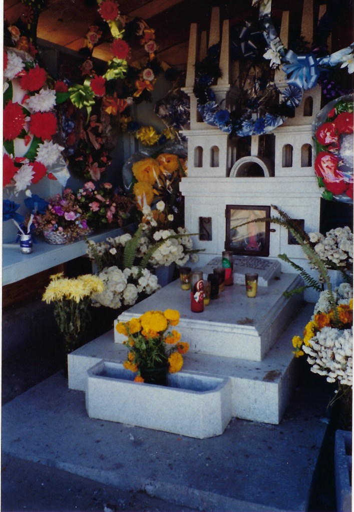
Dia de Los Muertos near San Quintín (Credit: Tj)
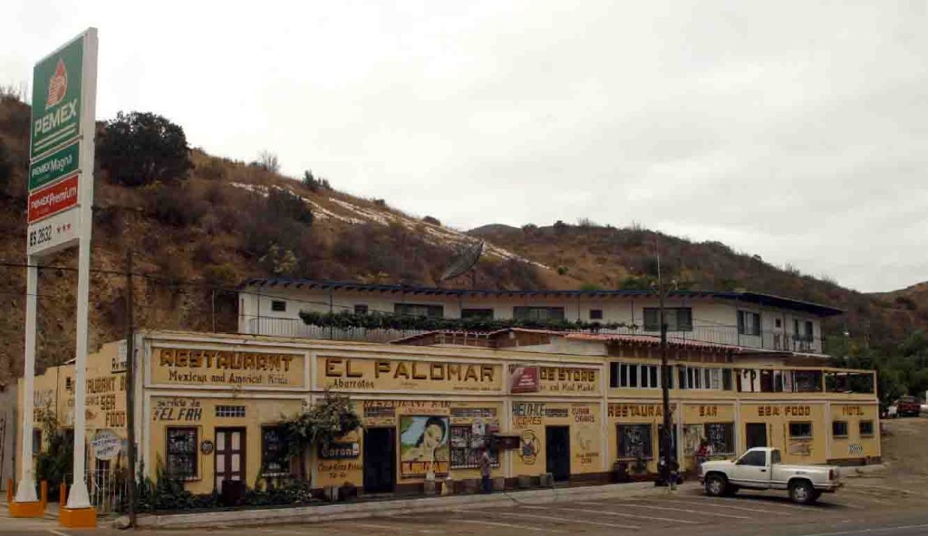
A mere 65 miles further when bypassing San Quintín involved a stop at El Palomar and yet another fine meal would give us a chance to stretch and “freshen up” while fueling up for the final remote stretch to BOLA. While we were anxious to arrive at Bob’s casita in LA Bay, lingering at the stop in El Rosario de Abajo was perhaps one of the most “spiritual” in the sense that the history of this area was revealed to us in a most visceral way. As you can see below, there is an abundance of moisture in this area, the result of favorable weather/climate influences of the Pacific Ocean. It is the site of the two earliest Dominican Missions founded in 1774 the Misión Nuestra Señora del Santísimo Rosario de Viñadaco that would be relocated along the Pearl River. (To learn of the history of area please refer to the following link with photos by David Kier: https://www.discoverbaja.com/2014/08/19/the-spanish-missions-on-the-california-peninsula-19-nuestra-senora-del-rosario-de-vinadaco-1774-1829/ )
As we investigated the adobe ruins along the Pearl River that empties into the Pacific we noticed a disquieting reveal beneath our steps of hundreds of bones of human remains that had been exposed by recent flooding along the banks of the river. It gave us pause to think of the hardships faced by the indigenous people upon the arrival of the missionaries.
In 1790, Padre Luis Sales wrote the following:
“In the year 1774 we were given an order to explore some territories in which to found new settlements and to establish the conquest of the heathen, and this in spite of the fact that the Franciscans had explored the locations indicated by the King and reported them as useless. Nevertheless, whether because of rains or the freshets of the arroyos, or other circumstances which I omit, a place with many heathen, called Viñatacót, was found, which served for the foundation of a mission named Nuestra Señora del Rosario, and it has turned out so prosperous that today it is one of the richest settlements, supplying much grain to maintain the neighboring Indians.”
Negotiating lodging and meals was much simpler than fuel (Credit: Tj) There’s a new mission in town… (Credit: Tj)
The Final Push to the Bay of LA
Magna Sin or just sin?
Obtaining fuel was one of the trickier transactions to make in Baja in that era. There were places where you could fuel up at a Pemex station, the only official (federal) outlets where you could purchase fuel in Mexico. Sin and Magna Sin were the two choices. The unleaded gasoline was called ‘Magna Sin,’ roughly translated: “without Magna” which was supposed to be free of magna, presumably lead, and have an octane rating of around 90. Forewarned, we brought additives to protect the recent model of vehicles we used. We also experienced a two tiered pricing phenomenon for Magna Sin of alleged, at best, but likely unknowable, octane rating. The Chicos del Club Placer, with toys in tow paid a slightly different price than locals. Generally a few pesos mas. That wasn’t quite the same experience when fuel of complete uncertainty was purchased on the side of the road siphoned from a barrel or jerry cans from the back of a beaten up pick-up truck. The law of supply and demand was not lost on the local mobile fuel supply entrepreneurs at whose mercy we were.
Señor, ten piedad de nosotros, as this is unlikely a Pemex franchise (Credit: Interwebs)
Before heading east across and then south along Carretera Federal 1 down center of the Baja peninsula we had to consider the remoteness of the terrain and whether there would be fuel at the turnoff to BOLA just beyond Cataviña or just before Punta Prieta near where Hwy 12 takes off to the east towards Bahía de los Ángeles. Our hope was at least there would be some relief offered by enterprising entrepreneurs, since the Pemex station at Cataviña was rumored to be closed. We were faced with the following calculus: It was roughly 150 miles from the Pemex in El Rosario to what was likely fuel of unknown origin at Punta Prieta and another 50 miles to Bahia de los Angeles. In my new 1992 Chevy CK-2500 pickup with a fuel capacity of 34 gallons and a rating of 12 mpg combined city/highway we had a distance of 408± miles between fill-ups. If we were traveling in Bob’s new 1991 Suburban, it had a 40 gallon capacity with a 13 mpg city/highway rating for a 520± mile range. Pedazo de pastel, right? But considering we were towing a boat, along with bikes, boards and other gear and with our passenger weight, in the mountains, a 30% reduction in fuel efficiency didn’t seem unreasonable. The challenge was on… It was LA Bay or bust!
Mission Hotel in Cataviña… A tennis court and swimming pool, but… … the gas station was, and apparently is, still closed in Cataviña (Credit: Recent photos from the Interwebs)
The uncertainty of fuel availability in Cataviña or Punta Prieta didn’t stop there. Another variable in our calculus was that uncertainty followed us to BOLA because there was no Pemex station there either. But Bob’s experience in LA Bay put us at ease as he knew that an entrepreneurial spirit reigned among the locals who would very likely be able to provide us with enough fuel to explore and get back to El Rosario. It seemed to be in their best interest to find a work-around the federal control over the distribution of gasoline. So in acknowledging the invisible hand of supply and demand, we weren’t too concerned as we could always trade one of our toys for a gallon or ten of fuel of unknown octane and origin. We were banking on the invisible hand because the round trip from El Rosario to LA Bay and back was 588 miles. Considering we had an optimistic range of 408 miles in the CK2500 and 520 miles in the Suburban that would leave us with -180 miles to explore in the pickup and -68 miles in the Suburban. This was, however, without considering our gross weight and the terrain effects on mpg. Even quantum mechanics, given my humble understanding, can’t reconcile negative miles of travel. There had to be fuel in BOLA! Perhaps Guillermo could hook us up…
Sonoran Desert scenery, boojums, cordon, et. al., near Cataviña, Baja (Credit: The Interwebs)
Driving in Baja was also an interesting exercise in interpreting intent, namely with turn signals. On many of the winding ridge routes where a quick glance down the canyons below revealed the rusting remnants of poorly negotiated curves, we would find ourselves behind a vintage quarter-ton pick-up with at least three tons of goods stacked precariously and towering above the bed and cab secured by, well that was generally undetermined. It was apparently common place for goods to be transported in such manner on the trans-peninsular mountainous portion of Highway 1 in Baja. Since my experience when using a turn signal was to indicate my intent to make a turn, it was, with caution I learned, when a turn signal ahead of us was used it may be to indicate the intent to turn or an invitation to pass. You might imagine the consequence of misinterpreting the intent of the driver of a sluggish vintage overloaded truck ahead. And that’s if his turn indicators functioned. The risk/reward coefficient of passing was in direct proportion to the angle of repose.
¡ BOLA Finalmente!
We survived the challenges of fueling, tolls, road surfaces, driving customs and behaviors, while never being stopped to pay a mortida tribute. But we did witness a shakedown of sorts by what appeared to be Sisters of the Unorthodox Crowdsourcing Order (Hermanas de la Colección de Dinero Poco Ortodoxa Charities) for the destitute, ill, and orphaned would on occasion, interrupt otherwise open roads. Once there was a menacing looking group of un-uniformed gents with semi-automatic weapons supervising the roadblock. I’m sure they were there for a twofold purpose: Protection as well as extraction. Needless to say, we generously donated to the cause of the orphans despite the unorthodoxy.
O’Day, pre-bent-mast, my new CK-2500, and Zodiac inflatable in the background… Not quite the Western Flyer. Then again we weren’t quite the crew of the Western Flyer (Credit: Tj)La Casita del Roberto with all of the pleasantries of home, simplified (Credit: Tj)
Bahía de los Ángeles, aka LA Bay, Bay of LA, & BOLA Coordinates: 28°56′53″N 113°33′37.44″W (Google Maps)
LA Bay, like much of Baja California, has a predominantly arid desert climate. At the north end of the bay lies Punta La Gringa and to the south is Playa Rincon. There are sixteen islands off the coast. On the eastern horizon lies the Isla Ángel de la Guarda separated from the other islands by the Canal de las Ballenas. The islands stretch all the way across the gulf forming a natural barrier against the tidal flow, consequently creating the optimum food balance for the urchins and anemones, shellfish, small fish, sardines, belocams, sea lions, mantas, dolphins, barracuda, sharks and ultimately ballenas (whales). To the terrestrial west are the Sierra de San Borja responsible for the occasional hot, dry winds known locally as “chabuscos” or “westies” whose velocities can go from zero to over 50 knots in a matter of minutes. These winds provided plenty of power for our sailboards, but great frustration for bike riding, sailing the O’Day, or hiking. On one occasion, arriving in the spring, no sooner than unhitching the O’Day and dragging it down to water’s edge did we hear a loud crash as the sailboat had been blown over, on the trailer, bare-masted and sadly thereafter, bent-masted. Fortunately Bob’s casita had a propane refrigerator and beverages were always chilled.
All of the creature comforts (Credit: Tj)Trusty steeds awaiting the calm following a chabusco (Credit: Tj)
On days when the winds weren’t savaging we would take the 17′ O’Day sailer or 12′ Zodiac inflatable out to investigate the flora and fauna of the bay and islands. The terrain around Bahía de los Ángeles provides nesting grounds for many species of sea turtles and birds, among the birds, elegant terns, Heermann’s gulls, brown pelicans, osprey, Anna’s hummingbirds, and a number of corvids. I learned from the local Museo de Naturaleza y Cultura that the waters contain all but about 10% of the known species of aquatic life common to the Sea of Cortez. The most common game fish is yellowtail (jurel), a type of sport fish that lives off the shore of California and Mexico. Yellowtail from this region of Baja can grow up to five feet long and can weigh up to 100 pounds.
Above Bob’s casita was a fresh water cistern on the aluvial slope that provided water for the kitchen and bathroom by way of gravity. To preserve the fresh water supply, we would take a five gallon bucket to the water’s edge to provide a salt water “boost” to flush the toilet. Apparently salt water had no effect on the little used septic system. One fine morning as I was dipping the bucket to provide the casita with abundant capacidad de descarga del inodoro, witnessing a glorious sunrise, I had to wade out perhaps 15 meters for a sufficient depth to dip as the tide was out. Gaze fixed on the sunrise, it wasn’t until I bent over to dip that I noticed the seafloor in my immediate vicinity began rippling. Soon, the seafloor for as far as I could see was erupting. I swear there were thousands of rays, presumably Mobula Munkiana, commonly known as Munk’s Devil Rays I’d likely disturbed. In true cartoon fashion, my inspiration for escape was none other than Wile E. Coyote…
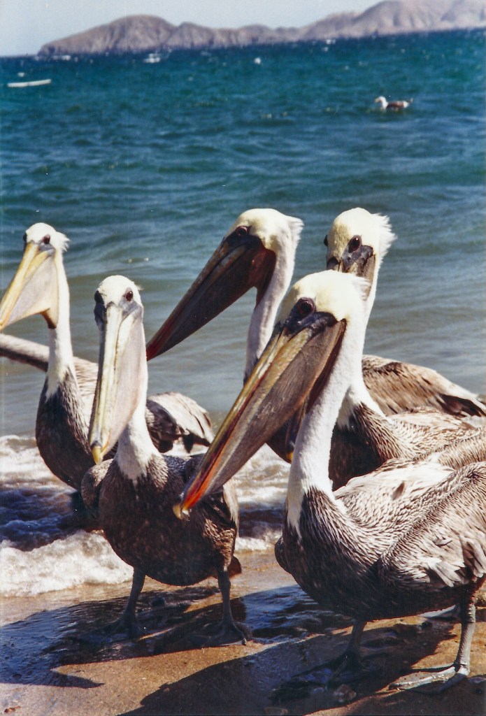
Top to bottom below: Los chicos anxiously awaiting the catch of the day, Rafael cleaning the catch of the day, and anxious pelicans waiting patiently for the spoils from the catch of the daty…
We would often feast on tacos de pescado and other delicacies from the gulf. On days we would enjoy the catch of the day, the pelicans scurried to enjoy the spoils of, on this day, sea bass. Other sport fish from the region included snapper (pargo), grouper, sierra, bonito and the occasional dorado. Non-sport fish like hammerhead sharks, triggerfish, barracuda, mantas, moray eels, sea horses, remoras, angelfish and many others exist in abundance.
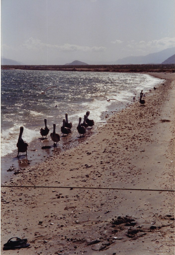
Clockwise from upper left: nesting osprey, a shoreline pelican parade, indifferent finbacks, lounging pinnipeds, frolicing pilot whales…
Kingdom: Animalia (Credit: Tj)
There are colonies of California sea lions near Isla Coronado known locally as Smith Island, and another south of Punta Animas, a clear water white sand inlet. The bay is also famous for its whale sharks that arrive in the warmer summer months. Other mammals include elephant, fur and harbor seals, sea lions, as well as finback, blue, gray, and humpback whales, pilot whales, orcas, and dolphin. Reptiles we observed included gila monsters and speckled rattlesnakes along with arachnids including scorpions, Baja recluses, and leaping spiders all of which kept us on alert.
Las Animas, a then vacant eco-tourist site (Credit: Tj)
Clockwise from upper left below: ironwood, cordons, bujums, chollas and various other prickly friends, Anna and her clutch, two flowering desert blossoms employing pollenizing strategies that occupy Queen Anna and a variety of other insects and birds, a legit desert wash along a hearty riparian zone, and a rock you’d think twice about sitting on…
Kingdom: Plantae with a guest appearance from an Anna’s hummingbird, calypte anna (Credit, Tj)
Terrestrial plants include a variety of cacti, shrub, grasses, flowering plants and other succulents adapted to the arid climate. There is a difference of 16 mm or 1 inch of precipitation between the driest and wettest months. The variation in annual temperature is around 13.1 °C or 55.6 °F. We generally enjoyed mild temperatures in the 60’s (F) in March and November. It in fact it rained for several days on one of the trips.
Lenticulars with a side of stratocumulus following (Credit: Tj)
Agave, barrel cactus, ocotillo, yucca, and boojum trees (alleged to be the inspiration for Theodore Geisel’s illustrations) cardons, cholla (known as O. molesta for good reasons: always keep a pair of pliers on hand to extract their nasty barbed spines), prickly-pears, elephant trees in the lowlands, Manilla and Guadalupe palms near springs, and Jeffrey pines and aspen at elevation. Mangroves exist in some of the island coves.
The elephant tree, pachycormus discolor (Credit: Interwebs)
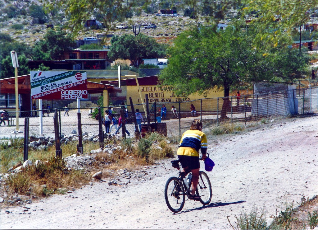
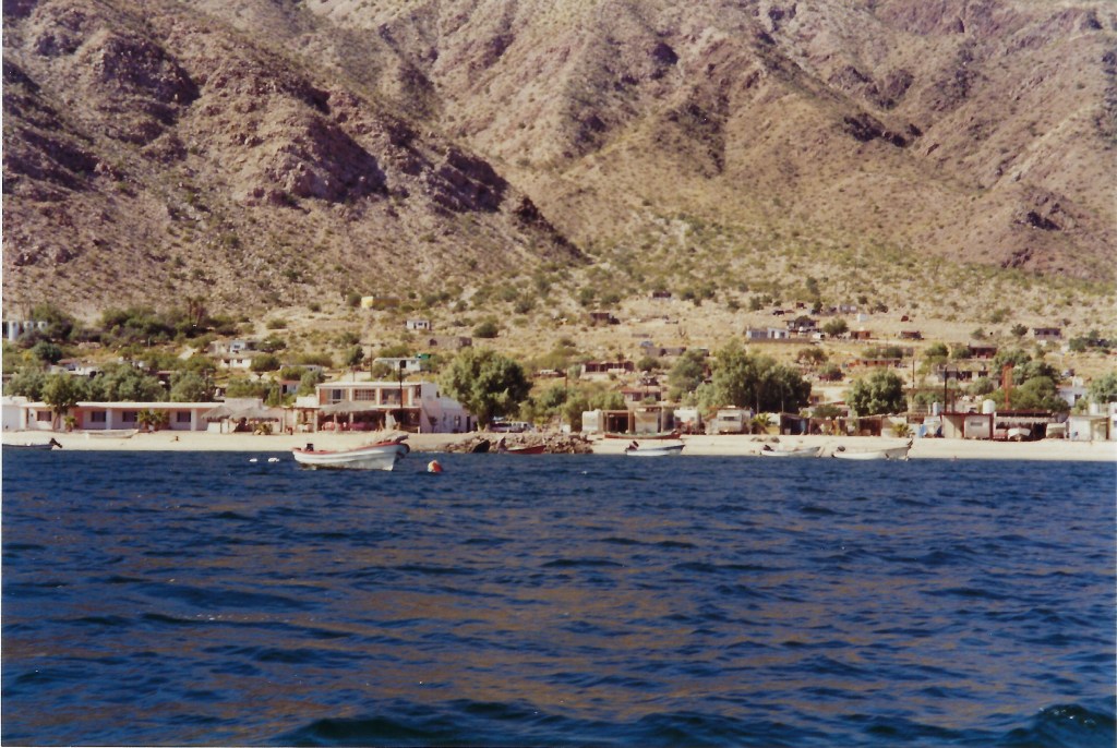
The village of LA Bay was approximately 7 km from Bob’s casita on the beach. A few restaurants, Guillermo’s and Las Hamacas, our favorites, a small market or two, a school, tortoise research station, ice plant, a couple of hotels, a liquor store (go figure), campgrounds, and museum pretty much made up the infrastructure in those days. Residents were sprinkled about in the hills about and above the village. Though I haven’t been back since, I understand the town has undergone many improvements that may or may not have resulted in benefit to the lifestyles of the locals.
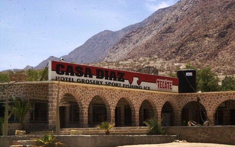
Village life top to bottom: Guillermo’s, local sportfishing with Rafael, the road into town, Bob arriving by air, LA Bay from up by the spring, Dwight pedaling by the school, Casa Diaz on of the earliest BOLA hospitality businesses appealing to the sport fishermen and Baja racers. (Credit: Tj)
Recreation was in great supply. From mountain biking up to the copper mines in the hills south of La Gringa to island exploration in the Zodiac and hiking around the village and up and down the beach made every day a new opportunity to explore the variety of life, land and seascapes.
Captain Dwight at the helm of the ZodiacFirst mate Tj looking for submerged obstacles on the O’DayBob unleashing the boardsCasita maintenance a necessity on each visitZen and the art of magnetically trolling for nails. Easier than repairing a flat
It’s appropriate to introduce my companions on these Baja Daze excursions. In the world of personality classifications, we all fit the Type A archetype: Type A and Type B personality hypothesis describes two contrasting personality types. In this hypothesis, personalities that are more competitive, highly organized, ambitious, impatient, highly aware of time management and/or aggressive are labeled Type A, while more relaxed, less ‘neurotic’, ‘frantic’, ‘explainable’, personalities are labeled Type B. (Wiki)
While you may think the behavior of four “alphas” would be ripe for conflict, our experience was quite the opposite. It must be that the slower pace of life had a “Type B affect” on us. I also suspect that having a regard, in fact a respect for what each of us brought, was the foundation for enjoying mutually satisfying experiences on these adventures. Bob, Dwight, and Dave are are driven independent business men whose appreciation for aesthetics and creativity is equal to their drive for success in their respective enterprises. Dwight and Dave are builders whose artistic flair runs the gamut from the subtle to the conspicuous, at times eccentric and always interesting. Bob’s business is in paving solutions that feature ecologically friendly products and he had a marvelous generosity for sharing his little slice of Baja. I, on the other hand, taught upper elementary students at the time. I believe my contribution to the enterprise was an unfailing enthusiasm for new experiences that captured the imagination of mi amigos. That and I was grappling with the end of a marriage and the recent illness and death of my parents. I wanted to escape and perhaps escape was just as tantalizing for my compadres, but for perhaps different reasons…
I just know that to this day, those times spent in Baja have lived within me and have provided me with a lasting faith in my relationship with the whole of life, the known and unknowable, as Steinbeck wrote, “Each of them in his own tempo and with his own voice discovered and reaffirmed with astonishment the knowledge that all things are one thing and that one thing is in all things–plankton, a shimmering phosphorescence on the sea and the spinning planets and expanding universe all bound by the elastic string of time.” My personal credo can be summed up as, the knowledge that all things are one thing and that one thing is in all things…
Left right, wait, that’s right left…Though we failed to find the manilla palm oasis the hike was a success since no one was bitten by a snake (Credit: Tj)
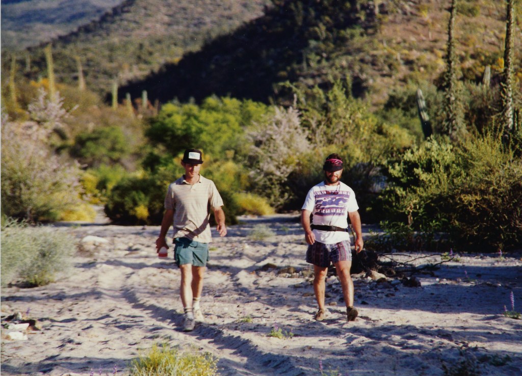
Typical of our exploration was a day spent in search of a fabled manilla palm oasis en route to Mission Borja. The search gave us the opportunity to hike up a wash for miles after the wash became impassable in the CK-2500. It didn’t take long to figure out that our 1.75 inch knobby equipped bicycles were no good in the sandy wash either. We don’t think we found the oasis. It was a good hike though.
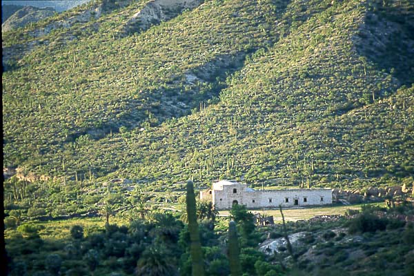
Not deterred by an unsuccessful/successful hike, we forged onward on another day in search of one of 26 missions established in Baja in the eighteenth century. San Borja was a Spanish mission established in 1762 by the Jesuit Wenceslaus Linck at the Cochimí settlement of Adac, west of Bahía de los Ángeles. Before becoming a mission, the future site of San Borja served as a visita or subordinate mission station for Misión Santa Gertrudis. The construction of buildings was begun in 1759. A stone church was completed during the Dominican period, in 1801. Wiki: https://en.wikipedia.org/wiki/Misi%C3%B3n_San_Francisco_Borja
The mission was abandoned in 1818, as the native population in this part of the peninsula disappeared. Hmm, I wonder how that happened. A few structures and ruins survive under the protection of caretakers.
We spent the night camped in the gardens of the mission. We did not see any of the members of the 8th generation family still caring for the mission on their property. It was a quiet evening with the moon illuminating the setting as clouds would pass by dropping a gentle rain providing the rhythm for contemplation, and a mystic visual feast. Another feast that evening… Right-out-of-the-can beef stew.
Accustomed to towing a Catalina 22, she excelled at transporting bicycles and desert friendly provisions.
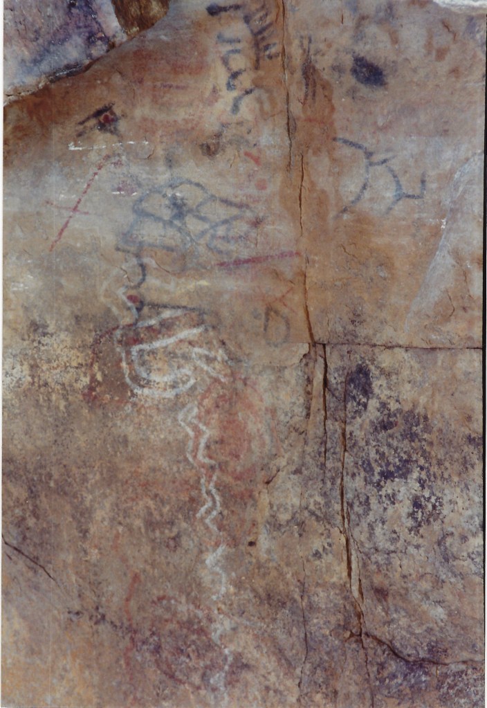
On another excursion on another day into the hills above Bahía de los Ángeles in the San Borja range we found an arroyo with cave paintings. We later learned these were the cave paintings of Montevideo. To reach this arroyo, we took a dirt road signed for Mission San Borja which goes south from the village a few miles west from Hwy 12 into Bahía de los Angeles. In two or so more miles a side road vered east and just beyond was a dry wash crossing with a short grade. The side road distance from where the intrepid CK-2500 could no longer progress to the painted cliff site was just a short hike.
Dwight confirming that we best not proceed any further in the pickupRock paintings we observed at Montevideo (Credit: Tj)
I’m pleased to learn that some measures are being taken to preserve what remains of the history and ecology of the Bahía de los Ángeles region. In 2007 Mexican President Felipe Calderón in cooperation with the nongovernmental organization Pronatura Noreste, Mexico’s National Commission for Protected Areas, the Global Conservation Fund (GCF) and others established the Bahía de los Ángeles Biosphere Reserve to protect the unique ecology of the region. It covers an area of almost 1500 square miles (387,956 hectares) and includes a portion of the Baja coastline, all 16 islands, numerous smaller islands and islets and the Canal de Salsipuedes and Canal de las Ballenas.[12][13][14] The reserve protects a diverse marine population including many endangered species including whale sharks, fin whales, California sea lions and five species of sea turtle.[15][16][17] The reserve is within the UNESCO “Islands and Protected Areas of the Gulf of California” Wiki: https://en.wikipedia.org/wiki/Bah%C3%ADa_de_los_%C3%81ngeles
Though the Village Was Quiet the Bay Was Alive!
I have many fond memories of the times spent in LA Bay hiking, biking, horseback riding, and sailing, but to have witnessed a feeding frenzy on the bay northwest of Isla La Ventana in the Canal de las Ballenas was one not soon forgotten. Since on that day I did not tote my camera along, memories are all I have. I recall a few trips in the Zodiac to investigate some of the nearby small islands across from Casa de Roberto on La Gringa. On this day, upon pulling into a cove on Isla Ventana and beaching the inflatable, we noticed a peculiar semicircular arrangement of hammerhead shark heads on an otherwise undisturbed beach. We figured local fishermen had cleaned their catch in the cove and left the heads to be discovered by unwitting tourists like us to be spooked, just as Steinbeck had noted earlier a suspicious feeling of being watched and unwelcome. Under the watchful yet indifferent gaze of a large number of gila monsters and other reptiles lounging on the rocks surrounding the beach we bid our deceased shark friends adieu dismissing any untoward intent by our hosts, deciding to check out Smith Island. On the horizon in the distance we saw what must of been hundreds if not thousands of seabirds, gulls, pelicans, and osprey, congregating and diving. Upon drawing closer to the disturbance we noted the surface of the bay roiling and not just from the exuberant bird activity. Feathers, oily water, and a stench filled the air along with menacing shadowy figures below the water’s surface.
A typical fishing map of the region
The apparent cause for the avian invasion was the migrating presence of untold masses of small feeder fish, nourished by the phyto- and zooplankton of the upper epipelagic or sunlight zone in an area of the bay between Punta La Gringa and the smaller islands north of Isla La Ventana where a deep channel lies beneath the surface of the bay whose denizens have hefty appetites. I’m not sure whether the arrival of the massive schools of fish was due to a specific occurrence like weather, the biological urge to reproduce, or the upwelling of colder nutrient-rich water from the deep channel to initiate the familiar nutrient-plankton-fish food web. It could be the frenzy was stimulated by the chaotic currents that flow vertically as well as horizontally in the bay or some other of the myriad natural causes. Hence the citizen scientist can only speculate. Whatever the cause, the birds seemed appreciative as they gorged upon the diminutive delicacies. What was most impressive were the several lurking Hammerhead sharks, huge mantas and other large dark masses swirling about in the depths. That caused me some concern seated in what was little more than an aquatic balloon with three other equally concerned members, bird poo and stench of regale notwithstanding. The uncontested rule of nature, “The big ones eat the little ones…” stimulates the imagination into wondering what other mysterious surface and subsurface predators were prowling these deeper waters of the gulf. You may note that my “risk” genes are not highly evolved.
After what seemed to be an hour of continually darting, weaving, and dive-bombing the unsuspecting waterborne morsels, the birds eventually tired or exhausted the day’s fare and withdrew for a rest on the neighboring islands. The beaches and rocky outcroppings became carpeted with reposing pelicans, gulls, and similar flying kindred compounding the layer guano. I don’t believe I’ve ever witness and assemblage of the diversity and number of animals in a particular place and time at once engaged in serendipitous collision of forces of nature.
Since I have no evidence of the frenzy we watched on the bahia, I did find this brief video on YouTube from Los Angeles (CA) that resembles the scale of the birds we observed without the other larger sea borne predators that were present. Imagine being in the open water in an inflatable within yards of this phenomenon…
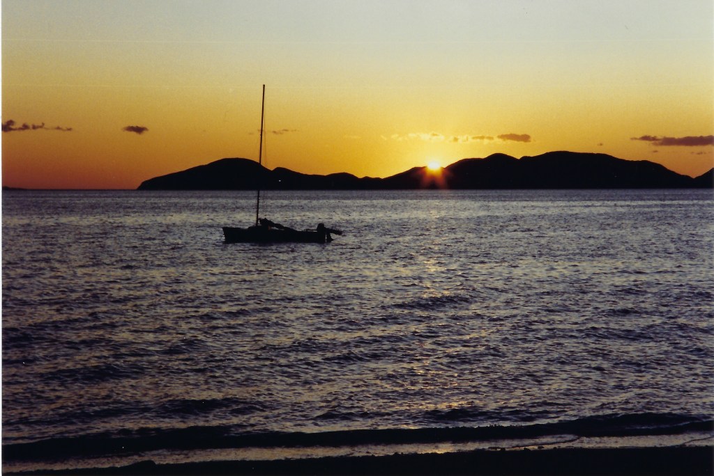
The Midriff, as this region in Baja is known and as I’ve noted is home to an extremely wide variety and richness of plant, animal, insect, and fish species, including all of the usual suspects for an arid desert bound by the Sea of Cortez, plus a large roster of other “weirdo” critters satisfying the species hunter seeking to add notches to his or her lifetime list. At LA Bay as many gringos call it, the most beautiful moment on most days comes at sunrise when a resplendent golden hue casts over the terrain or at sunset when the village lies deep in the shadow of the surrounding Sierra de San Borja and the islands and hills across the bay are bathed in an otherworldly magenta-lavender light, not unlike alpenglow in the Sierra. This is seen nowhere else in Baja.
As I sit recalling and writing of those singular experiences in the company of friends in an exploration of life, like that of the crew of the Western Flyer, exempt of concern about “matters of great importance we had left [that proved] were not important,” I am reassured that in the direct relationship among a small band of like minded, yet completely independent companions, on a journey of discovery, a wealth of understanding may be obtained.
Okay Dave, there’s the Pacific Ocean. So, I got us down to the beach. Do you think you can get us off?Getting onto the beach was easy. Dave and Dwight engineered a driftwood highway solution to get us off the beach. Last chance for a souvenir before crossing the border at Tijuana (Credit: Tj)
Our own interest lay in relationships of animal to animal. If one observes in this relational sense, it seems apparent that species are only commas in a sentence, that each species is at once the point and the base of a pyramid, that all life is relational to the point where an Einsteinian relativity seems to emerge. And then not only the meaning but the feeling about species grows misty. One merges into another, groups melt into ecological groups until the time when what we know as life meets and enters what we think of as non life: barnacle and rock, rock and earth, earth and tree, tree and rain and air. And the units nestle into the whole and are inseparable from it. Then one can come back to the microscope and the tide pool and the aquarium. But the little animals are found to be changed, no longer set apart and alone. And it is a strange thing that most of the feeling we call religious, most of the mystical outcrying which is one of the most prized and used and desired reactions of our species, is really the understanding and the attempt to say that man is related to the whole thing, related inextricably to all reality, known and unknowable. This is a simple thing to say, but the profound feeling of it made a Jesus, a St. Augustine, a St. Francis, a Roger Bacon, a Charles Darwin, and an Einstein. Each of them in his own tempo and with his own voice discovered and reaffirmed with astonishment the knowledge that all things are one thing and that one thing is all things—plankton, a shimmering phosphorescence on the sea and the spinning planets and an expanding universe, all bound together by the elastic string of time. It is advisable to look from the tide pool to the stars and then back to the tide pool again. Ch. 21 from The Log From the Sea of Cortez
I often think of Baja. And as it is a thought, a memory, it is also a feeling and a knowing. I hope to travel there on the moto in the not too distant future. I don’t know that I will capture the feeling that lies within me from those first encounters. It would be nice to be once again joined by El Club de Placer del Chicos for they are as much a part of those thoughts, memories, and feelings that I know came to me at a very important juncture in my life. For this they have my eternal gratitude as does this place, a living thing that is a part of me and I will forever be a part of Baja. As Steinbeck understood, “…all things are one thing and that one thing is all things… And the units nestle into the whole and are inseparable from it…”
.
The Sun sets …
The Moon rises…
Who says ya’ can’t get no satisfaction…
The use by date has since expired from one of my prized mementoes of the last trip down to Baja*. It is in need of refreshing…
*And the ballena sings… (Credit: Tj)
Claimers & Disclaimers:
All photos are mine (Tj) unless otherwise credited. All others are ripped from the interwebs with lame attribution.
All recollections are subject to natural age related memory loss or confabulation, a memory error defined as the production of fabricated, distorted, or misinterpreted memories about oneself or the world. People who confabulate present incorrect memories ranging from “subtle alterations to bizarre fabrications”, and are generally very confident about their recollections, despite contradictory evidence.
If it hadn’t been for remodeling and locating my photo album of Baja in the process of the shuffling about of the various contents of our home and the current Covid-19 crisis requiring age related social distancing and homesite hunkering I might have foregone this post. That I’ve been idled (READ: not infected!) by the CDC’s recommendation to avoid our invisible friend, there may well have resulted a few subtle alterations in my recall as the apocalypse rains down. I assure you, anything appearing to be bizarre was accurately recalled if only somewhat exaggerated…
It all began as an invitation from Andy Neufeld to ride the moto, with whom in countless chance meetings at the supermarket or hardware store our conversation always ended with, “Let’s get together and ride some time…” The body of the emailed invitation follows:
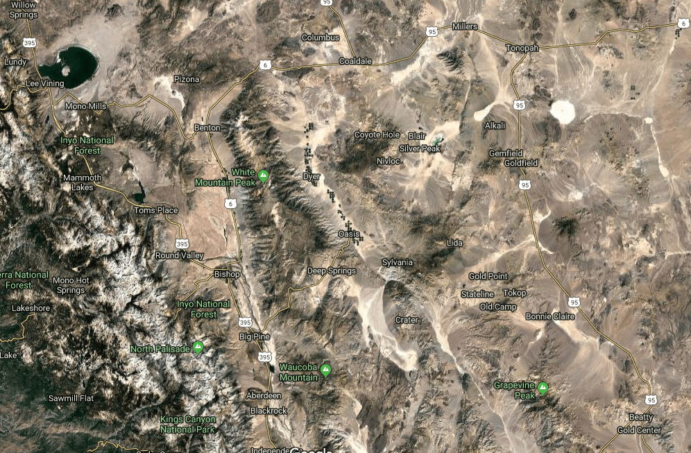
“Please get your bike (and your core) in shape and join me for an October ride. I propose that we leave Merced on the morning of Saturday, October 12 and cross over Yosemite National Park via Tioga Pass Road.”
“I propose that we then continue south from Lee Vining and stay the first night either near June Lake or near Mammoth Lakes. Mammoth is the more populated and busy of the two areas and it’s a little further along the route but in my opinion, June Lake is more desirable.”
“From the Lakes area I propose to travel to Panamint Springs and rest there through the middle of the day. Panamint Springs is a bit on the rough side as tourist destinations go. There are, however, hot springs and resort environments. There may be beer available for purchase. “
“When the sun goes down in Panamint Springs I propose to travel across Death Valley by the light of October 13th’s full moon, arriving late at our next destination, which will be Beatty, Nevada.”
“After a night in Beatty, we will travel north through Nevada and turn west toward Lee Vining, where we third and final night. The next morning, it’s back home through Yosemite.”
“I am inviting 4 people for this ride. If you can come, you are welcome to invite others. Please let me know if you are able to come, and how many you will be, and I will get to work finding us places to stay!”
I always get excited when invited on a ride. Especially one that comes with an itinerary and disclaimers and endnotes:
Weather can ruin everything. It can certainly change plans without notice. We’ll have to deal with it.
In my imagination of this trip, the riding will be the roughest part. No sleeping on the ground or eating out of cans.
There should be no expectation of any standard of any sort for gear or machines.
There are lots of individual decisions to be made and people might join late, leave early, or generally go off on their own paths at any time.
Sound like fun? Then let’s go!
Little did I know what was meant by disclaimer (or note) iv, “There are lots of individual decisions to be made and people might join late, leave early, or generally go off on their own paths at any time.” Especially the “go off on their own paths” part…
Day 1, Up and Over Tioga Pass
It doesn’t take much of a reason to get me packed and ready to roll as the sun rises…
Say a reason like, remodeling one’s kitchen and baths.
A disclaimer of my own:
Sadly, WordPress won’t allow directly embedding any of the video I took from the moto. I would first have to publish it on YouTube and link the content. I’m new at the whole GoPro thing, but there were several spectacular clips riding over Tioga Pass that would have added to the beauty and feel of the ride. The old dog needs to learn some new tricks… That’s why there are no photos of our crossing.
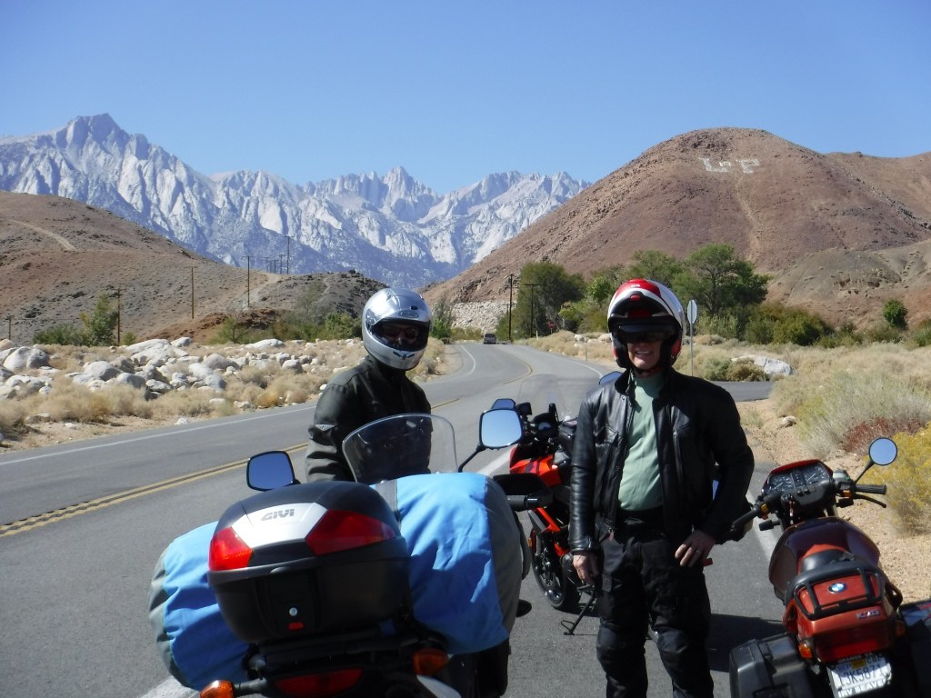
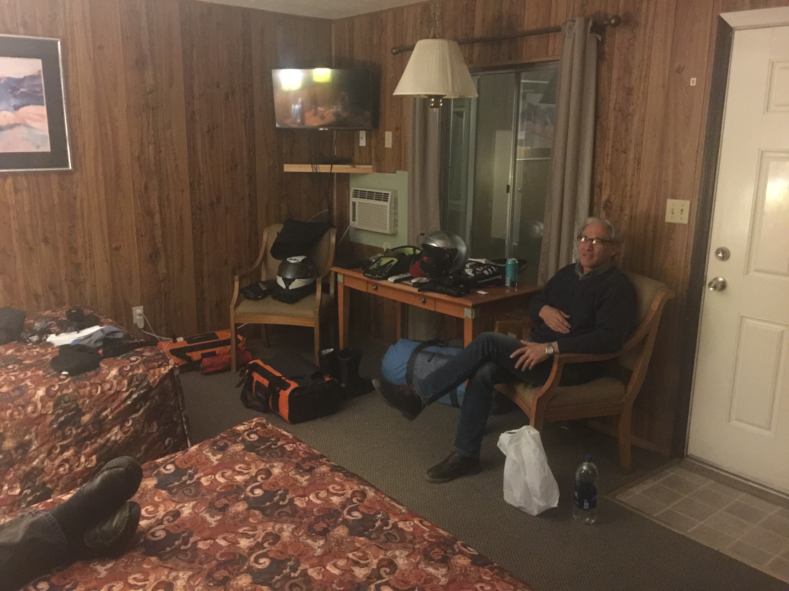
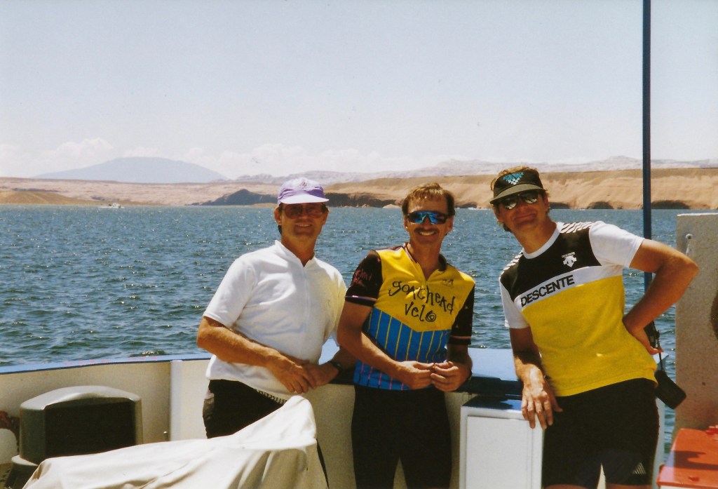
Another friend, fulfilled Andy’s generous offer to invite others and ignoring his second end note or disclaimer (ii), Pete Etchegaray, who you might have noticed has appeared in several of my previous moto adventures. Pete and I planned to camp. We drew the line at eating out of cans however.
Stoked to travel over Tioga Pass in the fall to enjoy the splendor of an East Side autumn was a deliciously seductive reason to ride in October. Sunny days and chilly nights were perfect, especially since we’d come off of a debilitatingly hot summer and that we’d only be riding through the night on the Death Valley leg of the journey. Perfect!
If you look closely, there’s a black air duct just above the cylinder head as we paused for a PS in Coulterville
Seems to me Coulterville could use a visit from Kevin Bacon…
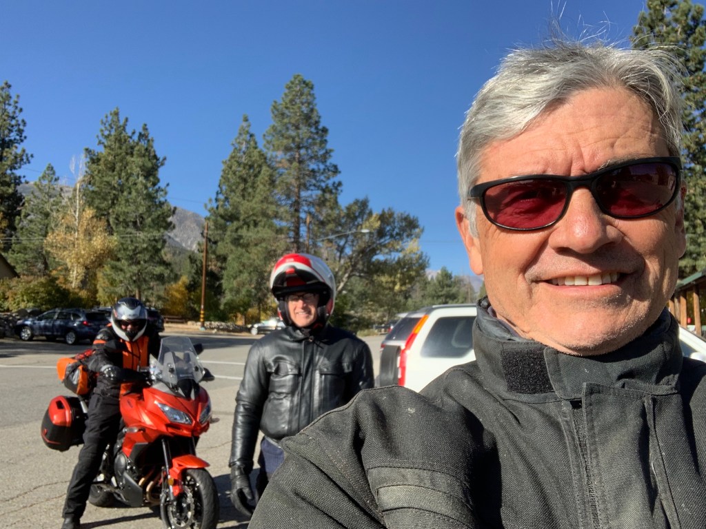
We began the ride by making our way to Hwy 120 via Hwy 59 north through Snelling, Merced Falls Rd. and Hwy 132 to Coulterville, Greeley Hill Rd. to Smith Station Rd. and the northern route through Yosemite. With the exception of a brief delay on the Greeley Hill Rd. leg to look for, but sadly not find, an air duct that fell off of Andy’s “Flying Brick”, we arrived in Lee Vining at the Whoa Nellie Deli for a snack around noon.
Pete who upgraded from his iPhone 3 to an X has become an expert at selfies; this one from Lee Vining
Compare Pete’s technique with IOS and Andy’s with Android
Andy (center), Pete (Right) and Yours Truly (rank amature selfie taker) at Karl’s Chevron Station in Mammoth where a quick headlamp change would improve my night riding vision
We arrived in Mammoth intending to meet with a veteran bicycle riding comrade, Karl Teller to exchange mockery, insults, and other juvenile impudence. However, as once before on an earlier Autumn East Side Moto, Karl and his son Johnny were off bow hunting elk. I guess next time I come to visit I’ll check the California Fish and Wildlife Big Game Hunting Digest to see what’s in season and when…
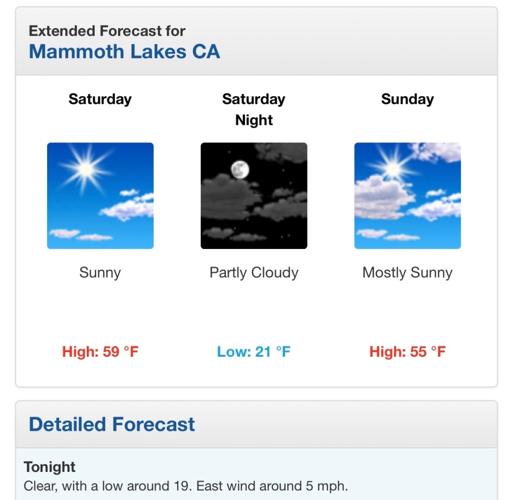
After a fine dinner at Roberto’s in Mammoth watching the sun set over the Sierra, the night chill began to weigh on our decision to ignore that second endnote as we motored back to the Sierra Nevada Lodge. We decided to disavow the notion of camping choosing instead to awaken in a warm motel room rather than a frosty campsite.
Warmth, like discretion, seemed to be the better part of valor as data driven decisions made sense
Data driven
Danny driven
Day 2, Elevation Extremes
Awakening to another clear sunny day, though chilly to be sure, we set off for breakfast at the Tom’s Place Resort, Cabins, Lodge, General Store, Cafe & Bar near Crowley Lake down Hwy 395 from Mammoth.
Pete having mastered the selfie in front of the TPRCLGSCB where darned good corned beef hash and eggs is served daily
Manzanar Camp
Having time but little distance to make our afternoon destination in anticipation of the full moon rise, we took a side trip up to Whitney Portal along the way stopping at the Manzanar Camp, a U.S. National Park Service Historic Site just north of Lone Pine. A little history thanks to the NPS:
Of note Andy (upper right), an avocational hand tool woodworker, is examining a handmade rice steamer whose fabricator only used dowels, mortise and tenon and dovetails.
I highly recommend touring the Manzanar Camp. I recall my first visit some 40+ years ago when the visitor center facility that is now a remarkable interpretive, interactive, historical museum of Smithsonian caliber was then a road maintenance facility for Inyo County. If timed right, you could jump the fence, trespassing, and examine the camp’s ruins back then. Today the Park Service has reconstructed many of the features of the camp with the compelling story of the hardships imposed on the interned, but resourceful and dignified Japanese American citizens during WWII.
Not likely to make the 400n-th movie
Upon arriving at Lone Pine for fuel and a mid-day snack, we were diverted from Hwy 395 to B Street so that a parade could commence commemorating the Lone Pine Film Festival. It seems that movies had been screened for three days, all day long and the event was wrapping up with a parade and later a campfire.
In 1920, Lone Pine was changed forever when a silent movie, The Roundup, was filmed in the Alabama Hills. Since then, over 400 movies, 100 TV episodes, and countless commercials have been shot in location in the area, immortalizing the striking rock formations and taking advantage of the picture-perfect weather.
I’ve always enjoyed spotting Mt. Whitney in as a backdrop to many of the western films I’ve seen over the years. Indeed the mountain is the star!
Whitney Portal
The East Side of the Sierra Nevada Range or what Mary Austin called “The Other Side of California” is captured in John Muir’s concise description, “In general views no mark of man is visible on it, nor anything to suggest the richness of the life it cherishes, or the depth and grandeur of its sculpture.”
The road to the road’s end at the portal is filled with stunning views of the peaks above and the valley below, each stretch of pavement revealing the majestic geology characteristic of this extraordinary western landscape. You have to overlook the road, movie crews, and other folks bagging the YOLO hike up to Whitney summit to appreciate Muir’s description, however, there is this…
Top pic below: Pete, Andy, and Mt. Whitney with a guest appearance by the official LP ‘Bama Hill; Next pict, Tj and Mt. Whitney; 3rd pic, Andy as Motaur; Last pic in the series, the Owens Valley, Alabama Hills, the southern terminus of the White Mountains, and what’s left of Owens Lake…
Pete on the rocks followed by a sweeper, neat, back…
Onward to Panamint Springs
No trip to Death Valley would be complete without entering the park from the north out of Lone Pine. After a brief reach on Hwy 395 south from Lone Pine to the intersection with Hwy 136 we headed in south-easterly direction through the settlements of Dolomite, Swansea, Keeler, all having seen more prosperous days when silver ingots were hauled by steamship across Owens Lake and then by rail to Los Angeles from ore mined at Cerro Gordo in the 1870’s. Had Andy and I been on more adventure worthy bikes like Pete’s V-Strom, we would have taken the 4×4 road up to the ghost town. Cerro Gordo will have to wait for the next bike upgrade.
History lesson: The 1872 Owens Valley Earthquake interrupted mining briefly rendering a pier in Swansea inoperable so enter Julius M. Keeler whose steamship “Bessie Brady” brought ore from Keeler across the lake to the town of Cartago. 1882 the Bessie Brady was destroyed by fire. There was a 300-foot wharf at Keeler, and the steamship route cut days off the time a freight wagon would have taken to circle the lake. She carried 700 ingots at a time in a three-hour crossing. Silver prices in the late 1800’s plummeted so the next boom of zinc, rallied the town along with small surges in the mining of silver, lead, and limestone. However, by the 1950s all mining had ceased. Train service was stopped in 1960.
A few reminders of those better days remain as does a small population of residents in Keeler.
The Carson-Colorado Rail depot (left) and Keeler Post Office (center) and no-gas, gas station (right)
A Catholic Priest and a Jedi Knight
Continuing east on Hwy 190 we rolled up and down, but more down than up considering we were heading towards Death Valley into Panamint Springs. The highway takes you through Rainbow Canyon (nicknamed Star Wars Canyon and Jedi Transition) just inside Death Valley National Park in Inyo County on the park’s western border. It is commonly used by the United States Air Force and Navy for fighter jet training and is frequented by photographers who, from the canyon rim at the Father Crowley Overlook, are able to photograph jets flying beneath them.
No jets today Pete, who is neither a priest nor Jedi Knight, as far as I know…
History lesson cont.: Father Crowley, for whom Crowley Overlook is named, is also the namesake for Lake Crowley, just north of Tom’s Place. Upon the completion of the Los Angeles Aqueduct in 1913, the diversion of the Owens River by the Los Angeles Department of Water and Power took the water from the the “Land of Little Rain” along 223 miles to Los Angeles, resulting in that city’s phenomenal growth. No mystery in the corresponding decline of the Owens Valley farms as the once verdant and productive agricultural economy collapsed. Before long, the verdant valley was returned to desert conditions where the vegetation consisted largely of greasewood and sagebrush. It was in this harsh environment that Fr. Crowley would live during his years of service to the area. With the demise of agriculture as an economic base, Fr. Crowley turned to tourism as a potential means of helping the valley residents survive. Learn more at: https://www.catholic.org/featured/headline.php?ID=1576
Tourism, that’s what gets a lake and and overlook named in your honor on The Other Side of California.
The Panamint Springs Resort in the 1950’s (top) and today…
Slipping into Darkness
After a fabulous burger and a thirst quenching draft we retreated to our respective corners. Andy found a lovely ironwood tree to nap beneath at the Panamint Springs Resort. Pete and I schemed to get a tent campsite and lodging for Andy so that we could enjoy the serene beauty of a night in the Panamint Valley as we had in the prior spring. Since riding across Death Valley under the cover of darkness illuminated by a full moon was the raison d’être, we thought we could use the resort as our base camp and tool around Death Valley and return to the camp that evening. After awakening Andy, since it was his inspiration to ride under the full moon to Beatty, we folded. After fueling up, we set off for Furnace Creek.
From a previous trip in 2016 (See Sand to Snow) we intended to catch the sunset from atop Zabriskie Point.
Since we were only 140 miles into our 290 mile day we topped off our tanks with some expensive petrol and as the sun was disappearing quickly, we bypassed the road to Zabriskie Point for the sunset. Besides, it was closed for repair, thus beginning our trek across Death Valley (278.5 feet below sea level at Badwater) in the fading light of the day. Seeing a young coyote alongside the road in the fading twilight–the soft, diffused light from the sky when the sun is below the horizon, either from daybreak to sunrise or, more commonly, from sunset to nightfall, or, a state of uncertainty, vagueness, or gloom–? You decide as I began to wonder about other potentially somewhat immovable obstacles that might wander onto the road. You know, like a freed descendant from the 20-Mule Team or Death Valley Scotty’s great, great, grand burro enjoying a saunter in the full moonlight. But the air, much cooler than the temperate mid-eighties of the afternoon and the low angle of the setting sun made for a dreamlike landscape and collision concerns briefly faded. Blissful optics only lasting for a few miles so we hunkered down keeping eyes peeled for any critters or road conditions that might detract from the otherwise surreal ride.
Fooled by the Full Moon
We didn’t really see the moon or enjoy it’s illumination until we had pretty much climbed out of Death Valley and began heading east on Hwy 190 crossing the Funeral Mountains. Finally, upon seeing the moon rise over the Funeral Mountain Wilderness Area, we pulled over. It wasn’t disappointing, it was just sort of not as we had imagined. Bundled up in ATG and concentrating on the road, the whole full moon affect was not so much noticeable. At least not like cross country skiing across a frozen Ostrander Lake, hiking above the treeline on the Sierra over Muir Pass, or sailing on the San Francisco Bay under a full moon. Besides now it was getting cold as we climbed up Hwy 190 out of Death Valley and we had variously been on and off the bikes for 12 hours. Fortunately the glow on the horizon of Amargosa Springs gave us inspiration to keep going so that stopping and adding a layer of insulation would make the final 70 mile leg possible, if not a little more bearable, in wind chilled to the single digits according to Pete’s V-Strom ambient temperature gauge.
Andy as the OH (original hipster) in minimalist leather and jeans…
From Wiki: Amargosa Opera House and Hotel is a historic building and cultural center located in Death Valley Junction, in eastern Inyo County, California near Death Valley National Park. Resident artist Marta Becket staged dance and mime shows there from the late 1960s until her final show in February 2012. The Death Valley Junction Historic District is on the National Register of Historic Places and is owned by the nonprofit established by Becket for the preservation of the property.http://www.amargosaoperahouse.org/
Next trip along Hwy 127 the Amargosa Hotel is a must stop to stay the night…
The theater was part of a company town designed by architect Alexander Hamilton McCulloch and constructed in 1923–25 by the Pacific Coast Borax Company. The U-shaped complex of Spanish Colonial Revival architecture style adobe buildings included company offices, employees’ headquarters, a dormitory and a 23-room hotel with a dining room, lobby and store. At the northeast end of the complex was a recreation hall used as a community center for dances, church services, movies, funerals and town meetings.
Had we only known that the now hipsterish AH&C served, “Delicious entrees and nourishing choices with ingredients sourced from a surprising abundance of local artisanal growers. No visit to the Death Valley region is complete without the discovery of how well you can eat in the desert!” (from the Amargosa Hotel and Cafe website), we could have gotten rooms enjoyed artisanal abundance and ridden those 70 miles the next day in the warmth of daylight.
Spacing Out in Beatty
This guy must have had one too many hot dogs from the Rebel 74 convenience store
Riding Hwy 127 across the Nevada border then on Hwy 95 to Beatty was to say the least, a bit of a let down. The first hour of the night ride from Stovepipe Wells was sublime. The second hour of the night ride to Amargosa Springs was “interesting”. The third hour of the night ride to Beatty was agony. Cold, hungry, and in the dark on a motorcycle riding up a lineal two lane undivided highway heavy with triple tractor trailer rigs isn’t my idea of a great time. Given my latent masochistic nature though, I kind of enjoyed the suffering. I think we all did and if by our subdued manner upon reaching the hotel was any indication, the distress was nary mentioned.
I did express early in the planning stages that when we arrived in Beatty, if too beaten up to pitch a tent in the cold at 10:00 pm in the dark, maybe staying at the Atomic Inn would be just the thing… to do… in Beatty Nevada. From their website: “The Atomic Inn is a retro themed classic style Death Valley lodge located in the Eastern Mojave Desert in the Wild West pioneering town of Beatty, Nevada. We are the gateway to Death Valley National Park, located just 6 miles from the Hell’s Gate Entrance! Established in 1979, The Atomic Inn has been under new management since 2012. We have completely remodeled the rooms in our boutique, themed hotel to offer the finest Death Valley accommodations in the area. However, we do remain the most affordable of Beatty Hotels.”
Pause to think what “boutique” and “most affordable” in separate sentences means. Yep. You can tell you’re in quality affordable boutique lodging by noting the preserved 70’s era wall panelling and luxurious see through bath towels that also work as dermabrasion devices. Notice the classic Nevada landscaped theme in the bedding…
It was late so in lieu of a hot dog from Rebel 74 gas station (note Andy grasping his stomach having eaten one…) Pete and I opted for a tasty boutique microbrewed beverage. 40 years ago such a thing didn’t exist in Nevada. 40 years ago the Atomic Inn wasn’t a boutique inn either.
Day 3, Columbus or Indigenous I’m Not
The following Columbus/Indigenous Peoples’ Day morning awash with sun shine was much warmer than just a few hours earlier. Packing before breakfast, Pete a conspicuously minimalist rider and aspiring hipster, finished first while I was wrestling with my strap dense DrySpec bags as an aspiring geezer. Andy was enjoying a few extra minutes of snooze as a seasoned OH would. Pete happened to meet fellow motorcyclist who had also spent the night at the Atomic Inn and who is a member of the Women In The Wind motorcycle club. She had been on the road for a few days hailing from Kingman Arizona and was enroute to a club gathering on the coast of California, at Morro Bay or Monterey if memory serves, or somewhere in between. It seems the Atomic Inn appeals to we wind therapy seeking types notwithstanding gender or club affiliation. It’s also testimony of Pete’s uncanny ability to meet and collect the stories of fellow motorcyclists.
What would we call our club, Silverbacks in the Dust?Pictures from of the interwebs… It appears that Alice doesn’t work here anymore.
After a nice breakfast of corned beef hash, eggs, and hashbrowns at Mel’s we were caloried-up for the ride ahead to Lee Vining for the night. The service was a bit slow because the place was packed. We were only one of two tables where English was spoken. There were families and couples of French, Dutch, Asian and Spanish speakers, all of whom apparently have a knack for finding places like Mel’s. It may have some renown in the Yelps or TripAdvisors of the interwebs and therefore attracts unwitting foreign tourists. I’m sure the tired kitsched-out Happy Days theme is uncommon in Flanders or Paris. There was one hitch in an otherwise fine, yet ordinary breakfast experience. A churlishly rude and ill tempered waitress, far more so than the fabled surley servers at McSorley’s Ale House in NYC, seemed indignant to have to take orders or deliver plates. She had the customer service skills of Social Security aged Bevis and Butthead. Fortunately, we had a much nicer, younger, and far more affable waitress. Maybe if you live in Beatty long enough it changes you…
After a slight navigation error (uh, my bad) our attempt to visit Rhyolite and the Goldwell Open Air Museum installations fell flat as temperatures were rising and miles and miles of nothing but miles and miles lay ahead. https://en.wikipedia.org/wiki/Goldwell_Open_Air_Museum
Ghost Rider, Lady of the Desert, and the Last Supper
Passing through Beatty once more, having traveled some twenty miles in the wrong direction, we righted our course and lo and behold we encountered our first true sign that we were definitely in Nevada.
Now closed, Angel’s Ladies Brothel in Beatty, Nevada. Perhaps the ill-mannered waitress is a disgruntled former employee or maybe a surviving passenger?
Oops, I (He) Did It Again
Our day included the option to head north on Hwy 95 to Lida Junction (home of the boarded up Cottontail Ranch Brothel) (Like Amazon, has the interwebs delivered the demise of the local Brothel?) then west on Hwy 266 to the Oasis junction then on to Hwy 168 over the twisties up and over Gilbert Pass to Big Pine. Another option was to travel further north to Tonapah then head west on Hwy 6 to Benton Springs. None of the three of us view love as a game nor do we have any affection for Tonopah. I don’t think Britney Spears, whose lead single from the album by the same name, Oops I Did It Again (not Tonopah), had geography on her mind when belting out the song on MTV in March of 2000 following the Y2K scare. Nor do I think she ever performed in Tonopah. Nor did Andy, who at mid-day, suddenly disappeared for the second time on the ride. (We are sworn to never speak of the first time he went MIA.)
I had taken the lead with Pete and Andy behind. The roads were true and in good condition so the throttle hand was itching to eat up some miles. When I arrived at the Y in the road where Hwy 266 splits from Hwy 168 I had by then lost sight of my two companions.
Like the closing stanza in Robert Frost’s, The Road Less Traveled;
I shall be telling this with a sigh Somewhere ages and ages hence: Two roads diverged in a wood, and I— I took the one less traveled by, And that has made all the difference.
Not ages hence, as I write this in November following our October adventure, and not in the woods but along a tree sided road, I sighed and thought that we had clearly discussed this junction, at and earlier junction to Goldfield on 266, when we contemplated how lost we were. You see, this part of the ride was untraversed by any of us in the past as had much of the prior route. I pitched the leg earlier because it passed by Deep Springs College once over Gilbert Pass on Hwy 168 to Big Pine.
From Wiki: Deep Springs College is a small, private liberal arts junior college in Deep Springs, California. With fewer than 30 students at any given time, the college is one of the smallest institutions of higher education in the United States. https://youtu.be/utziPMKcK3U
Deep Springs is founded on three principles, commonly called the “three pillars”: academics, labor, and self-governance. In addition to studies, students work a minimum of 20 hours a week either on the ranch and farm attached to the college or in positions related to the college and community. Position titles have historically included cook, irrigator, butcher, groundskeeper, cowboy, “office cowboy”, dairy, and feedman. Deep Springs maintains a cattle herd and an alfalfa hay farming operation.
Deep Springs College, home of the Cowboy Scholar
Why I chose Chico State over Deep Springs is a something of a regret I have. What I didn’t have is the IQ to get into the place… https://www.deepsprings.edu/
When I arrived at the summit of Gilbert Pass weaving in and out of scores of perfectly banked curves I decided to rest, collect myself for the downhill, and await my pals. After a few minutes with no sign of the lads, Pete arrived and asked if I had seen Andy. Uh, I thought he was behind you… After waiting for 20 or so minutes, we decided to turn back and find out what was up insofar as we were concerned given an earlier episode (which we are sworn never to mention).
Arriving back at the Oasis junction, no Andy was in sight. We puzzled over whether he had taken the wrong road, one diverging in an alfalfa field, one less traveled by, wondering what difference it would make. After inquiring at what appeared to be a ranch where the residents were apparently checking the back 40 and not around, I stopped a car asking the two young Parisians if they had seen a fellow on an orange moto heading east in the opposite direction from them on Hwy 266, the road less traveled. They smiled and said they had not. I asked them if they needed directions. Smiling again, they did not. I thought about how my dear and departed friend Larry would have handled that encounter. I am not worthy…
Pete and I decided to ride up and over Gilbert Pass, past Deep Springs, and high-tail it to Big Pine over Westgard Pass where we knew cell service was available to give Andy a head’s-up. Getting to ride the twisties back up Gilbert Pass again distracted me temporarily about wondering where Andy was and appeased my disappointment for not stopping and checking out Deep Springs College, maybe buying a tee shirt or mug. On my first trip up and back down the road, I passed by a pick-up and camper rig that was on the side of the road with a family having lunch. There was a table and chairs and food so I didn’t bother stopping and asking if they needed assistance. On the second trip up with Pete we noticed another vehicle stopped and so we decided to inquire. Neither vehicle’s occupants spoke English. Dutch and French again. Imagine that. Assuring us they were okay and awaiting a tow truck, we departed.
No sign of Andy, just a sign
Following Gilbert Pass we enjoyed Westgard Pass, one of the best ways to pass time on a moto.
Westgard not as twisty, but a blast nonetheless… What’s with 2 medial vowels in second syllable on that historic marker?
We rolled into the Mobile station in Big Pine. I called Andy leaving a voicemail and text and retreated into mini-mart seeking a High Brew “for those who do” and some sunflower seeds. As I was walking out of the store, checking my phone to see any response from Andy, I look up and what do I see? Andy walking up! I was relieved to find out that he wasn’t abducted by aliens that are rumored to visit the area in a cosmic rapture but that he consciously decided to take the road to Dyer, a 30 mile detour form Oasis, to get fuel as the “Flying Brick” didn’t have the gas mileage or capacity of the Kawasexy or Wee Strom. Feeling relieved we soon hit the pavement heading to our Lee Vining destination for the night (refraining from mentioning the earlier episode about which we’ve sworn to never speak).
Benton Breakaway
A quick 15 miles on Hwy 385 we continued north from Bishop taking Hwy 6 to Benton Station and the intersection with Hwy 120 to Lee Vining. Benton Hot Springs, a few miles west of Benton Station, is a funky relic of a time when miners and original Cowboys enjoyed the mineral waters heated from the depths below the thermally active Long Valley Caldera. https://volcanoes.usgs.gov/volcanoes/long_valley/
From the Historic Benton Hot Springs website:
The west was wild along the California and Nevada border in the late 1880s and Benton Hot Springs was no different. Horsemen came in from around the range on payday and enjoyed a good meal, a stiff drink and anything else they could find. The town was populated by fairly peaceful folks, but there was a sturdy jailhouse for those stepping over the line.
Some Original Cowboys
Above is a historic picture of the hot springs at Benton. One was described in a 1915 book as issuing water at 135 °F (57 °C for our Dutch and French friends)
Benton was once a small mining town with up to 5,000 inhabitants. Many of the original buildings still remain, but the town has never completely died. In fact it is still rich in ranching and farming and features the Old House and Inn, a popular vacation destination.
Benton to Laws Railroad
In 1883, a railroad line was completed to Benton Station and soon train service was initiated to Laws Station, located several miles east of Bishop Creek. Benton Hot Springs got its start around 1863 with the discovery of silver in the nearby Blind Springs Hills and along the White Mountains. One of the oldest surviving towns in Mono County, Benton was once thriving, with up to 5,000 inhabitants.
It’s always interesting to contemplate how in such a short period of time, maybe twenty years, the enterprise that would support several thriving East Side communities where mining, agriculture, and commerce could ramp up to build such impressive infrastructure that would sustain a significant population for another 50 years, but is today, scarcely evident.
Benton Hot Springs General Store, one of the original buildings 167 years after its founding
One of the 16 Benton Hot Springs tubs
46 Miles of Sweepers, Rollers and Long Straightaways…
46 miles to Hwy 395 with another 13 miles of slab to Lee Vining lay ahead. Now, late afternoon with shadows lengthening, there was an “urgency” to make our way to Lee Vining for what would likely be a competition for the last room at the inn, or Lake View Lodge, where Andy had earlier made reservations. By this time our camping gear was an accessory to make our bikes look like we were hearty adventure travelers.
Sweeper city… Make that sweeper countyOh and the woop de woops
It was on this stretch of highway I temporarily suspended my otherwise conservative approach to riding a motorcycle by opening up the throttle to see what the venerable Kawasexy could do. Throwing caution to the wind, I experienced the landscape passing by so rapidly it was a blur concentrating intently on the road as speed clearly exceeded the distance needed to stop should a wayward elk or pika run across the road before me. Only two vehicles passed in the other direction on the entire 46 miles between Benton Springs and Mono Lake. Knowing Pete’s predilection for speed, I was surprised not to see him in my mirror.
Mono Lake from Hwy 120
Venerable Institutions Galore
I arrived at the Lake View Lodge and in a few minutes was joined by Pete. It seems we had the same idea about the road. Andy, maybe ten minutes behind, savored the experience, sipping the landscape as Pete and I quaffed it.
As I had considered, the Lodge was full up for accommodating two more weary travelers on this late Monday evening. However, Andy asked if it would be possible to upgrade his reservation for one of the larger “cabins” that when presented to Pete and me exceeded our budgets for hostel. The Lake View Lodge is family owned and operated since 1932 and is a mash-up of a motel, a variety of small cabins, and larger modular homes. We were given the 4 Queen Cabin that could accommodate eight guests. The math worked out getting a deal since it was unlikely to be occupied that evening so we signed the register and made plans for dinner.
My first excursion over Tioga Pass included lunch at Nicely’s in the summer of 1972 heading to Kearsarge Pass Trailhead to backpack
After a fine dinner at Nicely’s, a venerable Lee Vining institution with a menu that probably precedes my first visit 47 years ago, we procured some après dinner beverages at the Mono Market (ditto a venerable institution) to enjoy while gathered around the smelter-caliber gas fireplace in the Queen to watch the Lions lose to the Packers on Monday Night Football. Much reflective conversation about the ride took place as we were warmed from the outside by fireplace and on the inside by a fine bourbon. The ride was on the whole quite satisfying. Covering over 800 miles by then, experiencing the changing season over a range of topography, can not be under appreciated.
Tomorrow the homeward leg over Tioga Pass…
Day 4, Adieu… As for 1/3 of the Crew, the Grind Beckons
I’m always last to load up fumbling with the camp gear we didn’t use
Time keeps on slippin’, slippin’, slippin’
Into the future
I want to fly like an eagle To the sea Fly like an eagle Let my spirit carry me I want to fly like an eagle Till I’m free
The clock was ticking and Andy, anxious to get back for the obligation of work, was pressing for an early start. Since we couldn’t fly like an eagle over Tioga Pass on our return route we rolled up to gas up at the Whoa Nellie Deli Mobile at the intersection of Hwys 395 and 120.
Whoa Nellie, where’s Andy? I thought he was in a hurry.
The ride back over the pass was absent of any warmth whatsoever as evidenced by Pete’s ambient temperature gauge reading below the scale of single digits. Wearing virtually every stitch of clothing I brought, including layering up the gloves, I resembled Ralphie’s brother Randy, from a Christmas Story.
Randy is on the left
Nature is not a place to visit, it is home
Poet Gary Snyder’s words expressing the relationship between nature and home is just the sort of Zen I was feeling as the ride concluded. We arrived home in Merced sound of body, mostly, and with rejuvenated minds. Rides such as this with friends elevates the experience especially when taken across the interestingly elevated topography* from the Sierra Crest to the depths of Death Valley and across the Great Basin of Nevada and the high desert of Eastern California. Certainly a motorcycle ride is the cure for most any ailment induced by inactivity or isolation. We all agreed that another ride would surely emerge to enjoy another season over new terrain in the fine company of one another.
Epilogue
And now the remodel nearly finished
*Topography defined as the relief features or surface configuration of an area or schema of a structural entity, as of the mind, a field of study, or society, reflecting a division into distinct areas having a specific relation or a specific position relative to one another.
Let’s see, do I veer left or go straight?
Sworn never to utter a word about nailing the lunar eclipse of the fool moon
When we were younger… Part 1, 1993 Tour de Basin Grande, 1994 Tour de Pomme de Terre, 1995 Tour de Pomme, 1996 Tour de Saguaro, and 1997 Tour de Ute
“I could remember anything whether it happened or not…”
What follows are my recollections of bicycle rides organized by Larry Johnston with a varying cast of characters over a period of nearly 30 years. Larry has since ridden the Burr Trail into the Mystic and so my tribute has taken form. My first summer cross state adventure with this intrepid though mildly warped contingent was a pedal across Nevada in 1993 and our last together, in 2015, a loop ride in Utah.
A wee bit of history… What would become an annual ride across a western state began in 1988 with the Tour de Sierra featuring Dale Soria, John Holbeck, Mike Sullivan, and Larry riding from Merced over Tioga Pass and back to Merced via Sonora Pass sagged by Dale’s wife Catherine. Larry’s adroitness for naming the rides improved following the Sierra crossing with The Tour de Montagne Blanc in ‘91 with the original riders in touring in the vicinity of the White Mountains and in ‘92 The Tour de Pahoehoe across northernmost California featuring John Adams and Steve (Ganong?) added to the “A” list crew as “B” members, with John Holbeck dropping out.
In 1993 I joined the cast as a “B” rider (invited by an “A” rider) along with Dale, Larry, Mike and Glen Rothell, Richard Vaughan, Don Lundberg, and Dave Moss as we made our way on the Tour de Basin Grand across Nevada. I modestly resented being a “B” guy since the reason I wasn’t an “A” guy was because the first two rides were scheduled when I had to return to work. Given the temperatures in Nevada, an earlier ride in July allowed for me to make this tour. It was bad form to skip the opening of the school year and abandon my newly minted sixth graders to join the prior rides typically beginning around Labor Day as school was commencing. So for the next 9 years Idaho, Washington, Arizona, Utah, Oregon, Colorado, Montana, New Mexico, Wyoming became my greatly anticipated summer cycling adventures as Larry conceded a mid-summer calendar, my own personal Tour de Life adventures.
Alaska and Hawaii itineraries subsequently surfaced, sadly (I think), I was unable to make those rides. Nevertheless, inspired by Larry I organized a ride in 2003 while Larry’s bunch were cycling from Valdez to Prudhoe Bay in Alaska. In 2008 Larry pitched a fall ride from Ventura to Death Valley over Sherman Pass and once again, plans were made and rides followed though less frequently as life off the bike became more complicated for all of us.
I am eternally grateful to Larry’s spirit, great humor, and generosity for planning and leading these rides and his memory will live with me, and all who were fortunate enough to join in these merry prankster tours, until I take my last ride to some border, which could be charitably described as bleak, dreary, isolated, and forsaken. A familiar feature of the end of most of these rides…
If bread is the first necessity of life, recreation is a close second
Edward Bellamy, whose words grace the above caption, apparently never recreated in Nevada. It was five days of pedalling for miles and miles across miles and miles of nothing but miles and miles. And bread, generally white and fried, sustained us over the six days…
Larry considered routes very carefully planning for terrain, climate, lodging, and traffic, and our routes were always majestic with reasonable challenges. In Nevada there were no reasonable challenges. Distance and terrain were unreasonably severe. However, the sag was always a welcomed sight. We could usually rely on the sag being at roughly twenty mile intervals where water, snacks, and tools were available to repair thirst, hunger, and mechanicals. This was unlike Tonopah which appeared on the horizon early in the day and remained there, a distant oasis, throughout the day until we finally arrived late in the afternoon having crossed what seemed an infinity of fault block mountains along the way.
Currant NV. A no-BS kinda place where no-BS badass cyclists enjoy a respite from miles and miles. I had a fried green salad.
The Current Inn where we stayed in ’93 is now out. I guess the whole fried green salad thing never caught on. Sadly, the big bull along with the local clientele is gone too. (photo taken in 2016 en route to our last ride in Utah). This is what miles and miles looks like from the bike’s perspective
How to capture the epicness of riding miles and miles through nothing but miles and miles? From the comfort of the sag of course. Sporting bad-ass style is our leader, Larry.
To the spoiled goes the victory, the morning of the ride’s conclusion from our final leg start in Ely (L to R: Mike Sullivan, Dave Moss, Richard Vaughan, Glenn Rothell, Dale Soria, Yours Truly, Larry Johnston, and Don Lundberg)
Our days began early as soon enough we would grow weary from the sun relentlessly beating down upon us. Don, the senior member of the ride who was then into his seventies (on the far right side in the photo above), rode his vintage Peugeot steel frame with a homespun carpet wrapped foam saddle, in running shorts, a chambray shirt, and running shoes. He routinely lost the shirt during the hottest part of the day. He was the master of the “duck-landing-on-ice” dismount at the sag. Don was truly inspirational for us thirty-somethings. After suffering from the affects of the desert, and by that I mean food desert along the Nevada byways, I was determined to influence where our meals were to be had on future rides.
Tour de Pomme de Terre, 1994
Riders: (L-R) Dale, Don, John, Glen, Larry, Chuck, Richard, Steve, Mike and Tom behind the lens. SAGs: Glen’s Suburban, Larry’s 4-Runner
There was mischief afoot in the land of apples…
Mike (center), the CEO of a Mega Rural Health Care Empire, wasn’t used to this sort of procacious behaviorBanana violation
Not only was Mike’s bike defiled by some reckless prankster. Larry’s rig was profaned by a banana and a beloved John Denver cassette of his accidentally unspooled out of a window when his sag was driven by the guy in the white jersey (Dale) holding the banana. Yes, the very banana pictured in the top and bottom bottom photos. Perhaps this was some vestigial behavior from their 10 Days on the Muir Trail.
Of note on this ride was Don’s 79th birthday celebrated in high style. Flame broiled burgers were an improvement over fried iceberg salads.
After a hard day’s ride, cornations followed with much frolicing by tradition
This ride concluded on the Montana Idaho border after a long flat rendering gravel road. Murphy Mack and the current lot of gravel riders have nothing on us.
A cold beverage to reward another victorious tour as we load up. Note the Serrota tandem, a.k.a. the Loco-Motive and 21-23 mm tires on all of the bikes
These rides variously involved five to seven days of riding sometimes over 100 miles in a day. At the conclusion of each ride, we’d wipe down, down a cool beverage, and get in the Sags for several hours of driving on the homeward bound leg… With seized legs bound by lactose where at fuel stops we would mimic circus clowns tumbling out of their tiny circus cars.
Once again spoiled by victory
Tour de Pomme, 1995
Riders: Larry, Glen, Steve, Don, Richard, Chuck, Tom, Pat, Gordy*, John A. SAGs: Glen’s trustworthy Suburban and Chuck’s Explorer**
A harbinger of things to come?
The value of planning cannot be underestimated. Nor can flexibility in an itinerary. The Tour de Pomme itinerary began, “Larry and Steve will proceed at 4:00 am from Mammoth to Yosemite Valley on Saturday, August 5, 1995 and rendezvous with Dale and Glen at 6:00 am. Glen’s Suburban will be taken from there to Richard’s house in Waterford arriving at 8:00 am. Mike and Tom (from Merced – a 45 minute drive) and Don (also from Waterford) will be waiting and ready to head north as the “Suburban Contingent” (eight people total).”
It continued: “The Suburban Contingent will travel to the Portland vicinity on August 5th, staying that night in a mutually agreeable Motel 6 or equivalent”. “On Sunday August 6th, the “Suburban Contingent” will arrive at Chuck’s house in Bellevue, Washington at 11:30 am… Chuck will supply the second sag vehicle (the “Northern Contingent” vehicle with at least four bike racks (this vehicle will return to Bellevue from the end of the ride with Chuck, Gordy, John, and Pat). Chuck somehow will have retrieved John Adams from the SeaTac airport that morning (John will be flying from San Francisco). Gordy will also be at Chuck’s helping Chuck get organized (or possibly retrieving John). All will proceed to the Anacortes start point, stopping briefly for a fast food lunch and last minute supplies, including three additional disposable ice chests (which may have to be carried on our laps to Anacortes). There was even a ferry from Vancouver involved in Larry’s complex plan.
The “Suburban Contingent” departed for Washington with the plan that we would travel deep into Oregon, get a room then make our way to Anacortes in the morning, pick up the “Northern Contingent” fresh from a good night’s rest along the way to our starting point in Anacortes. However, it was Fleet Week in Washington (how did that detail go unnoticed?) and nary a room was to be found, including the phantom room we booked in Vancouver, Washington on Mike’s credit card (company no doubt, he was afterall the CEO of a Mega Rural Health Care congromorant), after trolling the AAA Guidebook, at around 2 am. Staggering into the motel office with the one room that was available between Redding and Vancouver, we were told there were no rooms available. Alas, we found no room at the inn. A misprint in the guidebook had inspired a frustrated homeowner into falsely booking rooms on behalf of the hotel.
So what’s another 3 hours following 18 hours crammed into a Suburban? At the conclusion of the marathon drive to Chuck’s home in Belleview, we arrived and were graciously welcomed by his wife Gail who had prepared their home for a brief respite before embarking the next day on the Tour de Pomme.
The other details of airports (John Adams), ferries (Pat), and accommodations in Marblemount remain fuzzy. Forgetting must be evolution’s way of keeping humans from collapsing into embarrassment, or worse, despair, I suspect… Nothing that ice cream can’t cure.
You scream, I scream, we all scream for ice cream (left to right, Larry, Mike, Tom) The novelty noses were to poke a bit of fun at our leader Larry whose schnoz was pokeworthy
I don’t recall so much sunshine… I do recall hustling a nearly hypothermic senior member of the ride into the vehicle from freezing rain before he actually would need to be wrapped in a bag and mounted on the rack. We always darkly entertained having to carry out that contingency with said senior… Hypothermia wasn’t going to keep us from another festive birthday celebration…
Don’s strategy of having a birthday around the time of each year’s ride was uncanny. Here he celebrates #80!
By now you’ve perhaps noticed scant evidence that we actually rode our bikes. We did ride and discovered Washington has a few mountains. We climbed over 30,000 feet (descending just over 28,000 feet). Another feature of this ride was the enlistment of a rider expulsion clause. It became known as being Gordy’d. Suffice it to say that to be Gordy’d from a bike ride made up of such a motley crew must have involved some sort of enormous indiscretion. Not really. One just had to be observed doing just about anything annoying, annoyingly all of the time. Like not participating in The Flip…
*It’s a long story but Gordy was replaced by an Oscar Meyer weiner whistle at the conclusion of the ride. **Dale Soria should never drive impaired by memories of his youth jumping from airplanes into burning forests.
We had a huge lead in the RAM despite riding in debilitating heat until we decided to sleep…
Moving from the northern portion of the Western States to decidedly warmer climes, beginning a ride in Parker in August is ill advised. As described in Larry’s itinerary, “flat and fast” our first day was more like “dehydration and hyperthermia”.
This was the year Larry introduced the “Vaug-han” and “Mega Vaug-han”.
A Vaug-han is a verb described in the itinerary as: “A cunning bicycle touring maneuver involving use of sag vehicle; bicyclist leaps ahead in vehicle thereby taking advantage of favorable riding terrain or weather conditions, involuntarily requiring other tour members to care for sag.”
The Mega Vaug-han is described as a Vaug-han involving three or more cyclists.
You decide which of the four photos features this year’s innovation
This was also the first year a woman arrived on the scene.
It was also the year Tom used his intuitive epicurean sense (IEP) to locate food… IEP preceded GPS, another ride innovation, however developed a much less expense than the Big Brother’s effort to keep track of us all…
Most of us rode happily
Team Salsa, though we only sported Salsa jerseys, represented the Westies.
Larry reviewing the route with Don who had his 81st birthday prior to the ride. Don wore that expression often on the ride so we were extra careful in making sure he knew the course.
The Race Across America happened to be making its way across Arizona coincidentally as we were beginning our way across Arizona. It was kind of a big deal in 1996 and was being covered by mobile television crews. As we encountered “three intense grades between Congress and Prescott” television cameras were positioned to capture the agony of the RAM riders as they ascended Hwy 89 out of Wilhoit. We did our best to mug for the cameras, posers that we are.
The ride ended on the Arizona New Mexico border east of Springville, AZ which could be charitably described as bleak, dreary, isolated, and forsaken. A familiar feature of the end of most of these rides…
East Arizona meets West New Mexico
Up next, Part 2
Out with the younger and in with the older (new) millennium… 1997 Tour de Ute, 1998 Tour de Castor, 1999 Tour du Grand Ligne de Partage, 2000 Tour du Pays du Grande Ciel and 2001 Tour du Pays Enchante (A Spacey Odyssey)
Tour de Ute, 1997
Riders: Larry, Lance, Chuck S., Don, Chuck T., Richard, Glen, John H., Tom, and Ron. John A. was a last minute cancellation.
Vehicles: Glen’s Suburban, John H’s Tundra
The Burr trail through Long CanyonThe Burr Trail through Long Canyon
For this episode of the Tour de Life, I’ve chosen to recall the tour across Utah through Larry’s words as described in the detailed itinerary and update he provided all of the participants.
Tour de Ute (pronounced; “toor do ü-tay”
When: August 12-17, 1997 (Tuesday, Wednesday, Thursday, Friday, Saturday, Sunday); 4.5 days cycling.
Where: Across Utah State beginning at Uvada (about 150 miles northeast of Las Vegas) ending at the Utah-Colorado border near Hovenweep National Monument. Best map: “Indian Country” by AAA.
(L-R) Larry, Lance, Chuck S., Don, Chuck T., Richard, Glen, John H., Tom, and Ron behind the lens.
Day 1: Travel to Panaca, Nevada for 1:00 pm rendezvous; proceed east in sags on Hwy 319 to NV-UT border at Uvada (el. 5,500’± and ride via Hwy 56 to Cedar City (el. 5,600′). Stay the night at the Super 8 ($30±/person). Distance: 58 miles Terrain: Mild, rolling; warm ’em up, let ’em drift.
Larry showing interest in the natural history interpretationCedar Breaks
Day 2: Ride Hwy 14 east and up, up, up to Midway Summit (el. 9,896′) – a definite “Vaug-han”. Check out nearby Cedar Breaks National Monument. Proceed down then up to Long Valley Junction (el. 7,900±). Turn north on Hwy 89 to Hwy 12. Ride east on Hwy 12 through tunnels, over the “summit” (el. 7619′) to Bryce near Brice Canyon National Park – stay the night at the $30±/person Fosters Motel (you know, Al Foster’s place). Distance: 70 miles (don’t you love it?). Terrain: Big climbs, big descents; watch out for tourists.
Bryce Canyon, John H., Larry, and Ron, and Al’s place
Day 3: Follow 12 east and north through Escalante and the new National Park to Boulder (el. 5,000′?) Stay at Poles Place, $25±/person. Distance: 72 miles (don’t you love it even more?). Terrain: Up and down and all around; time to play…
Day 4: A short cut’s in store, who could ask for more? Ride east from Boulder on the Burr Trail and shuttle the 20± mile dirt section through Capital Reef National Park. Ride south to the ferry at Bullfrog Basin; swim or take the ferry across Lake Powell ($9/car – free/swim) before heading east on Hwy 276 where the day’s adventure can end at Hwy 95. Shuttle northwest or ride to the only place to stay for miles, the Fry Canyon Lodge (it’s near Natural Bridges National Monument); maybe $40+ a piece… it ain’t cheap. Distance: 103+ miles not counting the shuttles and ferry; pring paddles/swim suit. Terrain: The Lake Powell crossing will be flat.
(L-R) John H., Ron, Lance, Chuck S., Larry, Chuck T., Glen, and yours truly behind the lens at the Fry LodgeThe Burr Trail did not disappoint
From a recent correspondence with Chuck Thuot, “Some parts of ALL the rides leave edible memories, but that morning in Utah riding with you (…we were first out together) when we both dropped in to the entrance of that canyon on the Burr Trail was, for me anyway, perhaps the most ‘spiritual’ moment I’ve ever known in a wilderness setting (… and that’s after traveling on all 7 continents). At that moment I felt like I shouldn’t even speak so as to not desecrate experience. I remember us stopping and observing with profound awe at our stunning surroundings without a word be said between us…. thanks for being there !!“
Day 5: Spin 12 easy miles back to Hwy 276 and continue east on Hwy 95 past the Natural Bridges cut off (Hwy 275), the Mule Canyon Ruins, the Arch Canyon Ruins, and the Butler Wash Ruins to Hwy 191 at Blue Mountain (el. 6,000’±) just south of Blanding. Take Hwy 191 to White Mesa. Turn left (east) on Hwy 262 for a while (9± miles) then take the road that leads to Hovenweep National Monument (more ruins) on the UT-CO border. Pack ’em up and head south and west through Monument Valley, Page, and Zion National Park to Saint George or thereabouts. Find a place to stay… Distance: 93 miles unless it’s more or less; 396 miles total. Terrain: It’s probably all paved… Rock and roll, watch out for Navajos.
Ed. note, Thus ending a ride at another bleak, dreary, isolated, and forsaken border.
Reply by: July 1, 1997. Ride will be self-sagged; sags to be arranged (sag providers pay for no gas). A deposit of $20 is requested from all others; gas to be shared.
Misc: All participants should bring their own individual lunches, riding food, drinks, ice chest (shared). During ride, morning and evening meals are planned to be purchased at local commercial establishments. Driving to be shared by all riders. Reservations for motels during the ride are already arranged; pay upon arrival. Slower riders should leap-frog ahead; final logistics to be arranged depending on participants. This will be the best yet!
Larry, ever the master of precision logistics, provided an update posted August 05, 1997 Mojave, CA:
-Update- Tour de Ute
All is in a go mode for les Tour! There are 11 participants. The sag vehicles will be provided by John Holbeck (south vehicle) and Glen Rothell (north vehicle). Sag drivers pay no gas.
Logistics looking like this:
On Monday the 11th, Lance Vaughan (son of the originator of the infamous Vaug-han move) will proceed to Waterford from the Bay Area with his bike, John Adam’s bike (John A. please coordinate with Lance on bide transport) and probably Chuck Thuot, but not his bike (Chuck T. may find his own way to Waterford; Chuck, please coordinate with Lance and Richard). They will rendezvous with Richard Vaughan (of “Vaugh-han” fame) and Don Lundburg at Richard’s house in Waterford, hopefully around 4 pm.
Leaving Richard’s house at 4:30 pm, they will proceed (wiht 4 bikes and gear) to Crane Flt in Yosemite where they will meet Glen Rothell and Tom Jones at 6:30 pm. Tom Jones (from Merced) will have earlier joined with Glen Rothell in Mariposa and helped prepare Glen’s Suburban with racks for 8 Bikes (Tom and Glen please coordinate departure from Mariposa to be at Crane Flat by 6:30 pm). Richard’s vehicle (or whoever’s) will be left at Crane Flat, all proceeding to Larry Johnston’s house in Mammoth Lakes, arriving at around 8:30 pm; all will stay the night at Larry’s house (voulez-vous acouches avec moi?).
On Tuesday the 12th, Chuck Satterfield (from Mammoth) will arrive at Larry’s at 5:30 am and join the rest of the north contingent in leaving Mammoth Lakes no later than 6:00 am. Breakfast will be enroute, maybe in Tonopah. The north group will arrive around noon at Panaca, NV. There’s a small restaurant on the southeast corner of the intersection of Hwys 93 and 319. Lunch and rendezvous with the southern contingent will be there.
Pine Tree Inn and Bakery, a small restaurant on the southeast corner of the intersection of Hwys 93 and 319.
Meanwhile on Tuesday morning, John Holdbeck and Ron Burien will leave (with 3 bikes; john H. will be bringing a bike for Chuck T. along with extra bike shoes) from Calimesa in time to get to the Las Vegas airport by 9:35 am. This is the time John Adam’s plane arrives form the Bay Area. From Las Vegas, they will proceed to Panaca and meet the north contingent at the restaurant at eh corner of Hwys 93 and 319 (see above). After lunch all will proceed to the UT border and bike to Cedar City as planned.
Larry’s update continues: There are a couple of notes on the remainder of the trip. First, the 2nd day’s route will be slightly different. Instead of continuing on Hwy 14 from Cedar City to Long Valley Junction, the route will turn north on Hwy 148 at Midway Summit through Cedar Breaks National Monument and then on Hwy 143 to Panguitch. From there, it will proceed south on Hwy 89 to Hwy 12, then to Bryce.
At Bullfrog Basin (at Lake Powell), the ferry supposedly leaves ont he odd hour; 9, 11, 1, etc.
Lodging has been reserved on Saturday the 16th for 11 people at the Best Western Travel Inn in Saint George (Exit #8 from I-15). There will be 3 – 3 bed rooms and 1 – 2 bed room; around $30 per person.
The south and north vehicle people have each been asked to provide a large water container (5+ gallons), bike tools, two ice chests, and a floor pump. The south vehicle has been asked to provide an extra set of wheels (one front, one rear). A CB radio will be available for each vehicle at Panaca (via Larry).
For the north vehicle, baggage space will be at a premium; please go light.
Four days and 1147 miles in April 2019 from the Central Valley to the Pacific coast, across the Carrizo Plain, over the Tehachapis to the Mojave and Death Valley, returning back home along Sierra…
Flowers for the KawasexyFlowers for the T-120
The 2018-2019 rainy season in California proved to be a bit shy in the early months however by January the atmospheric rivers roared. With record breaking snow levels in the Sierra and above normal rainfall in the rest of the state, the long dormant seeds of California’s native vegetation exploded as the days lengthened and temperatures began to rise. Considering the ravaging fires of last summer, the landslides associated with burn scars were limited and the verdant landscape was renewed.
This season’s banner yearTwenty-nine year average precip
The maps above show how this year’s precipitation (top) is substantially greater than in the past 20 years (bottom) that have been considered drought conditions for much of the Western U.S.. Note the scales. (Northwest Climate Toolbox)
In Spanish, the Sierra are living up to their name… (NOAA/NASA Observatory image)
All of the rain gave me the opportunity to consider this spring’s moto to view the best of the super bloom. Joining me on this two wheel road trip was fellow rider Pete, on his Bonneville T120, and I on the Kawasaki Versys. This was to be our third loop around California to enjoy what the state has to offer in terms of the best two seasonal transitions: fall to winter and winter to spring…
Day 1 Merced to Cambria (Approx. 266 miles)
Old Panoche Rd.
Selecting a route that would showcase the variety of climate zones in California wasn’t a difficult task. Our route would take us from Merced, our home in the Central Valley, on SR 59 and 152 to Dos Palos where we traveled south on N. Russell Rd. through South Dos Palos then west on W. Shields Ave., crossing over I-5 continuing west on our favorite back road, Old Panoche Rd. through Panoche Valley and the Coast Range foothills.
The patched and potholed Old Panoche Rd. rewards you with vistas of verdant chaparral and woodland ecoregions and a great chile verde burrito in the Paicines region
Old Panoche Road is a winding road through open range, blue oak, and gray pinion pine foothills where golden eagles, Western bluebirds, the oak titmouse, the Lewis’s woodpecker, yellow-billed magpies, and phainopepla are resident. Mammals in the area include three federally endangered species; the San Joaquin Kit Fox, Giant Kangaroo Rat, and Nelson’s Antelope Squirrel. The American Badger is also native to the valley. Endangered reptiles in the valley includes Blunt-nosed Leopard Lizard. When approached from the west slope during winter you’ll see mountain bluebirds and flocks of sparrows down from higher elevations. During spring, Swainson’s hawks nest along this road.
More Old Panoche Rd.
Not all of the sunlight goes into photosynthesis as the controversial Panoche Valley Solar Farm is now generating 130 megawatts of power serving San Benito County. Originally proposed at 399 MW, the cost was estimated at approximately $1 billion. The project faced lawsuits from three environmental groups who charged that project would harm native species such as the giant kangaroo rat, blunt-nosed leopard lizard, San Joaquin kit fox, and various bird species. The project was downsized to 247 MW and eventually 130 MW in 2017 after a settlement was reached. [Wikipedia]
Once over Paicines Pass, twisties and sweepers made for a quick descent down to the Paicines Store. Now likely powered by the PVSF, the store’s kitchen produced wonderful chili verde and asada burritos that powered us until dinner. Controversies are abundant in our changing world. It’s nice to have something like a small country store making a legit chili verde to reassure that as some things change, some things remain the same. Well, maybe now the lights are solar powered.
It was on to Hollister, San Juan Bautista, and Castroville for a fuel stop for the machines and our connection to the iconic SR 1. With more traffic than we prefer, Hwy 1 is a beautiful route to enjoy especially exposed to the elements as one is on a motorcycle. The winding road to the Big Sur, Lucia, Gorda, Ragged Point communities, often isolated by the ravages of rainfall induced landslides, all dodged atmospheric bullets this wet season as closures were temporary unlike in 2017.
San Jose Mercury News photo
The Mud Creek Slide, which rained debris in one of the state’s largest landslides, destroyed a quarter-mile section of the roadway. The road had been blocked since May 20, 2017 near the tiny town of Gorda, 65 miles south of Monterey, where the slide occurred when a quarter-mile section of the two-lane road fell into the Pacific Ocean at Mud Creek, along with 50 acres of hillside. The Soberanes Fire in 2016, along with other slides along the route, including an eight-month closure that bisected the town of Big Sur in 2017, meant an even longer wait for an uninterrupted drive along the cliff-hugging highway that kept us on an interior route last year.
The road was open and though we may have wanted to lean a bit more into the curves, sightseeing tourists kept us vertical as we slogged down the highway. Though it was cloudy and cool and the traffic slow, we dressed for the conditions and, making the best of the slog, enjoyed the vistas down to Cambria which were stunning.
How about some witnessed natural history?
Acorn Woodpeckers (Melanerpes formicivorusare) are very unusual woodpeckers that live in large groups, hoard acorns in granaries, and breed cooperatively. Cooperative breeding is defined as more than two birds taking care of nestlings in the nest. At Nepenthe, a group of acorn woodpeckers gathered acorns by the thousands last fall and wedged them into holes they’ve made in tree trunks, telephone poles, or side of the restaurant. Several were flitting about perhaps inspecting their cache or catching insects, another source of food. These birds will mate in the fall when the acorns are plentiful that is unusual for most birds. I suspect this display was less to impress than to capture a tasty insect or a vintage acorn. It was at Nepenthe afterall…
And now for some cultural history…
State Route 1 was one of the most difficult routes to build particularly along the Big Sur coast. The state first approved building Route 56, or the Carmel-San Simeon Highway, to connect Big Sur to the rest of California in 1919. Federal funds were appropriated and in 1921 voters approved additional state funds. San Quentin State Prison set up three temporary prison camps to provide unskilled convict labor to help with road construction. One was set up by Little Sur River, one at Kirk Creek and a third was later established in the south at Anderson Creek. Inmates were paid 35 cents per day and had their prison sentences reduced in return. The route necessitated construction of 33 bridges, the largest of which was the Bixby Creek Bridge. Six more concrete arch bridges were built between Point Sur and Carmel.
No wonder infrastructure doesn’t get done like back in the day…
After 18 years of construction, aided by New Deal funds during the Great Depression, the paved two-lane road was completed and opened on June 17, 1937. The road was initially called the Carmel-San Simeon Highway (Route 56), but was better known as the Roosevelt Highway, honoring the current President Franklin D. Roosevelt. A 1921 law extended Route 56 south over the county road to Cambria. [From Wikipedia]
Pete’s high performance gear that has stood the test of time
We made it to the campground just in time for fish tacos in Cambria at the West End Bar and Grill. As state campgrounds go, the San Simeon Creek Campground is nearly perfect. Just a few miles from Hearst Castle and Cambria, it’s a fully equipped campground. The ocean lullaby ensures a great night’s rest.
Tom’s yet-to-be-tested high performance gear
After a hearty breakfast at Cambria Mimosas Steak & Seafood and fuel at the local Shell Station, day two beckoned… sans mimosas.
Day 2 Cambria to Panamint Springs (Approx. 342 miles)
From Cambria we would head east on California SR 46, south on US 101, and east again on SR 58 detouring south of Bakersfield through McKittrick, Derby Acres, Maricopa, Taft, and SR 166 to Mettler and weaving in and around back roads through some serious agriculture to Arvin. The southern Central Valley (San Joaquin Valley) is ironically home to fossil fuel production and large scale farming often in the proximity of, if not on the same, acreage. Descending from the foothills, pumpjacks and pipelines dominate the landscape. Further down slope orchards of almonds, avocados, walnuts, pistachios, oranges, tangerines, lemons, and fields of potatoes, carrots, lettuce, garlic, and onions with an occasional pumpjack interspersed. We saw cattle and calves, sheep and lambs grazing on rangeland where oil extraction was taking place. Hopefully, as the roadside banners remind us, the food will grow as this year’s (abundant) water flows.
State Route 58 was super bloom central for 2019
In spite of large scale oil production and agriculture, it was on the outset of this leg of our spring tour that we were astonished by the super bloom. The coastal foothills and westside plains were ablaze with color, the density and scale of which I’ve never seen. The timing of the this year’s rain on the plain was exquisite.
Note the bug splatter free helmet Note the minimalist windscreen and bug splattered visor
I guess there’s a reason the Bonnie gets more attention than the KawasexyPete enjoying the upgrade from a 3G to an X
After a quick fuel stop in Arvin, we began the ascent over Tehachapi on SR 58. The darkened skies were intimidating as we wove through truck after truck slogging up the pass. Once over Tehachapi Pass, north on SR 14 and 395 the skies cleared. However, confronted by brutal headwinds, we were buffeted to and fro through Bradys and Brown, with a blustery stop at Pearsonville for gas where our helmets came in handy to deflect the wind causing other patrons at the Shell/Subway to grimace as they were pelted with sand and other debris while filling up. Somehow we missed seeing the Uniroyal Gal (a.k.a. the Hubcap Lady) in Pearsonville. That’s the sort of thing that will turn a grimace into a smile…
See photo credit
From Pearsonville, just south of the 9 Mile Canyon exit on US 395 that takes you over Sherman Pass, a route I’ve taken on a bicycle three times, it was on through the Red Rock Canyon, Little Lake, Coso, Coso Junction, Dunmovin, Haiwee, and Grant in increasing headwinds blasting us to Olancha where SR 190 took us east to Panamint Springs. I made the best of the conditions as I tucked in the slipstream behind a Jeep Wrangler. With a taller windshield and the Jeep, my ride was a bit more pleasant than Pete’s with his swave minimalist cafe windscreen. Given the frequency of the winds in this region, I’m pretty sure the number of settlements named on the map outnumber the residents on that stretch of road. Not so much of a super bloom there as the timing of the considerable rain that occured in the desert wasn’t as prolific in the production of wildflowers. Or maybe the wind blew all of the flowers’ seeds away…
As we began the descent into the Death Valley Monument the winds tapered, yet once again our desire to lean into the twisties was stymied by a group of gentlemen tourists cautiously riding their shiny Harley Davidsons as we shared the road. Once again we enjoyed the vistas freed from having to determine the line and apex of the next turn.
If you look closely you’ll see the Father Crowley Overlook in the Google Map screen capture below. I wonder what it was that was overlooked with this Father Crowley fellow…
Google MapsFrom the Father Crowley Overlook
Arriving at the Panamint Springs “Resort”, all was forgiven and forgotten about the raging viento as we were greeted with calm. Once our tents were pitched and sandwiches and a cold beverage were consumed at the definitely desert funky Panamint Springs Restaurant we were ready to enjoy the big sky perhaps to see a stealthful F-18 or F-15e from the nearby Nellis AFB, Edwards AFB, NAWS at China Lake, or NAS at Lemoore buzz this Star Wars Canyon.
The Panamint Springs Resort was originally owned and operated by Buffalo Bill Cody’s cousin, Agnes Cody. The motel was opened in 1937 when the first toll road was constructed traversing the Panamint Valley. A post office operated at Panamint Springs from 1940 to 1946. Change comes slowly to the desert, but who needs a post office when you have free WiFi?
Nothing like a good night’s rest on rocksPanamint Sand Dunes from the Panamint Springs Campground
As the sun was setting the light reflected off of the harsh desert terrain softened as the warmer wavelengths of the spectrum illuminated the landscape. Snow topped Telescope Peak glowed in the setting sun.
We were invited to share a campfire with our campground neighbors with whom we shared stories of our travels. As we watched meteorites flash across the night sky with the Milky Way as the backdrop while contemplating the planets, stars, galaxies, clusters, the question of how big is the universe and then what? What defines a “thing” and how big can they get? The next “thing” I knew it’s morning in the space time continuum and it was time to Jet Boil some java…
After sharing itineraries with our other campground neighbors we packed up the gear and headed south.
Day 3 Panamint Springs to Three Rivers (Approx 256 miles)
Day three would take us southbound on Panamint Valley Rd. also known as the Trona/Wildrose Rd. (SR 178) through Trona, the absolute garden spot of the Eastern Sierra Mojave region.
White Desert Chicory (Rafinesquia neomexicana) and Purple Desert herons bill (Erodium texanum A. Gray) and a SGHYF (small ground-hugging yellow flower)
Entering Trona one is at once struck by the industrial mineral production and isolated feel of the place. Passing by multiple roadside dumps of the remnants of times of greater prosperity cast something of a pall over the town despite being a very pleasant sunny, windless spring morning. I’m pretty sure automation and international markets have some responsibility for the decline of Trona. There is a high school. In fact it’s one of the best maintained facilities in the town. The baseball and football fields were sand. I can’t imagine taking a short hop as a shortstop or what being tackled as a receiver would feel like. Then again, it’s probably preparation for the hardscrabble life that awaits after graduation…
Esparza’s Family Restaurant, formerly the Fox Movie Theater
Pete has quite an appetite for such a compact fellow. Since earlier we hit the road without breakfast we decided to stop in Trona for a bite to eat where he recalled his first stay at the now closed Pinnacles Motel some thirty years earlier. Since the Esparza’s Family Restaurant was one of two eateries in Trona, we dropped in. There didn’t appear to be any evidence of a thriving community as we rode past shuttered businesses after abandoned houses. The server was very pleasant and a couple of mothers and their “free range children” arrived as we were seated. A few minutes later a couple of auto-tourists dropped in. Take out orders were dispatched. I guess their business model works for what appeared to be a town on its last leg. We discovered that in its previous life the restaurant was a fancy Fox Movie Theater (opened in 1954–my birth year–so it wasn’t exactly ancient history). The boomtown appeared to be considerably busted but my Belgium waffle, two eggs, and bacon were delish.
Some more history courtesy of desertusa.com:
Trona is home to the Searles Lake playa located in the Searles Valley on Hwy 178 in the Greater Mojave Desert. Searles Lake is one of a chain of pleistocene lakes which were formed during the Ice Ages. The dry lake bed contains a plethora of sodium and potassium minerals of the carbonate, sulfate, borate and halide classes, due to long sedimentation and evaporation processes which occurred over a period of about 150,000 years.
The Trona Pinnacles are the sisters of the Mono Lake tufa
The dry lake also contains the Trona Pinnacles National Natural Landmark which consists of more than 500 tufa spires. Trona Pinnacles has been the site of many movies and commercials because of its prehistoric mystical appeal. Over thirty film projects a year are shot among the tufa pinnacles, including backdrops for car commercials and sci-fi movies and television series such as Battlestar Galactica, Star Trek V: The Final Frontier, Disney’s Dinosaur, The Gate II, Lost in Space, and Planet of the Apes.
A short jaunt south on SR 14 brought us back to last spring’s route over Walker Pass on SR 178 to Wofford Heights and Kernville with a slight variation. Stopping in Kernville for fuel and a lesson in credit card fraud prevention, we got conflicting reports about our intended route on the Great Western Divide Highway over the Sequoia Crest. Since we knew that the Sherman Pass Route over the Sierra was snowbound, we had planned to take Mtn. Hwy 99 to Johnsondale catching the GWDH to where it becomes California SR 190 through Camp Nelson and Springville joining Yokohl Valley Drive to SR 198 and Three Rivers for the night. Alas, the road to Camp Nelson was closed for the winter as reported by a young fellow on an Yamaha Fz07 or was it an 09? Despite my checking with CalTrans before departing and being assured the route was opened, he said that there was a gate across the road that morning and that he turned back.
The best laid plans of mice and men in the mountains on motorbikes in the spring… CalTrans let me down.
Instead we traveled over Alta Sierra on SR 155 through Glenville and Old Stage Rd. into Porterville. North on SR 65 through Strathmore, Lindsay, and Exeter we then turned east on SR 198 to Three Rivers for the night. The compensating feature of missing out on the Great Western Divide Highway was that the air was deliciously scented by the blossoming citrus in the region.
Just as we were anticipating arrival and setting up camp in the Sequoia National Park at the Potwisha or Buckeye Flat campgrounds, we encountered a long line of stop-and-go traffic near the Kaweah Terminus Dam. Damn, it must have been Spring Break traffic filling the park! As we rolled on we discovered that a terrible accident involving a pick-up that appeared to be smashed in some sort of head-on collision. We later learned that medi-flight responders evacuated victims.
Rolling on, the traffic cleared in Three Rivers however, upon approaching the entrance station to Sequoia National Park, we noted that only two of the fourteen campgrounds in the entire park were open (see the introduction about snow) and they were full. The friendly ranger referred us to a couple of private campgrounds in Three Rivers and lo and behold we discovered the Three Rivers Hideaway right on the Kaweah River.
Serendipitous find Kaweah River Hideaway campsite
Where was Baer? In Three Rivers that’s where
We shared a section of the campground with a fellow who introduced himself as Chris, based in Colorado, who was kayaking the spring runoff in California. After dinner we sat around the campfire sharing what brought us there and came to find that he was a professional kayak river guide. He proved to be a fascinating adventurer, at once humorous and humble. His website, whereisbaer.com, is filled with content of his many world wide wet adventures. When asked if he had a favorite river Mr. Baer simply replied, “Yep, the one I haven’t yet run.”
That’s a line I’ll steal when I’m next asked about a favorite moto tour!
Chris Baer’s tricked out Bluebird and vintage KLR caboose
Day 4 Three Rivers to Home (Approx. 283 miles)
Our final day took us on another variation of last year’s route to SR 216 to Woodlake where a delightful breakfast was enjoyed at Dora’s.
Chili verde eggs, rice, beans and tortillas… YUM!
This year we continued north into the hills instead of staying in the valley through Auckland, Badger, Sierra Glen, Pinehurst, and Cedarbrook, all quaint Sierra communities along right-wrist-fatiguing-twisties and sweepers. North through more of the same sorts of wee settlements named Dunlap and Squaw Valley. A short westward bump on SR 180 and north again on Ellwood Rd. and Piedra around Pine Flat Reservoir through Trimmer on E. Trimmer Springs Rd. to Maxon, Watts Valley, and Burrough Valley Rds. delightfully adorned in best springtime array.
Pine Flat Reservoir near Trimmer with Fiddlenecks (Amsinckia)
Enroute to Tollhouse Rd. we discovered that Dry Creek was wet. We also noted several folks on a springtime ramble who were picnicking along side of the bucolic Maxon Rd., or was it Watts Valley Rd. or Burroughs Rd.? Regardless, the spring splendor was evident on any winding country road in the vicinity.
Reaching SR 168 a quick right hand turn took us up to the Cressman’s store on the way to Shaver Lake where some caffeine chased by a lime Bubbly hit the spot.
San Joaquin River watershed Fuller Buttes (domes) foreground, Mt. Ritter background (?)
After the caffeine-sugar rush at Cressman’s, we turned tail on SR 168 and headed, north on Auberry Rd. Before dropping down to Auberry and New Auberry (?) to Kerckhoff Lake we encountered a view of the Sierra crest that competed with the many twisties for our attention on the namesake road, which was neither new nor old, as we headed down to North Fork. This view is comparable to that of the Mile High Vista on the Sierra Vista Scenic Byway that you can access in North Fork or in Bass Lake on Beasore Rd..
More twisties up Rd. 274 to Bass Lake and Yosemite Forks where we joined SR 41 through Oakhurst zipping onto SR 49 into Mariposa for petrol for the Triumph.
Like Sea Biscuit returning to his stable, we continued zipping on SR 49 to the Mt. Bullion Cutoff where we dropped down Guadalupe Grade on SR 140 to Catheys Valley being careful to slow our zipping as that section crawls with CHP anxious to ticket unaware tourists. To avoid the speed trap, we took Hornitos Rd. to Merced Falls and Snelling Rd. to G St. finally arriving at home sweet home to the affectionate gaze of SoBe eagerly awaiting a reward for being a good dog (and only driving Toni, Kyndra, Luna, and Dakota just a little crazy).
Four days and 1147 miles from the Central San Joaquin Valley, across the Coast Range to the Pacific coast, bisecting the Carrizo Plain, up and over the Tehachapis, to the Mojave and down to Death Valley, & back along western slope of the Sierra home.
I’m looking forward to my next, and who knows, maybe my next favorite tour, the one not yet taken…