The gray mask of the fog, the pale plate of the sun, The dark nudeness of the stripped trees And no motion, no wave of the branch: The sun stuck in the thick of the sky and no wind to move it The sagged fence and the field Do not remember the lark or her mate or the black lift of the rising crows, The eye sees and absorbs; the mind sees and absorbs; The heart does not see and knows no quickening. There has been frog for a month and nothing has moved; The eyes and the brain drink it, but nothing has moved for a number of days; And the heart will not quicken.
William Everson
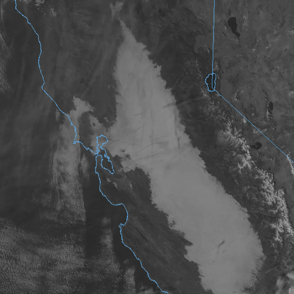
The tule fog arrives like a whispered incantation, stealing across California’s Central Valley on phantom feet. It is no ordinary mist—this is fog with weight and presence, a living shroud that swallows orchards whole and erases the horizon line between earth and emptiness. The fog denies fellowship with lunar transit; phases of the moon marking the progress of the month. Denied also is communing with emerging winter constellations scoring the progress of the seasons.
Born from the marriage of high atmospheric pressure, cold winter air and moisture rising from irrigated fields, it pools in the valley’s basin like spilled cream, thick enough to taste. Tule fog doesn’t drift like the summer coastal fog, so much as settle, heavy and deliberate, transforming familiar landscapes into liminal spaces where distance loses all meaning. A grove of almond trees becomes a procession of gray ghosts. Highway signs emerge from the white only to vanish again, oracles speaking their warnings to no one. Even Christmas lights appear diffused, in soft focus, haloed as if the fog absorbs their illumination.
There’s something primordial about tule fog, something that predates the geometric precision of modern agriculture. It takes its name from the tule reeds that once dominated the valley’s marshlands—those ancient wetlands now mostly drained and paved, yet the fog remembers. Each winter it returns like a revenant, reclaiming the valley floor, asserting the old wilderness beneath the cultivated rows.
In the half-light of winter dawn, the fog transforms the mundane into the mythic. Travelers become pilgrims crawling through an achromatic dream. Sound behaves strangely here—absorbed, muffled, made intimate. The world contracts to whatever small circle of pavement your headlights can carve from the white.
And then, just as mysteriously as it descended, the fog lifts, burned away by afternoon sun or banished by wind, leaving only damp memory on fence posts and a peculiar clarity to the air, as if the valley has exhaled.
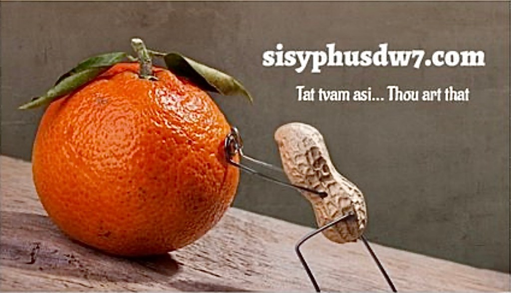
Join Sisyphus in his adventure in youthful indiscretion.
A Public Service Message(Warning: Graphic photos follow)
I greeted the good doctor early on a recent November morning, “You know Dr. Mehrany I have a low incentive threshold,”
“How’s that Mr. Jones?” he asked.
“Well, all it takes is a maple bar in your waiting room, and I’m willing to have you take a knife to my face.”
“I guess it beats cancer, eh?” he replied.
“But what about donut-induced heart disease or diabetes?” I beseeched.
“Everything gives you cancer, there’s no cure, there’s no answer except that Mohs surgeries are 98-99% successful, the most efficacious treatment for any cancer,” retorted the doctor, “You take your chances with cholesterol and blood glucose.”
Drop the mic!
My apologies to Dr. Mehrany whose response I doctored and Joe Jackson’s line about cancer from Everything Gives You Cancer.
What are the Odds?
And so began my most recent appointment with Kosgrow Mark Mehrany, MD, a skin cancer specialist whose practice is divided between San Jose and Modesto, near my home in the Central Valley. This would be my fourth basal cell carcinoma removal by way of a procedure known as a Mohs surgery.
Skin cancer is the most common type of cancer in the United States, with about 1 in 5 people developing it at some point in their lives. Each year, more than 3.5 million cases are diagnosed, making it a significant health concern. As one of the 3.5 million—it’s not a league in which I am proudly enrolled.
It Pays to Have Good Doctors
My now deceased family doctor, Christian Gallery, began detecting suspicious growths he diagnosed as a type of pre-cancer called actinic keratoses a decade ago. He was comfortable removing most of these scaly patches on my back and chest by freezing or a simple surgical removal, the standard treatments. When he suspected there may be a more serious basal cell carcinoma on my face he recommended I see a specialist.
That was my first encounter with Dr. Mehrany in his office in Modesto, CA in the spring of 2019. Dr. Mehrany confirmed Dr. Gallery’s diagnosis by biopsying a spot on my cheek. The resulting confirmation was that of a basal cell carcinoma he proposed to remove, using what is known as a Mohs micrographic surgery.
Mohs surgery is a procedure performed by a specially trained surgeon. Dr. Mehrany’s six page curriculum vitae* is impressive, but the fact that in his career he has performed over 20,000 Mohs surgeries is even more reassuring.
His manner is straightforward yet he has an amicable sense of humor. At least he feigns to laugh at my jokes. And once he’s executing the procedure his focus and attention is razor-sharp. Ugh. His staff are all equally genial and give you the sense that even though the office waiting room is full, each patient is accorded sincere regard and every effort is made to erase apprehension. Perhaps that’s the purpose of the donuts and coffee…
What Is Dr. Mehrany Screening For?
Skin cancer comes in a variety of forms, and some kinds are more frequent or dangerous than others. More than 98% of skin cancers are either basal cell and squamous cell carcinomas. Melanoma is another, less common type of skin cancer. Melanoma can be deadly unless it’s detected and treated early. Getting your skin checked regularly by a skin cancer specialist, like Dr. Mehrany, helps to protect you by catching skin cancer early when it’s easiest to cure.
Given that my youth into adulthood was spent when skin cancer detection wasn’t as refined as it is today, all of the summers spent in swimming pools, backpacking in the Sierra, riding bicycles, running, sailing, golf, and skiing meant I had a healthy year-round exposure to UV wavelengths of natural sunlight. Skin cancer develops when skin cells grow uncontrollably, in my case due to damage from ultraviolet (UV) rays from the sun, or tanning beds for those whose desire for sun-kissed aesthetics don’t have the time or hobbies to bronze in hours of exposure outdoors. And for those whose labor exposes them to harmful solar radiation, my sincere empathy.
This damage can lead to changes in the DNA of skin cells, resulting in abnormal growths that can become cancerous. Though I became aware of damage that repeated long exposure to sunlight was a form of Russian roulette that only emerged later in life, my haphazard mitigation with protective clothing and topical sun screens was preempted by naiveté. In the hypocrisy of pretending that tanning beds were for the vain, I was convinced that celebrating life in the great outdoors could achieve the same aesthetic that was beyond consequence. Vanity, it appears, is in the skin of the beholder.
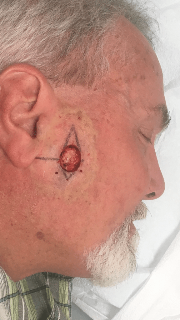
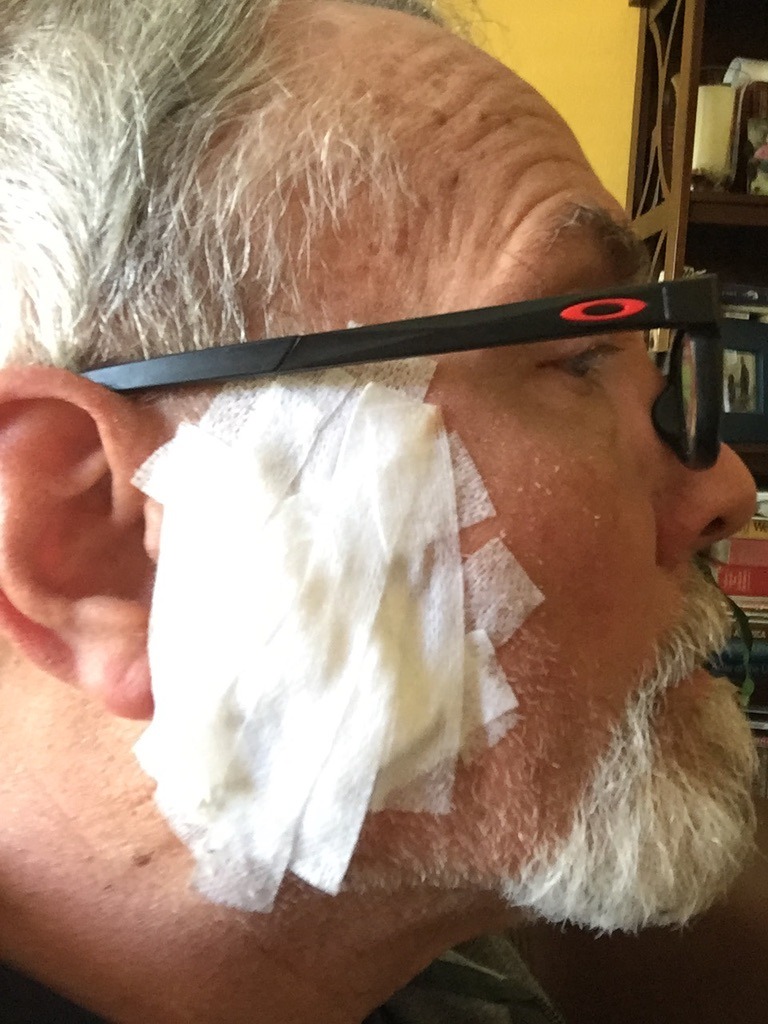
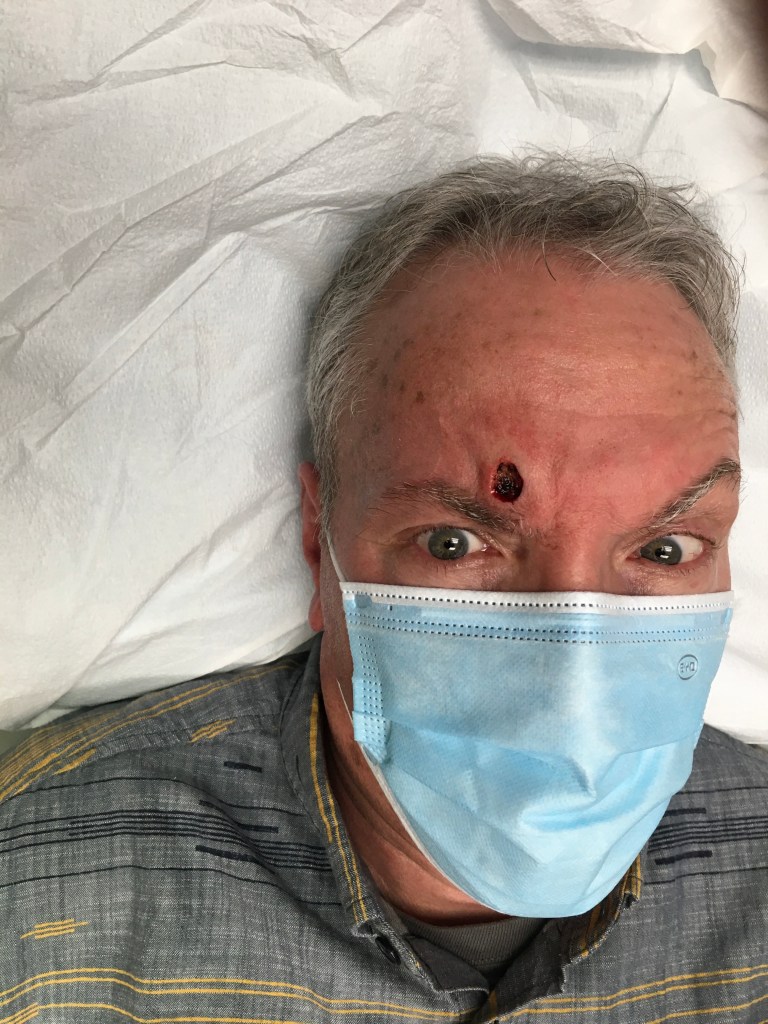
Warning, the photos below are quite graphic.You can thank my wife who enjoyed the surgeries from the peanut gallery.
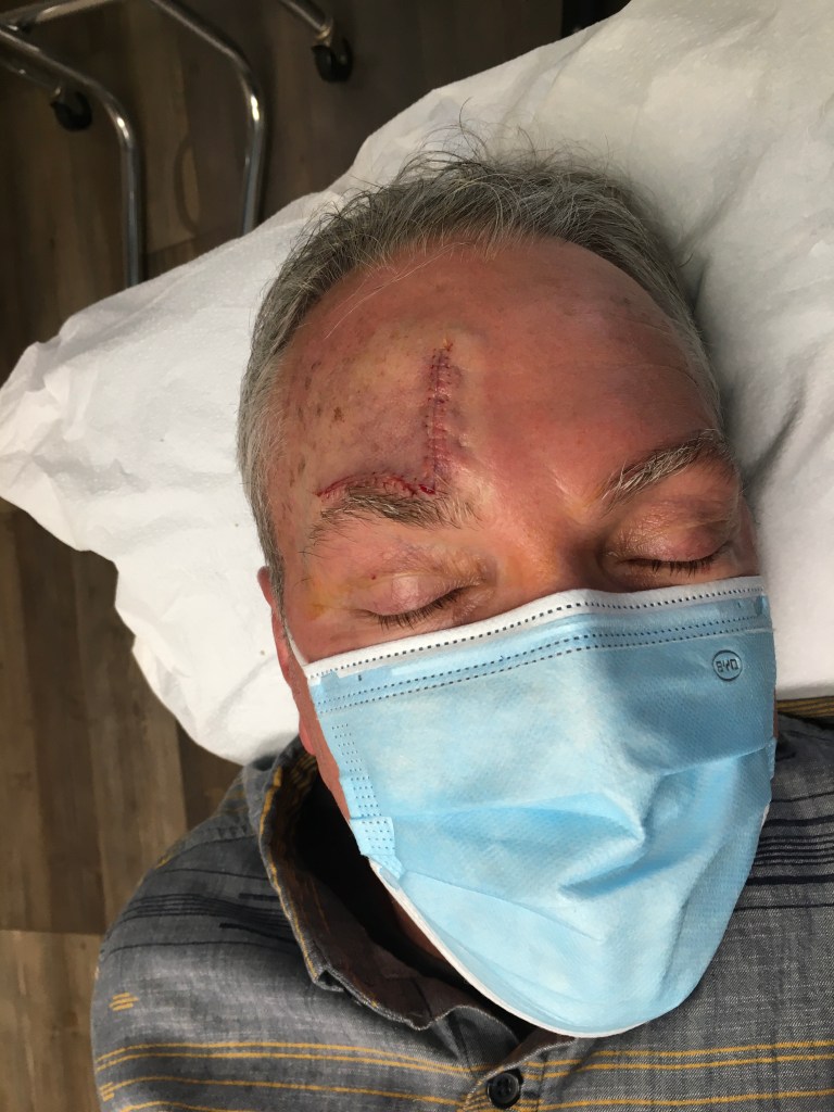
April 2019-The First Round: Mapping the sutures
Cheek surgery site with stitches and the surgical wound dressingyou flaunt leaving his office
January 2021-Round Two: Can’t You Hear Me Noggin
Start to finish, about three weeks. “Covid doesn’t stop for cancer…” declared Dr. Mehrany (I neglected to “flip” the selfies)
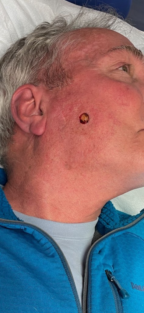
February 2022-Round Three: Another Cheek Crater
in the middle photo is the pressure dressing, awaiting results of the first scraping. We were still masking.
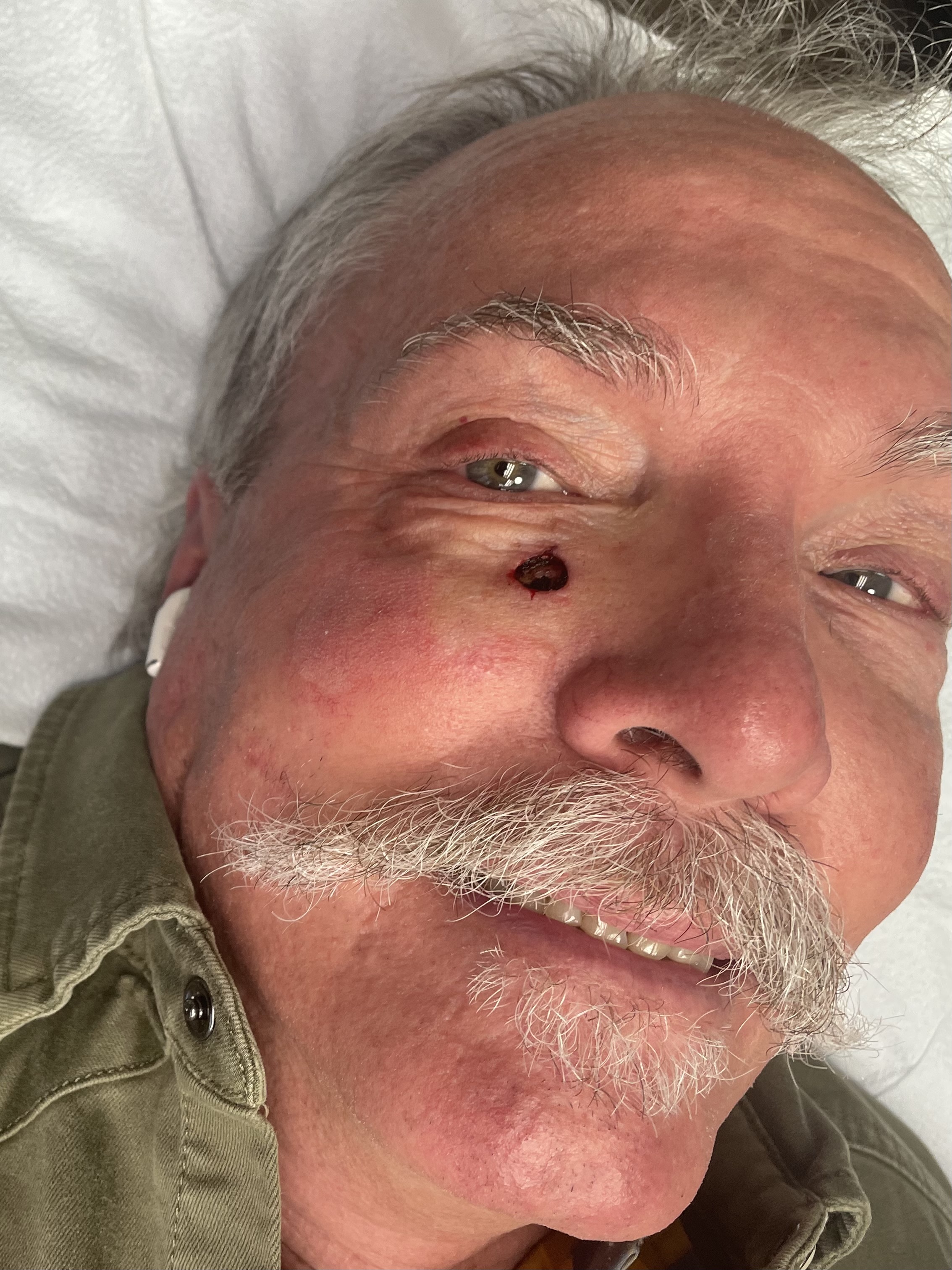
November 2025-Round Four: Too Close to the Eye for Comfort
Oddly, all four carcinomas have clustered on the right side of my face. (The flipped selfie makes the appearance of the scar on the left side. I assure you, it’s on the right side.)
How Mohs Surgery Actually Works
Armed with a pocket full of syringes, donning appropriate PPE and surgical loupes, with a surgical blade called a curette, and a cauterizing pen at hand, Dr. Mehrany removes a layer of cells. Although the official name for the procedure is Mohs micrographic surgery, the shortened version of Mohs Surgery is common.
The surgery is performed as follows: the skin suspicious for cancer is treated with a local anesthetic, so there is no feeling of pain in the area. In fact, the most painful part of the procedure is the “poke and burn” of the injection. To remove most of the visible skin cancer, the tumor is scraped using a sharp instrument called a curette. A thin piece of tissue is then removed surgically around the scraped skin and carefully divided into pieces that will fit on a microscope slide; the edges are marked with colored dyes; a diagram of the tissue removed is made; and the tissue is frozen by Dr. Mehrany’s technician, Manny. Thin slices can then be made from the frozen tissue and examined by the doctor under the microscope.
I asked Dr. Mehrany if there’s any way to know when the damage actually happens. Turns out it’s impossible to pinpoint. The two biggest variables are how aggressive the mutation is and how well your immune system fights back. The damage could have occurred decades ago, but when it decides to show up as cancer? That’s anyone’s guess.
Of course minimizing exposure is the gold standard for preventing skin cancers, however a history of sunburns along with genetic factors of having lighter skin and a family history of skin cancer are the most common causes. Other factors include having many moles or atypical moles and certain skin conditions. When the damage occurs and how long it takes for the cells to mutate is widely variable. Thus any pale skin entitlements are moot when it comes to skin cancer.
It Doesn’t Smell Like Bacon Frying in the Kitchen
Most bleeding during the procedure is controlled using light cautery, although occasionally, a small blood vessel is encountered, which must be tied off with suture. A pressure dressing is then applied, and you’re asked to wait while the slides are being processed. Dr. Mehrany will then examine the slides under the microscope to determine if any cancer is still present and subsequently annotate his map of the cancer location accordingly.
If cancer cells remain, they can then be located at the surgical site on the patient by referring to the map. Another layer of tissue is then removed, and the procedure is repeated until Dr. Mehrany is satisfied that the entire base and sides of the wound have no cancer cells remaining. As well as ensuring total removal of cancer, this process preserves as much normal, healthy surrounding skin as possible.
More Donuts Await
The removal and processing of each layer of tissue take approximately 1-3 hours. Only 20 to 30 minutes of that is spent in the actual surgical procedure. The remaining time is required for slide preparation and interpretation. It usually takes the removal of two or three layers of tissue (also called stages) to complete the surgery. Fortunately for me, the most recent surgery took only the removal of a single layer of tissue. Even the more severe first case only took two tissue layers. I figure that’s about a donut per stage
Therefore, by beginning early in the morning, Mohs surgery is typically finished in one day. I was in at 7:30 am and out by noon. At the end of Mohs surgery, you will be left with a surgical wound free of tumor which is then reconstructed that same day. Several options for reconstruction may be discussed with you in order to weigh your preference of what will provide the best possible cosmetic outcome versus what will provide the easiest and simplest recovery.
Time to Lace Up the Pigskin
Suturing the wound was interesting from my perspective. The site was completely numb, so I did not feel pain. However, the snugging of the suture was a little unnerving. For this surgery, there were some 25 stitches. Times four surgeries—those are the battle scars of freedom. Or inattention. Dr. Mehrany’s skill at reconstructing the surgical wound is truly his genius.
There was modest discomfort following the wearing off of the anesthetic. Not unlike what you might feel after a dental procedure like a filling or crown, and the slight pain was softened by a couple of extra strength Tylenols. Sorry RFK, I’ll risk autism for relief from surgery whether I plan to get pregnant or not.
Moving Forward
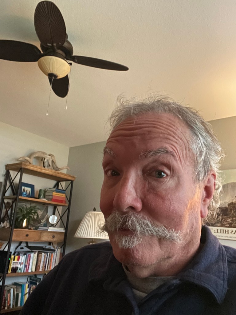
These days wide full brimmed hats have replaced ball caps. UV protective arms and legs are a part of my cycling kit. SPF 70 is used on the other exposed parts, namely my face and neck. Prevention. It’s never too late, I suppose. It beats the consequences of my youthful naiveté masked as virility. In January of next year, I have my six month follow-up exam. I’m hopeful that I will get the all clear, until the following exam in July.
Despite displaying the battle scars of freedom, I’m not ready to look like the patchwork of grandma’s quilt, but it beats an early departure for the dirt farm to join her…
My advice? If you’ve spent anytime in the sun be aware of the consequences! Also, you’re likely to gain more weight from the donuts than lose weight from the removal of the cancer…
…each one offering new knowledge. Or a route to conquer new lands. Maps get at the fundamental question of “where is this place in relation to everything else I know?” Or answering the question ‘what do I want?’ in the case of kings (actual and would be, wink, wink, nod, nod) and conquistadors seeking new lands to conquer.
My earliest encounter, as I remember, was with the colorful US state map puzzles in elementary school. In figuring out the spatial relations of states borders with their identities, geography was revealed. Classroom globes and Nystrom pull-down maps gave me a sense of the scale of place. It was also around that time when a subscription to the National Geographic magazine introduced maps with their rich colors and cultural details. I also learned that Greenland is not larger than the African Continent once the Mercator Projection illusion was explained.
Then came California State Automobile Association maps that guided my fledgling journeys from the nest as a newly licensed driver.
Around that time, topographic maps of the Sierra became the next oracle at whose feet I spent hours in the off-season exploring potential backpacking adventures for the summer. From learning how to use a compass for navigating crosscountry routes, and as I developed a love of sailing, marine charts taught me to read water the way the backpacker reads terrain and how a compass heading would get me safely from point A to B on land as well as water. A collateral effect to marine maps was to avoid submerged hazards or wayward currents in the Central Coastal waterways of California, since boats with holes in the hull don’t float very well.
There was a time that whenever traveling I went out of my way to find sources of maps whether at gas stations, visitor centers, bookstores, marinas, or any other map wielding enterprises I might encounter, anticipating yet another magically satisfying guide to my curiosity about the world.
My favorite daydreaming map from ravenmaps.com
60/40 the “Golden Ratio”
Whenever I read about an unfamiliar place or see such a place in a YouTube video, or on television, or come up in conversation, I always seem to open Google Maps to see that place in the context of geography and topography. It’s generally the story in the piece about the place that leads me to look up that particular spot. As I’ve come to expect rapid change in the evolution of technology, Google Earth and Maps, presented a whole new way to satisfy my curiosity of a place. I go to Google first to get the big picture. I’m really trying to read a place, not just locate it. I sort of see a 60/40 split between the context of a place and its location on a map.
Each view in the Google cartography catalog is like a different chapter about a place in context. Satellite view gives us the ground truth—the actual colors and textures, the patterns of development or wilderness, how light or dark it is, whether it’s green or brown or white. We can see things like agricultural patterns, the density of settlement, the relationship between built and natural environments. Terrain view tells us the story that gravity tells—where water flows, what’s difficult to cross, why settlements are where they are, what views people might have. It’s the view that the backpacker and sailor in me probably gravitates toward instinctively, because I’ve learned to read consequences in contour lines. And the Standard view gives us the human overlay—the names, the roads, the political boundaries, the infrastructure. It’s the interpreted landscape, the one that shows us how people have organized and named and connected things that makes up the context.
Using all three together, I’m essentially triangulating—getting a more complete picture than any single view could give me. I’m catching things like: “Oh, this town that sounded random is actually at a mountain pass” or “This coastal city has a natural harbor that explains everything about its history” or “These two places that seem close are actually separated by serious terrain.” It’s almost a form of due diligence before my imagination fully commits to a place. It’s like I need to see it from multiple angles before I really know it. Thanks also to Wikipedia et. al. for providing further context.
Cartographic Curiosity
That reflex to open Google Maps when I encounter a new place name—I think that’s the same cartographic curiosity in my past experiences with maps, just a bit more evolved. I’m not just passively receiving information about a place; I’m actively situating it, understanding its neighbors, seeing how it fits into the larger puzzle, but not as confusing as the four corner states in that elementary puzzle. It’s a form of engagement, really. Different map types have probably shaped different aspects of my curiosity. The topo maps from backpacking taught me to read landscape in three dimensions on a two dimensional plane, to anticipate what’s around the bend. Marine charts taught me about hidden geography—the shapes beneath the surface that matter just as much as what’s visible. Each type of map is almost like learning a different language for understanding a place.
For bicycling and motorcycle adventures, Plotaroute and Rever deliver both planning and real time features of tracking terrain. Interestingly, Butler Motorcycle maps are a throwback to the AAA roadmaps of yesteryear (although AAA roadmaps are still available and updated from their predecessors). Butler maps differentiate between different types of road criteria (road undulation/twisties, elevation change, scenery and peril) in the traditional folding paper maps, albeit in waterproof and tear resistant forms. From the Rever (in collaboration with Butler Maps) website: The recommendations are illustrated on the map by color-coded overlays indicating the quality and/or type of road. Those are illustrated as follows:
As you can see, the Butler/Rever collaboration offers the benefits of using an app in real time on the moto rather than stopping to drag out and unfold a paper map, which in the wind presents challenges of a different sort.
The Butler Paradox
I use Butler Motorcycle maps in planning my “moto-adventures” along with digital and other resources. I’ve written about them in my blog, sisyphusdw7.com using the maps in the context of their rating system of roads as G1, G2, and G3 and my parodying them by rating some blasé road out of Huron, California on which a blind intersection or straight away sight lines obscured by rolling hills and impatient cagers, speed-drunk, make for peril that Butler chooses to define a little differently. From my blog, 2021 Spring Mojave Moto: To See a National Park Devoted to a Tree…:
Pouring over Google satellite views of our intended route was subordinate to the Butler Motorcycle Maps criteria of Lost Highways and PMT’s (Paved Mountain Trails) and G1-3 routes. These byways are also a throwback to the roads I’ve pedalled over in another time and place and that I’m trying to reprise on the moto before riding off into the sunset.
“A Butler Lost Highway [is one] of faded center lines, crumbling shoulders, and long lonely miles putting these roads in a category of their own. These are the roads that seem lost in time. It is what these roads lack that make them worth the journey.”
“A Butler PMT sweeps through the remote forests and mountain ranges of California that are paths of pavement that leave even the most seasoned riders searching for ways to describe their riding experience. These roads are exceptionally tight and twisty and other unique opportunities to explore the less traveled corners of California.”
Those descriptions are from the editors of Butler maps. I’ll add the first of a few more categories of my own, the Jones PARoC‘s (Paved Ag Roads of California), or, “Two lane roads astoundingly arrow straight with right angled intersections bordered by crop obscuring sight lines and stop signs, double yellow line disregarding, pucker inducing, impatient cagers of questionable sobriety trying to pass anything with ≥ 2 or ≤ 18 wheels.”
My parody ratings, PARoC’s (Paved Ag Roads of California) highlight what Butler Maps don’t show—the agricultural hazards, the blind intersections hidden by orchards, the deceptive rolling hills where you can’t see what’s coming over the crest. A perfectly straight farm road could be a G3 in the Butler system but a terror rating in the Sisyphus system if it’s got dust-covered blind corners and ag equipment pulling out unpredictably, which in the agricultural heartland of California, is a year round hazard, as are speed-drunk cagers. These PAROC’s are theG-ratings for anxiety rather than joy. A perfectly straight farm road could be a G3 in the Butler system but a terror rating in the Sisyphus system if it’s got dust-covered blind corners and ag equipment pulling out unpredictably or oncoming cars passing slow moving trucks.
The Paradox Explained
On a recent episode of The Lowdown hosted by Neil Graham The Best Motorcycle Ride in America, Scott Calhoun, a co-founder of Butler Maps, told the origin story of this tool I, like thousands of other riders rely on. I better understand how they decided what made a road a G1 versus a G3, what criteria mattered, how they balanced twistiness with scenery with pavement quality with traffic. Butler Maps are really selling a curated experience, aren’t they? They’re not just showing you how to get somewhere; they’re saying “these are the roads worth riding for their own sake.” The map becomes aspirational—a collection of possible adventures rather than just routes.
While my blog may be a shameless imitation, my integration strategy is straightforward—using Butler roads as the backbone or highlight reels of longer journeys, the sections I’m actually looking forward to rather than just enduring to get somewhere. A G3 road isn’t necessarily “better” than a G1—it’s just different. A newer rider, someone on a heavy touring bike, or someone who just wants a scenic cruise without technical demands might specifically seek out G3s. Meanwhile, the experienced rider on a nimble bike looking for that flow state of linked corners gravitates toward G1s. And G2s are that sweet spot—interesting enough to be engaging, but not demanding your full concentration on every curve. Aristotle would recognize it: the mean between extremes, neither a boring slog nor a white-knuckle terror.
The fact that I’ve chronicled a couple dozen of these multi-day, multi-state rides on my blog suggests I’ve become something of a cartographer myself—documenting not just the routes but the experience of riding them, occasionally noting when Butler’s assessment matched mine, when conditions had changed, and what I discovered that the map couldn’t show.
Into the Unknown
There’s also the aspect of using a map as a security blanket in planning any outing, whether on foot, a bicycle, motorcycle, (BTW, I’ve catalogued dozens of rides on Plotaroute, Rever, and Google Maps with links on my moto blogs), or a sailboat on the bay, basically, any adventure into the unknown. It’s nice to have a preview of what awaits and some degree of preparedness for the inevitable, unknowns. Maps don’t eliminate the unknown, there will always be unknowns, but they shrink them to a manageable size. You can see the big climb coming, know where the water crossings are, anticipate when you’ll be exposed or sheltered. It’s not about controlling everything; it’s about not being blindsided
A dramatic coastline or mountain range can grab you on its own merits. That’s the 40% of a map’s utility I noted earlier. The geography itself poses questions about how it formed, what it’s like to be there, how people navigate it. But that 60% of a map’s utility, context, means the stories attached to places are what really animate them for me. A town becomes more interesting when you know it was the setting of some historical event, or that someone you’re reading about lived there, or that it’s mentioned in a documentary about a particular way of life.
Shrunken to a manageable size
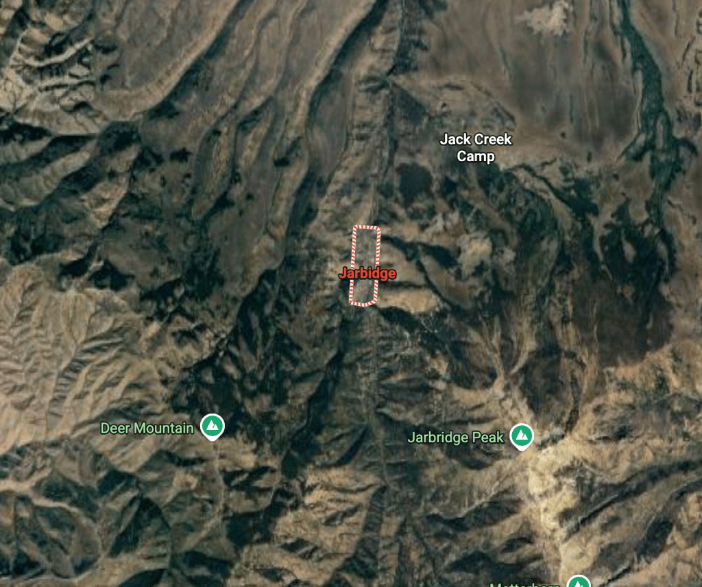
Those two elements probably feed each other, don’t they? The context makes me look at the map, and then the geography adds new dimensions to the story. You hear about a remote town in Nevada, say Jarbidge, and look it up—and suddenly you’re understanding why it’s remote, what kind of journey it would take to get there, and what the surrounding terrain tells you about how people live. The map fills in what the story left out, or sometimes contradicts what you imagined. Just in case you’re curious: Jarbidge, Nevada
By cataloguing many of my rides on my blog, in Plotaroute, Rever, or Google Maps—I’m essentially building my own atlas of personal experience. Each mapped route is a record of a negotiation between what I hoped to find and what I actually encountered. I sometimes look back at those routes and remember specific moments: where we stopped, where it was harder than expected, where we found something surprising.
The “preview” aspect is interesting too. I’m essentially doing reconnaissance from my desk or phone—checking grades, finding bailout points, seeing whether that road actually goes through or dead-ends. The multi-state rides require a different kind of planning too. I’m not just stringing together good roads; I’m thinking about daily mileage, where to stay, weather patterns across regions, the rhythm of challenging sections versus easier cruising. The Butler roads become ingredients in a larger recipe I’m composing. For motorcycle rides especially, knowing what kind of curves are coming, whether the pavement is likely to be good, if there are services along the way—that’s not just convenience, it’s safety.
OMD, (Obsessive Map Disorder)
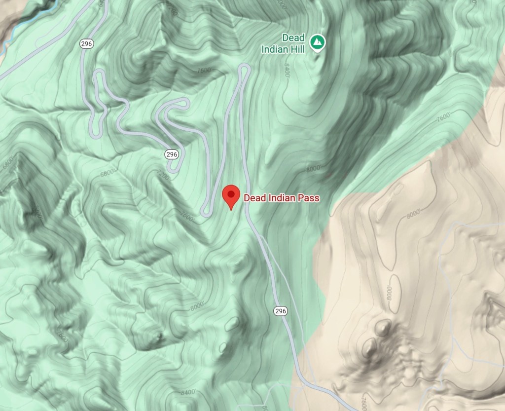
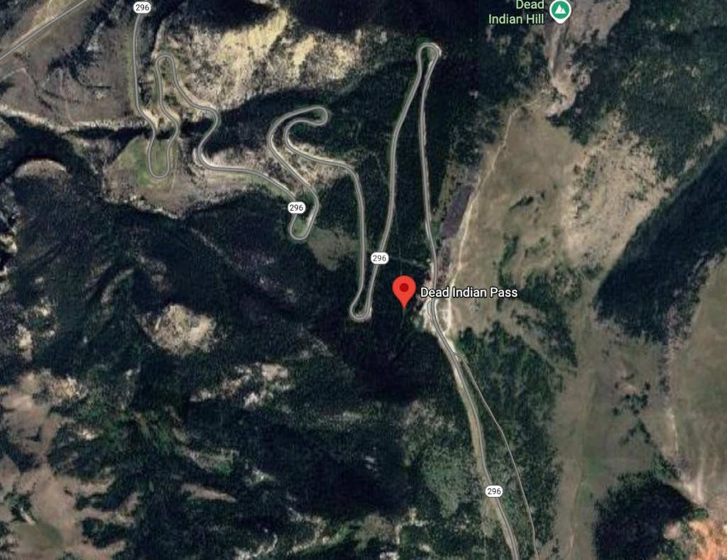
That’s Larry on the right and me on the left on the Chief Joseph Trail, WY-296, at Dead Indian Pass in Wyoming in July, 2002
I cannot complete this “Confession of OMD” without noting the Western States bicycle rides with various groups of knuckleheads that were planned by our dear departed friend, Larry Johnston. It has contributed to the scope of my relationship with maps and trip planning—from those National Geographic maps of childhood to literally crossing entire states under our own power, relying on Larry Johnston’s meticulous planning. Bicycle touring in July—when most people avoid being outside—speaks to a particular kind of commitment. And doing it state by state through the West, we experienced the geography in the most intimate way possible: at bicycle speed, feeling every grade, every wind pattern, every temperature shift. That’s reading the map with your legs and lungs. The planning for those trips was critical—water sources, daily mileage limits, places to resupply, lodging, bailout options if someone struggled. In my tribute to Larry, the friend who did that cartographic labor of love for the group, I hoped to honor the often-invisible work of the planner. Someone has to be thinking three days ahead while everyone else is just focused on the day’s ride.
I hope that my current motorcycle and bicycle itineraries with distances and profiles on Google Map and Plotaroute links embedded on sisyphusdw7.com are carrying forward that same ethic. I’m not just documenting my trips. I’m creating usable maps for others, the way Larry did for us. Each route I share is another invitation, the kind I first accepted when I put together those state puzzles so long ago…
Friendship is messy. Loss is constant. And men? We rarely talk about it.
I’ve been thinking a lot about what we carry, what we lose, and how we show up—or don’t.
These thoughts came from listening to an episode of Offline with Jon Favreau called “Are Men Okay?” featuring Zac Seidler, a psychologist who studies men’s health for the Movember Foundation. The show opened with a startling fact: more than half of American men die before the age of 75, and that number is getting worse.
Seidler and Favreau talked about how men often misunderstand what wellness means, especially in a digital world that celebrates performance over vulnerability. His words struck a chord. I’m no longer a young man, but I have sons who are—and I recognized the quiet ways men of every age hide what hurts.
Among my own circle of old friends, I can see that same silence. We’re all facing losses—some recent, some long ago—and each of us is trying, in our own way, simply to survive them. You don’t conquer loss; you learn to live beside it.
Childhood Friend
One of my oldest friends is someone I’ve known since childhood. We grew up together, went to the same schools, drifted apart for years, and eventually both returned to town—he to teach college, I to teach younger students.
We still crossed paths occasionally, mostly through our shared obsession with staying fit: he ran, I biked. Once, during a casual conversation in a grocery store line, he surprised me with, “You were always an underachiever.” I never knew exactly what he meant. Maybe teasing, maybe judgment, maybe even a sideways compliment. It stuck with me.
Years later, at our fortieth high school reunion, he sat alone at a table that included me and a few mutual friends. Once known for his easy charisma, he seemed withdrawn, almost impatient with the sentimental tone of the evening. When a slideshow of classmates who had passed played to soft music, he muttered something about sparing him the “maudlin sentimentality.” I understood the impulse. Grief sometimes makes cynics of us all.
Not long ago, his partner died. I reached out simply to say I was sorry and that I was here if he needed to talk. He thanked me, but I keep thinking about him—loss isolates even the most social among us.
Teaching Colleague and Musician
Another friend is a former teaching colleague—someone I shared a wall, a schedule, and twenty years of classroom chaos with. We both taught math and science to sixth graders, juggling equations, experiments, and preteens on the verge of self-destruction.
We also shared a love of music: he played bass; I played drums in our staff band, proudly called Staff Infection.
When he retired, a few years after I did, he and his wife seemed to embrace the good life—travel, golf, family. Then, suddenly, she was gone. I saw him at her memorial and later sent a note, offering an ear if he ever needed one. He thanked me, but we haven’t talked since.
I think about him often—even deep friendships can slip into silence, especially after loss. Maybe it’s time to call again.
Cycling Companion
The last friend I want to mention is someone I’ve known almost entirely through bicycling, going back nearly forty years, with a few shared backpacking trips in the Sierra. Recently, he suffered two strokes, days apart, which threatened the thing he loved most: riding at a high level, even as he approached eighty.
When I checked in a couple of months later, I saw both his pride and his quiet embarrassment—the strokes had shaken him, but not his determination. He is slowly recovering, taking long walks and gentle rides, and refusing much of physical therapy because, in his words, it was “just balance work.”
His setback isn’t only physical. Since retiring from his photography business—a career largely erased by the digital era—he’s been more isolated. Cycling remains his anchor, the thing that keeps him connected to a small community of fellow riders. I just reached out again and will be picking him up tomorrow for a local ride.
Reflections on Friendship and Loss
Loss changes everything. Silence isolates. Connection saves us.
Thinking about these friendships, I see a common thread: loss reshapes our lives in ways both visible and quiet. And yet, it also reminds me of the enduring power of connection. Reaching out—even when it feels awkward, belated, or uncertain—matters.
The podcast Are Men Okay? reminded me that men rarely talk about how they’re truly doing, and I recognize that pattern in myself and in the friends I’ve written about. But in spite of—or perhaps because of—our losses, we can choose to persist in connection. A shared ride, a text, a moment of music, or simply showing up can make the difference between drifting apart and surviving together.
I don’t claim to have all the answers, and grief has a way of reminding us that life rarely unfolds as neatly as we wish. Still, I believe there is grace in reaching out, in extending empathy, and in sustaining the bonds that have shaped us.
So here’s my invitation: call the friend you’ve been thinking about. Send the note you’ve been putting off. Show up.
We survive loss better when we survive it together. And sometimes, survival is simply showing up—on a bike, on a walk, or in a conversation that refuses to be postponed.
“And what is good, Phaedrus, And what is not good— Need we ask anyone to tell us these things?” — Robert M. Pirsig, Zen and the Art of Motorcycle Maintenance
That’s a good question.
“What is hip? Tell me tell me if you think you know. What is hip? And if you’re really hip, the passing years would show That you into a hip trip. Maybe hipper than hip. Sometimes hipness is what it ain’t.” — Tower of Power, “What Is Hip?”
The Education of a Pluralist
My first encounter with philosophy — aside from Saturday morning cartoons with the likes of Mr. Peabody and Sherman — was in Ed Bean’s PHIL-01 at Merced College, where I learned that rationalism and empiricism aren’t opposites—they complement each other. Reason and observation, working together. So far, so good.
Then Ed introduced me to the Romantics, who insisted that feelings and instincts provided understanding that reason alone couldn’t touch. This aligned perfectly with my hippy-adjacent life in the Sierra—backpacking and ski touring with John Muir’s writings, natural history handbooks, and USGS maps. I was prepared for mind-expanding forays into forests and mountains, though at that point I hadn’t yet added Castaneda’s Don Juan to my mountaineering library.
What I absorbed from all this, both in the classroom and on the trail, was something my working-class parents had already taught me: pluralism. Not the academic kind—the lived kind. My father was a cement mason who worked alongside men from different cultures. They coexisted peacefully, mostly, maintaining their unique identities while contributing to something larger. I was taught we were a nation of different ethnic and religious groups, each preserving its traditions, but not at the expense of others.
By the time I reached the CSUC campus, I’d developed what I’d call a pragmatic-constructivism: that knowledge comes from the interplay between theory and practice, actively constructed through human interaction and experience. Different philosophical schools offered diverse explanations of the world, and there wasn’t necessarily one single, absolute truth. Different viewpoints could be equally valid.
A Trip to the Principle’s Office
It didn’t happen often, but in my career as a middle-school classroom teacher, I would send quarreling factions to the office to let the big-money cheeses sort things out while I dealt with the more earnest, or enthusiastic students in my flock.
In my classroom, I did maintain that there are Moral principles: Those that guide ethical behavior and decisions. You know, honesty, integrity, and fairness. There are also Scientific principles or the fundamental laws or truths that explain natural phenomena. Examples of these scientific principles include gravity, thermodynamics, and evolution. And there are Mathematical principles. These are basic truths or assumptions used in mathematical reasoning. Examples include the commutative and associative properties. Lastly and with a tip of the hat to folks like Frank Lloyd Wright or Steve Jobs, there are Design principles. These are guidelines for creating effective designs. Here, examples include balance, contrast, and unity.
These principles seemed to me to be the culmination of our evolved civility and the basis for culture all in the pursuit of progress.
This became the foundation of my teaching career. I believed in it. I built my classroom around it. Teaching rested on the belief that certain principles—moral, scientific, mathematical—provided shared ground. Not that everyone had to agree on everything, but that we could at least agree honesty meant something, gravity worked the same for everyone, and 2+2=4 wasn’t up for debate.
What Changed?
From 1981, when the first Apple II computer arrived in my classroom, to my retirement in 2015, I watched personal technology manifest itself in the internet and social media. And somewhere in that span, something shifted.
Pluralism—the idea that multiple valid perspectives can coexist peacefully—requires something subtle to function: a shared belief that truth exists, even if we approach it from different angles. We can disagree about how to understand the world while still agreeing that the world is there to be understood.
But the internet and social media didn’t just multiply perspectives. They fragmented the very idea of shared reality. Language, power, and social context didn’t just shape knowledge anymore—they replaced it. My students could find “evidence” for anything. Every viewpoint came with its own facts, its own authorities, its own truth.
The postmodernists had warned about this, about the challenge to objective truth. But watching it happen in real time, in my classroom, in the culture—that was different. What I’d understood as healthy pluralism began to look like something else entirely. Not diversity of perspective, but diversity of reality. Not multiple paths up the same mountain, but people insisting they were on different mountains altogether.
Sometimes hipness is what it ain’t.
So How Has That Worked Out?
I was raised to believe that pluralism meant we could hold different views and still find ways to coexist, contribute, build something together. I spent thirty-seven years teaching on that premise.
And now? I’m not sure what we have instead, but it doesn’t feel like pluralism. It feels like something that borrowed pluralism’s language—”multiple truths,” “different perspectives,” “your truth”—and turned it into a tool for avoiding any shared understanding at all.
Pirsig asked, “Need we ask anyone to tell us these things?” about good and not-good. The assumption was that we know, intuitively, without needing external validation. But what happens when we’ve lost even that shared intuition? When the passing years don’t show whether you’re “into a hip trip” or just lost in the noise?
I don’t have an answer. Just the sense of standing on a corner somewhere—not quite Winslow, Arizona—watching the traffic and wondering when things changed, and whether anyone else notices. Whether the principled pluralism I was raised on has been replaced by something darker and more deliberate. And whether we can find our way back.