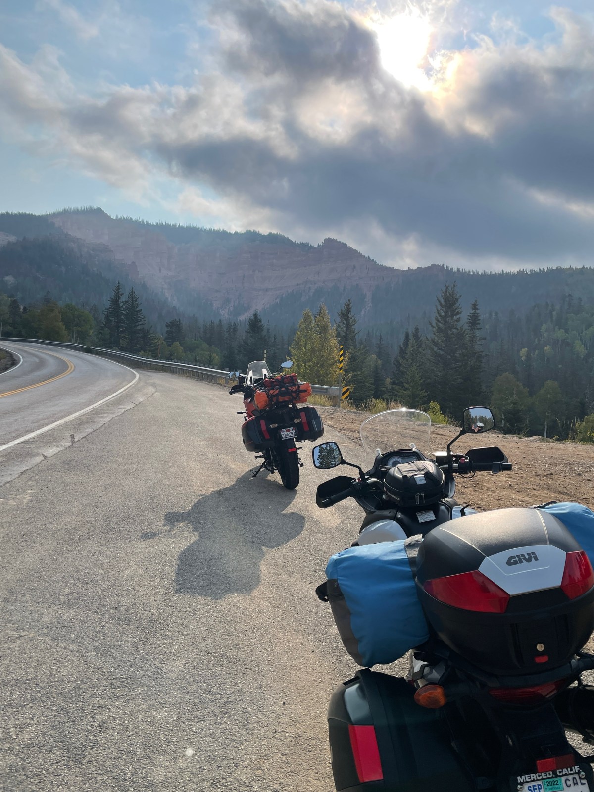
The road beckons, as usual, Sisyphus and Associates are willin’ to scratch the “Quest into the Unknown” itch on this proposed journey that will reprise a scene or two from where we’ve been before (check out the links). This is to satisfy our incurable quest into the unknown, including some new territory close to Tucson and Tucumcari. Tehachapi, meh.
As the seasons begin to change, we hope the weather cooperates and foregoes any extreme behavior. Well, we’ll just have to wait and see. Our first two days are familiar as they include previous stops in Tonopah and Cedar City with drive throughs in Torrey, Caineville, Hanksville, and Green River. Our ultimate destination and turnabout will be Santa Fe in the Land of Enchantment. I’m curious how the state motto, “Crescit Eundo,” translated from Latin, means “It grows as it goes.” I’ll have to ask Bob and Suzanne our enchanting hosts about the allusion to dynamic progress…
Sisyphus is an insufferable map geek. The roads over which our route will take us fall into the Butler designated “road qualities” of Lost Highways, G1, G2, and G3 segments. Check out Mojave Moto Spring 2021 for Sisyphus’s expansion of the Butler “road qualities” descriptions at https://sisyphusdw7.com/2021/04/29/mojave-moto-spring-2021/. There will be deserts and high forested mountains, river valleys, and arroyos to cross through small towns on backroads that are our preferred intermediate waypoints. What did folks do before Google Maps and Earth? Okay, our quest will sort of be into the unknown. Sorry Mr. Natural.
You may think this trip isn’t so much a quest into the unknown what with having covered ground on previous rides and extensive use of mapping. And you’d be correct. The quest into the unknown isn’t so much about the terrain. We know we’ll be awed by the varied landscapes we’ll ride through. The quest is more about the journey following some of Edward Abbey’s travels and the romance of the road that seems to permeate the long-haul trucker’s, poet’s, and map-loving motorcyclist’s zeitgeist. So, why not let’s call it, There and Back Looking for the Other Abbey’s Road (Trip2021).
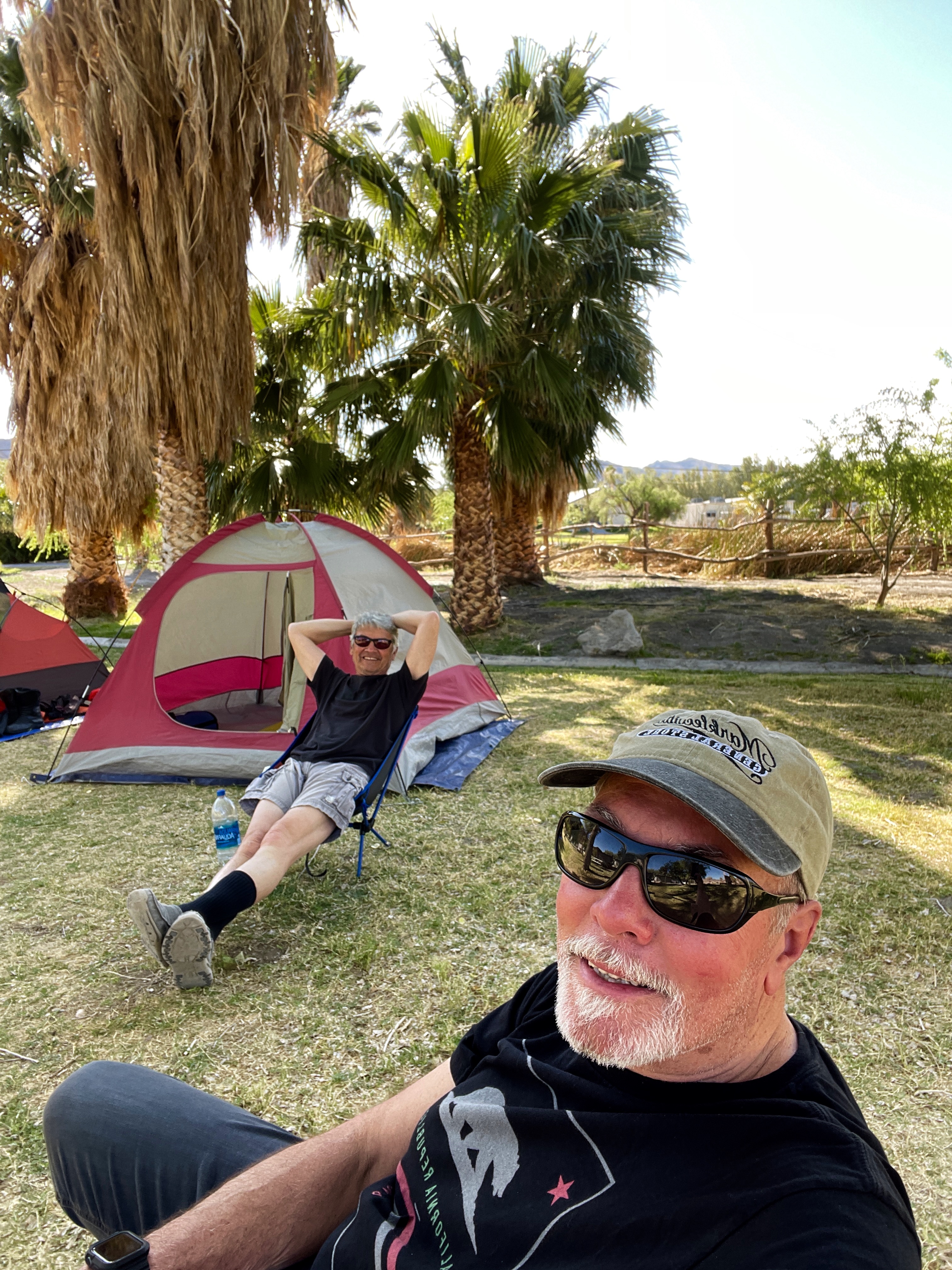
Sisyphus humbly offers a scroll-worthy (at least click on the blue map links) proposal for this twelve-day moto adventure, broken into Part 1, Eastward We Go, and Part 2 Westward Down and Bound. Bring your imagination along and join us if you’re willin’ as a brief narrative of the route with some images captured previously in-person and from the interwebs detail our intended waypoints and consider the ese on Guest-friendship that follows.
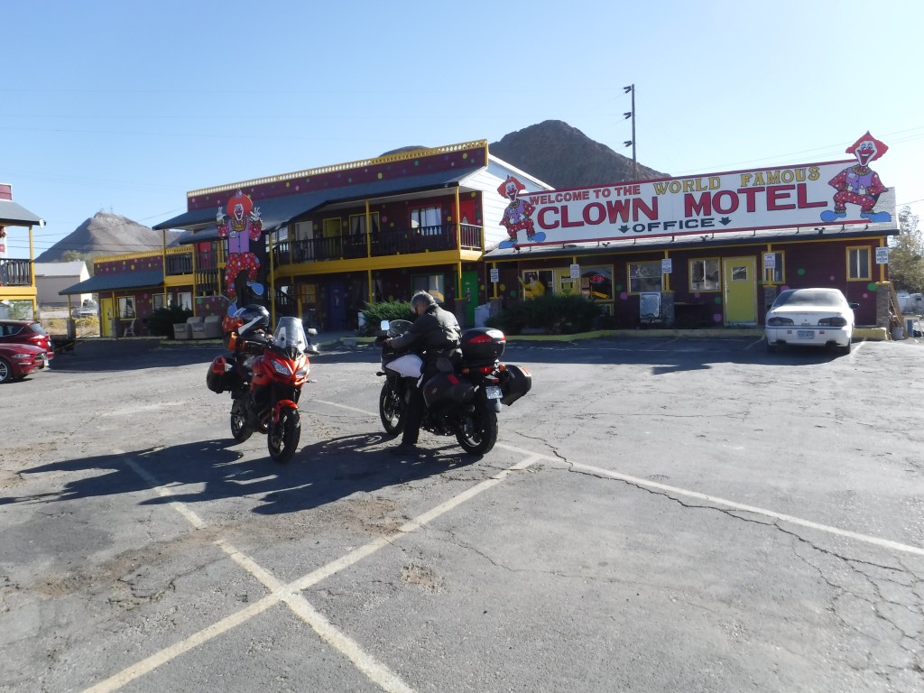
There’s nothing creepier than a cemetery next to a Clown Motel
The Sierra poses the first “obstacle” to overcome. We’ll take CA-120 by way of J-59, CA 132 to Smith Station Rd. (281 miles) with the Tioga Pass Option, or the CA-108 over Sonora Pass Option (~309 miles) to Bridgeport then Lee Vining on US-395. It just depends on which route is on fire…
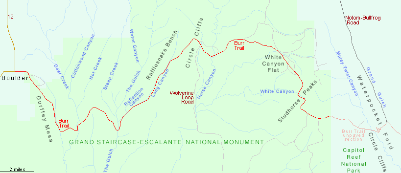
From Lee Vining, it’s US-395 to the junction w/ CA-120 to Benton (Hot Springs). From there we make our way on US-6 to Tonopah, across range and basin country, where Sisyphus and his Associate Pete stayed in the fall of 2020. You can read about that trip and the next two legs we are reprising from the Burr Trail Here We Come blog post. sisyphusdw7.com, Burr Trail Here We Come
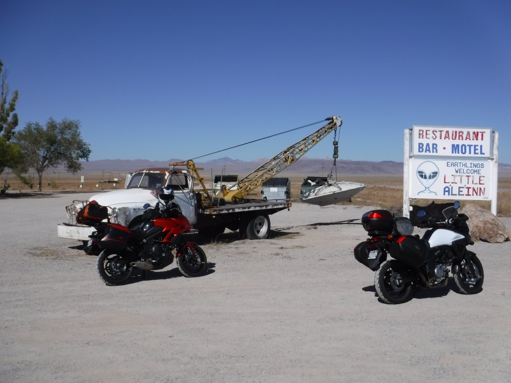
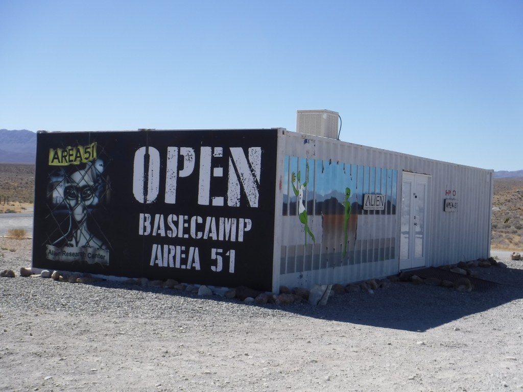
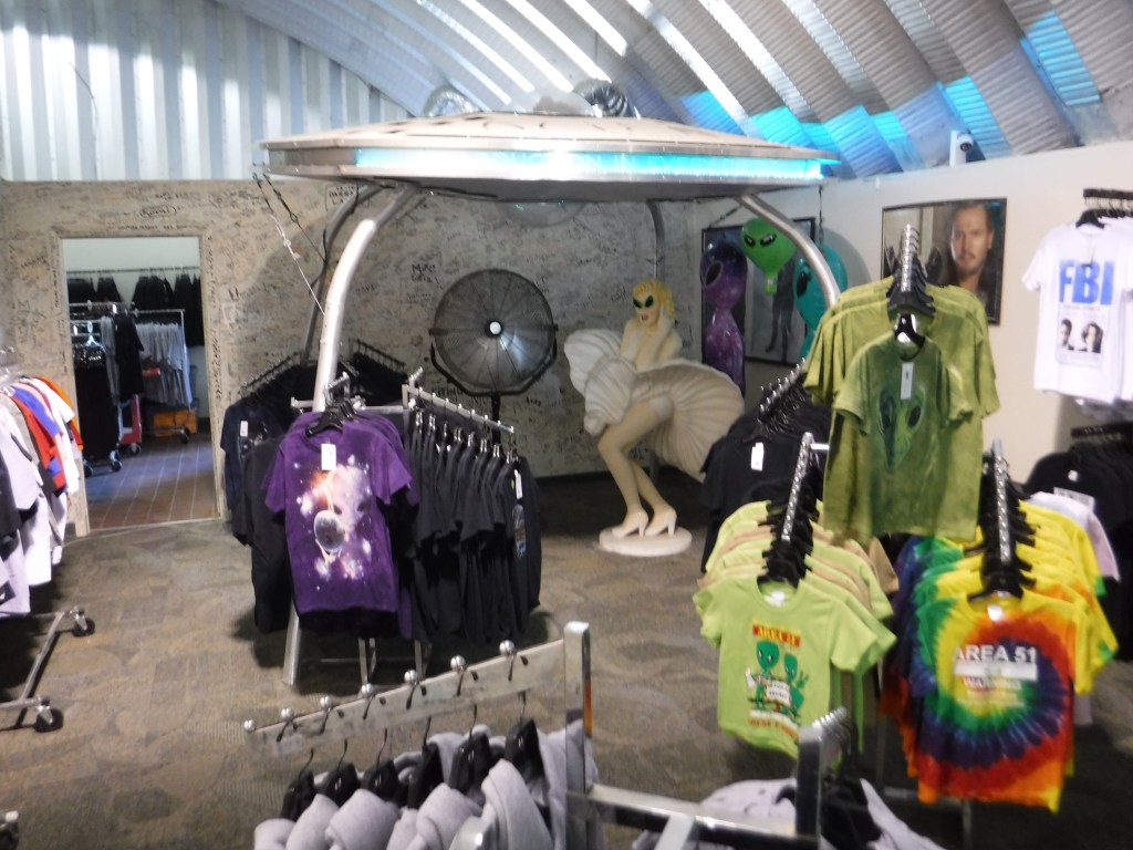
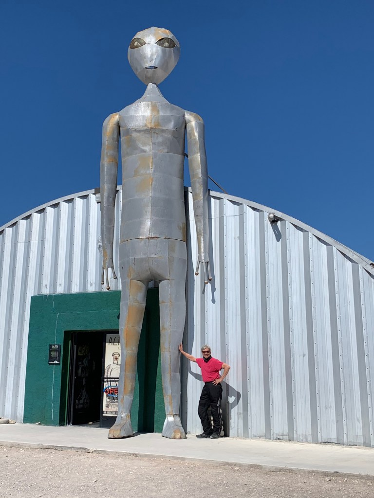
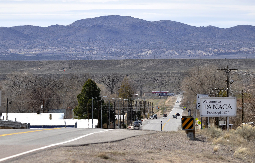
From Tonopah, we ride on US-6/NV-95 through Warm Springs and catch the road to Rachel on NV-375. We hope to avoid being abducted by aliens who are allegedly held captive at Area 51. That doesn’t preclude stopping for a souvenir T-Shirt at the Alien Research Center at Crystal Springs should we escape. T-Shirt safely stowed, we proceed on US-93 through Caliente, perhaps for a delightful lunch, infusing cash into the local economies, to the junction w/ NV-319 in Panaca.
Sisyphus’s Associate, Pete at the Alien Research Center in 2020
From Panaca it’s NV-319 to the Nevada/Utah border where the road becomes UT-56 to Modena. Modena, just an R away from mRNA vaccine name recognition fame… I wonder if there’s a Pfize Utah?
From there we will climb to Cedar City on UT-56.
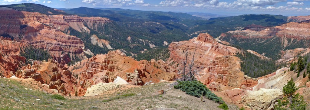
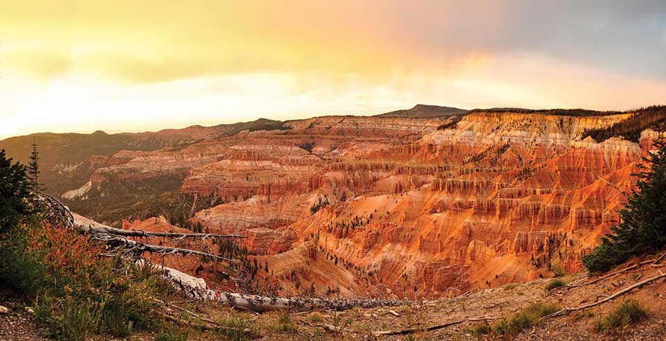
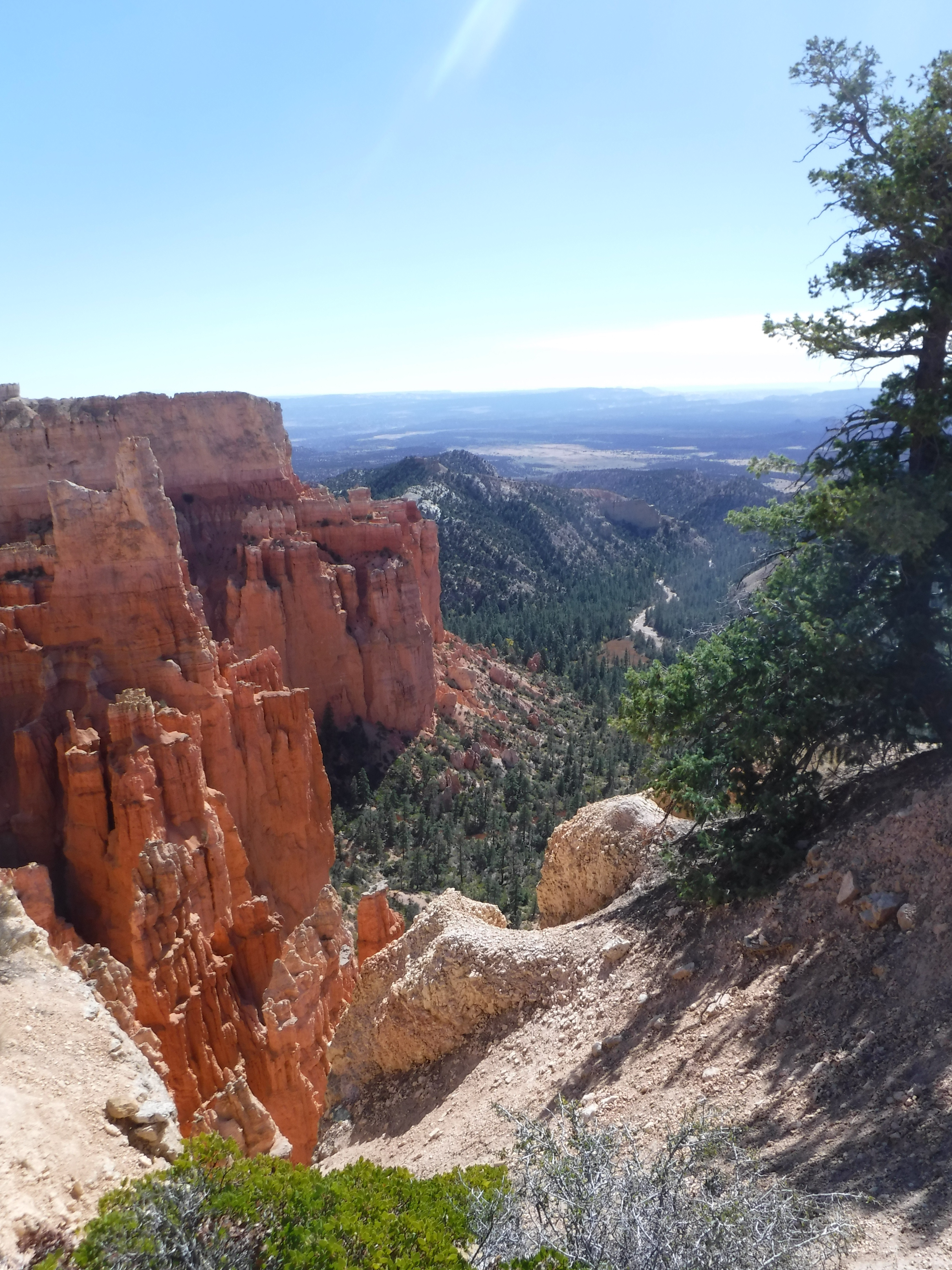
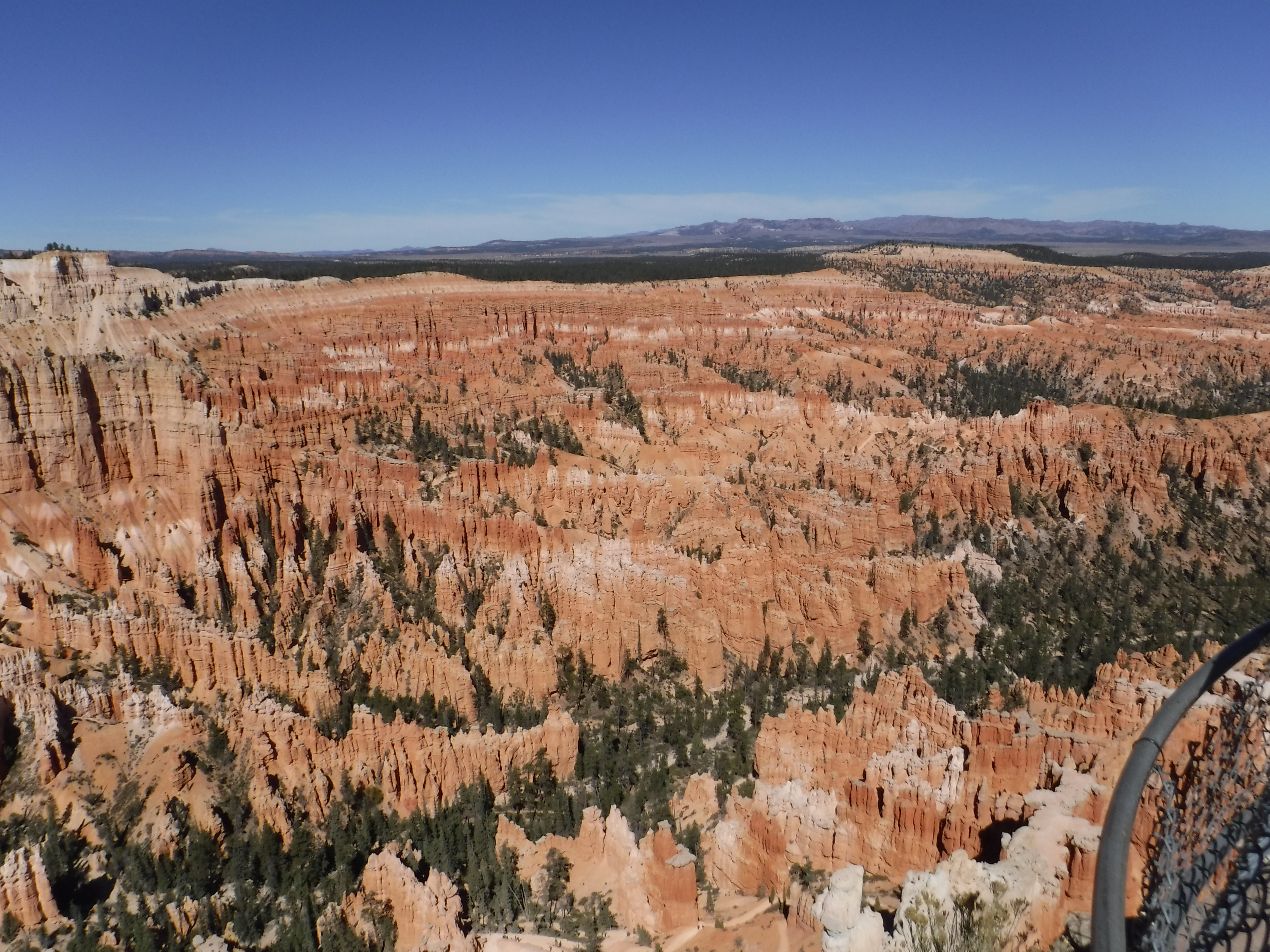
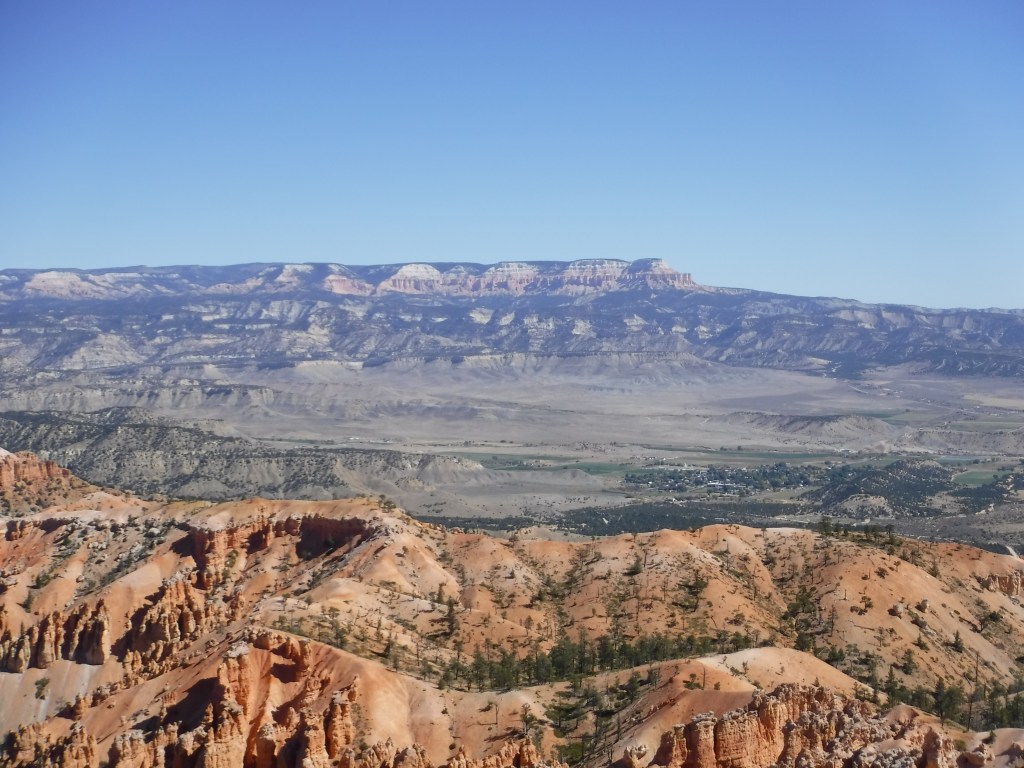
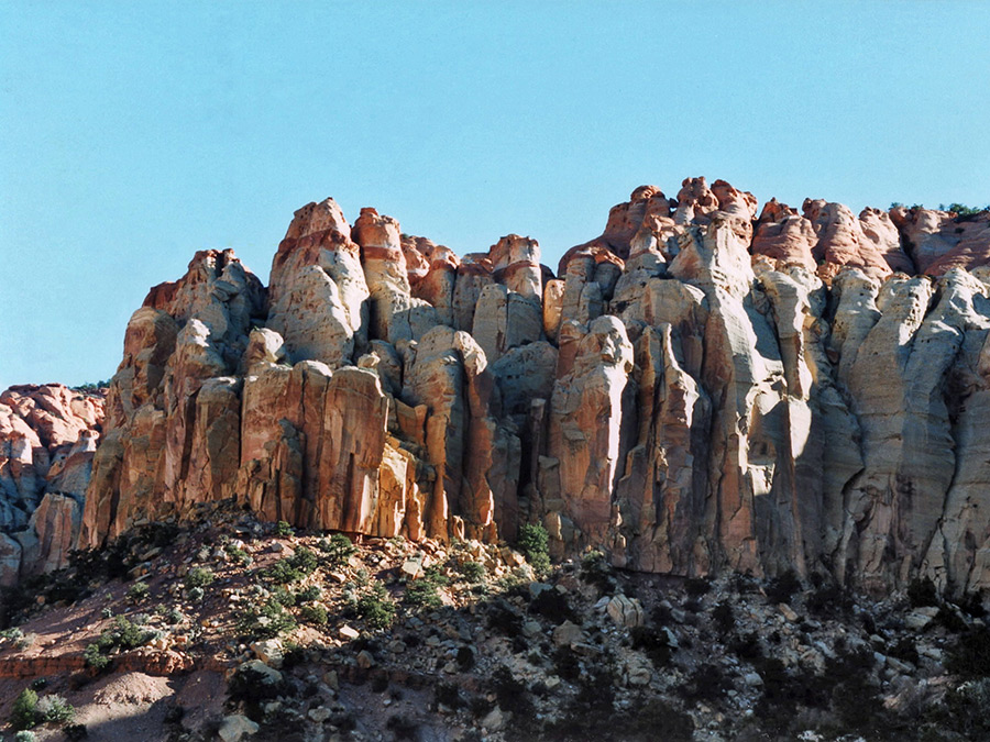
East of Cedar City, Cedar Breaks from the Chessman Ridge Overlook
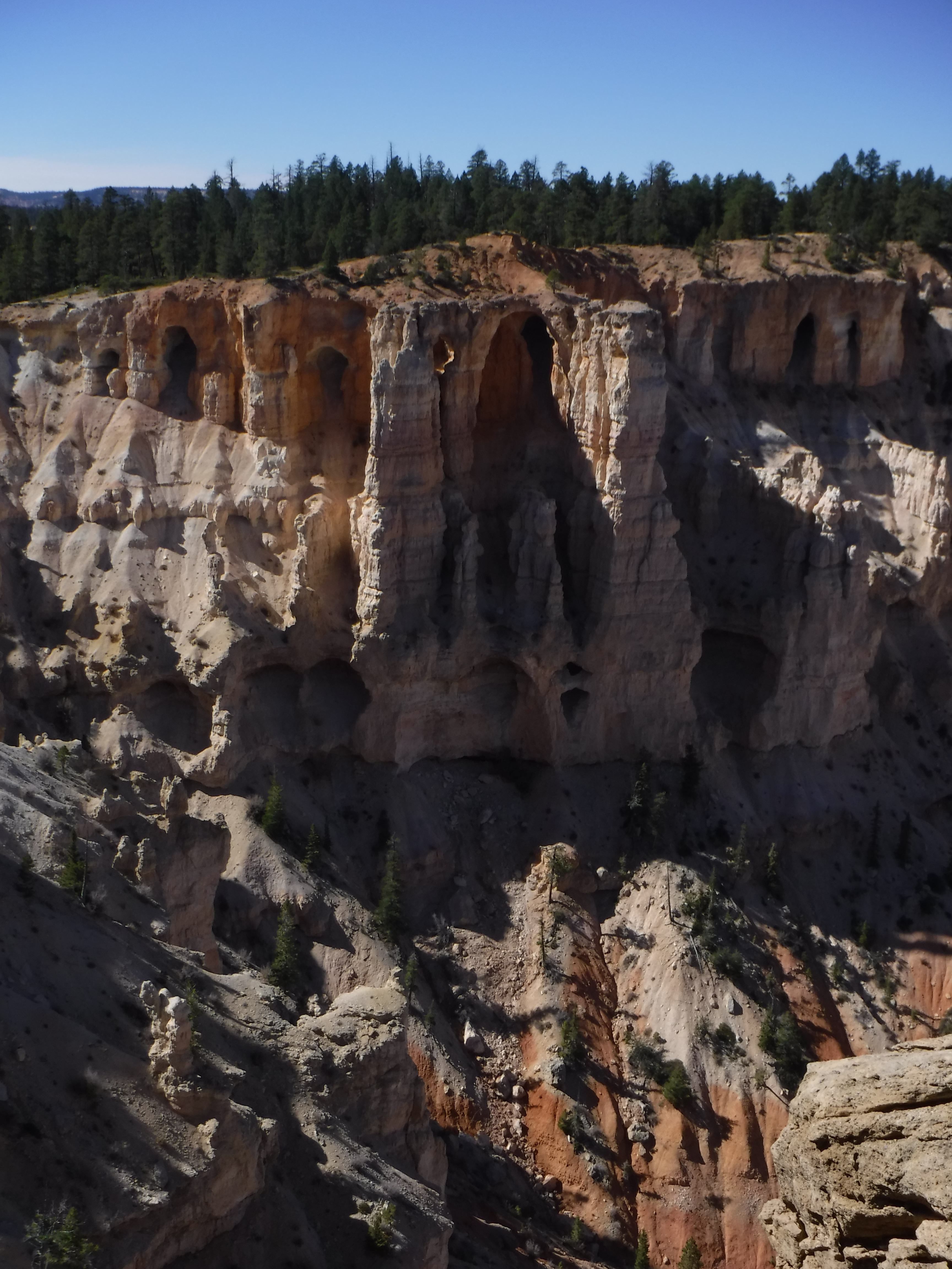
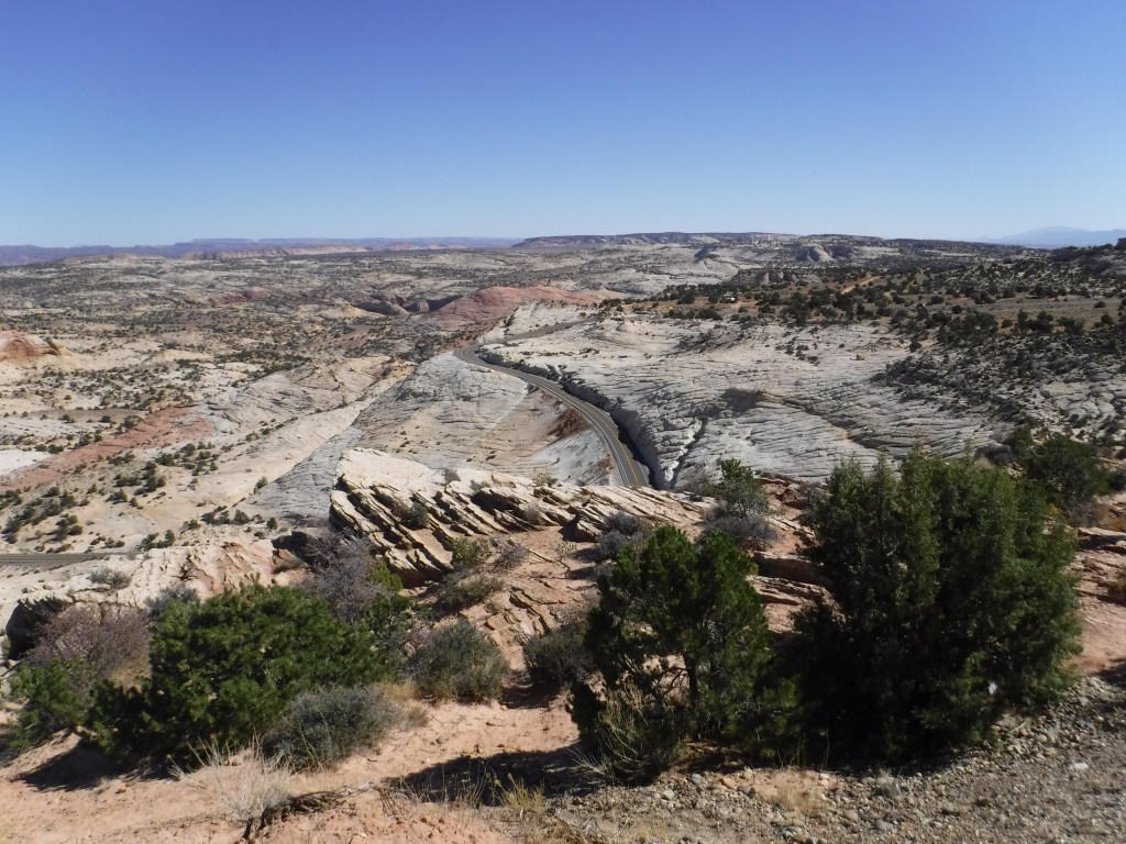
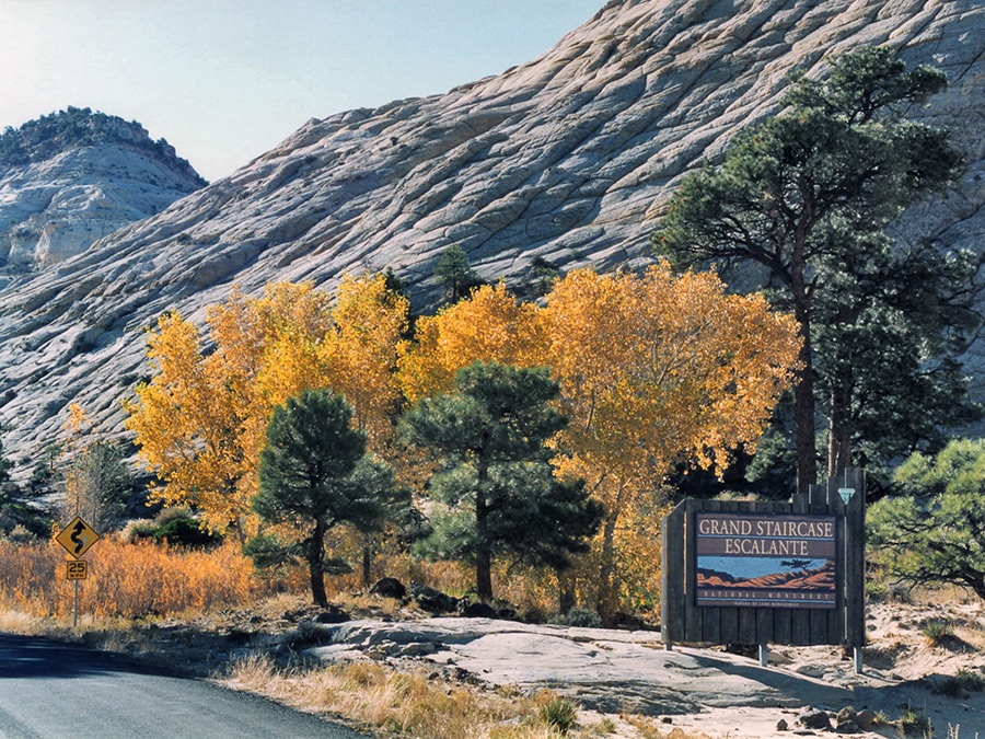
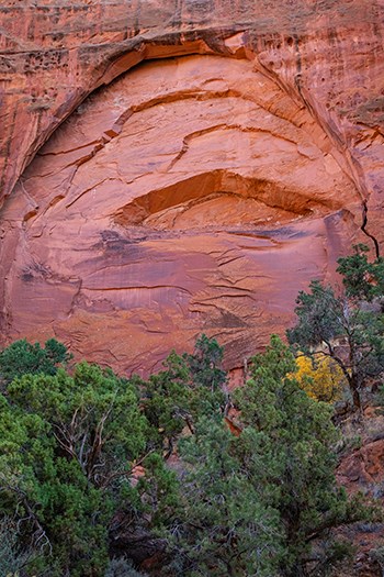
Following breakfast, an early departure takes us on UT-14 to Tod’s Junction meeting UT-14 and US-89 through Hatch to the junction w/ UT-12 through Tropic, Cannonville, Henrieville, Escalante, and Boulder where we will tip our helmets to the Burr Trail, then roll into Torrey to the junction w/ UT-24.
State Route 12, Utah
From Torrey, it’s UT-24 along the Fremont River, past Capitol Reef, through Fruita, Caineville to Hanksville. Staying on UT-24 we make our way through Green River via a brief spin on I-70 to US-191 to Moab, Arches, and red rock country.
The irony of technology vs the written word was not lost on Edward Abbey
Via Moab US 191 through the La Sals and into the Rockies to Monticello and the junction w/ US-491 we make our way through Lewis and UT-184, to Mancos and UT-3 and US-160 to Pagosa Springs. Here we take US-84 through Chomo, cross the Colorado/New Mexico border to the junction of US-84 and US-64. The last leg on US-64 is to the junction w/ UT-17 into Chama.
Via US-64 from Chama, we pass through Brazos, staying on US-64 at Tres Piedras, we cross the Rio Grande on the Rio Grande Gorge Bridge on our way to Taos. It’s fun to walk to the middle of the span and jump up and down. More fun if an 80,000-pound rig passes by.
From Taos, it’s UT-68 to Pilar, where we roll alongside the Rio Grande to Espanola and Pojoaque, then take US-285/US-84 into Santa Fe.
The Rio Grande near Taos
= OR =
Abbey’s Road Trip 2021 V1.1, a.k.a. The Aspen Anna Option (with a nod to Taos)(?)
This route option skips the Moab to Chama, Chama to Santa Fe Days 4 & 5 legs of The Other Abbey’s Road Trip V1.0.
With this option, the riding distance for days 4 and 5 increases by 140 miles so that we might visit Aspen. One of the other Associates, Andy, who you will recall from the Riding Under a Fool Moon post, has daughter who resides there. And Anna happens to be a former student of Sisyphus. Who knows, maybe we’ll see Lance Armstrong and George Hincapie riding their bikes, neither of whom is a former student, but Aspen is a small town. The bonus of crossing the Continental Divide resplendent in fall color looms as we make our way through the Rockies.
Briefly, south out of Moab on US-191 to the junction w/ UT-128 to junction w/ UT-46 in La Sal. A short distance to the Utah/Colorado border where UT-46 becomes CO-90 we roll to Naturita where we don a few extra layers and take CO-141 up and up to the junction w/ US-50 just south of Grand Junction to Delta. Junction US-50 w/ CO-92 to Hotchkiss and junction w/ CO-133 to Carbondale and the junction w/ Rds. 101, 100 to CO-82 on to Aspen. Lots of twisties in the mountains.
Out of Aspen, likely wearing every stitch of clothing we’ve packed, it’s CO-82 over Independence Pass. Unless closed whether the weather! Then on to the junction w/ US-24. US-24 due south to the junction w/ US-285 near Johnson Village. US-285 to junction w/ CO-17 to Alamosa where we pick up US-285 crossing the Colorado/New Mexico border to Tres Piedras and US-64 to Taos. From Taos it’s UT-68 to Pilar where we roll alongside the Rio Grande to Espanola, and Pojoaque and take US-285/US-84 into Santa Fe.
Should the decision be made to skip Taos, remain on Hwy-285 to Santa Fe (Aspen to Santa Fe) ~303 miles. If my vote counts, I say Taos it is.
Meanwhile, on to Santa Fe…
Day 6 – Santa Fe Layover*
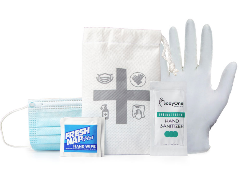
Mask man to the rescue!
Without imposing too much, while in Santa Fe we anticipate that the Bob and Suzanne Delaware, our resident hosts, will consent to allow Bob to summon his considerable skills as a platinum tour guide to provide Sisyphus and his Associates with a condensed tour of Santa Fe. This skill set has been honed over a number of years shepherding student travelers to the nation’s Capitol and the Big Apple, as well as his personal European and stateside rambles.
Land of the Enchanting Delawares
Hopefully we’ll not have to deal with any plague spreading oppressors! Besides, Bob’s tour will get us out of Suzanne’s lovely red hair…
From Santa Fe, we head north on US-84 to Pojoaque and cross the Rio Grande on US-285 to Espanola. Remain on US-285 to La Quachia (US-84) along the Rio Chama to Abiquiu, with Georgia on our minds, or choose the option to head west and visit Los Alamos via NM-502, -501, -4, and check out what’s shakin’ at ground zero for mutually assured destruction. In either case, then proceed to NM-126 through the mountains to the junction w/ NM-96 and US-550 near La Jara. From the US-550 Interchange, we roll through Counselor, Nageezi to US-64.
On to Farmington along the San Juan River to Shiprock where US-64 will take us across the New Mexico/Arizona border to Teec Nos Pos and the junction with US-160 and the Four Corners Monument north on US-160, a six-mile (x2) round-side trip.
Back on US-160 near Red Mesa, we cross the San Juan River just west of Bluff to the junction w/US-163 to Mexican Hat.
Es un hermoso sombrero
Day 8 – Mexican Hat to North Rim Campground ~265 miles
Okay boys keep the bikes in the middle of the lane
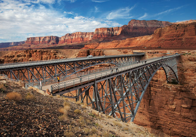
From Mexican Hat on US-163, in the midst of the Navajo Nation, to Kayenta and the junction w/ US-160 and AZ-98, up to Page and the Glen Canyon Dam and Lake Powell where we’ll spend a moment considering the abject reality of climate change, then head to the junction w/ US-89 across Antelope Pass to Bitter Springs and US-89A crossing the not so mighty Colorado River on the Navajo Bridge across Marble Canyon to Jacob Lake (from Mexican hat it’s ~220 miles to Jacob Lake Campground) where Hwy-67, which takes us to the North Rim of the Grand Canyon, lies some 45 miles south from Jacob Lake.
Backtracking, as the North Rim is an out-and-back, we take US-89A back to Bitter Springs, then US-89 south to Cameron, where we roll to the South Rim of the Grand Canyon on AZ-64.
Leaving the South Rim, we motor on AZ-64 to Williams before getting on the Historic Rte-66 the following morning. Maybe we can find a corner to stand on with fine sights to see, not Dallas Alice, but the takin’ it easy girl…
Williams Arizona, lost in time
Take’ It Easy You may recognize JB. How ’bout the fiddle player? Hint: DL
Getting our kicks on Historic US Rte-66 while takin’ it easy, we roll through Ash Fork, Seligman, Yampai, Peach Springs, Truxton, Cozier, Valentine, Hackberry, Antares, Hualapai, Berry, Getz, to Kingman perhaps to mistakenly stand on a corner scanning to see a flatbed Ford. Road-weary, a kind passerby reminds Sisyphus that the corner about which Jackson is singing is in Winslow, not Williams, or Kingman for that matter, though either city’s name satisfies the meter of the song… There’s probably a corner in Seligman we can stand on too, though there is one too many syllables.
In Kingman we take US-93 to the junction with AZ-68 to the Arizona/Nevada Border.
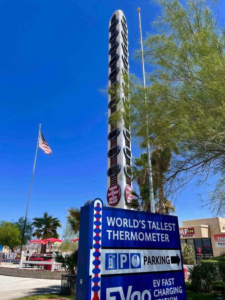
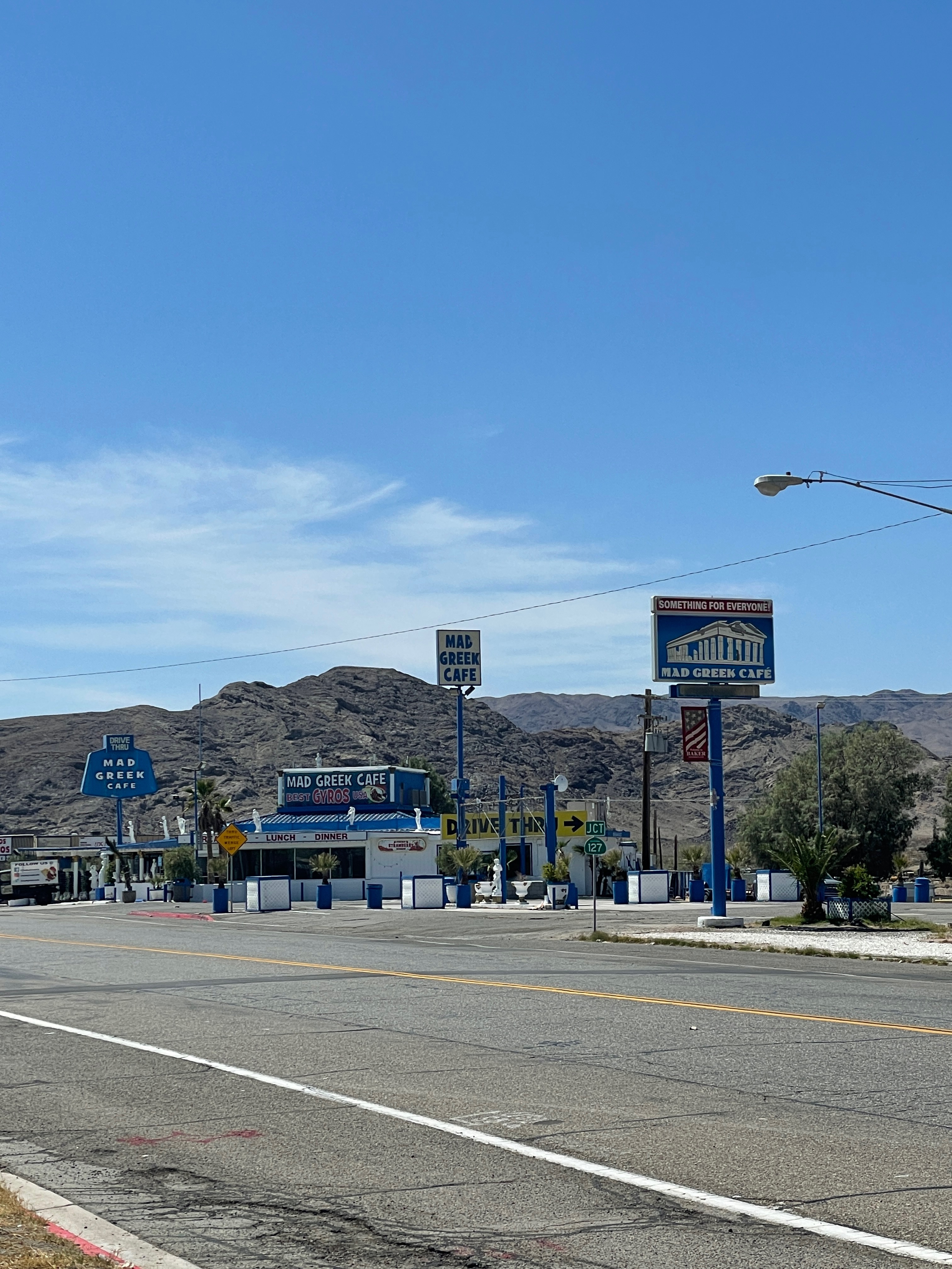
Entering the great Mojave at the interchange of AZ-68 and NV-163 and crossing the Colorado River again, what’s left of it downriver from the Davis Dam, this time in Laughlin, we head to Palm Gardens on NV-163. From the junction w/ US-95 in Palm Gardens, we roll to Searchlight and the Nevada/California border as NV-164 becomes Nipton Road to the I-15 (Barstow Fwy). From there we “slab” over Mountain Pass past the historic but abandoned and vandalized Hi-Lo Restaurant, to Baker and the world’s tallest thermometer where the Mad Greek Restaurant and Alien Fresh Jerky all await a similar fate.
From there we cruise through the remaining Mojave National Reserve to Shoshone on CA-127, the Death Valley Rd. We will heed the Desert Oracle’s advice and Desertoracle.com, Episode 127, Try Not to Die
Somewhere in the distance is the Amargosa River that “flows” through Shoshone
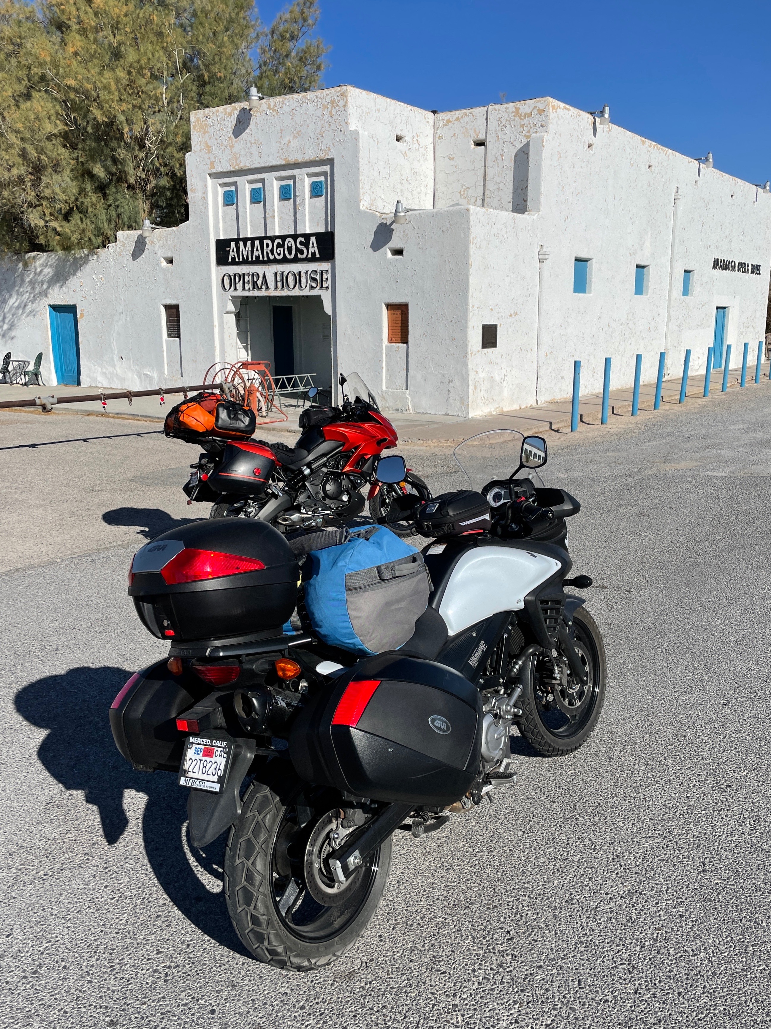
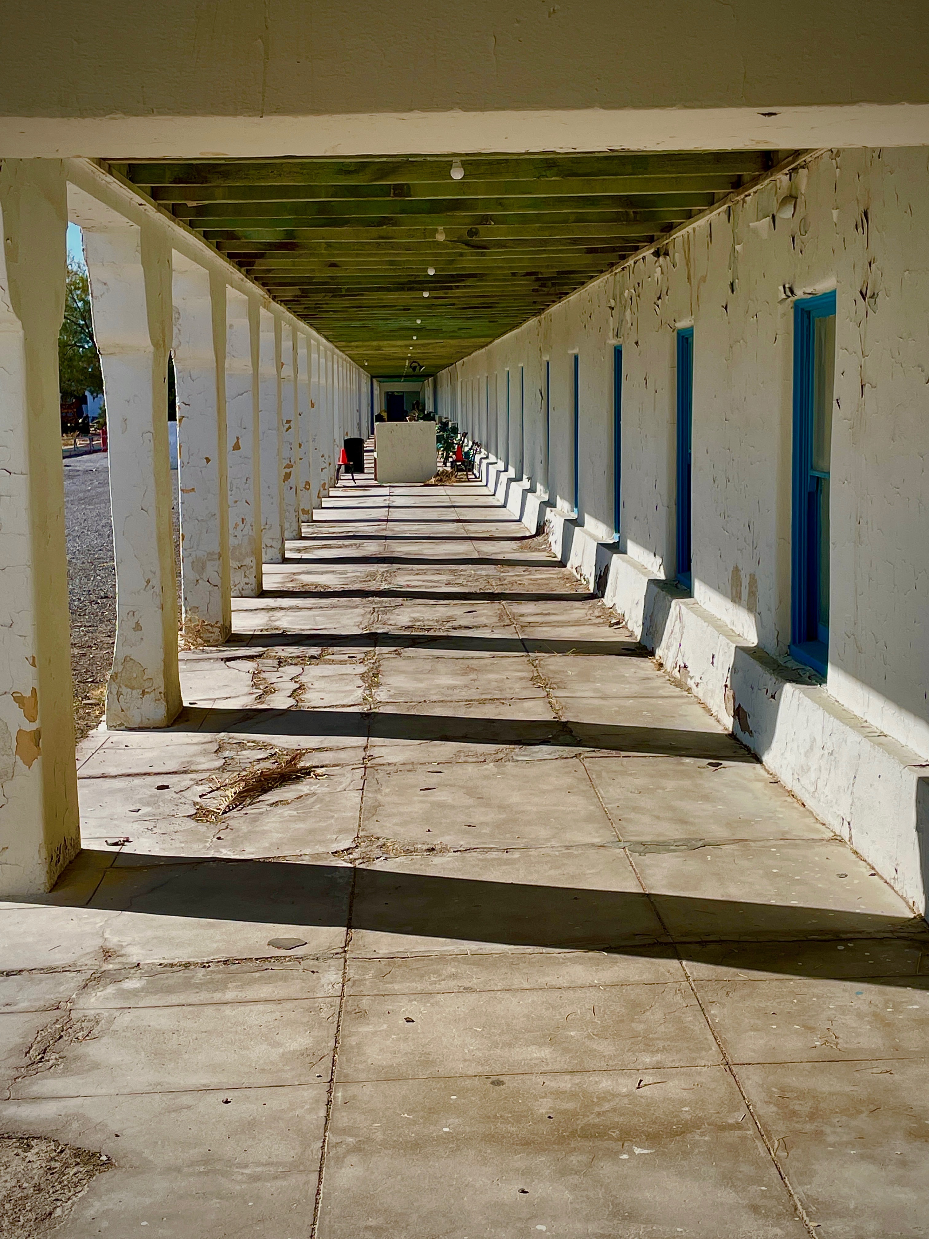
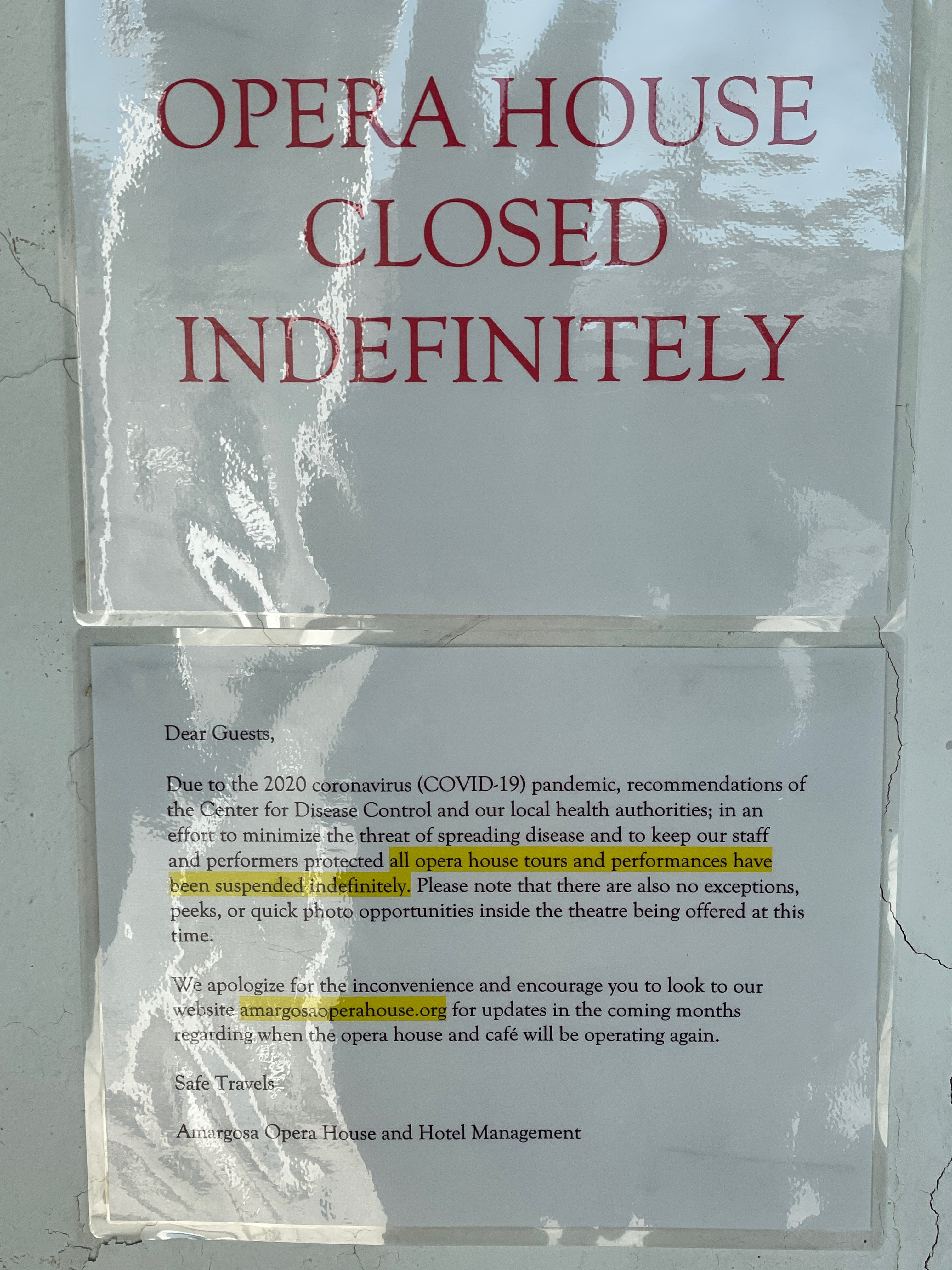
Our early departure from Shoshone takes us past Death Valley Junction and the Amargosa Opera House on CA-127 or we detour through Death Valley CA-190 ~164 miles to Lone Pine*
CA-127 becomes NV-373 at NV border where we continue to the Interchange of NV-373 and US-95 to Beatty, maybe catching Rhyolite on a short side trip on NV 374 (six miles, twelve round trip) that we missed on the Riding Under a Fool Moon, Death Valley by Moonlight ride (because of Sisyphus’s navigation error) for a picture or two. Then it’s back on US 95 to Goldfield (to check out the Santa Fe Motel and Saloon). Parenthetically speaking.
*Death Valley, Furnace Creek and Stovepipe Wells, through Panamint Springs on CA-190 to Lone Pine: DV to Panamint to Lone Pine
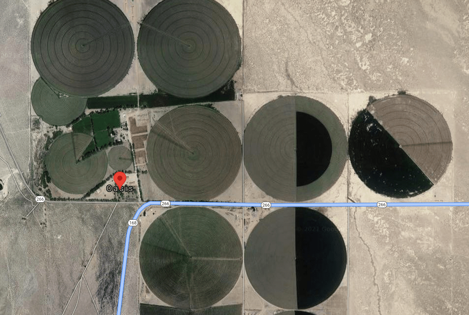
From Goldfield we take US-95 south, backtracking as it were, to the junction w/ the Lida NV-266 junction crossing the Nevada/California border to the junction w/ CA-168 at Oasis where circular irrigated alfalfa fields thrive. This was the scene of an alien abduction during our Riding Under a Fool Moon, Death Valley by Moonlight moto adventure linked above. This was a pre-pandemic ride in the fall of 2019 with the Associates Pete and Andy, one of whom mysteriously disappeared. Fortunately, for Anna’s sake, he was released by his captors and we were reunited in Big Pine.
Alien guidance systems posing as circular irrigated fields
Over Gilbert Pass, past Deep Springs College, where Sisyphus regrets not having the wherewithal to have attended, and over Westgard Pass to Big Pine Hwy on CA-168 where we take US-395 to Lee Vining and CA-120 over Tioga Pass and CA 140 to la douceur du foyer where there are numerous corners to stand on, but not many flatbed Fords. Thus ending the story of our route with a hard-to-read text, according to my editor…
Deep Springs College features fewer distractions than Chico State, Sisyphus’s alma mater
But wait, there’s more…
Abbey’s Road Trip 2021 Layover Days: Lessons From the Past Regarding Guest-friendship, An Ese…
Where Sisyphus considers a dialog with an Homeric epic. The italics indicate Sisyphus’s considerations…
While ours is scarcely an epic journey, Sisyphus will reflect on how the classics deal with road trips and apply their wisdom to our contemporary adventure. Sisyphus has considerable regard for how the past informs the present and future.
According to J. B. Hainsworth, in the course of the Homeric epic Odysseus encounters several examples of xenia, “guest-friendship” providing models of how hosts should and should not act. The Phaeacians demonstrate exemplary guest-friendship by feeding Odysseus, giving him a place to sleep, and granting him many gifts and a safe voyage home, which are all things a good host should do.
The Delawares have Phaeacian DNA.
Polyphemus demonstrates poor guest-friendship. His only “gift” to Odysseus is that he will eat him last. Calypso also exemplifies poor guest-friendship because she does not allow Odysseus to leave her island.
Polyphemus and Calypso offer classic “six of one, half dozen of another” poor guest-friendship outcomes. I’ve always known the Delawares to offer the finest beverage upon their guests’ arrival and to offer exceptional repast and delightful conversation before bidding adieu. Neither Bob nor Suzanne have ever once hinted at cannibalism. Their abiding hospitably permit their guests who’ve either satisfied or have exhausted their memorable visit to exit with good cheer. The Delawares conduct all guest-friendship with exceptional grace and decorum unlike Polyphemus or Calypso.
Odysseus
Polyphemus
Antinous
Calypso
Another important factor to guest-friendship is that kingship implies generosity. It is assumed that a king has the means to be a generous host and is more generous with his own property. This is best seen when Odysseus, disguised as a beggar, begs Antinous for food and Antinous denies his request. Odysseus essentially says that while Antinous may look like a king, he is far from a king since he is not generous.
I promise to not relegate Pete or Andy as beggars to test Bob’s hospitality, as Odysseus did to Antinous since I know Bob, unlike Antinous, is kingly in his every manor and exhortation. If at all flawed in his sincere humility, Bob is indeed kingly in his generosity. I am reminded of his wise counsel: It never happened.
Guest-friendship follows a very specific pattern:
The arrival and the reception of the guest.
Arrival will be on September 30, 2021, mid afternoon, baring the incalculable unforeseen delays of any quest into the unknown.
Bathing or providing fresh clothes to the guest.
A garden hose or perhaps a refreshing Santa Fe thundershower will do. We may need to do laundry. Perhaps we can obtain a wash tub and scrub board from one of the vendors on the Plaza.
Providing food and drink to the guest.
We will sustain the first three rounds of any beverage occasion. Beyond that, neither Santa Fe nor the Delawares bear any responsibility for poor choices. The Delawares may still be on the hook to shuffle us off to the nearest pub or contact our loved ones for bail.
Questions may be asked of the guest and entertainment should be provided by the host.
Good cheer and maybe a beverage or two are the only requirements for entertainment since exposure to centuries of Santa Fe culture and history requires more time to absorb and greater tolerance than the Delawares can muster for weary moto riding dirtbags despite my earlier comments about Bob’s superb skills as a guide.
The guest should be given a place to sleep, and both the guest and host retire for the night.
A curb for our mounts, a yard for a tent, perhaps a couch or a chaise lounge will do. Should the Delawares elect to get a room for the night elsewhere, I think we can support their choice, as we pledge to limit damage to their domicile. We can’t guarantee that no harm will come to Bob’s tomatoes, however.
The guest and host exchange gifts, the guest is granted a safe journey home, and the guest departs.
Our gift will be our departure. As for the safe journey home, guaranteed. We will leave more or less on time.
Another important factor of guest-friendship is not keeping the guest longer than they wish and also promising their safety while they are a guest within the host’s home.
Departure will be on the morning of October 2, having stayed with our gracious hosts Bob and Suzanne for two nights max. It likely takes longer than that for the Santa Fe authorities to evict us. Regardless, the Delawares know Sisyphus’s attention span is limited.
Sisyphus will guarantee the safety of our hosts, only insofar as the pharmaceuticals and preventives guarantee our safety. We will respectfully do our best to erase any plague spores the heretofore mentioned oppressors have spread…
Thanks to Wiki for informing Sisyphus of the specifics of the Homeric epic.
The actual post trip narrative will arrive sometime in October, Sisyphus is already feeling it…
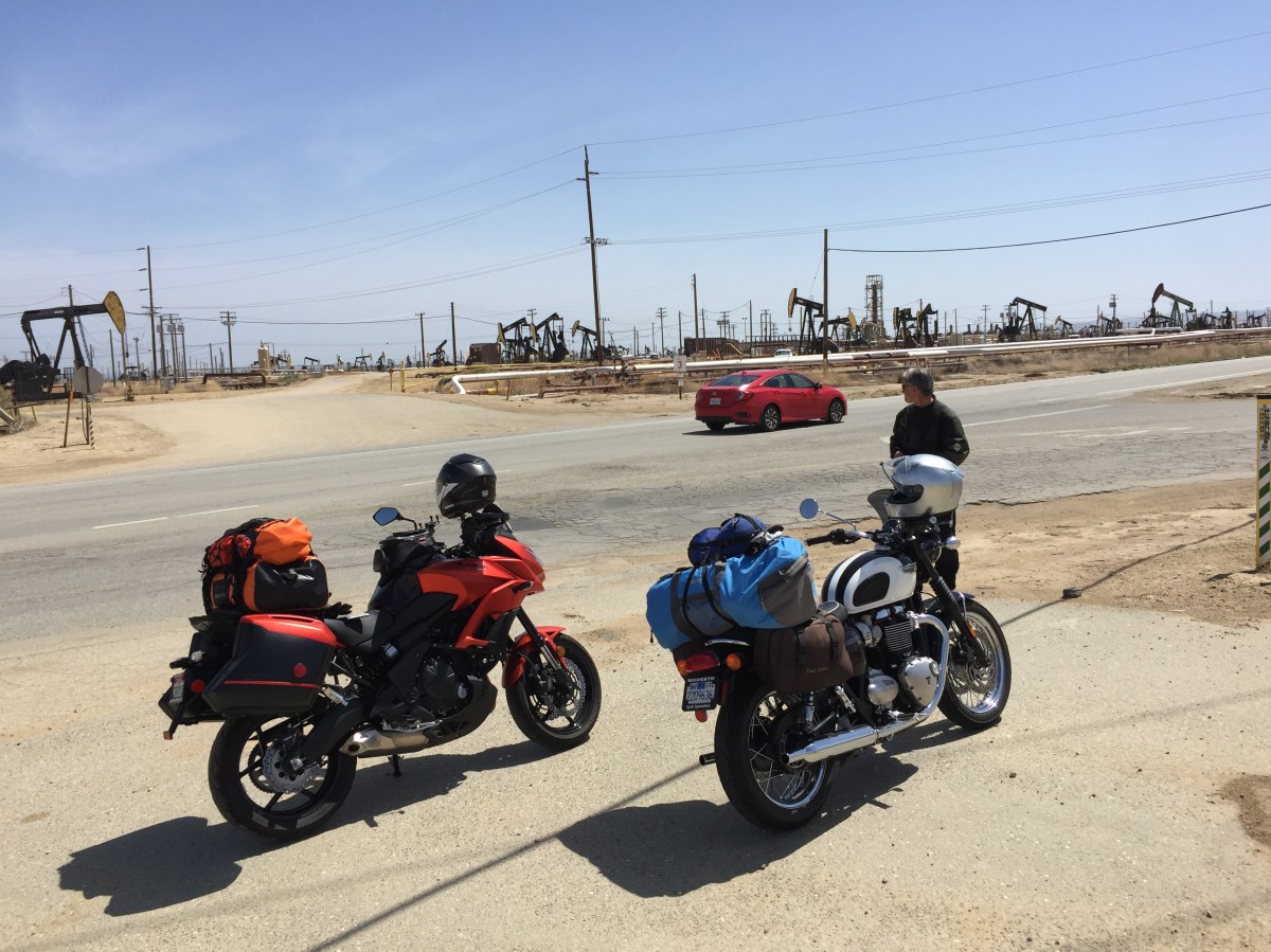
From 2018 Pete on his Bonny joins Tom on the Kawasexy.
Somehow lost in the quanta of physics, the ether of the interwebs, or my incompetence at blogging on WordPress, I originally posted this as a “page” intending that it join its brethren in those vignettes found in my “posts”.
Since I barely understand how navigation on my site works, I thought that linking the page to my posts would patch my bungle. Please enjoy…
It is not enough to fight for the land; it is even more important to enjoy it. While you can. While it’s still here. So get out there and hunt and fish and mess around with your friends, ramble out yonder and explore the forests, climb the mountains, bag the peaks, run the rivers, breathe deep of that yet sweet and lucid air, sit quietly for a while and contemplate the precious stillness, the lovely, mysterious, and awesome space. Enjoy yourselves, keep your brain in your head and your head firmly attached to the body, the body active and alive, and I promise you this much; I promise you this one sweet victory over our enemies, over those desk-bound men and women with their hearts in a safe deposit box, and their eyes hypnotized by desk calculators. I promise you this; You will outlive the bastards. ~ Edward Abbey
If Edward Abbey’s sentiment resonates with you, you’ve passed the first test to become an associate!
Some people like it, some people don’t. We are talking about the desert.
Ken Layne, the Desert Oracle
Not spring yet, but plans were fomenting…
Conventional wisdom asserts that visiting the desert in the winter or spring is preferable to a summer visit. That leaves the fall option, but a landscape brutalized by an unrelenting summer is, IMHO, less interesting than, say a fall tour of the temperate montane forests north of the Mojave. At the same time, riding a moto over icy roads is a risk since, post pubescent, I’ve abandoned. As I was commencing route planning, given that back roads to the Pacific, the Mojave, and the Sierra were all under consideration, the unsettled weather was one of the first challenges to overcome. The window of favorable conditions was narrowing.
Originally planned for a year ago, but cut down by the pandemic, it was time to put our foot on the rock and don’t stop. https://youtu.be/dGbqudQtKmw as the drums were calling…
For my riding buddy Pete and me, Covid vaccination schedules used up several weeks in January, February, and March along with yet another Mohs surgery for moi, familial obligations for nous deux, and Pete’s jury duty. Even in retirement there are considerations to which one must attend.
When at long last a launch date was chosen even a failed crown wasn’t going to deter me. I needed to shore up the loose ends of an itinerary to make this real. Our departure target of April 11 would be a week after what I fancied as most of the millennial Spring Breakers having scattered and hopefully before the onset of yet another dry and unbearably “warm” spring regime Daniel Swane (@Weather West) was predicting would begin to build. I imagined only northern climate escaping, RV motoring whiteheads would be sporting about the interstates in route to some of the more popular destinations on our itinerary leaving us the Lost Highways and G1-3 PMT’s (I’ll explain later) the loneliest roads for our preferred method of travel.
The downside to packing a week before departure on one’s preferred method of travel is that one forgets where one put stuff, not unlike the cluttered shelves in one’s garage… (Note the convenient location of the Charmin)
Our tour was decided to be strictly camping, eating the local fare, and riding under 300 miles a day. We would have to touch the sea, sand, and snow. I planned for a six or seven day tour depending on how much sleeping in the dirt (perhaps boondocking should campgrounds be closed with questionable availability of an occasional shower), would influence our decision making. Lucky for us all of the above worked out.
Pouring over Google satellite views of our intended route was subordinate to the Butler Motorcycle Maps criteria of Lost Highwaysand PMT’s (Paved Mountain Trails) and G1-3 routes. These byways are also a throwback to the roads I’ve pedalled over in another time and place and that I’m trying to reprise on the moto before riding off into the sunset.
A ButlerLost Highway[is one] of faded center lines, crumbling shoulders, and long lonely miles putting these roads in a category of their own. These are the roads that seem lost in time. It is what these roads lack that make them worth the journey.
A Butler PMTsweeps through the remote forests and mountain ranges of California that are paths of pavement that leave even the most seasoned riders searching for ways to describe their riding experience. These roads are exceptionally tight and twisty and other unique opportunities to explore the less traveled corners of California.
Those descriptions are from the editors of Butler maps. I’ll add the first of a few more categories of my own, the JonesPARoC‘s (Paved Ag Roads of California), or, two lane roads astoundingly arrow straight with right angled intersections bordered by crop obscuring sight lines and stop sign, double yellow line disregarding, pucker inducing impatient cagers of questionable sobriety trying to pass anything with ≥ 2 or ≤ 18 wheels.
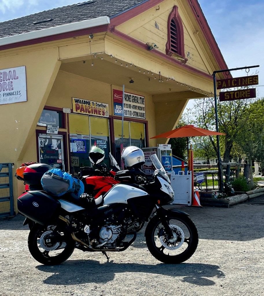
Our first day would include legs of familiar routes to familiar destinations we’ve come to appreciate and look forward to revisiting. From Merced, we made our way to Panoche Rd via Jones PARoC’s (CA-59 to Dos Palos, Russell Ave. to Shields, then over I-5 to Panoche Rd) to Paicines, rolling through the ag engine of the Central San Joaquin Valley into the bucolic rangelands of the Coast Ranges, where in the past we would grab a burrito. Unfortunately we did not appreciate the conviction and dedication of the cook at the Paicines General Store who was observing the Sabbath. No burritos for us.
And in the sixth day, the cook finished her works that she made, and she was refreshed in the seventh day from all her works that she had made…
Sadly, I did not photograph what would be a recurring theme of this trip, making new friends. As Pete and I substituted a shared Kind bar for a carne asada or carnitas burrito, three gentlemen on three bikes rolled up. One on a Triumph Tiger, another on a small displacement Honda CBR, and the third on a Yamaha XMAX scooter. I apologize for not whipping out the phone to snap a photo, something Pete and I would exam post ride…
The guy on the scooter was a dead ringer for Peter Bogdanovich. The fellow on the sport bike was in full seasoned leathers sporting a long gray braided ponytail. It was only after removing his helmet did we realize he was bald and the disembodied ponytail was attached to the back of his helmet. Once again confirming that refrain should be observed when judging the cover of a book.
The third fellow on the Tiger was apparently their spokesperson or more likely the most extroverted of the three. We exchanged the usual pleasantries of where we were from and where we were headed. Our new friends were on a day ride from Santa Cruz enjoying the CA-25, also known as the Airline Highway, on a fine spring morning. They were impressed and maybe a tad envious of our intended multi-day tour first to the coast, then across the desert, and home through the mountains. It would not be the first time we observed longing in the eyes of an imagined adventure appearing on the faces of those who would learn of our intended journey.
From Paicines, we headed south on CA-25 past the Pinnacles National Park and just past Coalinga Rd to Bitterwater where CA-25 intersects with G-13, AKA the Bitterwater Rd in San Benito County. We traveled another of theseButler PMT roads back in 2019 on the Wildflower Tour only taking PeachTree Rd that intersected with Indian Valley Rd bearing right onto Hare Canyon Rd to Lake Nacimiento.
Our 2019 PeachTree Indian Valley Rd route on the left follows the San Andreas Fault. On the right, this year’s route from the Jolon Rd in southern Monterey County was just west of the San Andreas Fault. You choose…
Our new route took us through King City to G-14, Jolon Rd past Ft. Hunter Leggitt through Jolon and Martinus Corner to Lockwood where we took the Interlake Rd past the Lake San Antonio Rec Area to Nacimiento Lake Dr. Here we rode across the dam whereupon we inspected the lake’s campgrounds. Pausing for a snack at the Oak Hill Market, we decided that 80+ degrees was too warm to set up camp, and since it was a bit early in the day we opted to head to the cooler state park in San Simeon, still observing the “under 300 mile a day” criteria.
With onshore winds picking up, a very cooperative state park ranger directed us to a protected campsite despite the sandwich board sign at the entry that the campground was full. Considering we were at the end of a modest 241± mile day and the temps were in the low 60’s, our decision to abandon Lake Nacimiento was rewarded. Our new ranger friend belatedly admitted that he’d forgotten to take the sign down. The skeptic in me believed he was discouraging late Sunday afternoon campers seeking refuge to knock off a little early…
The importance of electrolyte replacement and checking messages while moto-touring cannot be underestimated…
Our good fortune would be followed by another fine meal of fish and shrimp tacos at the West End Bar and Grill in Cambria. Procuring night caps, we headed back to camp to relax, reflect, and continue rehydrating.
We awakened early, just before the roar of the cock-a-doodle-doo trash collector at the Hearst San Simeon State Park crash-bang-boomed awakened the campground from restful sleep soothed by the ocean soundscape. I was already up as is customary for a gentleman of my age and preparing water on the JetBoil for coffee. As we were breaking camp the truck pulled up to the dumpster across from our campsite. The roar of the hydraulics lifting the dumpster to empty was met with a ear-splitting metallic crash that was considerably louder than the usual ringing of dead soldiers landing in the truck’s bin characteristic of campground refuse. Upon closer inspection it seems the operator had dumped the dumpster into the bowels of his trash truck. The operator noted our witnessing the event, rolled down his window and exhorted, “I guess I’ll be taking this one with me!” and in classic Duke Kahanamoku fashion unwittingly conveyed, “Take your time – wave comes. Let the other guys go, catch another one.” Needless to say, Cambria is not Lake Nacimiento.
By the time we had finished unpacking our gear to hit the road to our next campsite, we rolled past our intrepid trash collector and exchanged, “It never happened” gestures, yet another friend, though nameless, encountered.
A modest day to Saddleback State Park Campground east of Palmdale from Hearst San Simeon State Park would be roughly ±249 miles. From the itinerary: We’ll need to get provisions in Palmdale for our destination for the night at Saddleback State Park Campground which is 24 miles east of Palmdale at the original Joshua Tree Monument headquarters and campgrounds established in 1958 that in 1994 became the Joshua Tree National Park southeast some 116 miles thanks to Bill Clinton. I’m into details.
We wound our way on Butler PMT’sthrough the hills on Nacimiento Lake Rd east on CA-46 to Vineyard Drive crossing US-101 in Paso Robles. Reaching Templeton we made our way south on El Palomar/Cripple Cr Rds with a short east on CA-41 where we joined nearby Creston/LaPanza Rds south eventually intersecting with CA-58 at Wilson’s Corner. Got that? Leaving the foothills, we continued east on CA-58 through the Topaz Solar Farm into, with little or no irony, oil country on the northern edge of the Carrizo Plain before entering Kern County foothills to CA-33 near McKitterick. Did I mention that I’m into details?
A second Jones category of roads, known as OCPRoC;’s (Oil Country Paved Roads of California), two lane roads astoundingly arrow straight with right angled intersections bordered by pumpjack and pipeline obscuring sight lines, stop sign and double yellow line disregarding, pucker inducing impatient cagers of questionable sobriety and mental health trying to pass anything with ≥ 2 or ≤ 18 wheels, most of which, filled with explosive fluids.
Energy, whether fossil or photovoltaic is where you find it, eh? Time to stop for nalgas relief, hydration, and a Kind energy bar…
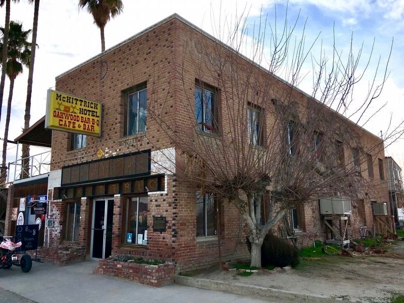
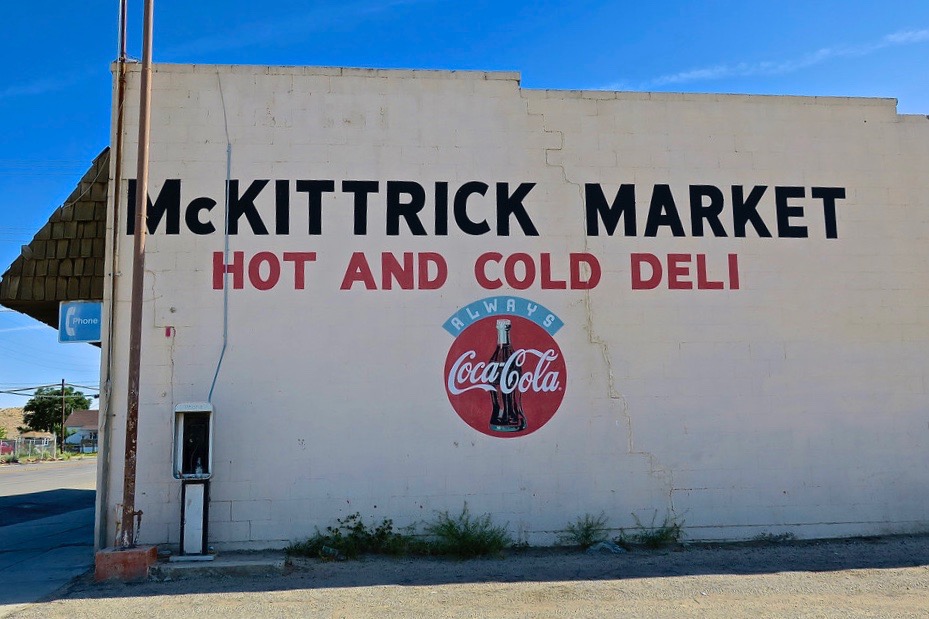
Fortunately the market was open. The historic McKittrick Hotel, yet another missed opportunity to sample local fare, forced us to purchase electrolytes to replenish our hydration stores at the hot and cold deli where we met our next new “friend”. This new “friend”, who remains nameless, was, well, let’s just say, interesting.
As we made our hydration transactions a woman introduced herself by stating she had just contributed $20 to the humble proprietor of the McKittrick Market to, “Stop the pipeline!” She continued to tell me that she was fleeing Los Angeles as a Donald Trump underground gas/Soilent Green perplexity had devastated the city and the entire population of Los Angeles was beating a hasty retreat from the carnage. She then described how she had driven her late model Mini Cooper on the right side emergency lanes of the freeways to escape the bumper-to-bumper fleeing Angelenos, eventually finding solace in, of all places, McKittrick where pump jacks outnumber residents 1000 to 1 and apparently where the opportunity to claim a $20 tax write-off donation presented itself. I was speculating about the tax write-off. You gotta love the gateway to the desert where the irony:weirdness coefficient begins to increase geometrically.
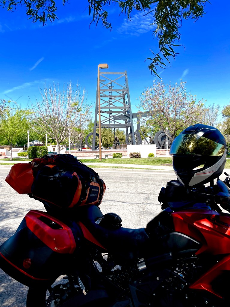
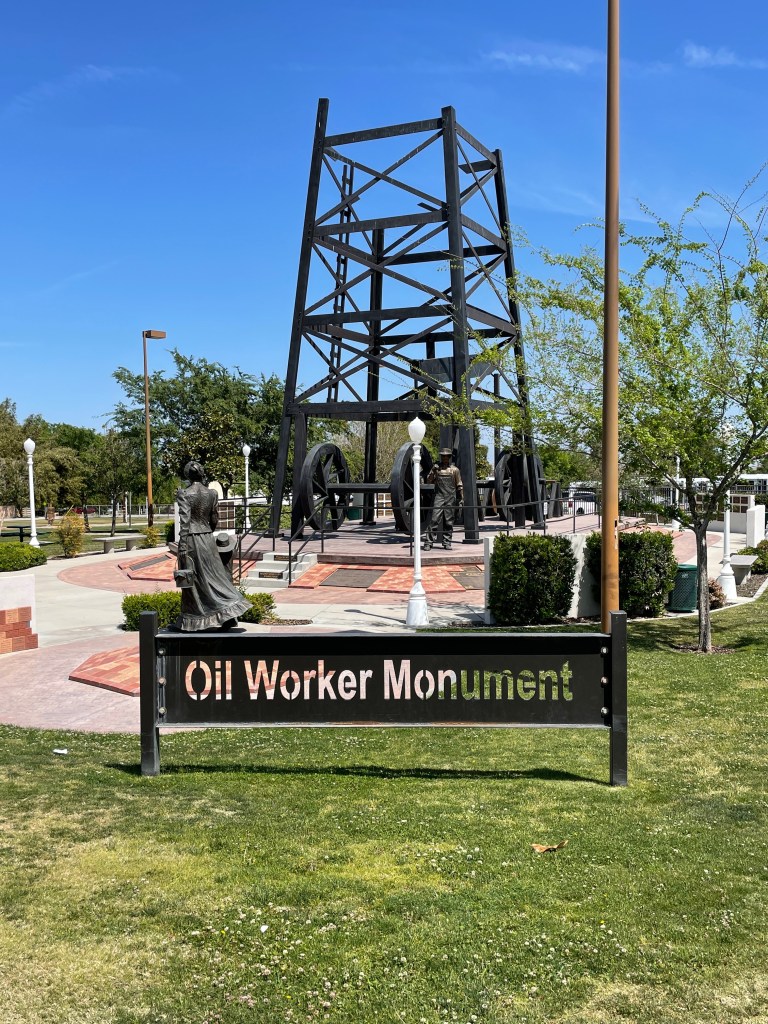
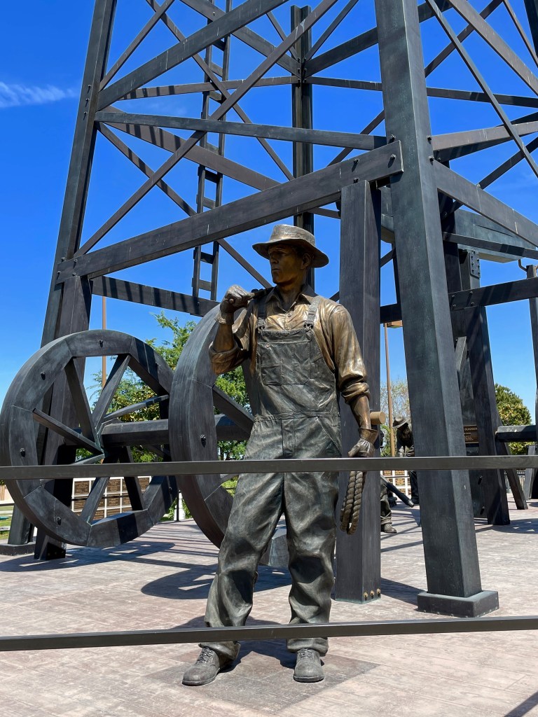
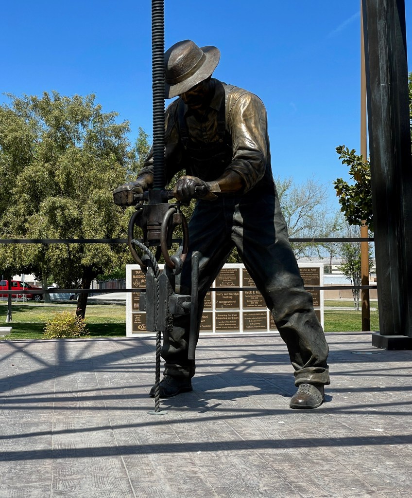
We stayed south on CA-33 through Derby Hills to Taft. I had recently watched a Huell Howser, California’s Gold episode on the Taft Oil Workers’ Monument and made a point of stopping.
Dedicated in 2010, during Oildorado, the Taft Oil Worker Monument is a beautiful bronze sculpture that depicts the life in the oil fields in 1910. The tribute to the men and women whose hard work and determination built the petroleum industry and, as a result, the community of Taft is commemorated through plaques and bricks honoring the individuals who have created our City. The monument’s artistic creator, Benjamin Victor created the largest bronze sculpture West of the Mississippi, right here in Taft, CA. This larger than life sized monument is a beautiful tribute to our oil industry and all of the hard working men and women throughout the years. (Courtesy of the Taft Chamber of Commerce and Visitors Bureau)
I thought Pete’s partner Cheryl would appreciate that we would acknowledge a bronze sculptural art installation on this tour. I imagine it’s a much cleaner representation, and with the Chamber’s somewhat more romantic description, of the roughnecks that Gerald Haslam chronicled in his works about the men who worked the Midway-Summit oilfields of yesteryear. https://en.wikipedia.org/wiki/Gerald_Haslam
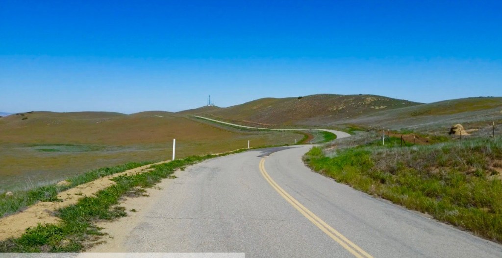
We continued south on CA-33 in the heart of the westside oil country in route to Maricopa where we then took CA-168 south to Hudson Ranch Rd, just across from Soda Cr. Rd that bisects the Carrizo Plain National Monument. Continuing on Hudson Ranch Rd, an emphatic gold Butler Lost Highway/PMTG1 route lay before us, through the Bitter Cr National Wildlife Refuge and up and up through the Los Padres National Forest to Pine Mt. Club (elev. 5,554 ft). There we saw our first rapidly melting north facing patches of snow from a weather system that recently contributed to our delayed departure. On down to Frazier Park (elev. 4,639 ft) where we stopped to delayer before descending further to Lebec and the warmer eastern San Bernardino County where, the weather having sorted itself out, keeping our foot on the rock, couldn’t stop us now.
Hudson Ranch Rd looking east (left) and north (right)
From Lebec, we skirted I-5 on Ralphs Ranch Rd. through Gorman where Gorman Post Rd. took us to CA-138 (Lancaster Rd.) then on to the Old Ridge Rt. Rd to Pine Pine Canyon and Elizabeth Lake Rds, pure Butler PMT’s.
The plaque says it all. Not so much the yellow sign…
Entering the outskirts of Palmdale we encountered the most urban and desert (urbert or desban?) environs of the trip navigating over crowded busy streets teaming with post Covid shutdown revival. After a fine meal at Los Originales restaurant and a quick stop for post ride beverages observing the three R’s of relaxation, reflection, and rehydration, we sought our second night’s accommodations after 249± miles of mostly Butler PMT/Lost Highways G1’s and G2’s mixed in with a few (and now for a third Jones category road) PDRoC‘s (Paved Desert Roads of California-description follows), eventually landing at the Saddleback Buttes State Park Campground.
There our new friend, the campground host Gary, and Pete shared Airstream pleasantries. It seems one must be prepared for pleasant conversation when one travels, especially if you want to make new friends. Perhaps the pandemic and shut-down of public intercourse fueled the hyper-willingness to engage in polite casual conversation with someone other than your roommate, partner, kids or dogs in lockdown. We were well equipped to exchange light playful, sometimes teasing, remarks; essentially good natured raillery centering on trailer/moto banter. This is much better gambit to ensure meeting new friends than the dystopian ramblings of a wacked-out Mini-Cooper driving schizophrenic…
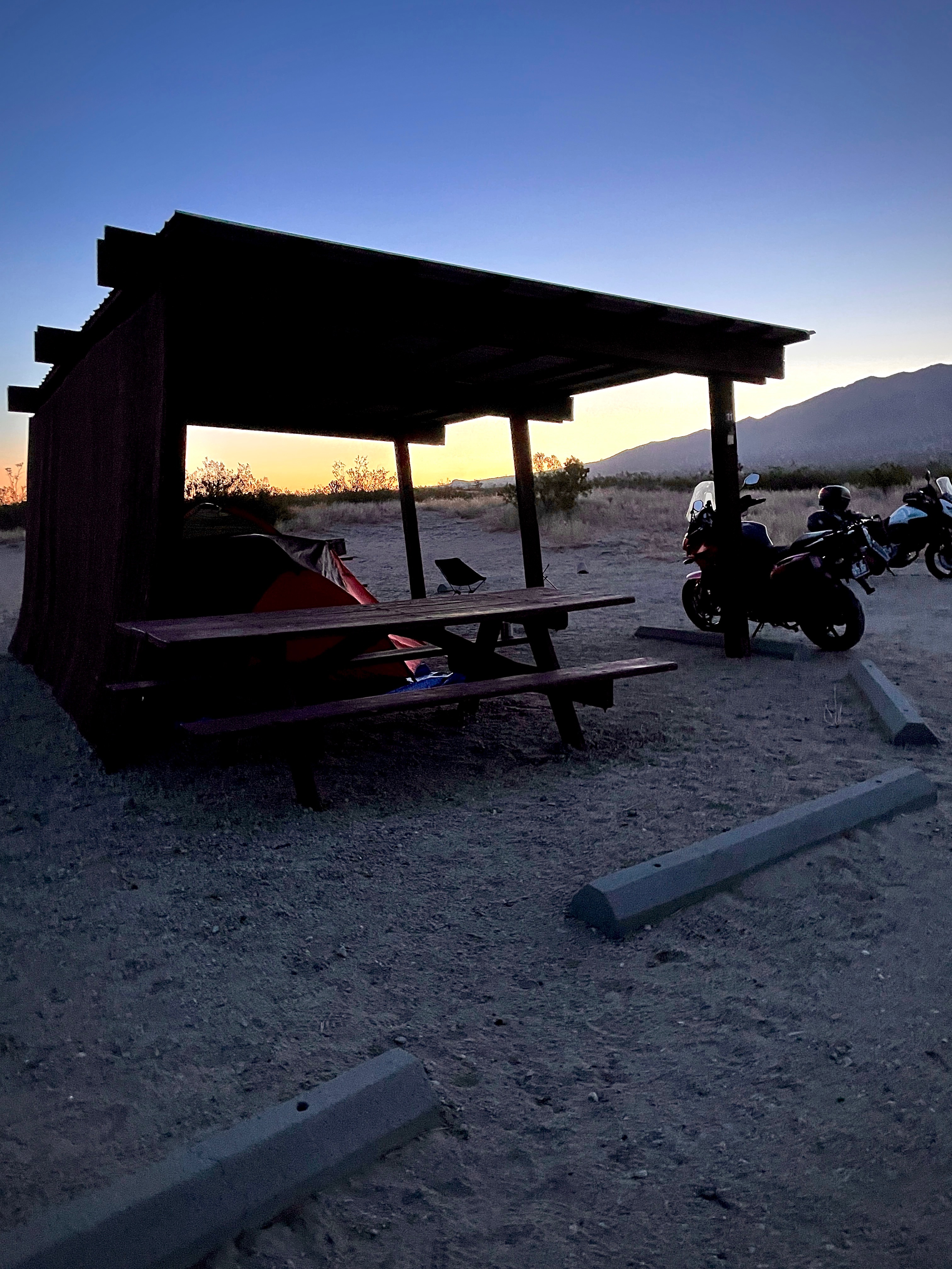
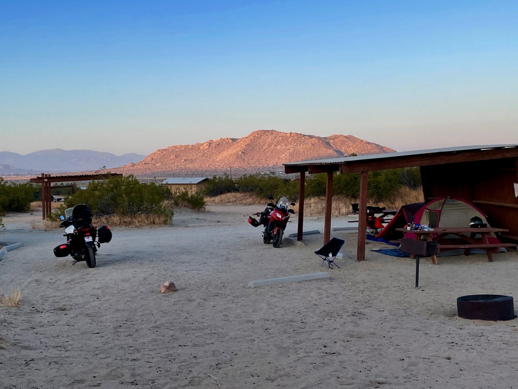
Clockwise from upper left below, our Nomadlandish campground host’s ’62 Globetrotter, our recreational mobile Nomad camp, and our first (of many) desert UFO sightings at sunset.
The cabana under which we pitched camp provided a windbreak of sorts as throughout the night gusts would rattle our tents. Having just listened to the first six episodes of the Lost Hills podcast the week before that explored a series of strange shootings at a state park in Malibu, one of which ended with the murder of a 35-year-old father in front of his two kids, prepared me for an uneasy night in an isolated desert campground. The podcast by Dana Goodyear is centered around the murder of Tristan Beaudette, a father who was killed, shot while asleep in his tent, June 22nd, 2018 while camping with his two young daughters in Malibu Creek State Park. Although there were no witnesses or suspects, after Beaudette’s death, other people started coming forward with stories of being shot at near the same campground.
All I could think of is how far away Malibu is from Palmdale and and how 2018 isn’t 2021 and that a suspect had eventually been arrested, though he claimed to be innocent. That wasn’t enough when I was awakened by the crunching of footsteps in the desert sand around four A.M….
Saddleback Buttes State Campground as the sun rose and no one had been murdered…
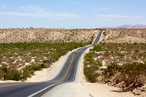
Day 3 was intended to be a short ride to Joshua Tree National Park (±126 mi) which would allow time to find a campsite, if enough spring break millennials had scattered, and explore the park. Hopefully it wouldn’t be unbearably hot or windy. The route took us through Mojave Heights, Victorville, Apple Valley, Lucerne Valley, and Flamingo Heights on CA-247 also known as Old Woman’s Spring Rd. Check out the Google Maps link above.
These roads, similar to the Jones PARoC’s classification, might best be described as Paved Desert Roads of California or PDRoC’s. I may just be splitting hairs with the Butler folks who might argue that these are simply Lost Highways. The romanticism of a Lost Highway is misplaced on these roads that also share features with PARoC’s, namely, two lane roads astoundingly arrow straight with right angled intersections, sometimes paved often not, bordered by mirage obscuring sight lines and stop sign, yellow double line disregarding, pucker inducing impatient cagers and semi drivers of questionable sobriety trying to pass anything with ≥ 2 or ≤ 18+ wheels. At least if a threat was approaching one of these intersections from a dirt road, we’d have a warning dust cloud.
Old Woman Springs Rd a.k.a. Scenic California State Highway 247 a genuine Jones DPRoC
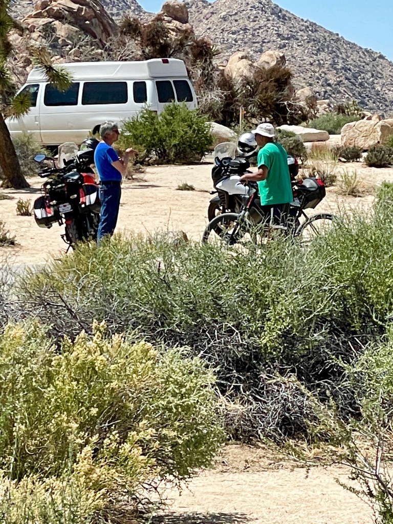
Upon arriving in Joshua Tree, I made a point of dropping by the Desert Oracle office to give Ken Layne a whazzup. If you’ve followed any of Sisyphus’s ramblings, you’ll know I’m a huge fan of Ken Layne and his Mojave ramblings, cast of recurring characters, and RedBlueBlackSliver soundscapes. You too can enjoy his Desert Oracle, “cult-favorite radio show and print periodical based in Joshua Tree that explores everything from the political to the paranormal.” According to his bio in Outside magazine, Layne left an influential career in digital media to create the Desert Oracle and his cast of characters has stretched my jowls in appreciation of their tongue-in-cheekiness about things Art Bell never imagined. Check it all out at https://www.desertoracle.com
Alas, Mr. Layne was traveling elsewhere in the Mojave and his office, right on the busy Twentynine Palms Highway, was deserted. He even took down the Desert Oracle sign. Must be like Tom Bodett leaving the light off at an abandoned Motel 6.
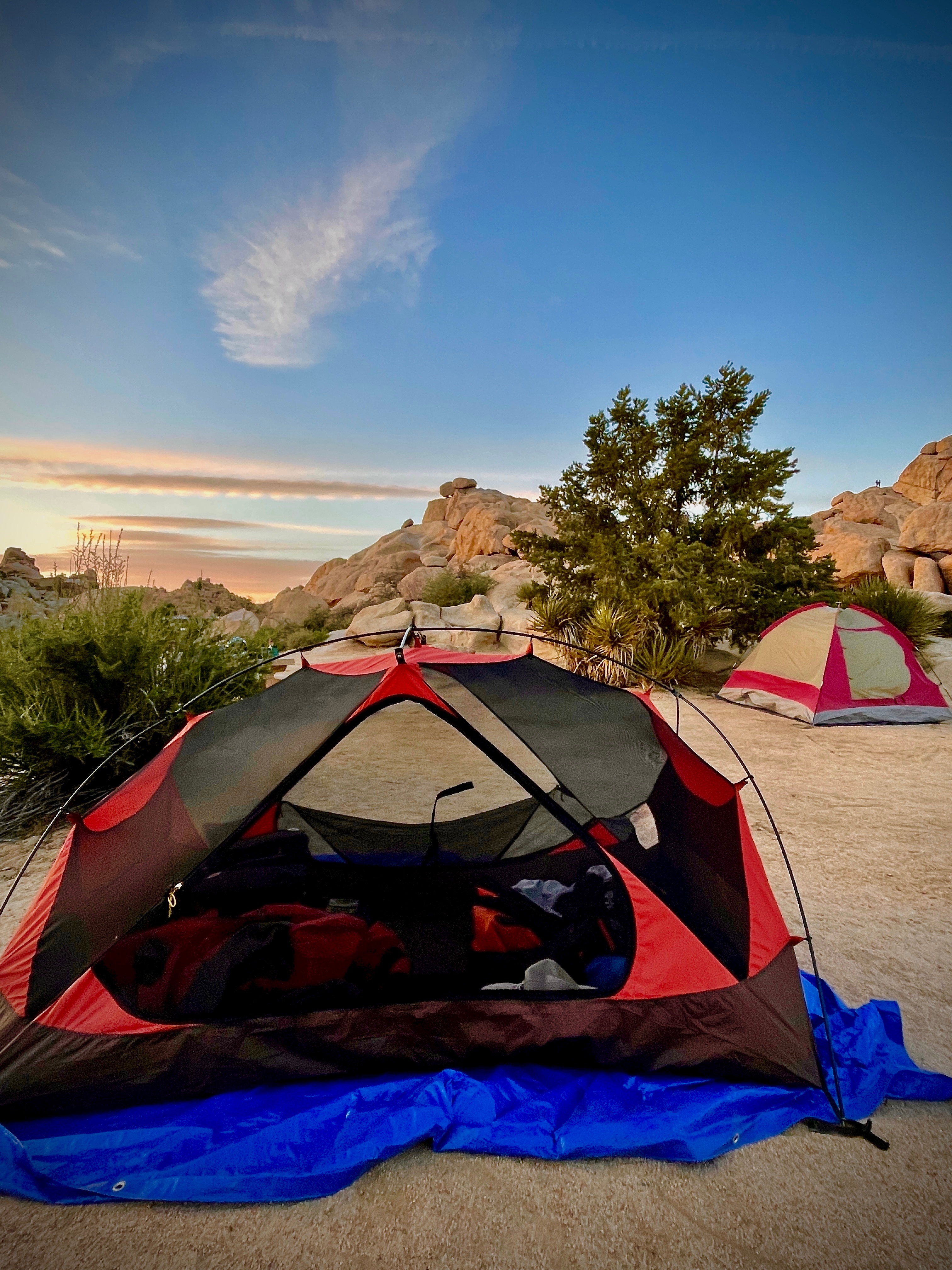
Since daylight was burning, we headed up Park Blvd to the West Park Entrance station of the National Park to a rather small “conga-line” as Pete refers to the queue that clutters the entrances to National Parks these days. Unlike other parks, the small printed 8.5 x 11 sign in the entrance station window declaring “Campground Full” would not deter us. What, the feds can’t manage to come up with a sandwich board? When in my best desperate but kindly grandpa, yet dirtbag appearing entreaty, I persuaded the young attendant to suggest where we might find respite, she dismissively replied, “Try the Hidden Valley Campsite, it’s iffy, but it’s non-reservation.”
Arriving at the campground a more official permanent “Campground Full” sign would not deter us from taking the one way road through the campground to exit, though crestfallen. But as serendipity was infusing the gentle desert breezes, the first of two of our newest best friends stepped onto the road and waved us to stop. When Andreas asked if we were looking for a place to camp, even though I really couldn’t hear his invitation wearing earplugs and head nestled in helmet, I was elated to accept whatever it was he was offering.
Ditching the gear so I could now actually hear, Andreas’s pal Pablo graciously offered his adjacent campsite for us to pitch our tents. It seems the common denominator of motorcycles compelled our comrades’ generosity. Days earlier the gentlemen had located two campsites adjacent to one another using Andreas’s strategy to pester campers who appeared to be packing up early in the morning to claim their campsites in the struggle of age old first-come-first-served campsite homesteading. They had decided they needed the two spaces for their separate vehicles, but were only using the one space for socializing.
Having settled into our campsite, Pete and I set off to ramble along the Hidden Valley Nature Trail.
Returning from our ramble, thirsty and peckish, we offered to compensate our hosts for their generosity to pick up anything they might need from town, though they declined our offer. Pablo did request chamomile tea and since I just happened to have brought along some Sleepytime along, we were able to humbly thank him with the slightest barter. The dinner hour approached and the fumes of our Victorville Denny’s breakfast were in dire need of a burrgurr and electrolytes, so we headed back to the millennial vortex at the Joshua Tree Saloon . Little did I know that delicious desert burrgurrs would sustain us over the next three days…
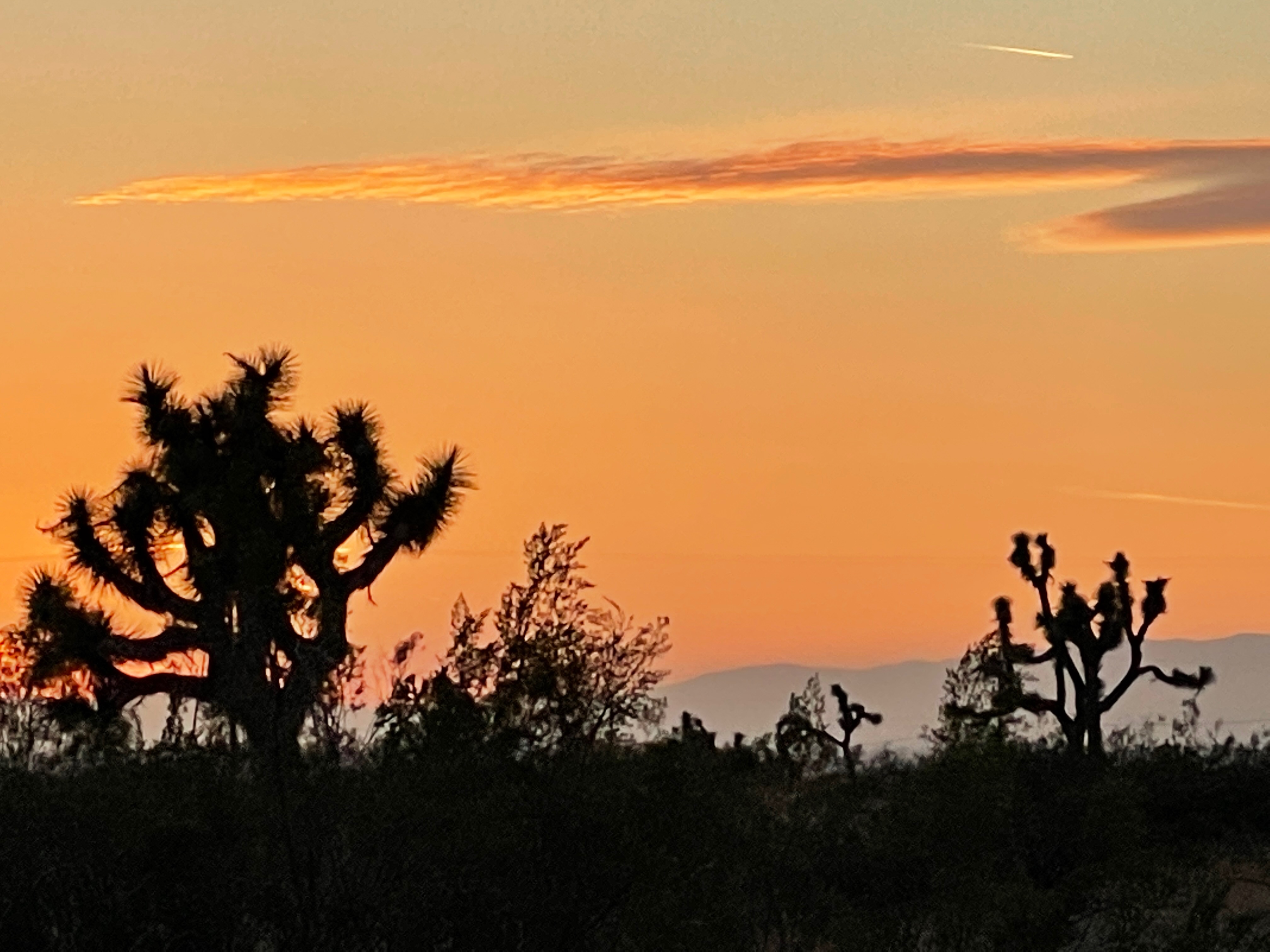
After dinner and beverage procurement we returned to the campsite to once again pay tribute to the 3-R’s of relaxation, reflection, and rehydration. The setting sun and the rising waxing crescent moon set the mood while the Sleepytime brewed next door and the last of our remaining electrolytes were consumed. This is when the the first of dozens of UFO’s appeared in the night sky as coyotes serenaded…
Three…Two…One…The aliens have landed!Aliens occupied the campsite in their dome shaped spacecraft just south of us as seen in the photo on the bottom of this night gallery… We could have used Rod Serling’s baritone to further enhance the mood. https://youtu.be/8p4w6gocXS8
Up and at ’em for the sunrise while waiting for the JetBoil to heat water for coffee. The cock-a-doodle-do, crash-bang-boom trash truck rambled through the campground and it appeared no one had been abducted by the aliens camped next door…
Prior to departing in the morning, we paused to share more pleasantries about where we had come from and where we were headed with our new friends. We learned that Andreas was a photographer and property management exec and he and Pablo were from Huntington Beach. They had met at a recent Noobs Rally in Death Valley that Pablo was covering for ADVMoto and that Andreas was participating in on his KTM 790 Adventure R. Amusing tales of past travels were exchanged as well as an hilarious account of how Andreas arrived in the US from Austria, his native home. Upon returning home I was entertained by a piece Pablo had written on ADVMoto about how he used a Zero electric moto to supplement his Covid-dormant acting income as a two-wheeled Doordasher.
We bid farewell to our gracious hosts after exchanging contact info. Andreas, Pete and Pablo posed for the scrapbook and Andreas, a professional photographer captured our departure.
AndreasPablo and PeteThe VStromThe Versys Adieu friends…
It was in Joshua Tree that Sisyphus confirmed that absurdity is alive and well long after Camus’ passing…
The roads across the Mojave Preserve are wide open with few curves, few towns, and fewer services. These are classic Butler Lost Highways… Forgotten towns like Amboy, Cadiz, Essex, Kelso, Cima Goffs, Baghdad, Ragtown, Ivanpah, Tecopa, Zzyzx, and Shoshone are spread across this great expanse of BLM lands, the Mojave National Preserve, and the Joshua Tree and Death Valley National Parks. Once variously thriving centers of mining and railroads are now left to the dreams and aspirations of folks who don’t mind driving for hours for a loaf of bread or gallon of milk. More likely a carton of cigarettes and a quart or two of bourbon, scotch and a twenty-four pack of Miller. Oh, and a Lotto ticket preserving the, “I seen the elephant” respect for the past.
Getting an early start seems to be the conventional wisdom. Hitting the Jones DPRoC from Joshua Tree, we rode on east CA-62, the Twentynine Palms Hwy, before heading north on the Butler Lost Highways of Goodwin Rd and over Sheephole Pass (el. 2,307′) through the Bristol Dry Lake on the Old Amboy Rd to the Amboy Crater and Roy’s Motel and Cafe.
Then from Roy’s it was a short hop east on historic Route 66 for a few miles before taking Kelbaker Rd over Granite Pass (el.4,024′) connecting Kelso with Baker. Clever name, Kelbaker, eh? Now we were deep into the Mojave National Preserve.
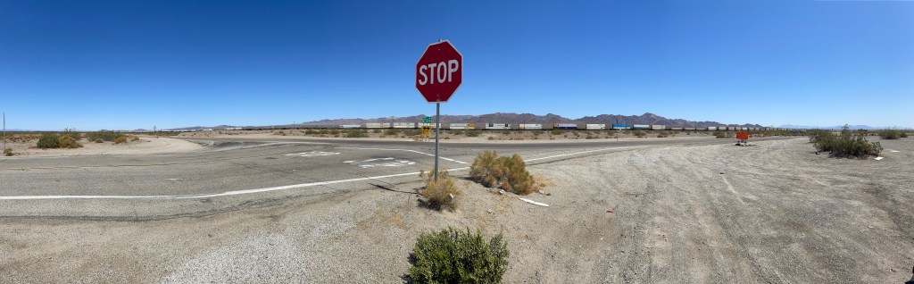
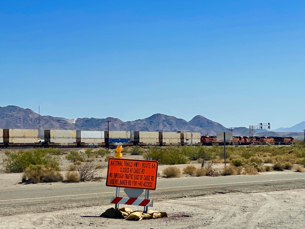
Turn left at the stop sign on Route 66 to go to Kelso. You can’t miss it.
This is why you can’t miss it… Old Route 66‘s troubles began in September 2014 when flash flooding damaged dozens of bridges and the roadway itself, forcing San Bernardino County to close the historic road indefinitely… I wonder if this will make the Biden Infrastructure cut. I pretty sure it won’t make Lindsey Graham’s counter proposal.
Kelso Dunes
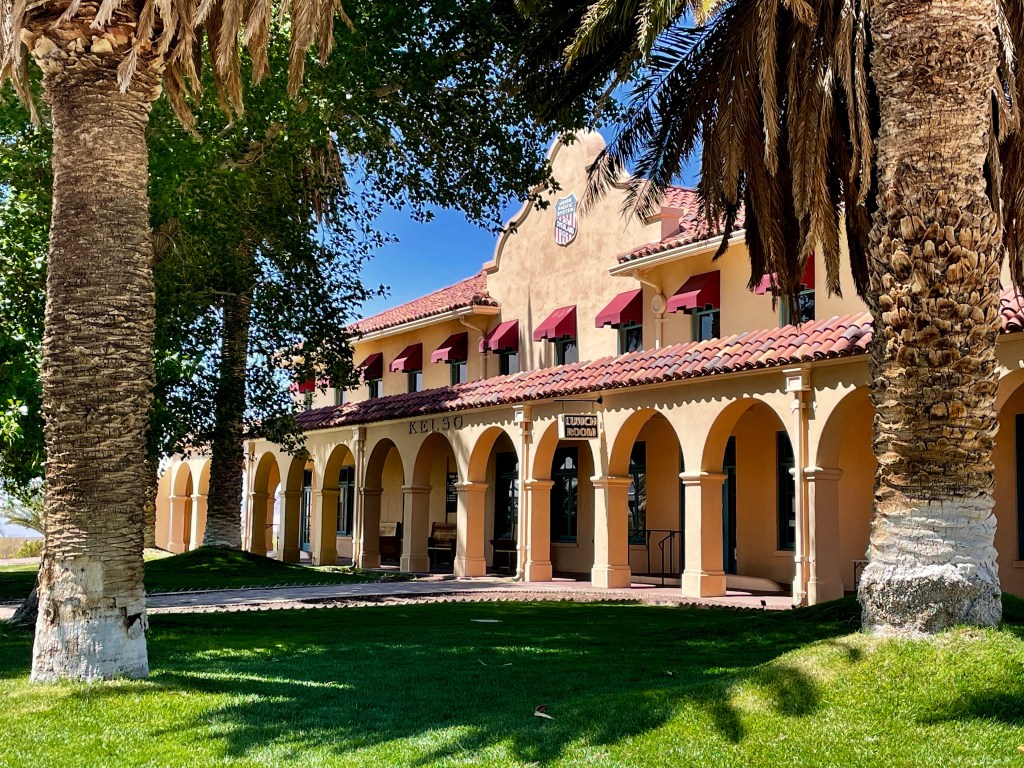
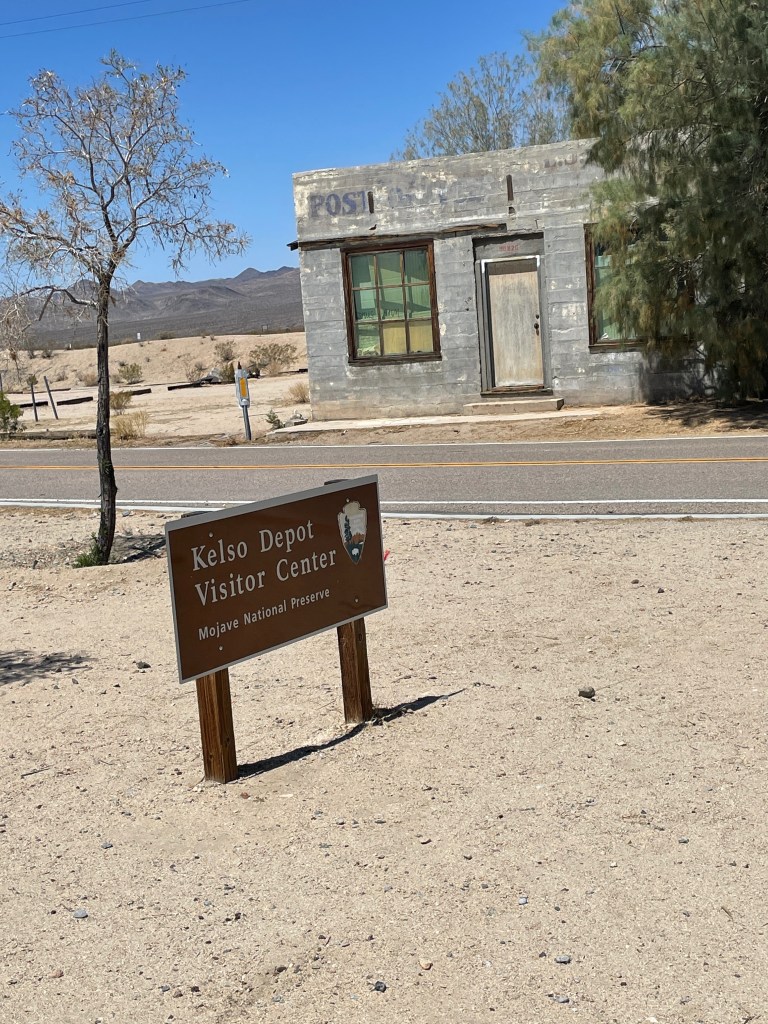
Regarding this oasis, Kelso, from Wiki:
Kelso is a ghost town and defunct railroad depot in the Mojave National Preserve in San Bernardino County. It was named after railroad worker John H. Kelso, whose name was placed into a hat along with two other workers to decide the name of the town. The town was built in 1905 specifically as a railroad station along the rail line between Utah and Los Angeles, originally called “Siding 16,” because of its location and nearby springs that provided abundant water.
Starting off as what was a simple train depot in the 1920s, the town of Kelso boomed briefly to as many as 2000 residents in the 1940s, when borax and iron mines opened nearby. Gold and silver were also discovered in the nearby hills of what became known as the Kelso district. The town shrank again when the mines closed after about a decade.
Kelso was a base of operations for the San Pedro, Los Angeles and Salt Lake Railroad, connecting track of Union Pacific Railroad, to which the SPLA&SL had negotiated trackage rights, with the Atchison, Topeka and Santa Fe Railway east-west line to the south. Here, trains were watered and “helper” locomotives were attached to assist the regular trains in climbing the steep Cima Hill. The distance between Las Vegas and the connection with the Santa Fe line at Daggett was too far for trains without a meal car, so Kelso was a convenient spot for a restaurant stop.
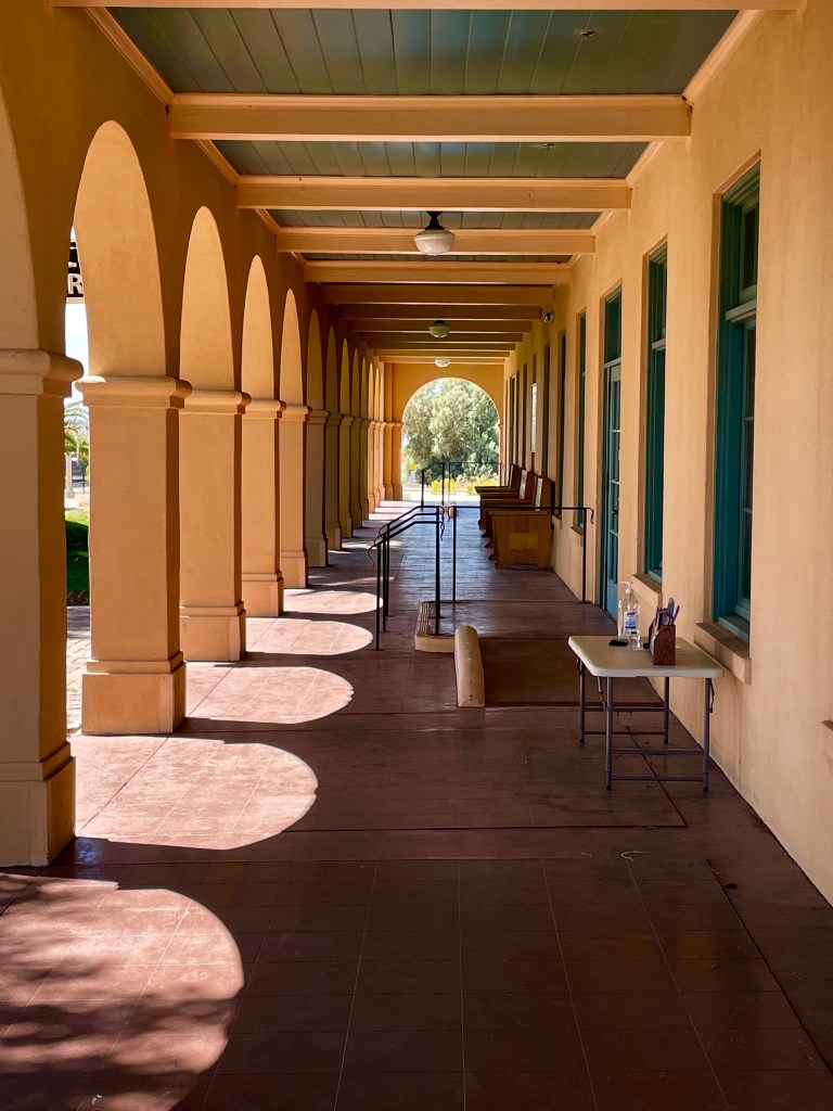
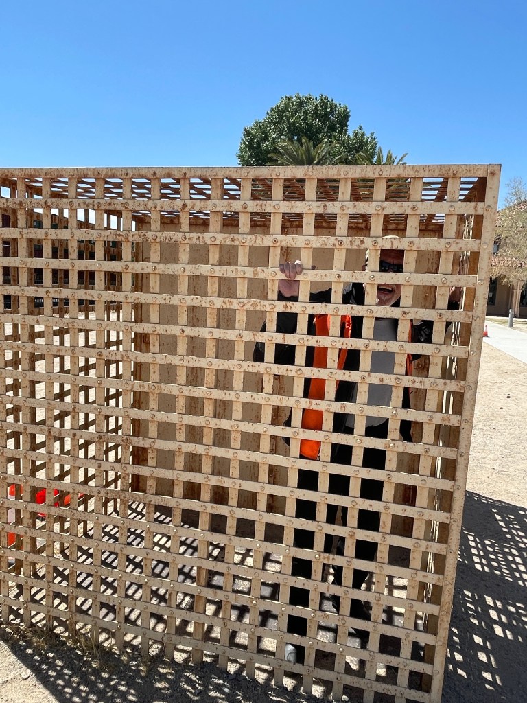
Another amazing preservation of a storied past…
About 1944 the railroad brought in an old strap iron jail (above) to detain local drunks. It is now on display just outside the Kelso Depot temporarily housing a visiting sober-minded lad.
Trains continue to roll through Kelso…
On the way to Baker… Or was it Amboy, Kelso, or Shoshone?
The next stop en route to Shoshone was Baker where Kelbaker Rd crosses I-15 and becomes US-127 that would take to Death Valley Junction the following day.
The town of Baker is frequently used as a stop for food and fuel by drivers on Interstate 15 between Los Angeles and Las Vegas. Baker is noteworthy for primarily two reasons:
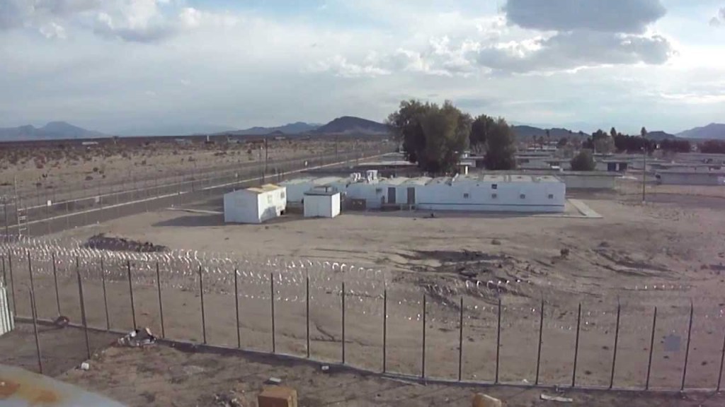
1) It is the site of a vacant, 223-bed for-profit Cornell prison that had experienced escapes in August and November 1995 and two on July 15, 1997. The prison also experienced a major riot on December 2, 2003, four weeks before it was temporarily closed. It was permanently closed on December 25, 2009, and,
2) Baker is home to what is proclaimed the World’s Tallest Thermometer.
They just don’t make thermometers, and I trust prisons, like that anymore…
Baker used to be noteworthy for three things, but the “World Famous” Mad Greek Cafe is now closed, no doubt a victim of Covid, and Alien Fresh Jerky isn’t quite as noteworthy since Nevada has cornered alien chic.
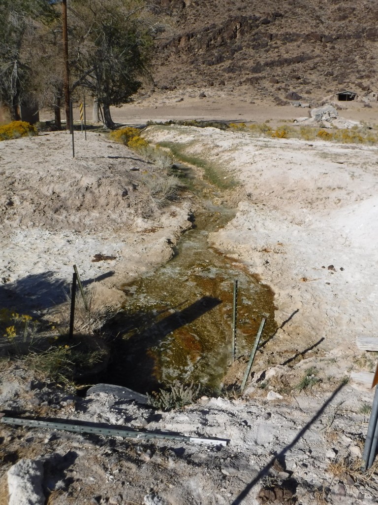
From Baker we pressed on to Shoshone after a quick inspection of the Tecopa Hot Springs which, despite the Brewery & BBQ, temps were warming and the wind was whipping, and there were no trees to shelter our humble ripstop abodes….
Maybe on January or February tour…
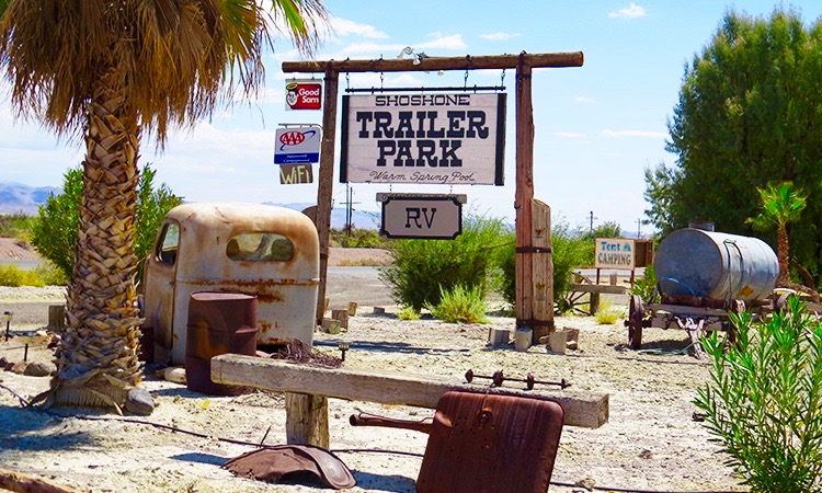
We arranged for a campsite at the Shoshone RV Park having logged around 200 miles. From the outside the campground didn’t look like much but once inside it was agreed to be our favorite campground northeast of Joshua Tree. At least until we got to Lone Pine which is northwest of Joshua Tree. There was electricity to charge our hungry devices and showers along with a flowing ditch fed by water from the Amargosa River and we met new friends!
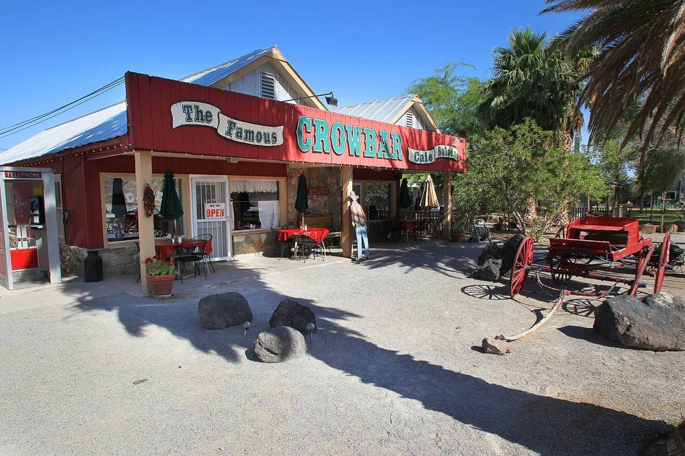
After a short stroll into town we enjoyed a delightful burrgurr at the Crowbar. There’s an interesting aside to the story behind Shoshone. The town is owned lock, stock, and barrel by Susan Sorrells and her husband including the Crowbar and the campground and RV Park. There’s an article at https://mojaveproject.org/dispatches-item/reimagining-the-amargosa/ that provides a facinating backstory. I imagine the Crowbar rocks on a Friday night. It was hump day and the modest crowd we joined was decidedly relaxed and reflective while rehydrating.
Indeed, making new friends is a theme of this trip and I’d like to introduce Tasha and Mark who pulled into the campground after dark in an RV with their four children, all 10 and younger after being on the road for the better part of a day. They had left their oldest daughter in charge of the younin’s back at the RV and had escaped to the fire pit near the tent camping area where Pete and I were relaxing, reflecting, and rehydrating following our meal at the Crowbar. They were like minded clutching White Claws to see our our Pale Ales in pursuit of the Three R’s and adult-hooding, sans children.
As we shared our back stories and adventures thus far we could see that far-away look overtake the couple imagining how free we were from their responsibilities of a young family and careers. Tasha was a middle school principal with whom I, a retired middle school teacher, immediately related exchanging some of our memorable experiences with the beasts who inhabit that middle school ecosystem. She was on leave, thankful to not have to manage a staff and distant learners, but now tasked to manage an infant, a toddler, and the rest of their distant learning brood.
Mark was an employee of Google whose tenure topped 18 years, hired when Google was itself an infant! His duties included managing teams monitoring and preventing misinformation and other privacy concerns. For a guy and his wife who were likely wazillionaires, they were both quite sweet and humble with with hilarious stories about life on the road with their kids and their careers. After a couple of hours they retreated to assess the damage to the RV from their free range children and we stumbled, er, rambled to our tents.
Meanwhile, back at the tents the evening winds were breezing up. The sound of the zephyrs gently rustling the fan palms and poplars with the flowing water just behind us made for a pleasant stargazing soundscape.
Satisfactorily relaxed, reflected, and rehydrated it’s nite-nite time…
After midnight the gentle breeze soundscapes had escalated to a gale force, tent rattling, sleep depriving, Mojave tempest and all I could think of was falling fronds from the fan palms or branches from the poplars impaling us as they were blown from the trees. Mind you, riding a motorcycle doesn’t concern me as much as dying in some sort of a campground calamity.
Alas, we met the rising sun with nary a splinter. And there was no cock-a-doodle-do, crash, bang, boom trash collection alarm.
Day 5: Death Valley Junction, 911, Dante’s View, Stovepipe Wells, Panamint Springs, Dave, Keeler, and Lone Pine
What would be day in which all of the experiences would be tossed into a blender and later enjoyed as a mental smoothie began with revisiting The Amargosa Opera House in Death Valley Junction (See a previous post from December of 2019, Riding Under a Fool Moon for context). In October of 2019, a full moon on October 13 would cast a supernatural lucence over Death Valley and so Andy, our third moto-buddy unable to make the this Mojave trip, proposed we ride across the Valley floor, bajo la luz de la luna llena. That fall trip was to be followed by a Winter/Spring ride across the desert that was cancelled, a victim of the pandemic, that we were now reprising. Before riding into the night to Beatty, NV, we stopped at the Opera House to put on every stitch of warm clothing we packed to make final the 50± mile trek to the Atomic Inn.
During the day and not in frosty darkness, Marta Beckett’s dream was brilliantly illuminated. Watch, California Dreamer: A tribute to Marta Becket, Death Valley’s ghost town ballerina, if you’re not familiar with the story: https://youtu.be/39QGMZzku0E
Warning: The manner in which a RAM mount holds an iPhone so that one can use the phone’s GPS function can activate the emergency notification feature…
There’s a nifty feature on my iPhone/iWatch that can alert emergency services even when there’s no emergency. It’s constantly telling me I’ve fallen when I haven’t. It gives me an opportunity to dismiss the alert by responding that I did not fall. Nice…
Nice until you’re on the moto, screaming down US-190 headed to Furnace Creek when, by placing the phone in the clasps that keep the phone’s screen in view from the cockpit of the bike, it activates the emergency 911 notification feature. With a soft shoulder and no room on the pavement to pull over and with gloves on that prevented me from activating the touch screen, I was unable to dismiss the automated 911 call. A series of flashing messages and tones indicated that an emergency call had taken place to the Nye County Sheriff’s department in Pahrump, NV, the closest services to my location.
I immediately received a series of four telephone calls from the 911 dispatcher, apparently trying to reach me to confirm an emergency. Pahrump was the same distance, some 30 miles, as it was to Furnace Creek. I guess the feds don’t dispatch emergency 911 services from Death Valley if one hasn’t crossed into park boundaries. I was apparently only a mile or two from the park boundary when the accidental alert was transmitted. A few miles later there was a turnout at an abandoned campground, now a boondocking community. No wifi or cell service was available. How do these people watch Netflix? It wasn’t until we reached Dante’s View that I had cell service and sheepishly called the 911 dispatcher to let her know that a terrible mistake was made and I appealed to her for mercy. She casually said, “I’ll put you through to the Deputy we sent out and you can explain…” This, I felt, was worse than having to go to the Principal’s office.
After a moment or two, she got back to me and said, “I can’t reach the Deputy but no worries, this sort of thing happens all of the time…” Well, at least they didn’t send a helicopter.
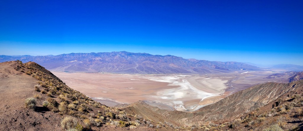
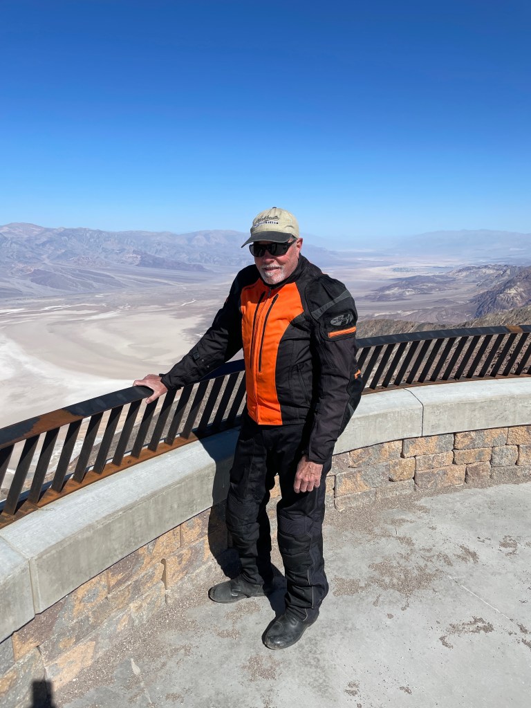
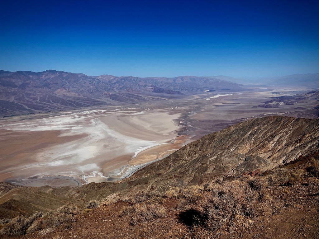
Telescope Peak, 911 Squid, and Badwater and Furnace Creek in the distance, top to bottom below:
We gassed up and munched down on snacks at Furnace Creek. There we met two fellow moto comorads one on an older model VStrom and the other on a former BMW police bike like Pete’s old BMW recliner. Pleasantries were exchanged in that light playful, sometimes teasing, manner; essentially good natured raillery centering on moto banter as we traded stories of our mutual adventures. The gent on the VStrom was quick to remind us that in his experience of touring, if one tours with a group, make sure at least one of the bikes is Japanese so that when the American, German, British, or Austrian bikes break down, someone can go for help.
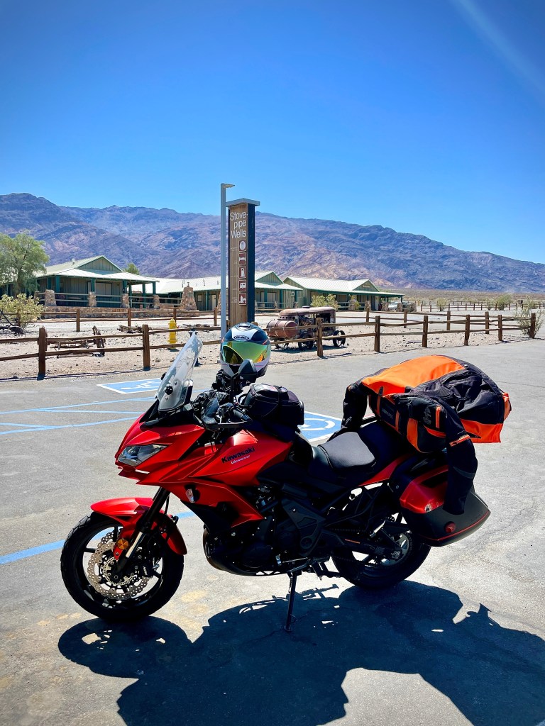
Parking lot date palms in Furnace Creek and a reliable Japanese moto, the Kawasexy Versys, in parking lot at Stovepipe Wells
We met our next new friends in Stovepipe Wells where we had stopped for caffeine as the warming temps were inducing Jones DPRoC drowsiness. Drowsiness and operating machinery are incompatible so stopping to peel off the cozy sleepiness inducing layers protecting us from the morning cold as the thermometer pushed 90 degrees was imperative. Leaving my jacket and phone on the table outside of and around the corner to the market’s entry, then sitting in rocking chairs placed under the shade of the porch in front of the market to enjoy a Cold Brew (for those who do), a thoughtful young woman and her partner came around the corner to alert me to having left my phone on the table, unguarded. See what kind of careless behavior drowsiness induces!
Her curious partner expressed his interest in our motorcycles and not unlike my enthusiasm upon returning to motos, had dozens of questions about the make, model, displacement, handling, fuel range, carrying capacity, etc. of the bike as he dreamed of doing exactly what we were doing. He said he had waited long enough for his friends to commit to their shared dreams of freedom the open road offers. As those friends were dropping like flies abandoning their dreams to carers and families, he was on the brink of going for it! Apparently his family or career was worth sacrificing. Of course I recommended the California Motorcycle Safety Program to get a feel for whether he was up to challenges and risks of putting torque and horsepower between his legs before abandoning his family and career. I felt kind of creepy when I realized I had uttered that bit about “between his legs” in front of his female friend…
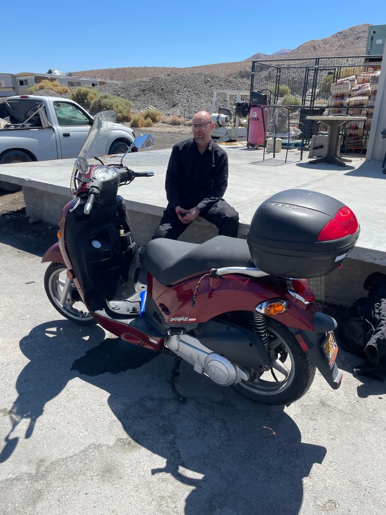
Bidding adieu, we jumped back onto the bikes headed for Panamint Springs Resort, a favorite Death Valley destination we’ve visited many times over the years. We considered staying in the campgrounds across from the restaurant, but it was early in the afternoon and lying around for hours in the unrelenting sun didn’t appeal to us. That’s when we met Dave from Portland.
Dave from Portland
You may have noticed a fluid spill beneath his Kymco Peoples 250cc scooter. It was a problem that developed in Death Valley involving an oil/coolant mixture that began to cause problems with the engine… running. Dave and his scooter had made it all the way from Portland. It was the informed opinion of the jack-of-all-trades Panamint Springs maintenance guy who pressure tested the engine that the People’s death was immanent. Being in a spot, Dave who noted that he was due to be in Asia in a couple of weeks was considering his options. Consensus arrived at there appeared to be three. The first was to try limping into Olancha or Lone Pine uphill 50± miles on Hwys 190 and 136. The single feature of this option that increased its worthiness is that cell reception could be had at the Father Crowley Overlook should he need rescue at the top of the most extreme slope. However, there was no place to repair the bike in either Olancha or Lone Pine, even Bishop for that matter.
The second option was “downhill” on Hwy-178 to Ridgecrest by way of the Searles Valley a distance of ±72 miles. Though this route had spottier cell reception, it was probably more heavily traveled than the route to Lone Pine and there was a Kawasaki dealership in Ridgecrest where he could get a great deal on a new bike. There was also a repair shop, but all agreed that it would cost more to repair the Peoples 250 than it was worth, perhaps even costing more to junk the bike than it was worth. You’d think with all of that useless desert out there having to pay to junk a bike in the over regulated nanny state was downright unpatriotic. Or not. I’m of the “or not” persuasion.
The third option was to have for one of the Panamint Springs residents with a pick-up haul Dave and the bike to Ridgecrest for a small fee. There he could junk the bike and catch a flight out of the Inyokern Airport to LA and back to Portland and on to his appointment in Asia. I guess we’ll have to return to Panamint to hear the end of Dave-from-Portland’s odyssey.
Visiting Keeler on the way to Lone Pine was our next stop. I’ve noted Keeler in a past post and how silver ore from Cerro Gordo was once transported across the lake when it was more than brine ponds where the ore was then loaded on a train to be taken to Los Angeles to fuel LA’s early expansion.
While Keeler was a functioning ghost town, Cerro Gordo a mere 8.5 miles east is an aspiring ghost town retreat.
In July of 2018 Brent Underwood purchased the former mining town of Cerro Gordo for $1.4 million with a group of investors. Since March of 2020 when the pandemic began to rage, Underwood has been living at Cerro Gordo full-time and has created a measure of internet fame through his YouTube videos. Here’s a recent installment: https://youtu.be/vYDNICwwOmg
Up where you see the switchbacks is where Brent Underwood lives…
I visited Cerro Gordo back in the 80’s when it was under the ownership of another proprietor. Not unlike Bodie, the buildings that serviced the mines were, and continue to be under Underwood’s care, in a state of “arrested decay”. The American Hotel burned last summer and Underwood plans to rebuild the structure based on the original blueprints he has located. If he can provide enough of a water supply to operate the town, he plans for it to become an “adventure destination”… Good luck mate!
From Keeler we whipped into Lone Pine around the Owens Lake stopping at the USFS Eastern Sierra Visitor Center to check on the best shot at getting a campsite. The Lone Pine campground was recommended and so off we rolled. Upon arriving we found the campground to be attended but not crowded and its layout conducive to semi-privacy along Lone Pine Creek. The afternoon view of Mt. Whitney from the campground as shadows began falling across the canyon portal were stunning.
Late afternoon canyon shadows
Early evening moon shadows…
Early morning sunny brilliance…
Once again I was manning the JetBoil, up before the cock-a-doodle-do, crash bang boom trash collection alarm. Our new campsite neighbor/friends were up early as well having spent the night in their custom wooden teardrop trailer. From their home in Reno they enjoyed camping in the Eastern Sierra, particularly Whitney Portal where they trail ran. That reminded me that sitting on a motorcycle all day wasn’t exactly maintaining my cardiovascular fitness. I guess the trade off was how it benefited my mental health. That and the fact they indicated they were in the “medical field” could have erased my fear of campsite death had I only known the before bedding down hours earlier…
The Mt. Whitney Restaurant may have “the best burgers in town” and I bet more movie memorabilia than any other restaurant in Lone Pine, but the service was as slow and indifferent as the glaciers that carved the face of the namesake mountain in the background…
From Lone Pine our route took us south on US-395 to CA-14 just outside of Inyokern to CA-178. Leaving the more prosaic, Butler PMT and Lost Highway classifications as we were entering the Sierra, new Butler road classifications came to be used. This included a G1 road, described as, “These are the best motorcycle rides in Southern California. Always very dramatic and a thrilling experience. Expect high mountain passes, deep canyons, sweepers, switchbacks, and twisties.” Up Walker Pass on CA-178 and down through Canebreak and Onyx were G1 and G2 roads. A G2 road is, “Only a notch below G1, these are great motorcycle rides. Expect dramatic scenery, road action, and lots of elevation change.” Those Butler editors were on to something!
CA-155 through Weldon, South Lake, and Mountain Mesa to Lake Isabella are more typical of the arid foothill reservoir roads with shopping centers catering to Lake Isabella visitors we see in our neck of the woods. We noticed a tremendous amount of work being done around the dam at Lake Isabella. In preparing this ride report my research found an online engineering website, ENRCalifornia, describing the project as follows: “For the job, construction crews will raise both the main and auxiliary dams 16 ft to help minimize the risk of overtopping and add filters and drainage to both dams to increase dam stability. They will also construct improvements to the existing spillway, and build a new 300-ft-wide emergency spillway.” The article went on to indicate the cost at $600 million.
Damn, the Isabella Dam safety modification project is adding 16 feet at roughly the cost of $37,500,000/ft. What a deal!
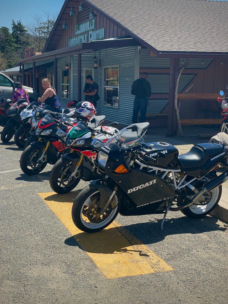
At Woford Heights we rolled west on CA-155 up and over Alta Sierra. The up and over leg of the ride into Glennville is a profoundly Butler G1 and G2 class ride. Indeed! Pete and I agree that of all of the roads we’ve ridden in California, this one is a gem for its combination of surface, engineering, landscape, and remoteness.
Glennville consists of The Saddle Sore Saloon, the Highway 155 Market & Cafe, and Cedar Creek Pizza. Given that it’s smack dab in the middle of thousands of acres of cattle ranches, miles from Bakersfield and Lake Isabella, it must be supported by folks like those we met from Las Vegas who had been riding these G1 and G2 roads on their exotic sport bikes.
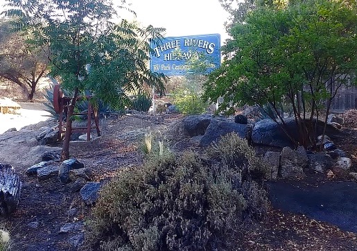
Dropping layers, we set off enroute to Porterville, CA-65 up to CA-198 and Three Rivers for the night. Traveling through Strathmore, Lindsay, Exeter, Yokohl, and Lemon Cove we were treated the scent of intoxicating citrus blossoms. The olfactory excitement recalled my first trip through those orchard decades ago coming down from a backcountry backpack. Sublime!
Arriving at our favorite campground in Three Rivers knowing that Potwisha and Buckeye Flat were the only two campgrounds open in the National Park and full, we arranged our campsite learning that there wasn’t enough water flowing in the Kaweah to support the local rafting businesses this season. Two years ago when Pete and I camped along the banks of the Kaweah we met Chris Baer a professional raft guide who entertained us with tales of his exploits pursuing whitewater all around the world. The Kaweah was raging at that time. Now it was but a stream without massive snowmelt to fuel its torrent…
Chris Baer’s rig from our 2019 Wildflower Tour
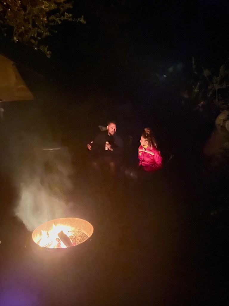
We rode to the Totem not far from the park entrance for an excellent buurguur and beverages. Returning to camp we met our neighbors and new friends, Gabriel and Roxi, and inspected their very cool wedge tent mounted just above the bed on their Colorado crew cab complete with a Yeti cooler that could take a week in the Mojave on a single block of ice keeping the beverages at the ready for relaxing, reflecting, and rehydrating after a rigorous day of exploring.
The couple were getting into camping and from our perspective were off to a great start. They’d already mastered purchasing bundles of wood and Duraflame logs as starters. Their enthusiasm for adventure was refreshing and their curiosity about our experiences gave us yet another opportunity to retell our tales of the road that we never seem tire of sharing. But I am curious about our new younger friends… What’s with White Claw among the millennial crowd?
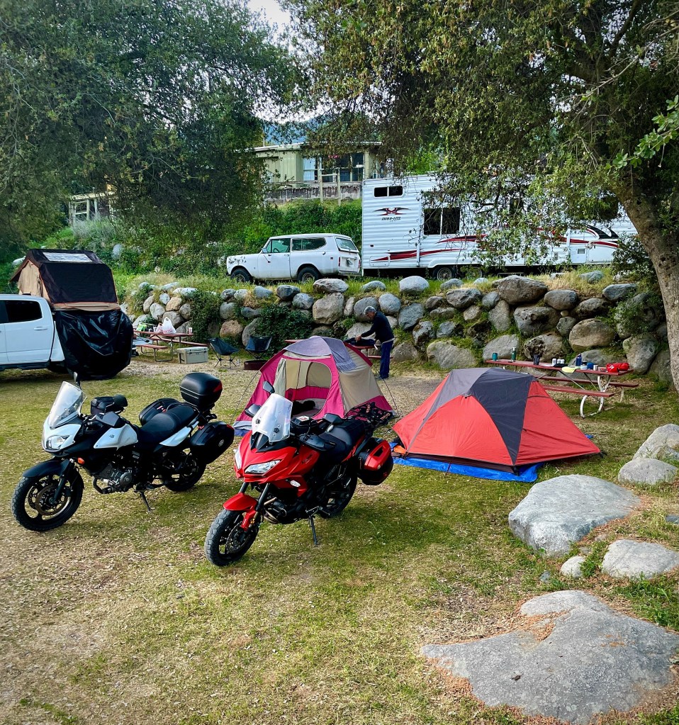
As a fitting last day of riding on our sea to sand to snow trip, we needed another complement of Butler G1 and G2roads. The Generals Highwaythat connects State Route 180 and State Route 198 through Sequoia National Park, the Giant Sequoia National Monument, and Kings Canyon National Park, was just the road. Clear of snow, the road was scheduled to be opened on April 23, but when we checked with the Hideaways camp manager, she said it had just opened earlier in the week.
The Butler maps wordsmiths declare the Generals Highway thusly: There are few places in the world where Giant Sequoia and Redwood trees can be found growing together and this is one of them. With 130 curves and 12 switchbacks, vehicles larger than pickup trucks are almost absent on the 16 mile stretch from Ash Mountain to the Giant Forest.
With many more decreasing radius curves over the total 73 miles from Three Rivers to Squaw Valley and elevations of 5,000 to 8,000+ feet, it was cold. But heated grips and layers kept us cozy and negotiating the road kept us preoccupied enough to forget how cold it was. There was patchy snow over most of the route but the roads were ice free. There was little traffic and our average speed was in the neighborhood of 40 mph because of those curves and switchbacks.
Despite focusing on the road, the naturalist in me couldn’t ignore the landscape, consisting of mixed-conifer forest species including ponderosa pines, Jeffrey pines, Douglas-fir, white fir, sugar pines (the world’s tallest and most massive pine species with the longest cones of any conifer one strives to avoid running over), and giant sequoias were hard not to notice.
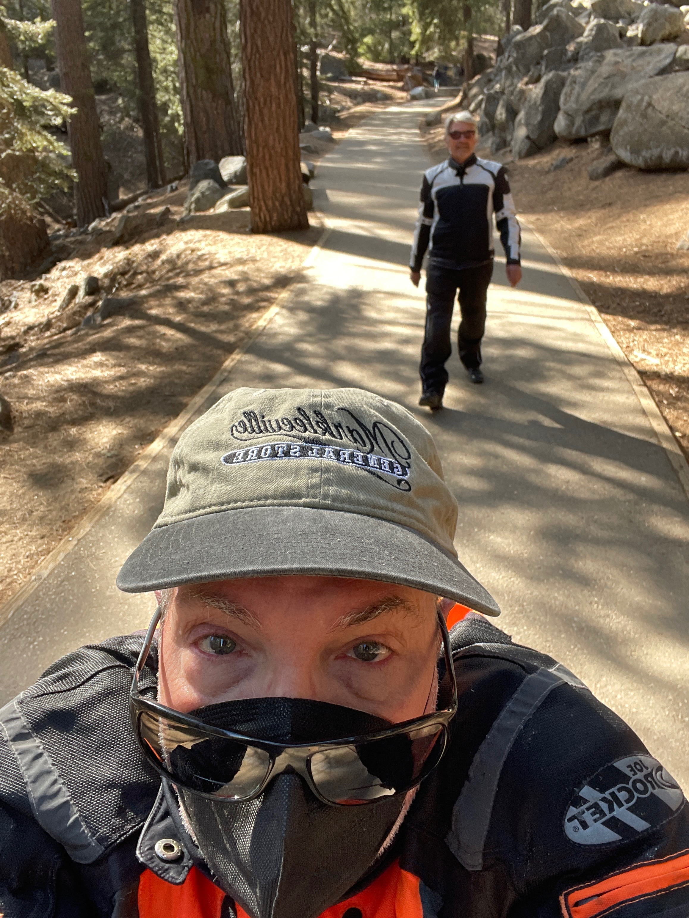
Beginning at upper left: The Kaweah River with Moro Rock in the background with Moro Rock left middle. To the right the lads making the downhill pilgrimage to the General. Bottom left, the General Sherman Tree, and to the right, Mt. Goddard forming the southwest boundary of the Evolution Basin in Kings Canyon National Park from the General’s Highway.
Making our way down to Piedra by way of Elwood Rd took us through the mixed lower montane zone of the western Sierra featuring ponderosa pine at the lower elevations along with California black oak, incense cedar, and some other trees (redbud, laurels, buckeye, cottonwoods) and shrubs (chamise and buckthorn) interspersed in rolling meadows of spring grasses and wildflowers (penstamin, lupine, golden poppies, Clarkia) and many more.
Burroughs Rd
Making our way on the bucolic and deserted Maxon and Burroughs Valley Rds to Tollhouse and CA-168 we began to notice on the 7% grade up from Prather the massive rolling thunder of hundreds of Harley Davidsons putting their imprinture on the serene spring day perhaps headed to Shaver Lake. Reaching these lower elevations and wanting to shed layers, we stopped to fuel up at the Shell Station in Prather where by then, it seemed that the herd of Harleys was thinning out and the tranquil natural sounds of a lovely spring day, restored… (The Kawasexy’s stock exhaust has the sound of a butterfly’s wings waving)
There was one last stop in Le Grand for tacos at Marco’s Taco Truck before arriving at our respective abodes, road-weary. It was there we met what would turn out to be the last new friends on the Mojave Moto Spring Tour. Perhaps as a measure of fatigue or as Pete suggested on a recent post trip bicycle ride, “Maybe we should take more photos so we don’t forget half of what we experience…” I didn’t catch the name of the two gents who had just returned from a dog show in Madera with their merled French Bulldog (whose name neither of us could remember). These fellows were a hoot. Their scheme was to breed this little Frenchy and their description of that process, complete with animated gestures, was unforgettable. Almost as unforgettable was the prancing around mocking the Westminster Kennel style when asked if they showed the little fella. With the fruits from this enterprise to make bank, they would buy a house and retire so they could do what we were doing. But first it was necessary to get a business license and permit. I didn’t have the heart to share that our retirements were paid in full for 37+ years of salt mine drudgery. Who am I to spoil a dream?
By the way, the tacos at Marco’s are right there with Ramon’s Tacos in Planada and M&M’s in Snelling. And with that we returned to embrace our loved ones and scratch the ears of our pooches who were far more enthusiastic about our appearance and odor of seven days on the road…
Epilogue
“Sometimes it’s a little better to travel than to arrive” ― Robert M. Pirsig, Zen and the Art of Motorcycle Maintenance: An Inquiry into Value
I’ve noted that my moto buddy is also my pedal buddy. When we ride bicycles together there’s lots of conversation and shared observation. We’re in a scene, completely exposed, and being social animals who aren’t obsessed with Strava, we’re freed to let our thoughts wander. When on the moto, I’m singularly focused on a full 180 degrees of of what’s in before me with awareness of what follows each minute I’m moving. Except when I’m not and the consequences of inattention jolt me into being present. Especially as my riding buddy points out.
It’s in the spirit of that coactive elastic relationship between ubiety and ubiquity that I chase the scene. When we’re on the moto, we take it all in and it filters back out once off the bikes. Certain moments are recalled but never are they as raw and perfect as when they flood one’s senses, as a part of the scene, as the scene unfolds.
“You look at where you’re going and where you are and it never makes sense, but then you look back at where you’ve been and a pattern seems to emerge.” ― Robert M. Pirsig, Zen and the Art of Motorcycle Maintenance: An Inquiry Into Values
So we try to reconstruct the ride, as I’ve done here. The photos help, but they convey a construct of the trip. The narrative is for me an exercise in finding irony or humor in something separate from riding. I’ve tried as best as I can to look back on the ride and where it took us to inspire and entertain, to find some measure of that same fleeting presence. And so I’ve noted routes and some of pleasures, oddities, and rewards of exploring new places and meeting new friends.
Prompted by Pete, I recently watched on the YouTubes a Fortnine video from the “Why We Ride” series where the host Ryan shared the essence of the following Pirsig quote:
“In a car you’re always in a compartment, and because you’re used to it you don’t realize that through that car window everything you see is just more TV. You’re a passive observer and it is all moving by you boringly in a frame.
On a cycle the frame is gone. You’re completely in contact with it all. You’re in the scene, not just watching it anymore, and the sense of presence is overwhelming.” ― Robert M. Pirsig, Zen and the Art of Motorcycle Maintenance: An Inquiry Into Values
Whether on a bicycle or a moto, “You’re in the scene, not just watching it anymore, and the sense of presence is overwhelming.” In the words of Jamie Robinson, “Just go ride and have a buurgurr…”
If you enjoyed this post, feel free to comment. Please, just be nice when you comment about my use of the Oxford comma. Pete is sensitive to grammar shaming…
“A plan once made and visualized becomes a reality along with other realities- never to be destroyed but easily to be attacked. Thus Kino’s future was real, but having set it up, other forces were set up to destroy it, and this he knew, so that he had to prepare to meet the attack. And this Kino knew also- that the gods do not love men’s plans, and the gods do not love success unless it comes by accident.”
― John Steinbeck, The Pearl
Photo Credit : Credit: NPS-Brent and Dawn Davis
And so ours was not, like Kino’s, an epic struggle to survive, but an attempt to dupe the gods who curbed several of our plans by visiting a plague, oppressive heat, and fire upon us. We prepared to meet the attack. Our plan was simple. Visit the Burr Trail in Utah and in the process escape the viral vector and acrid air of climate change induced fires by seeking the most favorable atmospheric conditions and terrain. Our success was not an accident. Average a couple three hundred miles a day on mostly lonely back roads seeking obscure destinations equipped with masks and hand sanitizers. It was two blokes on bikes–no closer than six feet–and six days to get from here to there. Sorry to disappoint you gods, we had a blast and it wasn’t by accident.
Merced to Tonopah
Fall on the east side, US-395 near Conway Summit north of Mono Lake
We left Merced at 8:00 am. We took our normal route over Sonora Pass to cross the Sierra because I wasn’t able to secure two reservations to go over Tioga Pass. Since this Sierra crossing is a leg of the trip we’ve done so many times before, I’ll get on with the novel parts of of this particular journey over the next six days on the road while citing some satisfying memories of former past adventures.
My mate Pete and I have traveled US-6, US-95, NV-375 (The Extraterrestrial Hwy), US-93, and US-50 (The Lincoln Hwy) by way of Sonora Pass (CA-108), US-395, and CA-120 several times. I rode across Nevada on a bicycle with a group of knuckleheads in 1993 from the California/Nevada border all the way to the Utah border in four days. Three years later we rode our bikes across Utah taking six days. In fact we rode bicycles across all of the Western United States over the course of twenty-six years. What have I learned? It’s easier on a motorcycle. And so that’s my plan. Re-ride those bicycle adventures as moto adventures. That’s not to say the bicycle rides weren’t as fun, even though privacy was scat, uh, pardon me, scant, but we were younger then and suffering didn’t matter… as much.
The rider in 1994 will remain shamelessly nameless… (I took the picture, I’m not the subject)
Tonopah, our first day’s destination, lies at the base of a range above a basin that has a remarkable resemblance to every other basin and range in Nevada. I guess that’s why this area is known as the Basin and Range province of the Great Basin. I used to think it was nothing but miles and miles of miles and miles. Riding a bicycle across those miles and miles will do that to you.
After “riding hard” from Merced, stopping for fuel and grabbing a bite in Lee Vining, we stopped 13 miles west of Tonopah at the Miller’s Rest Stop well into the afternoon. We were closing in on mile 296 for the day and though just a few miles from our destination a stretch and nalgas break was taken. Any moto adventure always involves the road, terrain, weather, and landscapes. There’s another dimension too. You meet people, many of whom are on adventures of their own. For instance, meet Tim from Sacramento.
We would cross paths with Tim of Sacramento several times over the next few days
Pete and I pulled in and we soon spotted Tim on this beautiful 1995 GoldWing. As you can see, he had it outfitted with a trailer, complete with a pad for his cooler. He was just finishing up preparing an egg salad sandwich when he walked over to offer us a sandwich and a beverage. We declined the sandwich, but after considering it was only 13 miles to Tonopah, we humbly accepted the beverage with much appreciation.
Like us, Tim was traveling with a few buddies heading to Alamo, NV for the night some 174 miles down the road, considerably greater than our remaining miles. I guess that’s the difference between riding a GoldWing for hours and miles as opposed miles and hours on our Versys and V-Strom. After sharing stories of our respective trips and exchanging other motorcycle pleasantries, we bid adieu thinking that since Tim was heading southeast to Prescot, AZ (his ultimate destination) as we were heading east to Escalante (our ultimate destination) our chance encounter and receipt of gracious hospitality was a bonus feature on the day.
Tonopah, nestled near the base of the San Antonio Mountains and known as the “Queen of the Silver Camps,” like Her Majesty the Queen, is a bit long in tooth. I suspect that the unincorporated town primarily exists today because it is located at the junction of U.S. Routes 6 and 95, approximately midway between Las Vegas and Reno. Oh, and there’s the Clown Motel. I guess that’s as good a raison d’être as is the gas, “food”, and lodging in a mining town that’s seen better days.
We have the Tioga and El Capitan. Tonopah has the Clown… Has La Llorona taken to haunting the desert?
Tonopah is not exactly a city on the rise, as our Mayor declares Merced to be, unless after dark the denizens of this neighborhood choose to step up and out of the ground… Wait, what’s that shadowy figure in foreground? Could it be an alien presence?
Tonopah to Cedar City
Next gas 111 miles? 111 miles at 85 mph getting 58 mpg with a 5.5 gal. capacity is no problema!
Typical of contemporary rural Nevada, its recent history tells a story of abandoned dreams.
These photos were taken at the intersection of US-6 and NV-375. Speed and fuel efficiency apparently replaced the need for stopping at Warm Springs for fuel and sustenance. Pausing for a stretch and nalgas break, a pleasant necessity, apparently isn’t sufficient for restoring the Warm Springs Bar and Cafe to its heyday.
Bound for Cedar City, UT by way of Rachel and Hiko, NV on NV-375 we took a few moments to consider Area 51. And using our best Desert Oracle suspension of reason to contemplate the wonders of obscure yet sustaining alien induced capitalism enroute to Caliente for lunch. What little imagination Warm Springs lacked, the Little A’Le’Inn and the Alien Research Center has in spades.
I don’t wish to make the impression that we found Nevada to be in anyway lacking sophistication or refinement. Unlike the alien gimmick, the town of Caliente trades on its historic Union Pacific Railroad and depot.
Caliente, Spanish for hot, refers to a nearby hot springs and not so much the high summer temperatures…
We also found something that was missing back when I rode a bicycle across rural Nevada. Feast your eyes on our lunches…
In 1994 this salad would have been deep fried
Our last touch with civilization in Nevada was Panaca where we left US-93 for NV-319. Panaca from our perspective was typical of a quiet, not much happening sort of remote Nevada town where cows considerably outnumbered people.
Panaca, NV in 2016: “A Nevada man whose family was nearly killed [weeks ago] by bombs set off by a former colleague has no idea why he was a target.
To know Nevada is to not be deceived by bright lights, sleepy towns, or barren landscapes…
With 300-plus ranges separating as many basins in Nevada, from Montgomery Pass (7,419′) just east of the CA/NV border we crossed the last range over Panaca Summit, (6,719′). It was downhill into Modena, UT where NV-319 became UT-56 at the border.
And Now for Some Science:
Temperate deserts of continental regions have low rainfall and strong temperature contrasts between summer and winter. In the intermountain region of the Western United States between the Pacific coast and Rocky Mountains, the temperate desert has characteristics of a sagebrush (Artemisia) semidesert, with a very pronounced drought season and a short humid season. Most precipitation falls in winter, despite a peak in May. Aridity increases markedly in the rain shadow of the Pacific mountain ranges. Even at intermediate elevations, winters are long and cold, with temperatures falling below 32F (0C).
These deserts differ from those at lower latitudes chiefly in their far greater annual temperature range and much lower winter temperatures. Unlike the dry climates of the tropics, dry climates in the middle latitudes receive part of their precipitation as snow.
Temperate desert climates support the sparse xerophytic shrub vegetation typical of semidesert. One example is the sagebrush vegetation of the Great Basin and northern Colorado Plateau. Recently, semidesert shrub vegetation seems to have invaded wide areas of the Western United States that were formerly steppe grasslands, due to overgrazing and trampling by livestock. Soils of the temperate desert are Aridisols low in humus and high in calcium carbonate. Poorly drained areas develop saline soils, and dry lake beds are covered with salt deposits.
From the xerophytic shrub vegetation of the semidesert through Beryl Junction and Newcastle, we arrived in Cedar City, Utah entering the Colorado Plateau ending the second day of our tour just a few days before the Cedar City Livestock & Heritage Festival…
Leaving Cedar City after a fine breakfast at The Grind Coffee and Tea we wound our way to the hoodoos of Cedar Breaks. We were there in the morning so the angle of the sun’s illumination wasn’t as impressive.
Sunset, Cedar Breaks Amphitheater Credit: NPS
Hidden in the forested Ashdown Gorge lie the oldest rocks in the monument, relics from a time when Cedar Breaks would have been beach front property! In the late-Cretaceous period (~90 million years ago), southwestern Utah was a shoreline. It’s ironic that the ability of geologists to accurately date these geologic formations lies in conflict with the timeline most Utahans subscribe to. I guess they don’t have any conflict with the tourist dollars these remarkable formations lure.
Morning sun on the Breaks…
From Cedar Breaks it was a quick run through Panguitch on UT-93 and “Highway 12 — A Journey Through Time Scenic Byway” to Bryce Canyon. The geology and topography was outstanding. Speaking of tourist dollars, the crowds, rivaling anything we might see in Yosemite mid-tourist season, were surprising. A beleaguered attendant supervising traffic in a parking lot overlooking Bryce Point told us that the number of visitors to the park had exploded in the last several years peaking last year. Though crowded this day, he reckoned that the coronavirus would see smaller numbers of visitors this year. A quick search of Wiki confirms his story:
With 2,679,478 recreational visits in 2018, Bryce Canyon National Park has seen another record year for annual visitation. Recreational visits in 2018 were up by 107,794 visits from last year, and up over 1.6 million visits from 2010. The park has remained above 2 million annual recreational visits since 2016. (NPS)
From Bryce Canyon our route took us through Tropic and Escalante to Boulder. Scenic Byway 12 (SR-12)n is a 122.863-mile-long (197.729 km) state highway designated an All-American Road. SR-12 crosses various parts of Grand Staircase-Escalante National Monument, and continues northeast through Escalante and over the Escalante River, then over the Hogback, a narrow ridge with no guardrails or shoulders and steep drop-offs on each side. I recall riding my bicycle across the Hogback in 1997 in a thunderstorm. The air smelled of ozone and the hair on my arms stood erect. I was terrified then. My memory now is that I was heroic!
UT-12 proceeds north through more of the Aquarius Plateau, through Boulder and Grover, ending in Torrey at an intersection with SR-24, five miles west of Capitol Reef National Park where we would spend the night.
The 30-mile long portion of the highway that ascends and descends Boulder Mountain on the Aquarius Plateau is known as Boulder Mountain Highway.
After a delicious lamb burger with coleslaw for lunch at the Burr Trail Grill we made our way down the Burr Trail. While ordering, we saw Tim from Sacramento ride by with his crew. We were just a tad puzzled as we were under the impression he was not headed in our direction. Daylight was burning and so it was time to tackle the Burr Trail.
In 1997 our dearly departed bicycling buddy Larry led us on a ride across Utah. I was retracing parts of that tour and our Nevada (1994) tour on this moto trip some twenty-three years later with the goal of taking the Burr Trail once more. In 1996 the Clinton administration designated the Grand Staircase–Escalante a National Monument and it didn’t take long for the 34 mile leg from Boulder to be paved. Me thinks Edward Abbey understood the weltanschauung of the Utah DOT and Visitors Bureau. Progress, I reckon.
And Now for Some History…
John Atlantic Burr was born in 1846, during his family’s journey from New York to San Francisco on the SS Brooklyn while sailing across the Atlantic Ocean. Once they arrived, Charles and Sarah Burr then set out to Salt Lake City with their new baby. As part of the early pioneers from the Church of Jesus Christ of Latter-Day Saints, the Burr family eventually moved south in 1876 and founded the town of Burrville, Utah.
John Burr grew up to be a cattle rancher in the rugged backcountry of Utah. Living in such a desolate area, he needed to develop a route to move his cattle between winter and summer ranges, as well as to market. This cattle trail through the rough, nearly impassible country around the Waterpocket Fold, Burr Canyon, and Muley Twist Canyon came to be known as the Burr Trail.
The westernmost section of the trail down, some thirty-four miles to the border of Capitol Reef, was paved in 1996. The following summer a group of eleven lads pedalled across Utah, their intrepid leader, Larry Johnston, having planned the route to include this portion of the Burr Trail on what was then, fresh pavement, still warm from being laid. Well, maybe not that fresh, but it was new and little used. From the Day 4, August 15, 1997 itinerary entry Larry prepared:
Day 4, A short cut’s in store, who could ask for more? Ride east from Boulder on the “Burr Trail” and shuttle the 20± mile dirt section through Capitol Reef National Park. Ride south to the ferry at Bullfrog Basin, swim or take the ferry across Lake Powell ($9/car – free/swim) before heading east on Hwy 276 where the day’s adventure can end at Hwy 95. Shuttle northwest on Hwy 95 to the only place to stay for miles, the Fry Canyon Lodge (it’s near Natural Bridges National Monument) maybe $40+ a piece… it ain’t cheap. Distance: 103 miles not counting the shuttles and ferry. Bring paddles/swim suits.
Larry’s posaic description of the Burr Canyon Trail conned us into believing it was nothing compared to what we traversed to get there. The excitement of a short cut would soon be erased to be replaced by our reaction to riding through this spectacular canyon in the morning chilled air with a monumental sense of the sublime. It was at once breathtaking and exhilarating. That was characteristic Larry’s sense of humor, ever the coyote.
Here’s a NPS map of the routeWorth the wear and tear on the nalgas…
In Torrey we managed to again cross paths with Tim from Sacramento. He actually noticed us passing by as he and his comrades were in search of accommodations for the night and rode to catch us. When I asked, “I thought you were headed to Prescot via Las Vegas?” Tim replied, “We decided to take the scenic route.” I would like to think the enthusiasm Pete and I had conveyed had inspired him back at our chance meeting at Miller’s Rest Stop.
Note: I made GoPro video of the canyon ride, however, my free WordPress account doesn’t permit uploading video. I’ve posted it on YouTube and have linked it to Sisyphus and Associates, my Facebook alter ego.
Starting the day with a fine breakfast burrito at Paizlee’s in Torrey we hit the road bound for Ely, Nevada, our trip now at its mid-point.
And Now It’s Time for an Observation…
We would head northwest on UT-24 to Sigurd, missing the UT-119 cut-off to Richfield. Retreating on UT-118 south we merged onto I-70 to Beaver. This might be a good time to review the various highways, byways, and two-laners we encountered on the trip. Nevada’s and Utah’s roads were superior compared to most of the roads we’re familiar with in California. Aside from being well engineered with consistently maintained and even surfaces, virtually free of potholes, the roads were also free of the trash we commonly find in California, despite all of the “Adopt a Highway” volunteers.
Of course our population of nearly 40 million is considerably greater than the combined 6.28 million populations of Nevada and Utah. I imagine wear and tear and a cavalier attitude about litter (despite postings of fines) given so many people on the road–just over 15 million registered automobiles rolling over 163,696 mi² of California as compared to just over 2 million autos in Nevada and Utah rolling over 195,456 mi²–beats up the pavement in ways Nevada and Utah are spared, despite the ratio of cars to area.
Taking the UT-21 exit at Beaver, Ut, we traveled through Milford, Frisco, and Garrison, all ranch country sporting circular irrigated fields of alfalfa dotting the otherwise parched xerophytic shrub vegetation of the semidesert terrain to the Nevada/Utah border.
Back to basin and range…
From the border, it’s about 6 miles to Baker, NV where UT-21 becomes NV-487. Baker sits at the entrance to the Great Basin National Park. Pete discovered Baker a few years ago when returning home from a Colorado moto. His stories regaled the festive atmosphere of this artistic gateway to a National Park found in this very small town. When I learned that Kerouac’s Restaurant was going to be closed for the season as we were rolling through, I decided to press on to Ely for our fourth night to cut down our Day 5 mileage.
Felis catus, a.k.a. a Sphinx cat, the only (barely) stirring soul at Kerouac’s
Just north we merged onto US-6/50. The route was constructed over a historic corridor, initially used by the Pony Express and Central Overland Route and later for the Lincoln Highway. The Nevada portion crosses the center of the state and was named The Loneliest Road in America by Life magazine in July 1986. The name was intended as a pejorative, but Nevada officials seized it as a marketing slogan (the Utah DOT and Visitors Bureau have nothing on Nevada). The name originates from large desolate areas traversed by the route, with few or no signs of civilization. The highway crosses several large desert valleys separated by numerous mountain ranges towering over the valley floors, in what I’ve noted as the Basin and Range province of the Great Basin.
Dropping into Major’s Place en route to ElyIt’s downhill from Connor’s Pass into ElyEly, not much to say so I’ll leave it to Wiki…
And Now Some More History…
Ely is the largest city and county seat of White Pine County, Nevada. Ely was founded as a stagecoach station along the Pony Express and Central Overland Route. In 1906 copper was discovered. Ely’s mining boom came later than the other towns along US 50. The railroads connecting the transcontinental railroad to the mines in Austin, Nevada and Eureka, Nevada have long been removed, but the railroad to Ely is preserved as a heritage railway by the Nevada Northern Railway and known as the Ghost Train of Old Ely. (Wiki)
Comida, si, si, Californios we be…
By the time we set up for the night in Ely, we were pretty exhausted from pounding out the miles from Torrey. Pete refers to this as, “riding hard”.
Another long day of riding hard lay ahead. We were headed back to California from Ely some 78 miles to Eureka, 69 miles to Austin, and 64 miles to Middlegate on the Loneliest Highway. From there, it would be another 168 miles to Markleeville. We decided to get on with the hard riding by departing a frosty Ely (36 degrees) hoping it would warm up down the road. By the time we reached Eureka, my fingers were popsicles. Time to stop and warm up from the inside out.
After leaving Ely, it was 78 miles to Eureka, where we found the Pony Express Deli for breakfast!
And Now for Some Avocational Sociology…
It was an interesting cafe. No tourists, just locals except for us. There were a couple of what looked to be freshmen in high school aged girls having breakfast with one of their mothers. I thought about how difficult it must be to be so isolated, from what I learned in 26 years of teaching middle-school aged kids and raising a high school aged granddaughter, about the desire the age group has for their peers and for connecting with a world outside of a small town. Not so much a surprise, I Googled Eureka schools to learn that Eureka High School is the home of the Vandals (Vandals: A people of northern Europe, known for their cruelty and destructiveness, who invaded the Roman Empire and plundered Rome itself in the fifth century.) I guess that’s not much different than Viking or Raider mascots…
To my absolute surprise, I was pleased to see how for the 2020-21 school year there are 3 public schools in the Eureka County School District serving 291 students. Eureka County School District has one of the highest concentrations of top ranked public schools in Nevada. This district’s average testing ranking is in the 10/10, top 10% of public schools in Nevada with a student:teacher ratio of 10:1 which is less than the Nevada public school average of 20:1.
Eureka High and Gymnasium… Home of the Vandals! (Credit: EurekaCountyHS)
Whoa, there’s one book whose cover shouldn’t be judged.
Eureka, self proclaimed The Friendliest Town on The Loneliest Road in America (Photo: Wiki)
After another sixty some miles of not using any cornering body position, we encountered a 30 minute delay due to repaving of US-50 through the town of Austin. Austin, a well preserved mining town, is known as a “Living Ghost Town”.
Photos from the interwebs. Imagine the road in the pic on the left being completely ripped up to the soil, hence the delay & Stokes Castle on the right (Photos: Wiki)
Stokes Castle, a strange three-story stone tower, is located just outside town. It was built in 1897 by Anson Phelps Stokes, a wealthy eastern capitalist who had a financial interest in several of the local mines. It was occupied only for a month. Vacant and abandoned, it fell into disrepair. After fueling up, we continued westward.
The long and (not) winding road, leads (not) to your door but to Middlegate Station…Middlegate Station is no Eureka.
A quick Coke and cup of coffee and from Middlegate we leave US-50 for NV-361 to Gabbs and Lunning. It seems that Happy Hour begins pretty early in the day at the Middlegate Bar…
The Premier Magnesia mine in Gabbs, NV
We passed through Gabbs where the only domestically-mined source of magnesia ore in the United States can be found. You know, magnesia it goes into lots of stuff.
Time for More Science…
Magnesia is considered a “universal neutralizer”, which makes it ideal for applications where pH control is essential for safety and treatment, such as:
Water Treatment Animal Feed Spill Response Industrial Manufacturing Oil & Gas Construction Power Plants Environmental Waste Treatment Food & Beverage Pulp & Paper Marine Scrubbing /Desulfurization and Epson salts (premiermagnesia.com)
See, Epson salts doesn’t just come from the pharmacy.
Looking north from Gabbs
The intersection of NV-361 and US-95 was just west of Luning which is the only thing I remember about Luning. Next town was Hawthorn, home of the worlds largest ammunition depot. I found an article entitled, “Hawthorne Army Depot: Providing Lethality That Wins,” on the interwebs.
I guess storing live munitions underground beats storing them in an above ground silo…
Interesting. Fortunately the Army stores munitions much more safely than the Lebanese store ammonium nitrate. Nevertheless, we quickly rode through Hawthorn and skirting the western shore of Walker Lake we made our way to Yerington.
Yerington, on approach, appeared to be a small community of large alfalfa growing ranches. It is also home to the Anaconda Copper Mine, an open pit copper mine that closed in 1978. It is located just west of the town. A company town, Weed Heights, was built to support the mining operation which ran from 1952 until 1978. In Yerington we headed south on N-339 skirting the pit.
Anaconda Copper Mine, an EPA Superfund site (Google Maps)
Like Hawthorne, we didn’t hesitate to make our way through Yerington, though there are many fine people on both sides of the pit, I’m sure…
From Yerington we continued south on NV-339 to Smith Valley. Nevada State Route 339 merges with NV-28 through the valley, leading west 15 miles to US-395 north of Topaz Lake. Skirting past the lake, the California border was in sight.
Amazing what a little water and fertilizer can do for xerophytic shrub vegetation of the semidesert. It’s kind of like west-Merced county
Now heading west on CA-89 we made our way over Monitor Pass to Markleeville for the night and a very nice meal at the Cutthroat Brewing Company.
This building was being remodeled when Pete and I were here in April
Our final morning, at a frosty 36 degrees, found up suiting up with our warmest layers. We had Ebbetts Pass and the Pacific Grade Summit on CA-4 to make that morning. Approaching the pass are a series of gnarly switchbacks that require quick reflexive shifting and appropriate body position to navigate the grade and curves.
This doesn’t look as sinister as it really is…4 out of 5 were relaxed… One sent the pucker factor through the roof…
The curve just to the right of the middle CA-4 label on the map is a compound curve. According to Wiki, in the jargon of road engineers, a compound curve has two or more simple curves with different radii that bend the same way and are on the same side of a common tangent.
So, this is in physics what I’m trying to explain in English
Given the curve is also on an upward sloping grade of ±24%. You don’t want to be downshifting into first gear to slow on approach then roll onto the throttle at the apex of the turn to increase friction (traction) but suddenly, and accidentally, shift into neutral! The whole physics thing about momentum and friction is, well, actually pretty complicated to explain. But it’s not that difficult execute on a motorcycle.
My failure to execute the acceleration component (by shifting into neutral) neutralized the increase of friction component sending me into a wobble then exiting the turn across the middle of the lane into oncoming traffic. Fortunately, no cars were coming as that could have turned out much worse than it did. Strangely, I didn’t panic and was able to bring the Versys to a stop, upright, shift into first and find the correct line for the next curve making sure of my shift.
Fortunately the remainder of the ride was uneventful. I’ve already written about those remaining roads to get us back to Merced so I’ll conclude by supplying another quote from Steinbeck…
“Once a journey is designed, equipped, and put in process, a new factor enters and takes over. A trip, a safari, an exploration, is an entity, different from all other journeys. It has personality, temperament, individuality, uniqueness. A journey is a person in itself; no two are alike. And all plans, safeguards, policing, and coercion are fruitless. We find after years of struggle that we do not take a trip; a trip takes us. Tour masters, schedules, reservations, brass-bound and inevitable, dash themselves to wreckage on the personality of the trip. Only when this is recognized can the blown-in-the glass bum relax and go along with it. Only then do the frustrations fall away. In this a journey is like marriage. The certain way to be wrong is to think you control it.” ― John Steinbeck, Travels with Charley: In Search of America
Notes and Disclaimers
Unless credited, all photos were taken by either Pete or me.