

2023 Fall Moto V.5.0, October 2023
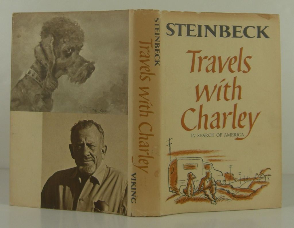
If only Steinbeck rode a Moto Guzzi…
“When the virus of restlessness begins to take possession of a wayward man, and the road away from here seems broad and straight and sweet, the victim must first find in himself a good and sufficient reason for going.”
“There’s a wonder about traveling whether in time or space or in the mind, and if it can be both at once, why that’s the best.”
“A writer must rearrange reality so that it will seem reasonably real to the reader.” John Steinbeck, Travels with Charley
Prelude to 2023 Fall Moto V5.0
Beginning with the premise of rearranging reality so that it will seem reasonably real to the reader, back in August when 105 degree days were the norm my invitation went something like this, “Ah-hem, hey Pete, let’s make a pass at the passes before they close for the winter, eh?” Note, unlike Steinbeck, I chose not to invite SoBe or Dakota, my two curs…
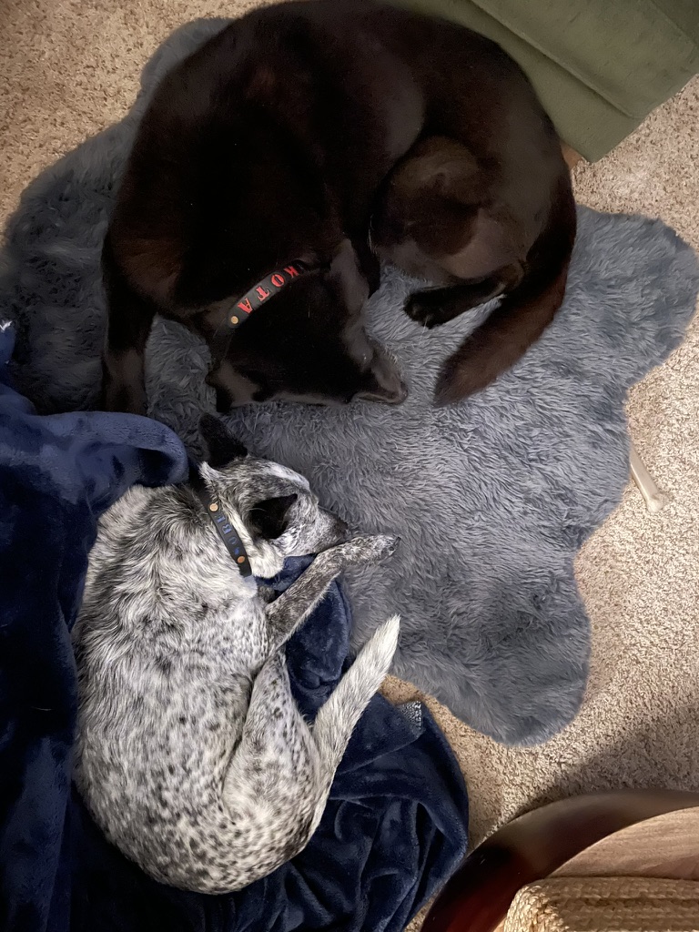
The yin and yang of my canine home…
I had by mid-September pitched four different trips for the late summer/early fall touring scheduled in my mind and in Google Docs. One to the north and east through California, Oregon, Idaho, Montana, Wyoming, then south and west to Utah, New Mexico, Arizona, and home. I anticipated eleven to twelve or more days. While intriguing, that was a bit too ambitious for Pete’s crowded September calendar. Too much space, too little time.
Anxious to spend some quality time on Il Mio Bella Rosso, my recently acquired Moto Guzzi V85TT in some broad, straight, and sweet roads, I was jonesing for more time and space adventure than the maiden voyage overnight to Bridgeport reported in Stairway to Heaven or Highway to Hell back in July.
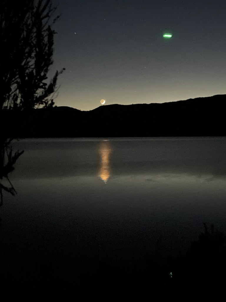
Bridgeport Reservoir, the moon, Venus and a visitor…
The next plan was for a Sierra crossing into western Nevada up to Oregon, then crossing to the Pacific, and down the Lost Coast. Upon mapping the route, I discovered the Anvil and SRF Complex Fires were fouling the air for better than half of the proposed ride. Besides, the air from my already dust fouled lungs due to the annual nut harvest was well underway. Already bracing for pneumoconiosis, I wasn’t anxious to breathe more airborne PM2.5 carbon particles. Besides, the overnight temperatures up around Goose Lake in northeastern California would assure frozen water bottles overnight…
Then there was the third pitch, let’s go for broke and head east to Moab. Again, unless we were planning on calloused nalgas from ten hour days in the saddle to keep the ride within a six day window, that same crowded calendar shelved that trip.
I then set about planning a fourth route that summited at Sherman Pass over the Sierra south of Mt. Whitney that included some Eastern Sierra side trips. However, by this time, fall had officially arrived and camping above a frosty 6,000 ft required heartier determination than both Pete and I could muster.
Finally, we mutually arrived at a 5-6 day October window in our overwhelmingly crowded calendars for retired guys. So I set about examining variables of routes, air quality, temperatures and weather. I had at last found a “good and sufficient reason for going.”
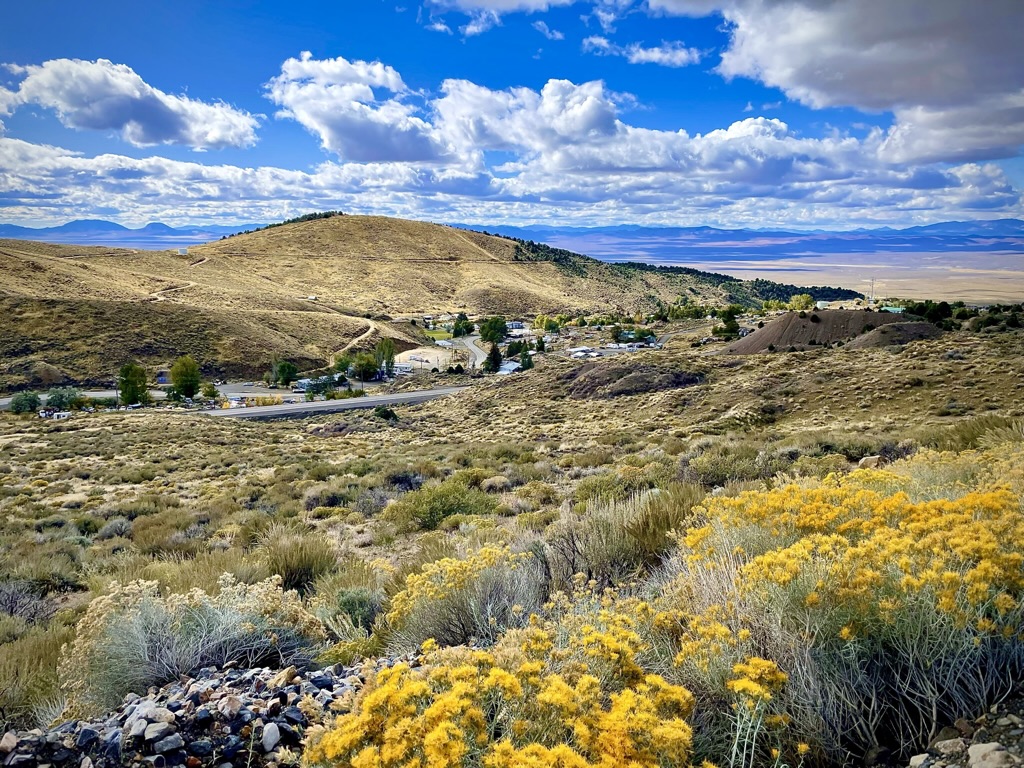
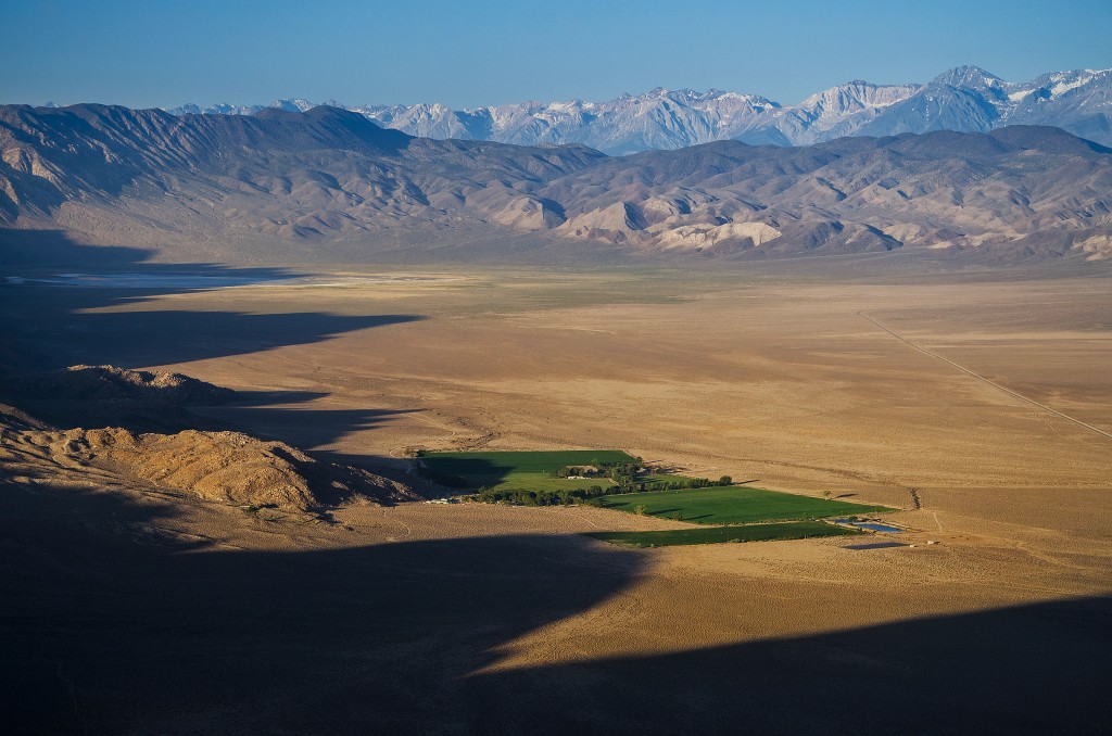
I hit upon a five day four night trip crossing the Sierra over Tioga Pass, heading to Hawthorne, Middlegate, Austin, Tonopah, Goldfield, and Dyer, Nevada to Deep Springs, White Mountains (and Bristlecones), Big Pine, Taboose Cr, Sherman Pass, Johnsondale, Success Lake, CA-245, and the golden hued fall foothills of the Sierra, home.
The ten day forecasts looked good, there were no fires in the vicinity of the route and Sherman Pass loomed large and free of snow. Aside from Austin, NV, where no rooms in the three local motels were available and overnight temps were forecasted to fall below 30 degrees, there were rooms available in Tonopah, somewhat warmer, but still a bit too chill for two chill geezers to camp. You can check out my obsessively compulsive, meticulously crafted Fall 2023 V5.0 Moto Itinerary that at last included Sherman Pass.
That’s me in the lime vest on the right (top) and blue bandana second from right (bottom). What’s with my Sherman Pass preoccupation? I had twice ridden my bicycle over the pass that runs west to east from just north of Kernville on Mountain Highway 99 to Pearsonville on the East Side at US-395. The rides began in Ventura on the Pacific Ocean and ended in Death Valley on those “back-in-the-day” two-wheeled adventures with various knuckleheads as we were grasping, and on Sherman Pass gasping, for the last vestiges of our youth.


Sisyphus atop Sherman Pass 2017 in the blue bandana
It seems I just wanted, as Steely Dan parleys in Do It Again, to “do it again” over the pass with a motor assist instead of pedaling. I’ve given up on the whole g(r)asping for vestiges thing.
Yeah, you go back, Jack, do it again
Wheel turnin’ ’round and ’round
You go back, Jack, do it again
In the mornin’ you go gunnin’ for the man who stole your water
Not to worry Pete. I had no intention of shooting you for a frozen water bottle.
And now for the “rearranged reality”
My plan is to portray the trip largely through video clips I managed to capture. The filming was episodic and by no means, not to be mistaken for epic. As a fan of motorcycle travel on YouTube, I’m amazed at the skill and technical wizardry that goes into compelling motovlogging. There are techniques and tools used to capture the essence of traveling across the country on a motorcycle that eclipse my patience, allowance, and ability to master. I like to ride and experience the terrain, make new friends, reflect, relax, and rehydrate over the day’s travels then return home and review the photos and tell a story. This time around, there will be a few more visuals to give you a sense of the movement and not just the moment in the trip.
I’ve learned a few things about YouTube that may affect what I had hoped to capture and portray. One, I filmed in HD-high definition 1080/60fps with a GoPro Seven. It takes horsepower and torque to download all those pixels on YouTube. SD, standard definition, offers an annoying facsimile of the visuals at 480p. You may need to seek the HD button in settings to click in order to override the SD option. Two, hopefully the music I’ve selected to accompany each clip isn’t prohibited by some copyrighted legal thing. I bought all of the music that I use in support of the creators, acknowledged them in the post and videos and hope that satisfies the lawyers.
Day 1 Merced to Hawthorne, NV (map link)

The Wee Strom and the Coastie ready, set, let’s go!
Meeting as usual at the Chevron on Yosemite Ave and “G” St in our hometown Merced, California, Pete and I were anxious to get underway having postponed any one of the several rides I proposed for August and September. We were finally on the bikes on October 10th. Both the V-Strom and V-85TT were loaded for camping which included our first night along Walker Lake just north of Hawthorne, NV.
Anticipating the post Labor Day Yosemite crowds would be lighter through the Big Oak Flat entrance to the park, we set off north on “G” Street/Snelling RD, J-16/Merced Falls Rd, to CA-132 for a stretch in Coulterville. From there, Greeley Hill/Smith Station Rds to CA-120 into the park, another stretch in Tuolumne Meadows, then over Tioga Pass to Lee Vining.
Sisyphus and Associate Crossing Tioga Pass (Video link) Music by Raul Midon
After making our way over Tioga Pass on a glorious fall day we descended into Lee Vining and the Mono Cone for a burrrggguuurrrr*.
Sisyphus and Associate Descend into the Mono Cone (Video link) Music by Tanya Maria
With the afternoon closing in and nalgas fatigue beginning to set in, we set off on US-395 north, CA-167/NV-359, and US-95 for the Sportsman’s Beach Campground, a BLM facility at Walker Lake.
Sisyphus and Associate Almost There (Video link) Music by Ron Thompson and the Resistors
Upon arrival at Walker Lake the wind was howling, gusting at 30-35 mph. There was little in the way of vegetation and I soon discovered the campground windbreaks were not very effective. I was trying to make a call into the Whiskey Flats RV Park that we passed in Hawthorne on our way to the lake to see if any camping was available where the wind didn’t seem as angry. Pete, was entertaining a gentleman whose camper was parked nearby and whose curiosity and loneliness prompted him to greet us with tales of past adventures on motorcycles, a common bridge to conversation when we find ourselves among other geezers.
Suddenly Pete yells that my helmet, placed on the table under the windbreak, had blown off the table and was rolling down the hillside. That’s it, let’s head back into town.
Ecotourism, Nevada style…
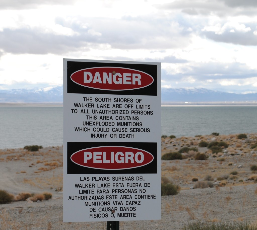
Our new friend, it seems, had cashed in the mortgage, gotten himself (along with his alleged wife whom we never saw) a fairly self-contained over-cab camper, with air conditioning and enough solar panels to power a suburban cookie cutter. In this rig they roamed the country in search of the Nomadland lifestyle, except for the hustle. Apparently his pension afforded fuel. Unlike the Instagram-YOLOing millennials whose carefully and meticulously curated van lives populate the interwebs, our friend, I’ll call him Dave, was far more pragmatic about his lifestyle. It was all about finding the best bargains, such as the Sportsman’s Beach Campground, a no fee BLM campground. It was no fee because it appears to have been abandoned by the BLM. The fact there were no unlocked bathrooms wasn’t a problem. Sure, it was 15 miles from town, on a windy unprotected shore of an endorheic basin, in the midst of the Hawthorne Army Depot, a U.S. Army Joint Munitions Command ammunition storage depot located directly south of Walker Lake. But for Dave, it was perfect despite the posted “Danger” warning.
Hawthorn is home to the Hawthorn Army Depot. The HWAD is the “World’s Largest Depot ” covering 147,000 acres or 226 sq. mi. and has 600,000 square feet of storage space in 2,427 bunkers. It is divided into three ammunition storage and production areas, plus an industrial area housing command headquarters, facilities, engineering shops, and stores reserve ammunition to be used after the first 30 days of a major conflict. Wiki.
It is only partially staffed during peacetime, but provision has been made to rapidly expand staffing as necessary. Maybe like with conflict in Ukraine, or Gaza, or Taiwan? Hawthorne did seem to be bustlin
As for Walker Lake…

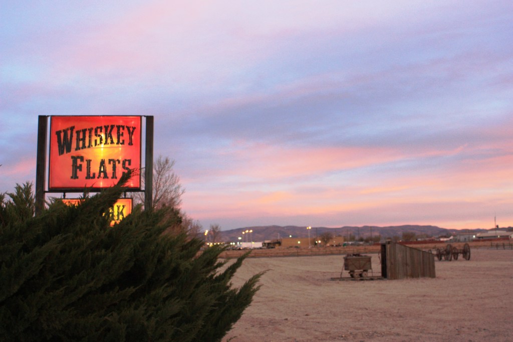
Escaping the windswept barren and dying lake containing unexploded ordnance, we secured lodging at the Whiskey Flats RV Park. When I called about tent camping availability, I was told yes, there was a large field designated for tent camping. Where we live a field is covered in some sort of vegetation. As you can see, the large field is not much more than a desolate gravel patch. Those Nevadan’s and their quirky colloquialisms! There was a fine laundromat with showers.
Hmmm… Pete, you go ahead and pitch your tent next to the mining cart. I’ll pitch mine by the wagon.

Earl was accommodating. We weren’t allowed near the manicured RV sites, but…
We managed to talk the fellow at the desk, I’ll call him Earl, into allowing us to pitch our tents near the boundary of the park, under a tree with a small table beyond the facilities and manicured RV sites. Most likely on the leach line for the laundromat and showers. The spare office was filled with an array of fittings for trailers and RV’s, a few snacks, and a choice of Buds or Coors. Not needing any fittings we settled on a couple of Coors.

What’s that smell?
After rearranging some of the larger pieces of gravel at our site, we set up our tents and headed into town for pizza. The joint was run by an East Indian family serving curried pizzas and other Indian entrees. It wasn’t bad. Oh, and there was the customary stop for 3-R beverages at the local Safeway. I challenged the young cashier to guess my age as she requested to see my ID. I interrupted the young cashier as her neighboring checker, who was closer in age to me, was invited to the guess the geezer’s age contest. The elder cashier guessed my age to be 12 years younger than actual and the younger cashier guessed two years younger. It must have been the motorcycle gear…
Whiskey Flats is situated right on US-95, a major highway that connects I-80 near Reno with Las Vegas. Consequently the truck traffic serenaded us through the night. We could have done our laundry and showered since sleep was a challenge, but it was only our first night away.


Place looks nice in the dark, like Ennis in True Detective Season 4, Night Country…
Jody Foster never showed up, we found no mysterious tongues outside our tents the next morning, and aside from the noisy trucks, it was peaceful.
Day 2 Hawthorne to Austin (map link)
I’m a fan of first light on these excursions. Besides, sleeping in with the constant roar of triple-rigged tractor trailers, mostly UPS, just yards from our campsite, incentivised capturing the waning crescent moon and Venus before sunrise.


I guess the sign is hard to see at night…
The next clip features Pete doing his best Al Franken impersonation over coffee on a chilly Hawthorne morning. Sisyphus and Associates Bid Hawthorne Good Morning (Video link)


Hawthorne isn’t exactly a food mecca. There were two pizza joints, a coffee kiosk, a casino restaurant that was undergoing renovation, a food truck, and a Mickey-D’s. Coffee, oatmeal, and a hash brown fast break, we enjoyed this fine light repast while eavesdropping on the comings and goings of the A.M. McDonald’s Hawthorne/US-95 crowd.
There was a rather loud gentleman conducting some sort of grand real estate deal on his cell phone with absolutely no nod to etiquette. There was the young man who I believe had a crush on the young lady at the counter. He came in, got water and sat down trying to engage her in conversation about the local high school football season. After he departed, another fellow came in, sat down without ordering, and engaged the same young lady behind the counter about how she should insist on a pay raise because she was so undervalued. Maybe she could get that raise if the local customers actually bought something at the joint.

Thar’s gold in ’em thar hills…
We set out for Austin by way of US-95 and near Lunning, took NV-316 passing the Walker Lane Minerals Corp Isabela Pearl Mine, a large open pit gold and silver mining operation. Then it was on to Middlegate, followed by a short ride on US-50 past the shoe tree, and NV-2/722 over Carroll Summit to Austin.


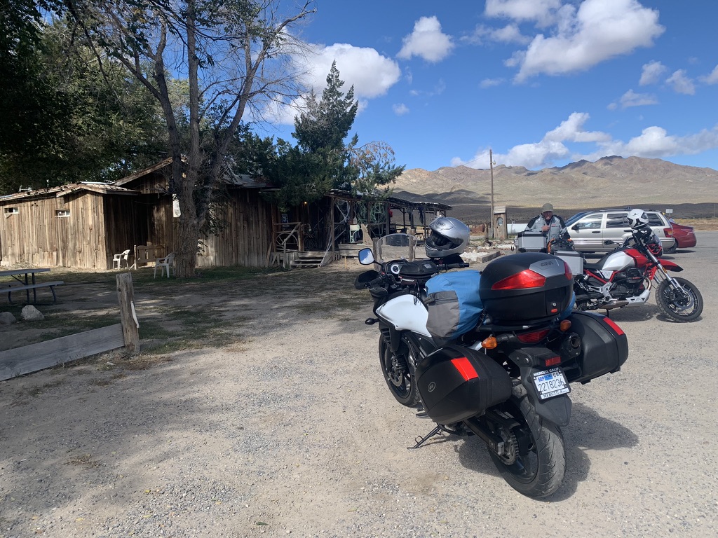

Middlegate Station just looks better in black and white. I bet that place rocks on payday.
Sisyphus and His Associate head to Austin… Nevada! (Video link) Music by The Flying Burrito Brothers, James McMurtry, and Little Feat
Twisties please…

Thank you!
Thirsty machines needed quenching too, so a quick stop at the only petrol station for miles and miles and a snack for the pilots ensued.

Neat thing about motos is that you can pretty much park anywhere…
As we stood outside shivering while eating snacks and watching life pass through Austin on the Lincoln Highway, we noted how conveniently the three no-vacancy motels are located.

At least the Cozy Mountain had the courtesy of acknowledging No Vacancy…

Austin from up the road a piece…
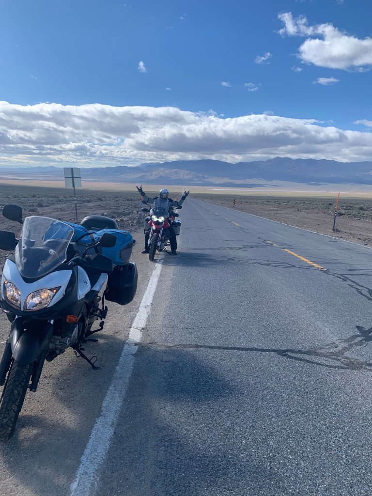
From Austin it was a brief stretch of pavement on the Lincoln Hwy, AKA The Loneliest Road in America, to NV-376 south. NV-376 was the most perfectly, and recently, paved stretch of highway I’ve ever ridden.


Interesting spot for a stop light…
Past the mining town of Carvers we were soon at the intersection with US-6, a couple of miles east of Tonopah. We arrived in town at our lodging for the night at the Tonopah Station Hotel and Casino after 269 miles of open road.
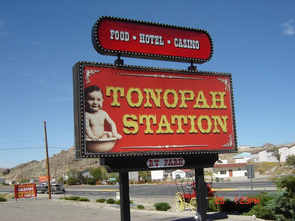
Not sure of the marketing concept behind the branding…
Interestingly, the description of the hotel on their website includes amenities such as restaurant, casino, bar, free parking, free WiFi, a desk, a flat screen TV, linens and towels, and the “Nye Regional Medical Center is a 2 minute drive away.”
Okay, to include linens and towels as an amenity seems a bit of a stretch. Noting the location of the Regional Medical Center as just a 2 minute drive away is all you need to know about the demographic choosing the Tonopah Station, notwithstanding their signage. I think I saw courtesy oxygen tanks next to some of the slots. Wait, we chose to stay there…


Playahs! That’s a hydro-flask and not an oxygen tank in my left hand…
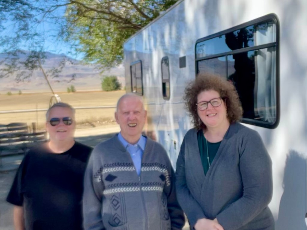
As we were unloading our gear we noticed a couple of bikes pull into the parking lot. One, a 1999 BMW GS and the other a 2019 V-Strom, both with Alaskan license plates. Later as we made our way to the Tonopah Brewing Co for dinner, we noticed the bikes again. We surmised, though we didn’t want to interrupt their meal, that the three occupants at a table near us were a family of moto-tourers.
As it turns out the next morning we met Doug, his daughter Lilly, and her husband Parker who were two-up on the BMW. Doug had been on the road with Parker for a month or so making his way down from Alaska where they met Lilly in Santa Cruz and were headed for a tour of the southwest before Doug began his trek down to Argentina! You can follow Doug’s adventure on Instagram @ joyful_moto.
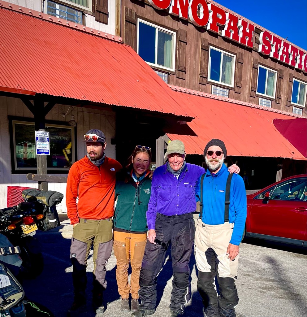
Parker, Lilly, Sisyphus, and Doug in Tonopah, NV (l-r)
After a delightful breakfast at the Tonopah Station Restaurant, where some 30 years earlier I fueled up with a group of seven other knuckleheads as we rode our bicycles across Nevada’s basin and range terrain, I recalled how the cuisine in Nevada caused grievous intestinal distress on hundred mile days of mile after mile of nothing but mile after mile. It seems that for the most part, the variety and quality of food that’s now available has improved. Either that or all the pedaling had something to do with the upset gut.
Day 3 Tonopah to Taboose Cr Campground (map link)

Hey Pete, we’re the youngest guys in the forest…
The third day was short, a mere 154 miles to our destination for the night at the Taboose Creek Campground. There was a sightseeing detour to the Ancient Bristlecone Pine Forest enroute. The Bristlecones are located off of CA-168 that is the California extension of NV-266. From the Tonopah Station we rode in search a couple of miles to find a Raley’s to purchase a pair of +2.0 readers at the to replace the glasses I apparently lost somewhere between Austin and Tonopah. After seeing the basin east of town spread before us and no Raley’s in site, we turned around to discover the Raley’s was right next door to our motel. Maybe I needed something stronger than readers. Well, from there we turned left, heading west for Goldfield. After about 40 miles did I discover I had once again zigged when I should have zagged. Had I headed east from the Raley’s parking lot on US-6 to NV-365, it would have taken us to the Goldfield mining “ghost town” as planned.
As it happened, serendipitously, I turning left on US-95/6 heading west and by realizing this wasn’t the way to Goldfield, we rerouted on NV-264 from US-95/6 south to Dyer, NV. Dyer is an unincorporated town located in Fish Lake Valley in Esmeralda County, Nevada. It has a population of 324 according to the sign as you enter town that serves the surrounding area’s sparse rural population of mainly ranchers and indigenous Paiute people. The town has a gas station/store/cafe (where guns, presumably open-carry or otherwise, are welcomed), a post office and an airport. We stopped for nalgas relief and patronized the store purchasing coffee and a snack. A rented RV pulled up to the entrance to the store’s parking and as Pete bid the gentleman directing the woman behind the wheel good morning, who tersely replied with a British accent, “I can’t talk just now, I’m trying to direct the camper.”
Apparently it was his wife’s first time behind the wheel and she was backing off of the pavement to park next to our bikes. Needless to say, we allowed him absolute concentration in his direction giving.
Percy, Digby, Sybil (l-r)
It turns out that Percy, his wife Sybil, and her father Digby were visiting the western US from Britain. They were a delightful trio who, ironically, were motorcyclists. Even more ironic was the fact that Percy had managed a Harley Davidson dealership outside of London. His wife, Sybil rode as well on a “Japanese Cow”, or Kawasaki. Digby, the father, was strictly a Vincent/BSA/Bonneville man whose demeanor brightened considerably when Pete mentioned that he has a T-120 at home and previously owned earlier 650 models.
We had an enchanting conversation with the English visitors and recommended some sights they might include seeing on their way to Yosemite. Since I never did get their names, I made them up to be as British sounding as my 23andMe ancestors.
Back on our bikes we continued on NV-246 that became CA-168 at the Nevada/California border. Zooming past irrigated alfalfa fields we passed through Oasis, CA where on a previous ride, Riding Under a Fool Moon, we thought we’d lost one of our fellow riders to an alien abduction. Turns out he made haste to Dyer for the lone gas station for miles and miles. Seems to be a theme in Nevada.
Photos courtesy of Deepsprings.edu
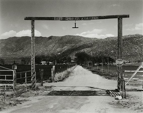
Had I only known then maybe Chico State would have been my back-up
The route from Oasis past Deep Springs and over Westgard Pass is one of the best surfaces with the least traffic over undulating and sweeping curves of any road on the East Side of the Sierra. We passed Deep Springs College, an interesting institution of higher learning that, like the landscape, is spare and deeply rooted.
Bound for the Bristlecones (Video link) Music by Dave and Phil Alvin and the David Grisman Quintet
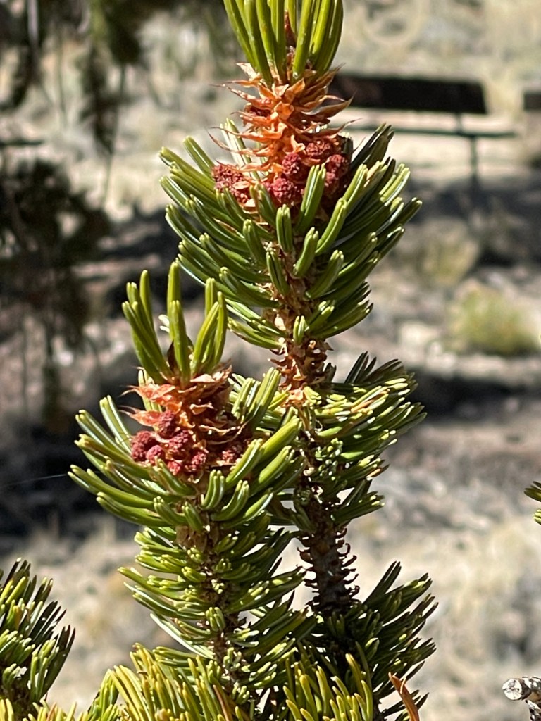
Upon approaching White Mountain Rd that takes you up to the Ancient Bristlecone Forest, you’re struck by how arid the landscape appears. The Great Basin bristlecone pine (Pinus longaeva) trees grow between 9,800 and 11,000 feet above sea level, in xeric alpine conditions, protected within the Inyo National Forest. Limber pine (Pinus flexilis) also grows in the forest. Snowfall is the primary source of water for the biome and there is evidence that climate change is impacting the forest.


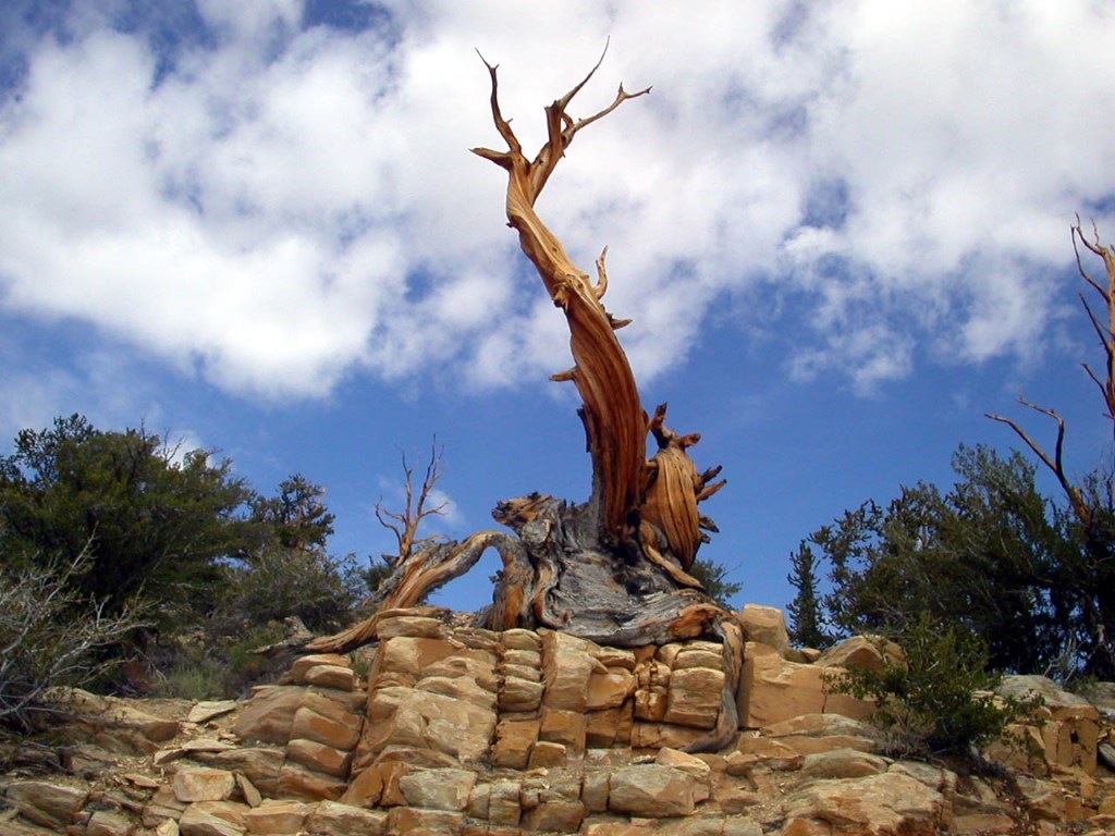
And we consider ourselves geezers...
We bid adieu to the guardian Raven at the Schulman Visitors Center and departing the bristlecones we set off for Big Pine.

Our plan was to grab a bite to eat and provisions for the 3-R’s, you know, for the rehydration, relaxation and reflection later around the campfire. We found the Copper Top BBQ restaurant where a generous serving of tri-tip and a beer, poured from the bottom up, was served.
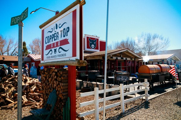


Add Big Pine to Kansas City, Central Texas, and Memphis for BBQ
Via US-395, midway between Big Pine and Independence, we turned west on Taboose Creek Road, and it’s two miles to the campground, far enough from US-395 so that the trucks offered a distant lullaby. All of the amenities secured for the evening, we set up camp.

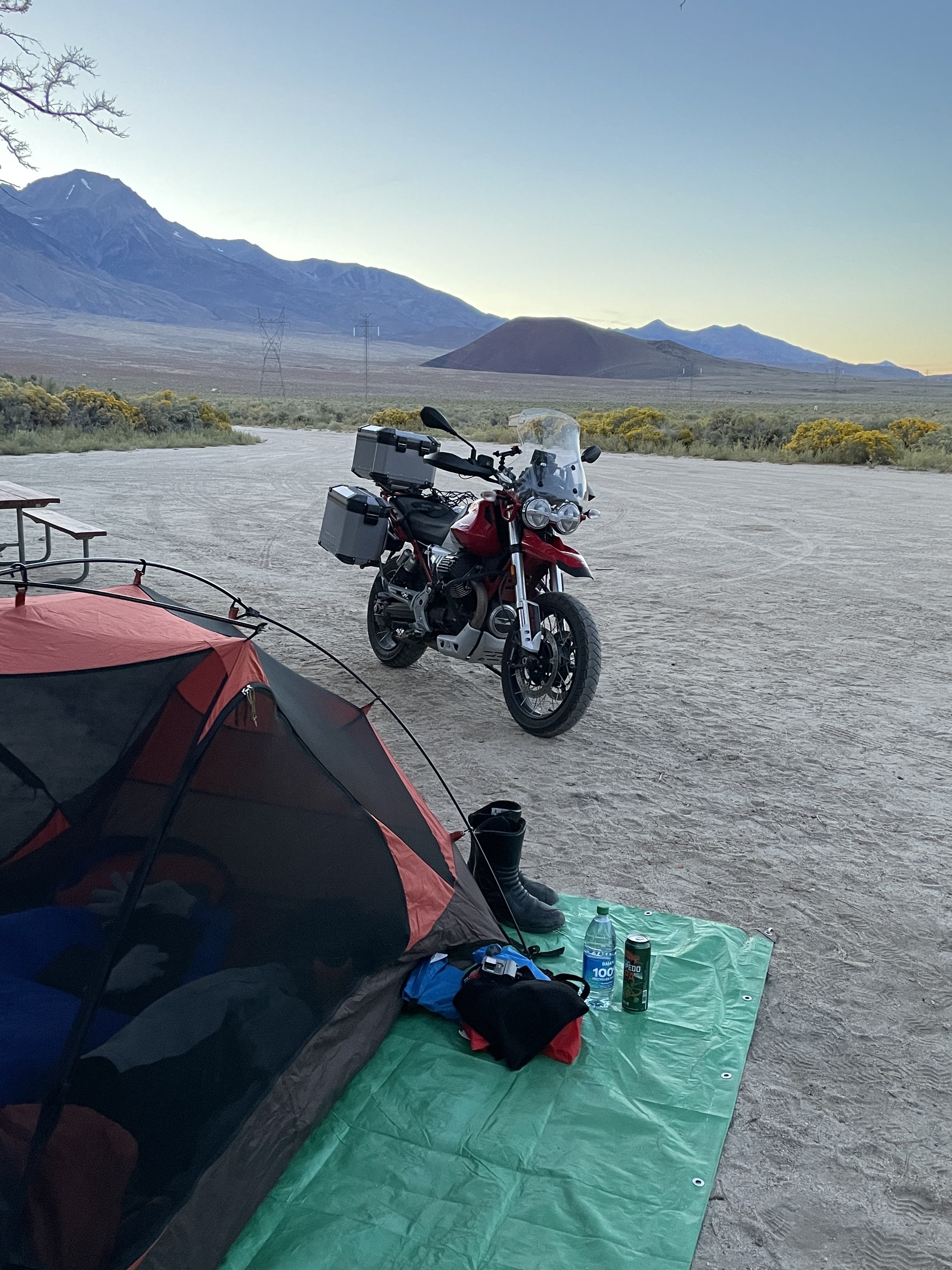
The 3 SECONDS TENT = “The #1 easiest, fastest 1-Person setup camping tent…”
Pete setting up the 3-Second Tent (in about 3 minutes)

The 3-seconds Tent on the right. The half-hour tent on the left
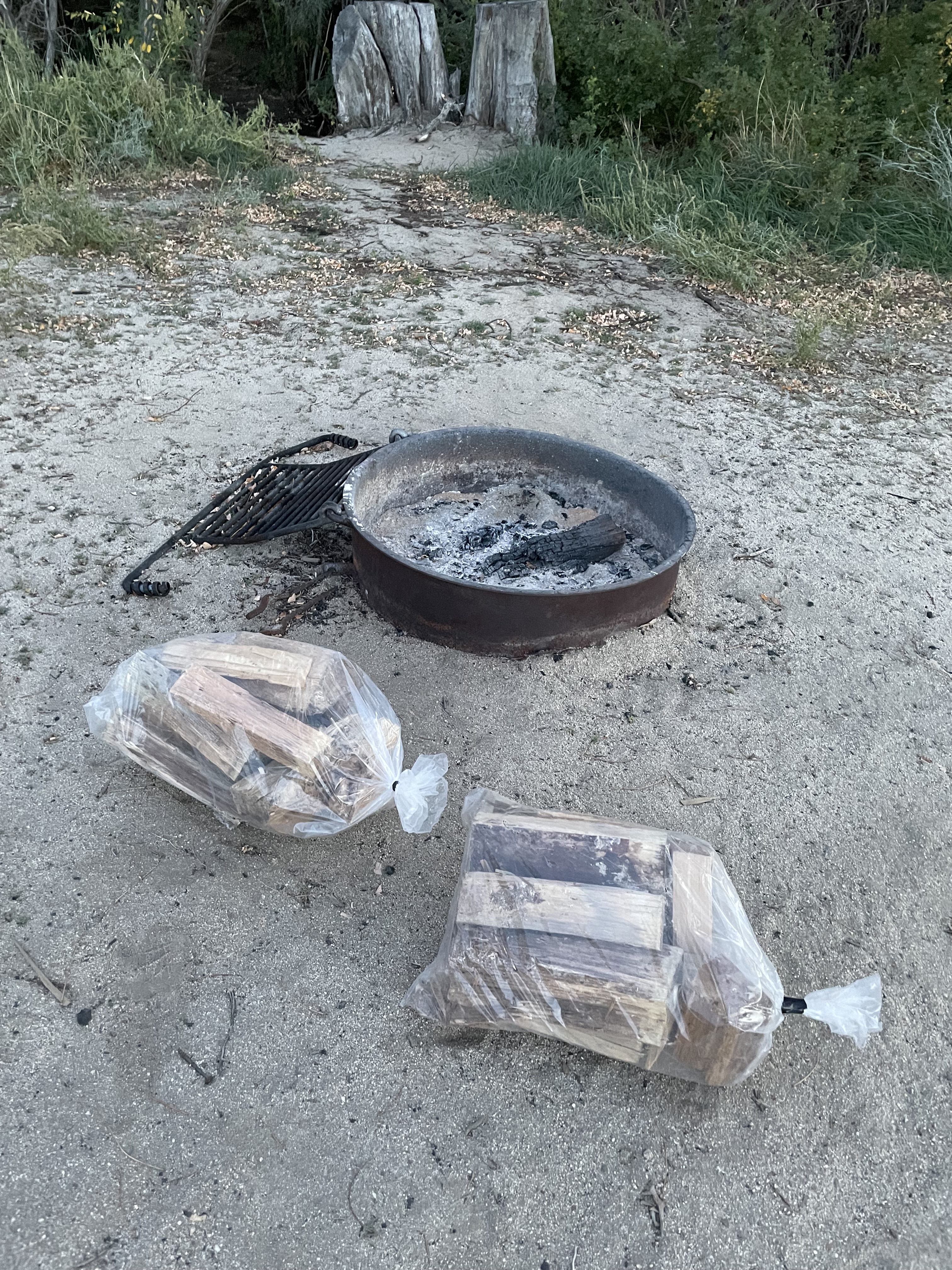
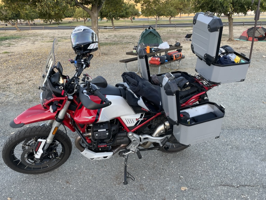
It never ceases to amaze me that in spite of paring down gear on each subsequent ride, I still manage to carry a “BIT-O-GEAR”.

If only my garage was this organized…
After reflecting on the day’s ride, warmed by the fire, mesmerized by the night sky, and enchanted by the Milky Way we called it day and turned in. Besides, the rehydrates, having sufficiently relaxed us, completed the 3-R hat trick.

2 of 3-R’s induced reflection…
Day 3 Taboose Creek to Success Lake (map link)

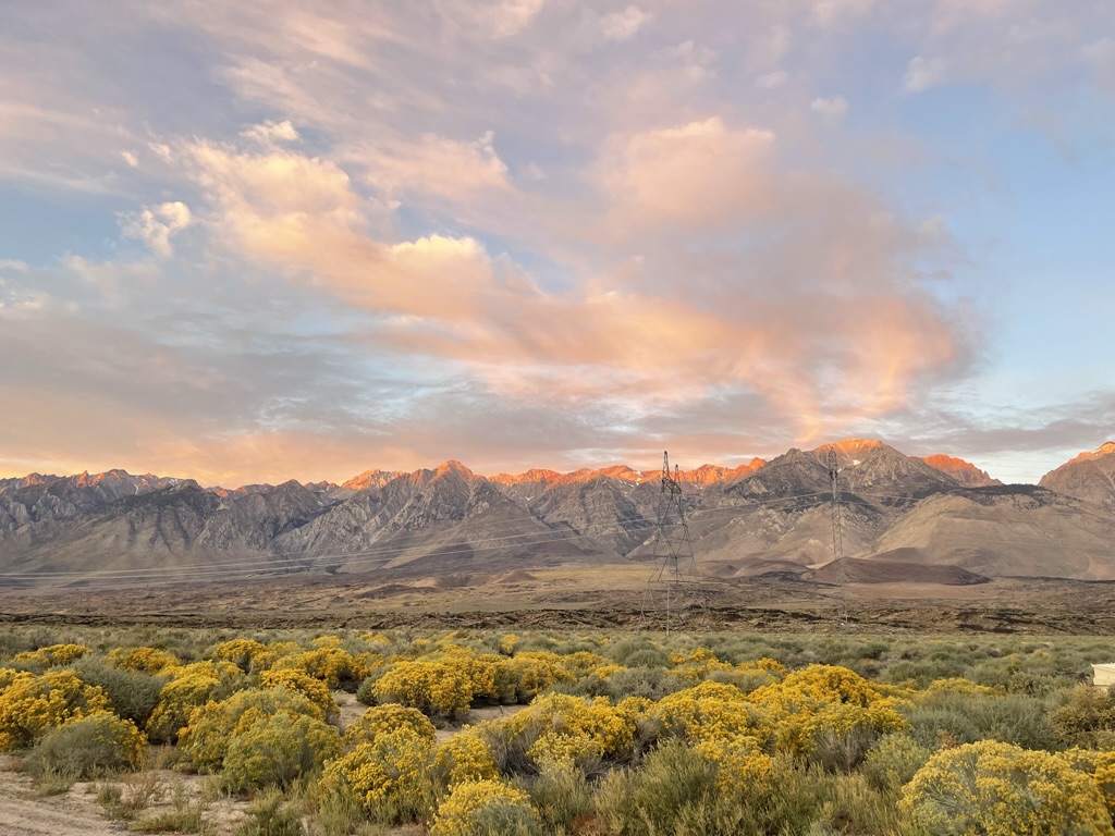


We awakened to a glorious sunrise, the air crisply chilled and clear. The angle of the sun’s rise, the sparse and wispy clouds filtering the light, and the vantage of the direction of the photo displayed how the Sierra Nevada, whose literal translation from Spanish is “snowy mountains”, is as John Muir noted more aptly, the Range of Light.


“Well may the Sierra be called the Range of Light, not the Snowy Range; for only in winter is it white, while all the year it is bright. —John Muir, in “Our National Parks” 1901.
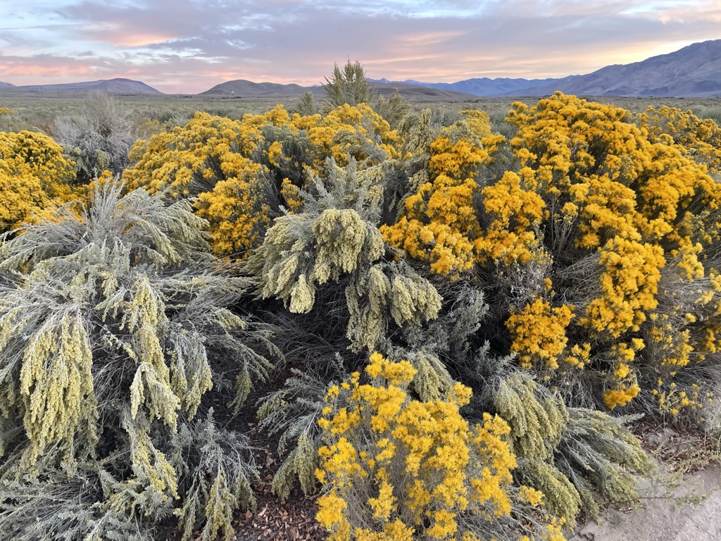
Rabbitbrush is a common name for shrubs, principally of the western United States, in three related genera of the family Asteraceae. The rabbitbrush below is one of the three of the genera, yellow rabbitbrush.(I hope no fellow California Naturalist notes my laziness in correctly, not necessarily incorrectly, identifying the plant).

It’s yellow for sure…
After our customary wake-me-up/warm-me-up/pack-em-up mochas, we bid our campsite adieu noting that it will become yet another campground deserving a future repeat stay.

If that’s all it did, wouldn’t it be worth having?
Lone Pine was a mere 30 miles south of our 225 mile day so we sought breakfast at the Alabama Hills Cafe.

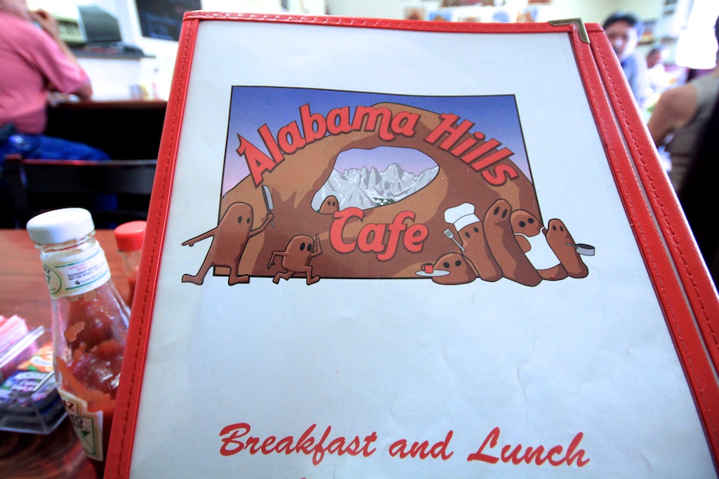
You decide on the menu art. Spheroidal weathering of exposed granite or chocolate yard bunnies left by Fido?
From Wiki: The rounded contours of the Alabamas contrast with the sharp ridges of the Sierra Nevada to the west. Though this might suggest that they formed from a different orogeny, the Alabamas are the same age as the Sierra Nevada. The difference in wear can be accounted for by different patterns of erosion.
That’s how SoBe and Dakota tried to convince me that I was more of a geologist than sanitationist as my twice-a-day field studies yielded “forms from a different orogeny” in our backyard.
The menu art notwithstanding, the breakfast was delightful with the cafe populated by as many locals as REI booted, Pataguchied, Sprinter Van tourists. Pete is pictured “incognito” the glasses adorned to keep patrons of the cafe from mistaking him for Humphrey Bogart (of High Sierra fame) or Jack Palance (of the remake of High Sierra, I Died a Thousand Times fame) despite their deaths years ago. See a previous post, https://sisyphusdw7.com/2019/11/27/riding-under-a-fool-moon/, for a brief but spectacular guide to movie making in the Alabama Hills.
From breakfast it was on to 9 Mile Canyon Road south on US-395 but not before topping off at the Shell Station just a five iron further south of our turn-off.

Maybe a mile of 9 Mile Canyon Rd…
I was fortunate enough to have among my friends a group of cyclists (of the pedal variety) in the years prior to reviving my motorcycle diversion. We twice rode from Ventura on the California coast across the state to Death Valley as well as across Washington, Oregon, Idaho, Montana, Wyoming, Nevada, Colorado, Arizona, and New Mexico. Oh, and twice across Utah. The group was lead by Larry Johnston, sadly now deceased and very much missed. You can see his influence in my desire to organize two-wheeled tours in: When We Were Younger where I shared a typical itinerary, this from our Utah ride, Larry would provide us knuckleheads. From that ride, the Burr Canyon will forever be stitched into the fabric of my memories as one of the most sublime experience ever. Utah remains as one of our favorite riding destinations, several posted on the site.
Crossing Sherman Pass (video link) Apologies for the SD (Standard Definition) replay. I downloaded it as a 1080p/60fps file but the YouTubes apparently exhausted any love for me in earlier links.

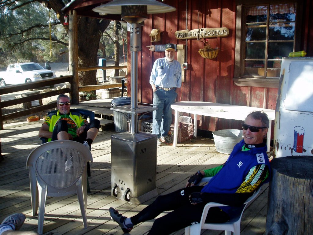
After a jolt of pressed java at the Grumpy Bear’s Retreat at Kennedy Meadows, a popular resupply stop for PCT hikers, we continued on to the actual Sherman Pass.
We reached our destination for the night, Success Lake, descending through the Southern Sierra Foothills on M-50, Hot Springs Dr. and Old Stage Rd to Porterville where a right turn put us on CA-190 to the Tule Campground. The lake, or rather reservoir, still brimming from Winter of ’23 Tule River watershed runoff appeared to be one of those California foothill “recreation reservoirs” where any number of mechanized forms of recreation seasonally populate the waters and campsites. In October there were a number of campers and a few fishers (not woke, but also not wanting to assign gender to the noun that describes the verb with or without an object, I invented “fishers”) not so many jet skis or wake boats.
The Guzzi open for business…
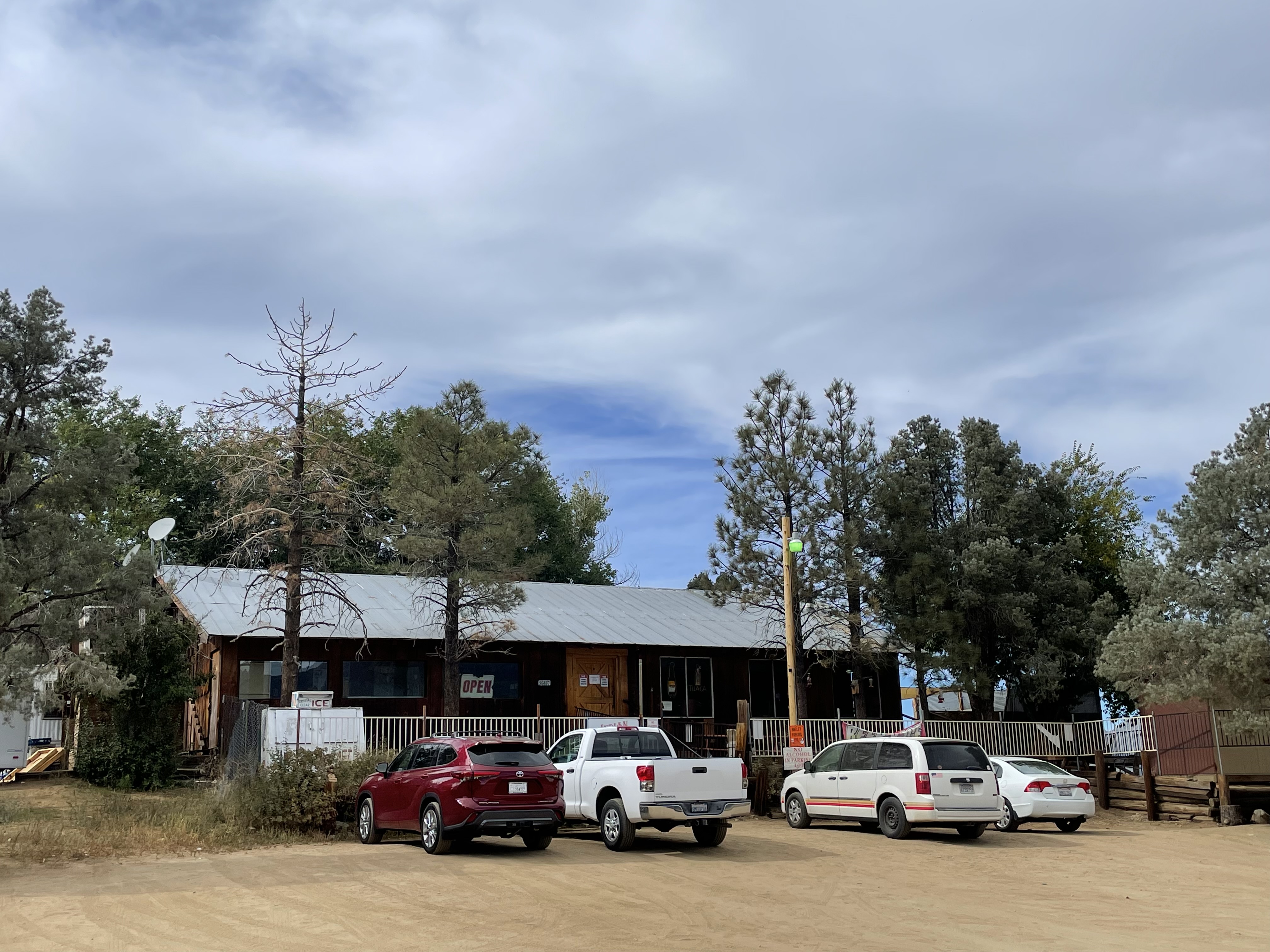
After a modestly satisfying meal down the hill (I don’t remember where or what but the “modestly satisfying” pretty much sums it up). We procured the 3-R’s beverages at The Success Market where a chap festooned in Harley apparel paid for the gas to fill his VW Bug in coin. I vaguely recalled what coins are since I seem to only receive them as change for cash purchases on moto tours that ends up in the little coin tray near the register. Those that do subsequently make it into my in my jacket pocket then end up in a vase on my chest-of-drawers (I learned in my teens that some guy named Chester, who was apparently a furniture maker, was a malaprop). I bet a chunk of the deficit could be eliminated if people donated the content of what I imagine millions of jars filled with coins languishing on Chester’s Drawers.
The campsites were barren. There was a nice bathroom/shower facility, however, you had to traipse through millions of goatheads to get to it. Another feature of the campground was the group of campers who set up their amplified instruments across from us. I regret not filming the affair as they began their performance, likely a practice. I have been the drummer in a couple of bands; Staff Infection, MC^2, and Timeless Flyte; a blues, fusion, and Byrds/Burrito Brothers tribute band respectively. I kinda’ know that when practicing, rehearsing is the official term I believe, mistakes can be made so that when it’s time to hit the stage, you don’t embarrass yourself. As Mozart noted, “The music is not in the notes, but in the silence between.”
These guys were cringeworthy bad. They sucked. Their musicality would have been much better had they eliminated the notes and stuck with the silence between. It was embarrassing to listen to their arrhythmic, non-metrical, discordant decidedly unmelodic playing, complete with shrill atonal vocals. (I’ve been watching Loudermilk on Netflix which unmistakably has influenced my critical music vocabulary and attitude).

Pete and I enjoyed Jupiter as the sun set, despite the cacophony...
Thank goodness the jangle ended around 10:00 pm as we turned in having enjoyed a lovely sunset and our customary 3-R’s. Unfortunately, that was when the adjacent campsite’s occupants began an audible conversation that lapsed into a drunken argument inside of their 500 sq. ft. tent. I liken the strength of their arguing in that voluminous tent to that of the storm raging on Jupiter’s enormous surface. Their arguing was only exceeded in volume by the crying infant, no doubt disturbed by the f-bombs exchanged by the foul mouthed adults. I pause to label them parents, as their behavior bordered on abusive in a way no legitimate parent would behave.

I might have slept better on Jupiter…
So much for sleep. I finally managed to fall asleep as the infant ceased crying and the grown-ups had apparently passed out sometime after 2:00 am. About a half hour later, as I am a man of a certain age, I needed to “see a man about a mule,” a familiar refrain I learned from my pops. The next morning I plucked about 2,357 goatheads from the bottom of my Heydudes. Each.

Once again, “If that’s all it did, wouldn’t it be worth having?”
Day 5 Homeward Bound Tule Campground to Merced (map link)
Our homeward bound route found us on familiar tarmac. The Sierra foothil roads are just one of the great rewards of motorcycling in California, available year round. From Lake Success to Porterville, instead of our planned route that would take us up to Springville and Yokohl Drive to CA-198, we had to detour as the severity of the massive ” ’23 runoff” that had refilled the dormant Tule and Tulare Lake basins, had caused flooding and several washouts on our preferred route.
From Porterville we rode CA-68 through the valley towns of Lindsay and Exeter to CA-245 missing the intoxicating springtime citrus blossom aromas of surrounding orchards. Through Woodlake and Aukland we made our way to Badger and the Mountain House Saloon for lunch, a popular moto roadhouse.
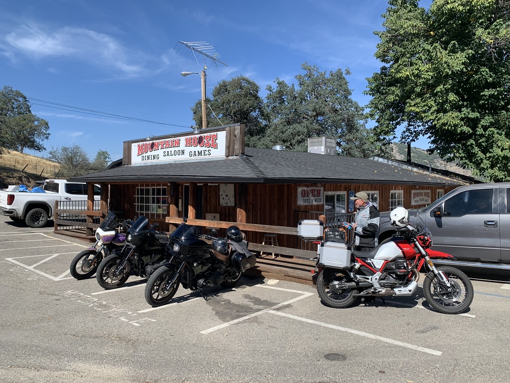
The Coastie making a bold aesthetic statement…
After seating for burrrrggggaaaahhhhs (*see Jaime Robinson @ https://www.motogeo.com/) several sportbikes arrived. I’m sparing your having to watch yet another 10x speed nausea inducing video on the noteworthy twisties of CA-245 in Fresno County. I hope my choice of music, if YouTube hasn’t taken down the videos because of some sort of copyright violation, made them worthwhile.
The remainder of the ride home was quite pleasant as the roads (described in previous posts), the weather, and Pete’s companionship made for yet another dandy experience on two wheels.
The link below is to the original itinerary I prepared for the trip: https://docs.google.com/document/d/19iCNY2zy8xbl2F25I81gwC1hF99cR6iX6z7AldhzrQw/edit?usp=sharing
Epilogue
I’ve made a new friend Tom C. and fellow V85 rider who detailed his account of riding a 2021 Moto Guzzi V85 TT from San Diego to Virginia in ADVRider.com, Moto Guzzi V85TT Test Ride: USA Coast-to-Coast in 21 Days”: https://www.advrider.com/f/threads/moto-guzzi-v85tt-test-ride-usa-coast-to-coast-in-21-days.1691855/
Tom had me on, “The Moto Guzzi v85 Adventure is loaded with charm: A steel trellis frame. More steel in front and rear trellis subframes. Dual round headlights. Right and left side eagle emblems on the tank, both looking forward. Cylinders sticking out on both sides. Air cooled, pushrod valve train. Weird controls with no red buttons. Using the start button to change riding modes. Using the mode button to change the display. Low to middleweight power with middle to heavyweight mass. While other adjectives apply, I choose to consider this mix of characteristics as charming.
He goes on to deliver what must be the most comprehensive review of the features of the bike I’ve read or seen to date. He does it with a conversational ease, though he goes deep into the weeds of some of the more technical aspects of the machine, its operation, and features never straying far from my largely emotional regard for those attributes and appreciation for the technical. I have a great regard for his observations and ability to convey the story of his 21 Day, Coast to Coast as thoroughly compelling.
What’s next?
Well, let’s see. It’s winter so the desert beckons, followed by spring with the Four Corners whispering, late summer shouting, “go north and east young man,” and the Lost Coast challenging. As always I’m in search of my next favorite ride!
Maybe Sisyphus won’t put off pushing that enormous blog bolder up the hill as he did with this tardy post from a ride some four month ago.
Sisyphus, January 2024
Timeless Flyte: Turn, Turn, Turn. Sisyphus is on the kit. Click twice for the audio.


One thought on “2023 Fall Moto to Austin… Austin, NV that Is”